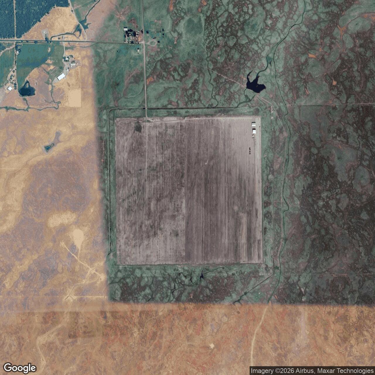
Vina Auxiliary Field / Deer Creek Ranch Airport, California
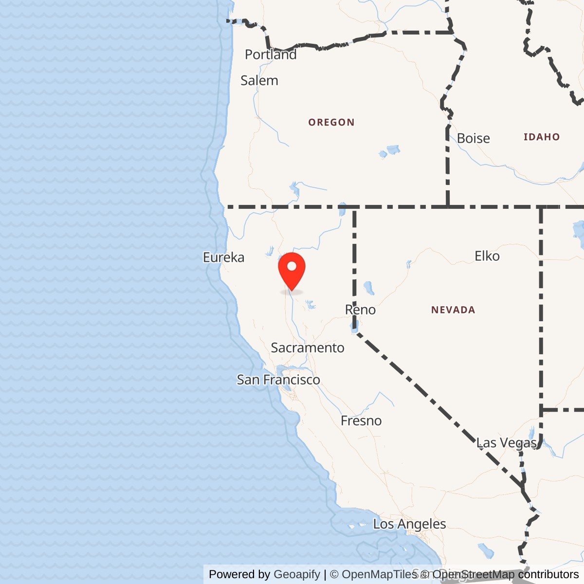
Longitude: -121.991302
Official Base Website: Private Deer Creek Ranch Airport
Current Role: Private Deer Creek Ranch Airport (CA60), permission required before landing; the surviving WWII square landing mat is still legible, with the listed modern asphalt runway 16/34 occupying part of the mat.
Vina Auxiliary Field was a World War II Army Air Forces auxiliary landing field built in the Sacramento Valley to support Chico Army Air Field. Its later civil and private name is Deer Creek Ranch Airport, FAA identifier CA60. The site sits northeast of Vina, in Tehama County, between the Sacramento River valley floor and the lower foothill country east of the river. That location placed it close enough to Chico Army Air Field to support student flying, but far enough from the main base to spread out traffic, reduce congestion, and provide an emergency landing surface for training aircraft.
The field was not a full Army air base. It had no known permanent training command of its own, no documented barracks cantonment, no heavy maintenance depot, and no postwar Air Force lineage. It was a satellite field: a simple, durable, square landing mat on a 323.62-acre wartime tract. Its importance came from how it supported the training machine at Chico. During World War II, the Army Air Forces needed thousands of new pilots and combat-ready aircrews, and that required more than one main runway. Auxiliary fields like Vina gave instructors and students places to practice approaches, landings, takeoffs, emergency procedures, and traffic-pattern work without overloading the parent base.
Vina's survival makes it more visually legible than many temporary wartime fields. The modern Deer Creek Ranch Airport still occupies the old landing-mat site, and AirNav lists CA60 as a private-use airport three miles northeast of Vina, at 280 feet elevation, with a 3,000-by-400-foot asphalt runway 16/34. The current airport is privately owned and permission is required before landing. The large World War II square mat remains the feature that defines the site from the air, even though only part of that pavement functions as the listed modern runway.
Mission and Military Role
Vina's military mission was auxiliary flight training and emergency landing support for Chico Army Air Field. Chico itself opened on April 14, 1942, and closed on December 31, 1945. The Chico Army Air Field collection at California State University, Chico, summarizes the parent field as a wartime Army flying school north of Chico where more than 5,000 cadets and officers received basic and advanced flight training before the city took over the main property after closure.
The Army's flight-training system depended on repetition. Student pilots needed repeated takeoffs and landings, traffic-pattern work, recovery practice, and emergency decision-making in aircraft that were forgiving enough for training but still dangerous in the hands of beginners. Local and airfield histories associate the Chico auxiliary network with basic trainers such as the Vultee BT-13 and BT-15. Those aircraft did not require the large infrastructure of a bomber field, but they did require room. A main school field could not safely absorb all training traffic by itself, especially when weather, wind, inexperience, and formation scheduling were all in play.
Vina's square landing mat was the key to its mission. Instead of one narrow runway, the Army built a large paved surface that could be used in multiple directions. The concept reduced the crosswind problem by allowing aircraft to land into the wind, or nearly into the wind, without needing a separately aligned runway. For student-pilot work, this mattered. It made the field useful for routine landing practice, and it made the site valuable as an emergency field for aircraft that could not safely return to Chico.
No separate combat unit is documented as being assigned to Vina itself. The field's unit identity flowed through Chico Army Air Field and the larger Army Air Forces training structure. Chico's parent missions included the Army Air Forces Basic Flying School / Army Air Force Pilot School and later combat-crew training. Published summaries of California World War II Army airfields identify the 10th Base Headquarters and Air Base Squadron at Chico during the earlier training-school phase and the 433rd Army Air Force Base Unit as the combat crew training station for fighters later in the war. Vina supported that parent-base mission as an outlying field, not as a self-contained station.
Site Design and Facilities
The wartime field consisted primarily of the landing mat. Published local military-field summaries describe Vina Auxiliary Field as a 323.62-acre Army airfield with a 3,000-by-3,000-foot paved landing mat. Abandoned & Little-Known Airfields describes Chico Auxiliary Army Airfield No. 3 / Deer Creek Ranch Airport as a World War II satellite field used by Chico Army Airfield, located about eleven miles southeast of Chico's main field, and notes that a January 13, 1943, U.S. Army aerial photograph showed the field already in use with thirteen single-engine aircraft visible on the mat. That early aerial evidence is important because it confirms that Vina was not simply a mapped proposal. It was an operating training surface during the war.
The 1944 USGS topographic depiction labeled the site as "U.S. Auxiliary Airfield" and showed the square landing mat. Aeronautical charts did not consistently show the field during the war, which is not unusual for military auxiliary fields. The field's purpose was local military training and emergency use, not public airway service. After the war, chart depictions became more visible. The March 1950 Mt. Shasta Sectional Chart depicted "Chico Aux #3" as a civilian airfield with a 3,000-foot paved runway, and the September 1957 Sacramento Sectional Chart still depicted it that way.
The field appears to have had very limited support construction. The available public record does not support describing Vina as having a tower, hangars, fuel storage, ammunition storage, barracks, or a full motor-pool or maintenance complex. Later aerial views show two small buildings on the northeast corner of the landing mat, but those are likely postwar civilian or private-airfield structures rather than documented Army-era facilities. The lack of major support buildings fits the installation's function. Vina was built to receive aircraft, not to house a base population.
The square mat was the installation. That is why the site's preservation is so important. Many World War II auxiliary fields disappeared beneath crops, roads, subdivisions, or industrial development. At Vina, the wartime pavement pattern remained visible through decades of postwar reuse, abandonment, private ownership, and private-airport listing. The airfield's physical survival gives the site unusual interpretive value as an example of the low-infrastructure, high-utility outlying fields that supported the Army Air Forces training system.
Role in the Wider Military Network
Vina belonged to the Chico Army Air Field auxiliary network. Chico was one of California's wartime aviation training installations, part of the larger Army Air Forces structure that converted civilian airports and agricultural land into a dense web of main fields, sub-bases, auxiliary landing fields, and specialized training ranges. The parent field trained thousands of cadets and officers, and the auxiliaries made that tempo practical.
The Chico auxiliary group included multiple outlying fields in the northern Sacramento Valley area, including Orland, Kirkwood, Vina, Campbell, and other fields associated with the Chico system. Each field served the same broad purpose, but each had its own physical fate after the war. Orland survived as a public airport. Kirkwood returned to agricultural use after a period of county airport use. Vina became a civilian airfield, disappeared from some public charts, was reused as a dragstrip for a time, and later reappeared as the private Deer Creek Ranch Airport. That varied postwar fate is typical of auxiliary fields. Their wartime value was network value, but after the war each site depended on local ownership, county needs, aviation demand, and land-use economics.
The field also illustrates a broader Army Air Forces design pattern. Main fields were expensive and complex. They needed hangars, housing, maintenance, classrooms, control facilities, utilities, medical support, and administration. Auxiliary fields could be much simpler. A square mat and minimal support could provide enormous training value because the main base supplied the instructors, schedules, aircraft, maintenance support, and command structure. Vina's story therefore belongs not only to Tehama County or Chico, but to the Army's national solution to the pilot-training problem of 1942 and 1943.
World War II Activity
Vina's daily wartime activity was likely repetitive, practical, and local. Student pilots and instructors from Chico used the field for training flights, landing practice, and emergency procedures. Aircraft would arrive from Chico, work the landing mat, and return to the parent field. The January 1943 aerial photograph showing thirteen single-engine aircraft on the mat suggests that the field could hold multiple trainers during a training period and that it was integrated into Chico's day-to-day flight schedule.
The field's lack of elaborate infrastructure does not make it unimportant. In flight training, simple fields often performed the most important safety function. They gave inexperienced pilots room to make mistakes away from the main base. They also gave disabled or low-fuel aircraft a nearby place to land. The very shape of Vina's square mat reflects that logic. The field was designed to remove as many wind-direction and runway-alignment constraints as possible.
Closure, Disposal, and Postwar Reuse
Vina's Army mission ended with the collapse of the wartime training requirement. Chico Army Air Field closed on December 31, 1945, and the auxiliary fields lost their military purpose. Published field summaries identify November 20, 1946, as the transfer date for Vina to the War Assets Administration. That date is the best clear marker for the end of Army control, even if flying activity for military training had likely declined or ceased earlier.
After the war, Vina was used as a civilian airport for Tehama County before later private ownership. The field appeared on the March 1950 Mt. Shasta Sectional Chart as "Chico Aux #3" with a 3,000-foot paved runway and remained on the September 1957 Sacramento Sectional Chart. Abandoned & Little-Known Airfields reports that it was no longer depicted on the April 1958 Mt. Shasta Sectional Chart, suggesting that regular public-civil airport status ended or became uncertain around 1957-1958.
The landing mat then found an unusual second life as a dragstrip. A local recollection recorded by Abandoned & Little-Known Airfields states that part of the surface was used as Vina Raceway from about 1963 to 1966. The strip reportedly used an area near the middle of the asphalt surface running north-south. This kind of reuse was common on former military airfields because wartime pavement offered long, flat, open surfaces that could serve racing, storage, agriculture, or industrial purposes after aviation demand faded.
Even when public aviation use diminished, the mat remained. The 1969 and 1980 USGS topographic maps still depicted the field and labeled it "U.S. Auxiliary Airfield." Later aerial views continued to show the square landing surface, two small buildings on the northeast corner, and the overall wartime outline. By the early twenty-first century the site was listed as the private Deer Creek Ranch Airport, CA60.
Current Status
The site is now Deer Creek Ranch Airport, FAA identifier CA60. AirNav's current FAA-based listing identifies it as a private-use airport at Vina, California, with permission required before landing. The elevation is 280 feet, and the airport is three miles northeast of Vina. The listed runway is 16/34, asphalt, 3,000 by 400 feet. The field has no control tower and no published instrument procedures.
The current airport listing has an activation date of September 1975. That date should not be confused with the World War II establishment of the Army auxiliary field. It appears to reflect the modern FAA-listed private-airport identity rather than the original military construction. The historically important point is that the modern airport occupies the wartime landing-mat site and preserves the Deer Creek Ranch Airport name as the current facility identity.
Because the field is private property and active only with prior permission, it should not be treated as a public historic site. Its strongest public interpretive value comes from maps, aerial imagery, aviation listings, and historic airfield research rather than from on-site visitation. From the air, however, the square landing mat remains one of the clearest surviving physical signatures of a Chico Army Air Field auxiliary.
Chronology
- 1942 The Army acquired the Vina Auxiliary Field tract during the wartime expansion of Chico Army Air Field's auxiliary network.
- 1943 The 3,000-by-3,000-foot landing mat was opened for use as a Chico Army Air Field auxiliary training and emergency landing field.
- 1943-01-13 A U.S. Army aerial photograph showed Chico Auxiliary Army Airfield No. 3 in operation, with thirteen single-engine aircraft visible on the field.
- 1944 A USGS topographic map depicted the square landing mat and labeled it "U.S. Auxiliary Airfield."
- 1945-12-31 Chico Army Air Field, the parent installation, closed.
- 1946-11-20 Vina Auxiliary Field was transferred to the War Assets Administration, marking the end of Army control.
- 1950-03 The Mt. Shasta Sectional Chart depicted "Chico Aux #3" as a civilian airfield with a 3,000-foot paved runway.
- 1957-09 The Sacramento Sectional Chart still depicted Chico Auxiliary No. 3 as a civilian airfield with a 3,000-foot paved runway.
- 1958-04 The field was no longer depicted on the Mt. Shasta Sectional Chart, suggesting the end or interruption of regular charted civilian-airfield status.
- 1963-1966 Part of the landing mat was reportedly used as Vina Raceway, a dragstrip operating on the former wartime pavement.
- 1969 A USGS topographic map depicted the 3,100-foot square landing mat and labeled it "U.S. Auxiliary Airfield."
- 1975-09 The modern FAA-listed Deer Creek Ranch Airport identity carries this activation date.
- 1980 A USGS topographic map still depicted the landing mat as "U.S. Auxiliary Airfield."
- 2003 The site was listed in the Airport/Facility Directory as private Deer Creek Ranch Airport, CA60, although it was not shown on the 2003 sectional chart.
- 2006-08-29 USGS aerial imagery showed the landing mat still intact, with two small buildings near the northeast corner.
- 2015-09-05 Aerial imagery again showed the Vina landing mat intact.
- 2023 Ground-level photography documented the two small buildings on the northeast side of the landing mat.
- Present The site remains private Deer Creek Ranch Airport, CA60, on the former Vina Auxiliary Field landing mat.