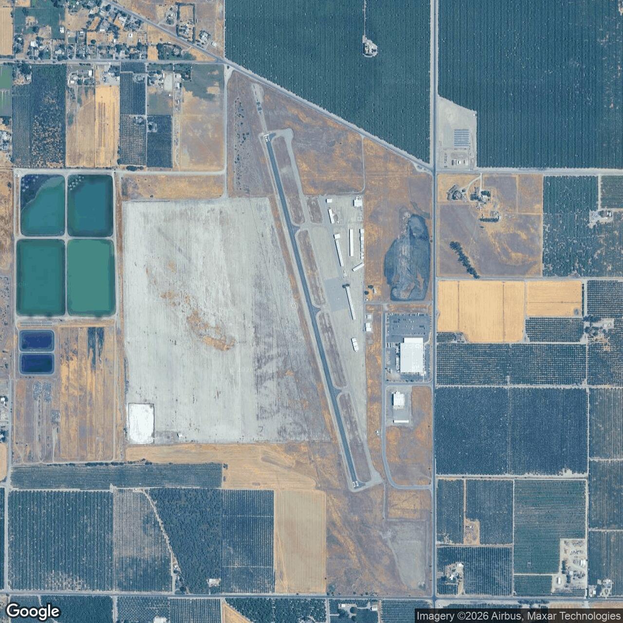
Orland Auxiliary Field / Haigh Field Airport, California
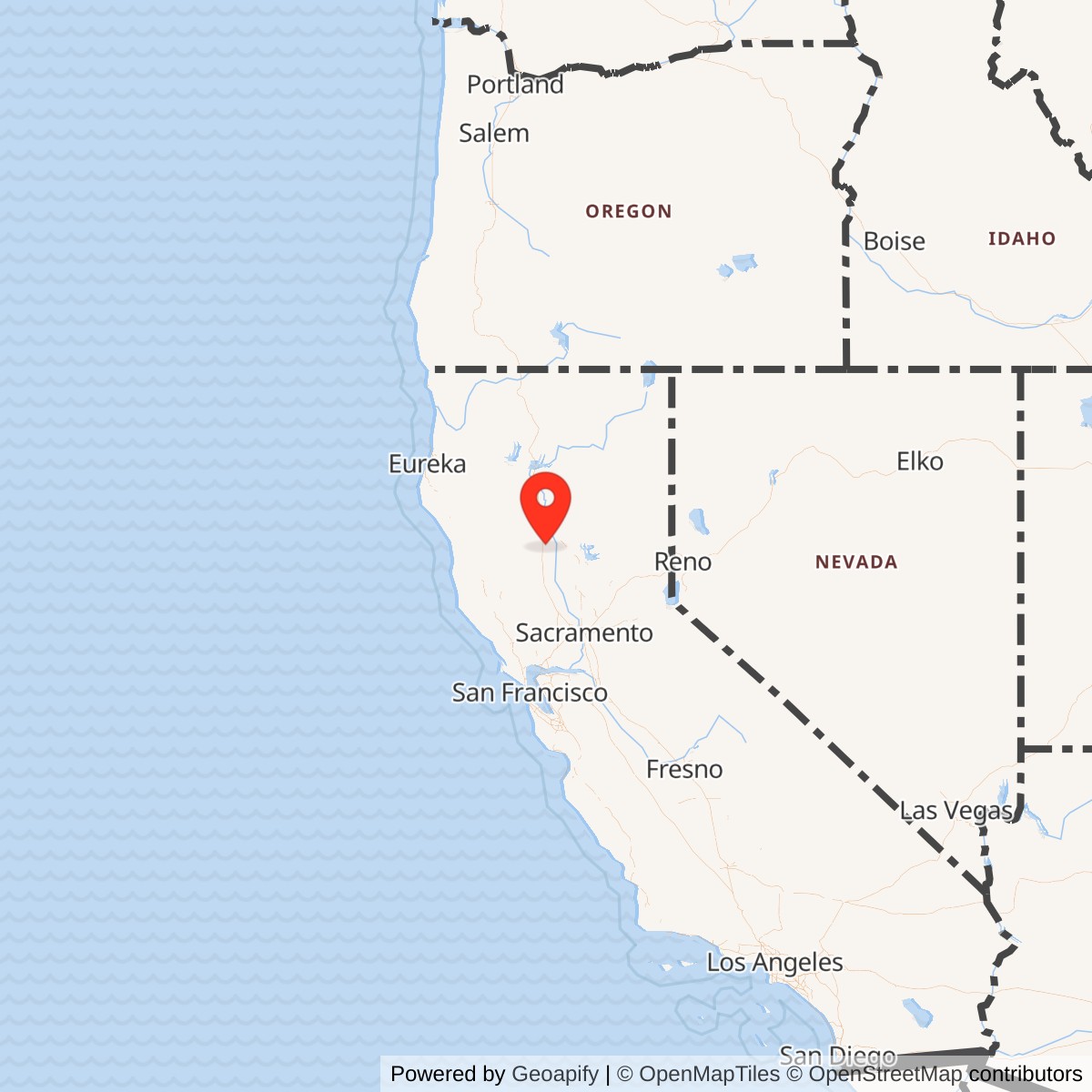
Longitude: -122.1463611
Official Base Website: Haigh Field Airport
Current Role: Haigh Field Airport / Orland-Haigh Field, publicly owned general aviation airport operated by Glenn County; associated airport, industrial, utility, and agricultural reuse on portions of the former military tract.
Orland Auxiliary Field was one of the small but hard-working World War II airfields that made Chico Army Air Field function as a real training system rather than a single crowded runway. The parent base at Chico trained thousands of cadets and officers in wartime flying, but no basic or fighter-training field could safely handle all of its students, emergency landings, and repetitive approach work on one main field alone. Orland gave that training system breathing room. It placed a broad, durable practice surface in open Glenn County farm country, close enough to Chico to serve the school but far enough away to disperse traffic, reduce congestion, and give young pilots a place to make mistakes without paralyzing the main base.
The Army established the field on land southeast of Orland that had been agricultural ground known locally as the Crocker tract. U.S. Army Corps of Engineers real-estate history, preserved by the California State Military Museum, states that Orland Auxiliary Field No. 1 was established on 29 May 1942, when the U.S. Government acquired 558.20 fee acres. The site was used as an auxiliary field to Chico Army Air Field for flight training.
The current airport is the direct successor to the wartime field. AirNav lists Haigh Field Airport as FAA identifier O37, open to the public, three miles southeast of Orland, with a 4,500-by-60-foot asphalt runway. The airport does not appear to have a standard ICAO identifier. Glenn County's airport page identifies Orland-Haigh Field at 4115 County Road P and describes the same 4,500-foot lighted Runway 15/33. The surviving public airport is therefore not just near the wartime site; it is the continuation of the wartime landing-field property under county civil-airport use.
Mission and Operational Role
Orland's wartime job was deliberately narrow. It was not a self-contained Army air base with barracks, shops, squadrons, and a large support establishment. It was an auxiliary landing field for Chico Army Air Field. The California State Military Museum's USACE-derived history states that Orland was one of five auxiliary fields to Chico AAF, that the auxiliary fields supported Chico, and that Orland was used to train fighter and bomber pilots. In practice that meant repeated takeoffs, landings, traffic-pattern work, approach practice, emergency-landing training, and dispersal capacity for aircraft and cadets operating away from the main Chico field.
That kind of auxiliary field mattered more than its plain appearance suggests. World War II pilot training depended on repetition. Student pilots needed to land, take off, recover from imperfect approaches, judge wind and distance, and learn how to use a rectangular or square landing surface under pressure. Every aircraft practicing those skills at Orland was one less aircraft in the pattern at Chico. Every emergency landing handled at an auxiliary field reduced the risk of closing the main base. Orland was therefore a safety valve, a training aid, and a capacity multiplier inside the Northern California Army Air Forces training network.
The field operated under the West Coast Army Air Force Training Command, the command structure responsible for aviation training across the region. Its association with Chico connects it to a wider wartime air-training landscape that included main fields, auxiliary fields, emergency strips, bombing and gunnery ranges, repair depots, and coastal and inland bases. Orland's role was modest compared with a main base, but it was essential to the system's daily rhythm. Without auxiliary fields, a training base could not safely produce pilots at wartime tempo.
Facilities and Physical Layout
The Orland field was built for utility, not architectural permanence. The Army leveled the agricultural tract and constructed a 3,000-foot square asphalt landing mat at an approximate cost of $100,000. A square landing mat was a practical training solution. It gave student pilots multiple possible landing directions, reduced dependence on a single runway alignment, and allowed use under varying wind conditions. It also matched the form used at several other Chico auxiliary fields, including Kirkwood and Vina.
The support plant was minimal. When the site transferred to the War Assets Administration, three structures were present: an instructor's building, a crash crew shelter building, and a latrine. The instructor and crash-crew shelter buildings were portable structures on skids. Other transferred improvements included roads, a five-foot-high fence, and the asphalt mat. The absence of large maintenance facilities, ammunition storage, fueling systems, barracks, and mess facilities is important. Orland was not designed to sustain a full garrison. Aircraft and personnel came from the parent training system, used the field, and returned to the main base or other support facilities.
In 1943 the War Department authorized repair and strengthening work at Orland Auxiliary Field. The work included resealing the asphalt mat, relocating fences, and improving drainage. That maintenance tells us the field was more than a paper site. A square landing mat used by wartime trainees needed constant upkeep because heat, drainage, aircraft traffic, and soil conditions could quickly damage pavement. The Army invested in keeping Orland serviceable because it was part of an active training pipeline.
World War II Use
Orland opened into one of the most intense aviation-training periods in American history. Chico Army Air Field was operating as an Army Air Forces training installation in 1942, and its auxiliary fields were built to absorb the pressure of rapid expansion. The California State Military Museum describes Orland as supporting fighter and bomber pilot training from the Chico Army Air Field schools. The field's evidence does not support assigning it a large permanent unit identity independent of Chico, but it does support a clear operational identity as a satellite field where pilots practiced the basic actions that made combat aviation possible.
The type of aircraft most associated with Chico's auxiliary training system included trainers such as the Vultee BT-13 and other training or transient aircraft using the Northern California fields. Orland's open mat could also support emergency landings by aircraft operating in the area. Because it had only a few temporary support buildings, its day-to-day use would have depended heavily on flight schedules, instructors, crash crews, communications, and support coming from the parent base. That pattern was common across wartime auxiliary fields. The field itself was a tool, and the school system supplied the people and aircraft that made the tool useful.
By 1944, the training need began to change. Chico's basic pilot-training mission reduced, and the Army identified Orland as surplus in October 1944, though it remained part of the disposal and postwar transition process until after the war. This was typical of auxiliary fields whose value was tied to a specific wartime training surge. Once the training pipeline shifted, contracted, or moved elsewhere, the small satellite fields became excess.
Closure and Postwar Transfer
Orland Auxiliary Field was deactivated on 30 November 1946, and the 558.20-acre site was transferred to the War Assets Administration. The postwar disposal process did not erase the field. Instead, it converted most of the site into a public airport. In May 1947, 480 acres were transferred from the federal government to Glenn County under deed restrictions that required public-airport use, maintenance of War Department improvements unless otherwise approved by the Civil Aeronautics Administration, protection of airport operations from incompatible development, federal emergency-repossession rights, and federal approval before sale or disposal.
The civilian airport was formally dedicated in June 1947 as Orland-Haigh Airport. It was named in honor of Melburn G. Haigh, a Glenn County supervisor. In September 1947, the remaining 78.2 acres of the former military site, located in the southern portion of the tract, were sold to private ownership for agricultural purposes through the Federal Farm Mortgage Corporation. Later changes reduced and diversified the former military tract. Glenn County sold 60 acres in the northwest portion to the City of Orland in 1958 for a sewage treatment plant, sold 17 acres in 1968 after FAA release, and sold another 51.5 acres to the city in 1985 for overflow ponds.
Role in the Wider Military Network
Orland's importance comes from its network role. As an individual field, it had a small staff footprint and minimal buildings. As part of the Chico Army Air Field system, it helped make large-scale flight training possible. Chico was the main base. Orland, Kirkwood, Vina, Campbell, Oroville, and other associated fields and ranges gave the training program room to operate. They let instructors spread traffic across the Sacramento Valley and northern California airspace, reduce congestion, conduct repetitive landing work, and provide emergency options for cadets and transient aircraft.
Current Status
Haigh Field Airport remains open as a public general-aviation airport operated by Glenn County. AirNav identifies the airport as FAA O37, open to the public, with Runway 15/33 measuring 4,500 by 60 feet. Glenn County identifies Orland-Haigh Field as located at 4115 County Road P, at the southwest corner of County Roads P and 200 south of State Highway 32, with a lighted 4,500-foot runway and UNICOM on 122.7. The airport's current built form includes a modern runway and taxiway layout rather than simply the original square mat in wartime use, but the field's continuity of place is clear.
The former military tract has also been partly adapted for non-aviation uses. The State Military Museum's USACE history describes an industrial park, hangars, aircraft rental and maintenance activity, a tomato drying field, sewage-treatment facilities, overflow ponds, and agricultural land on or adjacent to portions of the former site. Orland is therefore a strong example of a wartime auxiliary field that survived not as an abandoned concrete square, but as a practical county airport embedded in local infrastructure.
Chronology
- 1942-05-29 The U.S. Government acquired 558.20 fee acres southeast of Orland for Orland Auxiliary Field No. 1.
- 1942 The Army leveled the agricultural tract and constructed a 3,000-foot square asphalt landing mat for auxiliary use by Chico Army Air Field.
- 1942-1944 Orland functioned as one of the auxiliary fields supporting Chico Army Air Field flight training.
- 1943 The War Department authorized repair and strengthening work, including resealing the asphalt mat, relocating fences, and improving drainage.
- 1944-10 The Army listed the site as surplus property and eligible for purchase by a county or local agency.
- 1946-11-30 Orland Auxiliary Field was deactivated and 558.20 acres were transferred to the War Assets Administration.
- 1947-05 The federal government transferred 480 acres to Glenn County under public-airport deed restrictions.
- 1947-06 Orland-Haigh Airport was dedicated and formally acquired from the U.S. Government.
- 1947-09 The remaining 78.2 acres in the southern part of the site were sold to private ownership for agricultural purposes.
- 1947-09 AirNav's current FAA data lists Haigh Field Airport's civil activation date as September 1947.
- 1958 Glenn County sold 60 acres in the northwest portion of the site to the City of Orland for use as a sewage treatment plant.
- 1968 The FAA released a 17-acre parcel, which Glenn County then sold to private ownership with FAA provisions.
- 1985 Glenn County sold an additional 51.5 acres to the City of Orland for sewage-treatment overflow ponds.
- Present Haigh Field Airport / Orland-Haigh Field remains an open public general-aviation airport operated by Glenn County as FAA O37.