
Estrella Army Air Field / Paso Robles Municipal Airport, Paso Robles California
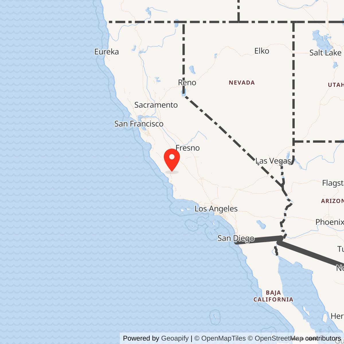
Longitude: -120.6270000
Airport ICAO ID: KPRB
Official Base Website: Paso Robles Municipal Airport
Current Role: Paso Robles Municipal Airport with general aviation, aviation businesses, CAL FIRE and CHP operations, Estrella Warbirds Museum, and transient military support; former western support tract in separate state institutional reuse
Estrella Army Air Field was a short-lived but substantial World War II Army Air Forces installation built in the Estrella district northeast of Paso Robles. Its military career lasted only from April 1943 to October 1944, yet the government created a complete 1,259-acre aviation property with two paved runways, fuel facilities, an operations building, fire protection, utilities, and a separate support area. The airfield's surviving runway pattern became the foundation of Paso Robles Municipal Airport, making the former military installation unusually legible in present-day civilian use.
The field's identity requires careful service separation. Construction began in September 1942 for a proposed Marine Corps bomber base, and early local reporting described the project in naval terms. By the time the first construction stage was completed on April 8, 1943, however, the Navy had decided to favor its Lemoore facilities and transferred the new airfield to the Army Air Forces. The completed installation was dedicated as Estrella Army Air Field and placed under the jurisdiction of Santa Maria Army Air Field.
The Marine Corps influenced the original design requirement, and local summaries state that Marine personnel used buildings west of Airport Road, but no source located establishes a separately activated Marine Corps air station, auxiliary air facility, or independently administered naval reservation at Estrella after the Army assumed control. Sherwood Field, the older Paso Robles emergency field southeast of the city, was a separate Navy property and already represents the distinct naval aviation installation in the area.
Site Selection and Construction
The government selected the Estrella district because it offered open agricultural land, generally favorable flying weather, room for intersecting runways, and road access to Paso Robles and the larger Central Coast military network. The location also placed the new field between major training areas at Camp Roberts and Camp San Luis Obispo while remaining within reach of Santa Maria Army Air Field. That geography made Estrella useful as a relief, alternate, and night-training field even though it never developed into a major independent fighter base.
Federal acquisition assembled land that had belonged to several local ranching and agricultural owners. Contemporary and local historical accounts place the tract at approximately 1,249 to 1,259 acres during acquisition and completion. The City of Paso Robles uses 1,259 acres as the completed installation figure, and that value is the most useful whole-property number because it also reconciles the later division of roughly 1,057 acres for airport use and about 202 acres for the institutional property west of Airport Road.
Construction began on September 3, 1942, after a contract went to the Doudell Construction Company of San Jose. Approximately 2,000 workers reportedly operated in two shifts to finish the first stage in slightly more than six months. The resulting installation had two 4,700-foot runways arranged in a broad V, fuel infrastructure, an operations building, and a small three-bay fire station. The speed of construction reflected wartime priorities, with operational utility taking precedence over elaborate permanent architecture.
A support complex was built across the road from the runway area. Local historical material describes forty-three buildings with underground utilities for housing, administration, and storage. The airfield itself initially lacked large hangars and extensive maintenance buildings, which was consistent with its role as a dependent and alternate field rather than a self-contained depot or major replacement-training center. Aircraft could operate, refuel, and receive limited support there while heavier maintenance and command functions remained at the parent station.
Mission Evolution
Estrella's mission changed before the airfield formally opened. The original plan called for a Marine Corps bomber base, but the Navy relinquished the property when construction reached its first operational stage. The Army Air Forces then adapted the field for night flying, fighter training support, alternate landing, and regional maneuvers. This was not a minor paper change because it replaced a proposed naval bomber installation with an Army field tied to Fourth Air Force fighter preparation and nearby ground-force training areas.
Santa Maria Army Air Field became Estrella's immediate aviation parent. Santa Maria had shifted toward Lockheed P-38 Lightning fighter training, and Estrella gave its instructors and students another paved field away from coastal fog and congestion. The Paso Robles field was used primarily as a backup training location for squadrons based at Santa Maria and was especially valuable for night operations. The arrangement allowed the parent station to distribute flying activity across more than one runway complex without duplicating its entire maintenance and administrative organization.
Army Air Forces planning also associated Estrella with Camp San Luis Obispo. Official wartime base-development history paired the ground-force camp with Estrella in the same way other large Army camps were linked to nearby Army airfields. That relationship indicates a broader support role beyond routine pilot training. The field provided an aviation access point for a regional military concentration that included Camp San Luis Obispo, Camp Roberts, Santa Maria Army Air Field, and numerous smaller air and maneuver facilities along California's Central Coast.
Wartime Operations
The initial Army cadre consisted of Lieutenants Raymond J. Goetting and Edgar J. McCullough and twenty-eight enlisted men. This small opening staff confirms that Estrella began as a dependent field rather than a full group station. By Christmas 1943, local accounts placed roughly 1,550 military personnel at Estrella and nearby Sherwood Field combined, showing how quickly wartime activity expanded even though the precise distribution between the two properties was not preserved in the sources located.
The principal flying mission was night and alternate-field training for the Santa Maria P-38 program. Pilots needed repeated takeoffs, landings, navigation exercises, emergency diversions, and familiarization with operations away from the parent runway. Estrella's inland location was particularly useful when weather restricted other Central Coast fields. The P-38 became the aircraft most closely associated with the site, although available evidence does not support a claim that a large permanently assigned P-38 inventory belonged to Estrella itself.
Estrella also participated in large regional military maneuvers during early 1944. These exercises connected aviation operations with the Army's extensive ground training system on the Central Coast. Aircraft could support observation, liaison, navigation, simulated tactical movement, and the movement of personnel while units from nearby camps practiced large-scale field operations. The event record is not detailed enough to assign individual sorties or participating squadrons, but the maneuvers show that the airfield served the wider wartime training landscape rather than functioning only as a local landing strip.
An unusual episode in local memory involved two Bell P-59 Airacomet jet aircraft landing at Estrella. The P-59 was the United States' first jet fighter and remained highly secret during the war. The account survives through the recollections of Lieutenant McCullough and the Estrella Warbirds Museum. It is plausible within the period's California test environment, but no official flight record was located, so the history treats the visit as a well-established local recollection rather than as a fully documented operational milestone.
Aircraft accident evidence confirms that Estrella supported more than routine light flying. Surviving serial-number and accident compilations associate the field with damaged or written-off Army aircraft during 1944, including a P-70 night-fighter conversion. These records support the broader picture of a field used by high-performance and specialized aircraft. They do not, however, establish that every aircraft involved was assigned to an Estrella-based unit, since transient and parent-station aircraft frequently used dependent fields.
Units and Organizations
No numbered Army Air Forces base unit, fighter group, or fighter squadron has been verified as permanently assigned to Estrella Army Air Field. The field's documented command identity is instead defined by its subordination to Santa Maria Army Air Field and its small local operating cadre. Capt. Roger F. Powell was serving as base commander when he announced in November 1944 that the facility might be transferred for county use, but the complete sequence of local commanders was not located.
The principal organization operating through Estrella was the Fourth Air Force training system centered locally on Santa Maria. P-38 squadrons and replacement trainees used the Paso Robles field as a backup and night-flying location while command, major maintenance, and most administrative functions remained at Santa Maria. This distinction matters because unit histories for groups that passed through Santa Maria should not automatically be treated as permanent Estrella assignments without station-specific evidence.
The Army ground-force relationship was also important. Camp San Luis Obispo was the installation paired with Estrella in official Army Air Forces base-development history, while Camp Roberts lay closer to Paso Robles and generated substantial regional movement and training demand. Estrella therefore linked air and ground training systems. Its value came from providing a runway and support point within a dense military region, not from housing a large autonomous combat organization.
The Navy and Marine Corps connection was preparatory rather than a mature command phase. Naval planners drove the initial bomber-base requirement, and some local accounts associate Marine personnel with the support buildings west of Airport Road. The Navy's decision to relinquish the project on April 8, 1943 prevented the field from developing into a separately named Marine Corps station. Sherwood Field remained the distinct Navy emergency field serving Paso Robles during the war.
Facilities and Physical Layout
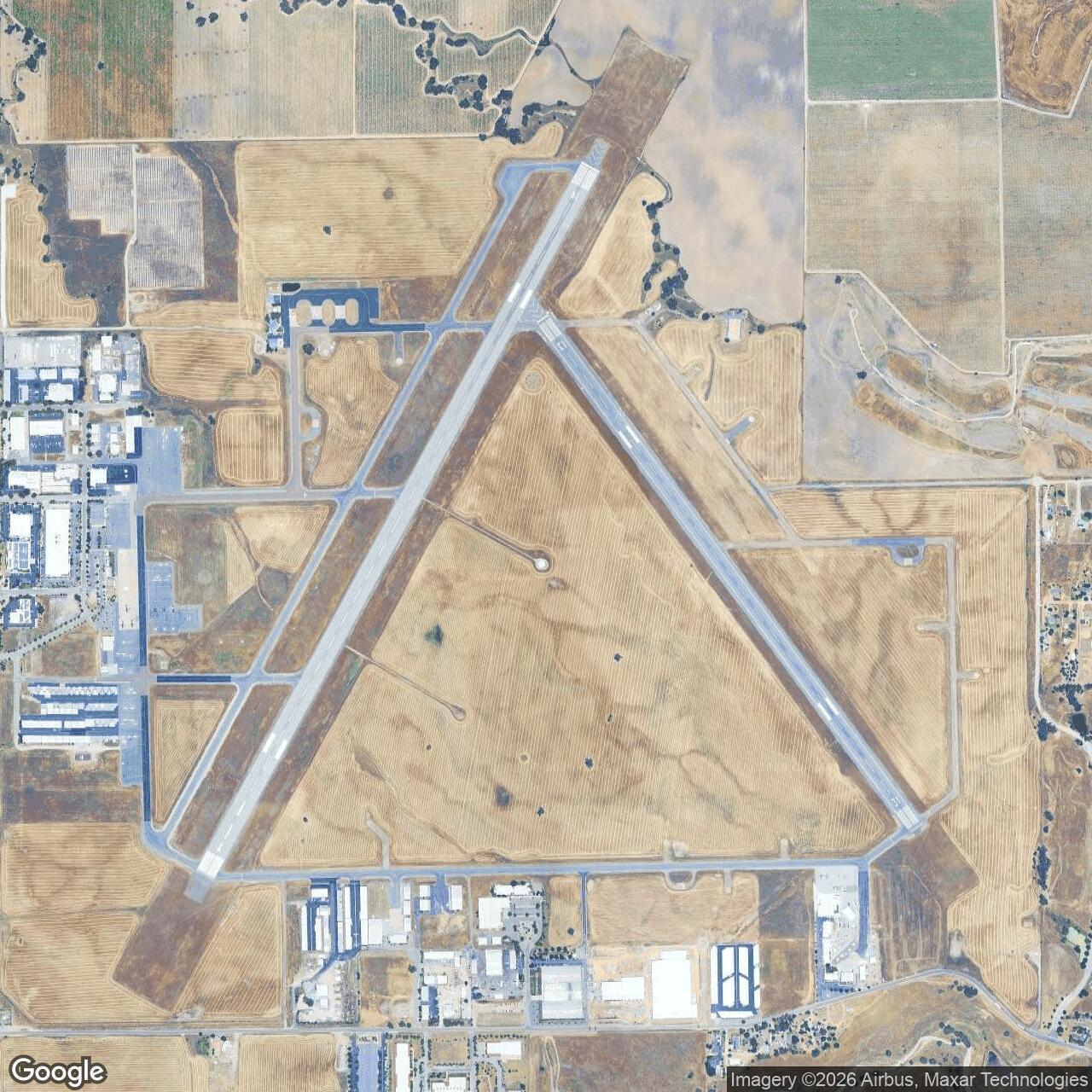
The two original 4,700-foot paved runways formed the operational core. Their V-shaped layout allowed pilots to use different headings as winds changed and gave the field more flexibility than a single-strip auxiliary landing ground. The present Runway 13/31 remains approximately the original wartime length, while the north-south runway was later extended to more than 6,000 feet. The continued use of both alignments preserves the basic geometry of the Army field.
The operations building coordinated local flying and provided the administrative center for the runway side of the installation. A small three-bay fire station supported crash response, and fuel facilities allowed aircraft to continue training without returning immediately to Santa Maria. The absence of major hangars in the first construction phase limited heavy repair work and reinforced the field's dependent status. Maintenance beyond local servicing would ordinarily have remained with the parent base.
Across Airport Road, the forty-three-building support complex contained housing, administration, storage, and utilities. The road divided the flying plant from the cantonment-like area and later helped determine postwar reuse. The airport portion remained devoted to aviation, while the western institutional tract became a state correctional or youth-authority property. This physical separation explains why postwar sources sometimes describe the transfer in two different acreage blocks.
Utilities were significant even though the buildings were temporary or utilitarian. Underground services supported the support area, and the federal installation included wells and wastewater infrastructure later shared between airport and state uses. After the City of Paso Robles acquired the airport, it assumed responsibility for water wells and sewage facilities serving both sides of the former military property. The persistence of these systems shows that the wartime buildout shaped later development beyond the runways themselves.
Role in the Wider Military Network
Estrella functioned as one node in the Fourth Air Force's California training network. Santa Maria Army Air Field provided the command and principal P-38 training organization, while Estrella added runway capacity, inland weather alternatives, and space for night flying. This relationship allowed the Army Air Forces to expand training without constructing a second complete parent base. The operational network mattered more than the number of units permanently housed at Paso Robles.
The airfield also supported the Army's ground-training concentration along the Central Coast. Camp San Luis Obispo and Camp Roberts trained large numbers of soldiers, and Fort Hunter Liggett added a vast maneuver environment farther north. Estrella offered an aviation gateway among those installations. The field's wartime and postwar usefulness both stemmed from this location near ground-force reservations rather than from a uniquely independent flying mission.
Sherwood Field formed a separate but related local aviation node. It predated Estrella, served first Army observation activity and then Navy emergency use, and remained southeast of Paso Robles. A wartime account describes Santa Maria aircraft mistaking Sherwood for Estrella during a weather diversion, illustrating how closely the two airfields could be connected operationally while remaining separate properties with different service histories.
The field's relationship to wider military systems continued after the Army left. Paso Robles Municipal Airport became a civil airfield, but its runway length and proximity to Camp Roberts allowed military aircraft to use it periodically. The Air Force's 2014 C-17 landing demonstrated that the airport could support rapid movement of personnel for the California National Guard. Modern military use is transient and support-oriented, not a restoration of the old Army airfield command.
Closure and Federal Disposal
Estrella's active Army mission ended quickly as wartime training requirements shifted. The airfield was inactivated on October 15, 1944, only about eighteen months after dedication. On November 27, Capt. Roger F. Powell announced that the property might be made available to San Luis Obispo County. County officials studied the proposal and agreed to pursue the field as a public airport, beginning a disposal process that lasted several years.
Different local sources summarize the transfer acreage and dates in slightly different ways. The City of Paso Robles states that the federal government transferred approximately 1,057 acres to San Luis Obispo County and 202 acres with buildings to the State of California on August 29, 1947. More detailed local research identifies a 966.8-acre county quitclaim on that date and a later state deed dated August 5, 1948. The history preserves the documented division without forcing the conflicting deed summaries into a single unsupported transaction sequence.
The county developed the aviation tract as a commercial airport. Between 1949 and 1952 it extended the north-south runway from 4,700 feet to about 6,009 feet, installed high-intensity lighting, and constructed a large hangar, ten T-hangars, and a terminal. These improvements shifted the physical plant from a temporary wartime auxiliary field toward a regional civil airport capable of scheduled airline and general-aviation service.
The state reused the western support area as a correctional or youth institution. This preserved some of the former military building zone while separating it administratively from the airport. The split illustrates a common pattern in World War II base disposal. Runways and aviation land went to local government under airport-use conditions, while cantonment or support acreage was redirected into another public purpose.
Environmental Record
The former military property remains in the Formerly Used Defense Sites inventory as Paso Robles Municipal Airport, property J09CA0354. The 2015 Army Corps inventory identifies one CON/HTRW site, a category used for containerized hazardous, toxic, or radioactive waste concerns. The inventory entry confirms an environmental-restoration relationship but does not by itself identify the contaminant, affected parcel, or present remedy status.
A General Accounting Office compilation published in 2001 listed the Paso Robles property with remedial design under way and a fiscal-year 1992 start. That historical table reported program cost figures, but such figures are time-specific snapshots and should not be treated as present totals. No current Army Corps closeout document or current parcel-level restriction was located during this review, so the history does not claim that the former defense-site issue is either unresolved or fully closed today.
Current Status
Paso Robles Municipal Airport now occupies the principal former runway property and remains owned by the City of Paso Robles. The current airport covers about 1,300 acres, a figure that reflects the modern civil property rather than the exact wartime Army reservation. It retains two paved runways, uses the identifiers PRB and KPRB, and supports general aviation, corporate flying, flight training, emergency services, charter operations, and aviation-related businesses.
The airport has become an important regional public-safety base. California Department of Forestry and Fire Protection operations use the field for aerial firefighting, and the California Highway Patrol has maintained aviation functions there. These missions continue the site's long association with rapid regional response, but they are civilian state operations rather than assigned military units. The airport also hosts the Estrella Warbirds Museum, which preserves the name and interprets the wartime aviation heritage.
Military aircraft still use the field on a transient basis. In June 2014 an Air Force C-17 Globemaster III landed at Paso Robles to validate the concept of moving large numbers of personnel to nearby Camp Roberts. The landing demonstrated that postwar runway improvements had given the former Army field a renewed military logistics value. No permanent active-duty, reserve, or National Guard flying unit is currently assigned to the airport.
The former support area west of Airport Road has a separate institutional history and is no longer part of a unified military installation. Modern airport business development, hangars, public-safety facilities, museum buildings, and the state institutional tract have replaced most obvious elements of the wartime cantonment. The runways, property division, infrastructure patterns, and Estrella name nevertheless preserve a direct connection to the Army airfield.
Post-World War II Conflicts and Events
Estrella Army Air Field itself had no post-World War II combat or contingency involvement because the Army inactivated it before the war ended and disposed of the property afterward. No assigned Estrella unit served in Korea, Vietnam, the Persian Gulf, Iraq, Afghanistan, or later operations. Any claim of such service would confuse the later histories of Santa Maria-trained units, nearby Army installations, or transient aircraft with the closed installation's own record.
The current municipal airport has supported military readiness without becoming a military base again. Its proximity to Camp Roberts, Fort Hunter Liggett, and Camp San Luis Obispo makes it useful for personnel movement, exercises, and occasional military aviation. The 2014 C-17 event is the clearest documented modern example. That support role belongs to the civilian airport's history and should be distinguished from an active military garrison or assigned-unit mission.
Chronology
- 1942-08-27 Local reporting announced federal selection of an approximately 1,200-acre Estrella tract for a proposed Marine Corps airfield.
- 1942-09-03 Construction began under a contract awarded to the Doudell Construction Company.
- 1942-09 to 1943-04 Approximately 2,000 workers completed the first stage, including two 4,700-foot runways, fuel facilities, operations and fire buildings, and a support complex.
- 1943-04-08 The Navy relinquished the completed project, and the Army Air Forces dedicated Estrella Army Air Field under Santa Maria Army Air Field.
- 1943 The opening Army cadre consisted of two officers and twenty-eight enlisted personnel.
- 1943 Estrella began supporting night flying, alternate-field operations, and P-38 training connected with Santa Maria.
- 1943-12 Local accounts placed approximately 1,550 military personnel at Estrella and Sherwood Field combined.
- 1944 Estrella personnel and aircraft participated in large regional military maneuvers.
- 1944 Two Bell P-59 jet aircraft reportedly visited the field, an event preserved in local recollection.
- 1944-07 Aircraft records associate a P-70 night-fighter conversion with survey or loss activity at Estrella.
- 1944-10-15 The Army Air Forces inactivated Estrella Army Air Field.
- 1944-11-27 Base commander Capt. Roger F. Powell announced that the facility might become available for county use.
- 1944-12 San Luis Obispo County officials endorsed further study of acquiring the property as a public airport.
- 1947-08-29 The War Assets Administration completed a major quitclaim transfer of airport land and improvements to San Luis Obispo County.
- 1948-08-05 A later quitclaim conveyed former support-property land and buildings for state institutional use according to detailed local research.
- 1949-1952 The county extended the north-south runway, installed improved lighting, and added hangars and a terminal.
- 1952 Scheduled commercial air service began using the postwar airport facilities according to the City's history.
- 1973-05-07 San Luis Obispo County sold the airport to the City of Paso Robles for one dollar.
- 1973 The City began operating and developing Paso Robles Municipal Airport and its industrial properties.
- 1989-1993 Local aviation preservation activity developed into the Estrella Warbirds Museum organization.
- 1992 Historical federal environmental tables identify the start of the FUDS response associated with Paso Robles Municipal Airport.
- 2001 A General Accounting Office compilation listed remedial design under way for FUDS property J09CA0354.
- 2014-06-08 An Air Force C-17 landed at Paso Robles to validate heavy-airlift support for nearby Camp Roberts.
- 2015-09-30 The Army Corps FUDS inventory continued to list Paso Robles Municipal Airport as J09CA0354 with one CON/HTRW site.
- Present Paso Robles Municipal Airport remains an active city-owned civil airport, public-safety aviation base, military-support airfield, industrial aviation center, and home of the Estrella Warbirds Museum.
Information sources (14)
- WEBCity of Paso Robles, History
Source for construction, dedication, acreage, facilities, property transfer, and postwar airport development.
- WEBCity of Paso Robles, Airport Overview
Source for current airport acreage, location, ownership context, and general aviation role.
- WEBCity of Paso Robles, Airport-KPRB
Source for the current airport identity, address, elevation, identifiers, and operating information.
- WEBEstrella Warbirds Museum, Estrella Army Air Field
Source for acquisition, construction, Army transfer, personnel, mission, inactivation, and disposal chronology.
- WEBEstrella Warbirds Museum, Why P-38
Source for the Santa Maria relationship, night-flying mission, and P-38 training context.
- WEBEstrella Warbirds Museum, Sherwood Field
Source for distinguishing the separate Navy emergency field from Estrella Army Air Field.
- WEBEstrella Warbirds Museum, We've Come a Long Way
Source for the museum's establishment and preservation role at the former airfield.
- WEBCraven and Cate, The Army Air Forces in World War II, Volume VI, "The Development of Base Facilities"
Source for Estrella's official relationship to Camp San Luis Obispo in the wartime base system.
- WEBWar Department, TM 14-510, Official Mileage Tables, 1 July 1944
Source confirming Estrella Army Air Field as an official wartime station near Paso Robles.
- WEBAir Mobility Command, Big Plane Lands on Small Runway
Source for the 2014 C-17 landing and modern military airlift support to Camp Roberts.
- PDFU.S. Army Corps of Engineers, Formerly Used Defense Sites Per State: California
Source for FUDS property J09CA0354 and its CON/HTRW environmental-site classification.
- WEBU.S. General Accounting Office, California FUDS Property Table
Source for the historical remedial-design status and program record for J09CA0354.
- WEBPaso Robles Press, Paso Robles Municipal Airport: 50 Years of Opportunity
Source for local acquisition history, staffing, postwar ownership, and modern airport development.
- WEBSkyVector, Paso Robles Municipal Airport
Source for current FAA-derived airport coordinates, identifiers, and runway information.