
Sherwood Field / Paso Robles Navy Emergency Field, Paso Robles California
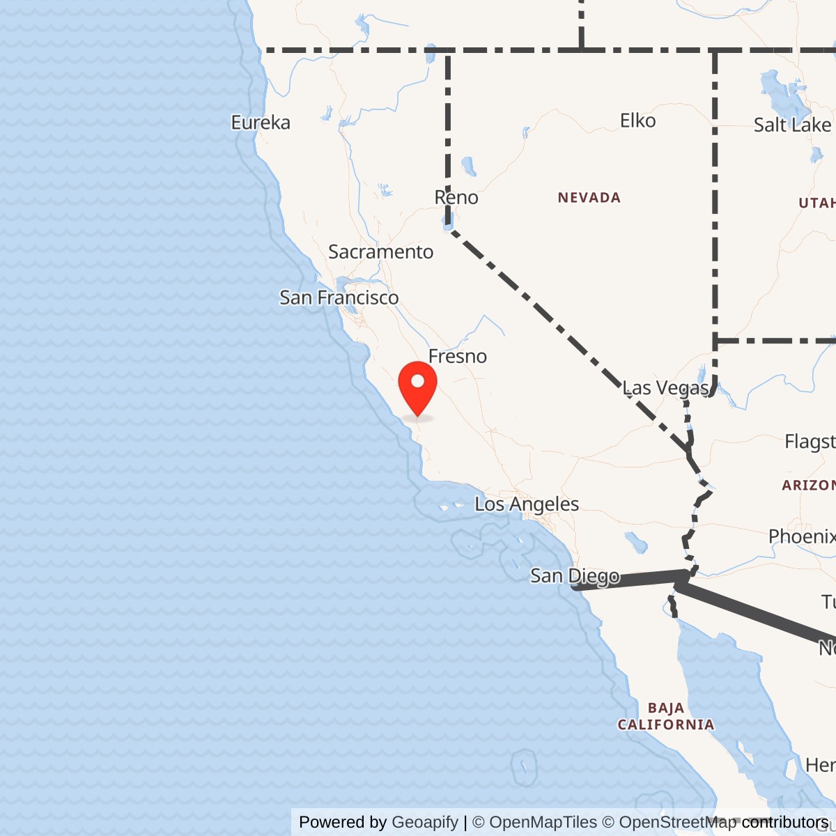
Longitude: -120.665
Current Role: Former Paso Robles airport/Sherwood Field used by the Navy as an emergency field rather than a full auxiliary air station; now redeveloped with residential, industrial, park, and commercial uses, with former aviation features and a wartime hangar documented locally.
Sherwood Field was a small but useful World War II emergency aviation field in southeast Paso Robles. It was not a commissioned naval air station, and it should not be described as equal in scale to Naval Auxiliary Air Stations such as Crows Landing, Hollister, King City, Monterey, Santa Rosa, Vernalis, or Watsonville. Its importance lies in a different category: a civilian airport that the Army improved during the 1940 defense buildup, then turned over to the Navy in late 1941 for emergency use within the dense wartime aviation network of California's Central Coast and Central Valley.
That distinction matters. Paso Robles had two wartime airfield stories that can easily be confused. The larger Estrella Army Air Field, built in 1943 north of town, later became the present Paso Robles Municipal Airport. Sherwood Field was older, smaller, and closer to the city. It began as the local Paso Robles airport in the late 1920s or early 1930s, was improved under Civil Aeronautics Authority and Army pressure in 1940 and 1941, hosted the 115th Observation Squadron of the California National Guard, and then entered Navy hands as an emergency field. The Navy returned it to the City of Paso Robles on August 19, 1945.
Prewar Airport and Army Improvement
The field began as a private airport associated with T. A. Osborne. It lay about a mile and a half southeast of downtown Paso Robles, then outside the city limits, at a time when aviation was still a local spectacle. The early field had two dirt or oiled landing strips and a few privately owned aircraft. In 1940, with federal aviation money and military interest increasing, Paso Robles moved to secure the airport as a public facility. Voters approved the purchase, and the city acquired the field for $9,000. The airfield then became Paso Robles' official airport.The field's early military value came from readiness rather than from size. In 1940 the Civilian Pilot Training Program used the field, and the possibility of Army Air Corps use helped justify local investment. In October 1940 the City of Paso Robles and the War Department agreed to lease the airport to the Army for one dollar per year. Private aircraft were moved away, survey and construction work began, and the site became a small military aviation facility tied to the regional mobilization around Camp San Luis Obispo and other California training locations.
The Army's improvements were substantial for a local field. Utilities, water, drainage, sewage, electricity, telephone service, hard-surfaced runways, a concrete apron, a large metal hangar, mess halls, showers, toilets, and supporting buildings changed Sherwood Field from a modest municipal airport into a more durable training and emergency landing facility. In early 1941 the federal government funded an additional 4,200-foot east-west runway, and the city purchased additional land for the improvement. These upgrades explain why the Navy could later use the field even though it never became a full naval air station.
The first military unit stationed at the improved field was the 115th Observation Squadron of the California National Guard. The squadron had been inducted into federal service and was attached to the 40th Division at Camp San Luis Obispo. Sherwood Field was named in honor of Captain George Sherwood, the squadron's first commanding officer, who died in a 1935 crash while delivering mail. The name thus tied the airfield to California National Guard aviation before its Navy period.
Navy Emergency Field Role
The Navy received Sherwood Field from the Army Air Corps later in 1941. The best available local aviation-history sources are explicit about the limited character of Navy use: the Navy used the field only as an emergency field, and a full complement was never stationed there. That makes Sherwood Field different from the larger Navy auxiliary stations. It functioned as a safety, dispersal, alternate-landing, and contingency airfield in a region crowded with wartime flying activity.The military logic was straightforward. Central California contained a dense web of Army, Navy, Marine, National Guard, civilian pilot-training, and contract-school aviation activity during World War II. Fog, weather, night training, mechanical trouble, fuel shortage, and navigation error could all make alternate fields valuable. A hard-surfaced field southeast of Paso Robles, close to Camp San Luis Obispo, Estrella Army Air Field, the Salinas Valley airfields, and the wider Alameda and Central Coast aviation network, had practical utility even without a large permanent Navy garrison.
A 1943 incident recorded in local aviation history shows exactly why such fields mattered. Army aircraft returning from maneuvers near Santa Maria found their home field fogged in and were told to use Estrella Army Air Field as an alternate. With fuel running low and darkness increasing, the aircraft instead found Sherwood Field. A local weather observer helped direct them in with a flashlight, and fuel was trucked in the next day from Estrella. The incident was not necessarily a Navy operation, but it illustrates the kind of contingency role Sherwood Field could play: a place where aircraft in trouble could land when the preferred field was unavailable.
The field appeared on wartime aeronautical charts and directories. Abandoned-airfield documentation notes that the December 1941 San Francisco Sectional Chart depicted Sherwood Field as a military airfield. A 1944 Army/Navy airfield directory reportedly described Paso Robles Municipal Airport, Sherwood Field, as having a hard-surface runway. The 1945 Army Air Forces Airfield Directory described the field as about 180 acres, with two asphaltic-concrete runways, a large metal hangar, and a city ownership status, while also noting that the field was not in operation at that moment. These details fit a wartime emergency-field profile: a known, paved, mapped aviation site that could be used when needed, even if it did not carry a large permanent unit establishment.
Facilities and Physical Layout
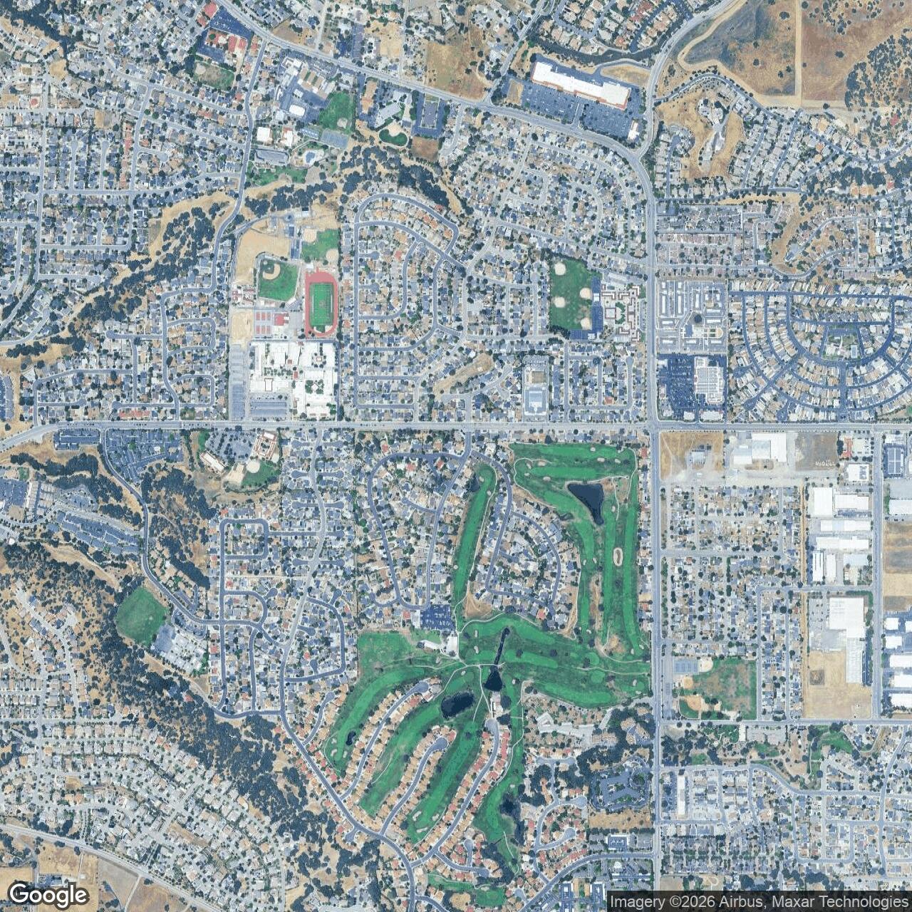
Sherwood Field's physical scale was modest compared with the major naval auxiliary stations. Its location was southeast of downtown Paso Robles, in the area later absorbed into the city's Sherwood neighborhood, Sherwood Park, and industrial development. Estrella Warbird Museum identifies the former field as boxed in by Creston Road on the west, Sherwood Road on the north, Fontana Road on the east, and Scott Street on the south. The site had runways, a hangar, an apron, utilities, mess and sanitation facilities, and a camp layout that could have been expanded if required.The prewar field had two oiled or dirt runways, one about 3,400 feet long and the other about 1,600 feet long. Army improvements added paved surfaces and a major east-west runway. Airfields-history sources describe the 1941 field as having two asphalt runways and a newly built hangar, while later airfield directories described two asphaltic-concrete runways measuring about 3,300 feet northeast-southwest and 2,500 feet east-west. The largest hangar was described as a 160-by-120-foot metal structure. These dimensions confirm that Sherwood Field was not merely a rough pasture strip, but they also confirm that it was much smaller and simpler than the main wartime naval auxiliary fields.
Several built features outlasted the military period. The large hangar became the core of an industrial building at 298 Sherwood Road, long associated with Ennis Business Forms and later publicly discussed as a historic World War II aircraft hangar. The old officers' mess reportedly survived in local civic use. Portions of the old ramp or runway pavement remained visible or physically present for decades even as housing, industry, and streets covered most of the former airfield. Those survivals are important because Sherwood Field has mostly disappeared as an airfield, but not completely as a built landscape.
Role in the Wider Military Network
Sherwood Field's value was as a small node in a much larger wartime aviation system. The Navy and Army both needed dozens of secondary fields in California because pilot training, tactical training, carrier-landing practice, gunnery, ferrying, maintenance, patrol, and emergency operations could not be safely concentrated on a few major bases. Aircraft training networks depended on alternate landing fields, satellite fields, emergency fields, and municipal airports brought under military control.Within that system, Sherwood Field sat near several larger military landscapes. Camp San Luis Obispo lay to the south; Estrella Army Air Field was built north of Paso Robles during the war; King City, Hollister, Watsonville, Monterey, and other naval auxiliary stations operated in the broader region; and NAS Alameda's training network stretched across central and northern California. Sherwood's exact Navy role was narrower than those stations, but its existence helped give the regional system more depth. It was a hard-surfaced emergency option in a corridor where training aircraft, liaison aircraft, and military traffic were common.
The field also shows how the Navy used inherited infrastructure during wartime. Rather than constructing every support point from scratch, the services reused existing municipal or private airports when those fields had the location, land, runways, and utilities to support military needs. Sherwood Field had already been improved by the Army before Navy use, so the Navy could fold it into its emergency-field network without creating a full air station.
Closure and Postwar Reuse
The Navy returned Sherwood Field to the City of Paso Robles on August 19, 1945. After the war, the field rapidly lost its aviation future. Estrella Army Air Field, built in 1943 and later transferred to civilian use, became the larger and more suitable public airport north of town. Sherwood Field was hemmed in by urban growth, and aviation activity shifted away from the older site.Local history states that Sherwood Field served as the Paso Robles airport until 1951, when city aviation operations moved to the current airport at the former Estrella field. In 1952 Paso Robles annexed the former airfield area in what became known as the Sherwood Annexation. Housing development, industrial reuse, streets, parks, and commercial uses gradually covered the former runways and support areas. The airfield was effectively erased from the air, though its name survived in Sherwood Road, Sherwood Park, Sherwood Acres, and local memory.
A 1976 incident underlines how long the airfield's physical traces remained confusingly visible. A pilot reportedly mistook the closed Sherwood Field for the active Paso Robles airport and landed on remnants of the old runway, ending up in a backyard without injury. That late mistaken landing shows that even after two decades of closure, enough pavement and visual pattern remained to suggest an airfield from the air.
Current Status
Sherwood Field is no longer an aviation facility and no longer a military installation. The former field is now a redeveloped urban area in southeast Paso Robles, with residential neighborhoods, industrial parcels, local streets, Sherwood Park, commercial uses, and surviving fragments or reused structures associated with the former aviation site. The large wartime hangar area at 298 Sherwood Road has been publicly described as containing a historic World War II aircraft hangar and has been associated with industrial and adaptive-reuse discussion.The present Paso Robles Municipal Airport is not Sherwood Field. It is the former Estrella Army Air Field north of town. Sherwood was the older airport and wartime Navy emergency field; Estrella became the continuing municipal airport.
Chronology
- Late 1920s / early 1930s Sherwood Field began as a private airport southeast of downtown Paso Robles, associated with T. A. Osborne.
- 1935 Captain George Sherwood, later honored in the field's name, died in an aircraft crash while delivering mail.
- April 1940 Paso Robles voters approved purchase of the airport site; the city acquired the field for $9,000.
- August 1, 1940 Civilian Pilot Training activity began at Sherwood Field with a class of students including several women.
- October 9, 1940 The City of Paso Robles and the War Department agreed to lease the field to the Army for one dollar per year.
- October 1940 Private aircraft were removed and military improvement work began.
- 1940-1941 The Army improved the field with utilities, hard-surfaced runways, a large metal hangar, drainage, water, sewage, and support buildings.
- Early 1941 Federal funds were appropriated for a new 4,200-foot east-west runway.
- 1941 The 115th Observation Squadron of the California National Guard operated from the improved field before the Navy period.
- Late 1941 The Army Air Corps turned Sherwood Field over to the Navy for use as an emergency field.
- December 1941 The San Francisco Sectional Chart depicted Sherwood Field as a military airfield.
- 1943 A recorded alternate-landing episode illustrated the field's usefulness when other airfields were unavailable because of weather and low fuel.
- 1944 An Army/Navy airfield directory described the Paso Robles/Sherwood Field airfield as having a hard-surface runway.
- 1945 The 1945 AAF Airfield Directory described Paso Robles Municipal Airport / Sherwood Field as about 180 acres with paved runways and hangars.
- 1945-08-19 The Navy returned Sherwood Field to the City of Paso Robles.
- 1951 Paso Robles aviation activity shifted to the current airport site at the former Estrella Army Air Field.
- 1952 Paso Robles annexed the former Sherwood Field area as the Sherwood Annexation; housing and other redevelopment followed.
- Mid-1950s Housing development began covering parts of the former field, though pavement and aviation features remained in places.
- 1976-12 A pilot reportedly mistook the closed Sherwood Field for the active Paso Robles airport and landed on remaining runway pavement.
- Present The former Sherwood Field area is redeveloped with residential, industrial, park, and commercial uses; surviving aviation traces and the former hangar preserve part of the site's memory.
Sources & References
- WEB Estrella Warbird Museum Sherwood Field
- WEB City of Paso Robles Airport Overview
- WEB San Luis Obispo Tribune Old Paso Robles airplane hangar will soon house brewery. How did airfield get started
- WEB Abandoned & Little-Known Airfields California: San Luis Obispo area / Sherwood Field entry
- WEB Aerofiles, California Airports Paso Robles, Sherwood Field
- WEB City of Paso Robles Economic Development Newsletter Ennis Facility at 298 Sherwood Road