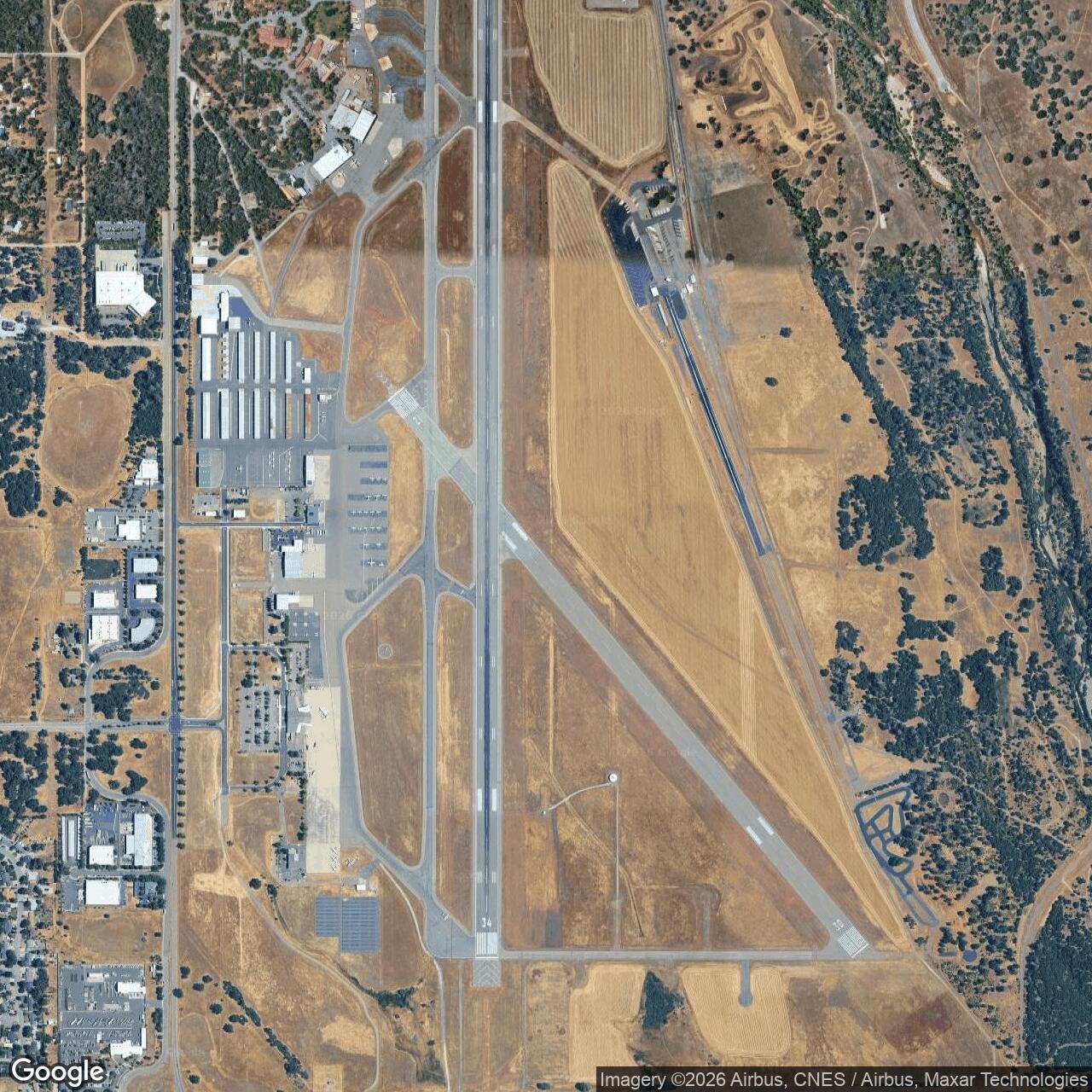
Redding-Shasta Army Air Field, Redding California
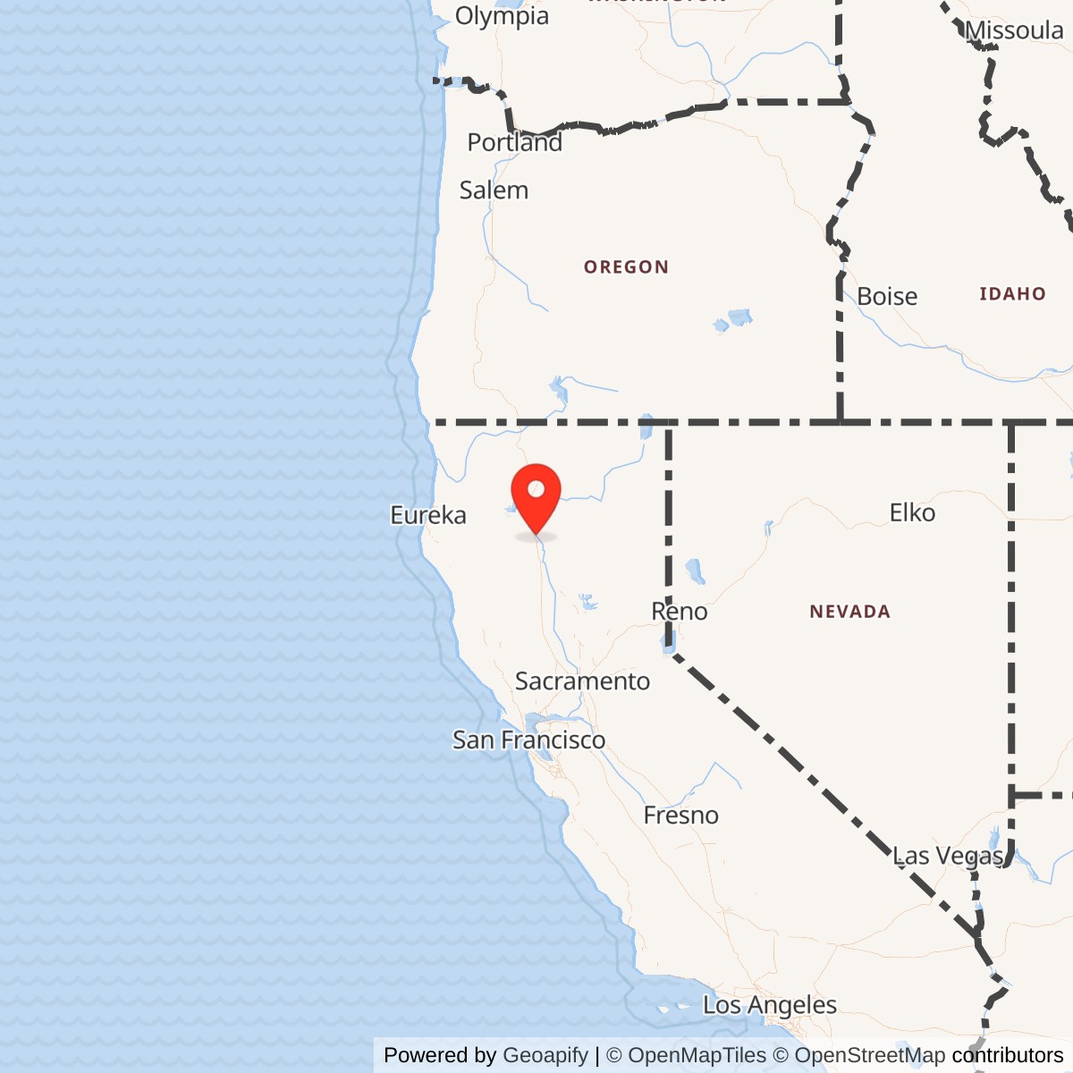
Longitude: -122.2933853
Airport ICAO ID: KRDD
Official Base Website: Redding Regional Airport
Current Role: Redding Regional Airport, a City of Redding public commercial-service and general aviation airport with airline passenger service, cargo, hangars, maintenance, and aviation-related services.
Redding Army Air Field was a World War II U.S. Army Air Forces field built on the southeast side of Redding, California, where the Sacramento Valley begins to open toward the Cascade and Klamath country of far northern California. The field occupied a transportation and aviation corridor that mattered in 1942. Redding sat on the north-south inland route between the San Francisco Bay Area, Sacramento, northern California, Oregon, and the Pacific Northwest. That made the site useful as an Army airfield in two ways: it could support fighter training away from the heavier congestion of the Bay Area, and it could also serve transient aircraft moving through the West Coast military air network.
The installation was known in wartime sources and later local histories by several related names. The prewar civil-airport project was associated with Stillwater Airfield and Redding Airdrome. After military construction in 1942, the field was known as Redding-Shasta Army Air Field and more commonly as Redding Army Air Field or Redding Army Airfield. Today the same airfield is Redding Regional Airport, formerly Redding Municipal Airport, a public airport owned and operated by the City of Redding. Its modern ICAO identifier is KRDD.
The field was established in 1942, used for wartime training, auxiliary-field operations, transient aircraft servicing, and support functions, then declared excess and returned to civil airport use after the war. It did not continue as an active post-1947 Air Force base. That makes it similar to other wartime Army Air Forces fields that later became municipal airports, rather than to fields such as Paine or Perrin that continued into full Air Force base careers.
Site Selection and Construction
Before the Army arrived, Redding had sought a new airport project under the public-works logic of the late 1930s and early 1940s. The civil idea was overtaken by wartime need. In 1942 the U.S. Army Corps of Engineers built the airfield as a military flight-training field for the Army Air Forces. When construction was finished, the new airdrome became Redding Army Air Field, also called Redding-Shasta Army Air Field.
The field's design reflected its wartime purpose. Local aviation history records two paved runways in the original military layout: a 6,000-foot primary runway and a 5,062-foot crosswind runway. The two-runway plan gave fighter and transient aircraft more operational flexibility in variable wind conditions and made the field more useful than a simple emergency strip. Later airport development extended and reconstructed the primary runway, but the basic crossed-runway pattern still links the modern airport to its wartime origin.
Formerly Used Defense Site records identify the military property as a 1,440-acre site in the southeast section of Redding. Those records describe the federal acquisition as 1,120 leased acres from the City of Redding and 220 fee acres from three private owners. The FUDS documentation also preserves important physical traces: an asphalt taxiway, revetments, tie-downs, and fueling bunkers were still present in the postwar environmental record. That survival matters because many temporary wartime airfields left little more than runways. At Redding, the military working landscape remained legible through airfield pavement, fuel infrastructure, and dispersal features absorbed into the civilian airport environment.
Mission and Military Role
Redding's first wartime mission was advanced fighter training and auxiliary-field support within the Fourth Air Force system. The field was garrisoned by the 433rd Army Air Force Base Unit under the command structure associated with Hamilton Army Air Field. Hamilton, on San Pablo Bay north of San Francisco, was one of the major West Coast Army air installations. Redding gave that network a northern California field where fighter training and dispersal activity could occur away from the main base.
The aircraft most closely associated with the training mission was the Bell P-39 Airacobra. The P-39 was a front-line fighter early in the war and a useful training aircraft for pilots moving toward combat service. Redding's open valley airspace and relatively isolated location suited the kind of advanced flying, transition work, and air-defense practice needed by fighter units. The 399th Fighter Squadron, part of the 369th Fighter Group, is especially associated with P-39 operations at Redding during the group's California training period.
Redding's mission changed in 1944. Operational control transferred to the Sacramento Area Command headquartered at McClellan Army Airfield. With that transfer, Redding shifted from fighter training toward refueling and maintenance for transient aircraft. That change did not make the field less useful. It shows how the Army adapted the site as training demands changed and as the West Coast air-logistics system matured. By late 1944 and 1945, a field such as Redding could support aircraft passing through northern California, serve as a maintenance and service stop, and remain available to the military aviation network without being a primary training base.
Operational Role
What happened at Redding was the ordinary but essential work of wartime air mobilization. The field trained and supported pilots who would move onward to other assignments. It housed base-unit personnel responsible for operating, maintaining, fueling, guarding, and administering the field. It supported aircraft operations day after day, with paved runways, taxiways, dispersal areas, fueling points, hangars or support structures, and communications and maintenance functions.
The P-39 training role placed Redding within the fighter replacement and training system of the Army Air Forces. Replacement training units and related support fields existed to convert pilots, ground crews, and squadrons into deployable air power. Not every training field sent a named combat group overseas directly from its runways, and not every aircraft assigned to a field left a dramatic combat record tied to that specific site. The significance of places like Redding lies in throughput and readiness. They gave the Army Air Forces enough distributed training capacity to produce and sustain the flow of pilots, aircraft, and units required for a global war.
The later transient-aircraft mission was equally practical. A West Coast aircraft moving between the Bay Area, Sacramento, Oregon, Washington, and the inland northern California route needed places where it could refuel, be inspected, receive basic maintenance, and continue onward. Redding served that role after the 1944 mission shift. In this phase the field was less a schoolhouse and more a service node. That distinction helps explain why Redding's military history did not end immediately when its fighter-training activity declined.
Units, Organizations, and Systems
The 433rd Army Air Force Base Unit was the key garrison and base-support organization identified with Redding in local historical accounts. Base units were the machinery of wartime airfield operation. They handled administration, supply, aircraft servicing, facilities, communications, motor transport, medical support, security, and other functions that made flight operations possible. Their work is easy to overlook because it was not a glamorous combat assignment, but without base-unit personnel the field could not train pilots or support transient aircraft.
Redding's fighter-training identity is tied to the 369th Fighter Group and especially to the 399th Fighter Squadron. The 369th Fighter Group activated at Hamilton Field in August 1943, then operated across several California fields during its replacement-training period. Its squadrons flew P-39 Airacobras, and the 399th is associated with Redding while the group's other elements used Marysville and Oroville during the same broader training cycle. This pattern shows how one fighter group could be split across multiple satellite fields to use available runways, airspace, and support capacity.
The field also belonged to larger command systems. Initially it was part of the Fourth Air Force network centered on West Coast defense and training. Its connection to Hamilton placed it in the same regional system that included major bases and auxiliary fields across northern and central California. In 1944 the transfer to Sacramento Area Command under the Air Technical Service Command system shifted Redding toward logistics, refueling, and maintenance. That change linked the field more closely to McClellan Army Airfield and the Sacramento maintenance and service network.
Facilities and Physical Layout
Redding's wartime airfield layout was defined by two runways, taxiways, and support areas on the east side of the modern airport landscape near Stillwater Creek. The longer runway was the main operating surface, while the crosswind runway provided a second axis for operations. Both runways survived into the postwar airport, although the principal runway was later reconstructed and extended to support larger and faster aircraft.
The wartime base area was located on the east side of the present airport, with access associated with Old Oregon Trail. Local airport history notes that some original pavement remained visible in that area. A long east-side taxiway no longer used for aeronautical purposes later became associated with the Redding Drag Strip, an example of how former military pavement could be repurposed within an airport landscape.
FUDS records add useful detail to the physical picture. They describe a 1,440-acre site, identify remaining asphalt taxiway features, revetments, tie-downs, and fueling bunkers, and note underground storage tank issues typical of older military and airport fueling environments. These details make clear that Redding Army Air Field was more than a pair of runways. It had dispersal, fueling, tie-down, and support infrastructure consistent with an operating wartime airfield.
Role in the Wider Military Network
Redding Army Air Field should be understood as one node in the wartime northern California airfield network. It was not a stand-alone base with a large independent command history. Its importance came from its connection to Hamilton Army Air Field, Fourth Air Force, the P-39 fighter-training system, and later Sacramento Area Command and McClellan Army Airfield. Those relationships explain why the Army built and used an airfield at Redding: the field extended the reach of larger bases and helped distribute training and support functions across a wide region.
Its relationships with Marysville and Oroville are especially useful for interpretation. Those fields appear in the same broad Fourth Air Force and fighter-training context. Marysville, Oroville, and Redding together helped absorb the fighter training and air-support requirements that could not be concentrated at a single main base. When the 369th Fighter Group split operations among Marysville, Redding, and Oroville, the pattern reflected the Army Air Forces' wartime habit of spreading units across fields to use multiple runways and reduce congestion.
Redding also belonged to the air-logistics geography of the West Coast. Aircraft moving north and south through California needed fields like Redding. The field's 1944 transition to transient-aircraft refueling and maintenance demonstrates that point. The mission had shifted from training replacement fighter pilots to sustaining aircraft movement, but the same geography still mattered. Redding remained useful because it sat along a practical air route through northern California.
Closure, Disposal, and Civil Return
By 1945 the Army Air Forces no longer needed Redding as a wartime training and support field. Local history states that the military declared Redding Army Air Field excess in 1945. FUDS documentation records the site transfer to the War Assets Administration on December 14, 1946. On October 6, 1947, 1,120 acres were conveyed by quitclaim deed to the City of Redding, with the deed releasing the federal government from certain restoration or damage obligations and including a recapture provision. Later airport histories state that final paperwork ending military ownership was completed in 1949.
The postwar transfer shaped Redding's civil aviation future. The city already had Benton Field, the older airport closer to downtown. With the former Army field now available, the city renamed the older field Benton Airpark and developed the larger former military field as Redding Airport, later Redding Municipal Airport and Redding Regional Airport. This pattern was common after World War II. The Army's wartime investment in concrete, grading, drainage, access roads, and utilities gave many communities airport infrastructure they could not have built as quickly on their own.
Current Status
Redding Regional Airport is an active public airport owned and operated by the City of Redding. AirNav identifies KRDD as a public-use airport six miles southeast of Redding. The modern airport has two asphalt runways, a control tower, scheduled airline passenger service, aviation fuel, aircraft services, hangars, and related airport businesses. The City of Redding describes the airport as a full-service airport providing commercial airline passenger service, rental cars, parking, transportation, aviation-related services, and aircraft hangar facilities.
The field remains economically and regionally important. It serves commercial passengers, general aviation, air cargo, maintenance activity, and regional transportation needs. It also remains close to wildfire and public-safety aviation networks in a part of California where airfields play an important role in emergency response and access to remote terrain.
The military layer is no longer operational in the same way, but it remains embedded in the airport's layout and land history. The runways, taxiway patterns, old base-side pavement, environmental records, and FUDS listing preserve the fact that Redding Regional Airport began as a wartime Army Air Forces field. The airport's civil success is therefore inseparable from its brief but decisive military construction period.
Chronology
- 1930s to early 1940s Redding sought a new airport project, associated in later accounts with the Stillwater Airfield idea.
- 1942 The U.S. Army Corps of Engineers built the Redding Airdrome as a World War II military flight-training field for the U.S. Army Air Forces.
- 1942 The completed field became known as Redding-Shasta Army Air Field and Redding Army Air Field.
- 1942 FUDS records identify the field as an auxiliary to Hamilton Army Air Field and describe the federal acquisition as 1,120 leased acres from the City of Redding plus 220 fee acres from private owners.
- 1943 Redding functioned within the Fourth Air Force/Hamilton airfield system, supporting advanced fighter training and P-39 Airacobra operations.
- 1943 to 1944 The 399th Fighter Squadron of the 369th Fighter Group is associated with Redding during the group's California replacement-training period.
- 1944 Operational control transferred to Sacramento Area Command at McClellan Army Airfield.
- 1944 The field's mission changed from fighter aircrew training toward refueling and maintenance for transient aircraft.
- 1945 The military declared Redding Army Air Field excess to requirements.
- 1946-12-14 FUDS records state that the site was transferred to the War Assets Administration.
- 1947-10-06 FUDS records state that 1,120 acres were conveyed by quitclaim deed to the City of Redding.
- 1949 Final paperwork ending military ownership of the field was completed, according to local airport history.
- Postwar The former Army airfield became Redding Airport and then Redding Municipal Airport, while the older downtown field became Benton Airpark.
- 1980s The longer former military runway had been reconstructed and extended to 7,003 feet.
- Present The site operates as Redding Regional Airport, KRDD, a City of Redding public commercial-service and general aviation airport.