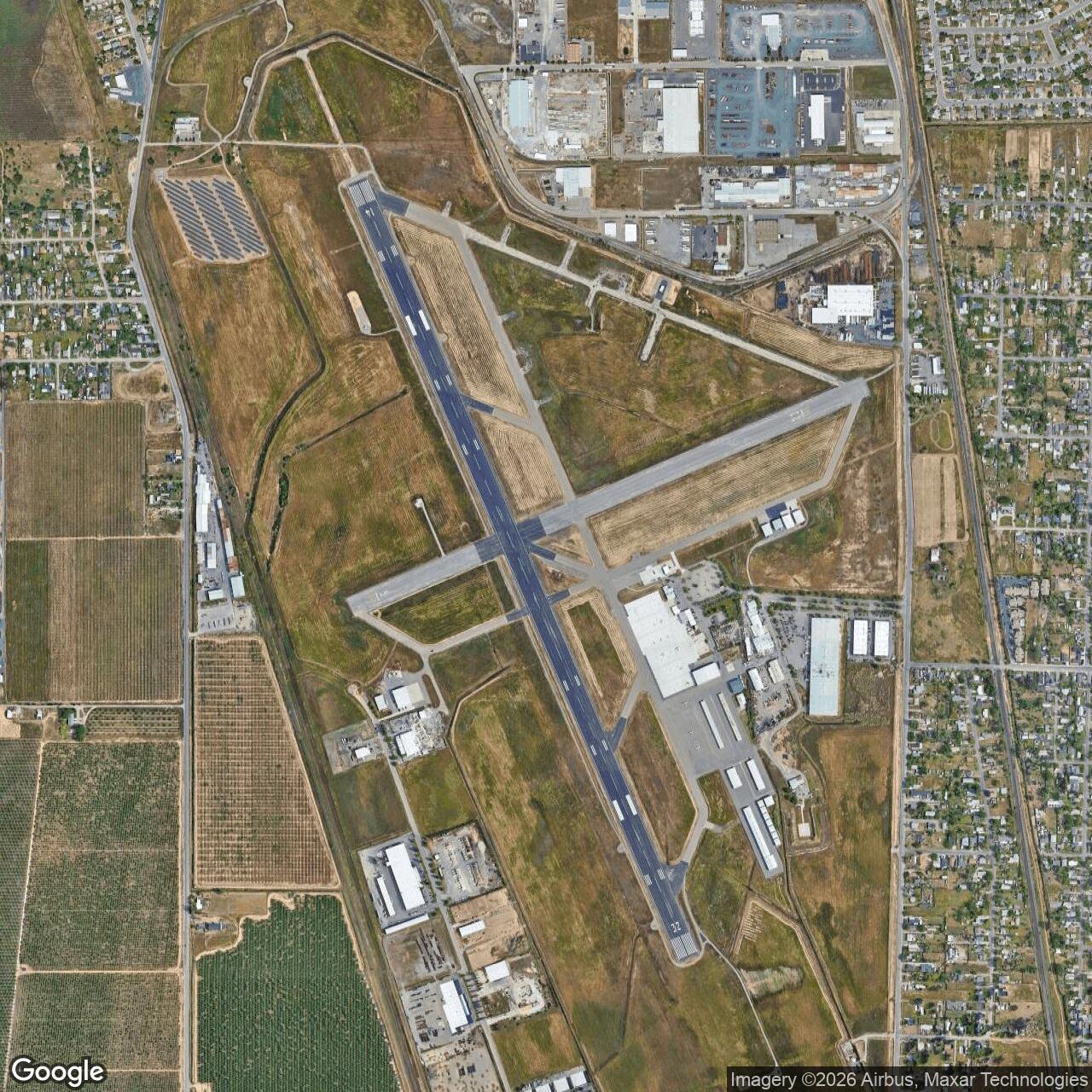
Marysville Army Air Field / Alicia Airport / Yuba County Airport, California
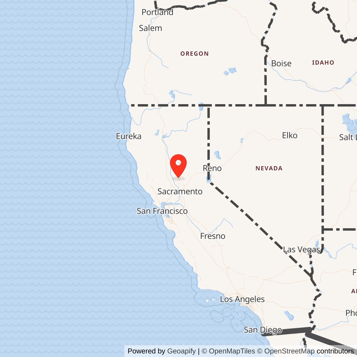
Longitude: -121.5698333
Airport ICAO ID: KMYV
Official Base Website: https://www.yuba.gov/departments/community_development/airport/history.php
Current Role: Yuba County Airport, a public general aviation airport and airport industrial park owned by Yuba County
WWII Army Air Forces field on Alicia Airport property. City of Marysville and Yuba County leased 833 acres to the U.S. Government on 1942-03-15; War Assets Administration surplus/cancellation action returned Marysville Army Airfield (Alicia) to county control on 1947-08-01. Used as air support for Marysville Cantonment/Camp Beale, tied to Hamilton Field/IV Fighter Command and later Air Technical Service Command; 369th Fighter Group station listed at Marysville circa 1943-11-05.
Marysville Army Air Field was a short-lived World War II Army Air Forces installation built on the already planned Alicia Airport southeast of Marysville, California. Its story is easy to miss because the field did not become a famous named Air Force base, and because the later Beale Air Force Base sits only a few miles to the east. The important distinction is that Marysville Army Air Field was not the same installation as Beale. It was the airfield created from Alicia Airport property to support the wartime Army training landscape around Marysville Cantonment, later Camp Beale, while also fitting into the Fourth Air Force fighter-training and support network of northern California.
The site began as a civil-airport project before it became military property. On October 9, 1940, the Civil Aeronautics Board, composed of the Secretaries of War, Navy, and Commerce, approved construction of Alicia Airport at a cost of $238,000. On January 1, 1941, the local sponsors accepted that offer of aid for airport development. On March 15, 1942, the City of Marysville and Yuba County leased 833 acres to the federal government for wartime use. Yuba County's present airport history describes that as use by the "U.S. Air Force during World War II," but that is a later-language anachronism. The independent United States Air Force did not exist until 1947. During the war, the operating service was the U.S. Army Air Forces.
Mission Evolution
The first mission was local airport development. Alicia Airport was created as part of the national prewar civil-airport expansion effort, a program that deliberately linked local aviation infrastructure with national defense needs. Marysville and Yuba County acquired the land and planned the airport before direct U.S. entry into World War II. That timing mattered. When the Army needed airfields quickly after Pearl Harbor, Alicia Airport offered a prepared or nearly prepared landing field near the new Army cantonment at Marysville.
The second mission was direct wartime military support. The March 1942 lease placed the airport in federal hands at the same time the Army was building and expanding the Marysville area into a much larger training system. The field's relationship with Marysville Cantonment, later Camp Beale, explains why it existed. Camp Beale was primarily a ground-force training reservation, but a large wartime camp needed nearby aviation support for movement, liaison, observation, administrative flying, and coordination with the wider Army Air Forces network. Marysville Army Air Field gave the Army that aviation foothold in the valley west of the Camp Beale reservation.
The third mission tied Marysville to the northern California fighter-training system. Historical summaries identify the field as a short-term sub-base of Hamilton Field under IV Fighter Command. That relationship placed Marysville inside the Fourth Air Force system that defended the West Coast early in the war and then increasingly trained replacement fighter pilots and crews. The official Air Force Combat Units of World War II station list places the 369th Fighter Group at Marysville Army Air Field about November 5, 1943, before the group moved to Oroville Army Air Field on January 28, 1944, and then returned to Hamilton Field in March. The 369th's aircraft included A-36s, P-39s, P-40s, and later P-51s, showing the kind of fighter-training mission to which Marysville was briefly connected.
The fourth mission was base-unit support after the Army Air Forces reorganized many domestic training units. An Air Force History Index abstract records that Marysville Army Airfield and the 433rd Army Air Forces Base Unit were activated at Marysville effective April 1, 1944. This fits the broader AAF pattern in 1944, when numbered base units often replaced older group-and-squadron structures at training and support installations. Marysville's later wartime function appears to have been less glamorous than fighter-group stationing but still essential: run the field, maintain facilities, support aircraft movement, and keep the airfield useful until the Army no longer required it.
World War II Operations and Units
Marysville Army Air Field's active wartime period was brief, but it sat at the intersection of several military needs. The field supported the Marysville Cantonment and Camp Beale environment, tied into the Hamilton Field and IV Fighter Command orbit, and then passed into the Army Air Forces base-unit system. This was a typical pattern for many smaller wartime airfields. They were not necessarily permanent bases with long rosters of famous units. They were nodes in a training and support network that could be activated, reassigned, and released as wartime requirements changed.
The 369th Fighter Group is the best documented combat-unit connection. Constituted in 1943, the group trained replacement crews and later participated in maneuvers after leaving California. Its station list puts it at Hamilton Field, Marysville Army Air Field, Oroville Army Air Field, back at Hamilton, and then to DeRidder Army Air Base in Louisiana. The group's Marysville period was short, but it is historically valuable because it links the field directly to the fighter replacement-training pipeline. A pilot, mechanic, armorer, or support soldier passing through Marysville in late 1943 or early 1944 was part of a national system that turned newly trained personnel into operational fighter replacements for a global air war.
The 369th was not the only unit history associated with the Marysville airfield environment. The Air Force History Index abstract for April 1944 documents the 433rd Army Air Forces Base Unit at Marysville. Base units were the administrative and functional structures that kept fields operating after the AAF shifted away from using tactical groups as domestic training-station management organizations. At a field like Marysville, this meant that the operational story was less about a single front-line unit and more about the daily support structure of a wartime airfield: flight-line operations, maintenance, communications, motor transport, supply, ordnance, medical support, fire protection, security, and coordination with higher headquarters.
The aircraft associated with the 369th and related fighter training help explain the physical demands on the field. P-39 Airacobras, P-40 Warhawks, and A-36 Apaches were single-engine combat aircraft requiring paved runways, dispersal and parking areas, fuel, maintenance, armament support, and enough clear approach space for repeated training operations. Marysville's later civil runways do not necessarily preserve every wartime configuration in original form, but the modern airport's long Runway 14/32 and secondary Runway 5/23 reflect a field that retained useful military-era aviation geometry. AirNav currently lists Runway 14/32 at 6,007 by 150 feet and Runway 5/23 at 3,314 by 60 feet.
Facilities and Physical Layout
The historic military installation was centered on Alicia Airport's 833-acre tract. The county history records that the leased property included lots in Farm Land Colony No. 1 east of the Sacramento Northern Railway right of way and that the lease covered 833 acres, more or less. In military terms, that was enough land for a small to medium Army airfield, with runways, taxiways, aprons, operations buildings, hangars or maintenance areas, utilities, roads, and support structures. It was not a self-contained ground-force camp like Camp Beale. It was an aviation support installation tied to a larger Army landscape.
Marysville's physical layout also reflected its Sacramento Valley setting. The field was flat, low-elevation, and close to road and rail corridors. AirNav lists the airport elevation at 64.3 feet and places it three miles southeast of Marysville. Those conditions were advantageous for wartime airfield construction. Flat valley land reduced grading problems, while proximity to Marysville, Olivehurst, Yuba City, Camp Beale, Hamilton Field's command network, and other northern California training fields made the site useful as a supporting airfield rather than an isolated post.
The current Yuba County Airport preserves the aviation use of the site even though most wartime temporary facilities have disappeared or been replaced. Today the airport operates as a public-use field with two asphalt runways, fuel, hangars, tiedowns, and general aviation services. Yuba County records note that the first two modern hangar structures were built in 1953, more hangars followed in 1979 and the 1990s, an FAA control tower operated from 1974 to 1981, an instrument landing system for Runway 14 was installed in 1980, and high-intensity runway lighting installed in 1982 replaced the original World War II lighting system. That last detail is important because it confirms a physical continuity from the Army airfield era into the modern airport even though the site's mission changed completely.
Role in the Wider Military Network
Marysville Army Air Field only makes full sense as part of a network. At the local level, it was the aviation companion to Marysville Cantonment and Camp Beale. Camp Beale trained ground forces, housed prisoners of war, used extensive maneuver and live-fire areas, and later became the foundation of Beale Air Force Base. Marysville Army Air Field gave that ground-training system a nearby airfield at a time when air-ground coordination, observation, transport, and fighter training were becoming more important to Army operations.
At the regional level, Marysville was part of northern California's Fourth Air Force system. Hamilton Field, Chico, Redding, Oroville, Sacramento, and other airfields formed a dispersed wartime aviation landscape. Some had major headquarters or training missions. Others served as sub-bases, auxiliaries, replacement-training sites, or support fields. Marysville's short service with IV Fighter Command and the 369th Fighter Group placed it in this same fighter-training web. Its later base-unit history shows how the AAF kept smaller fields functioning even after specific groups moved on.
At the national level, Marysville was one of many civilian or local airports converted into military airfields during World War II, then returned to civilian control after the emergency. That pattern is one of the most important stories in American military-base history. The Army did not have time to build every airfield from scratch. It used existing civil projects, expanded them, improved them, and then released many of them after the war. Marysville is a clean example of that lifecycle: civil airport planned in 1940, leased for war in 1942, used by the Army Air Forces, declared surplus in 1947, licensed as a public-use airport in 1949, and still operating today.
Closure and Postwar Reuse
The end of the war turned Marysville Army Air Field from a military asset into surplus property. The City of Marysville deeded its one-half interest in Alicia Airport to Yuba County on November 18, 1946, with the stipulation that the property be maintained and operated as an airport. On August 1, 1947, the U.S. Government and Yuba County reached an agreement under which the leased property, structures, and improvements known as Marysville Army Airfield (Alicia), containing 833 acres more or less, were declared surplus to the government's needs. That action canceled the wartime lease that otherwise would have extended to 1950.
The state of California issued a permit for the airport to operate officially as a public-use airport on September 30, 1949. From that point forward, the site's military identity became historical rather than operational. Yuba County Airport developed as a civil airport and airport industrial park. Commercial service appeared for a time. Yuba County records state that Air West offered commercial service in 1960, using a portion of the old restaurant as a terminal building, and that airline service ended in 1969. The site continued to modernize with hangars, lighting, instrument procedures, and airport services.
Current Status
Yuba County Airport is now an open public airport serving the Marysville and Olivehurst area. Its FAA identifier is MYV and its ICAO identifier is KMYV. AirNav places it three miles southeast of Marysville, with an elevation of 64.3 feet. The airport is publicly owned by Yuba County. Its primary runway, 14/32, is 6,007 by 150 feet, and its secondary runway, 5/23, is 3,314 by 60 feet. The field supports general aviation activity, hangars, tiedowns, fuel service, and instrument procedures.
Chronology
- 1940-10-09 The Civil Aeronautics Board approved construction of Alicia Airport at a cost of $238,000.
- 1941-01-01 A resolution accepted an Offer of Aid for Alicia Airport development.
- 1941 Alicia Airport was built as the local airport project serving the Marysville area.
- 1942-03-15 The City of Marysville and Yuba County leased 833 acres at Alicia Airport to the U.S. Government for wartime military use.
- 1942 The field became Marysville Army Air Field, associated with Marysville Cantonment, later Camp Beale.
- 1943-11-05, circa The 369th Fighter Group was stationed at Marysville Army Air Field according to the official Air Force Combat Units station list.
- 1943-12 AirNav's current FAA-derived airport record lists an activation date of December 1943.
- 1944-01-28 The 369th Fighter Group moved from Marysville Army Air Field to Oroville Army Air Field.
- 1944-04-01 An Air Force History Index abstract records Marysville Army Airfield and the 433rd Army Air Forces Base Unit activated at Marysville effective this date.
- 1946-11-18 The City of Marysville deeded its one-half interest in Alicia Airport to Yuba County, requiring continued airport operation.
- 1947-08-01 The U.S. Government and Yuba County agreed that Marysville Army Airfield (Alicia), including leased property, structures, and improvements, was surplus to federal needs, canceling the lease.
- 1949-09-30 The state of California issued a permit for the airport to operate officially as a public-use airport.
- 1953 The first two hangar structures were built in the postwar airport era.
- 1960 Air West commercial air service was offered from the airport.
- 1968 An apron area was constructed to serve as an airline ramp.
- 1969 Airline service was discontinued.
- 1974-1981 An FAA control tower operated at the airport.
- 1980 The Runway 14 instrument landing system was installed.
- 1982 A high-intensity runway lighting system was installed, replacing original World War II lighting.
- 1983 The approach lighting system was added.
- 1997-03-17 The Flight Service Station closed as part of replacement by automated facilities.
- Present Yuba County Airport remains a public general aviation airport and airport industrial park, preserving the former Marysville Army Air Field site in active aviation use.