
Naval Outlying Landing Field Cotati, Cotati / Rohnert Park California
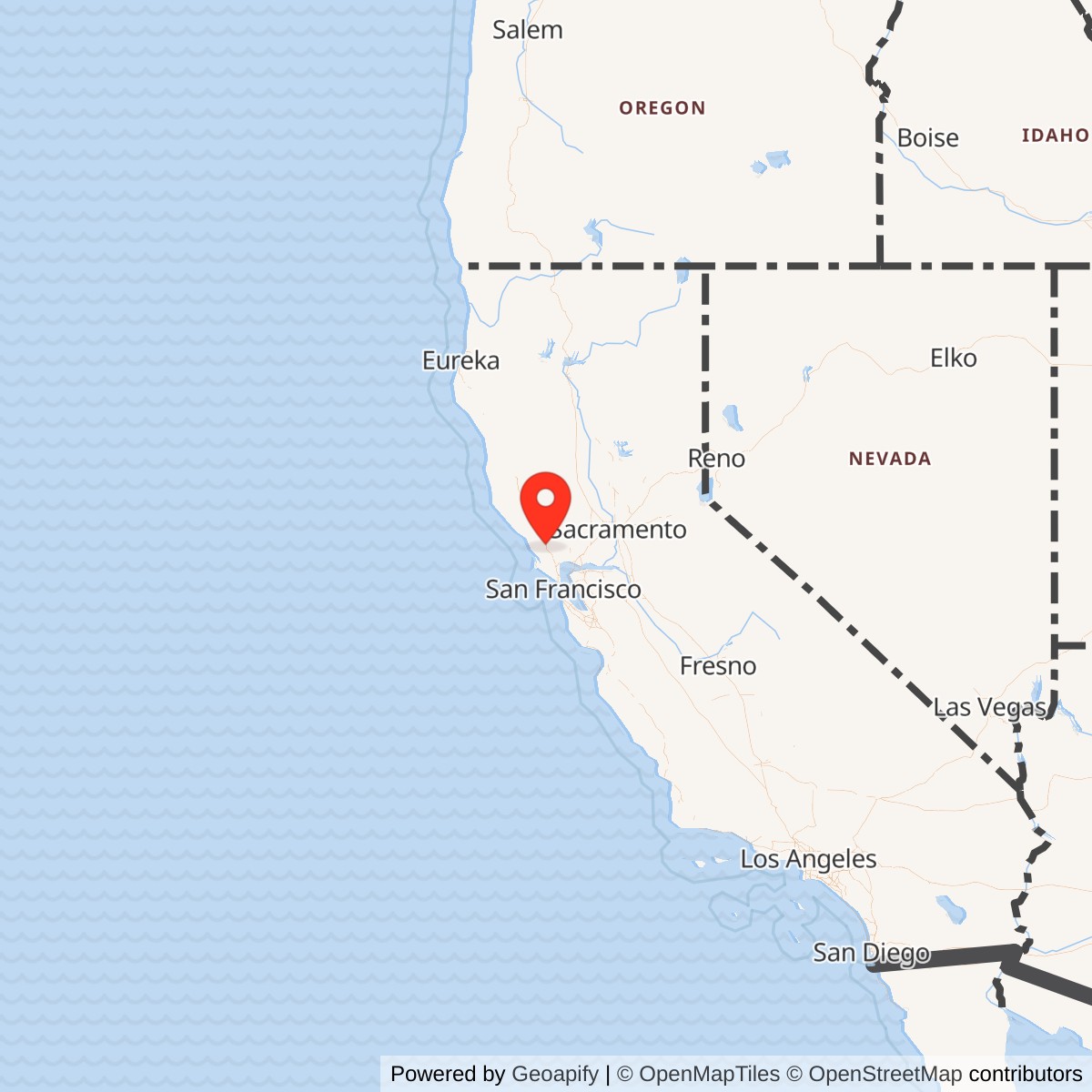
Longitude: -122.72
Current Role: Former NAS Alameda outlying landing field used primarily for touch-and-go and carrier-landing practice; now redeveloped commercial, residential, roadway, and former raceway landscape around Rohnert Park Expressway / Labath Avenue, with no intact airfield features visible.
Naval Outlying Landing Field Cotati was a small but real World War II U.S. Navy aviation installation in Sonoma County, California. It was not a full naval air station and it did not have the scale, permanent tenant population, or postwar military life of Alameda, Santa Rosa, or Crows Landing. Its importance came from a narrower purpose. Cotati gave the Navy an inland practice field where carrier pilots could repeat takeoffs, landings, and field-carrier landing practice away from the traffic, weather constraints, and operational congestion of the Bay Area's major naval air stations.
The field sat on open agricultural land associated with the Rohnert Seed Company and the Rancho Cotate landscape. The site was close enough to Naval Air Station Alameda to fit into the 12th Naval District's Bay Area aviation network, and close enough to the later Naval Auxiliary Air Station Santa Rosa to support that station's fighter, dive-bomber, and torpedo-plane training activity. At the same time, it was removed from dense urban airspace. That combination made Cotati useful even though the location had a serious weakness: seasonal flooding and poor drainage from the Laguna de Santa Rosa basin repeatedly damaged the field and prevented it from becoming the more capable auxiliary station the Navy initially appears to have wanted.
Official Navy construction history identifies Cotati as one of the Alameda auxiliary fields put under construction in 1942, alongside Concord and Hollister, before later expansion to Crows Landing, Santa Rosa, and South San Francisco. The field also appears in wartime and postwar airfield references as Cotati OLF, Cotati Naval Outer Landing Field, Cotati Naval Auxiliary Air Station, or Santa Rosa Field Auxiliary, Cotati Outlying Field. Those variant names reflect its subordinate status, not civilian ownership or purely local use. The 1945 AAF Airfield Directory described it as a U.S. Government-owned, Navy-operated field with two asphalt runways and no hangars.
Mission Evolution
Cotati's first mission was part of the Navy's 1941 to 1942 scramble to create enough aviation infrastructure for carrier warfare. Before the United States entered World War II, the 12th Naval District was already looking for additional practice fields near the major Alameda air base. The Cotati tract offered open land along the Northwestern Pacific rail and highway corridor north of San Francisco Bay. By late 1941 work had begun on crossed runways and a combined barracks and control-tower building. The timing matters. Cotati was not a late-war afterthought. It belonged to the first wave of Alameda auxiliary-field growth as the Navy realized that carrier aviation would require many more runways than the major stations alone could provide.The Navy's plan quickly collided with the landscape. Winter and spring flooding complicated construction and made the field less reliable than expected. Sources describing the field state that by spring 1943 the Navy recognized the site's limitations and shifted the more substantial auxiliary-air-station development north to Santa Rosa. Cotati then became an outlying field, a more austere satellite where the essential mission was repetitive flight practice rather than a full support base. That downgrade is central to the site's history. Cotati was not abandoned immediately, but it became a low-facility practice field rather than the principal Sonoma County auxiliary station.
Operational use began in 1943. Cotati supported aircraft from Alameda and Santa Rosa, especially touch-and-go practice and carrier landing preparation. Its runways were marked to simulate carrier flight decks, giving pilots a visual reference for the short, narrow, controlled environment they would later face aboard ship. The field's purpose was therefore practical and repetitive. Pilots needed to learn the sight picture, approach discipline, throttle control, and landing rhythm of carrier operations. Cotati provided a controlled strip of pavement where those skills could be drilled repeatedly.
By 1945 the field was already losing its military utility. Flood-related runway failures affected several sub-base runways in the area, and the Cotati repairs were judged too costly to complete. Military flight operations effectively ended in 1945, even while maps and records continued to depict Cotati as a Navy field or inactive naval auxiliary station for several years. The field was closed in 1946, remained idle or leased for limited purposes, was identified as inactive in postwar memoranda, was declared surplus in 1950, and was declared excess by the military on 1956-02-16. The federal government conveyed the property in 1958.
Operational Role and Training Activity
Cotati's wartime operational role was not glamorous, but it was vital to the everyday mechanics of naval aviation training. Carrier pilots did not become carrier pilots only by flying from actual carriers. They spent countless hours ashore learning to land precisely on fields whose markings and procedures approximated a flight deck. Outlying fields like Cotati reduced pressure on the main station, lowered collision and congestion risks, and let squadrons cycle many landings in a short time. Every routine landing at Cotati belonged to a larger Pacific-war pipeline in which pilots moved from training fields to carrier air groups and then to fleet operations.The aircraft associated with the field's broader training environment show the kind of war Cotati supported. Local and airfield-history sources describe operations progressing from early-war Grumman F4F Wildcat fighters, Douglas SBD Dauntless dive bombers, and Grumman TBF Avenger torpedo planes to later types such as the Curtiss SB2C Helldiver, Vought F4U Corsair, and Grumman F8F Bearcat. The exact mix at Cotati likely varied by time, squadron, and parent station, but the point is clear: this was a carrier-aircraft practice field, not a patrol bomber base, transport station, or lighter-than-air facility.
The field also had a small arms and aircraft machine-gun collimation function. A 1944 general layout map described at Airfields Freeman showed a machine-gun range along with the airfield's runways, tower, fire and crash truck garage, gasoline and oil storage, and small-arms magazine. That layout indicates that Cotati supported basic gunnery-alignment and weapons-support tasks as well as landing practice. Still, the field's central role remained flight training.
No major combat unit was permanently based at Cotati in the sense that a squadron would be based at a full naval air station. The installation was a subordinate outlying field under the 12th Naval District naval air-base system, connected first to NAS Alameda and then operationally to NAAS Santa Rosa. Its personnel footprint was small, its buildings were minimal, and its aircraft presence was transient. That is precisely why the field mattered. It gave larger stations more training capacity without duplicating their full base structure.
There is no documented post-World War II combat, Cold War, Korea, Vietnam, or later military role at Cotati. Santa Rosa returned briefly to Navy use during the Korean War period, but Cotati did not recover as an active training airfield. Its postwar military life was administrative rather than operational: inactive field, agricultural lease, local law-enforcement rifle range permit, surplus determination, excess declaration, and eventual disposal.
Site Design, Facilities, and Physical Layout
Cotati's physical design reflected an outlying landing field rather than a full station. The field had two paved runways laid out in a crossed pattern. The 1945 AAF Airfield Directory described the property as an irregularly shaped, roughly 200-acre tract with two asphalt runways: one about 4,000 feet long on an east-northeast to west-southwest alignment and another about 3,800 feet long on a northwest to southeast alignment. Each runway had a parallel taxiway, and an intermediate apron connected to the system. The 1944 U.S. Army/Navy Directory of Airfields listed Cotati OLF with a 3,900-foot runway.The field had no hangars. That absence is important because it marks the difference between Cotati and the larger auxiliary air stations in the same network. Aircraft came to Cotati to train, not to be fully maintained, housed, armed, and administered there over a long period. Facilities were limited to what an outlying field needed: a two-story control-tower and operations structure, a fire and crash truck garage, fuel and oil storage, a small-arms magazine, a water well, a ramp, and a machine-gun range or backstop. The minimum built environment reduced cost and allowed the Navy to use the field quickly, but it also meant that Cotati had little resilience once the runways deteriorated.
Drainage shaped the entire installation. The field lay in a low, seasonally wet area influenced by runoff and the Laguna de Santa Rosa system. Sources repeatedly connect Cotati's limited use to winter flooding and runway damage. The Navy's decision to develop Santa Rosa more fully while reducing Cotati to an outlying role makes sense only in that environmental context. The geography was good enough for basic practice, but not good enough for a major long-term auxiliary station.
After the Navy stopped flying there, the physical layout survived for years because the runways, taxiways, and apron were durable asphalt and concrete features. The 1950 USGS topo map labeled the site as Cotati Naval Auxiliary Air Station, inactive, and still showed the two paved runways and parallel taxiways. A 1952 aeronautical chart still depicted Cotati OLF as a Navy field with two paved runways. A 1954 map still labeled the inactive naval auxiliary air station. The built field outlasted the mission.
Units, Organizations, and Systems
The principal command relationship was the 12th Naval District naval air-base system. Official Navy construction history treats Cotati as part of Alameda's auxiliary-station growth in spring 1942. NAS Alameda was the major Bay Area naval air base, and Cotati was one of several outlying fields built or adapted to relieve pressure on Alameda and support carrier-aircraft training.NAAS Santa Rosa became the more direct local aviation partner after the Navy shifted the substantial Sonoma County auxiliary station northward. By 1945 Cotati was described as one of Santa Rosa's outlying fields. That makes Cotati best understood as a subordinate component in a nested system: Alameda as the major station, Santa Rosa as the more capable auxiliary station, and Cotati as the smaller practice satellite.
No permanently assigned carrier air group, squadron, or combat unit is known to have been based at Cotati as its home station. The aircraft and crews using the field were transient training users from the parent stations. This is normal for an outlying field. Its value was not a resident roster. Its value was available pavement, airspace, and repeated landing cycles.
The other relevant organizational system is the postwar federal disposal and FUDS system. Cotati moved from Navy field to inactive property, agricultural lease, local rifle range permit, surplus property, excess property, and private conveyance. Later federal environmental references list Naval Outer Landing Field Cotati as a Formerly Used Defense Site under FFID CA99799FA49500. That status reflects the federal military history of the land even after redevelopment erased the physical airfield.
Postwar Use and Current Status
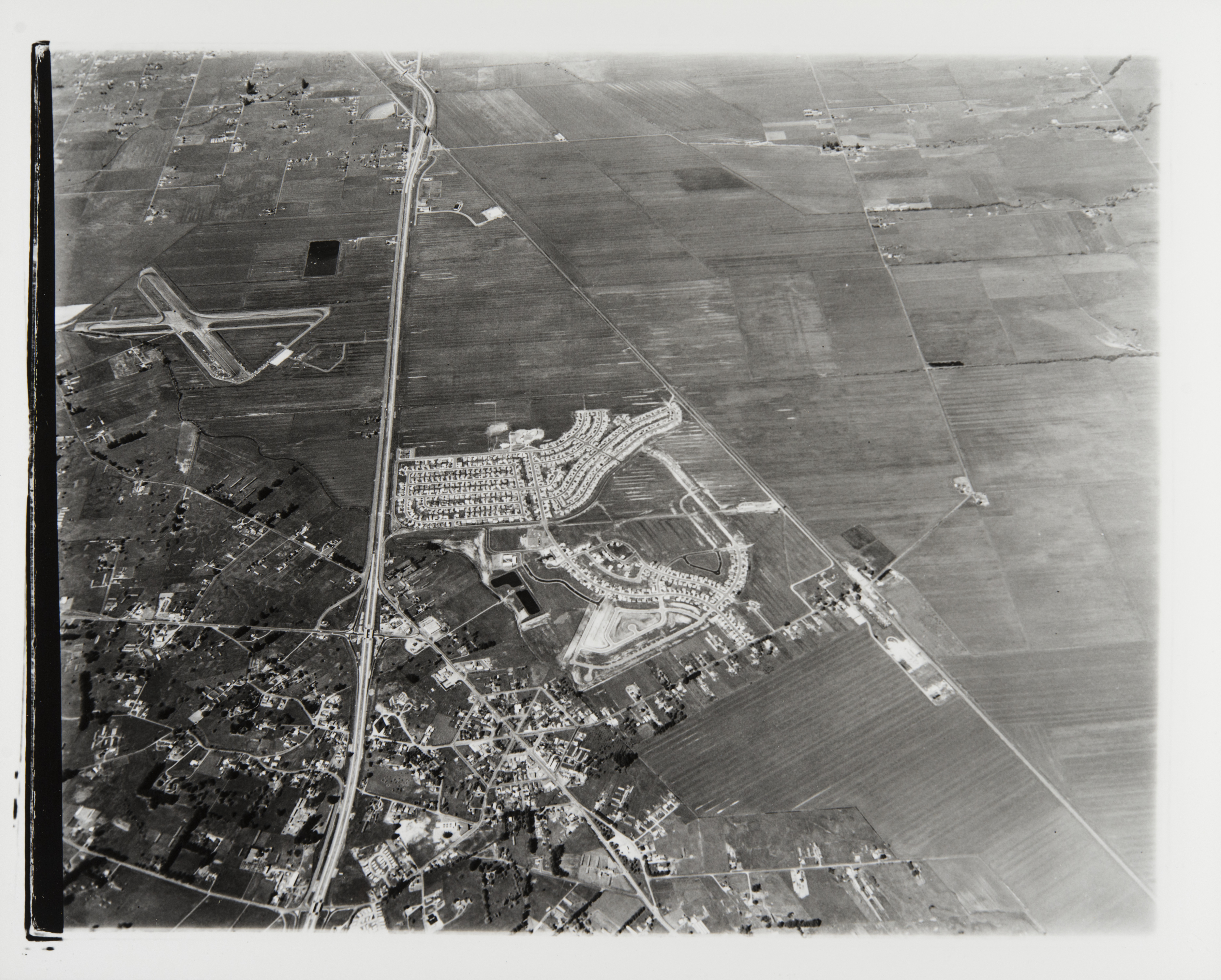
Cotati's postwar history is unusually visible because the abandoned Navy runways became a motorsports landscape. By the early 1950s the field was idle, but the pavement attracted road testing and racing. In 1957 the California Research Corporation requested use of the runways for road testing, and another lease allowed the City of Santa Rosa to use the former Navy runways for drag racing. The First Cotati Road Race used a course laid over the old runway pattern. During the late 1950s and 1960s, drag racers, sports-car clubs, and racing organizations used the former military field, turning a wartime Navy practice strip into Cotati Raceway.Historical aerial photographs from the 1950s and 1960s show the old crossed runway system still intact, with racing marks and facilities appearing over the old pavement. The same hard surfaces that had trained Navy pilots became a local automotive and sports-car course.
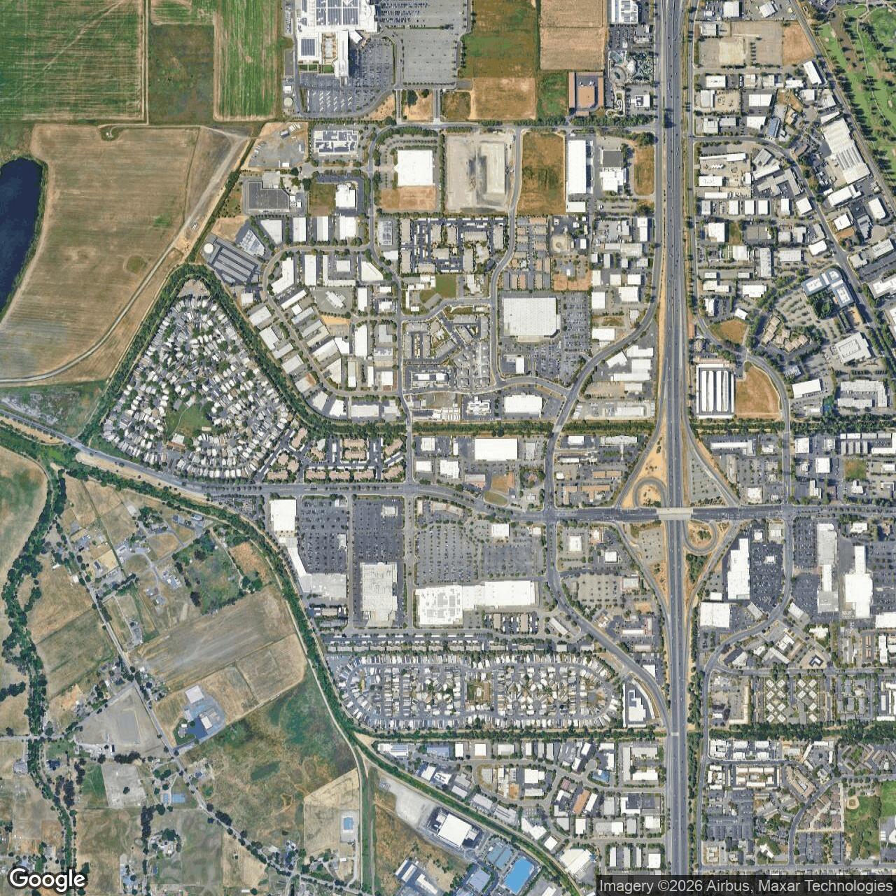
Redevelopment eventually erased the airfield. Rohnert Park Expressway was built across the former field in the early 1970s. Redwood Drive and freeway ramps altered the eastern side. Mobile-home, retail, commercial, apartment, office, and parking development expanded over the old property in the 1970s and 1980s. Airfield-history sources indicate that by the early 1990s visible airfield traces had effectively disappeared, and by 2013 no trace of the Cotati airfield remained in aerial view.
The current site is therefore former and redeveloped. The best representative location is around Rohnert Park Expressway and Labath Avenue, with Airport Road preserving the name of the former access route. The historic airfield area now lies under a mixture of roads, parking lots, retail and commercial development, apartments, mobile-home areas, and other urban uses. Cotati remains documented as a Formerly Used Defense Site through federal environmental-program references, but it no longer functions as an airport and does not retain an obvious intact runway landscape.
Chronology
- 1941 The 12th Naval District sought additional aviation training capacity near NAS Alameda, and work began at Cotati on a crossed-runway practice field.
- 1941-11 Local history summarized by Airfields Freeman states that ground had been broken by November for the two crossed runways and a combined barracks and control-tower building.
- 1942 Official Navy construction history places Cotati among Alameda auxiliary fields put under construction in spring 1942, along with Concord and Hollister.
- 1942 Aerial photography showed the Cotati runways largely constructed before completion of the concrete apron and support buildings.
- 1943 Cotati became operational as a Navy outlying landing field.
- 1943 The Navy shifted the more substantial Sonoma County auxiliary-station development to Santa Rosa because Cotati's drainage and flooding problems limited the site.
- 1943-08 The earliest located aeronautical chart depiction listed Cotati as a Navy auxiliary airfield.
- 1944 A general layout map documented runways, control tower, fire and crash truck garage, gasoline and oil storage, small-arms magazine, and a machine-gun range.
- 1944 The U.S. Army/Navy Directory of Airfields described Cotati OLF as having a 3,900-foot runway.
- 1945 The AAF Airfield Directory described Santa Rosa Field Auxiliary, Cotati Outlying Field, as a U.S. Government-owned, Navy-operated field with two asphalt runways of about 4,000 and 3,800 feet.
- 1945 Flood-related runway failures affected Cotati, and costly repairs were not completed.
- 1945 Military flight operations effectively ceased at Cotati, even though the field continued to appear on charts and in records.
- 1946 The field was closed.
- 1948 Aeronautical charts still depicted Cotati as a Navy field, although it was no longer in active military flight use.
- 1949 A memorandum from Commander, Naval Air Bases, 11th and 12th Naval Districts, identified Cotati as inactive; arable lands were leased for agriculture and the Sonoma County Peace Officers' Association used the rifle range under permit.
- 1950 The 1950 USGS topo map labeled the site Cotati Naval Auxiliary Air Station, inactive, and showed the two paved runways, parallel taxiways, and small ramp.
- 1950 The field was declared surplus.
- 1952 Cotati OLF still appeared on aeronautical charts with two paved runways, the longest about 4,000 feet.
- 1954 Cotati OLF was still shown on a USAF Sacramento Sectional Chart, but the aerodromes table listed the field as unattended.
- 1956-02-16 Naval Outer Landing Field Cotati was declared excess by the military.
- 1957 Licenses and leases supported road testing and drag racing on the former Navy runways.
- 1958-07-21 The federal government conveyed the 217-acre property to Michael Callan by deed.
- 1960s Cotati Raceway used the former runway system for drag racing and sports-car racing.
- 1971-1973 Rohnert Park Expressway was built across the former airfield area, and surrounding road and freeway development altered the site.
- 1977 Aerial photography still showed portions of both runways, though mobile-home and retail development had begun covering the former field.
- 1986 Codding Enterprises began additional retail redevelopment of the former airfield property.
- 1993 Aerial imagery described by airfield historians showed that visible airfield traces had been removed.
- 2013 Modern aerial imagery showed no remaining visible trace of the Cotati airfield.
- Present The former NOLF Cotati site is a redeveloped Rohnert Park urban and commercial landscape near Rohnert Park Expressway, Labath Avenue, and Airport Road.
Sources & References
- WEB U.S. Navy / Naval Historical Center Building the Navy's Bases in World War II, Chapter X, The Air Stations
- WEB Paul Freeman, Abandoned & Little-Known Airfields California: Santa Rosa Area, Cotati Naval Outer Landing Field section
- WEB DoD DENIX, Defense Environmental Programs Annual Report to Congress FY2008 References and Index, listing Naval Outer Landing Field Cotati, CA99799FA49500
- WEB Sonoma County Library Digital Collections Aerial view of Cotati and Rohnert Park, California, 1961
- WEB Tam's Old Race Car Site Cotati Raceway
- WEB City of Cotati Birth of a City