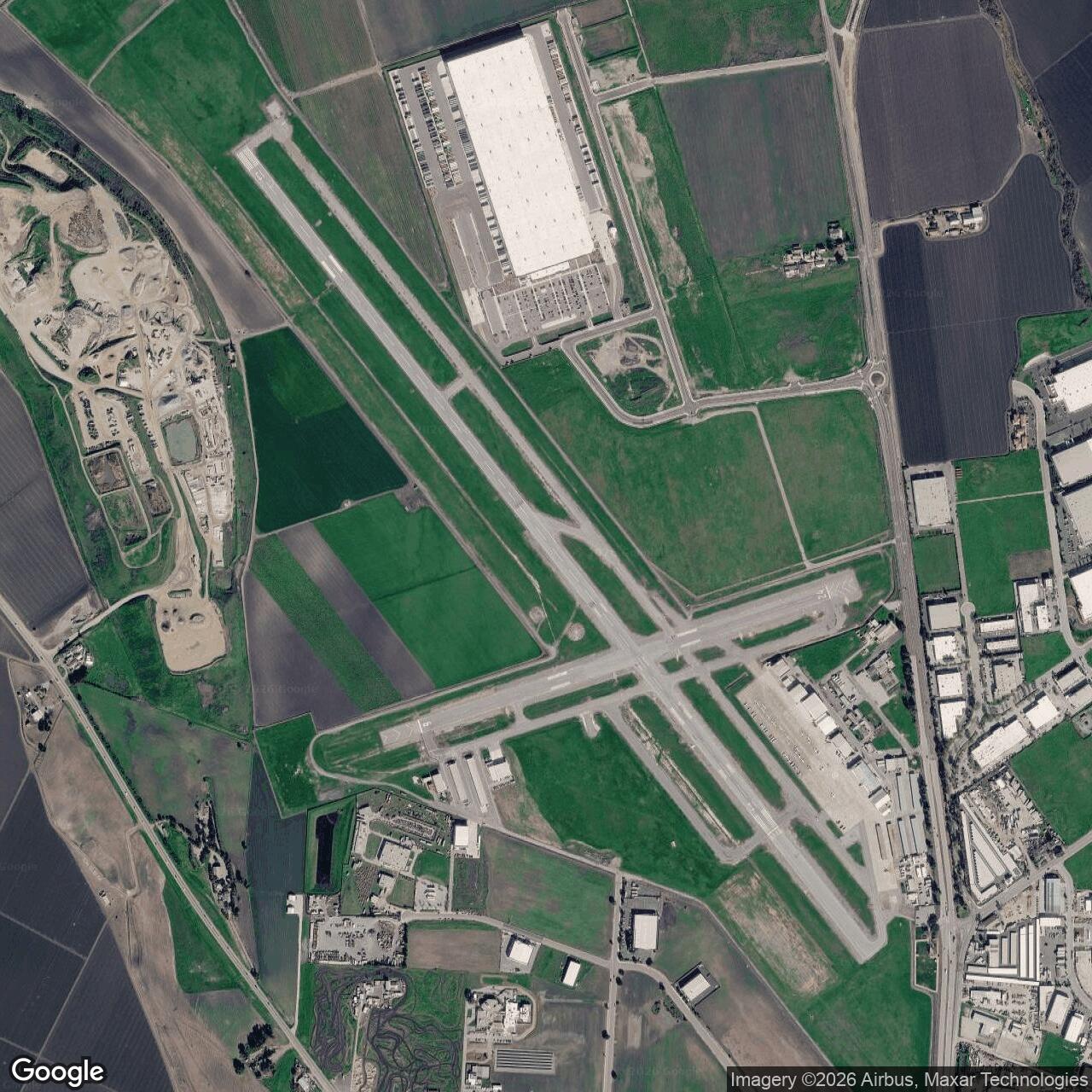
Naval Auxiliary Air Station Hollister, California
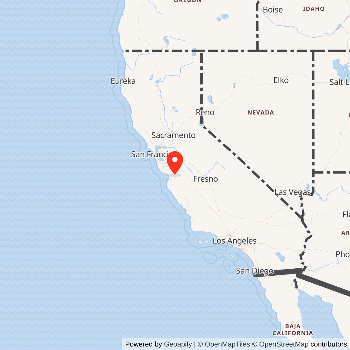
Longitude: -121.4102736
Current Role: Former NAS Alameda auxiliary training field; now Hollister Municipal Airport, a City of Hollister public-use general-aviation airport with airport businesses, glider activity, the surviving former Navy enlisted-club building in civic lease use, and CAL FIRE air-attack operations.
Naval Auxiliary Air Station Hollister was one of those World War II airfields whose importance is easy to miss if the story begins and ends with a modern municipal airport. Today the site looks like a working general-aviation field on the north side of Hollister, with two paved runways, hangars, airport businesses, glider activity, and a CAL FIRE air-attack presence. In 1943, however, the same ground was part of the Navy's crash expansion of carrier-aviation training in northern California. It was not built to be a permanent fleet base or a postwar naval air station. It was built to solve a wartime bottleneck: the Navy needed safe inland fields where pilots and air groups tied to the Pacific war could practice landings, weapons work, attack procedures, and local flying without crowding Naval Air Station Alameda or the Bay Area's more congested airspace.
Hollister's military value came from geography. The field sat in San Benito County, close enough to Alameda, Monterey Bay, Watsonville, King City, and other central-coast training locations to function inside the Twelfth Naval District aviation network, but far enough from the industrial Bay Area to offer open airspace and usable training approaches. Its position also placed it within reach of Monterey Bay torpedo practice areas and nearby bombing targets, including Hollister Target No. 5 on Santa Ana Valley Road. That combination made Hollister useful for the kind of advanced operational training that turned individual naval aviators and aircrew into deployable combat units.
The site began as a civilian grass strip and crop-dusting field known as Turner Field; the Navy purchased the property in 1941, commissioned the wartime naval auxiliary air station on June 26, 1943, and operated it through the end of World War II. Civilian aviation was allowed again by June 1946, and on December 9, 1947 the former Navy facilities were transferred to the City of Hollister by quitclaim deed. The modern Hollister Municipal Airport is therefore the postwar civilian successor to a short-lived but real Navy training installation.
Mission Evolution
The airfield's pre-Navy history began in the early era of California aviation. The Hollister airport planning record traces flying at the site to 1912, when the private grass airstrip hosted aviators Frank Bryant and Roy Francis for a two-day air show. By the mid-1920s the field was known as Turner Field after Everett Turner, who operated a local crop-dusting service there. The field remained a modest civilian aviation site through the interwar years, with the first annual Hollister Air Race and first parachute jump in 1932 and a special airmail event in 1936. That early history matters because the Navy did not create the location from nothing. It took over an existing local flying ground and transformed it into a wartime training station.The decisive change came during the 1941-1943 expansion of naval aviation. As the United States moved from emergency defense buildup into full-scale war, Naval Air Station Alameda became a major operating base for carrier aviation, patrol activity, overhaul, supply, and fleet support. Alameda itself could not absorb every landing, takeoff, weapons exercise, and operational-training requirement generated by the Pacific war. The Navy therefore began pushing auxiliary-field construction outward. The official Navy construction history, Building the Navy's Bases in World War II, explicitly places Hollister in Alameda's auxiliary-field growth: in spring 1942, fields at Cotati, Concord, and Hollister were put under construction, and later Crows Landing, Santa Rosa, and South San Francisco were added to the Alameda system.
Hollister's mission was not primary flight training in the Pensacola or Corpus Christi sense. It was an auxiliary operating and advanced-training field within a larger carrier-aviation pipeline. Local airport history states that, at peak operation, NAAS Hollister housed roughly 200 to 300 Navy personnel undergoing advanced weapons training and military operations or attack procedures before entering the war zone. That wording is important. Hollister was not merely a place to park airplanes. It was part of the final operational preparation of naval aviators and aircrew who had already passed through earlier stages of training and now needed realistic weapons and attack practice.
The field's use was closely tied to the naval war in the Pacific. Carrier air groups, composite squadrons, fighter squadrons, dive-bomber units, and torpedo units required constant shore-based practice before going aboard carriers or escort carriers. Hollister provided an inland airfield where squadrons could operate away from the most congested waterfront facilities. One concrete example comes from the Naval History and Heritage Command's history of USS Princeton (CV-23): VF-27 moved to NAAS Watsonville for additional training while VT-27 shifted to NAAS Hollister, after which the squadrons received replacement personnel and later qualified aboard USS Copahee. That kind of movement shows how Hollister fit into a practical training circuit rather than a static base assignment.
As the war ended, Hollister's mission disappeared quickly. The Navy did not need to preserve every auxiliary field after Japan's surrender. Some fields were retained, reactivated, or folded into Cold War training systems; others were declared excess or returned to civilian ownership. Hollister fell into the latter category. The field remained a military base until June 1946, when civilian activity was allowed again, and the War Assets Administration / federal property disposal process moved the facility into municipal ownership by quitclaim deed on December 9, 1947. The wartime auxiliary station became Hollister Municipal Airport, preserving the airfield function while ending the Navy installation identity.
Operational Role
What actually happened at NAAS Hollister was the repetitive, high-tempo work of wartime aviation preparation. Pilots and crews used the field for takeoffs, landings, formation work, local familiarization, gunnery-related support, weapons handling, attack-procedure training, and flights to associated ranges and targets. The field's value lay in reducing pressure on Alameda and in giving training units a controlled place to practice the operations that could not be learned only in classrooms or on crowded carrier decks.The air station's operating tempo was shaped by the needs of carrier warfare. By 1943 the Navy was expanding escort-carrier, light-carrier, and fleet-carrier aviation at a pace that required a whole web of shore establishments. A carrier air group could not simply appear fully ready at the pier. Its fighter, scout-bomber, dive-bomber, torpedo, and composite components had to be organized, filled with replacement personnel, taught to operate together, and then qualified for carrier work. Auxiliary fields such as Hollister, Watsonville, King City, Monterey, Crows Landing, and Vernalis gave the Navy the distributed geography needed to move squadrons through those final steps.
Hollister's specific weapons-training role is best illustrated by Hollister Target No. 5. The target was located on Santa Ana Valley Road east of Hollister and was directly tied to the air station. According to the San Benito account based on a 2001 U.S. Army Corps of Engineers site survey, the Navy leased the target land in June 1943 from Paul J. and Mrs. Hudner. Navy records described three targets there: a 520-by-50-foot cruiser outline, a 180-by-20-foot submarine outline, and a 100-foot-diameter circle with a 10-foot center. The targets were not full-scale ship replicas; they were marked with four-foot-wide lines of crushed white dolomite so aviators could identify them from the air.
The ordnance used at Target No. 5 was practice ordnance rather than high explosive. The San Benito account describes practice bombs similar to the Mk 15 Mod 3 practice bomb found years later at the airport dog park: cylindrical body, rounded nose, guide fins, sand fill, and a black-powder/phosphorus spotting charge that produced smoke and flash to mark impact. A Formerly Used Defense Site record excerpt identifies Hollister Target No. 5 as a leasehold condemnation superseded by lease, with the lease period running from August 1, 1943 to June 30, 1946. The target's lease dates line up with Hollister's operational period and show that the air station's military geography extended beyond the airport fence.
This target relationship is critical to understanding Hollister. The airfield itself provided runways, flight-line support, maintenance, housing, administration, and launch/recovery capacity. The nearby target area supplied the realistic practice environment. Together they formed a small but complete operational-training system: planes could depart NAAS Hollister, attack a ground target, observe impact markers, and return for debriefing, maintenance, and repeat sorties. That cycle is exactly what auxiliary fields were built to support.
Hollister also worked in relationship with other stations rather than in isolation. Watsonville, for example, served related carrier-air-group training functions. Monterey supported Navy auxiliary airfield operations near Monterey Bay. Alameda remained the parent system node. Squadrons and personnel could move between these fields according to training needs, aircraft types, weather, runway availability, and range scheduling. In that sense, Hollister was a small installation, but its operational role was system-wide: it absorbed a portion of the training load that otherwise would have constrained the Navy's combat aviation pipeline.
Units, Organizations, and Systems
The most important organizational relationship in Hollister's history was with Naval Air Station Alameda and the Twelfth Naval District. Alameda was the major naval air base in the Bay Area, and Hollister functioned as one of its auxiliary fields. The official Navy construction history places Hollister inside the same Alameda auxiliary-airfield expansion that included Cotati, Concord, Crows Landing, Santa Rosa, and South San Francisco. That relationship explains both the size and the limits of Hollister. It did not require the complete command apparatus of a major naval air station because it was designed to support and extend a larger parent base.The second major system was carrier-air-group training. The field supported advanced training for naval aviators and aircrew before combat deployment. Specific unit assignments at Hollister changed over time and are not as fully documented in easily available public sources as those of major naval air stations, but the Princeton example identifies VT-27 as one concrete squadron presence. In late 1943 and early 1944, VT-27 shifted to NAAS Hollister while VF-27 used NAAS Watsonville during additional training tied to the air group that would be associated with USS Princeton. That example shows Hollister receiving a torpedo squadron during a period when replacement personnel, carrier qualification, and final readiness were being assembled across multiple auxiliary fields.
A third system was the weapons and target network. Hollister Target No. 5 was part of a larger set of Navy rocket and bombing sites in California and Nevada. The target was not a separate base in the same sense as NAAS Hollister, but it belonged to the same operational system. It existed because air station training required somewhere to drop practice ordnance. The station and target should therefore be read together: Hollister was not simply an airport the Navy owned; it was the launch point for a local training complex.
The personnel system was smaller but still significant. The city airport master-plan history states that NAAS Hollister housed about 200 to 300 Navy personnel at peak operation. Those personnel would have included station officers, aviation operations staff, maintenance personnel, ordnance handlers, communications personnel, crash and fire support, medical or dispensary personnel, security, supply, and enlisted support staff required to keep the field functioning. Auxiliary fields often looked simple from the air, but even a small air station required a compact military town to operate safely.
Facilities and Physical Layout
Hollister's physical layout began as a civilian field and then changed under Navy control. The prewar site was a grass airstrip and crop-dusting field. The Navy's wartime work gave it a military air-station form: hard-surfaced runways, support buildings, aviation facilities, and living/support spaces for personnel. The modern airport still reflects the airfield logic inherited from that period, even though much of the wartime fabric has been altered, removed, or repurposed.The current airport has two paved runways. Runway 13/31 is 6,350 by 100 feet and Runway 6/24 is 3,149 by 100 feet. The city airport master-plan chapter similarly describes Runway 13/31 as the longest runway, oriented northwest-southeast, and Runway 6/24 as the shorter crosswind runway. These modern runway dimensions reflect later civilian improvement as well as the underlying Navy-era field layout; the airport did not simply revert to a grass strip after the war.
Several surviving or repurposed facilities preserve the Navy layer more visibly. The airport master-plan chapter identifies the Elks Lodge building on the east side of the airport near San Felipe Road as the former NAAS Hollister enlisted club. The building is city-owned and leased to the Elks Lodge, and the plan describes it as approximately 15,500 square feet. That is a valuable physical marker because many temporary World War II air-station buildings have vanished, while this one still anchors the wartime social/support landscape in the modern airport setting.
The field's location on the north side of Hollister gave it practical access to local roads, town services, and open approach areas. The current municipal airport sits west of San Felipe Road at Airport Drive and is owned and operated by the City of Hollister. Airport businesses, hangars, aircraft storage, glider activity, and CAL FIRE operations now occupy a landscape once shaped by Navy flight lines, barracks/support buildings, and military aviation support. The physical story is therefore one of continuity and erasure together: the aviation use survived, while the Navy installation identity was absorbed into municipal infrastructure.
Target No. 5 was part of the larger physical layout even though it was not on the airport itself. Located east of Hollister near Santa Ana Valley Road, the target area consisted of marked target shapes for practice bombing. It was deliberately simple-white dolomite outlines rather than elaborate wooden mockups-but it extended the operational footprint of the air station into the surrounding ranch landscape. The target area later returned to pasture and agricultural use, but the discovery of practice-bomb material decades later shows that the wartime training footprint remained legible below the surface.
Role in the Wider Military Network
NAAS Hollister only makes full sense as one node in a larger naval aviation network. It was not the main base, and it was not intended to be self-sufficient. Its significance lies in how it helped the Navy distribute training functions across northern and central California during a period when the Pacific war demanded aviators faster than the prewar base structure could produce them.The parent node was NAS Alameda. Alameda's wartime expansion gave the Navy a major Bay Area air base, carrier support point, and aviation logistics center, but major bases become chokepoints if every training sortie, maintenance cycle, and weapons practice has to occur there. The Navy's solution was to build and acquire auxiliaries. Hollister, Cotati, Concord, Crows Landing, Santa Rosa, South San Francisco, and other fields allowed the Alameda system to decentralize flight operations. That decentralization increased runway capacity, reduced local congestion, and placed training close to varied terrain and range areas.
Hollister also sat within the Monterey Bay and central-coast training system. Monterey Bay offered torpedo-practice opportunities, and nearby fields such as Watsonville, Monterey, and King City formed a cluster of wartime Navy aviation sites. This cluster mattered because pilots needed different kinds of practice: landing fields, targets, approach paths, overwater areas, and inland navigation. Hollister's inland position complemented the coastal fields rather than duplicating them exactly.
The wider system also included the Navy's carrier qualification pipeline. Squadrons trained ashore, moved between auxiliary fields, received replacements, and then qualified aboard carriers or escort carriers before combat deployment. The NHHC Princeton example, with VF-27 moving to Watsonville and VT-27 shifting to Hollister before later carrier qualification aboard Copahee, illustrates the network in action. A single air group's readiness could depend on multiple fields and ships, each performing a different piece of the process.
Finally, Hollister belonged to the national pattern of temporary wartime bases. The Navy and Army built hundreds of specialized fields during World War II because permanent prewar installations could not meet the mobilization demand. Many of these sites disappeared into municipal airports, industrial parks, schools, farms, or residential districts after 1945. Hollister is a good example of that pattern. It had a short naval life, but it left behind a durable airfield that continued serving the region.
Postwar Transfer and Civilian Reuse
Hollister's postwar transition was relatively quick. The city airport master-plan history states that NAAS Hollister operated as a military base until June 1946, when civilian activity was allowed. Eighteen months later, on December 9, 1947, the facilities were turned over to the City of Hollister through a quitclaim deed. That sequence captures the typical end of many wartime auxiliary fields: military activity wound down first, civilian access resumed, and formal transfer followed through federal surplus-property channels.In cooperation with the FAA and the state, the City of Hollister made repeated improvements, including runway overlays, taxiway reconstruction, runway-extension work, easement acquisition, AWOS installation, airport beacon improvements, and security fencing. Those improvements turned a former wartime training station into a modern general-aviation airport serving local and regional needs.
Hollister Municipal Airport's current use is broad. The city identifies it as a city-owned and operated airport on the north end of Hollister that supports general aviation and airport-related businesses. It also hosts the CAL FIRE Air Attack Base, which the city describes as important for wildfire suppression in six counties. AirNav identifies KCVH as a public-use airport, with fuel, maintenance services, two paved runways, and operational notes warning pilots to watch for firefighting aircraft and glider activity. The airport therefore remains operationally important, but in a civilian and emergency-services role rather than a naval training role.
The former Navy layer still matters for planning and safety. The former enlisted club, wartime runway layout, target-area history, and practice-ordnance discoveries all remind users that the airport and surrounding lands carry a military past. The 2018 report of a practice bomb found at the airport dog park and the continuing historical attention to Target No. 5 are examples of how former training uses can resurface long after a base is transferred. These are not reasons to treat the municipal airport as unsafe in ordinary use; they are reasons to document the military history accurately and to recognize the environmental and ordnance-awareness legacies of wartime training.
The surrounding wartime training landscape is more fragmented. Hollister Target No. 5 returned to private pasture use near Santa Ana Valley Road, and the Navy's lease ended by June 30, 1946.
Chronology
- 1912 The future Hollister Municipal Airport site began as a private grass airstrip and hosted an early aviation event with Frank Bryant and Roy Francis.
- Mid-1920s The property became known as Turner Field after crop-duster Everett Turner acquired and used it for local aviation activity.
- 1932 The first annual Hollister Air Race and the first parachute jump associated with the field occurred.
- 1936 A special airmail delivery event took place at the field, reflecting its prewar civilian aviation role.
- 1941 The U.S. Navy purchased the airfield property as part of the wartime expansion of naval aviation facilities.
- Spring 1942 Navy construction history identifies Hollister as one of the Alameda auxiliary fields placed under construction, along with Cotati and Concord.
- 1943-04 AirNav's current airport data lists an activation date of April 1943 for the airport record.
- 1943-06 The Navy leased land east of Hollister for what became Hollister Target No. 5, according to later USACE-related reporting.
- 1943-06-26 Naval Auxiliary Air Station Hollister was established/commissioned as a wartime Navy auxiliary air station.
- 1943-08-01 Hollister Target No. 5 leasehold records identify the beginning of the lease period that ran to June 30, 1946.
- 1943-1945 NAAS Hollister operated as an auxiliary field of NAS Alameda, supporting advanced weapons training and military operations/attack procedures for Navy personnel before combat deployment.
- 1943-1944 VT-27 shifted to NAAS Hollister while related air group elements used NAAS Watsonville before later carrier qualification aboard USS Copahee.
- 1945 With World War II ending, the Navy's need for the Hollister auxiliary field declined.
- 1946-06 Civilian activity was allowed again at the former Navy airfield, and the site ceased functioning as an active military base.
- 1946-06-30 The lease period for Hollister Target No. 5 ended.
- 1947-12-09 The former Navy facilities were turned over to the City of Hollister by quitclaim deed.
- 1989 onward The City of Hollister, FAA, and state partners carried out a series of airport improvements including runway overlays, taxiway work, easement acquisition, AWOS installation, beacon work, and fencing.
- 2001-08-23 USACE-related site survey work documented local memories and remnants associated with Hollister Target No. 5.
- 2018 A practice bomb discovery at the airport dog park drew renewed public attention to the Navy training history of the former air station and its associated target.
- 2025-06-02 The Hollister City Council approved environmental review for the Runway 6 Safety Improvement Project, reflecting continuing airport development.
- Present The former NAAS Hollister is Hollister Municipal Airport, an active public-use general-aviation airport owned by the City of Hollister and used by airport businesses, general aviation, glider operators, and CAL FIRE air-attack operations.