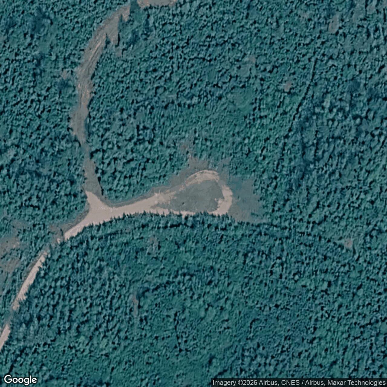
Bear Creek Radio Relay Station, Alaska
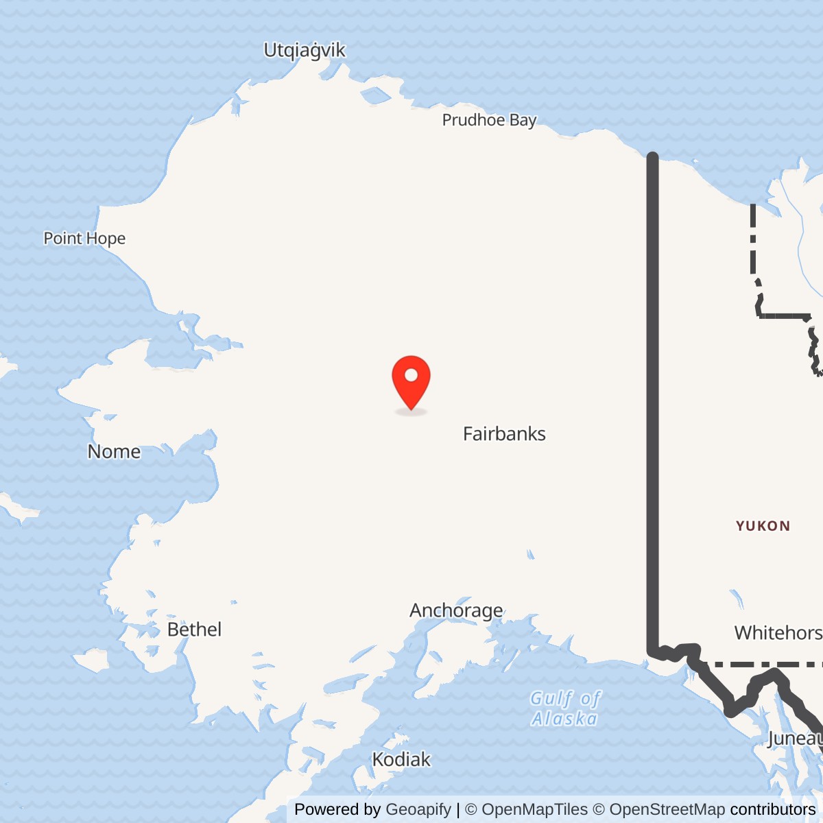
Longitude: -151.923850
Current Role: Former radio-relay property northeast of Tanana. Alaska DEC tracks multiple restoration areas; LF001 is listed cleanup complete, but that status is not a blanket determination for the whole installation.
Location: About seven miles northeast of Tanana by the 2019 Air Force description, reached by an approximately eight-mile dirt road. No surveyed installation-center coordinate has been verified. Alaska DEC points for the LF001 landfill and SS004 equipment-building area are component reference points, not an installation centroid or boundary.
- Role
- Staffed White Alice troposcatter and TD-2 microwave communications relay, not a search radar.
- Construction
- 1956-1957; January 6 activation is disputed between 1958 and 1959.
- Radio service ended
- 1979; the state separately reports decommissioning in 1981.
- Direct links
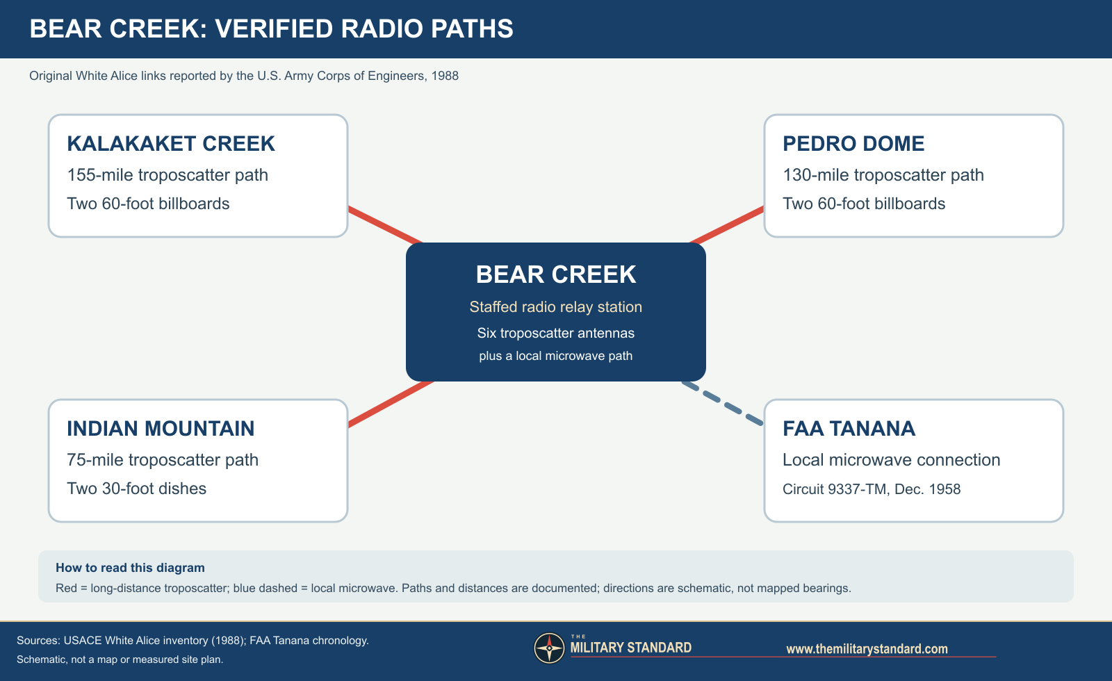
- Kalakaket Creek, Pedro Dome, Indian Mountain, and local microwave to FAA Tanana.
- Present condition
- Operating structures removed by the late 1990s; former property and outlying components have separate environmental histories.
Bear Creek Radio Relay Station was a separate, staffed communications installation northeast of Tanana, Alaska, in the original White Alice network. Six large tropospheric-scatter antennas linked it to Kalakaket Creek, Pedro Dome, and Indian Mountain, while a local microwave connection served the Federal Aviation Administration at Tanana. It was not an aircraft-search radar. Its purpose was to pass information across the difficult distances between Alaska's radar and command facilities. A 7,200-square-foot equipment and power building, a 5,200-square-foot dormitory designed for 16 people, support shops, fuel systems, road and river facilities made it a substantial operating station. Historical sources disagree on whether its January 6 activation was in 1958 or 1959. The historical inventory gives 1979 as the closure year; a later state letter says the facility was decommissioned in 1981. Its buildings and antennas were demolished and removed in 1997. The environmental record is distributed among several former component areas, and cleanup decisions must be tied to the area and date they address. [1] [2] [3] [4] [12] [13]
Origins and construction
Alaska's Aircraft Control and Warning network needed a way to move aircraft observations, command messages, telephone calls, and teleprinter traffic between remote stations and control centers. Earlier high-frequency radio was vulnerable to northern propagation problems, and line-of-sight microwave alone would have required many more mountain sites. The White Alice Communications System combined high-power tropospheric scatter for long hops with microwave where the terrain allowed a direct path. The original program comprised 31 facilities, including 22 troposcatter stations. Fourteen were colocated with other military installations. The Corps' historical inventory classifies Bear Creek among the original troposcatter sites without a colocated radar host. The existence of its own dormitory and maintenance functions supports its treatment as an independent installation, not a wing of Indian Mountain Air Force Station. [1] [2] [5]
The Corps inventory dates construction to 1956 and 1957 and identifies the Army Corps of Engineers and Western Electric as the principal original-program builders and electronic-system provider. The 1994 Corps management plan says construction began in 1956. Neither is an original Bear Creek construction contract or acceptance certificate. A later Air Force draft calls the site Bear Creek Communications Station initially, Bear Creek Air Force Station in 1958, and Bear Creek Radio Relay Station from 1961. Those are names for the same relay property, not evidence of three installations. The exact opening date is disputed: the 1988 inventory prints January 6, 1979, which is impossible as an activation date because the station was photographed operating in the early 1960s and closed in 1979; the 1994 plan prints January 6, 1958. Alaska DEC describes an operational interval of 1959 to 1979, and Paul Erhart, writing for the Tanana Tribal Council in 1998, gave January 6, 1959. The December 1958 commissioning of an FAA Tanana-Bear Creek circuit confirms communications activity before 1959, but does not prove when all White Alice circuits were accepted. Until an original acceptance record is found, the precise activation year remains disputed. [1] [2] [3] [4] [6] [15]
Site and built plant
The relay stood on a forested ridge about 1,650 feet above sea level beyond Tanana, reached by White Alice Road. Sources place it about six to nine miles northeast of the community, apparently using different starting points or component areas. The 2019 Air Force draft describes an approximately eight-mile dirt-road approach and a site about seven miles from town. The radio compound was not the entire operating geography. The Tanana Tribal Council's account describes an airstrip, access road, solid-waste area, water right of way, maintenance facilities, and a petroleum, oil and lubricant tank farm on the north bank of the Yukon River about eight miles down the access road. Later Alaska DEC records distinguish a hilltop landfill from a lower borrow pit and Yukon River POL area. These outlying components explain why multiple environmental map points and landowners appear under the Bear Creek name. [3] [4] [7] [15]
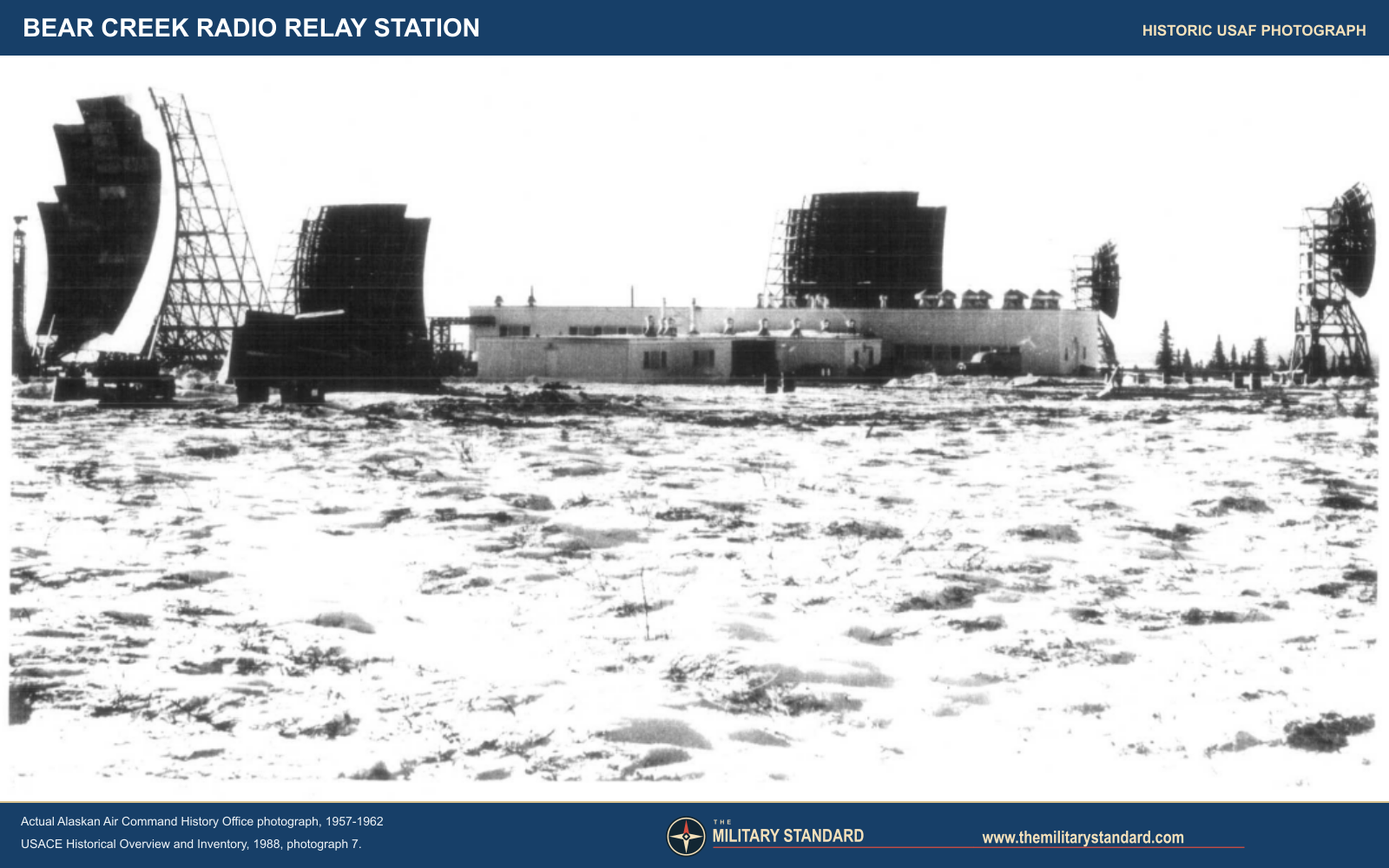
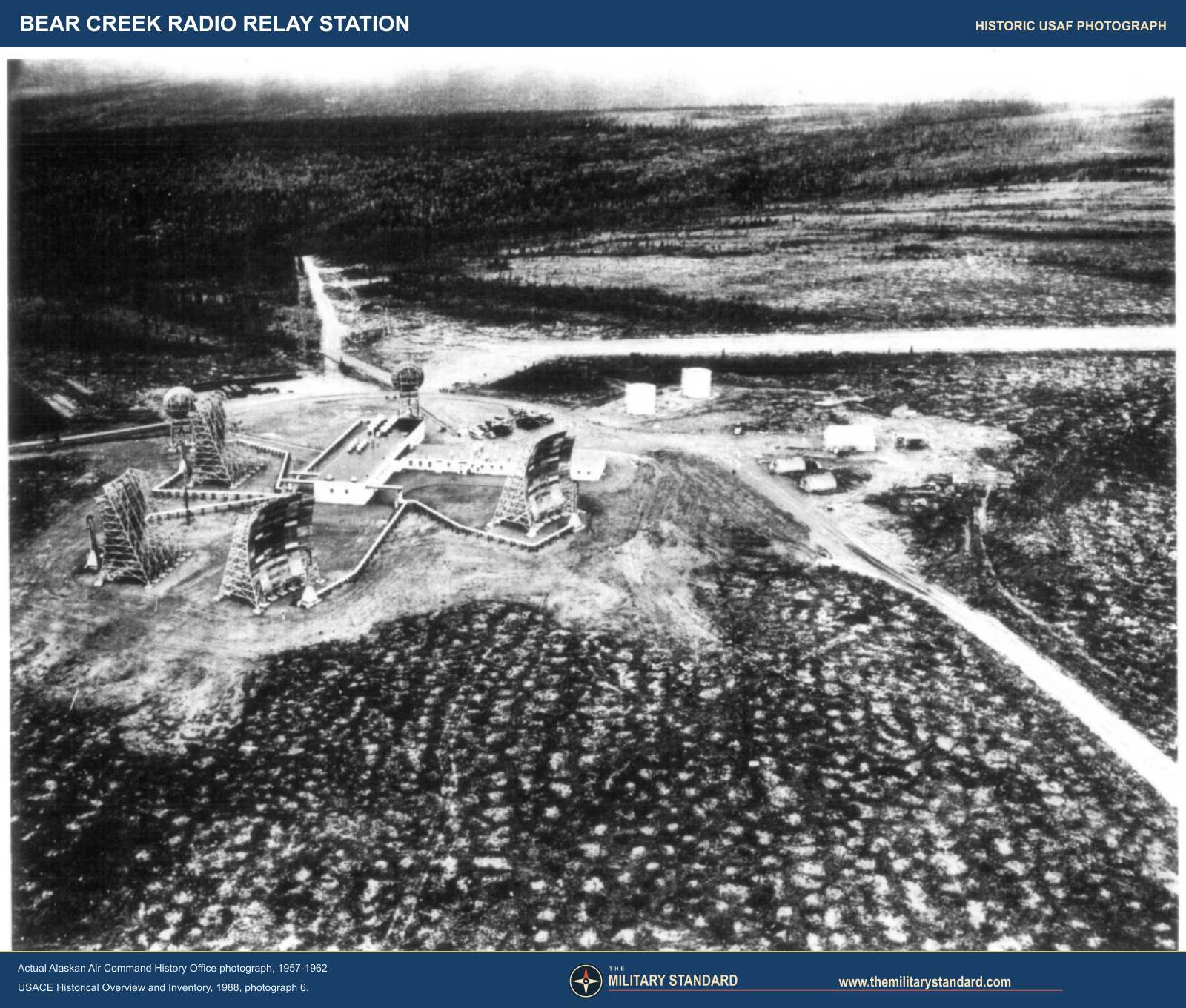
The original power and equipment building measured 7,200 square feet. A separate 5,200-square-foot dormitory had a 16-person design capacity. The latter is a building specification, not proof that exactly 16 operators occupied it at all times. A 1998 Tanana Tribal Council description of the functioning installation additionally identifies vehicle maintenance and operations shops, heated parking, a fire-water pump station, diesel and gasoline storage, and a water storage tank. Those support elements were part of keeping diesel generators, high-power transmitters, winter vehicles, and people working at a remote site. The 1988 Corps report's own aerial photograph shows the long central building, antenna field, access tracks, fuel tanks and other structures; its winter image shows the facade and the curved antennas in snowy conditions. Both are credited in the report to the Alaskan Air Command History Office, and the report dates the photo group to 1957 through 1962. Neither should be confused with a current property photograph. [1] [4]
Land-area descriptions measure different interests. DEC's 2022 letter states that the radio station was constructed on 16.2 acres withdrawn from federal holdings for military purposes. The official 2013 Air Force natural-resources inventory lists Bear Creek among excess sites at 115 acres. A Tanana environmental compilation calls the broader facility 116 acres. The 2019 Air Force draft calls its study site about 100 acres and its habitat table sums to 98.9 acres. These are not interchangeable measurements: a land withdrawal, an excess-site inventory and an ecological study boundary need not encompass the same parcels or road corridor. None is a verified present-day legal polygon. Environmental reference points for the LF001 landfill and SS007 borrow pit identify those particular areas, not the station center. [3] [7] [8] [9] [13] [15]
Radio paths and operational method
Bear Creek's three primary long-distance paths are unusually specific in the 1988 Corps inventory. A pair of 60-foot billboard antennas faced Kalakaket Creek, 155 miles away. A second 60-foot pair faced Pedro Dome, 130 miles away. A pair of 30-foot dishes connected to Indian Mountain, 75 miles away. A local TD-2 microwave link went to the Tanana FAA facility. These are directions and approximate circuit distances reported by the Corps, not bearings calculated from uncertain modern point coordinates. The 1988 inventory thus specifies six troposcatter antennas. The later Air Force draft says "four WACS antennas" without explaining whether it counted only the four large billboards or omitted the two smaller dishes. The route-specific earlier inventory and historic photograph are better evidence for the station's six-antenna layout. Bear Creek was a communications relay in the air-defense system; Indian Mountain had the radar mission. [1] [15]
In troposcatter service, a feedhorn illuminated a shallow parabolic antenna that sent a strong signal toward the horizon. A small portion scattered forward through the lower atmosphere and could be recovered at a distant station beyond ordinary line of sight. White Alice combined conversations and message traffic into radio channels and retransmitted them at junction stations. The Corps gives nominal power classes of 10 kilowatts for 60-foot billboards and 1 kilowatt for 30-foot dishes across the system. Those are technology-class figures, not a measured Bear Creek transmitter-output log. The source record reviewed so far does not establish Bear Creek's exact transmitter models, channel count, assigned frequencies, dated equipment replacements or day-by-day circuits. [1] [5]
The FAA Tanana chronology offers a useful but narrower view of the local connection. It records a White Alice point-to-point tie-in at Tanana on March 14, 1958, installation of circuit 9337 between Tanana and Bear Creek on June 27, and commissioning of 9337-TM on December 13. It records a receive-only 9337T service in November 1959 and its discontinuation in April 1960. These dated entries establish a changing civil aviation communications interface, not an FAA ownership claim over Bear Creek's military compound. They also show why a single White Alice activation year cannot stand in for every circuit's service date. [6]
Personnel, logistics and the Tanana connection
An independent dormitory, heavy radio equipment, power plant, water system, fuel storage and motor shop imply constant logistical support. Power generation and antenna alignment had to work through extreme cold and isolation. The 1988 aerial photograph shows an extensive cleared compound rather than an unmanned repeater hut. The size of the dormitory is the best verified local staffing proxy, but operating-unit orders, contractor rosters, shift schedules and first-person Bear Creek maintenance logs have not been found in the reviewed sources. The White Alice network's systemwide change to Alascom operation in 1970 does not, by itself, document the date a particular Bear Creek worker or contract changed employer. [1] [2]
The station was also tied to Tanana's civilian communications history. The documented FAA point-to-point circuit connected a federal aviation station with Bear Creek. A secondary history reports that the White Alice route improved local long-distance telephone access, but the reviewed primary record has not yet quantified how many public circuits were provided or when the community service began. More importantly, the land and disposal issues left by the military complex directly affected Tanana residents. In 1998 the Tanana Tribal Council environmental specialist described concern about the waste area and planned local stream assessment. The 2002 Alaska DEC chronology records government-to-government and interagency meetings with the tribal council and agencies over environmental identification and corrective actions. That participation belongs in the station history, rather than treating the former property as empty land after the radios shut down. [3] [4] [6]
Shutdown, land and physical change
The Corps' 1994 plan states that Bear Creek closed in 1979. This fits DEC's 1959 to 1979 operating interval even though the start year remains disputed. The 2022 DEC decision says the facility was decommissioned in 1981; operational closure and completion of decommissioning are distinct milestones. Satellite and commercial communications alternatives displaced the expensive troposcatter network during the 1970s. The 1994 survey called Bear Creek abandoned, reported that Alascom leased some land, and did not establish the condition of all structures. In 1996 Alaska DEC recorded discussions about demolition and use of an onsite landfill, with a PCB hot spot to be excluded. DEC's later signed decision states that all station structures were dismantled, demolished and removed in 1997. A 2019 Air Force draft instead calls the Clean Sweep demolition a 1996 event. The contemporaneous 1996 planning entry and signed 2022 retrospective favor distinguishing planning from removal in 1997; the precise date of each demolition phase has not been independently established. The landfill was covered with 18 inches of clean fill, graded and seeded. By 2005 DEC inspectors described the former relay station and its demolition landfill at the hilltop. [2] [3] [5] [13] [15]
The Corps' 1994 plan gave the property Alaska Historic Resources Survey number TAN-030, assigned a high preservation priority, and called for further study because integrity was then unknown. Its broad claim that the White Alice system was National Register listed must not be transformed into a verified individual National Register listing for Bear Creek. The status and ownership of specific parcels diverged over time. The 2011 landfill ROD identifies Tozitna Limited as the LF001 landowner, while a DEC SS007 entry says the borrow pit was on Tanana Native Corporation land. The 2022 LF001 letter says the landfill surface rights transferred to Tozitna Limited in July 2020, while also citing a 2018 recorded notice that identified the Air Force as owner. These may refer to different interests or parcels and cannot establish the current title chain for the whole installation. Air Force cleanup responsibility, land title, surface rights and public access are separate questions. [2] [7] [12] [13]
Environmental record and community response
Bear Creek's environmental history began almost immediately after closure and cannot be summarized as a single 1990s cleanup. Alaska DEC records the Air Force removal of roughly 300 gallons of PCB fluid in 1981, partial removal of PCB-affected soil in 1983, and more removal in 1985. In 1984 a Bureau of Indian Affairs investigator sampled surface water, soil and whitefish tissue without detecting PCBs in those samples. A negative result from that particular sampling effort did not rule out later localized soil findings. The 1989 preliminary assessment raised questions about buried drums, liquids and maintenance-shop floor drains. In 1992 inspectors noted floor drains and possible fuel impacts; 1993 results near an equipment-building doorway reached reported PCB concentrations up to 1,000 parts per million. EPA's 1993 decision not to pursue National Priorities List ranking was not an Alaska DEC closure of every subarea. The state continued investigation. [3]
The former station was divided into named environmental areas: LF001 landfill; SS002 vehicle-maintenance shop; SS003 fuel-storage area; SS004 equipment building; SS006 barrel-storage area; SS007 borrow pit; and SS008 Yukon River POL area. DEC's 2015 active- and closed-site tables gave conflicting status for SS004, but its later site-specific record confirms cleanup there in July 2015. Its 2022 signed letter states that all six SS areas had achieved Cleanup Complete status by that date, leaving LF001 as the last active area at the time. The letter itself then closed LF001. These environmental labels refer to functions and contamination questions within the Bear Creek property and associated lands, not six independent communications installations. They also do not establish that no waste remains buried anywhere on the former property. [3] [7] [10] [11] [13] [14]
The equipment-building area, SS004, shows why a first removal action is not the same as a final cleanup. A 1993 investigation found a PCB concentration as high as 1,000 parts per million near the building's west side. Work in 1997 targeted soil above 10 parts per million, but a later review estimated that approximately 300 cubic yards of soil with concentrations up to 10 parts per million remained beneath an 18-inch soil cap. DEC removed SS004 from a combined 2009 decision so its remedy could be addressed separately. Tanana residents opposed relying on the cap alone. The September 2011 SS004 decision required excavation of PCB- and petroleum-affected soil to the applicable level, and the 2012 action removed approximately 780 cubic yards. After reviewing confirmation results, DEC recorded SS004 Cleanup Complete on July 9, 2015, and removed its institutional-control designation. The 780-cubic-yard equipment-building action is distinct from the roughly seven cubic yards removed at LF001 landfill in 2011. Neither volume describes the whole station. [14] [13]
The hilltop LF001 site was an unlined disposal area in use from approximately 1956 to 1981 and perhaps later for some restoration wastes. The signed 2011 ROD places it about 1,000 feet west of the main relay compound. DEC's 1998 investigation and follow-on reviews addressed PCB concerns, landfill cover and possible subsurface material. A 2005 site visit found the capped demolition area revegetating. A 2008 visit found the old landfill capped and willows about five feet high, with soil berms limiting vehicle access. A May 2010 community meeting drew approximately 17 people. Residents expressed a preference for removing PCB-affected soil rather than relying only on a cap and long-term controls. The signed 2011 ROD chose excavation of soil over 1 milligram per kilogram PCB, offsite disposal, continued cap maintenance, a surveyed landfill boundary, notice before excavation and periodic inspection. The ROD estimated about 60 cubic yards might need excavation, but the subsequent work actually removed approximately seven cubic yards in 2011. Confirmation samples showed a maximum remaining PCB concentration of 0.0695 milligram per kilogram, below the one-milligram cleanup level. [3] [12] [13]
The choice of excavation was not simply the Air Force's initial preference. The ROD says its proposed plan had favored institutional controls and cap maintenance without excavation. Tanana participants objected to leaving PCB-affected soil in place, questioned whether Tozitna Limited should have to maintain controls for contamination created by the Air Force, and noted that local crews had experience excavating contaminated soil. The City of Tanana submitted a written comment, while residents also spoke at a public meeting. The Air Force selected the more interventionist alternative after that review. Even with excavation, the ROD retained the cap and land-use notice because LF001 remained an unpermitted landfill. This sequence makes community participation part of the actual remedy decision, not a ceremonial consultation appended to an otherwise fixed plan. [12]
In 2013, warning signs were installed; a notice of environmental contamination was recorded in 2018. The 2020 inspection found dense alder growth and signs in good condition. DEC's account of the 2021 second five-year review judged the controls protective at that time. The signed May 2022 letter then designated LF001 Cleanup Complete after evaluating the remaining contamination for recreational land use. It explicitly says that no institutional controls are required under 18 AAC 75, but the recorded environmental notice remains in effect to satisfy the solid-waste rule and ROD unless replaced by an equivalent public notation. This resolves the apparent contradiction between the website's "No ICs Required" field and the older control history: there are no current controls under that particular contaminated-sites regulation, yet the landfill notice and its cap and excavation provisions remain material. Cleanup Complete does not mean the buried landfill is gone, nor is it a statement about the entire former 115- or 116-acre operating footprint. [3] [12] [13]
The closure letter says drilling at the ridge-top landfill did not encounter a rechargeable groundwater source, even at depths of 41 feet, and DEC judged remaining exposure pathways incomplete or minimal for the evaluated recreational use. That finding applies to LF001 under its specific exposure assumptions. It should not be turned into a claim that every former Bear Creek component lacks groundwater or that water-quality concerns near Tanana were never raised. The tribal account and DEC's earlier community meetings document why residents wanted those broader questions examined. [3] [4] [13]
The SS007 borrow pit presents a different case. It was used as a gravel source and for drum staging; the Air Force disputed responsibility for all debris but agreed to clean contamination. DEC's 2005 and 2007 investigation described diesel-range organics and pesticides, including localized high DDT and DDD readings, plus buried crushed drums. The site was on Native-corporation land rather than the Air Force's hilltop property. A 2011 removal excavated petroleum- and pesticide-affected soil and drums. DEC approved a no-further-action decision in March 2013 and listed SS007 Cleanup Complete without institutional controls. Those determinations apply to the borrow pit, not automatically to LF001 or the antenna compound. [7]
The 2023 Air Force preliminary assessment reviewed by DEC identified no Bear Creek fire-training or other AFFF source area. That is evidence about identified historical foam uses; it is not a universal laboratory finding that every soil or water sample around Bear Creek was free of all PFAS. The record also shows that environmental case statuses have changed over decades. A history should report the dated decision and precise area rather than recycle an older sitewide "high priority" label or a newer one-line "cleanup complete" label without context. [3] [7]
Present condition and significance
Bear Creek is no longer an operating White Alice relay. Historic aerial and winter photographs preserve the shape of its compound and antennas, while a later Air Force draft includes a ground-level view of the former clearing and an overview of the road from Tanana. Its 2019 description places the old operating area in black-spruce forest with willows, alders and grasses growing where facilities once stood. It also notes hunting, gathering and use of the access road by Tanana residents, so a statement that the station is closed should not imply the surrounding landscape is unused. The draft map is a contextual overview, not a surveyed title plan. The available record does not establish whether small structures survive at every outlying component, the precise current parcel ownership, or public access rights. It would be misleading to use a landfill or borrow-pit coordinate as a tourist location for the antenna field. [1] [2] [3] [7] [15]
The installation's historical significance lies in its position between three important White Alice neighbors. The two 60-foot pairs reached a switching junction at Kalakaket Creek and the central Alaska network at Pedro Dome; the smaller dishes reached the communications element at Indian Mountain, where radar information needed a reliable way out. A local FAA path connected the national defense system with Tanana aviation communications. Bear Creek therefore tells both stories: the technical achievement of a large, staffed, remote relay, and the decades-long property and cleanup work that followed its short operational life. The sources are strong on the 1950s construction, layout, routes and 1980s-2020s environmental sequence, but weak on daily operating rosters, exact radio equipment and a surveyed modern property boundary. The conflicting activation year remains open. [1] [2] [3] [4] [6] [12] [13]
Chronology
- 1956-1957 Construction of Bear Creek's original White Alice compound, according to the 1988 Corps inventory. [1]
- 1958-01-06 or 1959-01-06 Conflicting reported activation dates; the 1994 Corps plan gives 1958, while a 1998 Tanana Tribal Council account gives 1959. [2] [4]
- 1958 A later Air Force draft says the site became Bear Creek Air Force Station; an original redesignation order was not located. [15]
- 1958-03-14 FAA Tanana chronology records a White Alice point-to-point tie-in. [6]
- 1958-06-27 Tanana-Bear Creek circuit 9337 was installed, awaiting the Indian Mountain tie-in. [6]
- 1958-12-13 Circuit 9337-TM was commissioned. [6]
- 1961 The same Air Force draft says the name became Bear Creek Radio Relay Station. [15]
- 1970 Alascom began operating the White Alice system under the systemwide agreement, according to the 1994 Corps plan; Bear Creek-specific transfer paperwork was not found. [2]
- 1979 Bear Creek closed as an operating relay, according to the 1994 Corps plan and Alaska DEC. [2] [3]
- 1981 The later DEC closure letter gives this as the facility's decommissioning year, distinct from the reported 1979 operating closure. [13]
- 1981 The Air Force removed approximately 300 gallons of PCB fluid, according to DEC. [3]
- 1983-1985 PCB-affected soil was identified and partially removed in more than one action. [3]
- 1989 An Air Force preliminary assessment raised concerns about possible buried waste and maintenance-shop drainage. [3]
- 1993 A site inspection reported a PCB hot spot near the equipment-building doorway; EPA's non-NPL decision did not close the DEC investigations. [3]
- 1994 The Corps cultural-resources plan found Bear Creek abandoned, some land leased by Alascom, and physical integrity undetermined. [2]
- 1996 Alaska DEC recorded demolition and landfill planning; a later Air Force draft dates Clean Sweep demolition broadly to this year. [3] [15]
- 1997 Station structures were dismantled, demolished and removed; LF001 was covered with 18 inches of clean fill and revegetated. [13]
- 1997 Initial SS004 equipment-building work removed the most heavily PCB-affected soil but left a capped residual area requiring later review. [14]
- 1998 Tanana Tribal Council planned stream assessment and raised subsistence-area concerns. [4]
- 2002-09-11 DEC recorded an interagency and tribal-government meeting in Tanana about environmental identification and corrective action. [3]
- 2005 DEC and Air Force inspected remaining restoration areas and the hilltop landfill cap. [3]
- 2008 Review of SS004 identified approximately 300 cubic yards of residual PCB-affected soil beneath a cap. [14]
- 2011-07-26 The LF001 Record of Decision received state approval, selecting PCB excavation, offsite disposal, cap maintenance and landfill controls. [12]
- 2011-09-06 A separate SS004 decision selected excavation rather than cap-only management after community objections. [14]
- 2011 Petroleum, pesticide and drum material was removed at the SS007 borrow pit. [7]
- 2011 Approximately seven cubic yards of PCB-affected soil were removed from LF001, according to the later DEC closure letter. [13]
- 2012 Approximately 780 cubic yards of affected soil were excavated at SS004 near the former equipment building. [14]
- 2013-03-08 DEC issued a cleanup-complete determination without institutional controls for SS007 only. [7]
- 2013-12-27 DEC approved an institutional-controls report for LF001 and the TVMG trash dump. [3]
- 2015-07-09 DEC listed the separate SS004 equipment-building area Cleanup Complete and removed its institutional-control designation. [14]
- 2018-06-13 A notice of environmental contamination for LF001 was recorded in the Fort Gibbon district. [13]
- 2019 The Air Force draft appendix documented the former clearing, road approach and approximate ecological-study area, not a new military use. [15]
- 2020-07 LF001 surface rights transferred to Tozitna Limited, according to DEC's 2022 letter. [13]
- 2021 DEC approved the second LF001 five-year review and reported the controls protective at that time. [3]
- 2022-05-05 DEC designated LF001 Cleanup Complete, with no controls required under 18 AAC 75 but the recorded landfill notice remaining in effect. [13]
- 2023-09-29 DEC recorded an AFFF preliminary assessment that identified no AFFF source areas at Bear Creek. [3] [7]
Information sources (15)
- PDF[1] Georgeanne Lewis Reynolds, Historical Overview and Inventory: White Alice Communications System, U.S. Army Corps of Engineers, April 1988
Source for: original-program classification, construction, building areas, antenna routes, technical context, and Bear Creek aerial and winter photographs numbered 6 and 7.
- PDF[2] D. Colt Denfeld, The Cold War in Alaska: A Management Plan for Cultural Resources, U.S. Army Corps of Engineers, August 1994
Source for: 1958 activation claim, 1979 closure, abandoned status, Alascom lease, preservation assessment and AHRS number TAN-030.
- WEB[3] Alaska Department of Environmental Conservation, Bear Creek RRS Landfill LF001 site report, hazard ID 792
Source for: station and LF001 history, 1981-2023 environmental chronology, landfill decision and five-year-review summaries, and landfill-specific WGS84 reference point.
- WEB[4] Paul Erhart, Tanana Tribal Council, Bear Creek RRS Continues to Pose an Environmental Threat, 1998
Source for: local account of construction and activation, component areas and Tanana Tribal Council environmental concern; activation year treated as disputed rather than conclusive.
- PDF[5] Alaska Department of Natural Resources, Alaska's Coldest Front: The Military in Alaska's Cold War, 2014
Source for: White Alice system context, radar-network communications purpose, technological transition and the broad 2014 empty/abandoned inventory label.
- WEB[6] Federal Aviation Administration Tanana Flight Service Station historical chronology, archived by Air Traffic Control History
Source for: March and June 1958 point-to-point work, December 1958 commissioning and 1959-1960 circuit changes.
- WEB[7] Alaska Department of Environmental Conservation, Bear Creek RRS Borrow Pit Area SS007 site report, hazard ID 106
Source for: borrow-pit location and distinct ownership, petroleum/pesticide and drum investigation, 2011 removal and 2013 cleanup-complete decision.
- PDF[8] U.S. Air Force 611th Air Support Group, Integrated Natural Resources Management Plan for Remote Sites, 2013
Source for: Bear Creek RRS listed among excess sites with 115 acres; this is an inventory figure, not a surveyed current parcel polygon.
- PDF[9] Ridolfi Inc., Compilation of Environmental Information for Sites of Concern In and Around Tanana, Alaska, reproduced by Alaska DEC
Source for: a 116-acre Bear Creek estimate, area-component context and the distinction between the radio compound and outlying environmental locations.
- PDF[10] Alaska Department of Environmental Conservation, FY2015 Inventory of Closed Contaminated Sites, Table J
Source for: listed Bear Creek component areas including SS004; this table conflicts with Table I in the same reporting year.
- PDF[11] Alaska Department of Environmental Conservation, FY2015 Inventory of Active Contaminated Sites, Table I
Source for: contemporaneous listing of SS004 as active and the Bear Creek trash dump; used to flag the conflicting inventory status.
- PDF[12] U.S. Air Force, Record of Decision, Landfill No. 1 (LF001), Bear Creek RRS, Alaska, May 2011
Source for: selected remedy, landfill position relative to the main station, soil threshold, cap and land-use controls, named responsibility, other component status as of 2011, and approval signatures.
- PDF[13] Alaska Department of Environmental Conservation, Cleanup Complete Determination, Bear Creek RRS Landfill LF001, May 5, 2022
Source for: original 16.2-acre federal withdrawal, demolition year, six other component closures, actual 2011 excavation volume, residual concentrations, land-surface transfer, recorded notice, and precise 2022 LF001 decision.
- WEB[14] Alaska Department of Environmental Conservation, Bear Creek RRS Equipment Building SS004 site report, hazard ID 772
Source for: equipment-building PCB hotspot, incomplete 1997 removal, separate 2011 decision, approximately 780 cubic yards excavated in 2012, and July 2015 cleanup-complete designation.
- PDF[15] U.S. Air Force, Pacific Air Forces Regional Support Center and 611 Civil Engineer Squadron, Integrated Natural Resources Management Plan Update, Draft Edition 1, Appendix H, February 2020, pages 399-405
Source for: later Bear Creek names, TD-2 microwave description, 2019 landscape photograph and overview, approximate 100-acre study boundary, physical setting, demolition-year discrepancy and current-use context. This is a draft; conflicting figures are not silently substituted for signed decisions or the 1988 antenna inventory.