
Indian Mountain Air Force Station / Indian Mountain Long Range Radar Site, Alaska
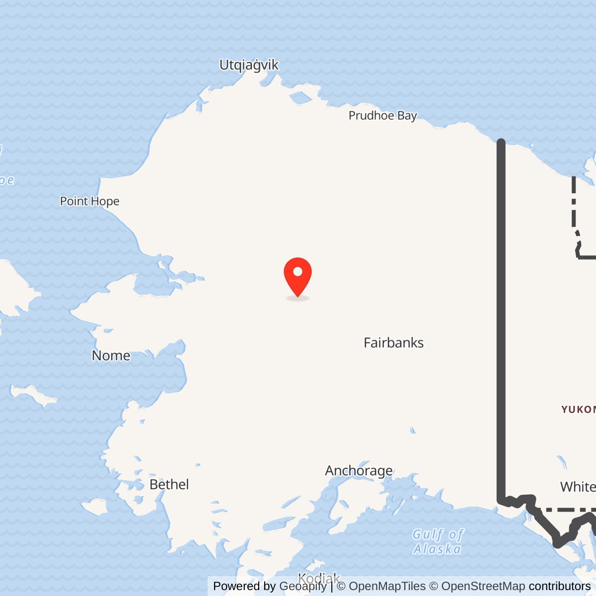
Longitude: -153.702268
Current Role: Active U.S. Air Force Indian Mountain Long Range Radar Site feeding Alaska NORAD regional surveillance; air-supported lower camp and upper radar camp, with continuing Alaska DEC restoration-area monitoring through 2026.
Coordinate note: 65.992754 N, 153.702268 W is Alaska DEC's WGS84 environmental point in the lower-camp area. It is not the radar antenna, White Alice antenna, property centroid, runway threshold, or surveyed boundary. The former White Alice OT008 area has a separate approximate upper-camp environmental point, 66.068333 N, 153.680000 W, with datum not stated by DEC.
- Radar role
- Aircraft warning and ground-controlled interception from November 1953; continuing long-range radar surveillance.
- White Alice role
- Tropospheric-scatter communications with Bear Creek, February 1958 to May 1979.
- Local unit
- 708th Aircraft Control and Warning Squadron, following a 143rd Air National Guard detachment.
- Radar equipment
- Original AN/FPS-3 search radar and later AN/FPS-6 height finder; AN/FPS-93 and AN/FPS-90 in the staffed era; AN/FPS-117 operational October 1984. Intermediate AN/FPS-20 is secondarily attested.
- Present identity
- Active Indian Mountain Long Range Radar Site. No surviving White Alice antenna is documented.
Overview
Indian Mountain is a continuing air-defense radar installation in the interior of Alaska, about 15 to 16 miles east of Hughes. Its staffed Aircraft Control and Warning (AC&W) station opened for ground-controlled interception in November 1953; its co-located White Alice Communications System terminal entered service on February 7, 1958. The radar and the communications station shared an Air Force host but performed different tasks. Radar crews searched the air approaches and supplied tracks for interception, while White Alice carried those reports and command traffic over a tropospheric-scatter path toward Bear Creek. White Alice ended in 1979, the 708th AC&W Squadron and its local control arrangements disappeared in the early 1980s, and the site became a minimally attended long-range radar station. The radar mission remains active in 2026. [1] [2] [3] [4] [5]
Installation Identity, Geography, and Coordinates
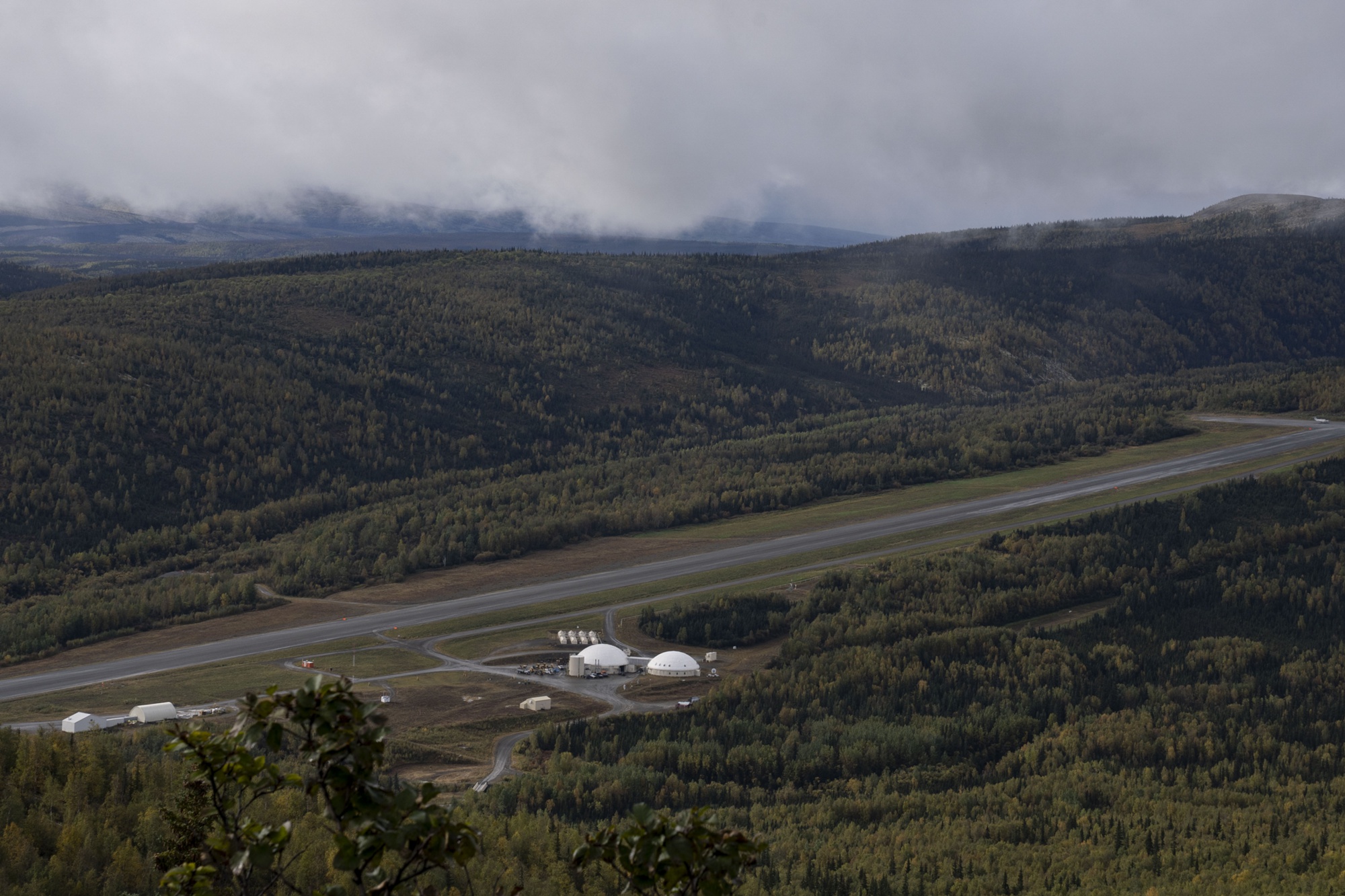
This is one installation with two historically distinct missions, not a radar base plus a separately established White Alice installation. The original White Alice network roster identifies Indian Mountain as co-located with an AC&W station, and Alaska DEC places the former White Alice equipment at environmental area OT008 within the upper camp. The lower camp contains the airfield, living and industrial facilities, while the upper camp occupies the mountain and contains the radar mission. An approximately ten-mile access road linked them. The 1950s builders chose the high radar position for surveillance even though it made construction, supply, water, heat, and maintenance difficult. Indian Mountain was one of the two Alaska AC&W stations, along with Sparrevohn, supplied entirely by air. [1] [2] [3] [5]
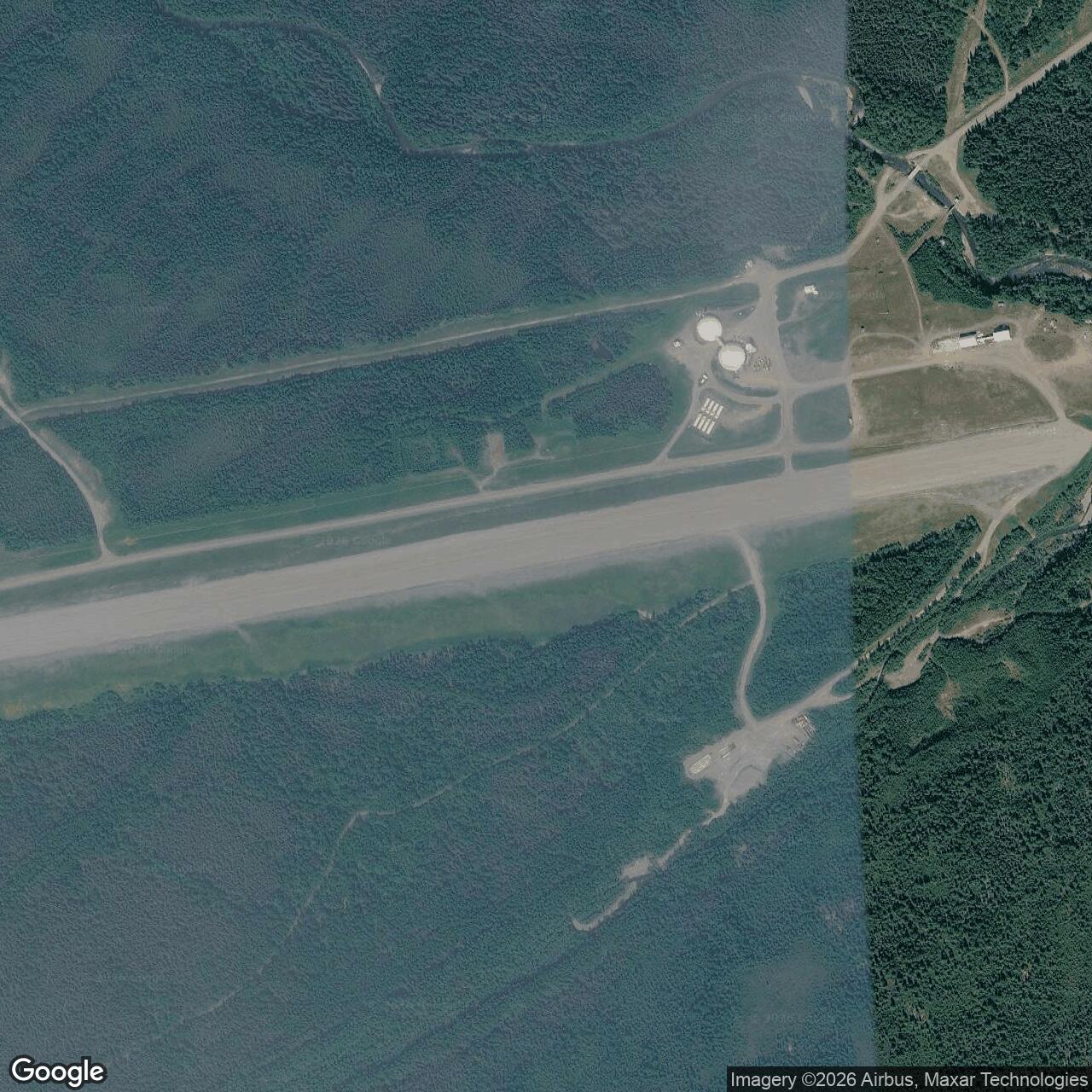
The representative 65.992754 N, 153.702268 W coordinate is Alaska DEC's WGS84 point for the installation-wide environmental record, in the lower-camp area. It is not a surveyed radar antenna, White Alice antenna, property centroid, runway threshold, or legal boundary. DEC separately places the former White Alice OT008 area at approximately 66.068333 N, 153.680000 W, but its OT008 record does not state a horizontal datum. That point should be used only as an approximate environmental-area locator. The two markers describe components of a split-camp host, not two independently numbered installations. No installation-wide acreage or current surveyed boundary was located. [3] [4]
Origins, Construction, and Supply
Indian Mountain and Sparrevohn were added to the first ten Alaska AC&W installations to close gaps in interior coverage. The 807th Engineer Aviation Battalion began construction at Indian Mountain in July 1951. The project required both a mountaintop operating area and a lower support camp, linked by the road but not by the tram found at some other split-camp radar stations. The ground-controlled-interception installation became operational in November 1953 at a reported construction cost of $1.5 million. Thus 1951 marks construction, not the beginning of operational radar service. The Alaska DEC overview's statement that the site operated from 1951 to the present uses a broader installation-life convention than the historic study's November 1953 radar-opening date. [2] [3]
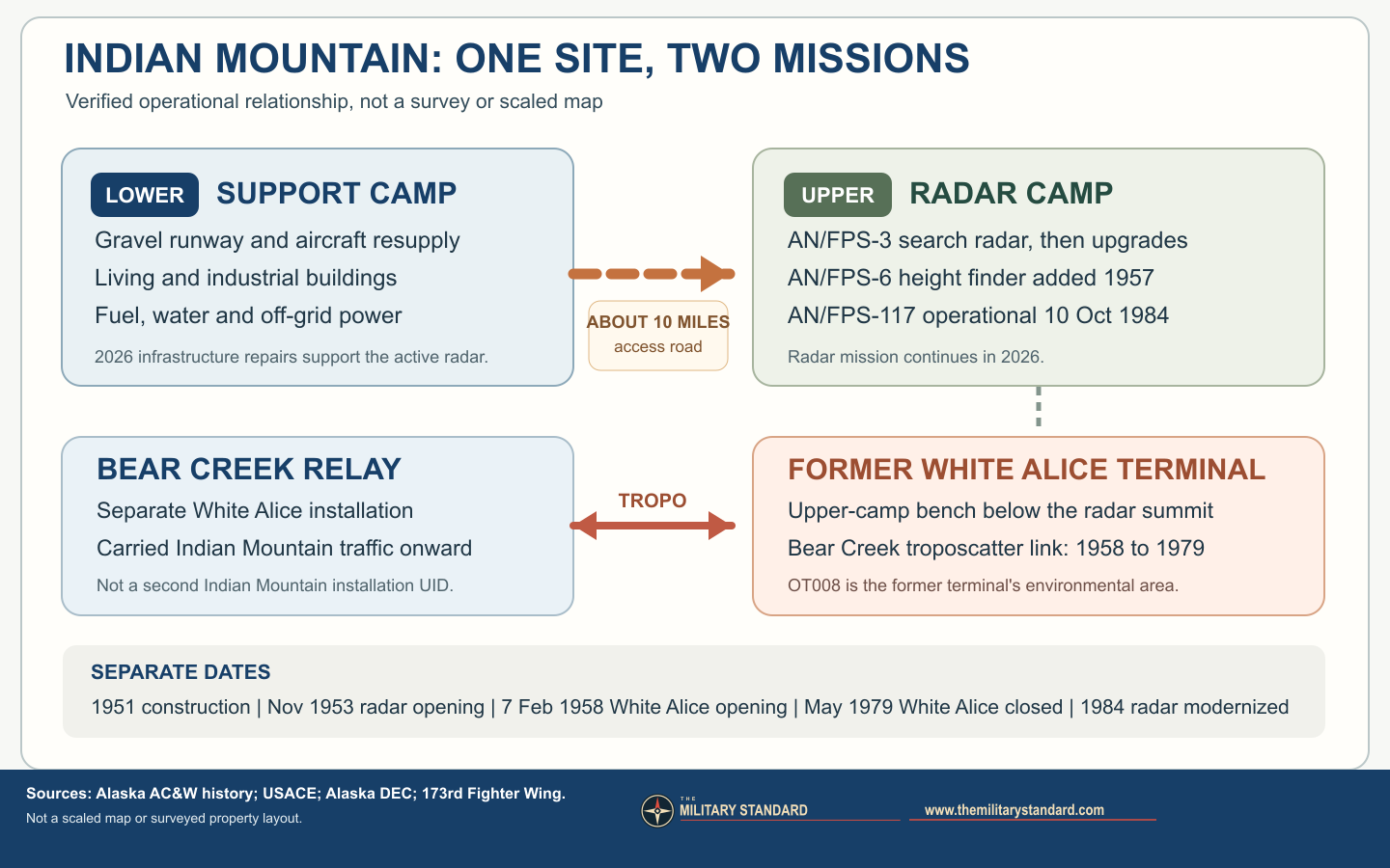
The lower airstrip was the station's logistical lifeline. A 2023 U.S. Air Force caption identifies lower-camp living and industrial buildings and the runway as support for the upper radar camp, while a 2026 Air National Guard account says Indian Mountain has no road connection to Hughes and describes a steep 4,100-foot gravel runway. The historic study calls the strip the steepest of Alaska's remote radar-site runways, with a 12 percent slope. Aircraft delivered people, fuel, equipment, food, and repair parts that could not simply arrive by truck from a nearby town. The modern site's water line, above-ground fuel pipeline, wellhouse, and off-grid diesel generation show that the same isolation still shapes operations. In July 2026, an Air National Guard engineering team repaired a water-line bridge, a 4,300-foot fuel pipeline, and riverbank protection because loss of those utilities could jeopardize radar continuity. [2] [5] [6]

Radar Mission, Equipment, and Units
The original search radar was an AN/FPS-3. It reported target range and bearing, but height information had to be developed separately for effective ground-controlled interception. An AN/FPS-6 height finder was added in 1957. Later modifications produced an AN/FPS-93 search set and AN/FPS-90 height finder, according to the Alaska AC&W historic study. A community-maintained station roster also lists intermediate AN/FPS-20 and AN/FPS-6B equipment, but the primary historic study does not establish the exact dates of those intermediate conversions. [2] [11]
Detachment F-16 of the 143rd AC&W Squadron of the 143rd Air National Guard ran the developing station until December 1952. The 708th AC&W Squadron then took over under the 160th AC&W Group; it passed to Alaskan Air Command headquarters control in 1953 and continued the local mission through the staffed era. The Air Force used the F-16 radar-network identifier for Indian Mountain. As a ground-controlled-interception station, it did more than display a blip: operators identified and tracked aircraft, obtained height information, and fed the control chain that could direct fighters from forward operating bases. The later A-03 identifier belongs to the long-range/JSS network at the same host. [2] [11]
An AN/FYQ-9 data system was installed in 1965 and remained until 1982, when Joint Surveillance System equipment took over the data-transmission role. This progression changed where radar information was processed and who needed to be physically present. The new JSS equipment sent tracks by satellite to the Regional Operations Control Center at Elmendorf, which became operational in 1983. Alaskan Air Command had already contracted site support to RCA Services in 1977, eliminating 103 military positions at Indian Mountain while retaining essential military operations personnel. With the remote-control center operating, the 708th squadron was deactivated and the old staffed AC&W organization ended. This did not mean that Indian Mountain ceased to detect aircraft. [2] [7]
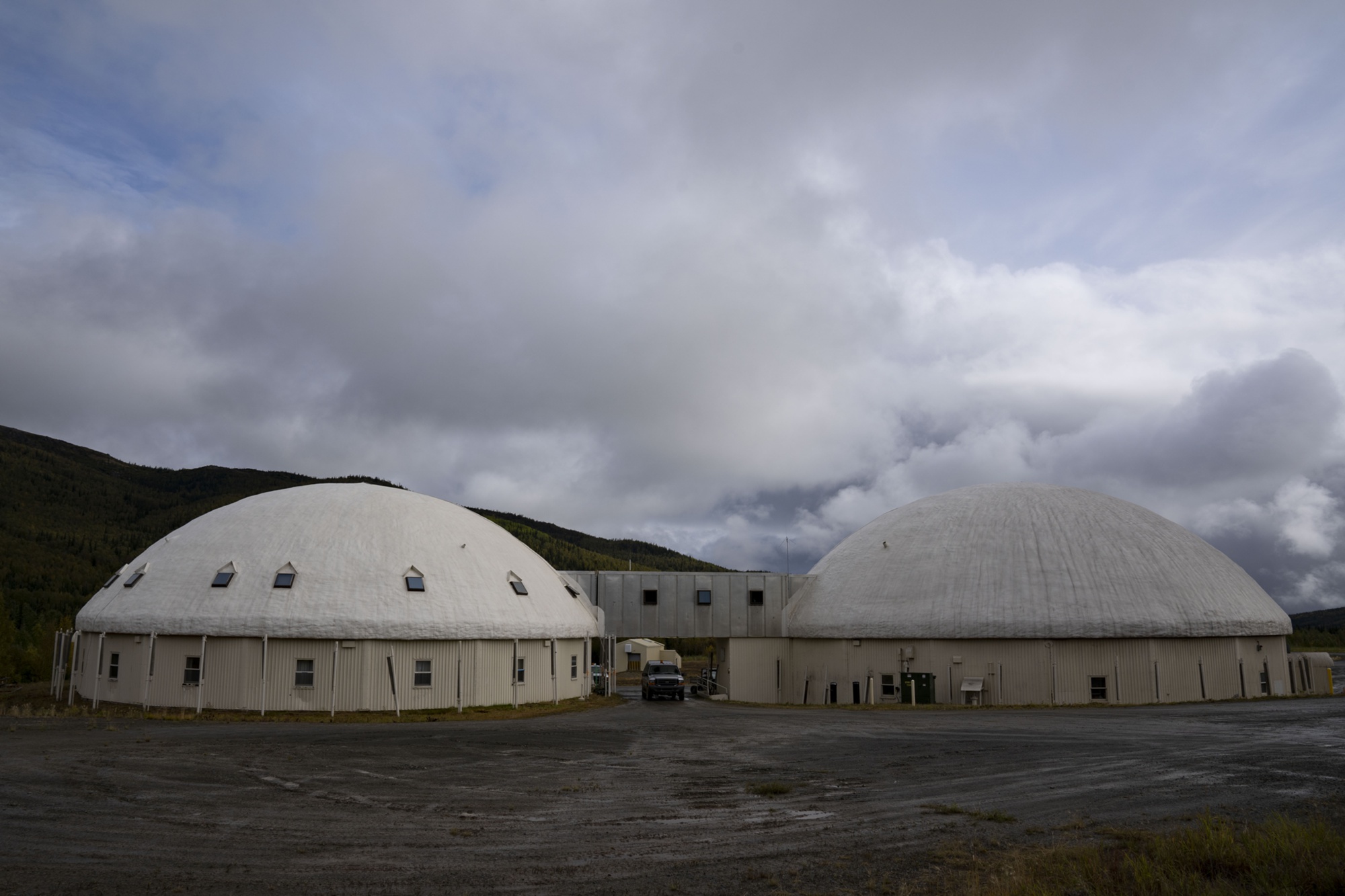
Under the Seek Igloo modernization, the Air Force installed an AN/FPS-117 minimally attended, three-dimensional radar in July through September 1984. A 1994 Corps of Engineers chronology gives October 10, 1984 as its operational date. The historic Alaska study places the conversion in October 1984 but has a typographical inversion, "AN/FSP-117"; the radar designation is AN/FPS-117. Unlike the earlier combination of a search set and a separate height finder, the three-dimensional radar supplied range, bearing, and elevation information in one system and supported a much smaller site workforce. A new double-dome composite building housed personnel and industrial functions. The older 708th-squadron inactivation and the 1984 equipment commissioning are distinct dates; Alaska DEC's description of AC&W deactivation in 1984 appears to summarize the completed mission transition rather than the exact squadron action. [2] [3] [7] [8]
White Alice Communications
Before White Alice, high-frequency radio was the command link, but Alaska's great distances and difficult propagation made it unreliable. The White Alice network used tropospheric scatter to carry voice and data traffic between distant sites beyond normal line of sight. Indian Mountain was among the original co-located stations, reducing the need to build a second remote support base. Construction of its tropospheric terminal began in 1956, and the Corps of Engineers gives February 7, 1958 as the operational date. Its route connected Indian Mountain to the independently established Bear Creek Radio Relay Station near Tanana. Contemporary accounts describe two 30-foot dish antennas aimed toward Bear Creek across roughly 75 miles; this antenna dimension and path length are supported by the station and veteran record, while the official Corps study confirms the link without a technical antenna schedule. [1] [2] [9] [10]
The White Alice equipment stood on a bench in the upper-camp area below the actual radar summit, sharing support infrastructure with the AC&W installation. This distinction matters visually: a widely circulated historic photograph of two dish antennas has been miscaptioned as radar, but a former White Alice supervisor identified it as the communications station viewed from the upper radar area. A Corps study describes a composite building serving White Alice and AC&W, and DEC identifies the former WACS structure, stained-soil area, and pump house as components of OT008. The terminal's power-intensive radio equipment and insulation oils later became part of the environmental history. [4] [9] [10]
Alascom's commercial satellite system displaced the White Alice path, with the historic study dating Indian Mountain's White Alice service from February 1958 to May 1979. DEC independently gives 1979 deactivation and says the WACS buildings were demolished in 1986, while the wider station record describes some White Alice and AC&W demolition in 1987. These dates concern different actions: communications shutdown, WACS building removal, and later removal of other obsolete facilities. The satellite replacement did not terminate the radar mission; it helped make the regional remote-radar architecture practical. [2] [3] [4] [12]
Role in the Wider Military Network
Indian Mountain filled an interior Alaska warning gap rather than standing alone as a mountaintop listening post. During the staffed era, its search and height information moved through the Alaskan AC&W command network, with Murphy Dome functioning as a direction-center node in the regional system. White Alice's Bear Creek link connected Indian Mountain to a wider chain toward Pedro Dome and Kalakaket Creek, and local circuits tied that chain into other Alaska communications. The site was therefore both an air-defense sensor and a communications endpoint. Its White Alice component should not be confused with a DEW Line radar station: the missions and networks interacted, but they were not identical. [1] [2] [9] [10]
The JSS and Regional Operations Control Center at Elmendorf moved track interpretation and control away from individual remote sites in the 1980s. In 2026, an Air National Guard account described Indian Mountain's radar as supplying continuous aerospace-surveillance information to the Alaska NORAD Region Air Operations Center at Joint Base Elmendorf-Richardson. The precise organizational chain and radar hardware have evolved since the 708th era, but the strategic logic persists: a functioning remote sensor must send trusted tracks to a regional controller. This explains why fuel, water, runway access, and communications maintenance remain operational matters rather than merely property-management details. [5] [7]
Physical Survival, Environmental Record, and Present Use
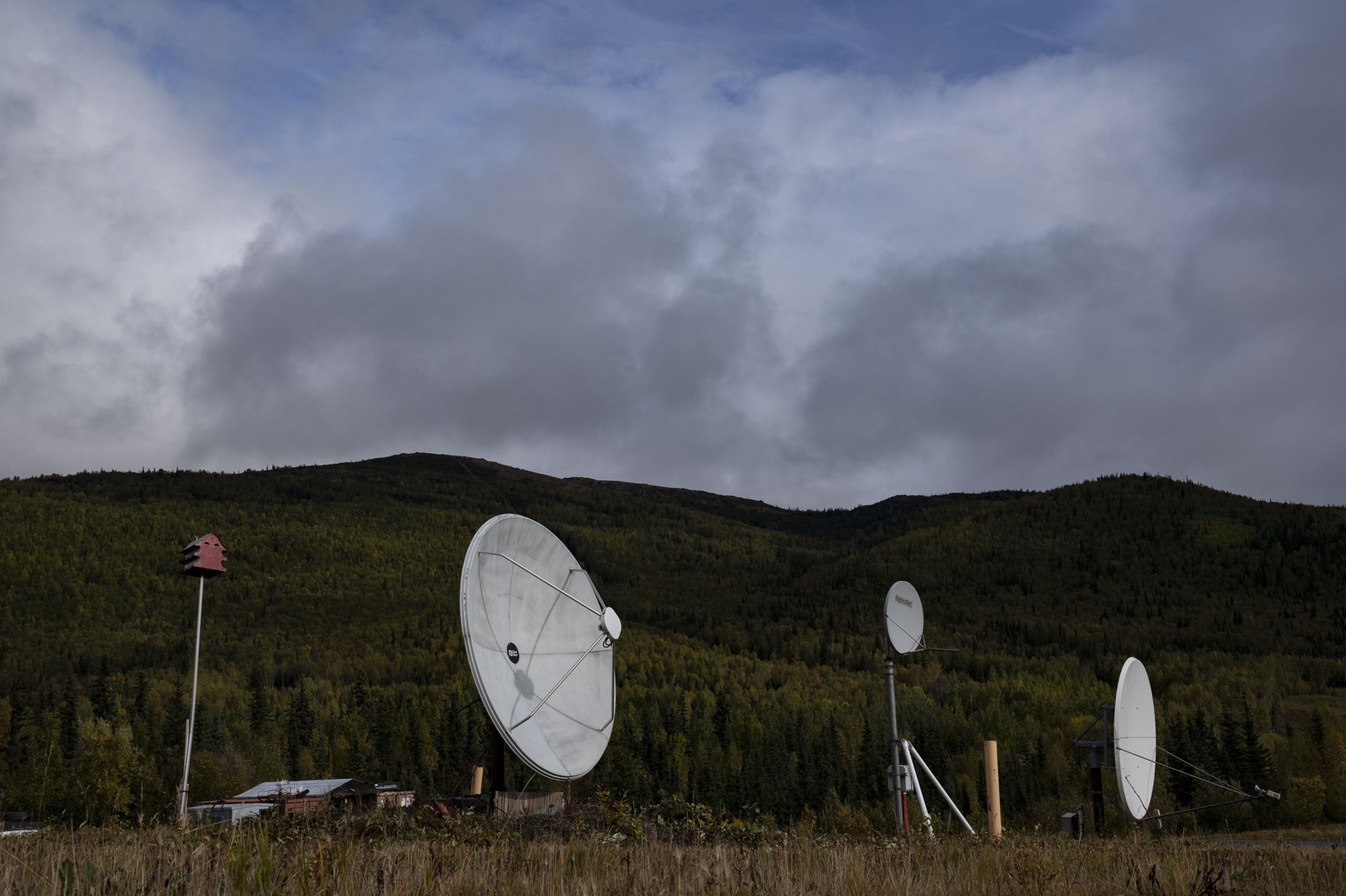
Modernization did not preserve the 1950s base intact. The Alaska historic study says most original AC&W structures were demolished, with unnecessary White Alice and older AC&W facilities removed in the 1980s. Its study-era inventory identified a radio beacon building, waste-treatment facility, radome tower, airfield, and road system from the 1950s-60s, plus several buildings associated with the White Alice period. That is a dated survey, not proof every item survives in 2026. The same study says the former AC&W site was recommended as not eligible for the National Register; the network-level White Alice historical significance does not, by itself, establish National Register eligibility for every remaining Indian Mountain structure. U.S. Air Force photographs taken September 6, 2023 document the lower-camp runway, buildings, satellite dishes, and two connected domes, as well as a C-12F supporting air access. The dishes are modern satellite equipment, not surviving White Alice antennas; the pictured lower-camp domes should not be mislabeled as the upper-camp radar antenna. Together with the 2026 Air National Guard account, these views establish continuing lower-camp support and an upper-camp radar mission, not survival of the original antennas. [2] [5] [6] [14] [15] [16]
The environmental history is also specific to distinct areas rather than a simple "site cleaned up" conclusion. Alaska DEC reports more than 60,000 gallons of fuel released in the upper and lower camps in the late 1970s and early 1980s, with petroleum products, solvents, and PCBs among the known contaminants. At the former White Alice area OT008, DEC documents PCB and diesel-range-organic soil contamination. Approximately 404 tons of PCB-contaminated soil was excavated and removed during 2020-21 work; remaining lower-concentration soil was consolidated under a lined and gravel-covered cap. The cap, signage, and a recorded notice restricting use and ground disturbance are ongoing controls, not evidence that all contamination vanished. [3] [4]
Other Indian Mountain restoration areas include landfills, spill areas, and groundwater concerns at both camps. DEC's 2023 five-year review, approved July 2, 2024, called for additional notices of activity and use limitations at sites with residual contamination. Its 2023 PFAS investigation found exceedances warranting further remedial investigation in on-site areas, but a separate off-base drinking-water review within four miles found no wells and no PFAS detections in sampled surface water. Those findings are not contradictory: they address different media and locations. DEC approved a 2025 long-term management report on February 23, 2026 for nine restoration areas, including OT008. Indian Mountain is therefore an active radar installation with active environmental management, not an abandoned or fully remediated base. [3] [4]
Chronology
- July 1951 The 807th Engineer Aviation Battalion begins construction of the split upper- and lower-camp AC&W installation. [2]
- December 1952 The 708th AC&W Squadron takes over from the 143rd Air National Guard detachment. [2]
- November 1953 Indian Mountain begins operational ground-controlled-interception radar service. [2]
- 1956 Construction begins on the co-located White Alice tropospheric-scatter station. [9]
- 1957 An AN/FPS-6 height finder is added to the original AN/FPS-3 search-radar system. [2]
- February 7, 1958 The Indian Mountain White Alice link to Bear Creek becomes operational. [9]
- 1965 An AN/FYQ-9 radar-data system is installed. [2]
- 1977 RCA Services assumes expanded site support; 103 military positions are eliminated. [2]
- May 1979 Indian Mountain White Alice service ends as Alascom satellite communications replace the link. [2]
- 1982 JSS equipment replaces the earlier data system and supports satellite transmission of radar tracks. [2]
- 1983 Regional Operations Control Center operations at Elmendorf enable remote monitoring; the 708th squadron is deactivated during the transition. [2] [7]
- July-September 1984 Seek Igloo installation of the AN/FPS-117 minimally attended radar proceeds. [8]
- October 10, 1984 The new AN/FPS-117 is recorded as operational at Indian Mountain. [8]
- 1986 DEC records demolition of the White Alice facility; some other obsolete facilities were removed in 1987. [3] [4]
- 2020-2021 PCB-impacted soil is removed or capped at the former White Alice OT008 area. [4]
- July 2, 2024 DEC approves the 2023 five-year review while requiring continued restrictions and management. [3]
- February 23, 2026 DEC approves the 2025 long-term management report for nine Indian Mountain restoration areas. [3]
- July 2026 Air National Guard engineers repair water and fuel infrastructure serving the still-active radar installation. [5]
Information sources (16)
- PDFNational Park Service, Historic American Engineering Record AK-23, Rabbit Creek White Alice Site
Source for: Original 31-station White Alice network roster and co-location of Indian Mountain's communications terminal with the AC&W installation.
- PDFArgonne National Laboratory and Alaska Office of History and Archaeology, History of the Aircraft Control and Warning System in Alaska: Air Defense of Arctic Skies
Source for: Indian Mountain construction, two-camp geography, squadron, radar types, AN/FYQ-9, White Alice service, JSS transition, Seek Igloo, and dated building inventory.
- WEBAlaska Department of Environmental Conservation, Indian Mt. LRRS (All Sites), hazard ID 137
Source for: WGS84 lower-camp-area environmental coordinate, installation-wide restoration record, 1980s transition summary, 2024 five-year review, and February 2026 long-term-management approval.
- WEBAlaska Department of Environmental Conservation, Indian Mt. LRRS WACS (OT008), hazard ID 191
Source for: Former upper-camp White Alice environmental component, approximate point with unstated datum, facility demolition, PCB and petroleum remediation, and recorded use restrictions.
- WEB173rd Fighter Wing, 173rd Civil Engineer Squadron Secures Critical Early-warning Radar Site in Remote Alaska, July 30, 2026
Source for: Continuing NORAD radar mission, air-only access, lower-camp runway, water and fuel infrastructure, and 2026 repair work.
- WEBDefense Visual Information Distribution Service, C-12F Hurons support Indian Mountain Long Range Radar Station, photograph 8043086
Source for: Public-domain U.S. Air Force photograph dated September 6, 2023, identifying the lower camp, runway, and supporting role of those facilities. Photograph is not evidence of historic White Alice antenna survival.
- WEBJoint Base Elmendorf-Richardson, Extraordinary people maintaining extraordinary locations
Source for: Contractor maintenance, AN/FPS-117 radar data flow, and Alaska Radar System connection to the regional operations center.
- PDFU.S. Army Corps of Engineers, The Cold War in Alaska: A Management Plan for Cultural Resources
Source for: Indian Mountain White Alice construction and exact February 7, 1958 activation, Bear Creek link, co-located facilities, and 1984 AN/FPS-117 installation and October 10 operational date.
- PDFU.S. Army Corps of Engineers, The Cold War in Alaska: A Management Plan for Cultural Resources, Indian Mountain inventory entry
Source for: Co-located White Alice and AC&W composite facilities and the Bear Creek communications link. This is a separate passage in the same report as the preceding source block.
- WEBIndian Mountain veteran recollections and White Alice supervisor correction, Alaska Lost Ski Areas Project
Source for: Qualified two-antenna visual description, Bear Creek direction, and correction of a radar-versus-White Alice photograph misidentification; not used to establish official operating dates.
- WEBRadomes Incorporated, Indian Mountain AFS site roster
Source for: Secondary cross-check of F-16 and A-03 identifiers and intermediate radar-model names; its 1994 AN/FPS-117 installation statement conflicts with the primary Corps 1984 chronology and is not adopted.
- PDFAlaska Department of Environmental Conservation, Special Study of the White Alice Communications System Sale
Source for: Alascom's satellite-replacement planning, including Indian Mountain among military-location satellite terminal candidates.
- WEB173rd Fighter Wing, Indian Mountain lower camp, photograph 260709-Z-F3914-1002
Source for: Public-domain July 9, 2026 photograph of runway and support buildings, with photographer-credit and Department of Defense image-use conditions.
- WEBDefense Visual Information Distribution Service, Indian Mountain lower-camp satellite dishes, photograph 8043087
Source for: Public-domain September 6, 2023 U.S. Air Force photograph of modern lower-camp communications equipment, not a White Alice antenna view.
- WEBDefense Visual Information Distribution Service, Indian Mountain lower-camp buildings and domes, photograph 8043088
Source for: Public-domain September 6, 2023 U.S. Air Force photograph of lower-camp structures; the pictured domes are not identified as the upper radar antenna.
- WEBDefense Visual Information Distribution Service, C-12F at Indian Mountain lower camp, photograph 8043090
Source for: Public-domain September 6, 2023 U.S. Air Force photograph illustrating continued air access to the isolated radar station.