
Cape Chiniak Tracking Station / Planned White Alice Site, Alaska
Built for an air-warning and White Alice mission that never opened, Cape Chiniak became an important early satellite-tracking station on Kodiak Island.
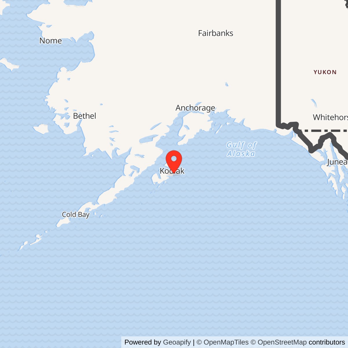
Longitude: -152.178083
Current Role: Former station property. Main tracking facility demolished in 1999; environmental cleanup and land-use controls remain documented by Alaska DEC. DEC case 54 is Active. Present parcel use and full current title need confirmation.
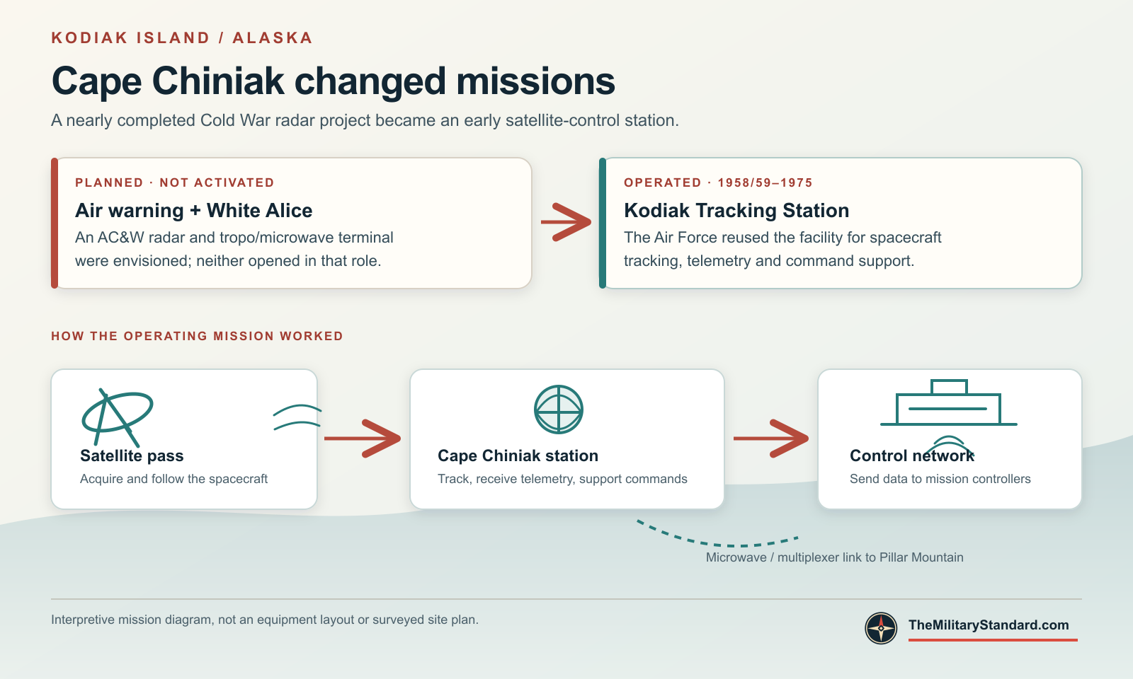
Cape Chiniak Tracking Station began as a proposed aircraft-warning and White Alice communications installation on eastern Kodiak Island. Those original missions were never activated. Instead, the Air Force adapted the nearly completed site for satellite tracking. Until 1975, personnel at Cape Chiniak followed spacecraft, recorded telemetry and supported commands to satellites passing over the North Pacific. The station was also called Kodiak Tracking Station and, in some records, Chiniak Air Force Station. [1] [2] [3]
- Military role
- Air Force Satellite Control Facility tracking, telemetry and command-support station.
- Original plans
- Aircraft control and warning radar and a combined White Alice terminal; neither opened in its planned role.
- Operational period
- Tracking use began in 1958-1959; station closed in 1975.
- Associated installation
- Pillar Mountain White Alice Communications Site, connected by microwave and multiplexer facilities.
- Approximate location
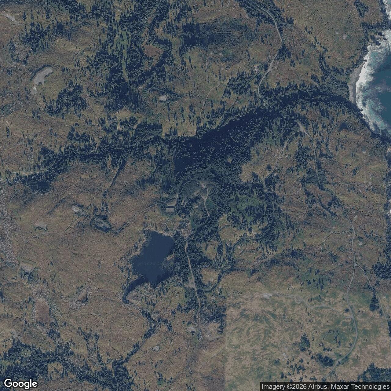
- 57.598601 N, 152.178083 W. This Alaska DEC environmental case point is not a surveyed station boundary.
The Air-Warning Plan
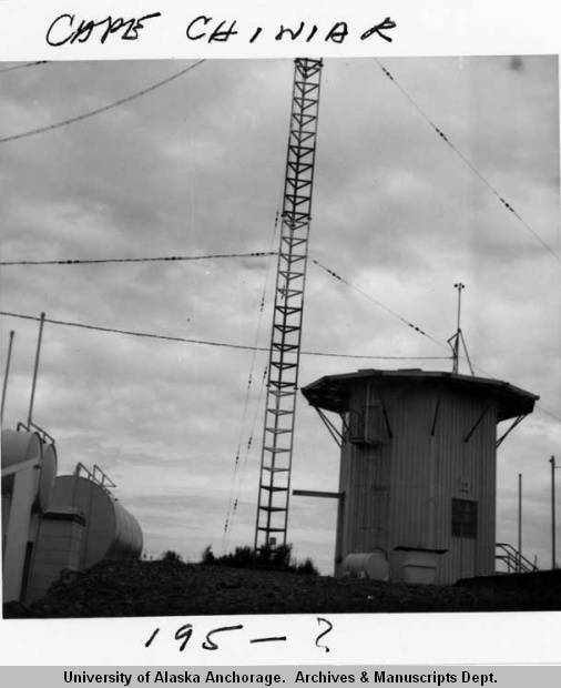
The Air Force acquired the Cape Chiniak property in 1957. Planners envisioned an aircraft control and warning (AC&W) radar station with a combined tropospheric-scatter and microwave White Alice communications facility. The proposed communications connection included a microwave path to Pillar Mountain near Kodiak. As the Aleutian Distant Early Warning Line took shape, Cape Chiniak's planned air-warning mission was dropped. Although construction was nearly complete, the site never opened as a White Alice terminal or operational AC&W station. [1] [2]
The change was underway by 1958. A declassified satellite-program report said the existing Cape Chiniak AC&W property would be used as an auxiliary tracking station, avoiding a separate construction project. The Corps' White Alice inventory places the start of Pacific Range Tracking Site operations in 1958-1959; Alaska's state historic context uses 1959 as the beginning of satellite-station service. [1] [4] [5]
Satellite-Tracking Station
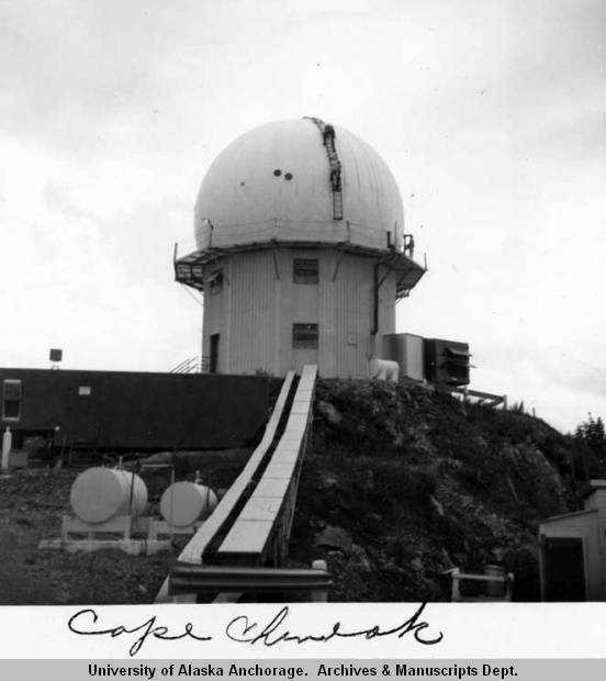
Cape Chiniak became a remote station in the Air Force Satellite Control Facility (AFSCF), whose control organization was based in California. A tracking station acquired a spacecraft during a pass, measured its position and motion, received and recorded radio telemetry, and relayed data and commands through the wider control network. The Corps identifies Philco Corporation as Cape Chiniak's operating contractor. [2] [3] [4]
The facility included a two-story composite radar and operations building, a separate communications building, an automotive shop, a dormitory, a power plant, another shop and 20 portable housing trailers. The earlier AC&W composite building was incorporated into the satellite-tracking plant. Declassified National Reconnaissance Office records identify Cape Chiniak's flight functions as orbital tracking and telemetry reception, first-pass acquisition, and support for the recovery-capsule sequence. The listed Kodiak tracking equipment included VERLORT tracking radar, VHF telemetry and direction-finding equipment, Doppler equipment and a VHF telemetry antenna. These were satellite-tracking systems, not an operating AC&W search radar. [2] [6] [7]
CORONA Missions
One of the station's best-documented missions was CORONA, publicly called Discoverer in its early years. CORONA satellites exposed photographic film in orbit and returned it in a small recovery vehicle. Cape Chiniak tracked spacecraft positions and supported the timing of reentry commands so that recovery vehicles would descend into the intended Pacific recovery area. Alaska's historic context records Cape Chiniak support for CORONA from 1959 to 1972. [5] [6]
A National Reconnaissance Office history describes the successful separation of Discoverer XIV's recovery vehicle over Kodiak in August 1960, an early success in the film-return program. Cape Chiniak belonged to the ground network supporting such passes, while recovery aircraft and mission control had separate roles. [8]
The Pillar Mountain Link
Communications connected Cape Chiniak with Pillar Mountain even though the Cape Chiniak White Alice terminal plan was abandoned. Alaska's historic context describes a 100-line telephone trunk and a microwave and multiplexer connection between the two installations. Pillar Mountain was an operating White Alice relay with its own troposcatter path to Diamond Ridge and local communications services; Cape Chiniak's operating purpose was satellite tracking. [1] [5]
After the 1964 Alaska earthquake, the access road to the tracking station was damaged or impassable. An Alaska Geological Survey account records that a technician at the satellite station used amateur radio to report the arrival of tsunami waves at Cape Chiniak. [9] [10]
Closure and the Site Today
The military space-tracking mission ended in 1975. A Corps history records a March closure decision, with other stations able to assume Cape Chiniak's duties, and gives July 1975 as the closure. Another Corps study describes the station as active through May 1975. Alaska's historic context also uses 1975 as the end of service. The Corps records transfer of the property to Leisnoi Native Corporation in December 1975. [2] [3] [5]
Later vandalism and deterioration damaged the buildings. The former tracking-station complex was investigated and cleaned up under the Formerly Used Defense Sites program. Alaska's environmental record says the main facility was demolished in 1999; subsequent work addressed petroleum and PCB contamination. Alaska DEC continues to list the case as active. [2] [11]
Cape Chiniak's history is a reversal of its original design. It was not one of Alaska's operating aircraft-warning radar stations, and its planned White Alice terminal never carried network traffic. Its substantial military career was in the early satellite-control network, including the first generation of reconnaissance satellites and their film-recovery missions. [1] [2] [5] [6]
Chronology
- 1957 The Air Force acquires the Cape Chiniak property for planned aircraft-warning and communications use.
- 1958 A satellite-program report identifies the existing property for conversion to an auxiliary tracking station.
- 1958-1959 The Pacific Range tracking role begins; the AC&W and White Alice terminal plans do not enter service.
- 1959-1972 Alaska's historic context identifies Cape Chiniak support for CORONA.
- August 1960 Discoverer XIV's recovery vehicle separates over Kodiak during a successful film-return mission.
- 1964 Earthquake damage affects access to the station; a technician reports tsunami arrival by amateur radio.
- 1975 The Air Force closes the tracking station; the Corps records property transfer that December.
- 1999 The main tracking-station facility is demolished during environmental cleanup.
Information sources (12)
- PDF[1] Historical Overview and Inventory: White Alice Communications System, U.S. Army Corps of Engineers (1988)
Source for: planned Cape Chiniak AC&W and White Alice roles, unactivated status, Pillar Mountain microwave relationship, and Pacific Range Tracking Site conversion. PDF page 60, printed page 53.
- PDF[2] The Cold War in Alaska: A Management Plan for Cultural Resources, U.S. Army Corps of Engineers (1994)
Source for: Air Force acquisition, AFSCF mission, Philco operation, physical facilities, 1975 closure and property disposition. PDF page 239, printed page 229.
- PDF[3] The Kodiak Coastal Defense System, U.S. Army Corps of Engineers
Source for: Cape Chiniak AC&W conversion and the tracking station's active period through May 1975.
- PDF[4] WS-117L Satellite Program Report, declassified National Reconnaissance Office record (1958)
Source for: Air Force decision to use the existing Cape Chiniak AC&W property as an auxiliary test tracking station.
- PDF[5] The Coldest Front: Cold War Military Properties in Alaska, Alaska Office of History and Archaeology
Source for: 1959-1975 satellite-station period, CORONA role through 1972, 100-line trunk and Pillar Mountain microwave/multiplexer connection.
- PDF[6] Military Satellite Ground Support Facilities, declassified National Reconnaissance Office record
Source for: Cape Chiniak's first-pass acquisition, orbital tracking, telemetry and recovery-capsule support functions.
- PDF[7] Ground Support Facilities table, declassified National Reconnaissance Office record
Source for: Kodiak station flight functions and listed VERLORT, VHF and Doppler systems.
- PDF[8] Intelligence Revolution 1960: Retrieving the Corona Imagery That Helped Win the Cold War, National Reconnaissance Office
Source for: Discoverer XIV recovery-vehicle separation over Kodiak and the 1960 film-return mission.
- PDF[9] Air Force Satellite Control Facility History, Air Force Satellite Control Facility historical chronology
Source for: 1964 earthquake damage to the access road and contemporary satellite-control operations.
- PDF[10] Tsunami Inundation Maps for Akhiok, Chiniak, Old Harbor, Ouzinkie, and Port Lions, Alaska Division of Geological & Geophysical Surveys (2021)
Source for: a Cape Chiniak satellite-station technician's amateur-radio report of tsunami arrival.
- WEB[11] Site Report: Kodiak - Cape Chiniak Tracking Station, Alaska Department of Environmental Conservation, hazard ID 54
Source for: environmental case point, demolition of the main complex in 1999, cleanup and continuing case status.
- WEB[12] Cape Chiniak station photographs, Christine McClain papers, Archives and Special Collections, Consortium Library, University of Alaska Anchorage
Source for: actual-site tower, antenna structure and domed tracking-station structure shown in the supplied scans cdmg13_1581_full.jpg and cdmg13_1582_full.jpg. Exposure dates unconfirmed.