
Cape Newenham Air Force Station / Cape Newenham Long Range Radar Site, Alaska
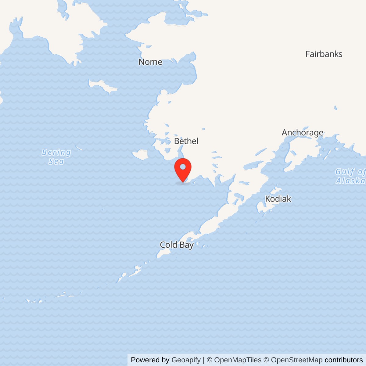
Longitude: -162.07611
Site Number: F-05; A-09
Airport ICAO ID: PAEH (support airfield, not radar identifier)
Current Role: Active Alaska Radar System long-range radar with AN/FPS-117 lineage, contractor support, controlled Air Force-owned official-business airfield and ongoing environmental monitoring/investigation.
- Historic unit
- 794th Aircraft Control and Warning Squadron
- Radar operation began
- April 1954
- Staffed station phase ended
- November 1, 1983; radar operations continued
- Later radar
- AN/FPS-117 operational October 16, 1984
- Approximate radar-location point
- 58.62667 N, 162.07611 W, from a specialist station inventory; not a surveyed antenna or property centroid
- Reported installation area
- 2,359 acres in the 2013 Air Force final plan; a later draft gives 2,103 acres
Identity and setting
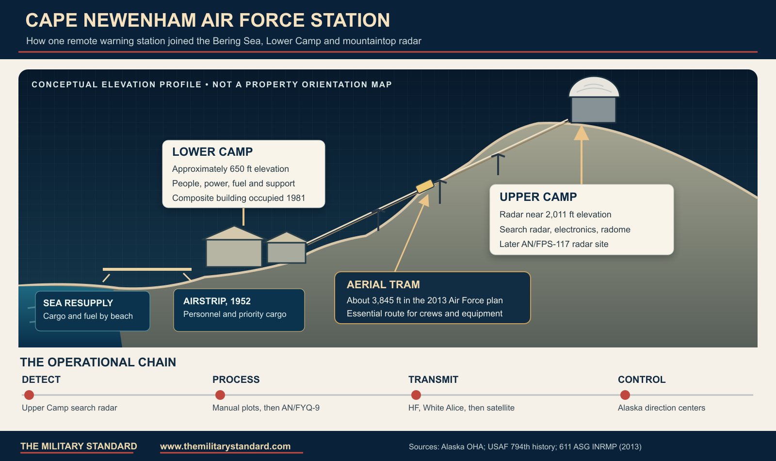
Cape Newenham Air Force Station was a staffed United States Air Force aircraft control and warning installation on a remote peninsula between Kuskokwim Bay and Bristol Bay in southwestern Alaska. Its former Air Force Station designation and its later Long Range Radar Site designation describe successive operating phases at the same larger installation, not two unrelated bases. The radar stood at Upper Camp on high ground, while the personnel, support functions, airstrip, beach landing area and much of the fuel infrastructure were at or approached through Lower Camp. An aerial tram joined the two levels. This dispersed arrangement was a response to terrain and radar line-of-sight requirements, but it also made construction, supply, winter access and maintenance unusually difficult. The historical site identifiers were F-05 and later A-09; the present Alaska Radar System identifier is also reported as J-09 in specialist inventories. [1][2][3]
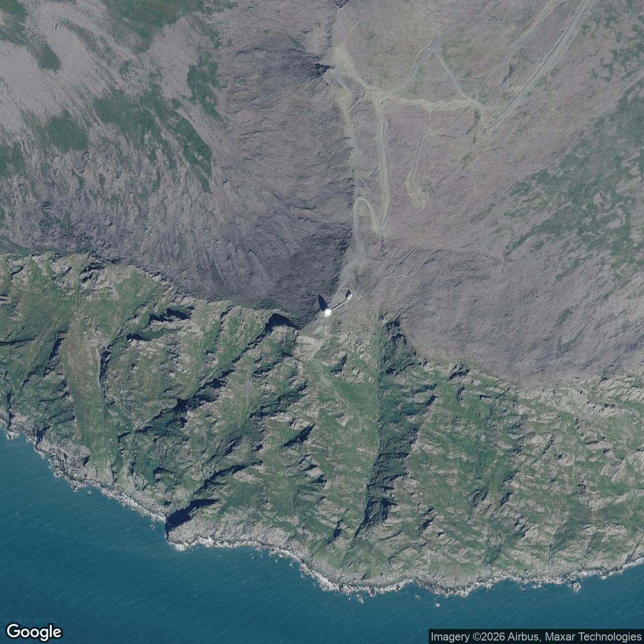
The Air Force's 2013 final natural-resources plan lists a 2,359-acre Cape Newenham Long Range Radar Site within Togiak National Wildlife Refuge. A later 2019 draft plan gives 2,103 acres. Those are differently dated planning figures, not a surveyed polygon reconciled here; this history uses 2,359 acres as the earlier final-plan area and flags the difference instead of silently selecting one as a precise present boundary. The radar-location point 58.62667 N, 162.07611 W is the approximate published F-05 radar point in the specialist radar-station inventory, not a surveyed antenna center or property centroid. The Alaska environmental database's 58.647405 N, 162.172723 W is its installation-level record marker near the cape, while the FAA airport reference point near 58.64815 N, 162.06380 W is the airstrip. None of these three points should be interchanged in a site map. [1][3][4][5]
The Alaska Warning Buildout
The Air Force selected the location as part of the postwar effort to create a permanent aircraft-warning screen across Alaska's approaches. Alaskan Air Command and the Army Corps of Engineers surveyed it in 1949. Haddock Engineers received the construction contract on 13 June 1950 and began work on 12 September. The original schedule proved unrealistic for a site that could receive bulk materials mainly during the short navigation season and that placed the radar roughly 2,000 feet above sea level. Lower Camp was substantially completed in 1952, but the upper radar position did not become operational until April 1954. The state history reports an initial construction cost of $4,303,962. Cape Newenham was among the original Alaska AC&W stations and was the last of that initial group to enter operation. [1][2][6]
The approximately 4,000-foot runway constructed in 1952 was indispensable for personnel, mail, emergency supplies and high-priority cargo, but it did not replace the annual sea movement of bulk stores and fuel. Landing craft brought cargo across the beach, and fuel was pumped ashore to storage. The annual replenishment program was called Mona Lisa and, from 1967, Cool Barge. This was not an ordinary road-served garrison: a missed sealift season or a failed aviation link had direct consequences for fuel, food and repair parts. The current FAA record still identifies the Cape Newenham LRRS airfield as an Air Force-owned, private-use, official-business-only facility, with a 3,945-by-150-foot gravel Runway 15/33. That airport reference point and runway are support facilities, not the upper radar location. [2] [5][7]
Upper Camp, Lower Camp and the Tram
The original physical organization put offices, dormitories and daily support in Lower Camp at about 650 feet elevation and the radar and electronics facilities at Upper Camp near 2,011 feet. The camps were connected by an aerial tram; the 2013 Air Force natural-resources appendix reports a 3,845-foot tram system. A tram car fell about 50 feet after a failure soon after the original installation was completed. A replacement operated by 1954, and a Riblett-type installation followed in 1962. The state cultural history also records a 1985 rebuild. They show how much the radar's high-ground location depended on a specialized transport system. [1][2][3]
Wind was another structural problem. The Alaska historic study records two radomes destroyed by high winds in 1955 and a rigid replacement installed in October 1959. A weather event on 11 September 1955, described in a contemporary station account preserved by a veterans' collection, reportedly killed two servicemen and injured ten; the official historic study independently documents the radome losses but does not establish every casualty detail. The persistence of the radar mission depended on replacing exposed equipment, strengthening shelters and keeping the tram, power, heating and communications systems functioning in severe coastal weather. [1][8]
The 794th and Daily Operations
The initial radar party was Detachment F-5 of the 531st Aircraft Control and Warning Group. On 8 December 1952 the Air Force activated the 794th Aircraft Control and Warning Squadron for Cape Newenham, authorizing 107 military positions, although construction delays kept actual operations limited until the radar opened in April 1954. The squadron was responsible for maintaining the search radar, observing and evaluating aircraft tracks, and passing warning information into Alaska's air-defense command system. After the 531st Group inactivated in April 1953, the 794th served under changing higher headquarters. The reactivated 531st regained it on 15 October 1977, and that group became the 11th Tactical Control Group on 1 July 1981. Those organizational changes altered the chain of command without creating a new installation. [2]
In its fully staffed period the station was also a small, isolated community. Air transport and the seasonal barge were essential to daily life as well as military readiness. Personnel lived at the lower camp while electronics crews traveled to the exposed upper site. The later composite support building, begun in 1975, consolidated functions that had occupied older dispersed facilities. Although the Corps of Engineers accepted the $11.7 million building in October 1980, safety deficiencies and design changes delayed occupancy until July 1981. Thus the start of construction, acceptance and actual occupation are three different milestones. After the station became a minimally attended radar site, that composite building was adapted to support the remaining equipment and contractor staff rather than the former squadron-sized population. [2] [3]
Radar Modernization and Data Flow
Cape Newenham opened with an AN/FPS-3 search radar. The documented modernization sequence includes AN/FPS-20 or FPS-20A, an AN/FPS-87A phase, an AN/FPS-93 or FPS-93A phase, and ultimately AN/FPS-117. The Alaska state history explicitly traces the initial FPS-3 through FPS-20 to FPS-93A; the Air Force unit history's equipment line adds FPS-87A between the FPS-20A and FPS-93 family. These records establish a lineage, not exact commissioning dates for every interim configuration. The model suffixes also vary between summaries, so no unsupported day-level changeover date or claim that all sets were simultaneously present is made here. The separate equipment histories explain the technical differences among the search-radar configurations. [1][2] [9]
Early radar tracks were handled by people using plotting and voice reporting. The AN/FYQ-9 semiautomatic data processing and display system became operational at Cape Newenham in July 1965, reducing the need to pass tracks manually. The improvement mattered because the Cape's search radar was only one sensor in a distributed warning chain: detecting an aircraft had value only if a regional direction center received timely, intelligible track information. By 1982 Joint Surveillance System equipment could transmit radar and beacon data by satellite to the Elmendorf Region Operations Control Center. That center reached initial operational capability on 15 June 1983. The transition moved much of the interpretation and control work away from the isolated station and prepared Cape Newenham for minimally attended operation. [2] [9]
Communications and the White Alice Connection
The first high-frequency radio communications link was vulnerable to atmospheric interference. The Air Force therefore integrated Cape Newenham into the White Alice Communications System, a microwave and tropospheric-scatter network built to carry defense information across Alaska. The 794th squadron history dates operation of the Cape Newenham White Alice site to December 1957. A later Army Corps cultural-resources study gives 18 January 1958 for the associated tropo station, apparently using a different operational milestone. The two records should be read as a late-1957 to early-1958 transition rather than forced into one unqualified opening date. White Alice facilities were related communications works at the radar installation, not another radar set. [2][10]
White Alice was inactivated on 30 March 1979 and replaced by an Alascom-owned satellite earth terminal. This was part of an Air Force decision to replace its expensive, aging remote communications network with a commercial satellite service. The change should not be mistaken for closure of the radar station: aircraft surveillance continued and soon became more dependent on reliable digital links to the regional center. The Corps cultural-resources account identifies the former White Alice structures as demolished, while the later radar site remained in service. Whether every communications parcel shared the same land instrument as the radar core is not established by the sources used here. [2][10]
Role in the wider military network
Cape Newenham watched the southwestern Alaska approach from a position that could not be replicated by a single inland radar. Its reports fed the Alaska AC&W network and the regional command-and-control centers that evaluated unidentified aircraft and directed interceptors. King Salmon was an important southern Alaska direction-center relationship, while Cape Romanzof and other coastal sites covered different sectors of the immense warning perimeter. These were functionally related installations, not annexes of Cape Newenham. The station's communications links, initially radio and White Alice and later satellite, were as necessary to the network as the radar antenna: without an onward path, a local track could not become a regional warning. [1][2][6]
That relationship changed in the 1980s. The staffed squadron and its manual processes gave way to a radar whose output could be sent to the Elmendorf regional operations center, with contractor personnel maintaining the remote plant. The airstrip still served the installation, and the Air Force continued to rely on aircraft to move technicians and priority material. A 2020 Department of Defense account of C-12 support specifically names Cape Newenham among the remote Alaska radar sites reached by gravel-airstrip flights. The strategic value of the cape therefore persisted even as the visible garrison shrank. [2][7][11]
Contract support, lrrs redesignation and the fps-117
On 1 October 1977 Alaskan Air Command implemented an RCA Services support contract after a trial period. It removed about 80 military positions, leaving 14 personnel principally in operations. This did not end the 794th or the site's military mission; rather, it transferred much of the maintenance and logistical workload to a contractor. As the JSS and Elmendorf ROCC came online, the Air Force drew down the remaining military complement. The 794th was inactivated on 1 November 1983, and the former Air Force Station was redesignated Cape Newenham Long Range Radar Site. The same physical installation continued operating, so 1983 is the end of its staffed AC&W squadron phase, not the end of radar surveillance. [2]
The AN/FPS-117 minimally attended radar became operational on 16 October 1984 according to the 794th history. The 2013 Air Force natural-resources appendix gives 1982 for installation of a minimally attended radar, but a later Air Force draft plan gives 1984, matching the unit history. The earlier appendix may fold the wider JSS conversion into the radar replacement, but the conflict is not fully resolved; 16 October 1984 is the best documented operational milestone. The equipment allowed warning coverage with far fewer people on the cape while sending data into Alaska's regional control network. A public-domain Air Force photograph from January 2009 shows a specialist preparing a main-bearing change on the Cape Newenham FPS-117. The photographed later equipment should not be used as a visual reference for the earlier FPS-3, FPS-87A or FPS-93A antenna. [2][3][12][21]
View the official, public-domain Air Force photograph of AN/FPS-117 maintenance at Cape Newenham. The earlier radar antennas are not shown in that image.
Clean sweep, environment and surviving site
Consolidation left older buildings, tanks, dumps and former communications works that no longer served the smaller radar operation. The Air Force's Clean Sweep program removed inactive structures at Cape Newenham in 2011 and 2012 according to the 2013 natural-resources appendix; the same plan notes earlier wind-damage debris cleanup in 2007. Historic accounts that say the entire station was restored or cleanup finished by 2005 are too broad. The active radar, support facilities and airstrip persisted, and the Alaska Department of Environmental Conservation continues to track separate contaminated areas. The surviving footprint therefore cannot be described simply as either an intact 1950s station or an abandoned ruin. [3][13]
At Upper Camp, site SS007 includes PCB-affected soil near the radar area and a downslope component. The Air Force placed contaminated material beneath a cap in 1996, with long-term inspections and controls intended to prevent exposure and migration. A 2021 action excavated 14 cubic yards of affected downslope soil, and the state approved the final construction report in December 2022. DEC lists SS007 as cleanup complete with institutional controls, which is a site-specific status, not a declaration that every Cape Newenham environmental issue is closed. State reviews in 2025 noted wear or erosion at portions of caps and recommended continued monitoring; a 2026 long-term-management work plan was approved. [13][14]
The Lower Camp vehicle-fueling area, recorded as SS08 or CS545, involves former and active fuel tanks, a fill stand and petroleum releases. DEC continues to list that component as active. Site TA001, the former large diesel tank area, also remains under investigation, including petroleum and lead questions. The Air Force and DEC have additionally pursued PFAS investigation planning at the installation; DEC approved a Phase I remedial-investigation quality-assurance plan in April 2026. Each of these environmental labels is a component of the larger LRRS, not a new Air Force Station. The right characterization in 2026 is an active radar site with continuing land-use controls, monitoring and investigation at identified legacy areas. [13][15][16]
Current operation and access
The former squadron installation remains a long-range radar site in the Alaska Radar System. The 2013 Air Force plan described a small year-round contractor presence and an active minimally attended radar. A 2026 official Air Force flying instruction still lists Cape Newenham LRRS among remote sites, and the FAA lists the airfield as Air Force-owned and closed to public use. These sources support continuing federal military operation and controlled access, not public touring. They do not establish the exact legal title to every parcel inside the historic acreage figures or prove that all 1950s structures survive. [3][5][17]
On 20 August 2026 a contracted Cessna 441 flying toward Cape Newenham LRRS Airport crashed near the cape, killing two pilots and six passengers. The National Transportation Safety Board issued a preliminary account on 16 September and its investigation remains open as of this research date. This incident is relevant here because it underscores the continuing dependence of the isolated radar site on air access; it is not evidence of any change to radar operations, and no cause of the crash is asserted. The history of Cape Newenham is therefore not only a Cold War story. It is also the history of a remote defense facility that has remained operational while its people, technology, built environment and environmental responsibilities changed. [18]
Chronology
- 1949 Alaskan Air Command and the Army Corps of Engineers survey Cape Newenham for an early-warning radar station.
- 1950-06-13 Haddock Engineers receives the radar-site construction contract.
- 1950-09-12 Construction begins at the remote coastal site.
- 1952 Lower Camp is substantially completed; an airstrip and original tram system support the installation.
- 1952-12-08 The 794th Aircraft Control and Warning Squadron activates for Cape Newenham.
- 1954-04 The Upper Camp radar becomes operational after construction delays.
- 1955 High winds destroy two radomes, according to the Alaska historic study.
- 1957-12 The 794th history dates Cape Newenham White Alice operation to this month.
- 1958-01-18 A Corps cultural-resources account gives this operational date for the associated tropo station.
- 1959-10 A rigid replacement radome is installed.
- 1962 A Riblett-type tramway replaces earlier equipment.
- 1965-07 The AN/FYQ-9 semiautomatic data-processing and display system becomes operational.
- 1967 The annual remote resupply program takes the name Cool Barge.
- 1975 Construction of a consolidated composite support building begins.
- 1977-10-01 An RCA Services support contract removes about 80 military positions while operations personnel remain.
- 1979-03-30 Cape Newenham White Alice is inactivated as commercial satellite communications replace it.
- 1980-10 The Corps of Engineers accepts the composite building, but occupation is delayed.
- 1981-07 Personnel begin occupying the composite building after safety and design work.
- 1981-07-01 The 531st Aircraft Control and Warning Group is redesignated the 11th Tactical Control Group.
- 1982 JSS equipment enables satellite transmission of radar and beacon data toward Elmendorf.
- 1983-06-15 The Elmendorf Region Operations Control Center reaches initial operational capability.
- 1983-11-01 The 794th inactivates; Cape Newenham becomes a Long Range Radar Site rather than a staffed AC&W station.
- 1984-10-16 The AN/FPS-117 minimally attended radar becomes operational.
- 1985 The Alaska historic study records a tram rebuild; environmental records begin the later investigation sequence.
- 1996 A cap is placed over PCB-affected material at Upper Camp SS007.
- 2007 The Air Force natural-resources plan records completion of wind-damage debris cleanup.
- 2011-2012 Clean Sweep removes inactive structures at the LRRS.
- 2021 An Upper Camp SS007 action removes 14 cubic yards of PCB-affected downslope soil.
- 2022-12 DEC approves the final SS007 remedial-action construction report.
- 2026-04-27 DEC approves a Phase I PFAS remedial-investigation quality-assurance plan.
- 2026-07-27 DEC approves the 2026 long-term-management work plan for CS545, SS007 and TA001.
- 2026-08-20 A contracted aircraft crashes near the LRRS airfield; the NTSB investigation is ongoing.
Information sources (21)
- PDF[1] History of the Aircraft Control and Warning System in Alaska, Alaska Office of History and Archaeology
SOURCE FOR: Selection, construction, upper and lower camp, tram, wind damage, radar and communications evolution.
- PDF[2] 794 Aircraft Control and Warning Squadron, Air Force Historical Research Agency lineage and operations summary
SOURCE FOR: Unit activation and command sequence, construction dates, support, White Alice, AN/FYQ-9, JSS, ROCC, squadron inactivation and FPS-117 operational date.
- PDF[3] Integrated Natural Resources Management Plan, 611th Air Support Group, 2013 final, Appendix 3.0 Cape Newenham
SOURCE FOR: 2,359-acre planning figure, refuge context, 3,845-foot tram, remote operations, Clean Sweep and site images.
- WEB[4] Cape Newenham LRRS - Air Force, Alaska Department of Environmental Conservation
SOURCE FOR: State environmental-record location marker, ongoing environmental program and 2024-2025 actions.
- WEB[5] Cape Newenham LRRS Airport FAA information, AirNav presentation of current FAA data
SOURCE FOR: Airfield coordinates, federal ownership, access restriction and runway dimensions, distinguished from the radar point.
- PDF[6] The Coldest Front, Alaska Office of History and Archaeology
SOURCE FOR: Alaska AC&W system context, Cape Newenham as last original station and remote construction logistics.
- PDF[7] Cape Newenham LRRS RNAV (GPS) Runway 15, Federal Aviation Administration
SOURCE FOR: Current military airfield identity and restrictive operating context.
- WEB[8] Cape Newenham AFS historical photographs and station accounts, Alaska Lost Ski Areas Project
SOURCE FOR: Attributed 1955 storm account, historic tram and camp images; private photographs linked, not reproduced.
- PDF[9] Aerospace Defense Command Historical Data, 1946-1973, Air Defense Command
SOURCE FOR: Technical distinction of AN/FPS-87A as a modified FPS-20A; station-specific equipment sequence remains grounded in the 794th history and Radomes inventory.
- PDF[10] The Cold War in Alaska: A Management Plan for Cultural Resources, U.S. Army Corps of Engineers
SOURCE FOR: White Alice tropo station, January 1958 date, 1979 closure and demolished communications structures.
- WEB[11] C-12s Keep Long-range Radar Sites, Remote Areas Functioning, U.S. Indo-Pacific Command
SOURCE FOR: Continued air transport to Alaska remote radar sites, including Cape Newenham.
- WEB[12] ARTEC, U.S. Air Force Medical Service photograph
SOURCE FOR: Public-domain 2009 FPS-117 maintenance photograph and data-flow context.
- WEB[13] Cape Newenham LRRS SS07, Alaska Department of Environmental Conservation
SOURCE FOR: Upper Camp PCB cap, 2021 excavation, 2022 construction acceptance, controls and 2026 long-term-management work plan.
- PDF[14] Remedial Action Construction Report, Cape Newenham LRRS SS007, U.S. Air Force / Alaska DEC archive
SOURCE FOR: Upper Camp PCB remediation history and official site-location map.
- WEB[15] Cape Newenham LRRS SS08, Alaska Department of Environmental Conservation
SOURCE FOR: Lower Camp vehicle-fueling contamination, active tanks and ongoing site status.
- WEB[16] Cape Newenham LRRS Air Force environmental record, Alaska Department of Environmental Conservation
SOURCE FOR: TA001 investigation and 2026 PFAS remedial-investigation planning.
- PDF[17] 3WGI91-212, U.S. Air Force, 3 September 2025
SOURCE FOR: Continued official listing of Cape Newenham LRRS among remote supported sites.
- WEB[18] Crash of Cessna 441 Airplane near Cape Newenham, Alaska, National Transportation Safety Board
SOURCE FOR: 20 August 2026 accident and ongoing preliminary investigation only; no causal conclusion.
- WEB[19] Cape Newenham AFS circa 1974, Radomes Online museum, photographs by Tom Wikoff
SOURCE FOR: Historic Lower Camp, tram, radome and runway visual references; linked, not reproduced.
- WEB[20] Cape Newenham AFS site inventory, Radomes Online museum
SOURCE FOR: Approximate published F-05 radar-location point and FPS-20A/FPS-87A/FPS-93/FPS-117 equipment sequence; not a survey.
- PDF[21] 2019 remote-sites natural-resources plan draft, U.S. Air Force
SOURCE FOR: Later 2,103-acre draft figure, explicitly contrasted with the 2013 final plan's 2,359 acres.