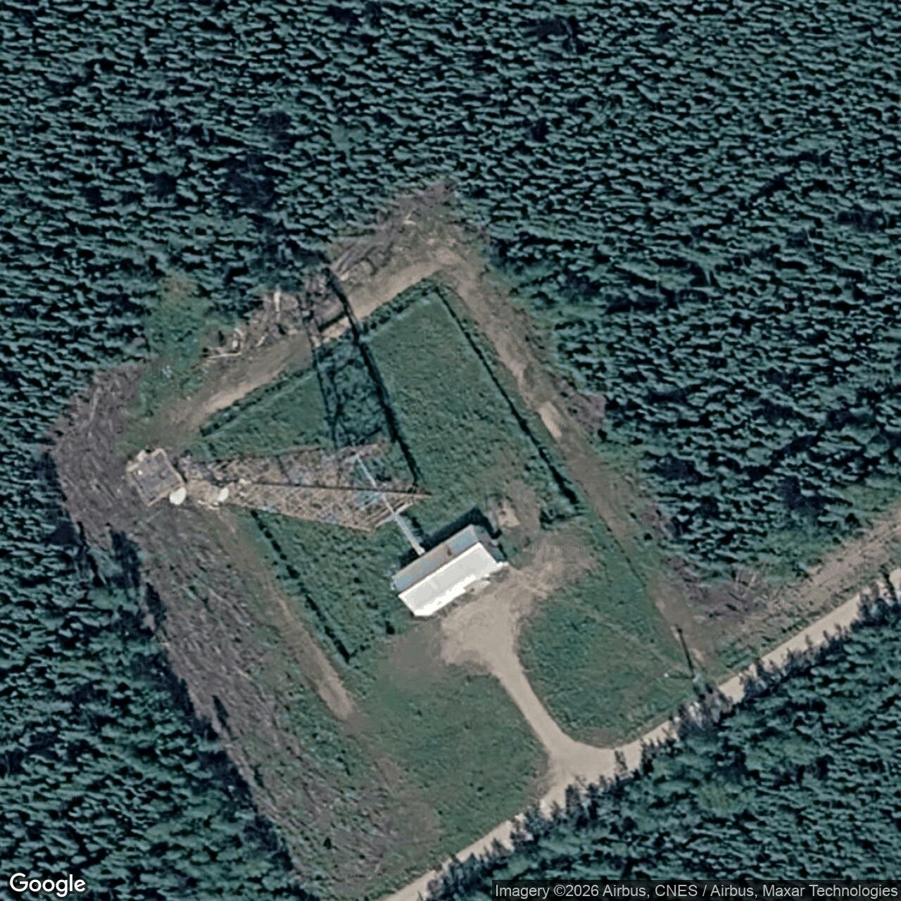
Gerstle River Air Force Station / Radio Relay Station, Alaska
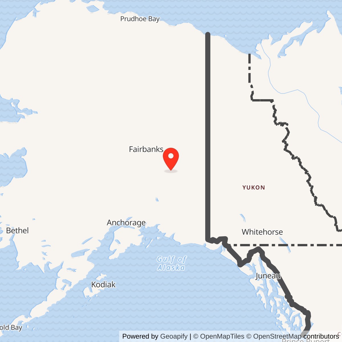
Longitude: -145.008589
Gerstle River was an unattended microwave repeater in Alaska's White Alice Communications System. It passed communications between Delta Junction and Knob Ridge on the interior route behind the Ballistic Missile Early Warning System at Clear. Its mission was to relay messages eastward, rather than to operate a warning radar. [1] [2]
- Role
- Unattended, two-way TD-2 microwave repeater on the White Alice BMEWS interior B Route.
- Direct neighbors
- Delta Junction west; Knob Ridge east.
- Historical location
- Near Alaska Highway mile 1391 in the 1983 Air Force study; that mile reference also appears for Knob Ridge and is approximate.
- Approximate map point
- 63.799722 N, 145.008889 W, a later Alascom tower-listing point, not a verified original White Alice mast or parcel boundary.
- Later record
- AT&T Gerstle River Microwave Repeater appears in Alaska's 2026 UST financial-responsibility list. The original TD-2 plant's survival is unverified.
Setting and Identity
The Air Force's 1983 study places Gerstle River near Alaska Highway mile 1391 southeast of Delta Junction. It repeats that mile for Knob Ridge, a separate station one full microwave hop away, so the milepost alone cannot fix Gerstle River's location. The Air Force relay was also separate from the Army's larger Gerstle River Test Site and similarly named training areas. [2] [10]
Later records call the relay Gerstle River Relay and AT&T - Gerstle River Microwave Repeater. A published Alascom tower compilation gives an approximate point of 63.799722 N, 145.008889 W. It identifies a later communications structure in the locality, not a surveyed boundary or confirmed position of the original Air Force tower. [7] [8]
The Clear Warning Route
The BMEWS radar at Clear needed dependable long-distance communications behind its warning mission. The White Alice interior B Route carried traffic east across Alaska and toward Canada. Gerstle River occupied the link between attended Delta Junction and unattended Knob Ridge. Cathedral lay one hop farther east, beyond Knob Ridge. The Corps' route records and 1994 cultural-resources map both place Gerstle River in that chain. [1] [2] [4]
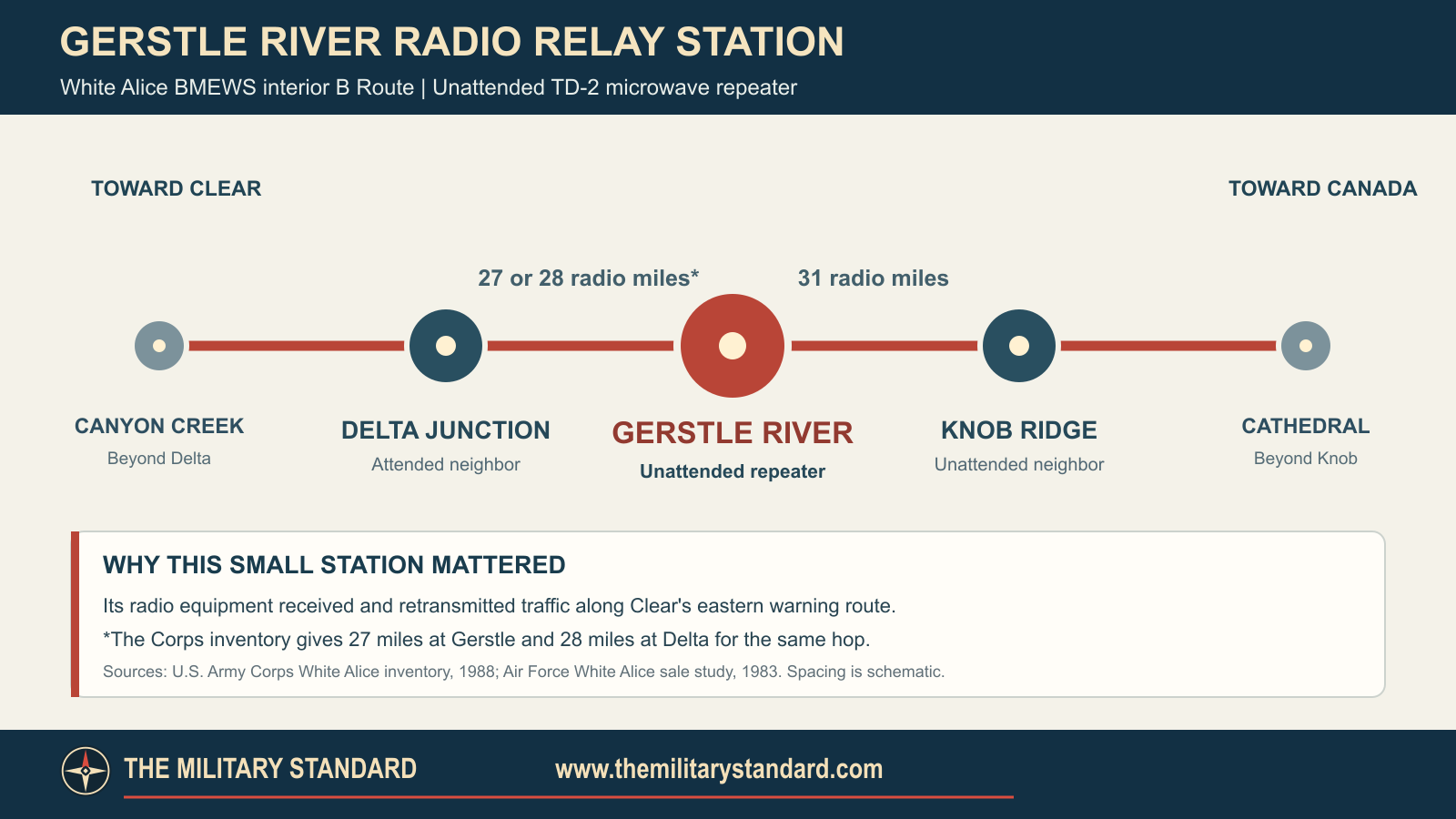
The Corps gives 27 radio miles to Delta Junction in its Gerstle River row but 28 in its Delta Junction row. Both entries refer to the same link. It gives 31 radio miles to Knob Ridge, and the Air Force sale study names the same direct neighbors. These are radio-hop figures, not road distances. [1] [2]
Construction and Equipment
The Corps dates construction of this BMEWS microwave station class to 1960 and its opening to 1960 or 1961. Most TD-2 repeaters had a radio-relay building, fuel tank and tower; some also had a latrine or automatic-maintenance shop. Gerstle River belonged to that line-of-sight microwave chain, but a station-specific as-built plan has not been located to establish its exact arrangement. Each relay carried circuits beyond the preceding antenna pair's horizon. [1] [2]
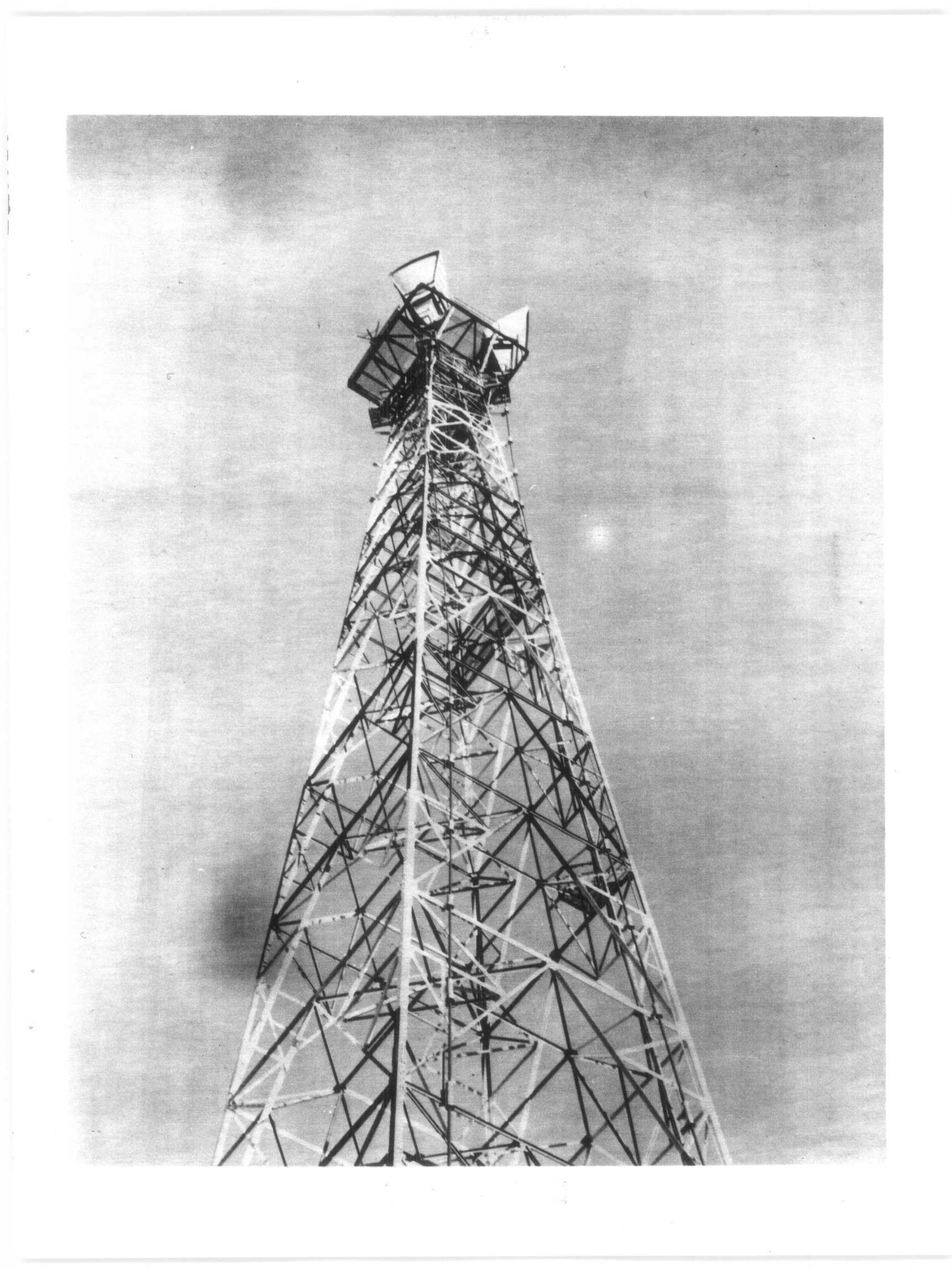
The photograph below shows the historical TD-2 tower at Soldotna, another White Alice station. It illustrates the equipment family rather than Gerstle River's specific tower. [1]
Western Electric installed White Alice under Air Force contract. The BMEWS extension carried communications from Clear toward the Alaska-Yukon border. Gerstle River's unattended classification distinguished it from permanently staffed stations; technicians still had to inspect, fuel, repair and maintain the repeater. [1] [2]
Alascom and Sale
The Alaska Communications System (ACS) and White Alice were separate networks, although RCA Alascom eventually operated both. Alascom took over ACS in 1971 and leased White Alice from the Air Force in 1976. Its 1977 list of TD-2 properties of interest and a 1978 Air Force appraisal table both include Gerstle River. The Air Force study describes White Alice's sale to Alascom in 1983 and places Gerstle River among the road-network microwave facilities. The exact acreage and terms of an individual Gerstle River deed are not documented there. [2]
The Air Force study also describes the wider replacement of White Alice land links by satellite earth stations. Gerstle River remained in the 1983 property account, but its last day of TD-2 operation is not recorded. Later commercial use of the station name does not establish that the original Air Force transmitter remained in service. [2]
Location and Environment
A December 1976 Federal Register notice records proposed Gerstle River microwave paths toward Delta Junction at azimuth 307.1 degrees and Knob Ridge at 109.4 degrees. Its longitude is inconsistent in searchable transcriptions, so the later Alascom tower point above is used only as an approximate locality reference. [3] [8]
Alaska DEC lists a case named Gerstle River Relay among closed contaminated sites in its 2006 and 2016 inventories. Those summary tables do not describe its contaminant, remedy or precise cleanup area. The separately named Army Gerstle River Test Site has its own environmental history. [5] [6] [10]
Present Condition and Images
DEC's underground-storage-tank financial-responsibility register lists facility 1699 as "AT&T - Gerstle River Microwave Repeater," with AT&T Alaska as owner and a policy period from June 2024 through June 2027. The record preserves the later commercial facility name. Whether the original Air Force building or TD-2 tower survives, and whether a microwave circuit operates there today, remains unverified. [7] [8]
The University of Alaska Anchorage's William F. McDowell papers include a White Alice photograph album whose finding aid names Gerstle River. The Soldotna tower photograph above is a representative view of TD-2 equipment, not a photograph of Gerstle River. [9]
Chronology
- 1960-1961 The BMEWS TD-2 relay class is constructed and opened; Gerstle River's exact opening day is not documented.
- 1976 RCA Alascom leases the wider White Alice system.
- 1976-12-13 Federal Register publishes a Gerstle River microwave application toward Delta Junction and Knob Ridge.
- 1977-05-20 Alascom's TD-2 property-interest list includes the Gerstle River class of sites.
- 1978-01-26 Corps awards appraisal work for the TD-2 sale inventory, which includes Gerstle River.
- 1983 Air Force sale study identifies Gerstle as an unattended two-way repeater in the sale account.
- 2006 DEC closed-site inventory names Gerstle River Relay.
- 2026 DEC lists AT&T Gerstle River Microwave Repeater as underground-storage-tank facility 1699.
Information sources (10)
- PDFU.S. Army Corps of Engineers, Historical Overview and Inventory of the White Alice Communications System, 1988
Source for BMEWS interior B Route, Gerstle River's direct TD-2 neighbors and conflicting 27/28-mile entries, 31-mile Knob Ridge link, general 1960 to 1961 opening period and relay class components.
- PDFU.S. Air Force, Special Study of the White Alice Communications System Sale, 1983
Source for unattended Gerstle River repeater role, Alaska Highway mile 1391, RCA Alascom lease and purchase history, TD-2 appraisal, and White Alice system context.
- PDFFederal Communications Commission, Common Carrier Domestic Public Radio Services Notice, Federal Register, December 13, 1976
Source for RCA Gerstle River microwave application and stated directions toward Delta Junction and Knob Ridge.
- PDFU.S. Army Corps of Engineers, The Cold War in Alaska: A Management Plan for Cultural Resources, 1994
Source for Gerstle River inclusion in the White Alice network map and Cold War cultural-resource context.
- PDFAlaska Department of Environmental Conservation, FY2006 Biennial Report, Closed Sites Inventory
Source for the specifically named Gerstle River Relay closed contaminated-site entry, distinct from Gerstle River Army test properties.
- PDFAlaska Department of Environmental Conservation, FY2016 Closed Contaminated Sites Inventory, Table J
Source for continued closed-case listing of Gerstle River Relay and separation from other Gerstle-named cleanup entries.
- WEBAlaska Department of Environmental Conservation, UST Facilities With Proof of Financial Responsibility, 2026
Source for AT&T - Gerstle River Microwave Repeater facility 1699, AT&T Alaska ownership listing and policy period.
- WEBCity-Data, FCC-Registered Antenna Tower Compilation for Delta Junction, Alaska
Source for a secondary published Alascom Gerstle River tower point near 63.799722 N, 145.008889 W; primary FCC record and its relation to the historic White Alice mast remain unverified.
- WEBUniversity of Alaska Anchorage Archives and Special Collections, William F. McDowell Papers Finding Aid
Source for the White Alice photographic album that lists Gerstle River among represented sites.
- PDFU.S. Environmental Protection Agency, Federal Register Federal Facilities Listing, June 27, 1997
Source for the separately identified Army Gerstle River Test Site.