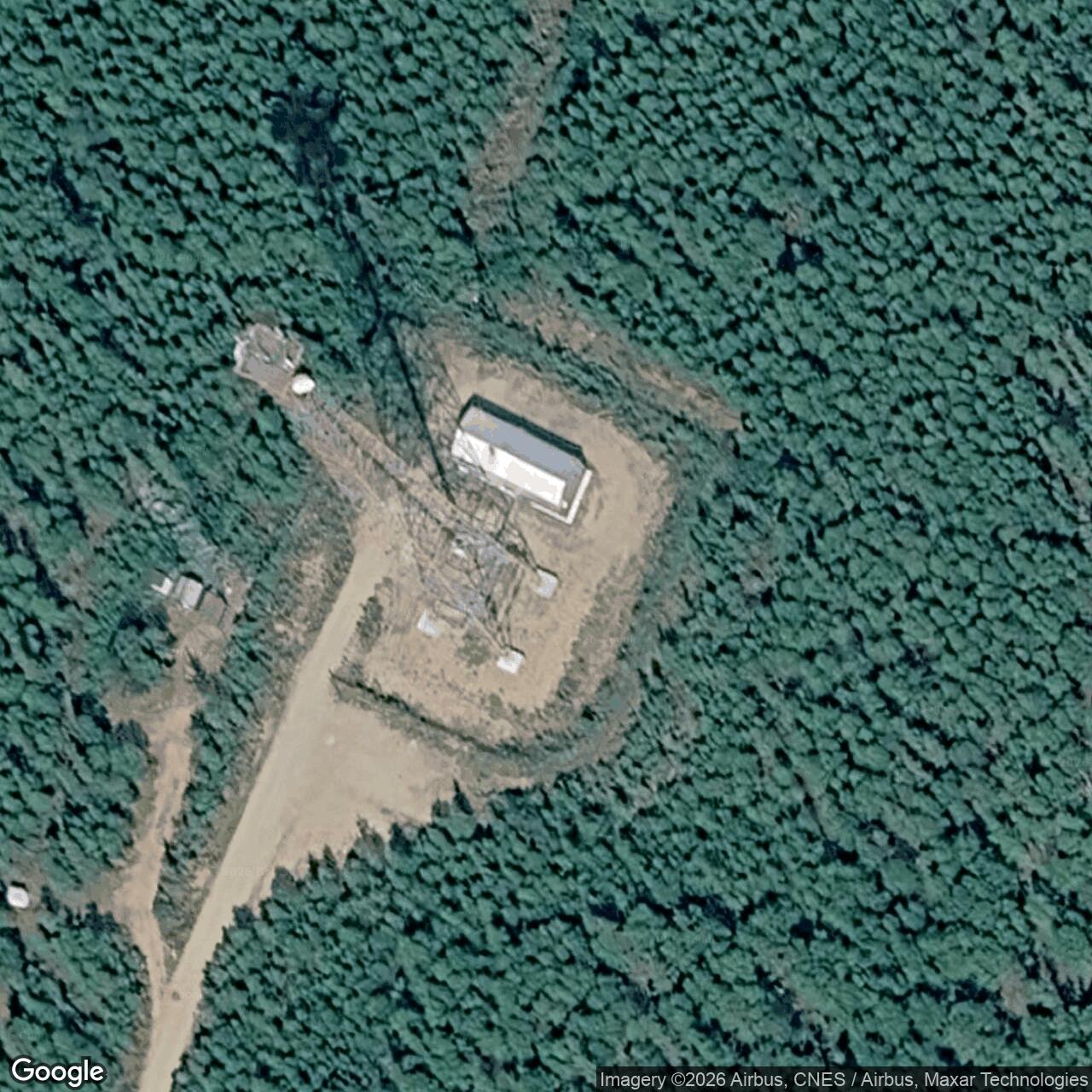
Knob Ridge Air Force Station / Radio Relay Station, Alaska
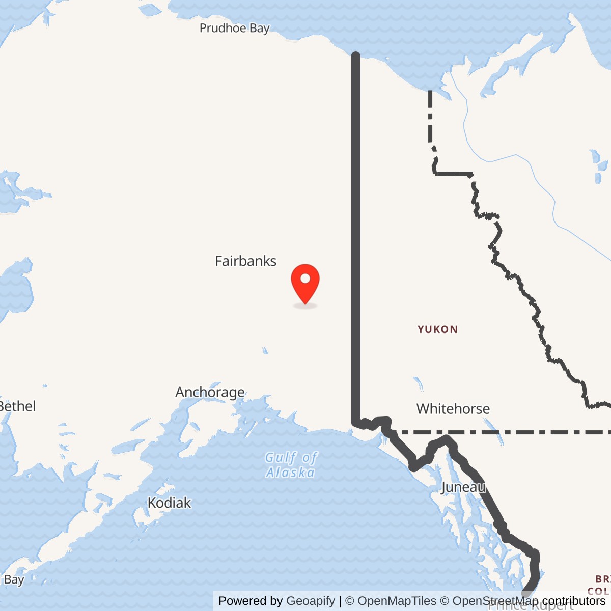
Longitude: -144.065715
Knob Ridge was an unattended microwave relay in Alaska's White Alice Communications System. Its direct links ran to Gerstle River and Cathedral, carrying rearward communications on the interior B Route for the Ballistic Missile Early Warning System at Clear. It was a communications node, not a radar station. The Army Corps and Air Force independently document the same two-way relay role. [1] [2]
- Role
- Unattended, two-way TD-2 microwave relay on White Alice's BMEWS interior B Route.
- Direct links
- Gerstle River, 31 radio miles; Cathedral, 20 radio miles in the Corps inventory.
- Service window
- Built with the 1960 BMEWS microwave group and open in 1960 or 1961, according to a class-wide Corps statement; exact Knob Ridge dates unverified.
- Modern facility point
- Approximately 63.648817 N, 144.065833 W, from a 2019 Defense Department listing of the Knob Ridge AT&T facility. This is not a surveyed Air Force parcel boundary.
- Land record
- U.S. Survey 4290 was a 2.06-acre proposed withdrawal for Air Force radio-relay use; the application was canceled in 1989. It is not verified as the station's total acreage.
Setting and Identity
Knob Ridge lies in the Dot Lake and Alaska Highway region of Southeast Fairbanks Census Area. The 1983 Air Force study assigns Alaska Highway mile 1391 to Knob Ridge, but also to Gerstle River, a separate station 31 radio miles away. The duplicated milepost cannot locate Knob Ridge's tower precisely. The coordinate above identifies a later AT&T facility in a Defense Department document, not the original TD-2 antenna or a property boundary. [1] [2] [6]
Federal property inventories identify the former defense installation as Knob Ridge Radio Relay, property number F10AK0140. That historic identity is distinct from the broader ridge place name and the later AT&T facility reference. [9]
The Clear Warning Route
White Alice linked far-flung Alaska defense locations over long-distance circuits. When Clear's BMEWS warning mission needed rearward communications, the Air Force added two routes toward the continental United States. The interior B Route crossed the Alaska road corridor and connected through Canada. Knob Ridge was between Gerstle River and Cathedral, with Delta Junction farther west and Tok Junction farther east. The node passed traffic along the chain; it did not operate the Clear radar. [1] [2]
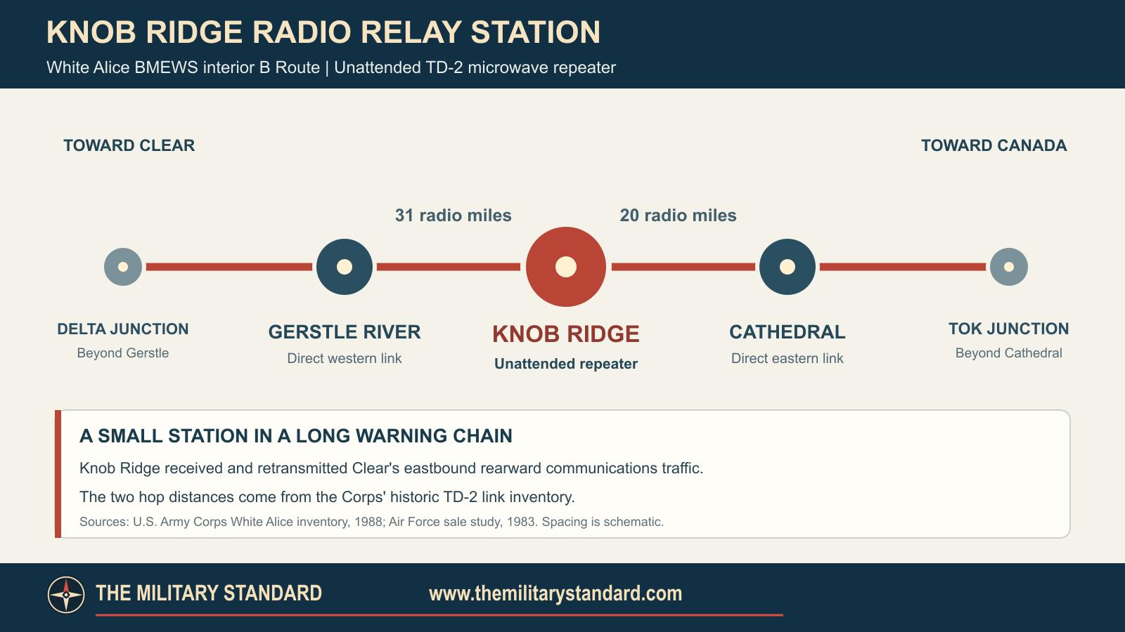
The Corps gives the Gerstle River hop as 31 radio miles and the Cathedral hop as 20. A 1976 Federal Register notice records RCA Alascom's application for microwave paths in both directions, confirming the planned links in a contemporary filing. It does not establish the exact day either path first carried traffic. [1] [3]
Construction and Technology
The Army Corps dates construction of the BMEWS TD-2 group to 1960 and opening to 1960 or 1961. Its class description includes a relay building, fuel tank and tower. The Air Force calls Knob Ridge an unattended two-way microwave repeater and includes it in the TD-2 property inventory. Knob Ridge's precise commissioning day and original tower dimensions have not been established. [1] [2]
Unattended did not mean maintenance-free. Technicians still needed access to inspect and repair the radio, power and fuel systems across this remote route. [2]
Lease, Sale and Land
The Air Force leased White Alice to RCA Alascom in 1976, with a sale following in 1983. Knob Ridge appears in the TD-2 appraisal and sale-site account and was not marked "personal property only" in the 1978 table. The study does not establish Knob Ridge's individual deed, access easements or complete title chain. This White Alice transaction was separate from Alascom's earlier acquisition of the Alaska Communications System. [2]
The Corps applied in February 1976 to reserve U.S. Survey 4290 for an Air Force radio relay site. The proposed tract contained 2.06 acres. In June 1989 the Corps canceled the request and the Bureau of Land Management ended the proposed withdrawal. That action concerned land administration, not a documented station shutdown. The 2.06-acre figure does not establish the size of every historic road, utility and operating interest. [4] [5]
Later Facility Record
Federal property inventories identify the former defense relay as Knob Ridge Radio Relay, F10AK0140. Alaska DEC lists a specifically named Knob Ridge Microwave Repeater Site among closed contaminated sites; its summary does not establish a remedy or closure for every part of the former installation. EPA separately lists a Knob Ridge Radio Relay Site near Dot Lake as not on the National Priorities List. [7] [9] [10]
The communications locality remains documented. Alaska DEC's 2026 tank-insurance register names AT&T Alaska as owner of the listed Knob Ridge microwave-repeater facility. A 2019 Defense Department document identifies a Knob Ridge AT&T facility at approximately 63.648817 N, 144.065833 W; local trail directions also mention a communications tower near Dot Lake. These records do not establish that the original White Alice tower or radio circuits survive. [6] [8] [11]
Historical Images
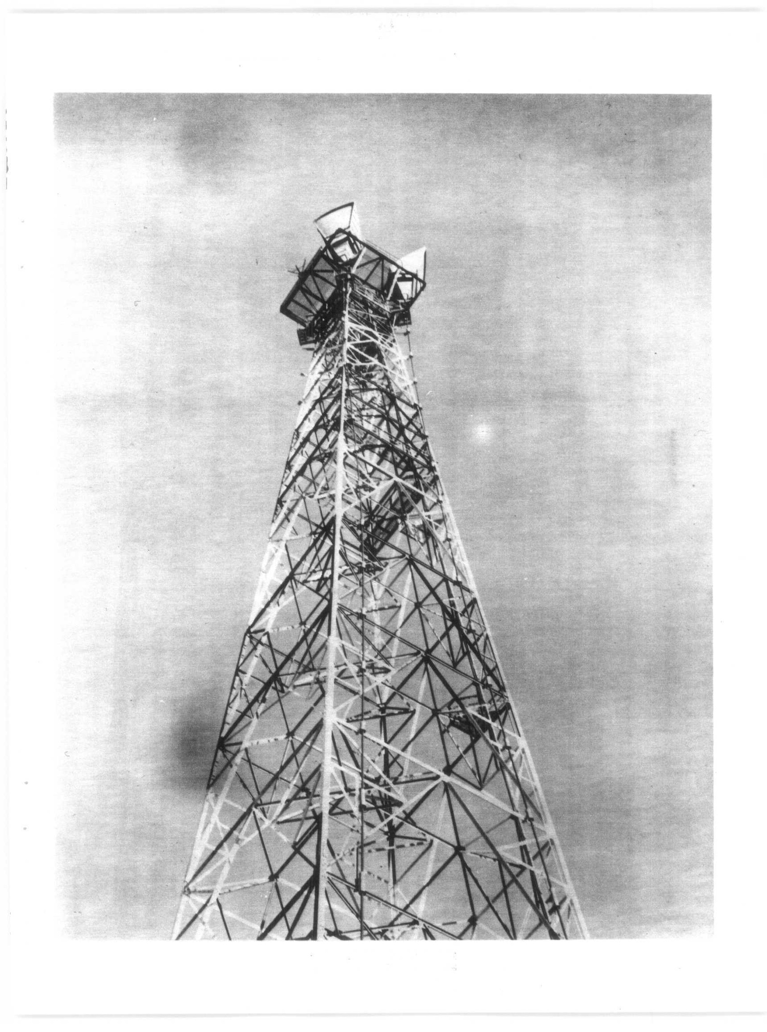
No authenticated historical photograph of Knob Ridge's Air Force relay is available here. The TD-2 image above shows Soldotna, a different White Alice installation, and illustrates the equipment family rather than Knob Ridge's precise tower or terrain. [1]
Chronology
- 1960-1961 Corps gives the BMEWS TD-2 class construction/opening window; the exact Knob Ridge date is unverified.
- 1976-02-03 Corps files F-22940 land application, as later recorded by the Bureau of Land Management.
- 1976 RCA Alascom leases the wider White Alice system.
- 1976-12-13 Federal Register publishes the Knob Ridge microwave application toward Gerstle River and Cathedral.
- 1977-08-18 Federal notice proposes a 2.06-acre withdrawal for Air Force radio relay use at U.S. Survey 4290.
- 1978 Knob Ridge appears in the TD-2 appraisal and sale-interest process.
- 1983 Air Force sale study describes the White Alice sale and Knob Ridge's unattended relay role.
- 1989-06-26 Land withdrawal proposal is terminated after the Corps cancels its application.
- 2006 Alaska DEC closed-site inventory names Knob Ridge Microwave Repeater Site.
- 2019 Defense Department document identifies a later AT&T facility point at Knob Ridge.
- 2026 DEC lists AT&T's Knob Ridge repeater tank facility as number 193.
Information sources (11)
- PDFU.S. Army Corps of Engineers, Historical Overview and Inventory of the White Alice Communications System, 1988, especially pages 12-13 and 60
Source for BMEWS A and B Routes, class-wide construction and facilities, TD-2 equipment and direct Knob Ridge link distances.
- PDFU.S. Air Force, Special Study of the White Alice Communications System Sale, 1983, especially pages 120-121, 193 and 233-236
Source for the lease and sale sequence, property appraisal, unattended station description and duplicated Alaska Highway milepost.
- PDFFederal Communications Commission microwave applications, Federal Register, December 13, 1976, page 54215
Source for the contemporary Knob Ridge application naming Gerstle River and Cathedral as direct microwave directions, not proof of license grant.
- PDFBureau of Land Management, Proposed Withdrawal and Reservation of Lands, Federal Register, August 18, 1977, page 41668
Source for application F-22940, U.S. Survey 4290 and its 2.06-acre proposed Air Force radio-relay tract.
- PDFBureau of Land Management, Termination of Proposed Withdrawal and Reservation of Lands, Federal Register, June 26, 1989, page 26847
Source for cancellation of F-22940 and termination of the proposed withdrawal's segregative effect, not a communications closure.
- PDFDepartment of the Air Force, Helicopter Transport Service Performance Work Statement, February 21, 2019, attachment 1
Source for the later Knob Ridge AT&T facility reference point at 63 degrees 38.929 minutes N, 144 degrees 03.950 minutes W.
- PDFAlaska Department of Environmental Conservation, FY2016 Inventory of Closed Contaminated Sites and Leaking Underground Storage Tank Sites
Source for the specifically named Knob Ridge Microwave Repeater Site closed-case listing; summary does not document contaminant or remedy.
- WEBAlaska Department of Environmental Conservation, UST Facilities With Proof of Financial Responsibility, accessed October 15, 2026
Source for AT&T Alaska facility 193, Knob Ridge Microwave Repeater and the listed 2024-2027 policy period.
- WEBU.S. General Accounting Office, Alaska Properties Identified for Potential Inclusion in FUDS Cleanup Program, 2001
Source for Knob Ridge Radio Relay property number F10AK0140; a program inventory, not a site-wide cleanup finding.
- WEBU.S. Environmental Protection Agency, Superfund Site Information Index, accessed October 15, 2026
Source for the separate EPA site identifier AKN001002360 and its not-on-NPL listing; not a cleanup or hazard assessment.
- WEBSalcha-Delta Soil and Water Conservation District, Knob Ridge trail description, accessed October 15, 2026
Source for the locally documented road and communications tower setting near Dot Lake, not historical tower identity.