
Glennallen Radio Relay Station, Alaska
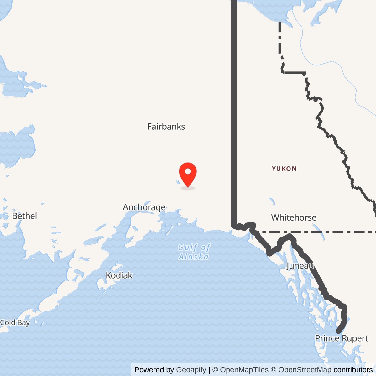
Longitude: -145.5469444444
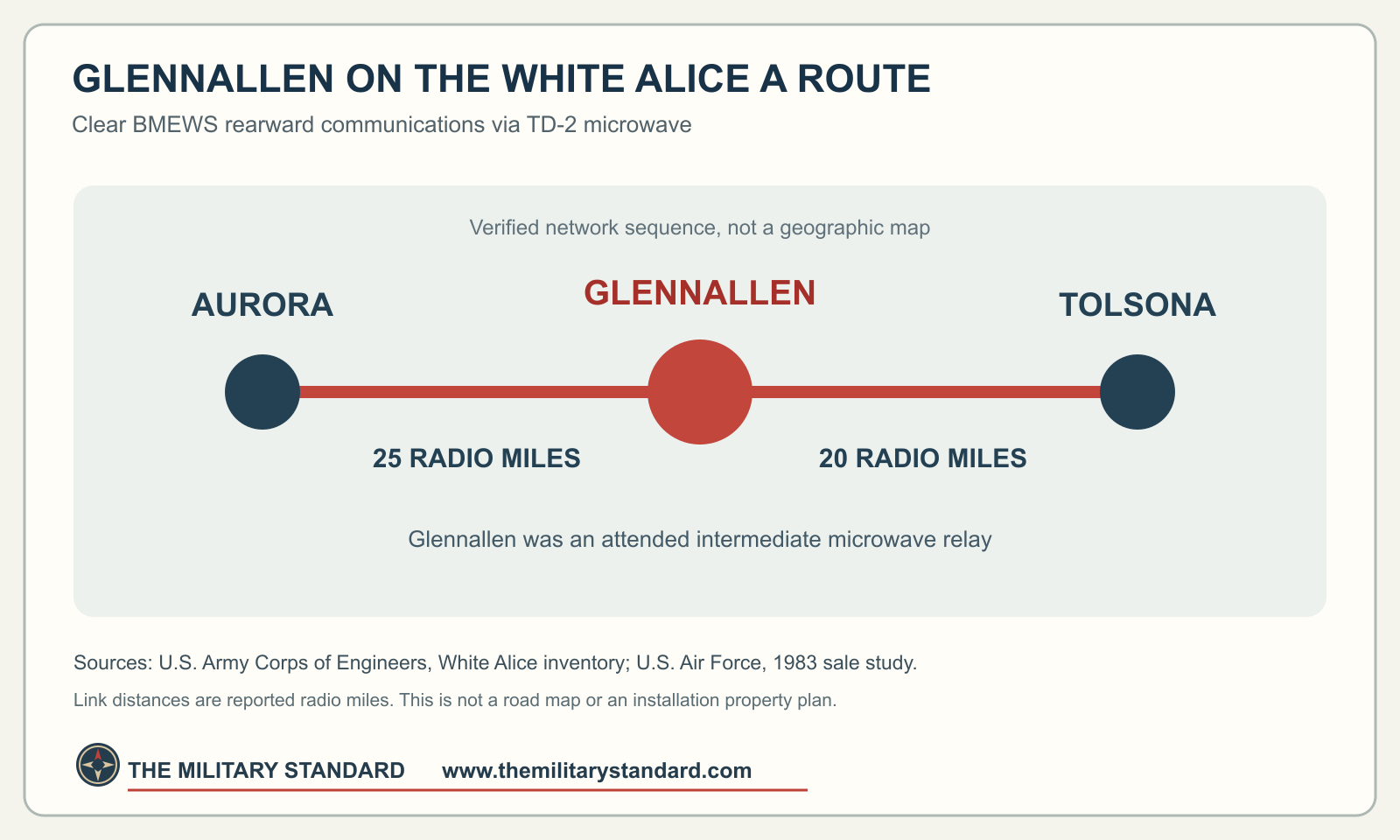
Glennallen was an attended microwave repeater on Alaska's White Alice Communications System. It carried traffic on the coastal A Route associated with the Ballistic Missile Early Warning System at Clear, directly between Aurora and the Tolsona relay site. Its role was communications, not radar detection. [1] [2]
- Role
- Attended White Alice TD-2 microwave relay on Clear's BMEWS coastal A Route.
- Direct links
- Aurora, 25 radio miles; Tolsona, 20 radio miles.
- Opened
- 1960, at year precision in the state archaeological inventory.
- Coordinate reference
- 62.110278 N, 145.546944 W is a 1974 RCA communications-filing point also used by a later DEC case. It is not a surveyed Air Force tower or boundary.
- Property distinction
- The 1983 Air Force sale study marks Glennallen personal property only, with real property to be leased.
- Later cleanup
- Alaska DEC case 2806 is Cleanup Complete, with closure approved May 20, 2002.
Location and Identity
The Air Force's 1983 study places Glennallen at historic Glenn Highway milepost 186. A 1974 Federal Register notice calls it the White Alice site at mile 189 and gives 62 degrees 06 minutes 37 seconds N, 145 degrees 32 minutes 49 seconds W. Alaska DEC uses the corresponding decimal point, approximately 62.110278 N, 145.546944 W, for its later AT&T Alascom Glennallen Repeater case, but also gives mile 186. The milepost descriptions differ; the matching coordinate is a communications-filing and later cleanup reference, not a surveyed original Air Force tower or property boundary. [2] [4] [5]
Alaska's archaeological record names the White Alice station AHRS GUL-126. It is distinct from the Tolsona station, GUL-124. Federal property lists also name Glennallen ACS Communications and Glennallen-Valdez LLIN. Those names are not automatically equivalent to the White Alice compound, and the available records do not justify merging their parcels or issuing new installation IDs. [3] [7]
The Clear BMEWS Coastal A Route
The Army Corps of Engineers identifies Glennallen on the A Route of the Clear BMEWS rearward communications network. Its direct TD-2 microwave links ran to Aurora, 25 radio miles away, and Tolsona, 20 radio miles away. These are reported radio-link distances, not road mileage. The state archaeological account says Glennallen opened in 1960; the Corps dates the broader BMEWS TD-2 construction and opening interval to 1960-1961. No Glennallen-specific first-traffic day has been found. [1] [3]
White Alice also supported commercial communications over Alaska's road-network microwave system. A station on a strategic warning route could thus have both military and civilian traffic. The Air Force study does not quantify Glennallen's traffic split, channel capacity or complete circuit roster, so those details are not inferred. [1] [2]
Attended Station and Equipment
The Air Force explicitly calls Glennallen an attended repeater. The site's AHRS description records a relay building, chain-link security fence, heating-fuel tank and communications tower. A crew was assigned, but neither source gives a Glennallen-specific number of workers, shifts or housing plan. Its original tower height, building footprint, tank capacity and antenna inventory remain unverified. The TD-2 structure was for line-of-sight microwave communications, not a giant troposcatter billboard antenna. [1] [2] [3]
A Pipeline-Era Microwave Proposal
On May 17, 1974, the Federal Register published RCA Alaska Communications' application for a Glennallen White Alice microwave path toward Stuck, a pipeline-construction location south of Copper Center. It proposed 2,126.8 MHz and supplied the station-filing point above. The notice records an application, not proof the path was licensed, built or part of the original 1960 warning route. It illustrates how an existing White Alice location could be proposed for an additional regional communications need. [4]
Lease, Excess and Property Transfer
The Air Force leased White Alice to RCA Alascom in 1976. The archaeological inventory says Glennallen was declared excess in 1979 and acquired by Alascom in 1983. The Air Force sale study is more precise about what was acquired: its table and site appendix mark Glennallen personal property only, with real property to be leased. That does not establish sale of the military land. A site-specific deed, lease map and full present title chain were not found. Excess status in 1979 is not, by itself, a last-traffic date. [2] [3]
Later Environmental Record
Alaska DEC's AT&T Alascom Glennallen Repeater record, hazard ID 2806, describes approximately 2.5 acres and about 10 cubic yards of diesel-range-organic-impacted soil near an incinerator. It mentions trichloroethylene as a possible co-contaminant, not a confirmed finding. The 2.5 acres is the later cleanup case's scope, not a verified original Air Force property acreage; the record does not date the incinerator to Air Force operation. [5]
DEC accepted the case into its Voluntary Cleanup Program on June 23, 1998. It approved closure at Method 2 cleanup levels on May 20, 2002. The public case is now labeled Cleanup Complete, with no institutional controls required, although the record notes advance approval for transporting soil or groundwater off-site. That is the status of this specific cleanup case, not a finding about every nearby former federal property. [5]
Photographs and Open Questions
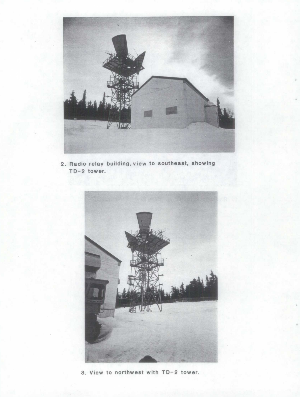
The University of Alaska Anchorage catalog lists official Air Force real-property photographs of "Glenallen" in the William F. McDowell collection, but the volume is not digitized online. No Glennallen photograph is presented as if it had been obtained. The archival image below instead shows the actual TD-2 tower and relay building at Rabbit Creek, another White Alice site. It is included to illustrate the equipment family only. For more photographs of this equipment family, see the Rabbit Creek White Alice history, which includes its HAER photo series. Those are Rabbit Creek views, not photographs of Glennallen. Glennallen's precise tower design, current surviving structures and active circuits still require site-specific evidence. [6] [8]
Open questions include the original tower footing and acreage, exact equipment and staffing, whether the proposed Stuck path was built, the relationship of earlier ACS and LLIN identifiers to the White Alice parcel, and present operation or preservation. The known 1974 coordinate and later DEC case should not be expanded into an invented site polygon. [2] [3] [4] [5] [7]
Chronology
- 1960 State archaeological inventory says Glennallen White Alice opened.
- 1974-05-17 Federal Register publishes RCA's Glennallen-to-Stuck microwave application.
- 1976 Air Force leases White Alice to RCA Alascom.
- 1978 Glennallen appears in the TD-2 appraisal and disposal process.
- 1979 Archaeological account says the Air Force declared Glennallen excess.
- 1983 Glennallen personal property transfers to Alascom; the Air Force study calls for a real-property lease.
- 1998-06-23 DEC accepts the later Alascom repeater case into voluntary cleanup.
- 2002-05-20 DEC approves closure at Method 2 cleanup levels.
- 2005 State archaeological report documents GUL-126 and its recorded site structures.
- 2026 DEC lists case 2806 Cleanup Complete; present microwave traffic remains unverified.
Information sources (8)
- PDFU.S. Army Corps of Engineers, Historical Overview and Inventory of the White Alice Communications System, 1988
Source for the Clear BMEWS coastal A Route, TD-2 class and Glennallen's 25- and 20-radio-mile links.
- PDFU.S. Air Force, A Special Study of the White Alice Communications System Sale, October 1983
Source for Glennallen's attended role, milepost 186, 1976 lease, 1978 appraisal, personal-property-only sale and real-property lease.
- PDFAlaska Natural Gas Development Authority, Glennallen to Palmer Gas Spurline Archaeological Studies, Final Report, November 2005
Source for AHRS GUL-126, 1960 opening, site structures, Aurora/Tolsona links, 1979 excess and 1983 Alascom acquisition.
- PDFFederal Communications Commission, microwave applications, Federal Register, May 17, 1974
Source for Glennallen White Alice communications-filing coordinate, mile 189 description and proposed Stuck link; an application, not proof of completed construction.
- WEBAlaska Department of Environmental Conservation, AT&T Alascom Glennallen Repeater, hazard ID 2806
Source for the later environmental case coordinate and 2.5-acre scope, contaminant description, 1998 program entry, 2002 closure and current Cleanup Complete status.
- WEBUniversity of Alaska Anchorage Archives, William F. McDowell papers, HMC-1212
Source for cataloged official Air Force Glennallen real-property photographs, not reproduced because the volume is not digitized.
- WEBU.S. Government Accountability Office, Alaska Formerly Used Defense Sites inventory
Source for separately listed Glennallen ACS Communications and Glennallen-Valdez LLIN property names and FUDS numbers.
- WEBLibrary of Congress, Historic American Engineering Record, Rabbit Creek White Alice Site Radio Relay Station, HAER AK-23-A
Source for identifying the Rabbit Creek historical TD-2 tower images reproduced in the 1988 Corps inventory; representative equipment-family views, not Glennallen photographs.