
Tok Junction Radio Relay Station, Alaska
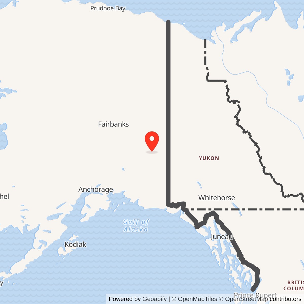
Longitude: -142.985054
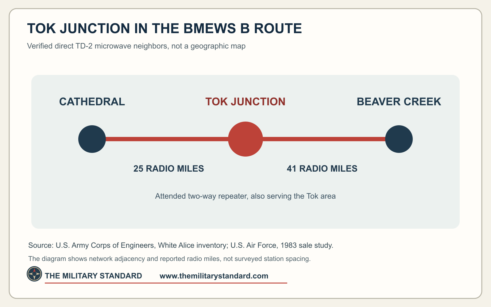
Tok Junction was an attended, two-way microwave repeater on Alaska's White Alice Communications System. On the interior B Route supporting the Ballistic Missile Early Warning System at Clear, it linked directly to Cathedral and Beaver Creek. It also served the Tok area. Tok Junction was a communications station, not a radar site. [1] [2]
- Role
- Attended, two-way White Alice TD-2 microwave relay on the Clear BMEWS interior B Route.
- Direct links
- Cathedral, 25 radio miles; Beaver Creek, 41 radio miles.
- Historic location
- Alaska Highway milepost 1314, according to the Air Force's 1983 study.
- Coordinate reference
- Approximately 63.337222 N, 142.982500 W is a 1976 microwave-application point, not a surveyed Air Force parcel or tower footing.
- Military importance
- Air Force personnel said numerous command-and-control circuits needed emergency patching at Tok.
Setting and Location
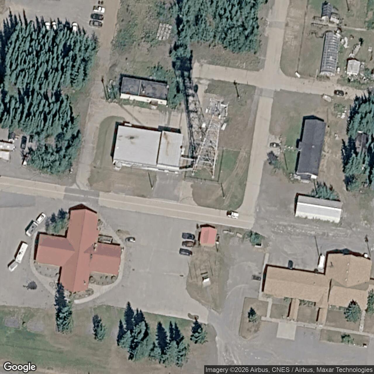
The Air Force located Tok Junction near historic Alaska Highway milepost 1314. A December 1976 federal microwave notice placed an RCA Alascom application at approximately 63.337222 N, 142.982500 W. This is a representative communications point, not the surveyed location of the original Air Force tower or the limits of the military property. A later AT&T Alascom terminal cleanup site lies about 150 meters west; its approximately 1.6-acre parcel does not define the full historic White Alice station. [2] [3] [5] [6]
The Clear BMEWS Route
White Alice carried Alaska defense communications through long-distance tropospheric-scatter and shorter microwave paths. The Clear BMEWS expansion required dependable rearward links. On the eastern interior B Route, traffic passed through Gerstle River, Knob Ridge, Cathedral, Tok Junction and Beaver Creek. The Army Corps recorded Tok's direct Cathedral and Beaver Creek paths as 25 and 41 radio miles. It dates construction of the BMEWS TD-2 group to 1960 and its opening to 1960 or 1961; Tok's precise first-traffic date is not documented. [1] [2]
Attended Operations and Military Circuits
Tok was an attended two-way repeater, with technicians available to maintain equipment and restore service. In June 1977 RCA Alascom proposed reducing the station's staffing from four technicians to two and replacing around-the-clock coverage with eight hours daily. The 1931st Communications Group Operations Division objected because numerous command-and-control circuits passed through Tok and the plan offered no emergency patching coverage. Its Maintenance Division raised similar restoration concerns, although Defense Communications Agency Alaska did not object. The record describes a proposal and dispute, not proof that the reduced schedule took effect. [2]
The staffing issue shows why Tok mattered to the military even while RCA Alascom operated White Alice under lease. It was a staffed relay in the warning network as well as a source of local Tok communications service. [2]
Buildings and Towers
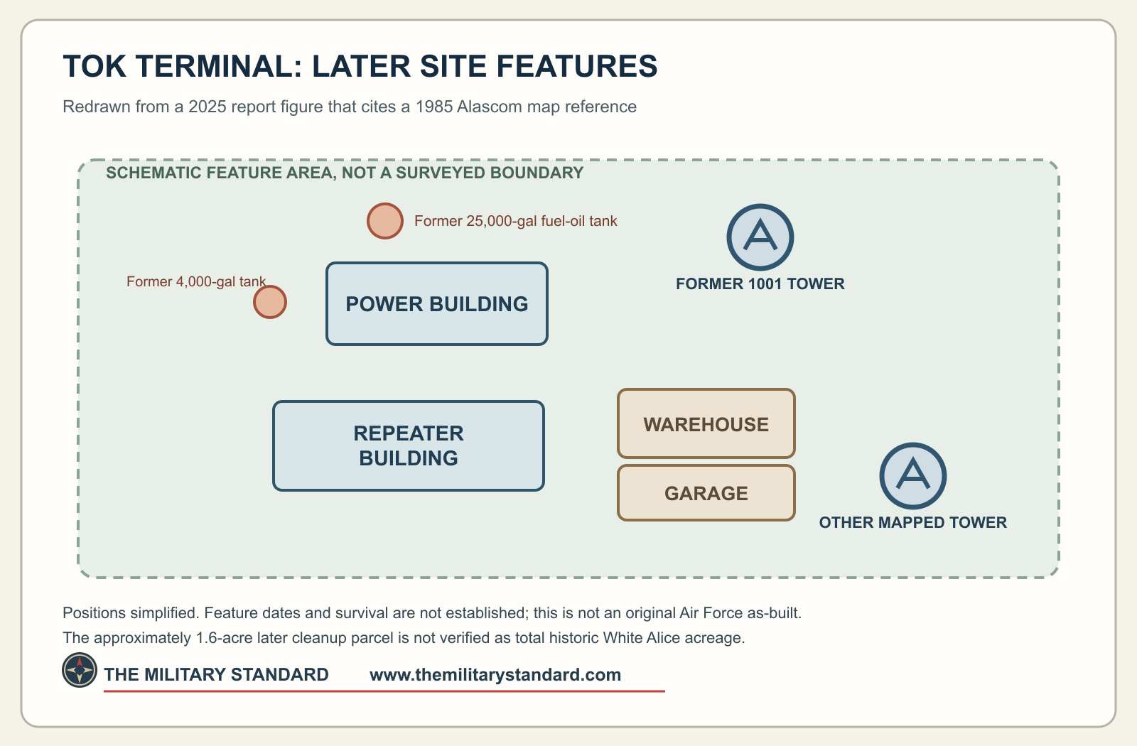
The Army Corps described the TD-2 class of microwave station as having relay, power, fuel and tower facilities. A later Tok Terminal Station figure identifies a repeater building, power building, warehouse, garage, two tower positions and former fuel-tank areas. That figure cites an Alascom real-estate map dated May 15, 1985. It illustrates the later compound's arrangement, though the construction dates and present condition of its individual structures are not known. [1] [5]
Lease, Equipment Change and Transfer
The Air Force leased White Alice to RCA Alascom in 1976. Tok was included in the 1978 TD-2 property appraisal and sale process. In 1980, an Air Force engineering program named Tok among six stations where installed radio and miscellaneous equipment was removed during the transition; the study reports that work complete by September. The equipment change did not establish that all Tok communications ended. The broader White Alice sale followed in 1983. Later state records use the names AT&T Alascom Tok Terminal Station and AT&T - Tok Junction Microwave Repeater. [2] [5] [7]
Later Condition and Environmental History
Fuel-related contamination at the later Tok terminal led to removal of about 50 cubic yards of soil in 1998 and another 400 cubic yards in 2006. A bioventing and related treatment system was later decommissioned in 2022. A 2025 domestic-water-well sample had no detected diesel-range organics, volatile organic compounds or polycyclic aromatic hydrocarbons, but Alaska DEC still listed the cleanup case as Active in 2026. The public records do not establish whether any of the later terminal's surviving structures date from the original Air Force installation. [5] [6]
Other federal communications properties also appear in Tok records: a separate Alaska Communications System site and a Tok Army Radio Communications property. Their exact relationship to the White Alice relay remains an open part of the area's communications history. [8] [9]
Historical Photographs
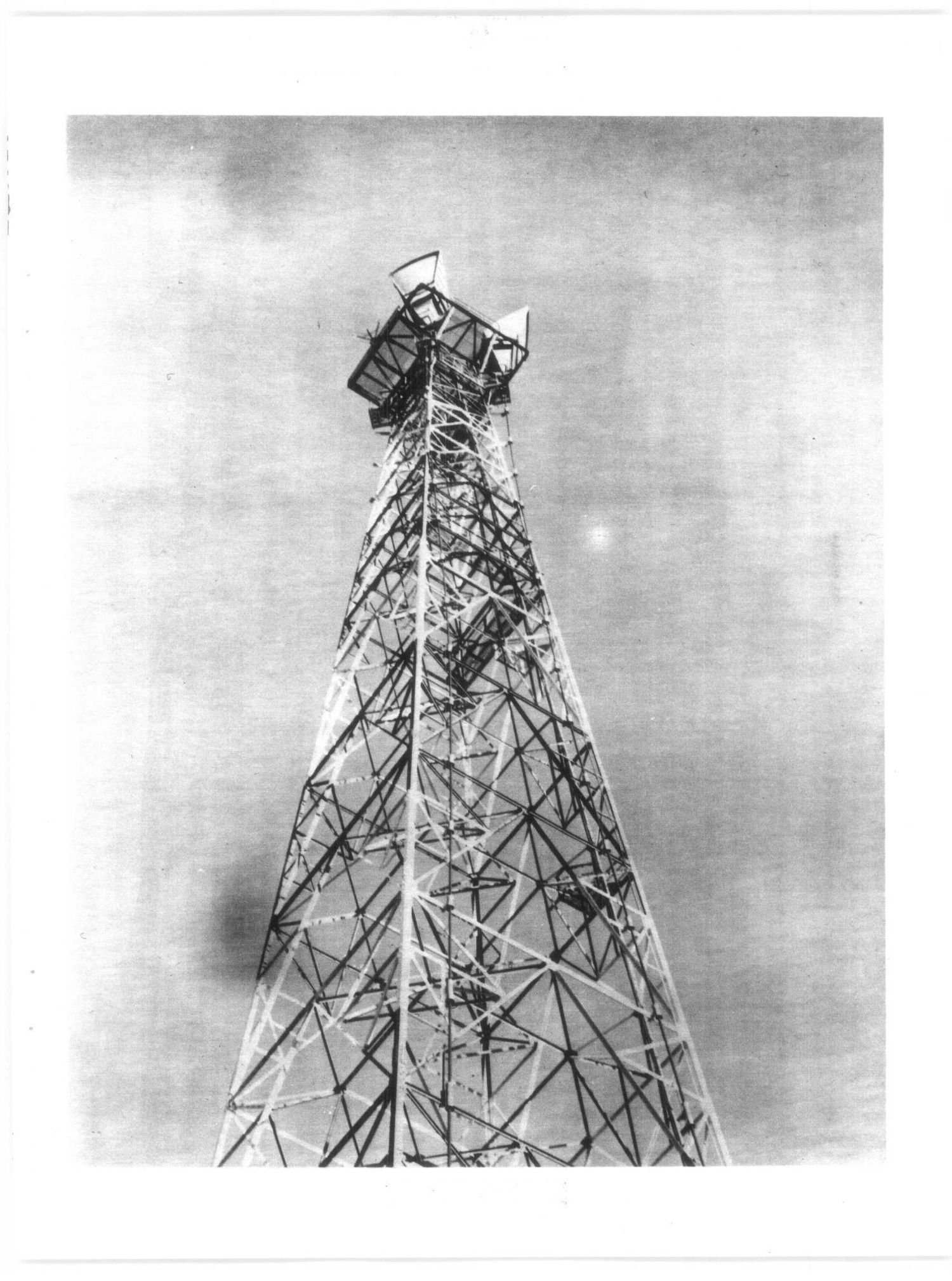
The University of Alaska Anchorage archives catalog Air Force real-property photographs of Tok Junction. The historical photograph below shows a TD-2 tower at Soldotna, offered as a representative view of the equipment family rather than a view of Tok. The site-specific layout diagram above is based on the later Tok terminal report. [1] [4] [5]
Chronology
- 1960-1961 The Corps dates construction and opening of the BMEWS TD-2 group to this period; Tok's exact first-traffic date is unknown.
- 1976 The Air Force leases White Alice to RCA Alascom.
- 1976-12-27 The Federal Register publishes RCA Alascom's Tok Junction microwave application.
- 1977-06 Proposed reductions in Tok staffing and hours draw Air Force command-circuit objections.
- 1978 Tok appears in the TD-2 appraisal and property-sale process.
- 1980 Tok appears in an Air Force installed-equipment removal program during the Alascom transition.
- 1983 The Air Force describes Tok as an attended Cathedral-to-Beaver Creek relay; the wider White Alice sale proceeds.
- 1985-05-15 An Alascom real-estate map later cited by the Tok terminal report bears this date.
- 1998 About 50 cubic yards of impacted soil are removed at the later terminal.
- 2006 About 400 cubic yards of additional impacted soil are removed.
- 2022 The inactive environmental treatment system is decommissioned.
- 2025-08-08 A domestic-water-well sample has no detected diesel-range organics, volatile organic compounds or polycyclic aromatic hydrocarbons.
- 2026 Alaska DEC continues to list the terminal cleanup case as Active.
Information sources (9)
- PDFU.S. Army Corps of Engineers, Historical Overview and Inventory of the White Alice Communications System, 1988
Source for Clear BMEWS interior B Route, TD-2 group dates, station type and Tok's 25/41-radio-mile links.
- PDFU.S. Air Force, A Special Study of the White Alice Communications System Sale, October 1983
Source for Tok's attended role, milepost, local service, 1977 staffing dispute, appraisal, 1980 equipment work and transfer chronology.
- PDFFederal Communications Commission, microwave applications in Federal Register, December 27, 1976
Source for RCA Alascom's reported Tok Junction coordinate and proposed microwave application.
- WEBUniversity of Alaska Anchorage Archives, William F. McDowell papers, HMC-1212
Source for cataloged Air Force Tok Junction real-property photographs.
- PDFALTA Geosciences, 2025 Groundwater Sampling and Analysis Report, Tok Terminal Station, September 10, 2025
Source for the later terminal parcel, site figure citing a 1985 Alascom map, tank areas, remediation and 2025 domestic-well test.
- WEBAlaska Department of Environmental Conservation, AT&T Alascom Tok Terminal Station, hazard ID 2946
Source for the later cleanup record's location and Active status.
- WEBAlaska Department of Environmental Conservation, UST Facilities With Proof of Financial Responsibility
Source for the later named Tok Junction microwave-repeater fuel facility.
- PDFU.S. Army Corps of Engineers, Tok ACS Site Environmental Assessment, 2007
Source for the separate Tok ACS federal property.
- WEBU.S. Government Accountability Office, Alaska Formerly Used Defense Sites inventory
Source for separately listed Tok ACS and Tok Army Radio Communications property identifiers.