
Nikolski Air Force Station Defense Radar and White Alice, Nikolski Alaska
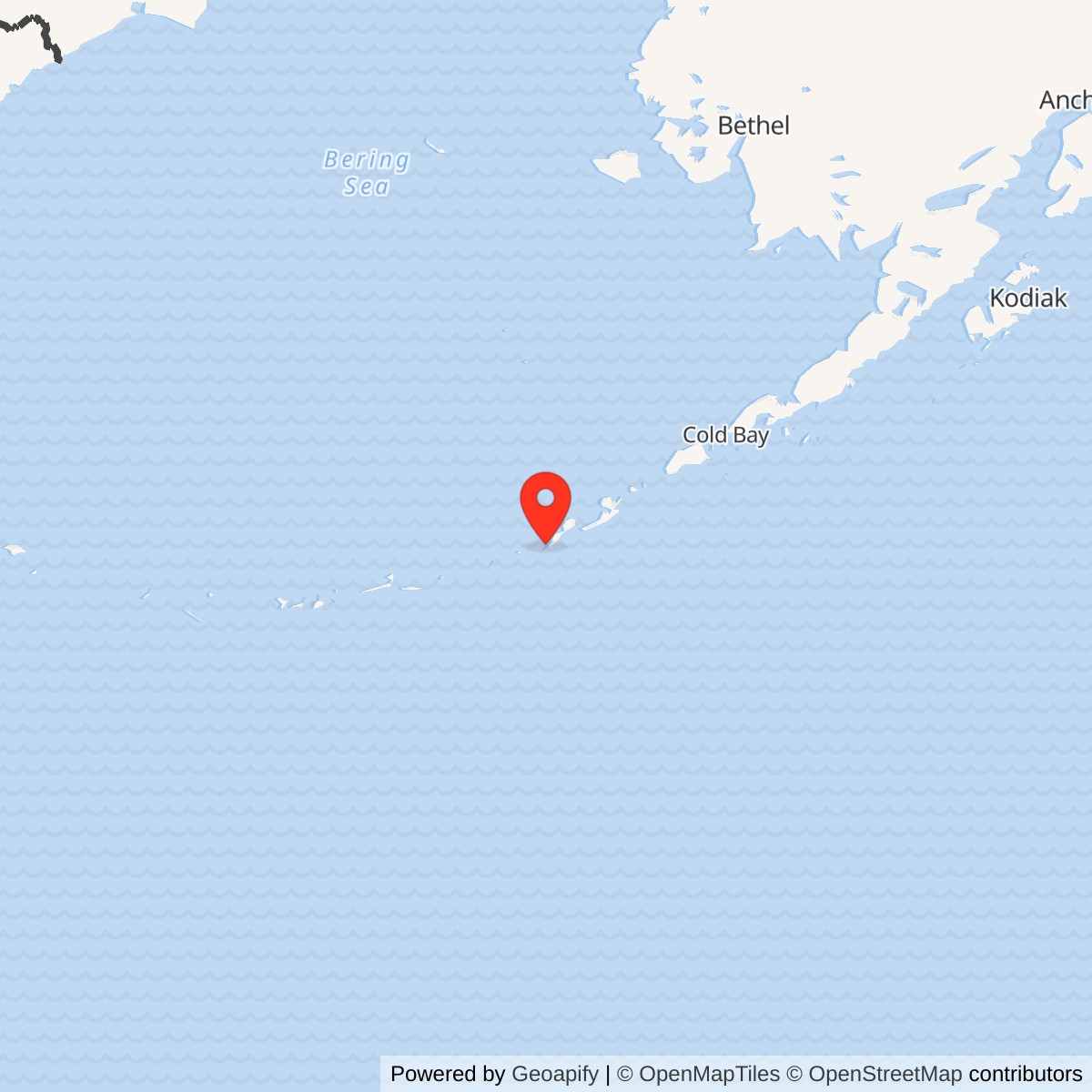
Longitude: -168.855104
Site Number: COB-1
Current Role: No active radar or military relay use documented. Major structures were demolished in 1988; former property remains subject to environmental review and selected institutional controls.
Approximate location: 52.973269 N, 168.855104 W. This Alaska DEC point identifies the former composite-building and antenna source area; it is not the surveyed boundary of the installation.
- Station code
- COB-1, Aleutian DEW Line extension.
- Radar
- AN/FPS-19, April 1959 to June 1, 1969.
- Communications
- White Alice relay to Driftwood Bay, Atka, and Adak, continuing into the late 1970s.
- Location
- Umnak Island near Nikolski, Alaska.
Overview
Nikolski Air Force Station, code COB-1, stood near the village of Nikolski on Umnak Island. It was the westernmost radar station in the six-site Aleutian extension of the Distant Early Warning Line. The same installation also carried White Alice long-distance radio communications. Its radar ceased operating in 1969, while the communications mission continued afterward. [1] [3] [6]
The station linked east to Driftwood Bay and west toward Atka and Adak White Alice. Beyond reporting air-warning information, its relay carried communications for the Navy, Federal Aviation Administration, and other agencies. [1] [2]
Project Stretchout and Construction
Project Stretchout extended the warning network west from the Alaska Peninsula across the Aleutians. Construction crews were working at all six Stretchout stations by August 1957. Nikolski was completed in 1959. The radar station was built on a mountain above the Umnak Island settlement and connected to an airstrip used to support the remote compound. [1] [5] [6] [7]
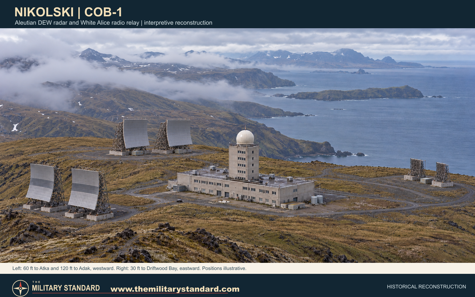
The Aleutian design combined radar operations, radio equipment, working space, and living quarters in a concrete composite building, with a central tower and radome for the search radar. The Corps estimated that the Nikolski station cost about $5 million to build. Fuel and other support facilities served the isolated installation. [1] [2] [5]
Radar Warning Mission
Aerospace Defense Command records place the COB-1 AN/FPS-19 aircraft-search radar in service by April 1959. Nikolski formed the western end of the original Aleutian radar extension, with Cold Bay as the sector main station and other radar points between them. The radar watched approaches across the North Pacific and passed warnings into the defense network. [3] [6] [7]
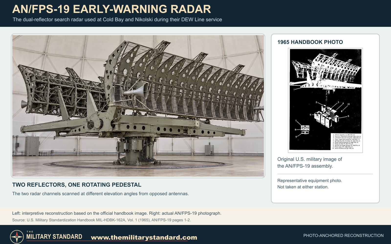
The AN/FPS-19's two radar channels fed back-to-back reflectors on a single rotating pedestal inside the radome. The official equipment photograph below shows that assembly; the larger view is a reconstruction based on it. The photograph documents the radar model, not the Nikolski installation. [10]
Alaskan Air Command controlled the Aleutian segment. The 714th Aircraft Control and Warning Squadron was based at Cold Bay, and its Detachment 1 served Nikolski. During February and March 1959, Strategic Air Command B-47 bombers and a chartered Twin Bonanza tested the new six-station segment with simulated penetrations at altitudes from 500 to 45,000 feet. The Air Defense Command history reports that the network detected and tracked all those flights. [7] [8]
The Aleutian DEW Line radar extension was inactivated on June 1, 1969. That date ended Nikolski's radar-warning mission, but it did not end the separate communications function at the site. [1] [3]
White Alice Communications
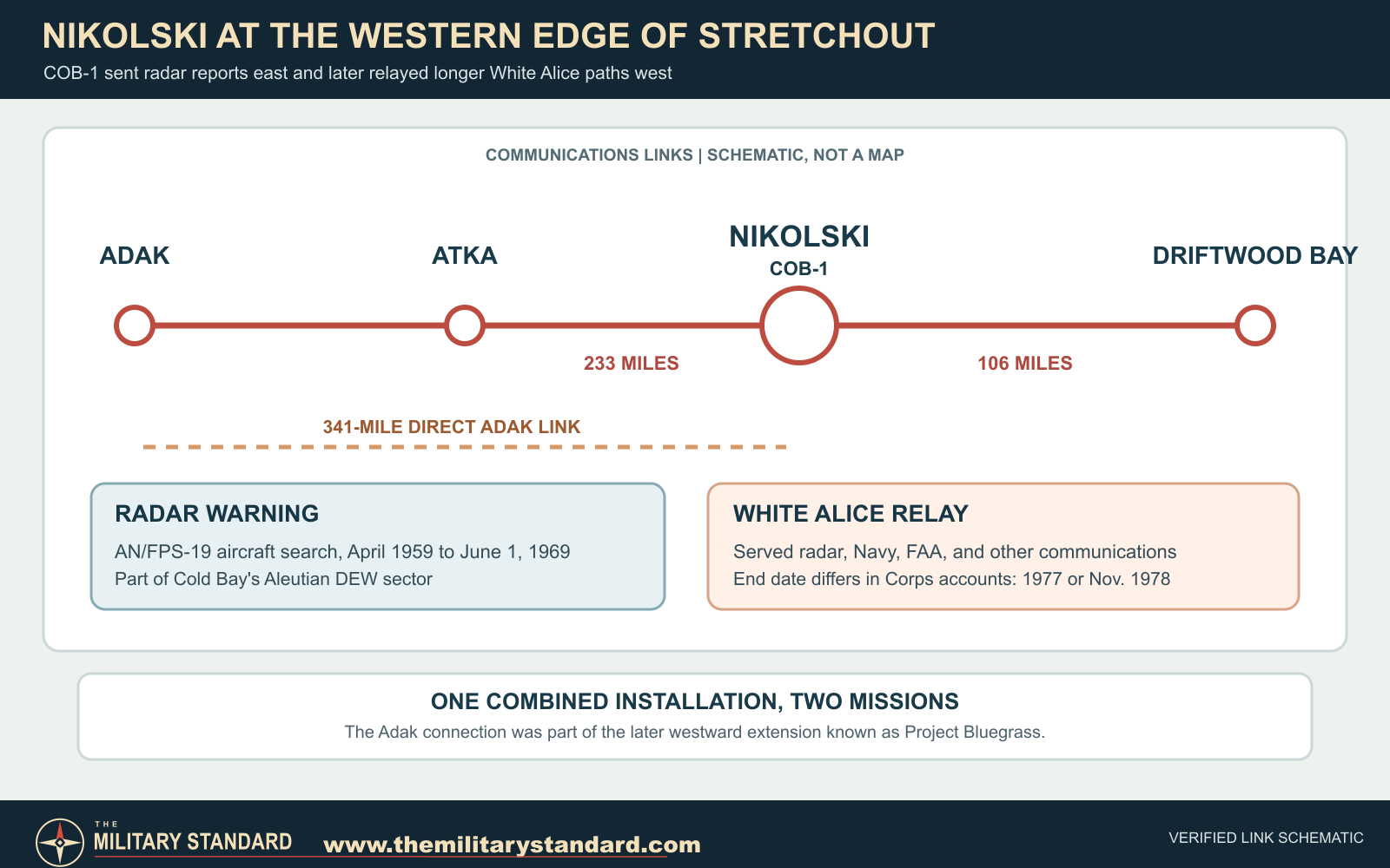
The Corps inventory identifies three Nikolski radio paths. Thirty-foot billboard antennas served the 106-mile path to Driftwood Bay; 60-foot antennas served the 233-mile path to Atka; and 120-foot antennas served the 341-mile direct path to Adak. These were fixed tropospheric-scatter links, which could bridge distances beyond ordinary line of sight. [2]
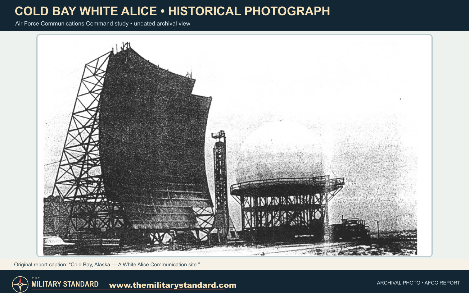
The archival photograph below shows a White Alice billboard reflector at Cold Bay, the main station of this Aleutian network. It gives a closer view of the equipment used on the route; it is not a photograph of Nikolski. [9]
The Adak path belonged to the later Project Bluegrass westward extension. Nikolski consequently connected the original Project Stretchout chain with communications reaching farther down the Aleutians. The 120-foot billboard antennas required for the Adak path were substantially larger than those serving Driftwood Bay and Atka. [1] [2]
The communications relay remained useful after the radar shut down. Records place its closure in 1977 or on November 1, 1978. Either way, radio service at Nikolski outlasted the air-warning mission by about a decade. [1] [4]
Daily Operations and Support
The site's position on an exposed Aleutian mountain offered long radio paths but made construction, supply, and maintenance difficult. The composite building concentrated its main functions under one roof. An airstrip and fuel distribution system supported personnel and equipment at the remote station. [1] [5]
Nikolski was more than a one-purpose radar post. Navy and civilian aviation communications shared the relay infrastructure with the Air Force network. That broader service explains why the communications installation outlasted the DEW radar. [1] [2]
Closure and Present Site
After radio operations ended, the abandoned station deteriorated. The Air Force demolished the main buildings and antennas in 1988. Former foundations, utilities, and support areas remained subjects of later site investigation. [1] [5]
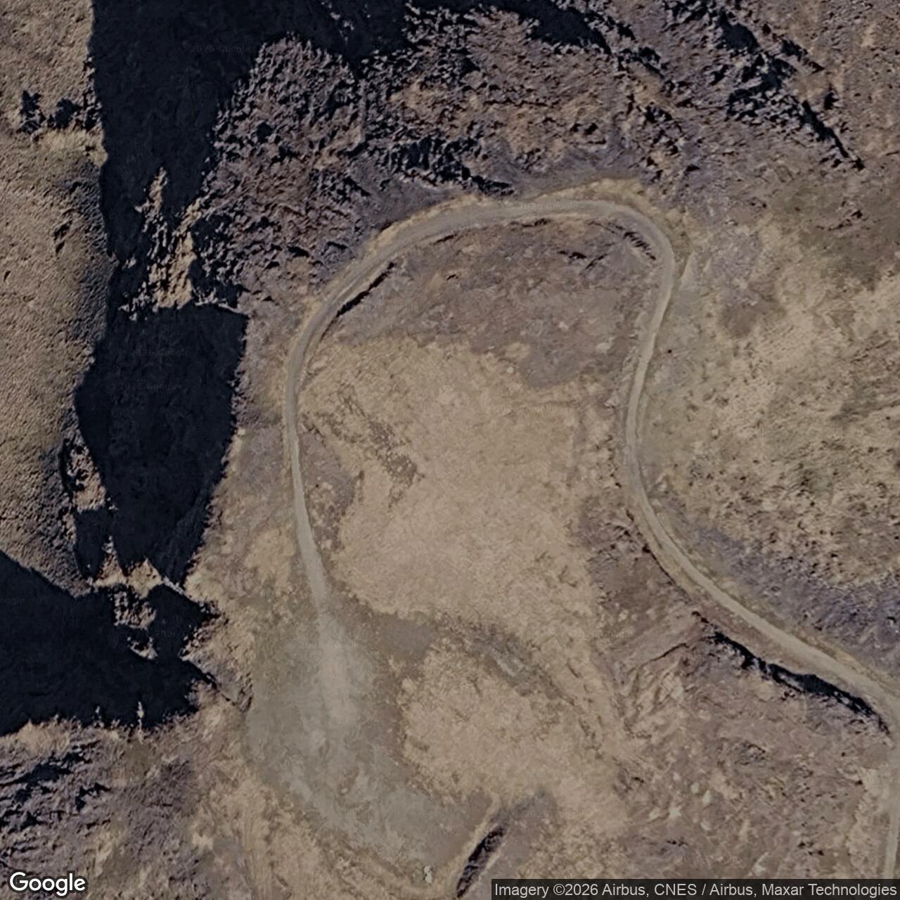
The former installation is not an active radar or White Alice station. Alaska DEC continues to document selected former source areas and land-use controls. Its OT001 coordinate is a point for the former composite-building and antenna area, not a surveyed boundary for the 435 acres historically withdrawn for military use. [4] [5]
Historical Images and Reconstruction
The reconstruction above illustrates the radome-topped composite building and three antenna-size pairs described in the Corps records. Their pictured positions are illustrative. The route diagram below distinguishes the 1959 to 1969 radar mission from the longer-lived radio relay. [1] [2] [3]
Chronology
- 1957 Construction underway at the six Project Stretchout stations.
- 1958 Construction continues at the Nikolski facility.
- 1959 Corps history dates completion of Nikolski COB-1.
- January 23, 1959 Alaskan Air Command assumes jurisdiction over the six Aleutian stations.
- February to March 1959 B-47 and Twin Bonanza flights test the new Aleutian radar segment.
- April 1959 AN/FPS-19 radar listed in service at COB-1.
- Late 1960s Project Bluegrass adds the long direct relay toward Adak.
- June 1, 1969 Aleutian DEW Line radar mission ends.
- 1977 or November 1, 1978 Corps entries disagree on the relay closing date.
- 1988 Air Force demolishes the station buildings and antennas.
Information sources (8)
- PDF1. The Cold War in Alaska: A Management Plan for Cultural Resources, U.S. Army Corps of Engineers, 1994
Source for: Nikolski COB-1 role, station design, communications neighbors, different relay closure accounts, 1988 demolition, and White Alice historic-property context.
- PDF2. Historical Overview and Inventory: White Alice Communications System, U.S. Army Corps of Engineers, 1988
Source for: Nikolski links to Driftwood Bay, Atka and Adak; distances and antenna sizes; Navy and FAA service; construction cost.
- PDF3. Historical Data of the Aerospace Defense Command, 1946-1973
Source for: COB-1 AN/FPS-19 search radar service from April 1959 to June 1, 1969.
- PDF4. Nikolski Radio Relay Station Proposed Plan, U.S. Air Force
Source for: Historic 435-acre federal withdrawal, construction and operation dates used in restoration records.
- WEB5. Alaska DEC Nikolski RRS OT001 White Alice Site Report, Hazard ID 133
Source for: Former composite-building and antenna area; 1988 demolition and present site controls; WGS84 point.
- PDF6. Alaska in the Cold War: The Coldest Front, Alaska Office of History and Archaeology
Source for: Project Stretchout and the six-station Aleutian DEW Line extension completed in 1959.
- PDF7. A History of the DEW Line, 1946-1964, Air Defense Command Historical Study No. 31
Source for: Alaskan Air Command and 714th Aircraft Control and Warning Squadron staffing, 1957 construction, and February to March 1959 flight tests.
- PDF8. Directory of USAF Organizations, July 31, 1964, Air Force Historical Research Agency
Source for: 714th Aircraft Control and Warning Squadron Detachment 1 assigned to Nikolski DEW Station COB-1.