
Cold Bay Air Force Station / Cold Bay Radio Relay Station, Alaska
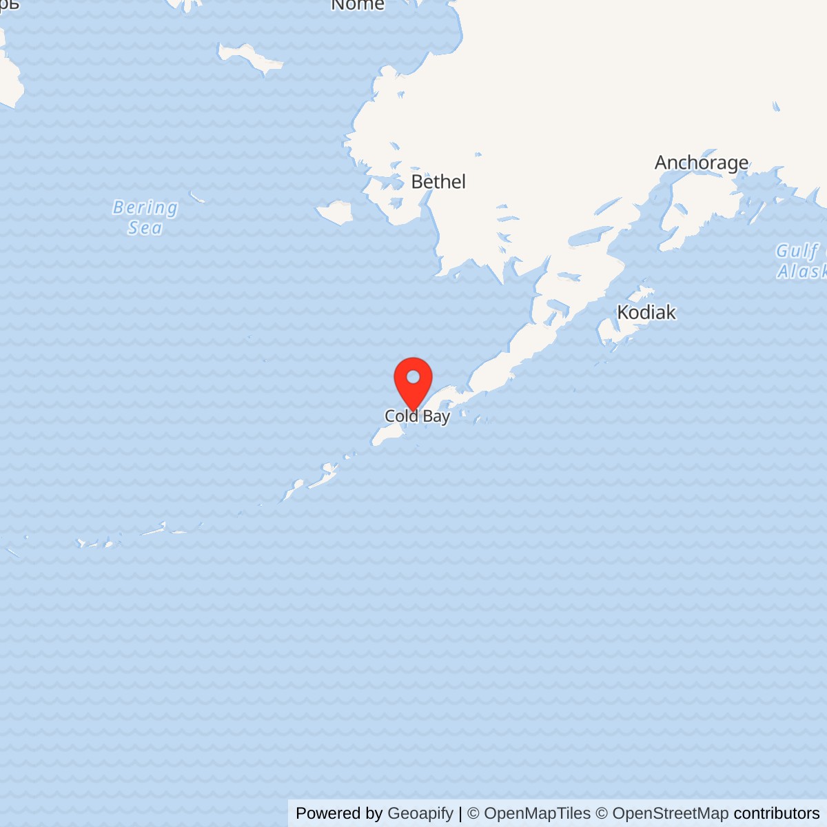
Longitude: -162.887605
Current Role: Original Grant Point radar and White Alice plant is former. DEC records ongoing land-use controls and monitoring at former station source areas. A later minimally attended Cold Bay radar near the community is not this plotted point.
Approximate Grant Point location: 55.262551 N, 162.887605 W (former White Alice source area).
- Site codes
- COB-Main; later F-26.
- Radar
- AN/FPS-19 DEW radar to 1969; later NORAD surveillance radar.
- Communications
- White Alice hub to November 1978.
- Successor
- Cold Bay Long Range Radar Site A-08, separately located and operational from 1985.
Overview
Cold Bay Air Force Station at Grant Point was the main station of the Aleutian extension of the Distant Early Warning (DEW) Line and a hub of the White Alice Communications System. The 714th Aircraft Control and Warning Squadron operated the radar mission, while the collocated communications plant passed reports and command traffic along the Alaska Peninsula and into the Aleutians. Both functions occupied the same concrete station complex, but their service periods differed. The AN/FPS-19 DEW radar began operating in 1959; the Aleutian DEW extension ended June 1, 1969. Cold Bay then continued as a NORAD surveillance station, while the White Alice route operated until late 1978. [1] [2] [3] [4]
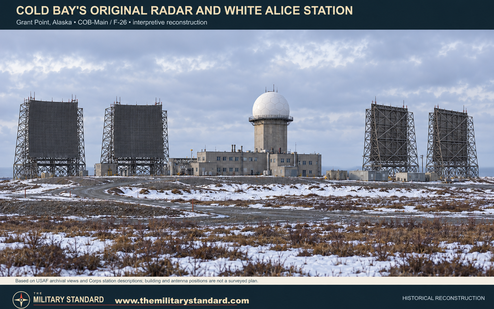
The surviving Cold Bay long-range radar is not at Grant Point. The Air Force built a smaller, minimally attended AN/FPS-117 installation nearer the airport during the 1980s modernization. It began operation July 6, 1985 and has its own installation identity, Cold Bay Long Range Radar Site, A-08. The original radar and White Alice buildings at Grant Point were later demolished. [1] [5]
Grant Point and the Aleutian Warning Line
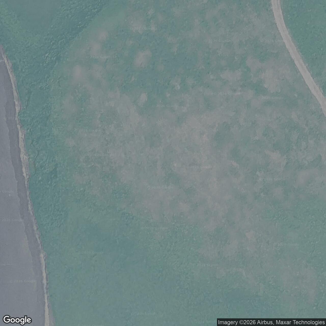
The original station stood near Grant Point, roughly 12 miles from the community of Cold Bay. Alaska's Department of Environmental Conservation records the former White Alice area at approximately 55.262551 N, 162.887605 W. The position locates the historic Grant Point complex, not the newer A-08 radar near the airport. The Department describes the old installation as a 216-acre former station; the figure belongs to the historic defense property, not to the later radar site. [5] [6]
The Joint Chiefs of Staff approved an Aleutian DEW extension in January 1957. Cold Bay was its main station, with five auxiliary stations at Port Heiden, Port Moller, Cape Sarichef, Driftwood Bay, and Nikolski. The chain added warning coverage along the exposed southwestern approach to Alaska. Unlike the contractor-operated northern DEW stations, military personnel manned the Aleutian sites. Cold Bay's location made it both the command and communications center for this particular extension. [1] [7]
Project Stretchout Construction
Project Stretchout brought the Air Force back to Cold Bay in 1957. Construction of the combined radar and White Alice plant advanced in 1958, and the network entered service in spring 1959. The six Aleutian stations used related designs: concrete composite buildings combined living quarters, administration, radar operations, communications equipment, generators, and a garage under one roof. At Cold Bay the main building was two stories across its lower wings, with a five-story central radar tower topped by a protective radome. The installation also required fuel, water, power, roads, and support facilities. [1] [2] [7]
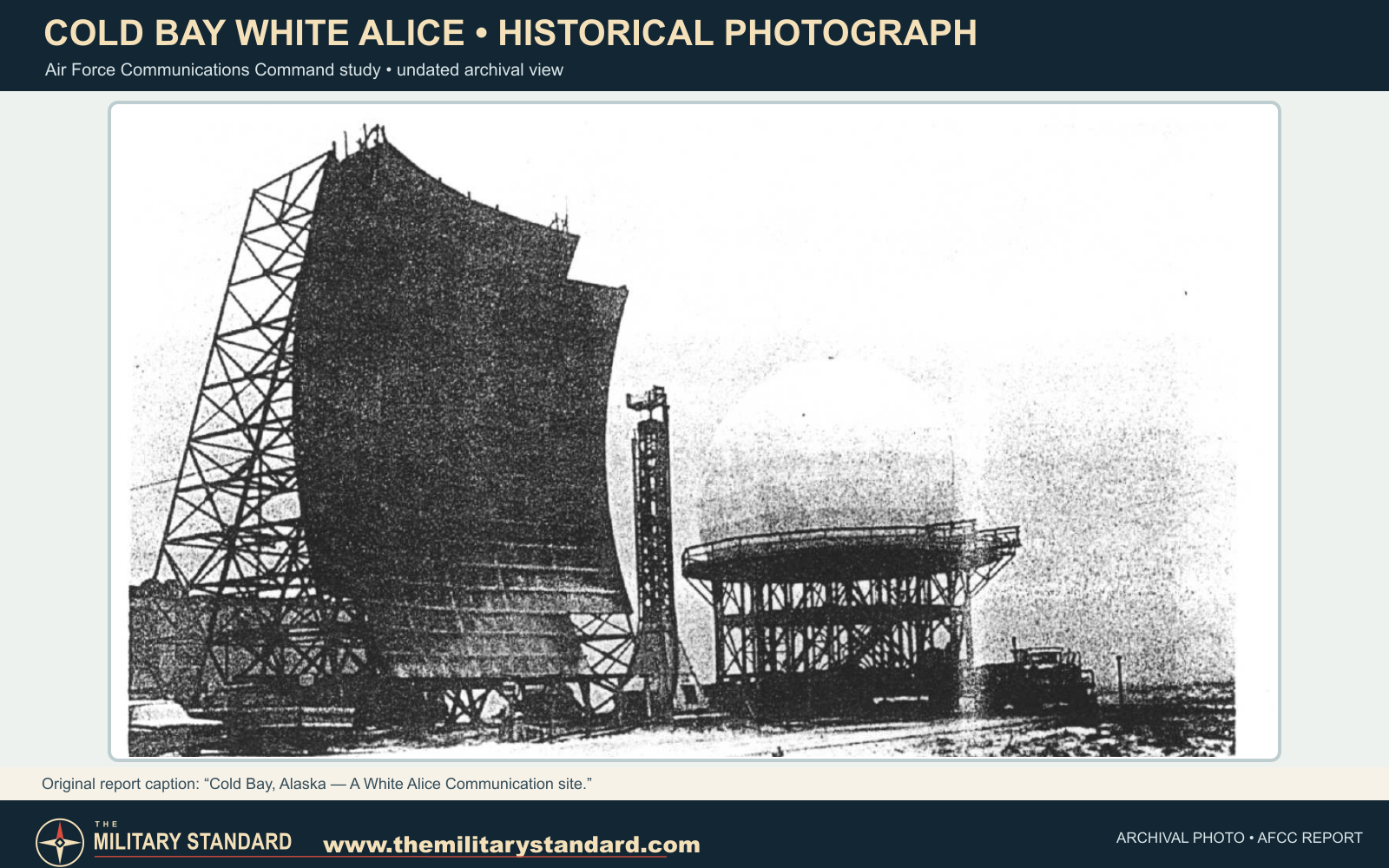
Four 60-foot White Alice billboard antennas stood outside the composite building. A fixed reflector was a communications device, not a radar antenna: it directed radio energy toward a distant station using tropospheric scatter, while the search radar rotated within its radome to detect aircraft. The Cold Bay reflectors formed two outward routes, approximately 105 miles to Port Moller and 92 miles to Cape Sarichef. The resulting hub connected the eastbound chain toward King Salmon with the westbound Aleutian stations. [1] [2] [3]
Radar Operations and the 714th Squadron
The Aleutian extension began official operation in April 1959; the completed stations passed to Alaskan Air Command control on May 1. Cold Bay carried the COB-Main designation and housed the 714th Aircraft Control and Warning Squadron. Its radar operators received aircraft tracks from the extension, while squadron detachments supported the auxiliary stations. The command arrangement made Cold Bay more than a relay point: it was the principal staffed warning station for the Aleutian sector. [1] [7]
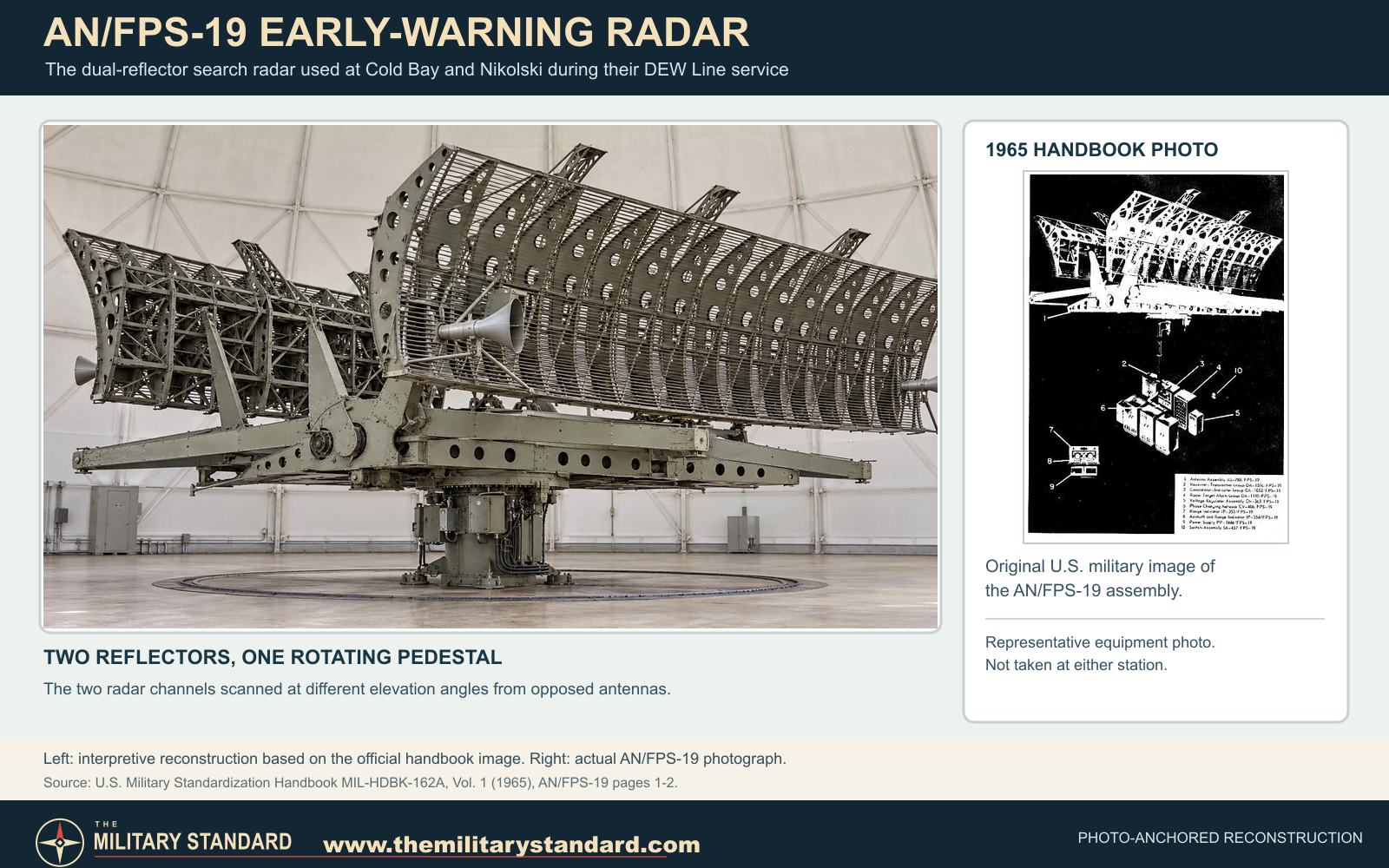
The AN/FPS-19 supplied the DEW Line search function at Cold Bay from 1959 until the extension's June 1, 1969 shutdown. Contemporary equipment tables also list AN/FPS-23 low-altitude alarm equipment at COB-Main. As the auxiliary radars closed, Cold Bay remained in service as an Alaskan NORAD surveillance station under the F-26 code. Its equipment changed with that mission. By the late 1970s, an AN/FPS-93 search radar was operating there; Air Force communications engineers tested it after its radio-frequency emissions interfered with a planned satellite earth terminal. [1] [3] [4]
The station demanded a substantial workforce. An Air Force Communications Command account described a 14-person communications detachment supported by the 714th Squadron. Radar and radio personnel shared the remote compound and relied on air service through Cold Bay for mail, supplies, and travel. Winds, rain, and isolation shaped ordinary operations as much as the electronics did. [3]
White Alice: Cold Bay as a Radio Hub
White Alice made the radar line usable as a connected warning system. The two 60-foot antenna pairs linked Cold Bay directly with Port Moller on the east and Cape Sarichef on the west, while the wider route connected through King Salmon to Alaska's principal communications network. The fixed antennas gave the Aleutian radar sites high-capacity over-the-horizon links where ordinary line-of-sight microwave alone could not span the distances. [2] [3]
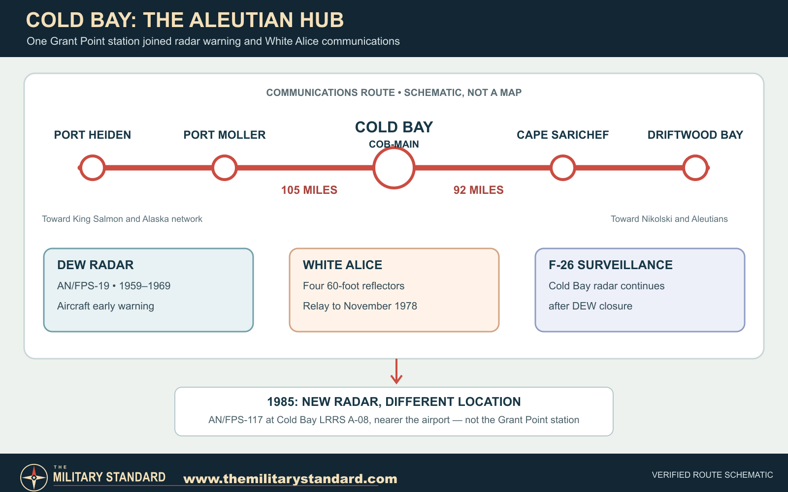
After the Aleutian DEW radar chain shut down in 1969, the Cold Bay White Alice station kept carrying communications for almost another decade. Commercial satellite service gradually displaced these large troposcatter paths. Air Force planning in 1978 linked the Cold Bay satellite terminal to the eventual shutdown of the Port Moller path, but the White Alice changeover involved schedule delays. The Air Force's retrospective closure table places Cold Bay among stations closed in the final quarter of 1978; the Corps history dates the local White Alice end to November of that year. The radar surveillance mission at Grant Point continued after the White Alice shutdown. [1] [2] [3]
The Move to a Smaller Radar Site
By the early 1980s, Alaska's radar system was changing from large staffed stations to radars sending data to a central operations center. The new Alaskan Regional Operations Control Center entered service in September 1983. The AN/FPS-117 combined long-range search and height information with far fewer people required at each radar location. At Cold Bay, the replacement was built at a separate site nearer the airport instead of being installed on the old Grant Point complex. The new radar was installed in May and June 1985 and became operational July 6, 1985. [1]
The move ended the military usefulness of the large Grant Point compound. The Corps records demolition of its former radar/White Alice composite building in the later 1980s; the Alaska DEC account places removal in 1987-88. The later Cold Bay LRRS continues the regional radar mission at its distinct A-08 location. The Grant Point site remains important as the place where Alaska's southwestern warning line, 714th Squadron operations, and White Alice communications met for more than two decades. [1] [5] [6]
Site After Military Use
Demolition removed the principal visible station structures, including the composite building and billboard arrays. The Air Force buried demolition material at the former property and later investigated fuel and debris areas. The former White Alice area is classified by Alaska DEC as cleanup complete with institutional controls, including protection and periodic inspection of the covered demolition area. The site no longer has an active radar or radio-relay function; the active Cold Bay radar is at A-08. [5] [6]
Historical Images and Graphics
An Air Force Communications Command historical study preserves a Cold Bay White Alice billboard photograph and a later radar-station view. The reconstruction depicts the former Grant Point concrete building, central radar tower, and four large relay reflectors. The route schematic shows Cold Bay's adjacent White Alice links and the later, separate A-08 radar site. [1] [2] [3]
Chronology
- January 1957 Joint Chiefs approve the Aleutian DEW Line extension.
- 1957-1958 Project Stretchout builds the Cold Bay main station at Grant Point.
- April 1959 The Aleutian radar and White Alice facilities enter service.
- May 1, 1959 Completed Aleutian stations transfer to Alaskan Air Command control.
- June 1, 1969 The Aleutian DEW radar extension closes; Cold Bay continues as a NORAD surveillance station.
- 1977-1978 Satellite replacement planning proceeds while Cold Bay's White Alice paths remain in service.
- November 1978 Cold Bay White Alice radio-relay operations end.
- September 1983 The Alaskan Regional Operations Control Center enters service.
- May-June 1985 The new AN/FPS-117 radar is installed nearer Cold Bay Airport.
- July 6, 1985 The new Cold Bay long-range radar site becomes operational.
- 1987-1988 The original Grant Point composite station is demolished.
- 2008 Alaska DEC grants the former White Alice area cleanup-complete status with institutional controls.
Information sources (7)
- PDF[1] The Cold War in Alaska: A Management Plan for Cultural Resources, U.S. Army Corps of Engineers, 1994
Source for: station design, COB-Main and F-26 chronology, 714th Squadron, 1969 and 1978 mission changes, separate 1985 radar, demolition.
- PDF[2] Historical Overview and Inventory: White Alice Communications System, U.S. Army Corps of Engineers, 1988
Source for: 1958 construction, 1959 opening, hub function, four 60-foot reflectors, Port Moller and Cape Sarichef distances, composite building.
- PDF[3] Special Study of the White Alice Communications System Sale, Air Force Communications Command, 1983
Source for: communications detachment, satellite replacement, 1978 actual closure, Cold Bay FPS-93 interference tests, archival Cold Bay photographs.
- PDF[4] Historical Data of the Aerospace Defense Command, 1946-1973
Source for: AN/FPS-19 service at COB-Main from April 1959 to June 1, 1969.
- WEB[5] Cold Bay Long Range Radar Site, Alaska DEC Site Report 687
Source for: former Grant Point station property, later radar relocation, historic 216-acre figure and installation history.
- WEB[6] Cold Bay White Alice Communications Site OT001, Alaska DEC Site Report 2826
Source for: Grant Point coordinates and property context, demolition period, present environmental status.
- WEB[7] A History of the DEW Line, 1946-1964, Air Defense Command Historical Study No. 31
Source for: Aleutian extension authorization, operational testing, Cold Bay main-station role and military staffing.