
Port Heiden Air Force Station / Port Heiden Radio Relay Station, Alaska
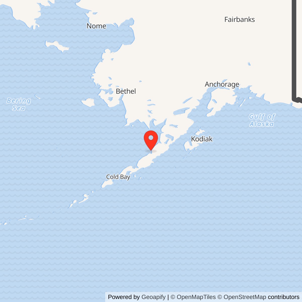
Longitude: -158.655556
Site Number: COB-5
Current Role: No current military operation documented. Former facilities were demolished by 1992; Alaska DEC records active cleanup, groundwater monitoring and land-use controls.
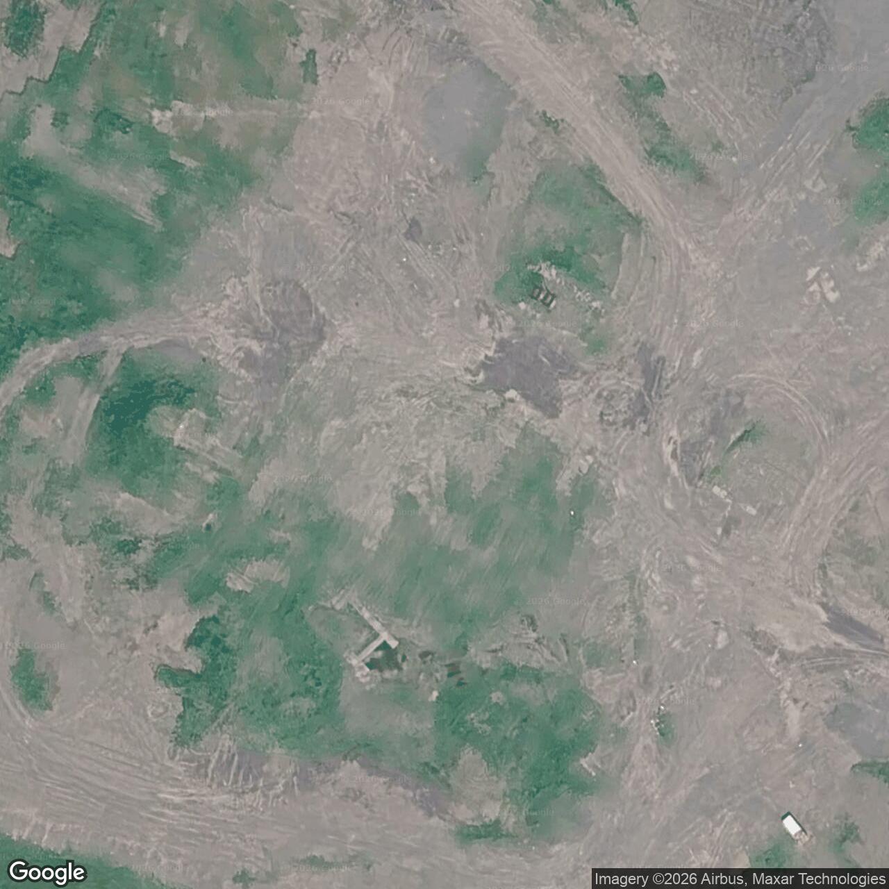
Coordinate label: Alaska DEC WGS84 point for the former OT001 composite-building area, not a surveyed installation center or antenna coordinate. 56.976903 N, 158.655556 W.
- Site code
- COB-5, eastern auxiliary of the Aleutian DEW Line.
- Radar
- AN/FPS-19 search radar, April 1959 to June 1, 1969.
- Communications
- White Alice tropospheric links to King Salmon and Port Moller; relay active until late 1978.
- Historic property
- Approximately 172.04 acres assembled for the former station, not a current parcel survey.
Overview
Port Heiden Air Force Station was the easternmost auxiliary radar station in the Aleutian extension of the Distant Early Warning (DEW) Line. At the same coastal site on the Alaska Peninsula, the Air Force also operated a White Alice Communications System tropospheric-scatter relay. Its two missions had different endings. The AN/FPS-19 radar joined the warning line in April 1959 and was inactivated on June 1, 1969. The communications plant remained useful as Port Heiden Radio Relay Station until late 1978, generally recorded as November of that year. Thus a 1969 radar closure did not mean that the installation was abandoned in 1969. [1] [2] [3] [4]
Port Heiden was designated COB-5. It was an auxiliary of the Cold Bay main DEW station, not an independent direction center. A detachment of the 714th Aircraft Control and Warning Squadron operated the radar under Alaskan Air Command. The companion White Alice route carried information northeast to King Salmon and southwest to Port Moller, connecting the remote warning sites to a wider command-and-communications system. Radar detection and radio transmission depended on one another, but the antennas served very different purposes. [1] [2] [3]
The Air Force built its Cold War installation within the much larger area of the former World War II Fort Morrow and Port Heiden Army Airfield. That predecessor is a distinct Army installation. The postwar Air Force acquired or controlled approximately 172.04 acres for its own station; the figure describes a historical assembly of property interests, not a single verified present-day parcel. Most of the station's buildings and antennas were demolished in 1990-1992. Environmental investigation and land-use management continue, but Port Heiden has no documented present-day military radar or White Alice operation. [2] [4] [5]
Location and Predecessor Landscape
Port Heiden stands on the north side of the Alaska Peninsula near Bristol Bay, with King Salmon up the peninsula and Port Moller farther southwest. The broad, open ground made a radar horizon possible without a mountain summit, but isolation, weather, and lack of a through-road made construction and maintenance demanding. Air transport, seasonal surface delivery, fuel storage, and local generation were indispensable. The existing wartime airfield and former military property gave planners a practical starting point, though the radar-relay plant was a new Cold War undertaking rather than simply a renamed Army airfield. [1] [2] [3] [5]
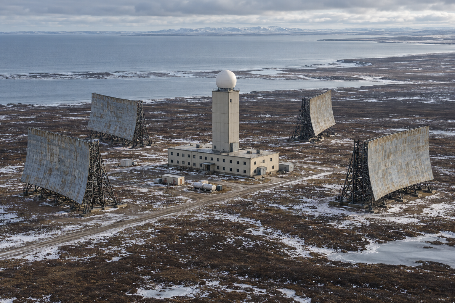
The coordinate 56.976903 N, 158.655556 W is the Alaska Department of Environmental Conservation's WGS84 marker for OT001, the former composite-building area. It is useful for locating a documented component of the station. It is not a surveyed station centroid, antenna position, airfield reference, or legal property boundary. The historical 172.04-acre total likewise should not be used as a current parcel polygon. [4] [5]
During World War II, the Army developed Fort Morrow and its airfield for the defense and support of Alaska. That installation left roads, buildings, and an airfield in the Port Heiden area. The later Air Force site was laid out inside the former military landscape, but its operational identity began with the DEW Line and White Alice construction of the 1950s. Treating the two eras separately makes it possible to explain both the continuity of the location and the change from wartime aviation support to Cold War warning and communications. [2] [4] [5]
Why the Aleutian DEW Extension Was Built
The original DEW Line was designed to give North America early notice of aircraft approaching over the northern polar region. The Aleutian extension carried a similar warning function southwest along Alaska's exposed peninsula and island chain. Cold Bay served as its main station. Nikolski, Driftwood Bay, Cape Sarichef, Port Moller, and Port Heiden were auxiliary stations. The alignment was a network, not six isolated radars: a detection had value only if it could be identified, reported, and passed to command organizations while time remained to respond. [1] [2]
Port Heiden's position at the eastern end of the Cold Bay segment connected the Aleutian warning chain toward mainland Alaska. King Salmon, about 141 miles away on the communications route, was an important support and onward-communications point. Port Moller, roughly 100 miles in the other direction, linked Port Heiden toward Cold Bay and the more distant auxiliary radar sites. These mileages refer to the documented radio paths, not driving distances or surveyed property separations. [1] [3]
Project Stretchout supplied the radar and communications construction for the Aleutian extension. By August 1957 construction was under way at the extension sites. A February 1957 Port Heiden construction contract recorded in Alaska's site files was approximately $3.55 million. The Corps' later inventory rounded the original station cost to $3.5 million. That cost describes the original undertaking, not the total spent over the entire operating life or on subsequent cleanup. [1] [3] [4]
Construction and Station Arrangement
The Port Heiden station was built in 1957-1959 around a reinforced composite building. Housing, technical rooms, utilities, and radar support were concentrated under one principal roof, a practical arrangement for personnel living and working in a remote climate. A taller central radar tower rose above the two-story portion. The AN/FPS-19 antenna was protected by a radome. Four large White Alice billboard reflectors stood outside, with a pair aimed northeast toward King Salmon and a pair southwest toward Port Moller. A fuel installation, water system, pump house, storage, and service structures supported the technical plant. [2] [3] [4]
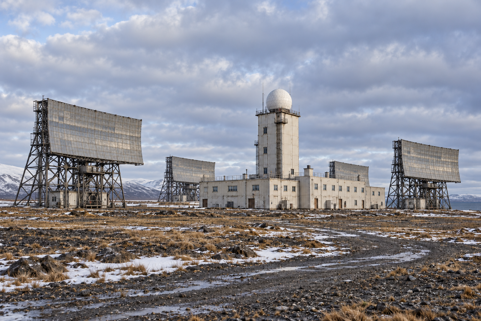
The station was not simply a radar dome with four communication antennas. Generators, heated rooms, fuel, water, communications equipment, maintenance space, and accommodations made continuous watch possible. Even after the radar stopped operating, enough of that plant remained to sustain the relay mission. Historic photographs credited to David Harvey show the large rectangular composite, the radome above its central tower, curved billboard antennas, open ground, and the exposed approach to the station. [2] [3] [6]
Published descriptions disagree on the composite building's floor area. The 1988 Corps inventory gives approximately 15,000 square feet, the 1994 Corps management plan about 28,000 square feet, and an environmental engineering account roughly 30,000 square feet. The difference may reflect measurement conventions, additions, or retrospective estimates. The secure architectural picture is the two-story composite with a prominent five-story central radar tower, not one uncontested square-foot figure. [2] [3] [4]
The large fuel system reflects the logistical weight of a remote continuous-duty station. The 1988 inventory reports tanks with total original capacity of approximately 540,000 gallons, as well as a water-storage component, pump house, and small ammunition-storage structure. [3] [4]
From Testing to an Operational Station
The radar installation and communications routes were ready for evaluation during the winter of 1958-1959. Alaskan Air Command received jurisdiction over the Aleutian extension on January 23, 1959. Between February 10 and March 26, Strategic Air Command aircraft made simulated penetrations for operational testing. The contemporary Air Defense Command history describes 55 B-47 flights, additional low-level Twin Bonanza operations, altitudes from about 1,000 to 45,000 feet for the bomber trials, and a low-level flight near 500 feet. It reports tracking of all test flights and transmission of 94.5 percent of reports. Those are extension-wide test results, not a separate Port Heiden performance score. [1]
The Air Defense Command history dates official operation of the six Aleutian DEW sites to April 1, 1959. Alaska's Port Heiden record also gives May 1, 1959 as the local handover to Alaskan Air Command. These refer to different administrative and operating milestones and need not be forced into one date. Port Heiden's radar-warning service therefore began in April 1959, while local transfer records document another step in May. [1] [4]
Alaskan Air Command staffed the Aleutian extension with military personnel, unlike the civilian operating pattern associated with much of the northern DEW Line. The 714th Aircraft Control and Warning Squadron, headquartered at Cold Bay, supplied detachments for the auxiliary stations, including Port Heiden. The documented mission was to operate the warning radar and pass reports through the command system. Neither the squadron's headquarters at Cold Bay nor the existing support airfield made Port Heiden a separate headquarters or fighter base. [1] [2] [7]
An official Air Force organization directory dated July 31, 1964 identifies Detachment 5 of the 714th at Port Heiden DEW Station, COB-5, while listing the squadron headquarters separately at Cold Bay. This contemporary entry fixes both the detachment number and its parent unit during the radar era. A 1964 Air Force personnel pamphlet described the assignment route: members traveled through Elmendorf and the main station at Cold Bay for specialized DEW Line training before permanent placement at one of the six Aleutian sites. That route explains how an isolated outpost could draw trained operators and maintainers from a common squadron organization. [7] [10]
AN/FPS-19 Radar and the Warning Mission
Port Heiden's principal radar was the Raytheon AN/FPS-19, a long-range search set designed for the DEW Line. The contemporary DEW Line history describes an L-band radar with back-to-back antennas for complementary high- and low-angle coverage, automatic target-alarm features, and a protective radome. The family description gives an approximate 160-nautical-mile range under specified conditions; it is not a guarantee that every aircraft could be seen at that distance from Port Heiden in every weather or flight profile. Terrain, altitude, interference, maintenance, and communications still mattered. [1] [2]
The radar searched the surrounding air approaches and gave operators indications to assess and report. A single return was not by itself an authenticated threat. Personnel had to examine and correlate tracks, distinguish expected traffic from unknown aircraft, maintain equipment, and forward warnings promptly. Port Heiden's place on the eastern end of the Aleutian segment meant that information could be passed toward King Salmon and the mainland warning organization while the other auxiliary sites observed the chain farther southwest. [1] [2] [3]
The Aleutian extension used the AN/FPS-19 rather than the separate AN/FPS-23 gap-filler radars installed at selected northern DEW sites. The Air Defense Command account explicitly distinguishes the Aleutian installation plan. No Port Heiden AN/FPS-23 has been verified. [1]
White Alice at the Same Installation
White Alice carried voice and data across long Alaska distances where ordinary landlines were impractical and high-frequency radio could be unreliable. At Port Heiden, two 60-foot-class billboard antennas served the approximately 141-mile path to King Salmon and two served the approximately 100-mile path to Port Moller. The 1988 Corps inventory describes both routes and identifies Port Heiden as a Project Stretchout tropospheric-scatter station. The curved billboards were passive reflectors associated with the radio links, not aircraft-search radar dishes. [2] [3]
Tropospheric scatter sent microwave energy toward a volume of the lower atmosphere and recovered a very small scattered portion at the distant station. High power, large antennas, precise alignment, reliable receivers, and continuous maintenance made that apparently improbable path useful. Port Heiden was an intermediate relay in a chain: messages from King Salmon could be regenerated or passed on toward Port Moller and, by further links, Cold Bay. The links carried warning-system communications and other authorized traffic; the station did not independently command all the radars to which the wider network connected. [2] [3]
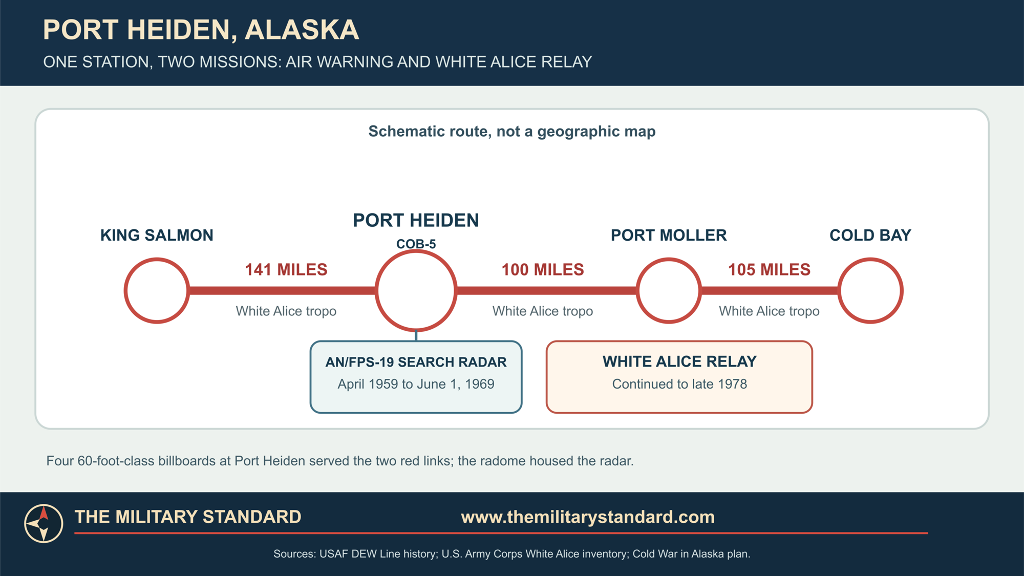
The King Salmon link is especially important to Port Heiden's history. King Salmon was both a logistical anchor for the Aleutian DEW segment and a communications gateway to the rest of Alaska's system. The Port Moller link connected the station back toward Cold Bay and the western stations. In this way Port Heiden joined a military warning network through two kinds of equipment on the same tract: the AN/FPS-19 detected aircraft, while the White Alice plant moved information. The roles should be understood together without confusing their technical functions. [1] [2] [3]
An original Air Force personnel account for the Cold Bay squadron shows how 714th detachments trained and rotated among the scattered sites. It describes the strain of isolated assignments, weather, limited recreation, and the importance of transport and communications. The specific routines at Port Heiden varied by year, but the combination of a staffed radar watch and a communications plant meant continuous technical duty far from major supply centers. [7]
Logistics, People, and Daily Work
The station's people had to keep radar, radio transmitters and receivers, power, heating, water, and fuel in service in a maritime subarctic environment. Airlift connected them to King Salmon and other support points. Weather could interrupt flights; the site therefore needed stored supplies and spare parts. The original composite arrangement shortened outdoor movement between work and living areas. The billboard reflectors and radome still required exterior inspection and maintenance, especially after severe wind or icing. [1] [2] [3] [7]
The former wartime airfield made the location more supportable than an entirely undeveloped peninsula site. It did not remove the distance to larger depots or the need for carefully timed deliveries. Construction materials and heavy equipment had to reach the peninsula, while day-to-day operation depended on replacement electronic parts, fuel, food, and trained technicians. Port Heiden's large historic fuel capacity and integrated utility plant are physical evidence of this logistics burden. [3] [4]
Published primary sources establish the 714th squadron relationship but do not provide a stable, year-by-year Port Heiden personnel roster. A detachment's size could change with operating policy and mission phase. The historical record supports a staffed 1959-1969 radar station and a later operating radio relay; it does not support assigning one fixed head count to both periods. [1] [2] [3] [7]
Technical work at Port Heiden crossed the boundary between electronics and infrastructure. A power or heating failure threatened the radar and radio circuits as surely as a failed transmitter did. The radome protected the rotating search antenna, while the billboard structures had to keep their alignment with distant partners across more than 100 miles of difficult country. Personnel at Cold Bay could coordinate the detachment, but operators at Port Heiden still needed to identify a local fault, keep the station habitable, and restore the affected link or radar watch. The integrated building and high-capacity fuel system were therefore part of the military communications and warning mission, not simply support amenities. [1] [2] [3] [7]
The 1969 Radar Inactivation
The Aleutian DEW radar extension did not remain a permanent part of the 1959 network. The 1994 Corps management plan lists Port Heiden's AN/FPS-19 as active from April 1959 until June 1, 1969. A statewide historical survey also identifies June 1 as the inactivation date for the Aleutian radars. This date concerns the radar mission. It should not be used as the closing date of Port Heiden Radio Relay Station. [2] [8]
After the radar stopped, the site continued to carry White Alice traffic between King Salmon and Port Moller. Alaska DEC describes conversion to a radio relay station in 1969, and the Corps inventory describes Port Heiden's communications role through 1978. The continuing relay required technical maintenance, energy, access, and communications supervision even without aircraft-search operators on watch. The prominent radome and old radar structures could still be visible for a time; their physical survival is not evidence of continued radar operation. [2] [3] [4]
The change also altered Port Heiden's place in the wider defense system. Its remaining value was as an intermediate transmission point rather than as a source of new aircraft tracks. A report from another radar could still traverse the communications network, but Port Heiden no longer originated reports from its AN/FPS-19 after radar inactivation. The later name Port Heiden Radio Relay Station accurately expresses that narrower mission. [2] [3] [4]
Replacement Communications and the End of Service
By the 1970s, White Alice routes faced replacement by commercial microwave, satellites, and reorganized Air Force communications. An Air Force Communications Command study traced the planned disposal of sites and the schedule for replacement links. It recorded a King Salmon satellite terminal operational on April 22, 1978 and placed Port Heiden among sites that closed in the October 1 to December 30, 1978 period. Plans published earlier in that study had projected different closure months. The recorded late-1978 closing window is stronger evidence of the actual transition than any single planning forecast. [2] [9]
The 1994 Corps plan and Alaska DEC's Port Heiden account say the relay was abandoned in November 1978. Together with the Air Force study's October-December actual-closure table, this supports November 1978 as the best available month, not a verified exact day. Some retrospective summaries use 1977 or round the event to 1978; the documented operating and replacement chronology supports late 1978. [2] [4] [9]
Closure ended a nearly twenty-year Cold War operating sequence: about ten years of radar plus communications, followed by roughly nine more years of radio relay. The station did not become a later Alaska Radar System long-range site. Its warning role had ceased in 1969, and its communications role ended as successor networks took traffic off the old billboards. [2] [3] [4] [9]
Property, Demolition, and Present Condition
The postwar Air Force assembled approximately 172.04 acres from several property interests inside the former Fort Morrow landscape. A 1961 federal land action and related acquisitions are part of that historic total. Subsequent transfers, relinquishments, leases, and state and Native corporation interests changed the property picture. The Alaska cleanup case identifies the Air Force, Alaska Department of Transportation, and Alaska Peninsula Corporation among landowners or parties associated with portions of the former station. The historic acreage therefore describes the military operating site. [4] [5]
After deactivation the vacant facility deteriorated. The 1988 Corps inventory reported extensive vandalism. During 1990-1992 the principal radar and communications structures were demolished, and the present site is not an intact architectural example of a combined DEW and White Alice station. Photographs taken during its operating or early post-operating years are consequently important for understanding the original arrangement. In the historic David Harvey views, the central radome and multiple billboards reveal both missions in a way that a current cleared site cannot. [2] [3] [4] [6]
The former station also has an environmental legacy from fuel handling, disposal, and electrical equipment. Alaska DEC identifies the composite and antenna area, a drainage pathway, a former fuel-pipeline area, and a landfill among investigated locations. Recent Air Force and state work has included PCB-contaminated soil removal, groundwater monitoring, and land-use controls. [4] [5]
Historical Significance
Port Heiden illustrates the close engineering and operational relationship between Cold War surveillance and long-distance communications. Its AN/FPS-19 made the site a working part of the Aleutian DEW Line. Its White Alice billboards carried reports and other traffic between King Salmon and Port Moller. When the radar line was inactivated, the radio chain continued, demonstrating that the same station could have a second useful service life after its original warning role ended. [1] [2] [3]
The location also connects two different periods of Alaska military history. World War II Fort Morrow supplied an inherited aviation landscape, while the 1950s Air Force built a specialized radar-and-radio station for the bomber-warning era. [1] [2] [3] [4] [5] [6]
Chronology
- World War II Army develops Fort Morrow and Port Heiden Army Airfield in the area later used for the Air Force station.
- February 1957 Port Heiden radar-and-relay construction contract recorded at approximately $3.55 million.
- By August 1957 Construction is under way on the Aleutian DEW extension.
- January 23, 1959 Alaskan Air Command receives jurisdiction over the extension.
- February 10-March 26, 1959 Aircraft test the Aleutian warning line in simulated penetrations.
- April 1, 1959 Aleutian DEW sites officially become operational; Port Heiden COB-5 enters radar service.
- May 1, 1959 Port Heiden local handover to Alaskan Air Command recorded in Alaska site file.
- June 1, 1969 Port Heiden AN/FPS-19 radar mission is inactivated.
- 1969-1978 White Alice communications continue through Port Heiden Radio Relay Station.
- April 22, 1978 King Salmon satellite terminal becomes operational as part of the replacement communications era.
- November 1978 Port Heiden radio relay is abandoned, within a documented October-December closure window.
- 1988 Corps inventory describes an abandoned, heavily vandalized station.
- 1990-1992 Principal former station structures are demolished.
- 2026 Alaska DEC continues to document cleanup, monitoring, and land-management actions at the former site.
Information sources (10)
- WEB[1] Air Defense Command, A History of the DEW Line, 1946-1964, Historical Study No. 31
Source for: Aleutian extension rationale, construction and test chronology, April 1 1959 operation, AN/FPS-19 technical family, 714th staffing, and absence of AN/FPS-23 on the Aleutian segment.
- PDF[2] U.S. Army Corps of Engineers, The Cold War in Alaska: A Management Plan for Cultural Resources, August 1994
Source for: COB-5 identity, radar April 1959-June 1 1969 service, 714th detachment, built environment, November 1978 relay end, and demolition.
- PDF[3] U.S. Army Corps of Engineers, Historical Overview of the White Alice Communications System, prepared 1988
Source for: Project Stretchout context, King Salmon and Port Moller 60-foot paths and mileages, historic station components, cost, and 1988 condition.
- WEB[4] Alaska Department of Environmental Conservation, Port Heiden Radio Relay Station, site report 185
Source for: contract and handover dates, historical land assembly, relay period, 1978 abandonment, demolition, environmental areas, ownership interests, and WGS84 OT001 reference.
- WEB[5] Alaska Department of Environmental Conservation, Port Heiden Radio Relay Station site summary
Source for: relationship to Fort Morrow, overall site history, present cleanup status, and environmental overview.
- WEB[6] David Harvey, Port Heiden COB-5 historical photograph gallery, hosted by DEW Line Adventures
Source for: historic exterior appearance of composite, radome tower, billboard antennas, and landscape. Images are research references only pending reuse permission.
- WEB[7] U.S. Air Force, Cold Bay Air Force Station personnel brochure, reproduced by the Online Air Defense Radar Museum
Source for: 714th Aircraft Control and Warning Squadron detachment context, personnel travel, training, and remote-service conditions.
- PDF[8] Alaska Office of History and Archaeology, The Coldest Front: Cold War Military Properties in Alaska
Source for: statewide context and June 1 1969 inactivation of the Aleutian DEW radars while communications continued.
- PDF[9] U.S. Air Force Communications Command, Special Study of White Alice Communications System Sale, October 1983
Source for: replacement communications planning, April 22 1978 King Salmon satellite milestone, and actual fourth-quarter 1978 Port Heiden closure window.
- PDF[10] U.S. Air Force, Directory of USAF Organizations, July 31, 1964, Air Force Historical Research Agency copy
Source for: Detachment 5 of the 714th Aircraft Control and Warning Squadron at Port Heiden DEW Station COB-5 and the separate Cold Bay squadron headquarters.