
Port Moller Air Force Station / Port Moller Radio Relay Station, Alaska
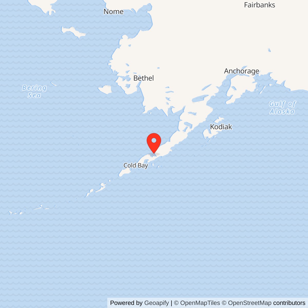
Longitude: -160.500913
Site Number: COB-4
Current Role: Former radar and communications plant; no current military operation established by the cited records. Post-cleanup ownership, reuse, surviving structures and parcel condition require current land-record and field verification.
Approximate location: 55.978056 N, 160.495833 W (EPA federal-facility registry point; not a surveyed antenna location or property boundary).
- Site code
- COB-4, auxiliary of the Cold Bay DEW Line main station.
- Radar
- AN/FPS-19 search radar; April 1959 to June 1, 1969.
- Communications
- White Alice links to Cold Bay and Port Heiden; relay continued to November 1978.
- Historic property
- Approximately 370.73 acres, not a current surveyed parcel.
Overview
Port Moller Air Force Station was both an early-warning radar outpost and a White Alice Communications System relay on the Alaska Peninsula. As COB-4, it was one of five auxiliary stations in the Aleutian extension of the Distant Early Warning (DEW) Line, with AN/FPS-19 search radar began service in April 1959 and the radar mission ended on June 1, 1969. The White Alice radio link remained in use for nearly another decade, until November 1978. The two functions shared one installation but had different operating lives. [1] [2] [3]
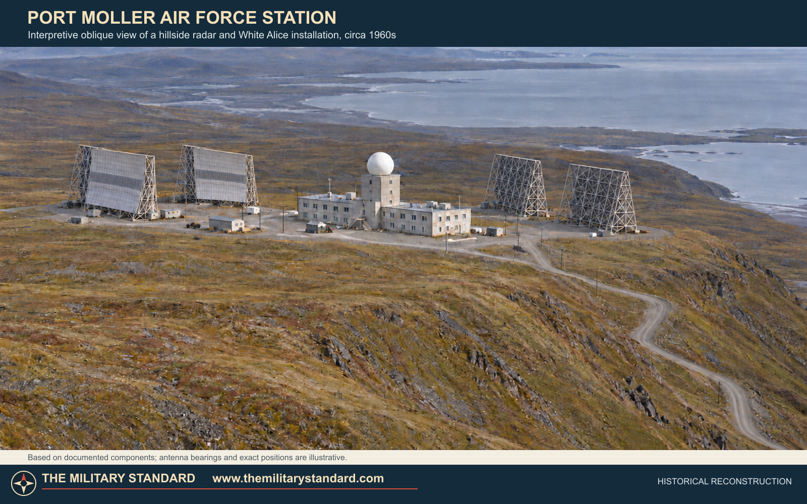
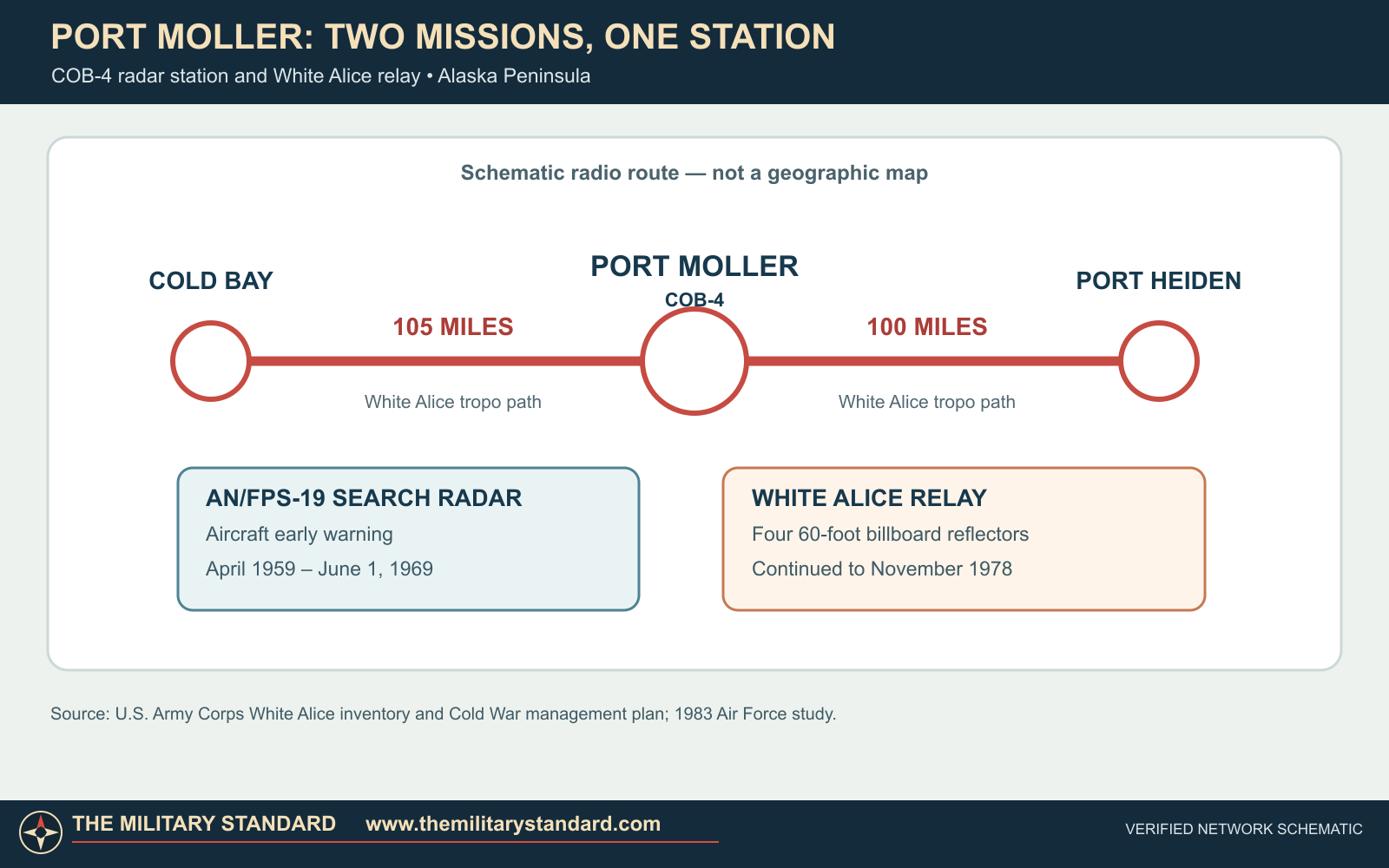
The relay joined Cold Bay, about 105 miles to the west, to Port Heiden, about 100 miles to the east. Four 60-foot billboard antennas provided the two tropospheric-scatter paths. At the same time, the radome above the station's composite building housed the rotating search radar that watched the Aleutian approaches. Port Moller was an auxiliary detection point, not the command center for the line; the radar and communications functions together allowed warning reports to move through the network. [1] [2] [3]
Location and the Aleutian Warning Chain
The former station stood near Port Moller Bay on the Bristol Bay side of the Alaska Peninsula. The radar and relay plant occupied a hillside about 1,050 feet above sea level, while its fuel-storage and supply facilities were nearer the water. A gravel airstrip lay roughly four miles northwest of the station. These separated components mattered at a location reached by air or water rather than by a highway from the rest of Alaska. [2] [7] [8]
An EPA federal-facility listing places Port Moller Air Force Station at approximately 55.978056 N, 160.495833 W. This is a registry location for the former installation, not a surveyed antenna position, legal property centroid, or boundary. The Corps recorded a historical 370.73-acre radio-relay site; that figure likewise describes the former defense property, not a current parcel. [7] [9]
The original DEW Line was meant to give North America warning of hostile aircraft coming over northern approaches. In January 1957, the Joint Chiefs of Staff approved an Aleutian extension to cover a vulnerable southwestern approach. The extension ran through Cold Bay and auxiliary sites at Nikolski, Driftwood Bay, Cape Sarichef, Port Moller, and Port Heiden. Port Moller's place between Cold Bay and Port Heiden made it both a radar point and a necessary communications hop along the peninsula. King Salmon farther east supported the chain. [1] [2]
Project Stretchout Construction
Project Stretchout built the Aleutian stations and their White Alice communications connections. Crews were working at all six sites by August 1957. The Corps awarded S. S. Mullen Company a Port Moller construction contract of approximately $4.01 million. The resulting station was a substantial complex in an exceptionally remote location, not merely a radar tower placed beside an existing village. [1] [10]
Port Moller used the standardized arrangement of the Aleutian extension. Its main poured-concrete composite building brought accommodations, technical spaces, power, administration, and other support functions under one roof, with a central radar tower rising above it. The AN/FPS-19 operated beneath a radome atop that tower. Two pairs of huge White Alice reflectors stood outside: one pair served the Cold Bay route, the other Port Heiden. The Corps also listed a concrete storage bunker, water pumphouse, fuel system, and the more distant gravel airstrip. Fuel was brought from a shoreline storage-and-supply area up to the station plateau. [2] [3] [7] [8]
The radar dome and billboard antennas were not interchangeable equipment. The AN/FPS-19 scanned for aircraft; its antenna rotated inside weather protection. The billboard reflectors directed microwave energy toward distant receivers and transmitters, allowing a communications path beyond ordinary line of sight by scattering energy in the lower atmosphere. Port Moller's four antennas therefore formed two fixed radio links rather than four separate radars. The station depended just as much on generators, fuel, heating, maintenance, water, and personnel quarters as on the conspicuous antennas. [1] [2] [3]
Testing and Air Force Operations
Alaskan Air Command received jurisdiction over the six Aleutian stations on January 23, 1959. From February 10 to March 26, Strategic Air Command B-47 bombers and a chartered Twin Bonanza flew simulated penetrations to test the new radar line and its USAF operators. An Air Defense Command history says all test aircraft were detected and tracked, with 94.5 percent of reports transmitted successfully. That figure describes the whole Aleutian extension test, not a Port Moller-only score. The same history dates official operation of the extension to April 1, 1959; a separate Alaska record gives May 1 as the handover of the completed sites to Alaskan Air Command. [1] [10]
Cold Bay housed the 714th Aircraft Control and Warning Squadron. A declassified 1964 Air Force organizational directory identifies Detachment 4 of that squadron at Port Moller DEW Station, COB-4. The men stationed there maintained and operated the auxiliary radar in a remote environment where poor weather or an interrupted supply line could affect both detection and communications. The radar fed the broader Alaskan air-defense system; Port Moller itself was not a fighter base or an independent direction center. [1] [4]
The AN/FPS-19 served as COB-4's search radar throughout the April 1959-June 1969 warning mission. Its rotating antenna was distinct from the station's fixed White Alice reflectors, which carried communications rather than detecting aircraft. [2] [11]
White Alice Link to Cold Bay and Port Heiden
The White Alice system carried radar reports, command traffic, and other communications across a country where cable routes were costly and conventional radio horizons were short. Port Moller's two tropospheric-scatter paths were about 105 miles to Cold Bay and 100 miles to Port Heiden. The relay helped connect the Aleutian radar chain toward King Salmon and the mainland communications system. [1] [3]
Port Moller and Port Heiden used nearly identical four-billboard and composite-building arrangements. Port Moller nevertheless had its own hillside terrain, shoreline fuel facilities, and operating history. The design consolidated radar surveillance and long-distance communications into a small, isolated station. [2] [3] [8]
After the radar inactivation of June 1, 1969, the station continued as Port Moller Radio Relay Station. The radio-only period is essential to the site's history: a 1969 date describes the end of its DEW radar mission, not the end of all operations. The Air Force's 1983 review of the White Alice transition shows how satellite terminals and new commercial circuits were expected to replace the older route. In its planning tables, a projected August 1978 closure appears; its later actual-closure table places Port Moller among sites shut down in the final quarter of 1978. The Corps' station account and a 1987 engineering history narrow that end to November 1978. [2] [5] [7]
Abandonment, Demolition, and Legacy
The station was left with a great deal of equipment and building fabric. GAO inspectors visiting closed White Alice sites in 1980 found Port Moller badly vandalized and weather-damaged. They described broken windows, open doors, peeling interior finishes, and standing water; a former chief mechanic told them the facility had been in good condition when it closed. GAO recorded a major loss of tools, furnishings, and reusable equipment, illustrating how quickly an isolated station could deteriorate after its operating crew departed. [6]
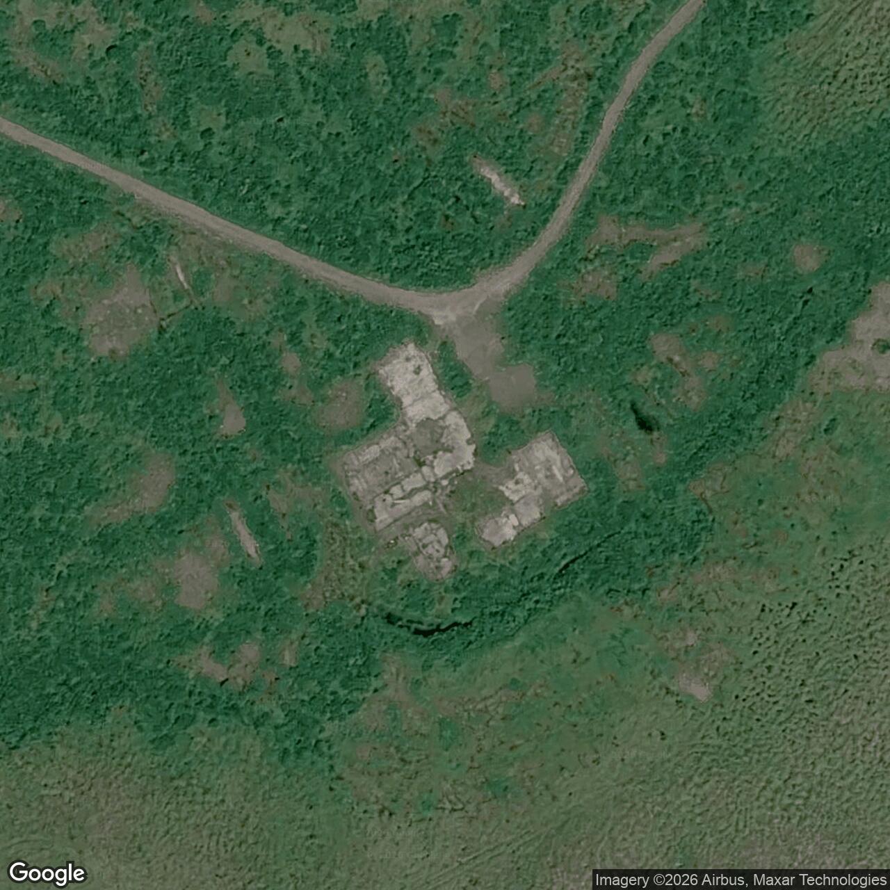
The Corps' 1994 Cold War management plan still described the composite building as abandoned, extensively damaged, and scheduled for demolition. An EPA-published Army Corps case study records demolition of the station buildings, removal of fuel tanks, and creation of an on-site debris landfill during 1994 remediation. Soil treatment followed in 1995. These activities removed the main visible radar-and-relay complex. [2] [8]
The station's military significance lies in its two successive roles. For ten years, its AN/FPS-19 contributed to aircraft warning on the southwestern edge of the DEW Line. For nearly another ten, its White Alice equipment kept the Cold Bay-Port Heiden link operating even after the radar had gone silent. The original buildings are gone, but Port Moller remains an instructive example of how air defense depended on both sensors and communications, and on the difficult logistics of supporting people and machinery at a remote Alaska Peninsula outpost. [1] [2] [3] [8]
Historical Images and Graphics
The University of Alaska Anchorage's Leland Olson collection includes a construction photograph of a building at Port Moller. A federal GAO report contains two 1980 interior photographs of a bedroom and standing water in the gymnasium, showing the deterioration that followed closure. Together they record both the creation of the station and its post-service condition. [6] [12]
The accompanying route schematic shows the station's two White Alice links and distinguishes the radar's 1969 shutdown from the relay's continued operation. The interpretive rendering gives a period view of the documented hillside station, central radar tower and radome, and four billboard antennas. It is a reconstruction, not a historical photograph or surveyed site plan. [2] [3] [7]
Chronology
- January 1957 Joint Chiefs approve the Aleutian DEW Line extension.
- 1957 Project Stretchout construction advances at Port Moller and the other extension stations.
- January 23, 1959 Alaskan Air Command takes jurisdiction of the six Aleutian sites.
- February 10-March 26, 1959 Aircraft test the Aleutian extension's AN/FPS-19 warning system.
- April 1, 1959 The Aleutian extension begins official operation.
- May 1, 1959 Completed sites are handed over to Alaskan Air Command in the local project account.
- June 1, 1969 Port Moller's AN/FPS-19 radar mission ends; White Alice relay continues.
- November 1978 Port Moller Radio Relay Station is abandoned after satellite-era communications replacement.
- 1980 GAO inspection documents severe vandalism and water damage.
- 1994 Corps remediation removes the main station buildings and fuel tanks.
- June-August 1995 Thermal desorption treats contaminated soil at the former station.
Information sources (12)
- WEB[1] A History of the DEW Line, 1946-1964, Air Defense Command Historical Study No. 31
Source for: Aleutian extension, site sequence, distances, test flights, official operation, Alaskan Air Command and 714th Squadron roles.
- PDF[2] The Cold War in Alaska: A Management Plan for Cultural Resources, U.S. Army Corps of Engineers, 1994
Source for: COB-4 equipment and dates, physical layout, radar and relay distinction, airstrip, 1994 condition and preservation assessment.
- PDF[3] Historical Overview and Inventory: White Alice Communications System, U.S. Army Corps of Engineers, 1988
Source for: four 60-foot antennas, Cold Bay and Port Heiden link distances, comparison with Port Heiden, historic cost and post-closure state.
- PDF[4] Directory of USAF Organizations, July 31, 1964, Air Force Historical Research Agency
Source for: Detachment 4 of the 714th Aircraft Control and Warning Squadron at Port Moller DEW Station, COB-4.
- PDF[5] Special Study of the White Alice Communications System Sale, Air Force Communications Command, 1983
Source for: 1978 satellite replacement plan, projected versus actual closure timing and late-1978 shutdown.
- PDF[6] Delays in Disposing of Former Communication Sites in Alaska: Millions in Property Lost and Public Safety Jeopardized, U.S. GAO, 1981
Source for: Port Moller 1980 inspection, facility size/cost account, deterioration, and original federal interior photographs.
- PDF[7] Engineering Report: DERP Sampling Results and Cleanup Design for Port Heiden and Port Moller, U.S. Army Corps of Engineers, 1987
Source for: former 370.73 acres, mission succession and November 1978 abandonment; fuel and station geography.
- WEB[8] Thermal Desorption at the Port Moller Radio Relay Station, U.S. Army Corps of Engineers and Federal Remediation Technologies Roundtable, 1998
Source for: 1,000-foot plateau, shoreline fuel facilities, 1994 demolition, 1995 soil treatment and post-closure physical change.
- WEB[9] Federal Agency Hazardous Waste Compliance Docket, U.S. Environmental Protection Agency
Source for: approximate federal registry coordinate and Port Moller Air Force Station name; point is not a surveyed station or parcel boundary.
- WEB[10] Port Heiden Air Force Station Site Report, Alaska Department of Environmental Conservation
Source for: period project contract account identifying the separate $4.01-million Port Moller award and May 1959 program handover.
- PDF[11] Historical Data of the Aerospace Defense Command, 1946-1973
Source for: AN/FPS-19 at COB-4 from April 1959 to June 1, 1969.
- WEB[12] White Alice, University of Alaska Anchorage/APU Consortium Library Archives, Leland Olson collection note
Source for: identified archival construction photograph of Port Moller; image reuse requires archive rights review.