
Shafter Lashup Radar Site / Minter Field Radar Site, Shafter California
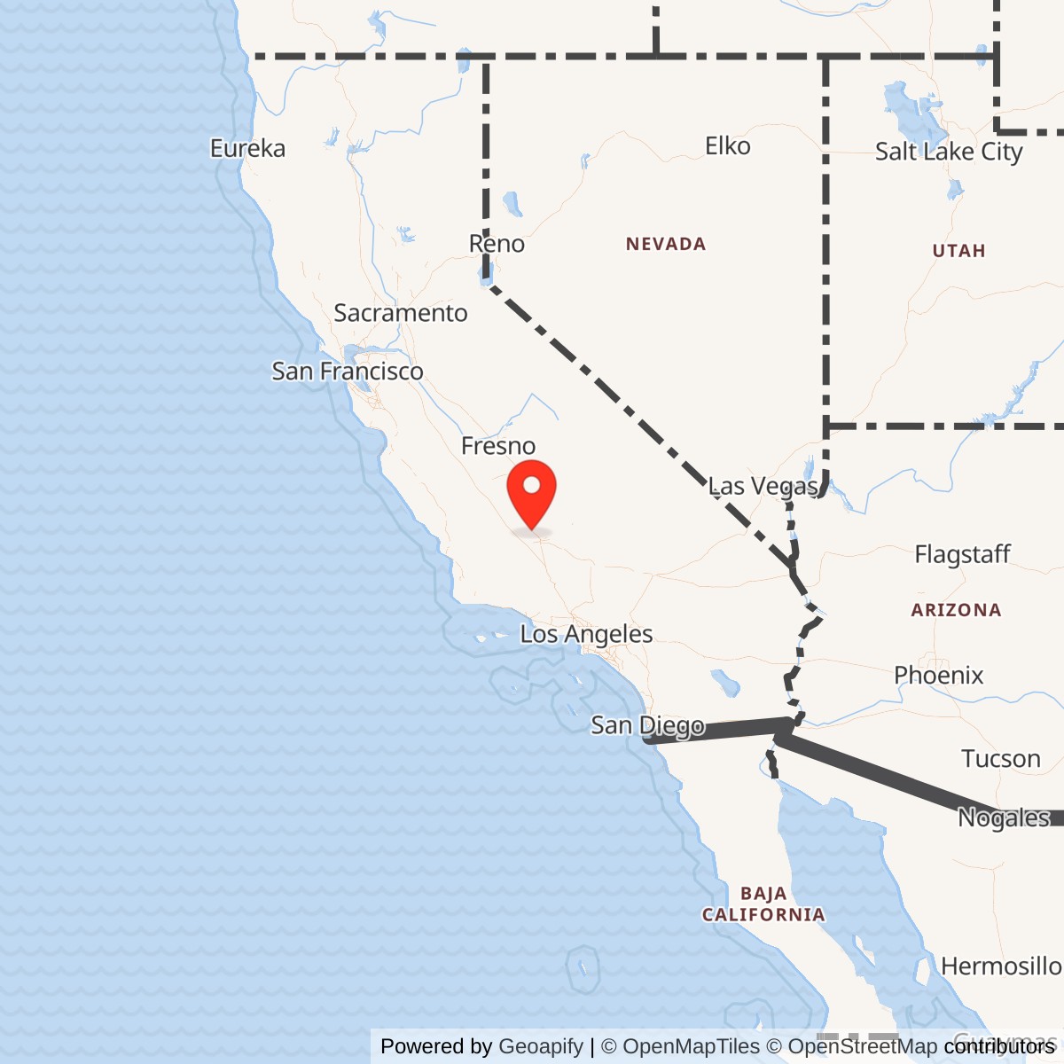
Longitude: -119.192131
Site Number: L-39
Official Base Website: Former Minter Field Lashup Radar Site L-39
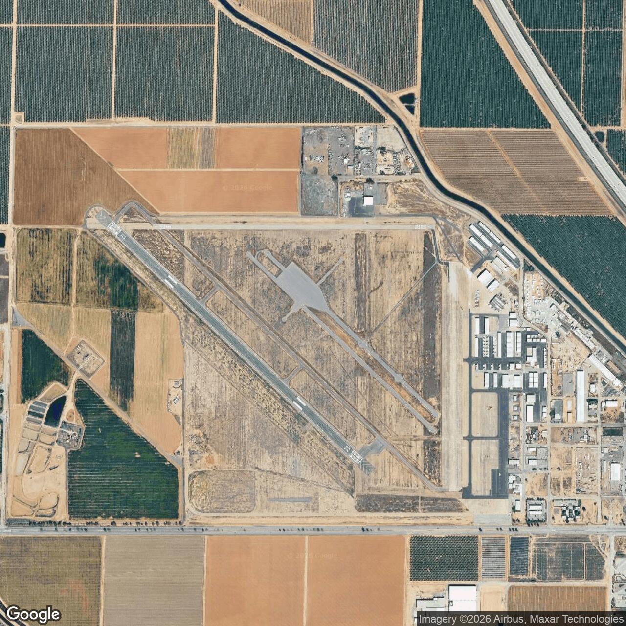
Current Role: Exact L-39 radar footprint is unidentified within the active Shafter-Minter Field Airport landscape. The broader property remains a public general aviation airport and aviation-industrial district operated by the Minter Field Airport District.
Installation Identity
The Shafter Lashup Radar Site was a short-lived United States Air Force Air Defense Command radar installation established at Minter Field during the first months of the Korean War. Contemporary and later Air Defense Command historical compilations identify the installation by the location name Minter Field and the Lashup site code L-39. The combined name "Shafter Lashup Radar Site / Minter Field Radar Site" is useful for distinguishing it within the modern Shafter area, but the most direct historical Air Force identification is Minter Field, L-39. It was not an Air Force station in the later permanent-base sense, and it did not become the proposed Shafter Air Force Station that was planned under the separate designation SM-161.
L-39 existed for only about twenty-one months, from September 1950 through June 1952, but its short life places it at a significant transition point in continental air defense. The installation belonged to the temporary Lashup radar network, a system assembled with available World War II-era and early postwar equipment while the Air Force struggled to build a more durable national radar barrier. Lashup stations were expedient by design. Their job was to place radar coverage into strategically useful locations quickly, provide warning and control experience, and bridge the interval before permanent Aircraft Control and Warning stations could assume the mission.
Minter Field was a logical place for an expedient radar site because the Air Force could place equipment on an already developed aviation property in the southern San Joaquin Valley without first creating an isolated mountain station from scratch. The former Army flying school had runways, roads, utilities, buildings, communications connections, and a long military aviation history. It also sat in a broad inland valley through which aircraft could approach Southern California and the interior from several directions. The Air Force therefore gained an operational radar location quickly, even though the site was not intended to be the final answer for regional warning coverage.
The physical identity of L-39 must be kept separate from three other Cold War projects at Minter Field. The Air Force later planned a manned long-range Aircraft Control and Warning station called Shafter Air Force Station, SM-161, but never built it. It later activated the unmanned Shafter Gap Filler Annex P-59A, later Z-59A, on the former airfield property, and it also established the separate Shafter Ground-to-Air Transmit and Receive site R-10. Those later sites had different missions, equipment, operating periods, property footprints, and organizational relationships. They should not be merged with L-39 merely because all occupied the same broader Minter Field landscape.
Strategic Context and the Lashup Network
The Lashup network emerged from the weakness of American continental air defense immediately after World War II. Demobilization had reduced wartime radar organizations and left the newly independent Air Force with inadequate warning coverage at the same moment that relations with the Soviet Union were deteriorating. The Berlin blockade, Soviet development of long-range bombers, atomic weapons concerns, and uncertainty over how quickly a hostile air attack could reach the United States pushed Air Defense Command toward a temporary solution. Rather than wait for an ideal national system, the command brought stored radar equipment back into service and installed it at locations that could be made operational quickly and cheaply.
Air Defense Command historical studies describe Lashup as a proving ground as much as a combat-ready warning system. The temporary network exposed shortages of trained personnel, spare parts, reliable search coverage, communications capacity, and especially height-finding capability. Some stations operated only part of each day, and the performance of available radar sets varied widely. Yet Lashup gave operators, controllers, commanders, communications personnel, and interceptor units a real network in which to practice the procedures that later permanent stations would refine. It also gave the country a limited warning capability while the permanent radar program was still under construction.
The Korean War transformed the importance of that temporary arrangement. North Korea invaded South Korea in June 1950, and American leaders suddenly faced a major war while also fearing that the conflict could widen into a direct confrontation with the Soviet Union. The Air Force accelerated permanent radar construction in July 1950, but those sites could not appear instantly. L-39 entered operation at Minter Field in September, precisely when the national air-defense system was being strengthened under wartime pressure. Its activation was therefore part of a broader Korean War mobilization even though the radar itself never deployed overseas.
Southern California presented a particularly demanding defense problem. The region contained major aircraft factories, military bases, ports, oil facilities, population centers, and defense industries, while the Pacific coast and inland approaches created a wide area to watch. The 27th Air Division assumed responsibility for the air defense of southern California in September 1950. L-39 operated inside that regional defense area as the division and Air Defense Command expanded radar coverage and interceptor control. The record located does not identify a named squadron permanently assigned to L-39, so the site should be described as part of the regional Air Defense Command system rather than assigned speculatively to a unit whose presence is not documented.
Minter Field Before L-39
Minter Field itself had already undergone several military identities before the Air Force installed L-39. The Army developed the field during World War II as a major basic flying school near Shafter, with a large cantonment, multiple runways, maintenance and training facilities, and a network of auxiliary fields. Thousands of aviation cadets and support personnel passed through the installation. When wartime training requirements declined, the Army reduced activity and eventually returned the field to Kern County, leaving behind a developed airfield that remained useful for aviation.
Local Minter Field history also documents a radar-training phase beginning in 1945 and extending into 1946. That earlier activity belonged to the Army Air Forces training mission and must not be confused with the later Air Defense Command Lashup station. The fact that both histories involve radar is one reason the L-39 story can become blurred in local summaries. L-39 was a postwar continental air-defense installation activated in 1950, not merely a continuation of the wartime radar instruction program.
By the time L-39 began operating, the larger airfield landscape was transitioning into civilian and mixed aviation use. The Minter Field Airport District's institutional history states that the Army controlled the field through 1949 and Kern County then managed it until creation of the independent airport district in 1985. The temporary radar mission therefore reused a former Army aviation property rather than creating an entirely new base. That relationship also helps explain why no defensible stand-alone L-39 acreage has been found. The radar used part of a much larger airport property, and assigning the acreage of Minter Field to L-39 would falsely imply that the Air Force radar site controlled the entire airfield.
Activation and Mission
Air Defense Command historical data place L-39 in operation at Minter Field in September 1950. The mission was temporary aircraft detection and warning within the Lashup network while the permanent system was being constructed. At a broad operational level, radar stations in the Lashup system supported the identification and tracking of aircraft and supplied information that could be used for warning and ground-controlled interception. The purpose was to discover potentially hostile aircraft early enough for command centers and fighter units to react.
The historical sources consistently identify an AN/CPS-4 as the documented radar at Minter Field. That point deserves care because the AN/CPS-4 was principally a height-finding radar, not the standard long-range search set usually expected as the centerpiece of an independent warning station. Air Defense Command histories emphasize that the AN/CPS-4 was one of the few adequate height finders available to the Lashup system. It was designed to provide altitude information that made ground-controlled interception practical when paired with suitable search coverage. The surviving Minter Field roster, however, lists only the AN/CPS-4, so no second search radar should be invented merely because one would normally be expected in a complete GCI installation.
This equipment ambiguity illustrates the limitations of the surviving public record. It is possible that Minter Field's L-39 operation depended on search information from another source, had additional equipment not preserved in the roster, or used the AN/CPS-4 in a more limited warning role. The evidence located here does not resolve which explanation is correct. A Gold-plus history should therefore preserve the documented fact, AN/CPS-4 at L-39, while clearly separating that fact from assumptions about equipment that the source base does not establish.
The AN/CPS-4 was a substantial radar in its own right. Developed from work associated with the Massachusetts Institute of Technology Radiation Laboratory, the set operated in the S-band and used a distinctive vertical antenna that earned the nickname "Beaver Tail." Air Force historical documentation describes a six-person operating requirement and a nominal detection range of about ninety miles. In the early 1950s the set was commonly paired with search radars such as the AN/FPS-3, and its principal value was furnishing target altitude information needed by controllers directing interceptor aircraft.
Operational Practice and Limitations
L-39's day-to-day work is not preserved in the same detail as the operations of later permanent radar squadrons. No surviving public unit history located provides shift rosters, operator names, a site commander, daily readiness statistics, intercept logs, maintenance reports, or a station newspaper. That absence should not be filled with generic descriptions presented as site-specific facts. What can be said is that the radar had to be operated, maintained, calibrated, supplied with electrical power, connected to communications links, and integrated into the regional warning system for the site to perform its documented mission.
The temporary character of Lashup helps explain why the record is thin. Air Defense Command intentionally used existing property and available equipment to avoid the time and expense associated with permanent installations. The command itself later judged the Lashup system more valuable as a training and developmental experience than as a fully adequate national shield. Stations faced personnel shortages, spare-parts problems, inconsistent equipment performance, and weaknesses in height finding and communications. L-39 should be understood within that imperfect system rather than retroactively given the capabilities of the later Semi-Automatic Ground Environment era.
Minter Field's location also imposed technical realities. The airport sits on the low, flat floor of the southern San Joaquin Valley rather than on a high mountain crest. A ground radar at that elevation would have been constrained by the radar horizon, terrain, local obstructions, and low-altitude masking in ways that a mountaintop station could reduce. The later permanent solution for this part of the network was Mount Laguna Air Force Station, positioned on much higher terrain in San Diego County. The shift from the valley floor to a mountain station illustrates the Air Force's movement from expedient coverage toward strategically selected permanent radar sites.
Command, Personnel, and Assigned Units
No independently assigned L-39 squadron has been established from the sources located. Air Defense Command's 1973 historical data roster lists Minter Field, site L-39, but leaves the squadron field blank. Radomes reproduces the same basic pattern and likewise does not assign a unit to the temporary Minter Field station. That omission is important evidence. It means the history should not attach the 750th, 751st, 863d, or another Aircraft Control and Warning Squadron to L-39 without direct documentation.
The 27th Air Division provides the best supported higher-command context. Air Force lineage material states that the division assumed responsibility for the air defense of southern California in September 1950, the same month L-39 became operational. The division administered and trained subordinate air-defense organizations and directed the regional system of radar and fighter-interceptor units. L-39 therefore operated within the southern California air-defense structure that the 27th supervised, even though the exact local detachment or squadron chain for the temporary radar has not been identified.
The 751st Aircraft Control and Warning Squadron belongs in the history as the organization that operated the permanent replacement site, not as the proven L-39 garrison. Mount Laguna operations began in spring 1952, and Air Force lineage material places the 751st at the permanent station. Within two months Mount Laguna assumed the area coverage previously associated with the Minter Field Lashup site. The transition makes the 751st directly relevant to L-39's closure while preserving the distinction between the temporary site and its permanent successor.
The later proposed 863d Aircraft Control and Warning Squadron requires the same discipline. Air Defense Command's permanent-site listings associate squadron number 863 with planned Shafter station SM-161, but the squadron and station were never activated there. That planned organization was part of a later proposal for a manned long-range site, not evidence of an assigned L-39 unit. Keeping that distinction explicit prevents a common historical error in which planned permanent-site data are projected backward onto an earlier temporary station.
Korean War and Continental Defense Role
L-39's most direct conflict connection is the Korean War mobilization. The radar did not fight in Korea, but it became operational in the United States during the rapid strengthening of continental air defense that followed the outbreak of war. American commanders had to consider the possibility that the Korean conflict could widen, that Soviet aircraft might exploit weaknesses in domestic warning coverage, or that an attack could coincide with forces committed overseas. Temporary radar sites such as Minter Field were part of the effort to reduce that vulnerability while permanent stations came online.
The site therefore contributed to a defensive mission whose success was measured partly by events that did not occur. No hostile bomber attack reached southern California during L-39's operating period, and no documented combat engagement has been located for the station. Its value was readiness, surveillance, training, and the ability to pass warning information during a period of strategic uncertainty. That kind of service can be less visible than an overseas campaign, but it was part of the same national mobilization that sent American air and ground forces to Korea.
Replacement by Mount Laguna
The end of L-39 was planned obsolescence rather than failure of the air-defense mission. Air Defense Command was simultaneously building a permanent network with better-sited stations, more durable facilities, improved communications, dedicated squadrons, and equipment intended for sustained operations. Mount Laguna Air Force Station, designated P-76, became one of those permanent sites. Operations there began in spring 1952, and by June the new station had assumed the coverage associated with Minter Field.
Mount Laguna initially used an AN/FPS-3 search radar and an AN/CPS-4 height finder, a pairing that shows how the same basic height-finding technology used at Minter could become part of a more complete permanent GCI station. The 751st Aircraft Control and Warning Squadron operated the site and supplied the permanent personnel structure absent from the surviving L-39 record. The mountain location also gave radar coverage advantages unavailable on the valley floor. Once that permanent capability was operational, maintaining the temporary Minter Field Lashup site no longer made sense.
L-39 therefore closed in June 1952 after less than two years of service. The closure did not mean the Air Force had lost interest in Minter Field as a radar and communications location. Instead, the service reconsidered how the property might fit into the next generation of the air-defense network. That process produced a proposed full station, a canceled squadron, a later gap-filler radar, and a separate communications site. The succession makes Minter Field an unusually instructive example of how one property could be evaluated repeatedly as air-defense technology changed.
Planned Shafter Air Force Station SM-161
After the Lashup period, Air Defense Command planned a permanent manned station at the Minter Field location under the designation SM-161, commonly identified as Shafter Air Force Station. Historical site tables associate the proposed location with the 863d Aircraft Control and Warning Squadron. Neither the planned station nor that squadron became operational at Shafter. The Air Force ultimately canceled the full long-range station rather than turning L-39 into a permanent base.
That unbuilt project is important because it marks a fork in the site's history. Had SM-161 been constructed, the Shafter area might have received a staffed Air Force station with barracks, administrative buildings, operations facilities, radar towers, utilities, roads, security infrastructure, and a much more visible military footprint. Instead, the Air Force satisfied later requirements through a different network design. Boron Air Force Station became the parent long-range radar site, while Minter Field later hosted subordinate gap-filler and radio functions.
The cancellation also explains why the name "Shafter Air Force Station" should not be applied casually to L-39. The Lashup radar was real and operational in 1950-1952. SM-161 was a later planned installation that never entered service. They occupied the same general location in planning terms but represented different generations of air-defense doctrine and different property concepts.
Later Shafter Gap-Filler and GATR Sites
The Air Force returned to the Minter Field landscape with the Shafter Gap Filler Annex P-59A, later Z-59A. That unmanned site used an AN/FPS-18 radar to detect low-flying aircraft that might pass below the coverage of the parent long-range radar system. It supported Boron Air Force Station and the 750th Aircraft Control and Warning or Radar Squadron rather than reviving the old L-39 organization. Its documented compound and equipment building belonged to a later technical generation and a different operating period.
A separate Ground-to-Air Transmit and Receive site, R-10, was also built at Minter Field. GATR facilities handled radio communications between ground controllers and interceptor aircraft, a function different from radar detection. Later photographs place R-10 on the west side of Minter Field and document its surviving building. The fact that R-10 has a known physical location does not solve the L-39 location problem. Radomes' satellite inventory explicitly states that the exact L-39 radar site is not known.
These distinctions matter because later structures are tempting physical stand-ins for a vanished temporary installation. A surviving GATR building or gap-filler equipment building may look like evidence of the 1950 Lashup station, but the chronology disproves that identification. L-39 ended in 1952, while the later systems belonged to subsequent air-defense programs. The safest current interpretation is that the exact Lashup footprint is unresolved somewhere within the broader Minter Field aviation landscape.
Physical Layout and Site Location
No reliable site plan for L-39 was located. The sources do not establish the precise antenna pad, operations shelter, generator location, barracks, communications hut, fencing, access road, or support-building arrangement. Because Lashup installations were deliberately expedient and often used existing properties, it is plausible that L-39 depended heavily on Minter Field infrastructure rather than creating a self-contained station. That remains an inference and is not treated as a documented layout fact.
Modern aviation sources describe Shafter-Minter Field as an airport of roughly 1,200 acres, and the Minter Field Airport District separately reports ownership of 1,172 acres. The World War II Army installation had its own larger documented acreage history. None of those totals establishes the size of the temporary L-39 Air Force use area.
Closure, Reuse, and Current Status
When L-39 shut down in June 1952, the Air Force did not leave behind a conventional closed base with a separately traceable disposal history. The radar had occupied part of a larger aviation property whose civilian life continued. The present Shafter-Minter Field Airport is an active public general aviation airport managed by the Minter Field Airport District. Runways, hangars, businesses, government tenants, industrial activity, and aviation organizations now occupy the broader field.
The Minter Field Airport District was created in 1985 and today manages the airport and an associated industrial center. Its public history emphasizes the field's World War II training heritage and the survival of some former military buildings, but it does not identify a preserved L-39 radar compound.
Chronology
- 1941 Minter Field entered Army flying-training service near Shafter as a major World War II aviation installation.
- 1945 Minter Field local history records a separate Army Air Forces radar-training phase beginning during the final year of World War II; this was not Lashup Site L-39.
- 1946 The earlier wartime radar-training activity at Minter Field ended during postwar demobilization.
- 1948 The Air Force began expanding a temporary continental radar warning system that became known as Lashup.
- 1949 The Army completed its postwar transfer of Minter Field back to Kern County according to the airport district's institutional history.
- 1950-06-25 The Korean War began, sharply increasing the urgency of American continental air-defense preparations.
- 1950-07 The Air Force accelerated construction of the permanent radar network in response to the Korean War emergency.
- 1950-09 Air Defense Command records place Minter Field Lashup Site L-39 in operation with an AN/CPS-4 radar.
- 1950-09 The 27th Air Division assumed responsibility for the air defense of southern California, placing L-39 within its regional defense area.
- 1951 L-39 continued temporary radar operations while permanent Aircraft Control and Warning stations were under construction across the western United States.
- 1952-02-29 Air Force lineage material places the 751st Aircraft Control and Warning Squadron at Mount Laguna as the permanent replacement station developed.
- 1952-04 Mount Laguna Air Force Station began radar operations with permanent-system equipment.
- 1952-06 Mount Laguna P-76 assumed the area coverage previously associated with Minter Field.
- 1952-06 L-39 ceased operations after approximately twenty-one months of temporary service.
- 1953-1955 Air Defense Command planning identified a proposed manned Shafter Air Force Station at the Minter Field location as SM-161.
- 1955 The proposed 863d Aircraft Control and Warning Squadron was associated in planning records with SM-161, but the Shafter station and squadron were never activated there.
- 1958-1959 The Air Force developed a different Minter Field solution using an unmanned gap-filler radar and separate radio communications facility rather than the canceled full station.
- 1959-02 Shafter Gap Filler Annex P-59A entered operation on the former Minter Field property according to compiled Air Defense Command site records.
- 1960s The Shafter gap-filler and GATR facilities continued as separate later Cold War installations and must not be treated as surviving L-39 facilities.
- 1975 The later Shafter GATR site R-10 ended Air Force service with the closure of its parent Boron radar organization; this date does not apply to L-39.
- 1985 The Minter Field Airport District was formed to own and operate the public airport.
- 2000s Radomes site research and satellite inventories continued to identify Minter Field as L-39 but stated that the exact Lashup radar location was not known.
- 2026 Shafter-Minter Field remains an active public general aviation airport; the precise L-39 footprint remains unresolved.
Information sources (16)
- PDFAerospace Defense Command History Office, Historical Data of the Aerospace Defense Command 1946-1973
Official historical compilation supporting the L-39 site designation, Minter Field location, September 1950 activation, AN/CPS-4 equipment, June 1952 inactivation, and broader radar-network context.
- PDFU.S. Army Center of Military History, History of Strategic Air and Ballistic Missile Defense, 1945-1955, Volume I
Official military history supporting the development, limitations, strategic context, and Korean War significance of the Lashup radar network.
- PDFAir Defense Command, The Air Defense of the United States, 1945-1951
Official Air Defense Command study supporting Lashup operating limitations, personnel and equipment problems, height-finder shortages, and the importance of the AN/CPS-4.
- PDFDavid F. Winkler and Julie L. Webster, Searching the Skies: The Legacy of the United States Cold War Defense Radar Program
Air Force-sponsored radar history supporting the Minter Field L-39 chronology and AN/CPS-4 technical and operational context.
- WEBFederation of American Scientists, Searching the Skies
Web edition of the Air Force-sponsored radar history supporting AN/CPS-4 characteristics and the development of continental radar defense.
- WEBRadomes, Minter Field, California
Site roster and history supporting L-39, AN/CPS-4, September 1950 to June 1952 operation, replacement by Mount Laguna P-76, and the distinction from SM-161, P-59A, and R-10.
- WEBRadomes, Radar Site Satellite Images
Site-location reference explicitly stating that the exact location of L-39 at Minter Field is not known.
- WEBRadomes, Shafter GATR, California
Reference supporting the later and physically separate R-10 communications site and its relationship to Boron AFS.
- WEBRadomes, Recent Photos of Shafter GATR, California
Photographic and historical reference distinguishing later R-10 and P-59A facilities from the earlier L-39 Lashup site.
- PDFAir Force Historical Research Agency-derived lineage, 27th Air Division
Unit-history reference supporting the division's responsibility for southern California air defense beginning in September 1950.
- PDFAir Force Historical Research Agency-derived lineage, 751st Radar Squadron
Unit-history reference supporting the Mount Laguna replacement station, its 1952 operations, and the transfer of area coverage from the Minter Field Lashup site.
- WEBMinter Field Airport District, Our History
Current airport authority history supporting the World War II airfield background, postwar county control, and continuing aviation use.
- WEBMinter Field Airport District, Industrial Center
Current airport authority information supporting present land ownership and the modern aviation-industrial use of the broader Minter Field property.
- WEBSkyVector, Shafter-Minter Field Airport
FAA-derived current airport data supporting the representative airport coordinates, present public-use status, and current airport acreage for comparison only.
- WEBCalifornia State Military Museum, Historic California Posts: Minter Field
Historical compilation supporting Minter Field's Army aviation background and the later L-39, Shafter gap-filler, and GATR sequence.
- WEBMinter Field Air Museum, Revised History of Minter Field
Local museum history supporting the earlier 1945-1946 radar-training phase and helping distinguish that wartime activity from the 1950-1952 Lashup installation.