
Shafter Gap Filler Annex Radar Site, Shafter California
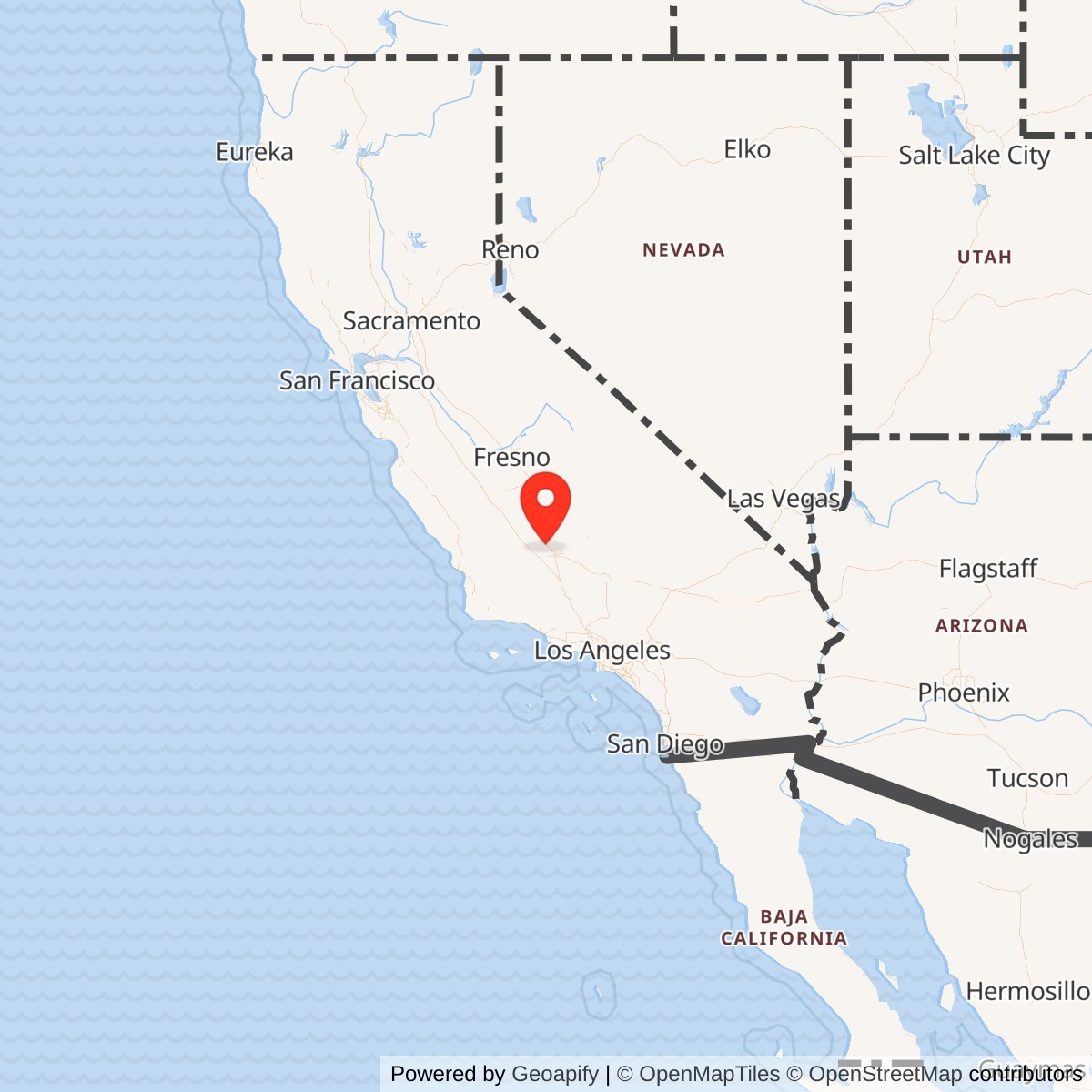
Longitude: -119.198014
Site Number: P-59A; Z-59A
Current Role: Former radar compound in the agricultural Minter Field landscape. The concrete-block equipment building and former radar-tower footing area were documented surviving in 1989 and 2003, with the building then used for storage; 2009 photographs again show the structure. Exact 2026 parcel ownership and building condition were not independently field-verified. DoD environmental reporting lists the FUDS response as Final Response Complete before FY2021.
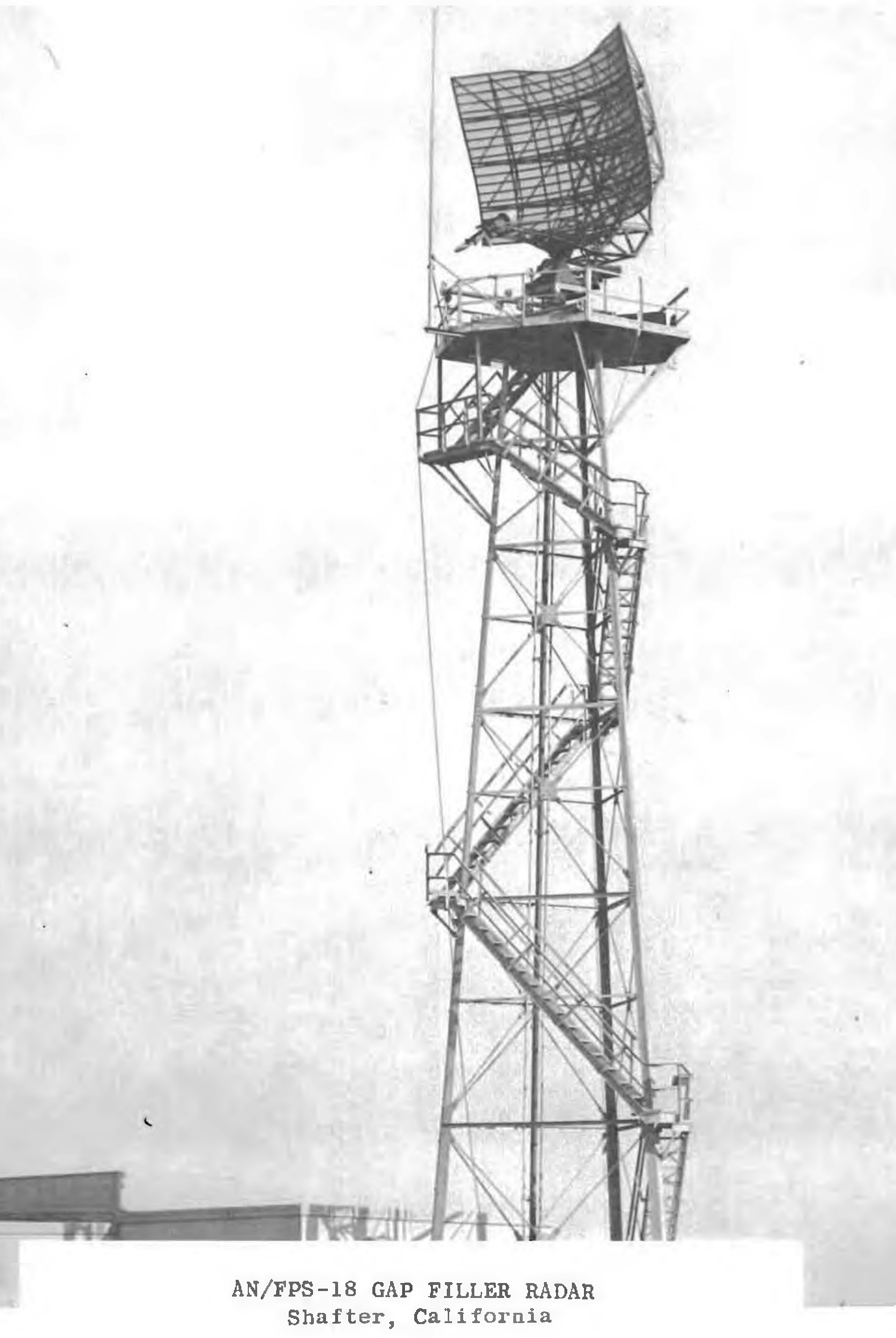
Shafter Gap Filler Annex used an AN/FPS-18 search radar. Details on how this equipment worked and locations it was deployed can be found here.
Shafter Gap Filler Annex was a small, remotely operated U.S. Air Force radar installation built on the former Minter Field property near Shafter, California. Its purpose was narrow but important. Long-range radar stations such as Boron Air Force Station could see aircraft at great distances, yet the curvature of the earth, terrain, and the geometry of radar coverage created low-altitude gaps in which an aircraft could approach below the effective line of sight of a distant search radar. Shafter filled one of those gaps for the southern San Joaquin Valley. The annex used an AN/FPS-18 search radar and automated data-processing equipment to detect low-flying aircraft, convert the radar return into data suitable for the air-defense system, and send that information by land line through the 750th Radar Squadron at Boron to the Los Angeles Air Defense Sector direction center.
The annex must be distinguished from several other military uses of the same Minter Field landscape. During the early Cold War, Minter Field had hosted temporary Lashup Radar Site L-39, which operated an AN/CPS-4 radar from 1950 to 1952. The Air Force later planned a full long-range Aircraft Control and Warning station at Shafter under designation SM-161, but that permanent station was never built. Instead, Minter Field received the much smaller P-59A gap-filler installation and a separate remote Ground-Air Transmit-Receive communications facility designated R-10. Shafter Gap Filler Annex was therefore neither a continuation of L-39 nor another name for R-10, and the canceled SM-161 station should not be treated as an operational installation.
The Air Force site carried the permanent radar-network designation P-59A and later the NORAD-era designation Z-59A. The suffix tied the annex to Boron Air Force Station, whose own identifiers were P-59 and Z-59. Air Force installation research also assigns the gap filler Permanent Installation Number 4438. Federal environmental records identify the former property separately as SHAFTER GAP FILLER ANX, FUDS property J09CA0628, with federal facility identification number CA99799F562800. These independent identifiers confirm that the gap filler was a distinct former defense property even though it occupied land associated with the much larger former Minter Field.
Why a Gap Filler Was Needed
Continental air defense in the 1950s depended on detecting Soviet bombers early enough for commanders to identify the track and direct fighters or surface-to-air weapons against it. Long-range search radars were indispensable, but a radar horizon meant that an aircraft flying close to the ground could remain hidden until it approached much nearer the station. Mountains, valleys, and local terrain could make the problem worse. Air Defense Command therefore developed a network of short-range gap-filler radars specifically to cover low-altitude approaches that could not be watched reliably by the main radar stations.
The national gap-filler program was part of a broader transition from visual observation and manually plotted radar toward automated continental surveillance. Air Force planning called for an unmanned network of short-range, low-altitude radars, and deployment of the AN/FPS-14 and AN/FPS-18 accelerated in the late 1950s. Gap-filler deployment peaked around 1960 as the Semi-Automatic Ground Environment, or SAGE, system was spreading across the United States. The Shafter annex belonged to this generation. It was not designed to command fighters from its own operations room. It existed to sense low-altitude traffic in a blind area and inject that information into a command system located elsewhere.
The southern San Joaquin Valley presented a logical requirement for such coverage. Shafter lay approximately twelve miles north of Bakersfield and roughly 124 miles from Boron Air Force Station. That distance allowed Boron to cover a large portion of southern California with its long-range radar while leaving low-altitude geometry that could benefit from a closer sensor. Placing the annex at Minter Field also avoided the expense of creating an entirely new large base. The former airfield already provided an accessible military-associated location in open agricultural terrain, while a compact remote radar compound could be built without the barracks, housing, administrative complex, and extensive utilities required by the canceled SM-161 long-range station.
From Lashup L-39 to P-59A
Minter Field's radar history began before the gap-filler program. In late 1950 the Air Force operated temporary Lashup Radar Site L-39 there using an AN/CPS-4 radar. Lashup sites were emergency measures created while the permanent continental radar network was still being developed. L-39's service ended in June 1952 when the regional radar network matured and Mount Laguna Air Force Station assumed broader coverage responsibilities. That first radar episode established Minter Field as a known air-defense location, but the temporary site was not the same compound or mission later represented by P-59A.
The Air Force subsequently planned Shafter Air Force Station SM-161 as a manned long-range radar station at Minter Field. Surviving site histories agree that the SM-161 project was canceled before construction as an operational station. The solution ultimately adopted was smaller and more specialized. Rather than duplicate a complete long-range station with its own radar squadron, cantonment, and command facilities, Air Defense Command placed a low-altitude gap filler at the field and established the R-10 remote communications facility nearby. This decision left Minter Field with two detached support sites serving a distant parent station rather than with the large radar base once envisioned.
The commonly cited operational opening for P-59A is February 1959. That month is retained because compiled Air Defense Command site records consistently identify the annex as operational at that time, although no day-level activation order or real-estate acceptance document was located. February 1959 also fits the national deployment cycle. Air Defense Command was bringing AN/FPS-14 and AN/FPS-18 gap fillers into service in the late 1950s as the Ground Observer Corps was being eliminated and SAGE-compatible radar coverage was becoming the preferred method of closing low-altitude holes.
Radar Equipment and Data Processing
Shafter's principal sensor was the Bendix-built AN/FPS-18, a medium-range S-band search radar developed specifically for the SAGE-era gap-filler mission. Air Force historical documentation places the AN/FPS-18 family in the 2700 to 2900 MHz band. The 750th Radar Squadron's own history describes the Shafter set as having a range in excess of forty miles. The smaller range compared with a major long-range station was not a deficiency. The radar was intended to look into a local low-altitude gap, not replace Boron's primary search radar.
The radar return did not remain at Shafter as a local picture for a permanently staffed control crew. The 750th Radar Squadron history states that Shafter had a data processor and that its search information was processed by an AN/FST-1. The processed information then traveled by land line to the squadron at Boron and from there by land line to the Los Angeles Air Defense Sector direction center. This chain is the key to understanding the annex. Shafter was a sensor and communications node inside a distributed system. Detection occurred near Shafter, but identification, track correlation, command decisions, and interceptor control belonged to the larger air-defense organization.
The AN/FST-1 function was especially important because automated air defense depended on transforming local radar observations into data that could be merged with information from other sensors. The annex therefore required more than a rotating antenna and transmitter. It needed radar electronics, signal and data-processing equipment, land-line interfaces, power, environmental control, and the equipment needed to keep a remote site stable enough for continuous surveillance. When the system worked properly, an aircraft detected in the Shafter coverage area became part of a regional track picture rather than remaining an isolated scope return at a small agricultural radar compound.
Unit and Command Relationships
The organization directly responsible for Shafter was the 750th radar organization at Boron Air Force Station. The unit had begun as the 750th Aircraft Control and Warning Squadron and was redesignated the 750th Radar Squadron (SAGE) on 1 May 1961. Its documented command relationships included transfer to the Los Angeles Air Defense Sector on 1 October 1959 and later return to the 27th Air Division in 1966. The Shafter annex did not have a separately documented radar squadron of its own. It was a remote operating location belonging to the 750th system.
A surviving history of the 750th makes this relationship explicit by stating that the squadron had one gap-filler radar site, Shafter. That same account identifies Shafter's AN/FPS-18 and AN/FST-1 processing chain. This is stronger evidence than merely finding P-59A on a national site list because it shows how the parent unit understood the annex operationally. Shafter was one of the squadron's distributed assets, and its value lay in extending the parent station's surveillance picture into terrain and low-altitude geometry that Boron's long-range radar could not cover as efficiently by itself.
The parent squadron's mission also shows what happened after Shafter's data left the annex. Under normal SAGE conditions, the 750th fed radar information into the direction center at Norton Air Force Base for regional processing. In backup operations under the BUIC concept, the squadron could assume a larger local air-defense role and work with the 47th Artillery Brigade and assigned fighter-interceptor units. Shafter itself did not launch fighters, fire missiles, or direct weapons from a local battle staff. Its contribution was earlier and more basic: detect a target at low altitude and make that detection available to the organizations that could identify, track, and engage it.
Personnel and Daily Operation
The gap-filler concept deliberately minimized permanent staffing at the remote sensor. Air Force historical studies describe the planned continental gap-filler system as unmanned, and later site documentation specifically describes Shafter as an unmanned remote operating location. No evidence was located for a separate permanent Shafter garrison, barracks population, squadron headquarters, dining facility, medical detachment, or family-housing area. The installation's small footprint and surviving building configuration are consistent with an automated site that required periodic technical attention rather than a resident military community.
Unmanned did not mean maintenance-free. The radar, processor, communications circuits, electrical plant, ventilation, and mechanical systems still had to be inspected, repaired, calibrated, and supplied. Those tasks belonged to the parent radar organization and its support system, although the surviving Shafter-specific record reviewed here does not identify a named permanent maintenance detachment or establish a daily visit schedule. The history therefore treats maintenance as a necessary parent-unit function without inventing a local manning roster that the sources do not provide.
No Shafter-specific commander has been identified because the annex was not organized as an independent command. Command authority ran through the 750th at Boron and the higher air-defense structure. This is an important distinction from a full Air Force Station. The canceled SM-161 station would have required a substantial assigned unit and command establishment. P-59A instead represented the opposite design philosophy: minimize local manpower, automate the sensor, and move information electronically to an already existing command site.
Site Design and Facilities
The surviving physical evidence shows a compact installation built around one concrete-block equipment structure and an adjacent radar tower rather than a conventional base. Photographs taken in 1989 and 2003 identify a diesel-generator wing on the north side and a radar-equipment section on the western portion of the building. At the end where the radar tower once stood, two tower foundations or footings were still partly visible in 2003 while a third had been removed. This arrangement placed radar electronics, data equipment, and electrical generation together in a small hardened utility building, with the antenna tower immediately beside it.
The diesel-generator wing was essential to the site's mission. Radar and data-processing equipment could not depend on casual farm-area electrical reliability during an air-defense alert. A dedicated generator section provided local power resilience and supported the automated concept by keeping the radar and communications chain alive without a large on-site staff. The photographs do not prove the original generator model or fuel capacity, and no surviving engineering drawing was located.
The radar-equipment section housed the electronic functions needed to operate the AN/FPS-18 and process its output. The tower footings show where the antenna structure stood relative to the building. By 1989 the tower and radar antenna were gone, but the equipment building remained. By 2003 the structure was being used for storage, and photographs show an agricultural setting with farm materials around the building. Additional 2009 views again documented the surviving structure from the south and west.
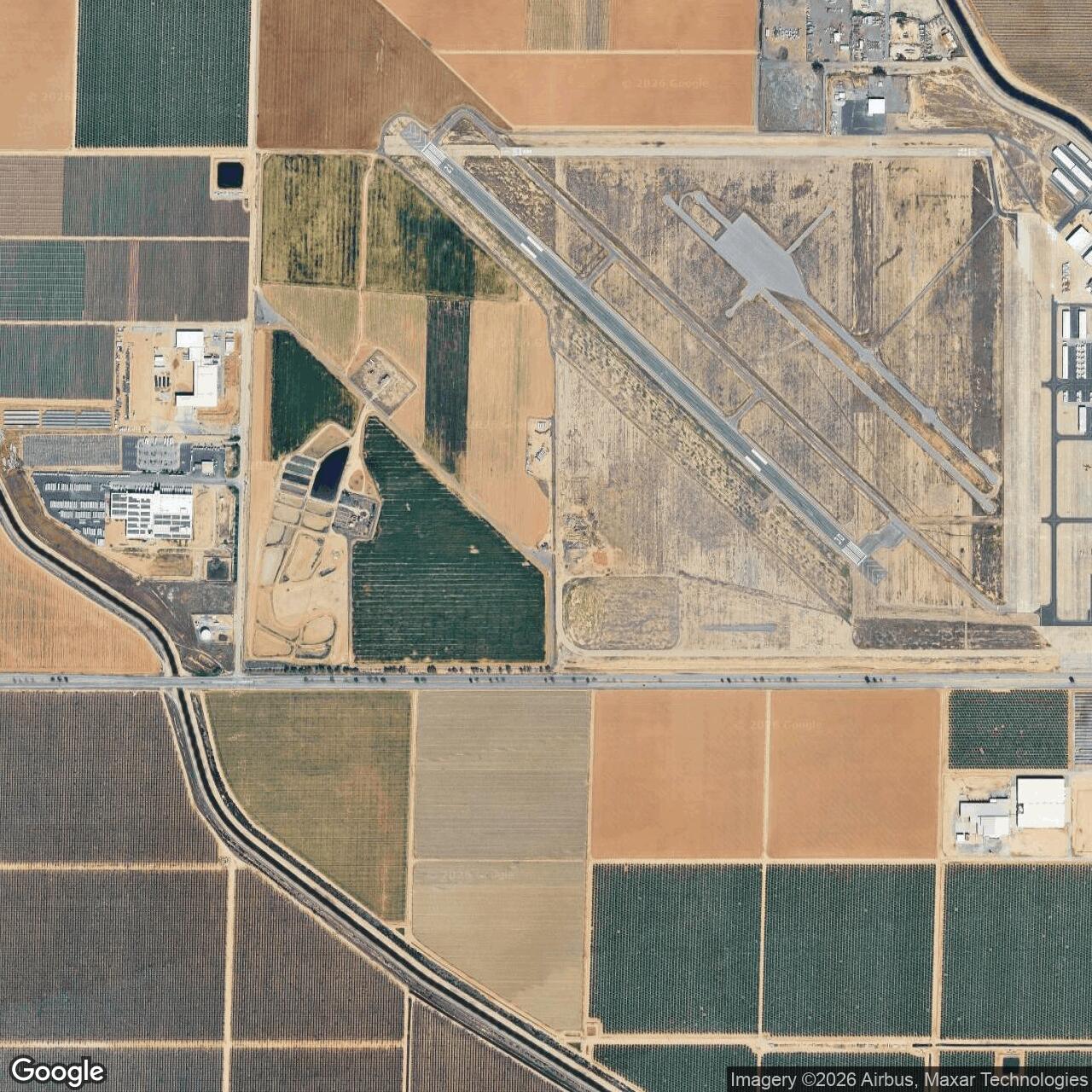
The annex lay on the west side of Minter Field, approximately one-half mile southeast of the separate R-10 GATR site according to later site documentation. That proximity can create confusion in maps and secondary accounts, but the two facilities performed different tasks. P-59A detected low-altitude aircraft and sent radar data into the surveillance network. R-10 provided remote ground-air communications for Boron. They were complementary components of the same air-defense system, not one combined installation.
Cold War Operational Role
Shafter's service fell within the period when the continental air-defense network reached its greatest technical complexity. By the early 1960s SAGE direction centers were receiving data from long-range and gap-filler radars, interceptor squadrons stood alert, Army Nike units defended major population and strategic areas, and command centers attempted to turn a continent-wide flow of sensor information into an integrated defensive response. Shafter was one small point in that architecture, but low-altitude coverage mattered because an attacker would logically try to exploit gaps in the main radar screen.
The Shafter record also illustrates the rapid pace at which air-defense doctrine changed. The annex entered service during the rise of SAGE and the final expansion of the anti-bomber radar network. Within a few years, intercontinental ballistic missiles had become the dominant strategic threat, and senior defense officials increasingly questioned the cost of maintaining a very dense interior bomber-defense network. Gap fillers remained useful against aircraft, but they could not solve the missile problem. The resulting force reductions eventually reached Shafter.
The 1961 Closure-Date Conflict
Many later radar-site compilations state that Shafter Gap Filler Annex became inactive in June 1961. That date cannot be accepted as the final Air Force service date because declassified Air Defense Command documentation demonstrates that the site remained in the force structure years later. On 8 January 1966, the Office of the Secretary of Defense approved deletion of another gap-filler site during fiscal year 1966, and Air Defense Command specifically selected Z-59A, Shafter, California, for deletion. A site that had actually left the operational force in June 1961 would not have been selected for force-structure deletion in 1966.
The 750th Radar Squadron history provides a second reason to reject the 1961 endpoint. Its description of the mature Boron system identifies Shafter as the squadron's one gap filler and describes the AN/FPS-18 and AN/FST-1 data route in the same account that discusses Boron's later SAGE and BUIC configuration. The record does not provide an exact Shafter shutdown date, but together with the January 1966 deletion order it establishes that the annex survived substantially beyond the secondary June 1961 date.
Closure and Property Afterlife
Shafter's deletion came during a national contraction of interior air defense. Air Force historical analysis records that the number of gap fillers declined sharply after the early 1960s and that all such radars had ceased operation by 1968. Shafter was selected earlier than that final national cutoff, in fiscal year 1966. Its closure therefore fits a broader shift away from the dense radar architecture designed primarily for massed bomber attack toward a smaller network emphasizing perimeter warning, joint-use radar, backup command capability, and warning against the strategic environment that remained.
Removal of the radar antenna and tower transformed the site from an operational sensor into a small utility building in agricultural surroundings. The 1989 photographs already show the tower gone and concrete tower footings beside the surviving structure. In 2003 the equipment building was being used for storage. The surviving form makes the annex unusually legible for such a modest Cold War site because the building still showed the separation between the generator wing and radar-equipment section decades after its military role ended.
Federal environmental records preserve the annex as a separate Formerly Used Defense Site. The U.S. Army Corps of Engineers' California inventory lists SHAFTER GAP FILLER ANX, property J09CA0628, with one Installation Restoration Program site in the CON/HTRW category. That classification identifies a conventional or hazardous, toxic, and radioactive waste response category and should not be confused with a Military Munitions Response Program designation. Nothing in the reviewed FUDS listing establishes that Shafter was a bombing, gunnery, missile, or ammunition-storage site.
Department of Defense environmental reporting gives the former annex federal facility identification number CA99799F562800 and lists it among FUDS properties that achieved Final Response Complete before fiscal year 2021. The table shows one Installation Restoration Program site and zero MMRP sites. This means the recorded environmental response reached the Department of Defense's final-response-complete milestone. It does not establish that every conceivable contaminant is absent, does not transfer title, and does not by itself prove the exact current landowner.
A California State Water Resources Control Board Department of Defense cleanup summary also identified SHAFTER GAP FILLER ANX, J09CA0628, and recorded a Joint Execution Plan date of 18 December 2007. Together, the state and federal records show that the tiny radar annex remained identifiable for environmental-program purposes decades after radar operations ended.
Chronology
- 1950-09 Temporary Lashup Radar Site L-39 began operation at Minter Field with AN/CPS-4 radar.
- 1952-06 L-39 ceased operation after regional radar coverage shifted to the developing permanent network, including Mount Laguna Air Force Station.
- 1953 National air-defense planning gave priority to development of an unmanned network of short-range low-altitude gap-filler radars.
- 1950s Shafter Air Force Station SM-161 was planned as a full long-range Aircraft Control and Warning station at Minter Field but was never constructed.
- 1957-1962 The Air Force deployed roughly 200 AN/FPS-14 and AN/FPS-18 gap-filler radars nationally.
- 1959-01-31 Air Defense Command disestablished the Ground Observer Corps as automated radar coverage expanded.
- 1959-02 Compiled Air Defense Command site records identify Shafter P-59A as operational with an AN/FPS-18 gap-filler radar.
- 1959-10-01 The 750th Aircraft Control and Warning Squadron transferred to the Los Angeles Air Defense Sector.
- 1960-12 National gap-filler deployment reached its peak, with 131 sites operating in the continental United States.
- 1961-05-01 The parent unit at Boron was redesignated the 750th Radar Squadron (SAGE).
- 1961 Boron became an operational SAGE radar station feeding the regional direction center at Norton Air Force Base; Shafter formed part of the squadron's distributed radar system.
- 1962 The continental SAGE network was essentially complete, with dozens of gap-filler radars contributing low-altitude data.
- 1963 Boron entered the Z-series NORAD identification era; Shafter is subsequently documented as Z-59A.
- 1966-01-08 The Office of the Secretary of Defense approved deletion of an additional gap-filler site in fiscal year 1966, and Air Defense Command selected Z-59A Shafter for deletion.
- 1966 Shafter Gap Filler Annex was removed from the Air Force operational force structure; the exact technical shutdown day was not located.
- 1968 Air Force historical analysis records that all continental gap-filler radar operations had ceased by this year.
- 1989-05 Photographs documented the former Shafter equipment building still standing after removal of the radar tower and antenna.
- 2003-07 Photographs documented the former equipment building in storage use and showed surviving portions of the radar-tower footings.
- 2007-12-18 California Department of Defense cleanup tracking records identify a Joint Execution Plan date for Shafter Gap Filler Annex J09CA0628.
- 2009-06-05 Site photographs again documented the former gap-filler building in the Minter Field agricultural landscape.
- 2015-09-30 The USACE California FUDS inventory listed Shafter Gap Filler Annex J09CA0628 with one CON/HTRW Installation Restoration Program site.
- Before FY2021 Department of Defense reporting listed Shafter Gap Filler Annex / CA99799F562800 as having achieved Final Response Complete, with one IRP site and no MMRP site.
- Present The former radar compound remains a distinct documented Cold War site within the broader Minter Field landscape; exact 2026 parcel ownership and physical condition have not been independently field-verified.
Information sources (10)
- PDFAir Defense Command Historical Study No. 19, A Chronology of Air Defense 1914-1972
Primary declassified Air Defense Command chronology documenting the 1966 selection of Z-59A Shafter for deletion.
- PDF750th Radar Squadron history
Compiled unit history drawing on Air Force Historical Research Agency records and documenting Shafter's AN/FPS-18, AN/FST-1, distance from Boron, and land-line data path.
- WEBSearching the Skies: The Legacy of the United States Cold War Defense Radar Program
Air Force and military historic-preservation study explaining the gap-filler mission, SAGE-era network, AN/FPS-18 characteristics, and national force reductions.
- WEBRadomes.org, Information for Shafter, California
Radar-site roster and history documenting P-59A/Z-59A, AN/FPS-18, Minter Field relationship, canceled SM-161 plan, and coordinates.
- WEBRadomes.org, Recent Photos of Shafter GFA, California
Site-specific photographic documentation of the equipment building, generator wing, radar-equipment section, tower footings, and relationship to R-10.
- PDFU.S. Army Corps of Engineers, Formerly Used Defense Sites Per State, California
Official FUDS inventory identifying SHAFTER GAP FILLER ANX J09CA0628 and its CON/HTRW Installation Restoration Program site.
- PDFDepartment of Defense Environmental Network and Information Exchange, Table 9 Final Response Complete Before FY21
Official Defense Environmental Restoration Program table identifying CA99799F562800 with one IRP site, no MMRP site, and Final Response Complete status.
- PDFCalifornia State Water Resources Control Board, Department of Defense Cleanup Program Summary
State environmental tracking source identifying Shafter Gap Filler Annex J09CA0628 and its 2007 Joint Execution Plan date.
- WEBAirforcebase.net, Vandyland Trip Report
Site-visit source identifying Shafter Gap Filler Annex as PIN 4438 and providing 2009 exterior photographs.
- PDFHistorical Data of the Aerospace Defense Command (17.6 MB)
Source for historic image