
Adak Army Base / Davis Army Airfield, Alaska
The wartime airfield, dispersed garrison, harbor defenses and supply depot supported the Aleutian campaign.
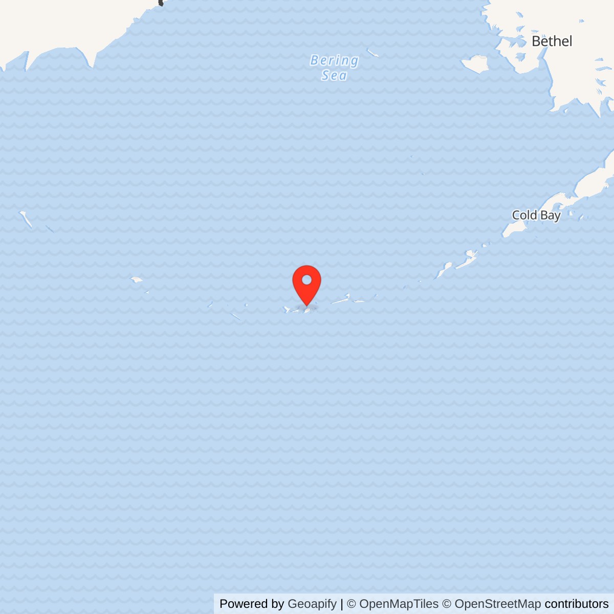
Longitude: -176.6425
Current Role: Adak Airport occupies part of the inherited military airfield. Former Army camps, depot and outlying defense landscape have later naval, civilian and historic-resource associations.
- Wartime role
- Army air base, protective garrison, command center, amphibious staging and reserve supply
- Army occupation
- August 30, 1942
- First offensive mission
- September 14, 1942, against Kiska
- Principal construction unit
- 807th Engineer Aviation Battalion; additional engineer forces followed
- Combat aircraft
- P-38 and P-40 fighters; B-17 and B-24 heavy bombers; B-26 Marauder and B-25 medium bombers
- Airfield plant
- Crossing steel-mat runways, revetments, Kodiak T-hangars, operations and repair shops
- Ground defenses
- Infantry outposts, Coast Artillery batteries and joint harbor entrance control
- Supply facilities
- Sweeper Cove docks, fuel storage and Army Reserve Depot
- Garrison life
- Dispersed tents and huts, hospital, mess and service facilities; The Adakian newspaper
- Army service phase
- 1942-1947; later Davis Air Force Base phase follows
- Land area
- Army-only acreage unresolved; broader landmark and later Navy totals have different scopes
- Location
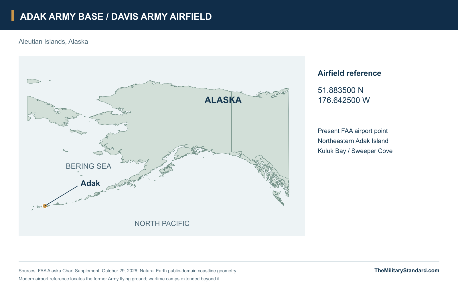
- Northeastern Adak Island, Aleutians West Census Area
- Latitude / longitude
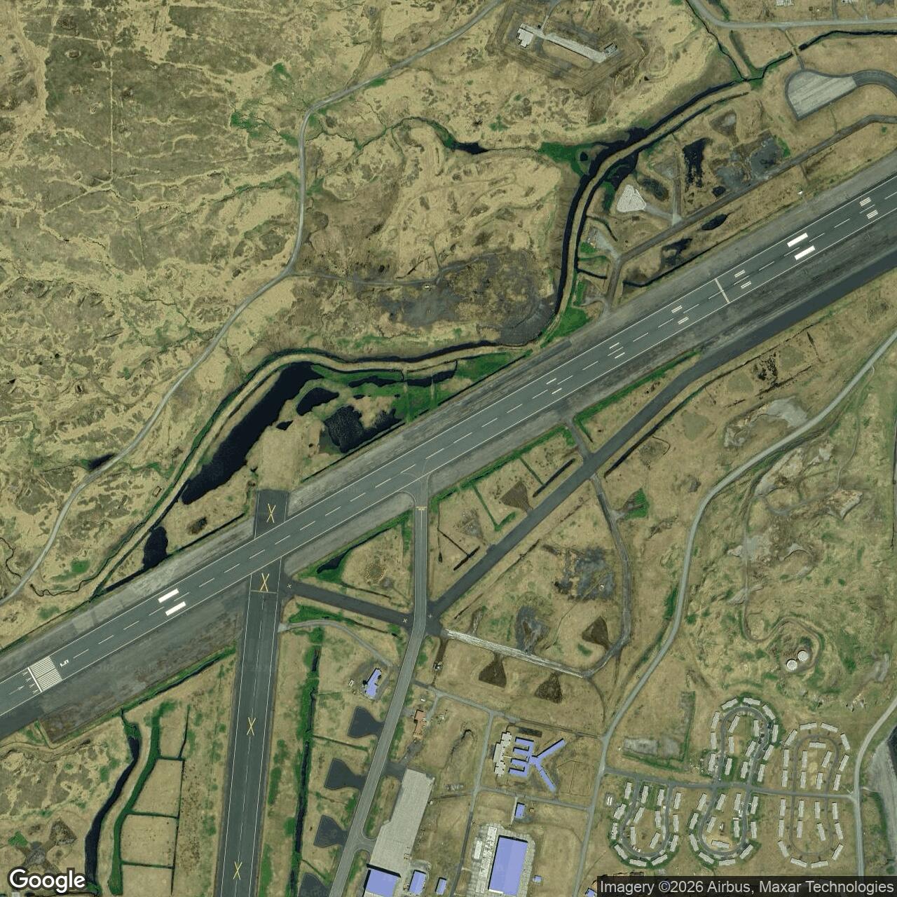
- 51.883500, -176.642500; present FAA airport reference, not a wartime boundary
A Forward Base Between the Airfield and the Harbor
Adak Army Base grew from an urgent effort to move American air power closer to Japanese-held Kiska into one of the principal operating and supply centers of the Aleutian campaign. Its airfield occupied low ground beside Kuluk Bay and Sweeper Cove, while camps, headquarters, stores and defenses spread into the surrounding hills. The sheltered harbor and adjacent flying field made the location valuable to both the Army and Navy. Together they supported aircraft, ships and troops moving west through a chain of islands where distance and weather complicated almost every operation. [2] [3] [4]
The Army installation forms the wartime foundation of the later Davis Air Force Base and Adak Naval Operating Base. The original Army airfield and the Navy's northern field near Andrew Lake were separate developments, although both services used the island's roads, harbor and support facilities. The location reference used here, 51.883500 north and 176.642500 west, is the present FAA Adak Airport point. It locates the inherited airfield landscape; the Army's wartime camps and outlying installations occupied a much broader area. [3] [7] [14]
Landing and the Race to Build a Runway
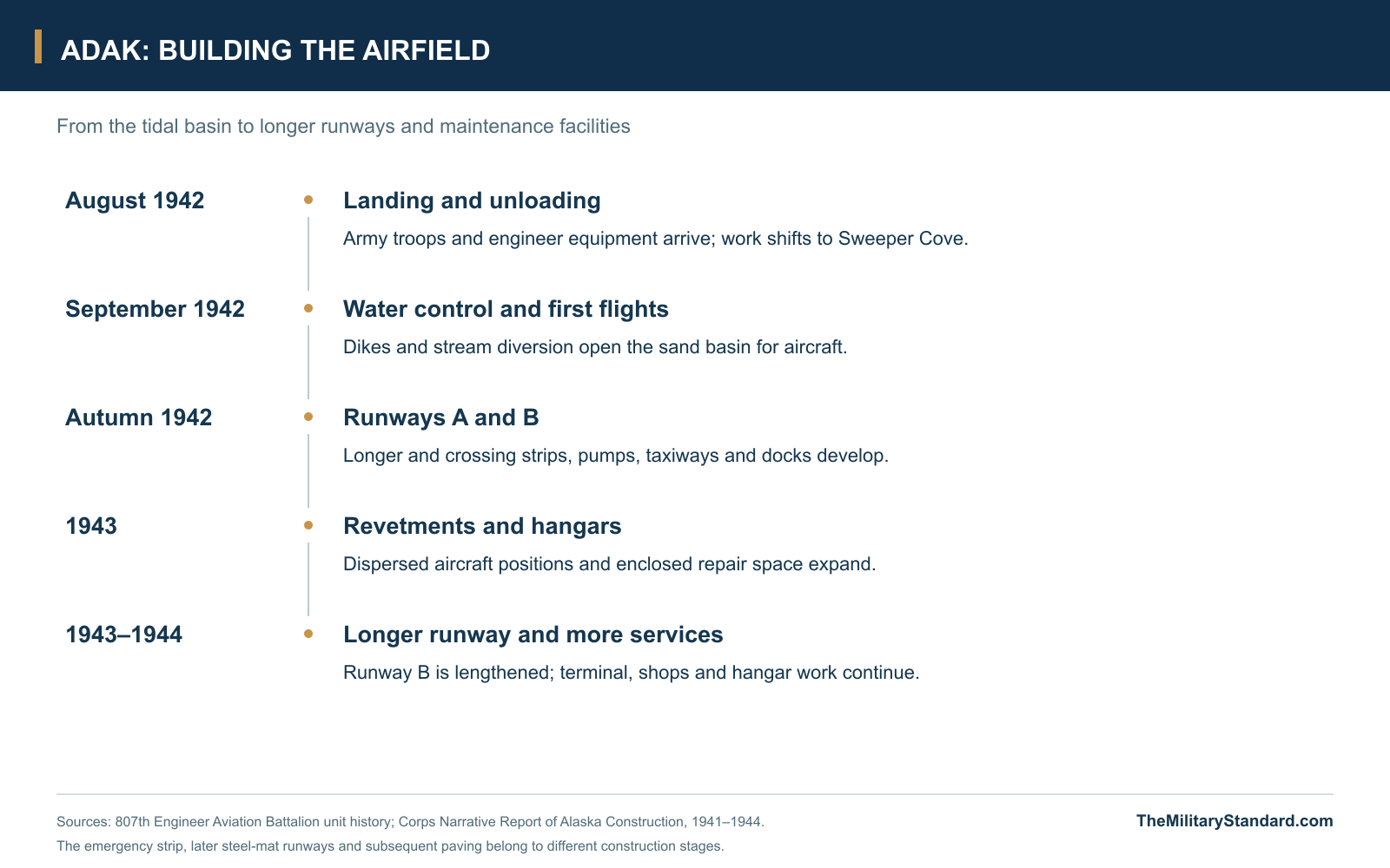
After the June 1942 attacks on Dutch Harbor and Japanese occupation of Attu and Kiska, American bombers faced long flights from the eastern Aleutians. Adak offered a position from which fighters could accompany bombers against Kiska and a harbor in which ships could assemble. Army troops landed on August 30, 1942. The 4th Infantry Regiment established defenses while engineers began the work needed to receive aircraft and supplies. Brigadier General Eugene Landrum commanded the landing force, with Colonel B. B. Talley directing the engineering undertaking. [3] [4] [6]
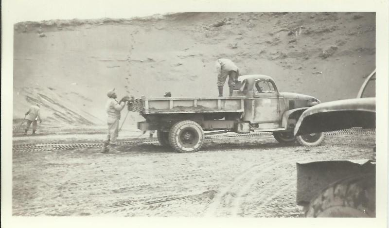
The 807th Engineer Aviation Battalion brought an improvised fleet of tugs, scows and barges carrying construction equipment, fuel and steel landing mat. Its unit account places the engineer convoy's arrival on August 31, following the initial landing. Bad surf complicated unloading on Kuluk Bay, so the beach operation shifted to the more sheltered Sweeper Cove. Tractors, cranes and labor from several branches moved supplies away from the shoreline. The engineers' first tasks therefore included creating the means to unload and distribute the materials needed to build the base itself. [1]
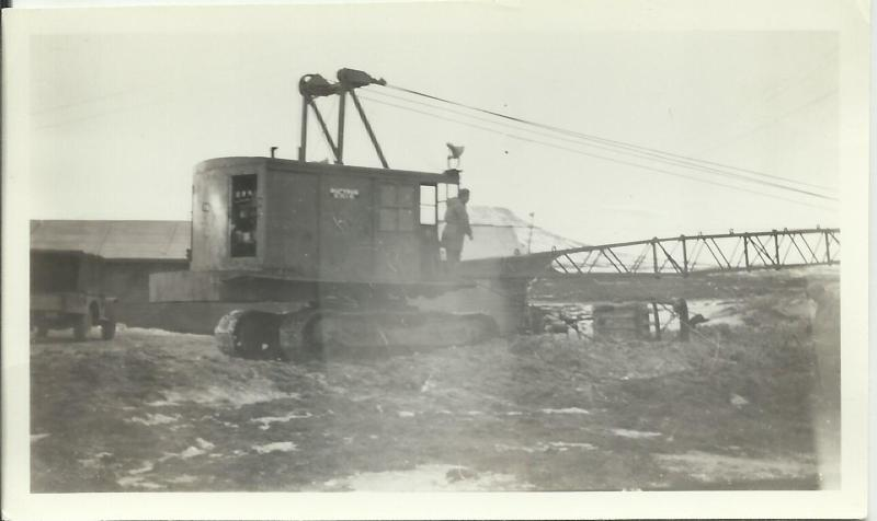
The promising runway site was a tidal basin in lower Sweeper Valley. Diking kept the sea out, but the engineers also had to divert the stream that fed the enclosed ground. Once the water was controlled, the exposed sand offered an unusually quick route to a usable strip. The 807th history records a B-18 landing on September 10, followed by fighters and heavy bombers over the next few days. The first offensive mission from Adak struck Kiska on September 14, turning the unfinished construction site into an operational air base. [1] [4]
Improving the Airfield and Supporting the Aircraft
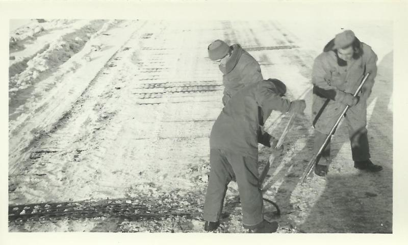
The first strip was a beginning rather than a finished airfield. Heavy rain and high tides could overwhelm drainage, while loaded aircraft needed more runway than the initial surface provided. Engineers built the longer Runway A beside the original strip and added crossing Runway B. Dikes, tidal gates, pumps, taxiways and revetted hardstands became part of the flying installation. The 1944 construction report describes steel-mat runways of 6,000 and 7,800 feet after enlargement. Those dimensions belong to the developed wartime field, not its first September landing surface. [1] [2]
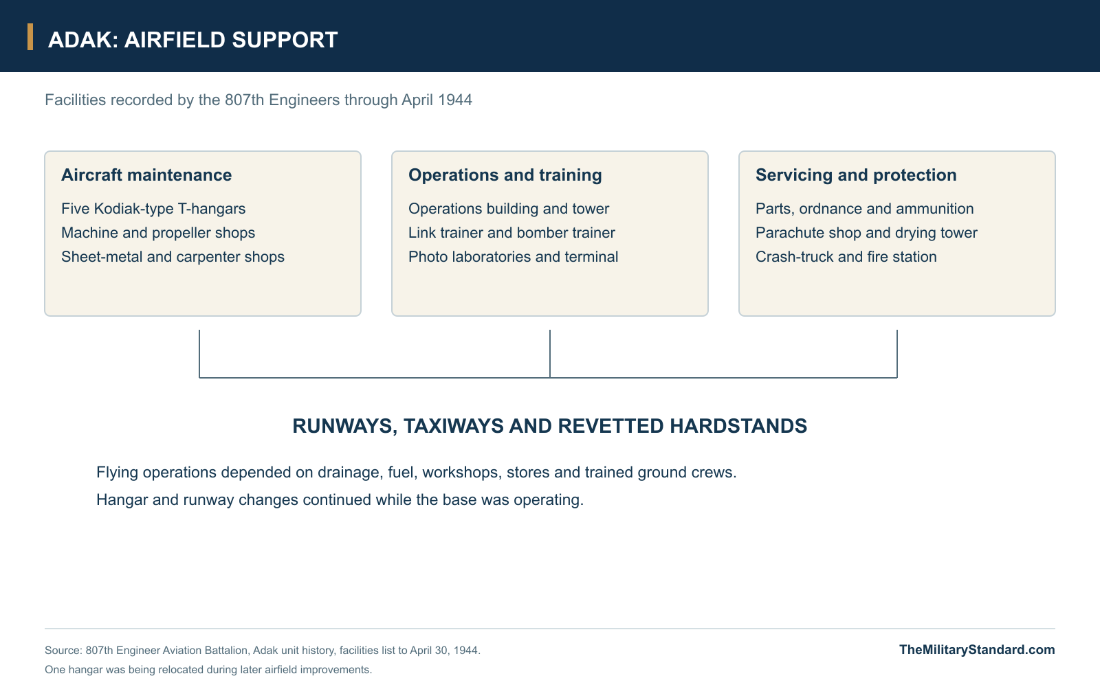
Maintenance facilities followed the initial flying operations. Army mechanics first worked outdoors through the autumn and winter, exposed to the same wind, rain and snow that interrupted missions. The 807th record dates completion of the first Kodiak-type T-hangar to April 23, 1943, and lists five by April 1944, with one being relocated during runway improvements. The field also acquired machine, propeller and sheet-metal shops, photo laboratories, an operations building, a Link trainer, parachute facilities, a terminal and a crash-truck station. This plant turned a forward strip into a base capable of keeping aircraft in service. [1]
Aircraft passing through or operating from Adak included P-38 and P-40 fighters, B-17 and B-24 heavy bombers, and Martin B-26 Marauder and North American B-25 medium bombers. Their functions and periods overlapped as the campaign developed. The 77th Bombardment Squadron's history describes its ground echelon arriving on October 2, 1942 and rapidly establishing quarters, mess, dispensary, supply and maintenance sections. A flying unit's presence required much more than parked aircraft: the ground organization had to create the working camp and support system that made repeated missions possible. [4] [5]
The Dispersed Army Camps and Service Areas
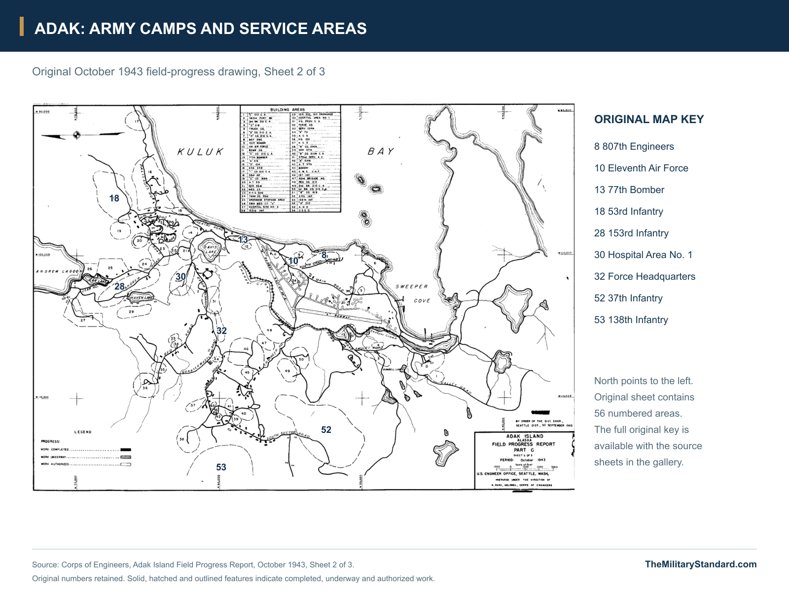
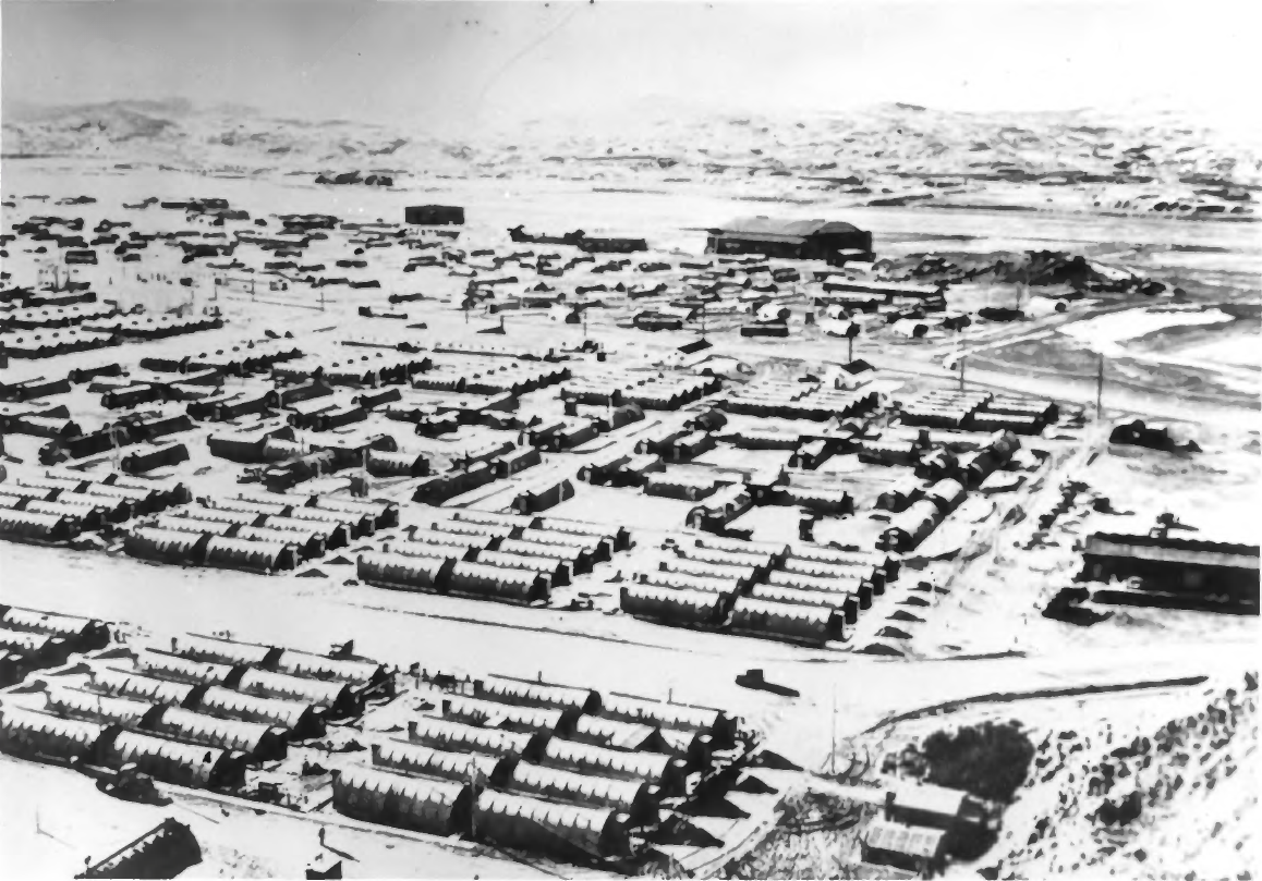
The October 1943 construction sheets show the scale of the installation beyond the runways. Their numbered areas identify infantry camps, Coast Artillery positions, headquarters, signal and service organizations, engineer areas, hospitals, ordnance storage and a bakery. Roads connected these groups while leaving room for dispersal across the terrain. The main drawing distinguishes completed work, construction under way and authorized work. It captures a base still being built, with unit areas and service facilities developing alongside the continuing air campaign. [2]
The map identifies the 53rd, 153rd, 197th, 37th and 138th Infantry in different areas, together with numerous elements of the 210th Coast Artillery. It also marks the 807th Engineers, Eleventh Air Force and the 77th bombardment organization. These are dated locations on an October 1943 progress drawing, rather than a roster for the first landing or every later year. They show how the airfield depended on a substantial surrounding Army community whose defense, construction and service roles extended across the island's developed northeast. [2]
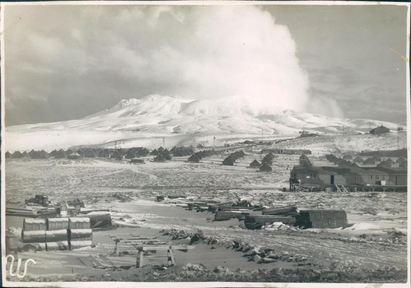
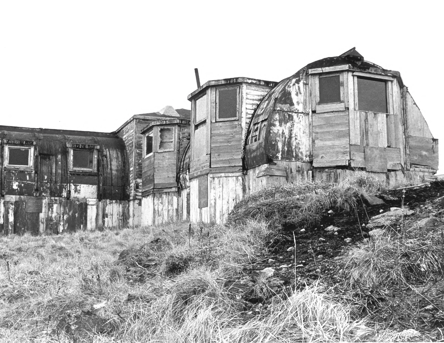
The Army hospital and advanced command posts occupied the slopes west of the principal flying area. In the 1980s, the NPS survey found relatively little intact hospital fabric, but recorded a distinctive Quonset structure with bay-window additions and nearby remains associated with the command-post area. It also described the concrete vault and other traces of the wartime headquarters landscape. These later observations help locate the Army's dispersed plant, while showing how much had changed after decades of naval occupation and adaptation. [3] [10]
Defending the Anchorage and Maintaining Communications
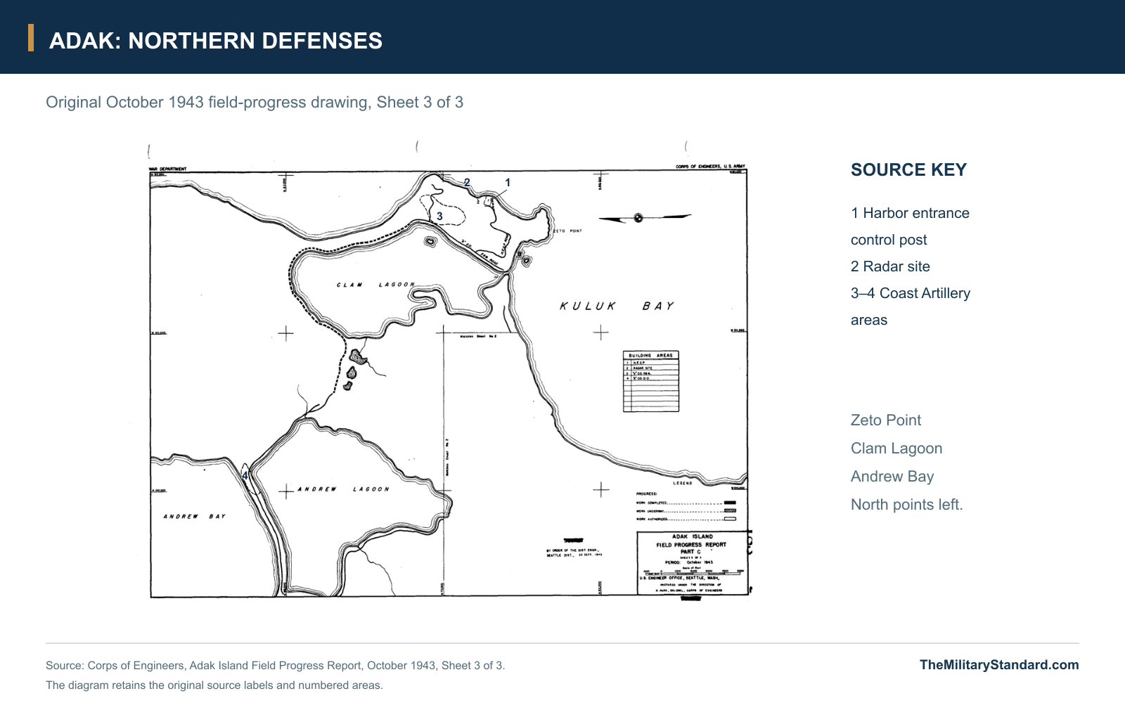
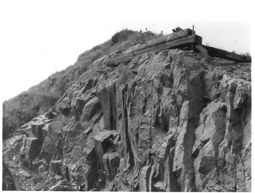
Adak's offensive role did not remove the need for local defenses. Infantry outposts covered bays and approaches, and artillery protected important portions of the developed coast. The NPS nomination records 155-mm gun positions at North Spit in Shagak Bay and Zeto Point, with 90-mm batteries near the runways on the western side of Kuluk Bay. Those positions complemented the infantry and Coast Artillery areas shown on the construction plan. The dispersed arrangement reflected the need to protect an airfield, supply beaches, anchorage and support camps spread over difficult ground. [2] [3]
At Zeto Point, a joint Army-Navy harbor entrance control post watched the approach to the anchorage. The northern construction sheet labels the harbor-control position, a radar site and associated Coast Artillery areas. The wider island also supported aircraft-warning and communications functions. These facilities belonged to the wartime base network, connecting the airfield and anchorage with the larger defense and operating system. Their presence should be distinguished from the much later White Alice communications site and other Cold War installations on Adak. [2] [3]
The flying operation relied on navigation and communications as well as local protection. Fog, low ceilings and fast-changing weather could separate an aircraft from its formation or prevent a crew from locating the field on return. Radio navigation and weather information were essential parts of operating along the Aleutian route. The Army's own plan identifies ACS and signal-related areas, while the FAA's historical study places Adak within the region's wartime navigation network. Aircraft servicing, information and communications worked together to keep the base useful when visual flying conditions deteriorated. [2] [8]
Sweeper Cove and the Expanding Supply Base
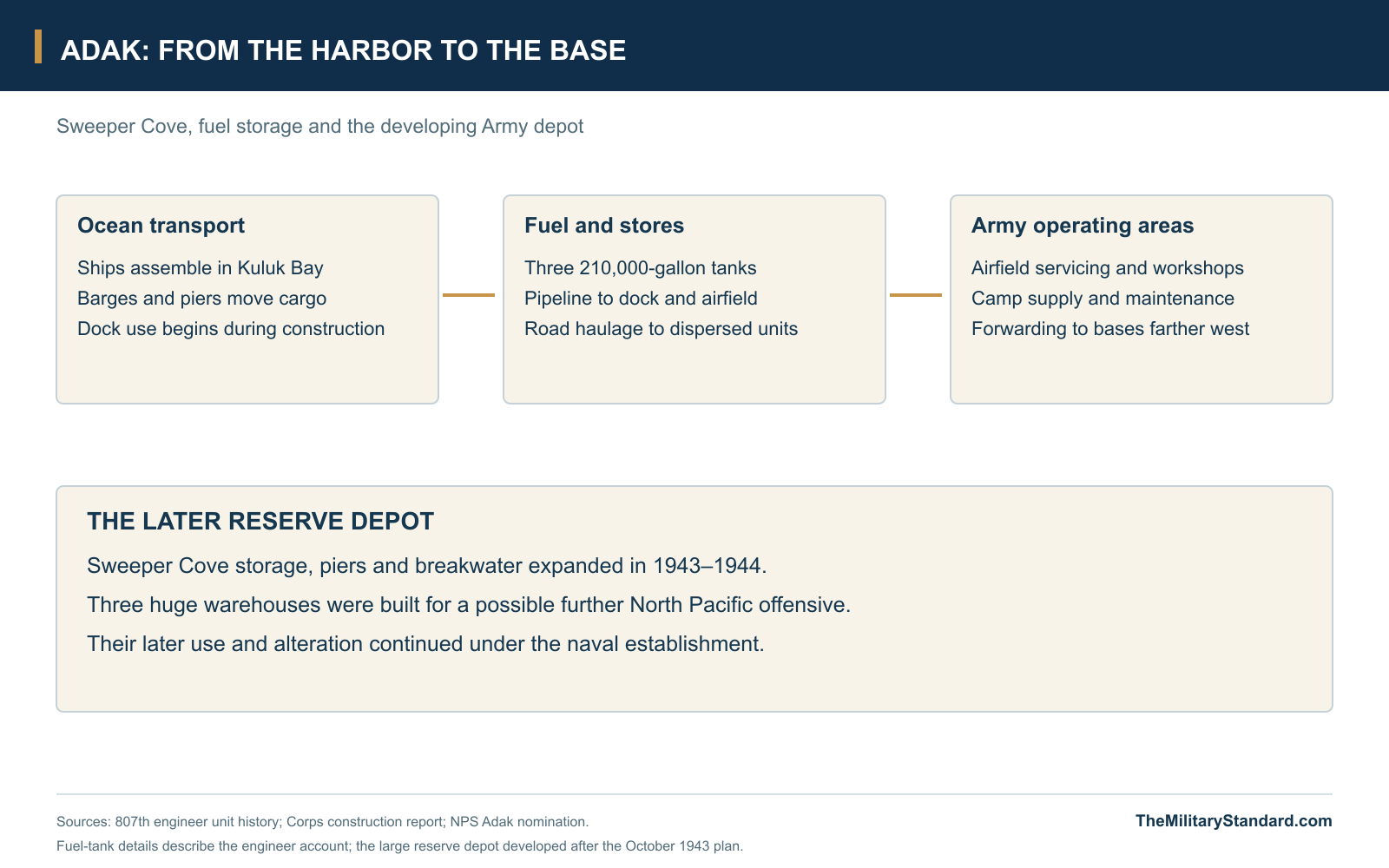
Sweeper Cove provided the working connection between ocean transport and the Army installation. The engineers first used improvised unloading arrangements, then added a barge dock and ocean-going ship berths. The 807th account describes docks entering use before every construction detail was complete, an indication of how closely building work followed operational demand. Three 210,000-gallon bolted steel tanks and connecting pipelines supplied aviation gasoline. Roads and handling equipment carried the flow inland to aircraft areas, stores and camps, while the protected anchorage held vessels awaiting their turn to unload. [1]
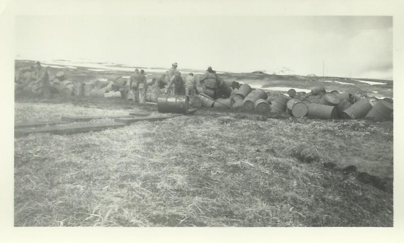
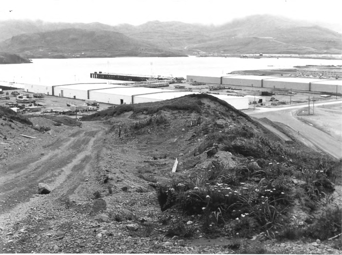
The island's role continued to grow after the fighting moved farther west. The Army Reserve Depot at Sweeper Cove was built to equip and support a possible future North Pacific offensive. Its three immense warehouses, each described in the nomination as 181 by 800 feet, stood beside piers and a breakwater. Storage, repair and distribution became major functions in their own right. The depot connected Adak's wartime airfield and harbor with a longer planning horizon, even though the projected northern invasion of Japan never took place. [3]
The Army and Navy developed different parts of this shared logistical landscape. Navy construction included repair and small-craft facilities, drydocks and support for patrol aviation. Early naval aircraft used facilities near the Army field before the separate northern naval air station expanded around Andrew Lake and Clam Lagoon. The distinction explains the island's multiple airfield and waterfront sites. A photograph of a naval hangar or flying-boat area can show an important part of wartime Adak without depicting the Army runway or its maintenance buildings. [7]
Command, Campaign Staging and the Advance West
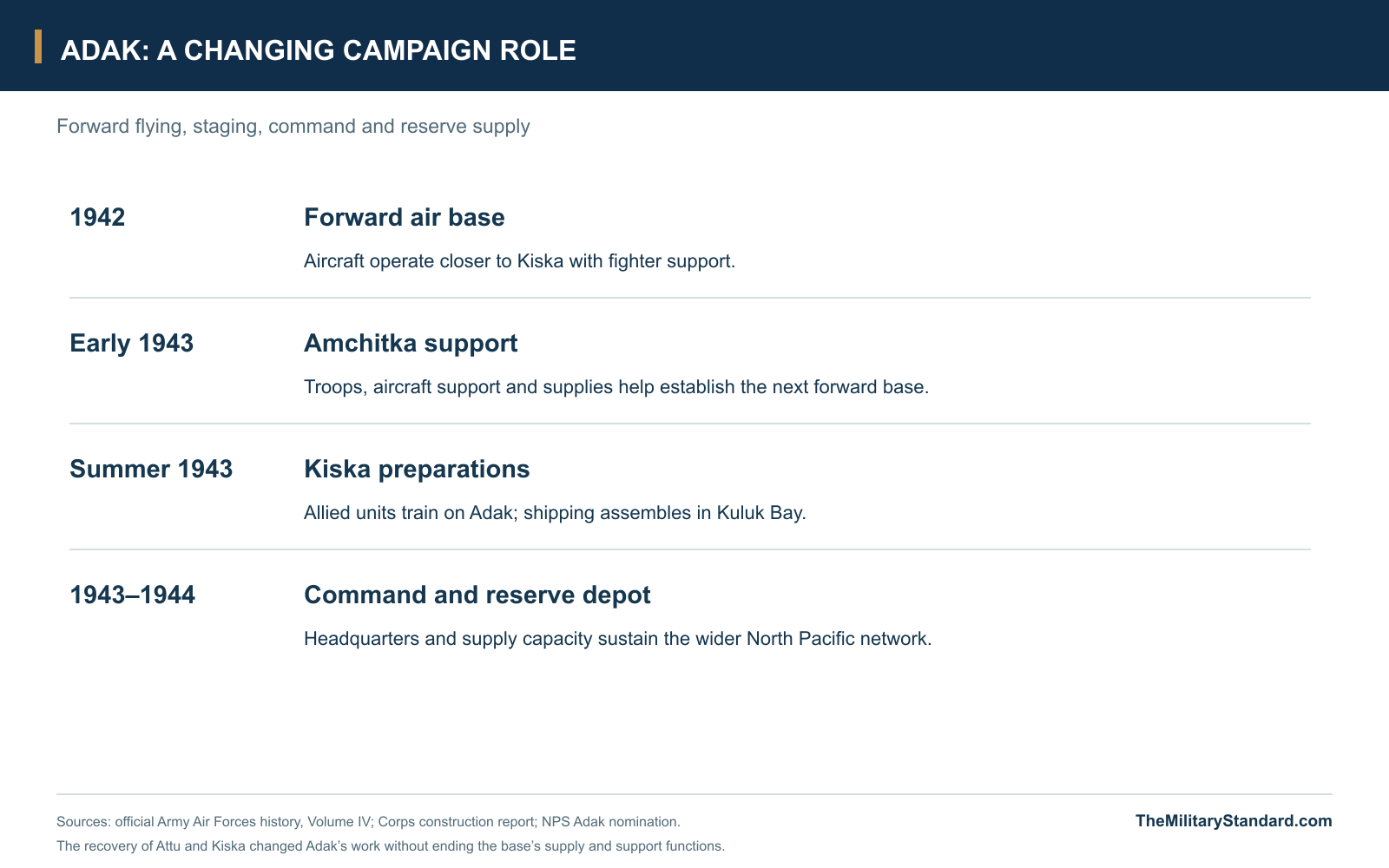
Adak supported operations whose departure points moved as new bases became available. The Amchitka force assembled on the island before its January 1943 landing, and Adak's aircraft helped cover the new position while another forward airfield was built. Repair, supply forwarding and staging consequently grew in importance as the front moved closer to Kiska. The base retained value because an offensive needed a chain of supporting installations behind its leading field. Fort Glenn, Cold Bay, Adak, Amchitka, Attu and Shemya each contributed at different stages of that advance. [3] [4] [8]
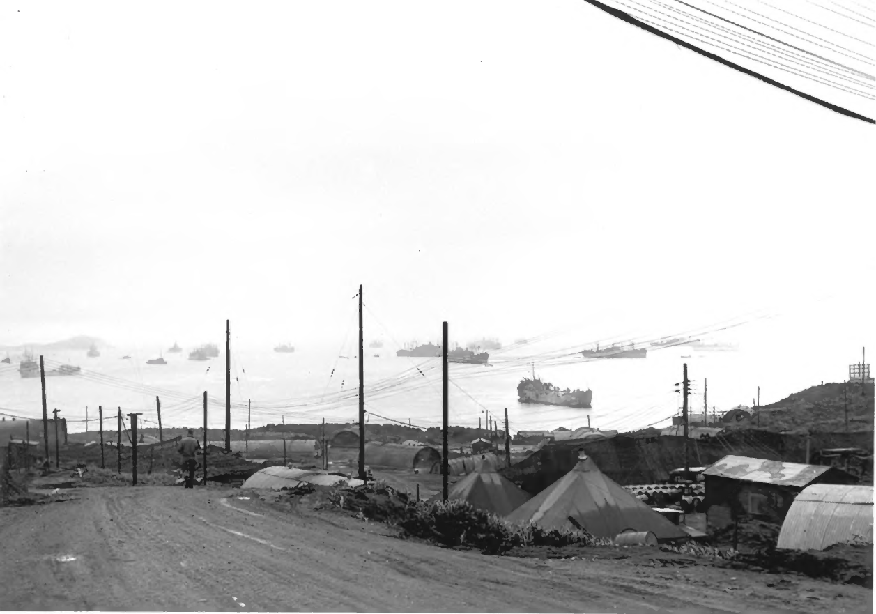
The island also became a command center. General William Butler established an advanced Eleventh Air Force command post there, and senior Army and Navy commanders used Adak to direct the 1943 operations. Eleventh Air Force headquarters moved to the island in August 1943. For the Kiska undertaking, Allied troops trained on the surrounding hills and beaches while a large fleet assembled in Kuluk Bay. The combination of headquarters, training ground, anchorage, airfield and stores made Adak a working base for the whole campaign rather than an isolated flying station. [3] [12]
After Attu was recovered in May and the Kiska landings in August 1943 revealed the Japanese evacuation, the Army began reducing its Aleutian commitments. Construction and planning continued where facilities could support future operations. The Corps report records later depot authorizations extending the Adak construction program into 1944. The shift explains why new warehouses and support buildings could rise while combat strength elsewhere in the theater declined. Adak's changing workload followed the difference between winning the immediate campaign and retaining the capacity to operate in the North Pacific. [2] [4]
Living and Working on Adak
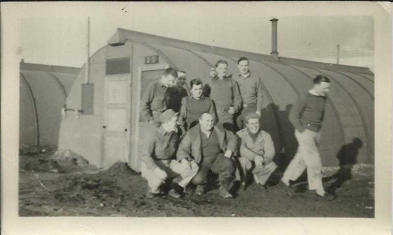
The first winter brought a camp of tents, temporary shops and hurriedly assembled huts. The engineers described their own housing work taking place outside normal duty hours, while arriving Quonsets were initially allocated to mess, administration and supply needs. The 77th's account likewise shows a unit building its camp after reaching the island. Shelter and ordinary services developed while personnel continued unloading ships, maintaining aircraft and preparing missions. The camp's familiar rows of huts conceal the labor required to establish basic working and living conditions on exposed, wet ground. [1] [5]
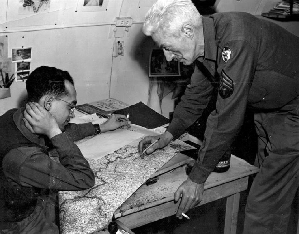
The Army newspaper, The Adakian, helped sustain a community far from home. Edited by Corporal Dashiell Hammett, its small staff produced news, cartoons, reviews and accounts of life in the Aleutians. Artist Don Miller contributed to a publication whose humor traveled beyond its own island. The newspaper's daily production gave the garrison a shared record of events and a way of describing its frustrations. Its office photograph places that work inside the same Quonset environment that housed so many less visible parts of the base. [9]
On August 3, 1944, President Franklin Roosevelt arrived in Kuluk Bay aboard USS Baltimore and visited the troops. By then the installation combined an established garrison with a large depot construction program and the remnants of its earlier role at the front of the air campaign. The visit drew national attention to service in a theater that had become less prominent after the recovery of Attu and Kiska. For the personnel who remained, routine work, weather and isolation continued after the best-known campaign milestones had passed. [3] [6]
Davis Field and the End of the Army Phase
The airfield acquired the name Davis in honor of Colonel Everett S. Davis, an early Alaskan air commander whose transport was lost in November 1942. The 3rd Wing historian dates the naming to January 4, 1945. After the war, Eleventh Air Force became Alaskan Air Command in December 1945, and headquarters moved back to Elmendorf in October 1946. Those changes reduced Adak's command role but left a substantial airfield and support plant available for the postwar military organization. [11] [12]
The Army airfield passed into the independent Air Force period in 1947 as Davis Air Force Base. Its later night- and all-weather fighter mission belongs to that successor history. The Navy assumed the airfield in July 1950 and operated the broader Adak establishment for decades, with mission closure in March 1997. These transitions ended successive service phases without erasing the earlier physical landscape. Runways, roads, stores and harbor facilities continued to shape later uses long after the Army had built them for the Aleutian campaign. [12] [13]
The combined Army and naval wartime landscape became a National Historic Landmark in 1987. The Army-only acreage cannot be equated with the broader nominated district or the later Navy withdrawal. Adak Airport now uses part of the former military flying ground, while historic remains occupy other parts of the island. The original plans and dated photographs show how the wartime installation functioned: an interconnected system of airfield, camps, command posts, defenses and waterfront supply facilities built around the demands of a remote North Pacific campaign. [3] [14] [15]
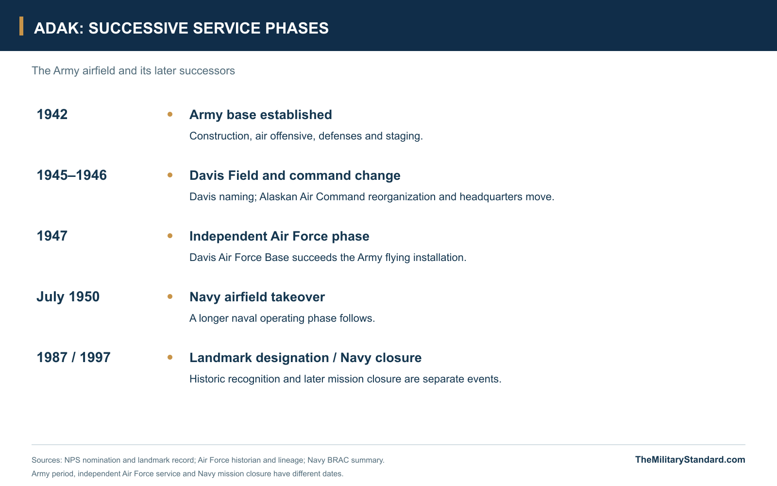
Chronology
- August 30, 1942 Initial Army landing on Adak; local defense and base construction begin. [3] [4]
- August 31, 1942 807th Engineer convoy arrival recorded in the battalion history. [1]
- September 10-14, 1942 First aircraft landings followed by the September 14 offensive mission against Kiska. [1] [4]
- October-November 1942 Longer and crossing runways, docks, fuel and camp facilities develop. [1]
- January 1943 Amchitka expedition stages through Adak before establishing the next forward base. [3]
- April 23, 1943 First Kodiak-type T-hangar completed, according to the engineer account. [1]
- August 1943 Kiska expedition assembles; Eleventh Air Force headquarters moves to Adak. [3] [12]
- October 1943 Three Army construction sheets record the airfield, roads and numbered unit areas. [2]
- 1943-1944 Army Reserve Depot and additional facilities extend the construction program. [2] [3]
- August 3, 1944 President Roosevelt visits Adak aboard USS Baltimore. [3]
- January 4, 1945 3rd Wing historian dates the Davis field naming to this day. [11]
- 1945-1947 Air command reorganizes and returns to Elmendorf; independent Air Force phase follows. [12]
- July 1950 Navy takes over the airfield from the Air Force. [13]
- February 27, 1987 Combined Army and naval wartime landscape designated a National Historic Landmark. [15]
- March 31, 1997 Navy mission closure, distinct from the earlier Army and Air Force transitions. [13]
Related Sites
Information sources (15)
- WEB807th Engineer Aviation Battalion, unit history: Adak Island, reproduced by NPS
Wartime engineer account of the convoy, drainage, first landings, runway development, hangars, docks, fuel and housing through April 1944. The transcription contains inconsistent dates and claims that require comparison with other records.
- PDFU.S. Army Corps of Engineers, Narrative Report of Alaska Construction, 1941-1944
Adak section, printed pages 178-180 and three October 1943 field-progress sheets. Describes the authorized construction program, garrison growth, drainage, runway work, depot additions and numbered building areas.
- WEBErwin N. Thompson, NPS, Adak Army Base and Adak Naval Operating Base nomination, 1984 and supplements
Original field-survey descriptions and military-landscape history: Army camps, hospital, command posts, harbor defenses, depot and the separate naval air station. Survey-era survival and 46,700-acre nomination scope are dated to the record.
- WEBWesley Frank Craven and James Lea Cate, The Army Air Forces in World War II, Volume IV, chapter 11
Official air-war history, reproduced by HyperWar, explains the advance to Adak, September 1942 operations, winter flying, Amchitka and the later Aleutian campaign.
- WEB77th Bombardment Squadron, History for 1941-1943, reproduced by NPS
Contemporary squadron history with forewords by Robert Hamby and Bailey Howard; Adak ground-echelon arrival, camp construction, maintenance, bomber operations and morale. Conflicting aircraft-arrival dates and victory claims are not treated as settled facts.
- WEBAdak Historical Society / U.S. Navy / Alaska Maritime National Wildlife Refuge, Adak Historical Guide, revised 2012
Historical district map and numbered markers explain Armytown, reserve depot, hospital, command post and naval sites. Later road names and commemorative locations are distinguished from the wartime layout.
- WEBBureau of Yards and Docks, Building the Navy's Bases in World War II, Volume II, 1947, chapter 23
Official construction history, reproduced by HyperWar, documents early Navy co-use of Army facilities, the separate northern naval airfield, harbor facilities and support to the Aleutian campaign.
- PDFFederal Aviation Administration, Aircraft Navigation in the Aleutian Air War
Government historical study describes the Aleutian air route, weather, radio navigation and military airfield development. Regional navigation-system descriptions do not identify every individual Adak equipment model.
- WEBNational Park Service, The Adakian, updated July 18, 2025
History of the Army newspaper, Dashiell Hammett, Don Miller and the wartime staff; accompanying Army Air Forces photograph shows Hammett and Miller working in the newspaper office.
- WEBNational Park Service, Adak landmark photographic documentation
Original photographs and caption sheets include 1943 camp and invasion-fleet views, E. N. Thompson's 1983 depot and defense-site survey, and 1985-1986 hospital-area documentation.
- WEBDoug Beckstead, 3rd Wing historian, Elmendorf Army Air Base's first commander, December 2, 2008
Air Force historian's account identifies Colonel Everett Davis, the November 1942 transport loss near Lake Iliamna and January 4, 1945 naming of the Adak airfield.
- WEBAir Force Historical Research Agency, Alaskan Defense Command lineage
Official lineage describes the Eleventh Air Force's Adak move in August 1943, the December 1945 Alaskan Air Command redesignation and October 1946 return to Elmendorf.
- WEBDepartment of the Navy, Former Naval Air Facility Adak BRAC summary
Successor Navy phase, 1950 takeover, later 1959 land withdrawal and March 31, 1997 mission closure. Later Navy acreage is not an Army-only footprint.
- PDFFederal Aviation Administration, Alaska Chart Supplement, October 29, 2026
Adak entry gives the present airport reference N51°53.01' W176°38.55' and identifies civilian Adak Airport. This reference locates the inherited airfield landscape, not a wartime boundary.
- WEBNational Park Service, Adak Army Base and Adak Naval Operating Base National Historic Landmark
Official designation date February 27, 1987 and summary of the linked airfield, anchorage and campaign-staging landscape. Current parcel access is not determined by the broad landmark description.