
Tanacross Army Airfield, Alaska
Army engineers built Tanacross's garrison through an Interior Alaska winter, helping sustain the chain of airfields that carried Lend-Lease aircraft toward the Soviet Union.
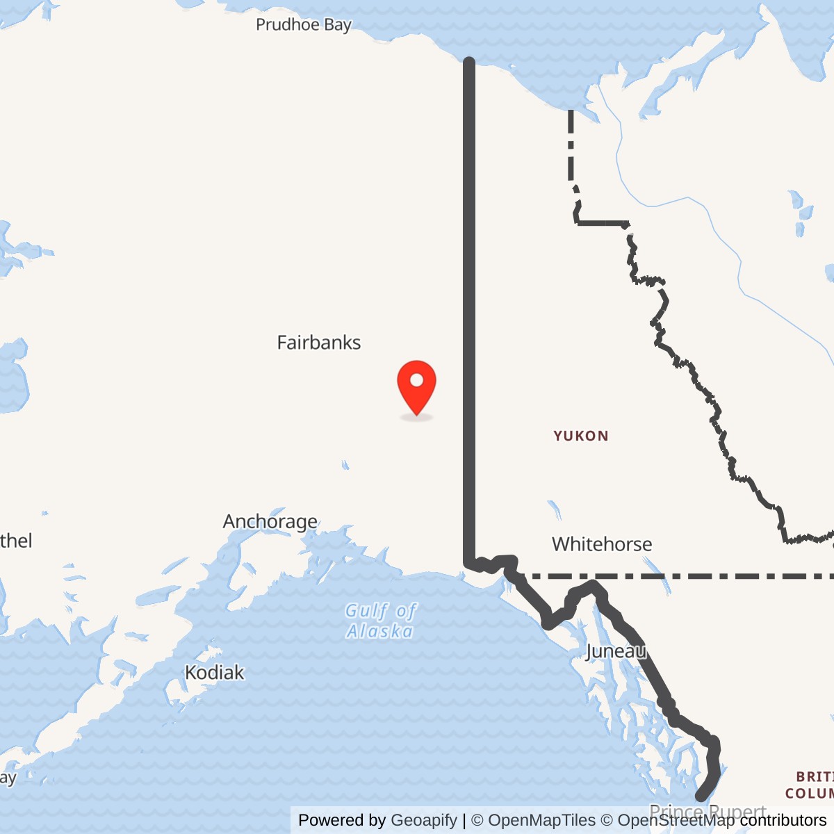
Longitude: -143.329
Official Base Website: Tanacross Airport
Current Role: Public airport (TSG) and seasonal wildfire support
- Role
- Army Air Forces staging, refueling and servicing
- Route
- Northwest Staging Route
- Army garrison work began
- November 2, 1942
- Initial project completed
- June 1, 1943
- Construction unit
- 176th Engineer Regiment (General Service)
- Resident engineer
- Captain William T. Bostick
- Initial facilities program
- Two officers and 48 enlisted men
- Original gravel runways
- 5,000 × 300 feet and 3,500 × 300 feet
- Operations buildings
- 16 × 16-foot Stout houses
- Wartime land interests
- 7,705 acres in two tracts
- Declared excess
- October 12, 1945
- Civil airport
- Tanacross Airport (TSG)
An Airfield at Tanana Crossing
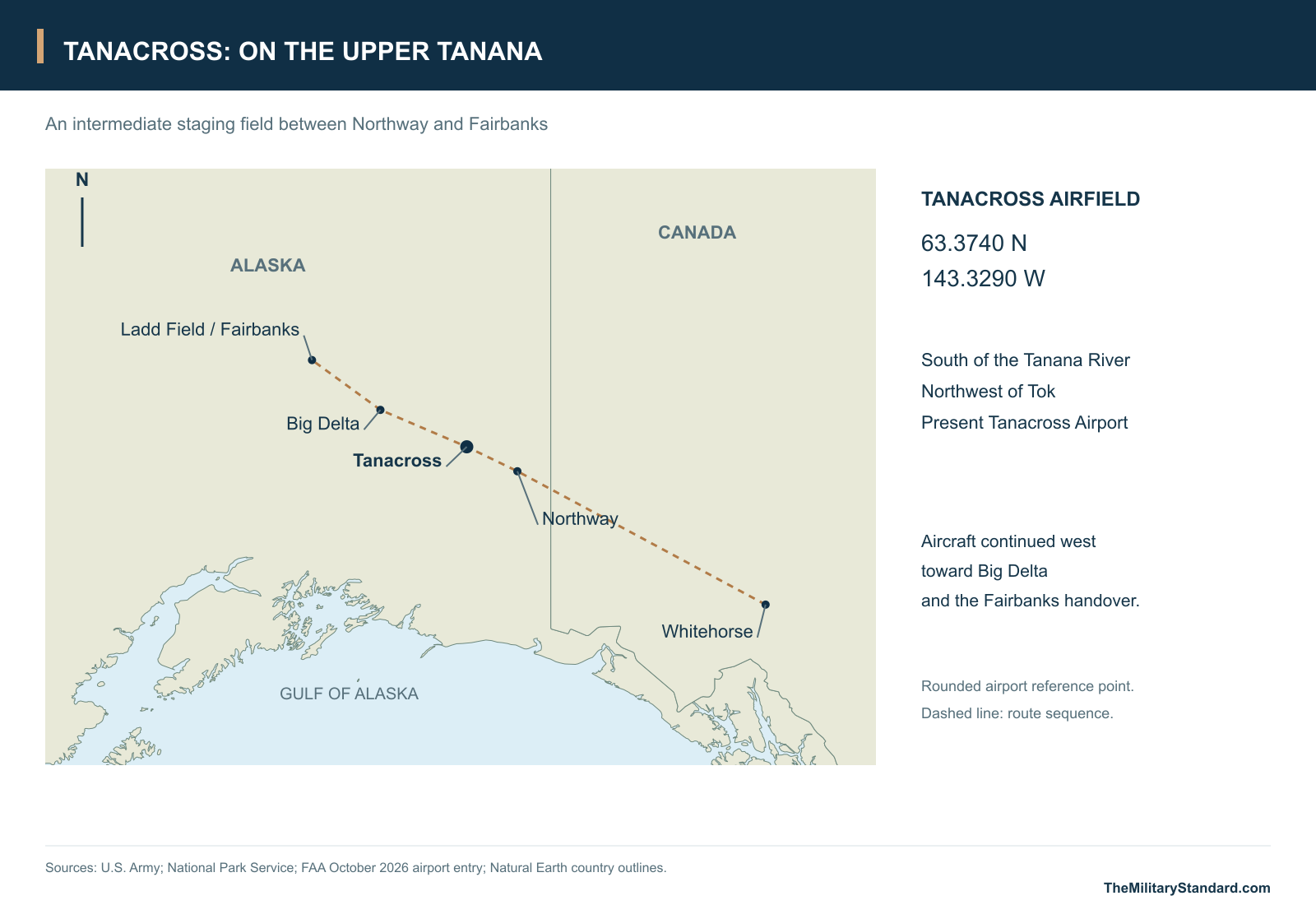
Tanacross Army Airfield occupied the south side of the Tanana River northwest of Tok. Its two crossing strips and compact garrison became part of the Northwest Staging Route, which linked the continental United States and Canada with interior Alaska. Tanacross lay between Big Delta on the way to Ladd Field. This location made it useful as an intermediate landing and service point in an aircraft delivery system that depended on a chain of working airfields rather than a single long flight. [1] [4] [5] [19]
The airstrip preceded the Army garrison. The Upper Tanana ethnographic history traces airplane mail service to the original north-bank community and the clearing of a south-bank strip in the early 1930s. It records the Tanacross village council's consent in 1941 to military improvement and emergency use. The old village, airfield and present village represent different places in that history; the community later moved to the south bank in 1972. [2] [18]
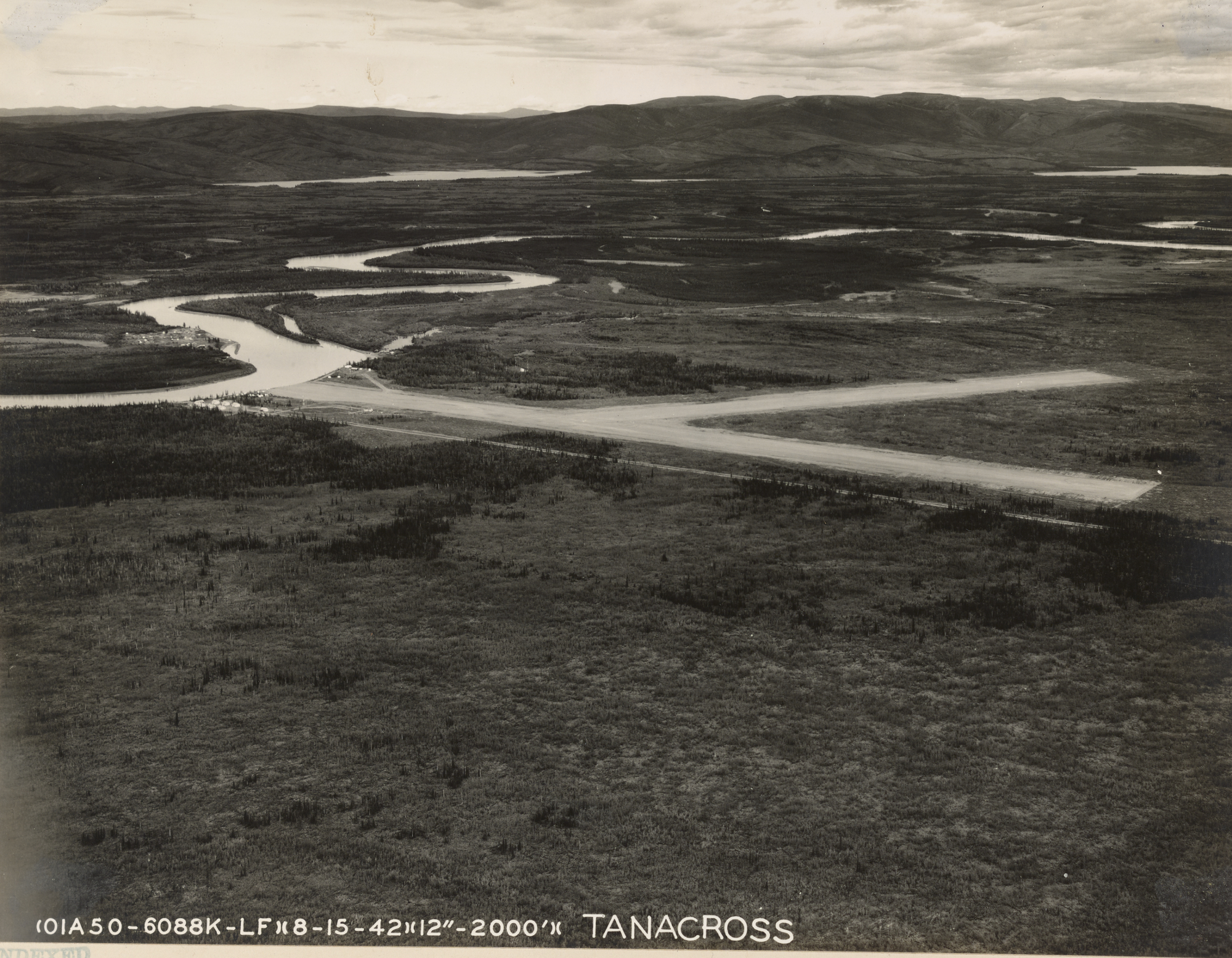
The first wartime land permit covered 3,025 acres administered by the Civil Aeronautics Administration. The Corps inventory dates the permit instrument to October 28, 1943, with effect from May 27, 1941. That distinction helps explain why military use is recorded before the Army engineer project began. An Army aerial taken August 15, 1942 already shows the crossing airstrips in the river valley. [1] [3] [13]
Building a Winter Garrison
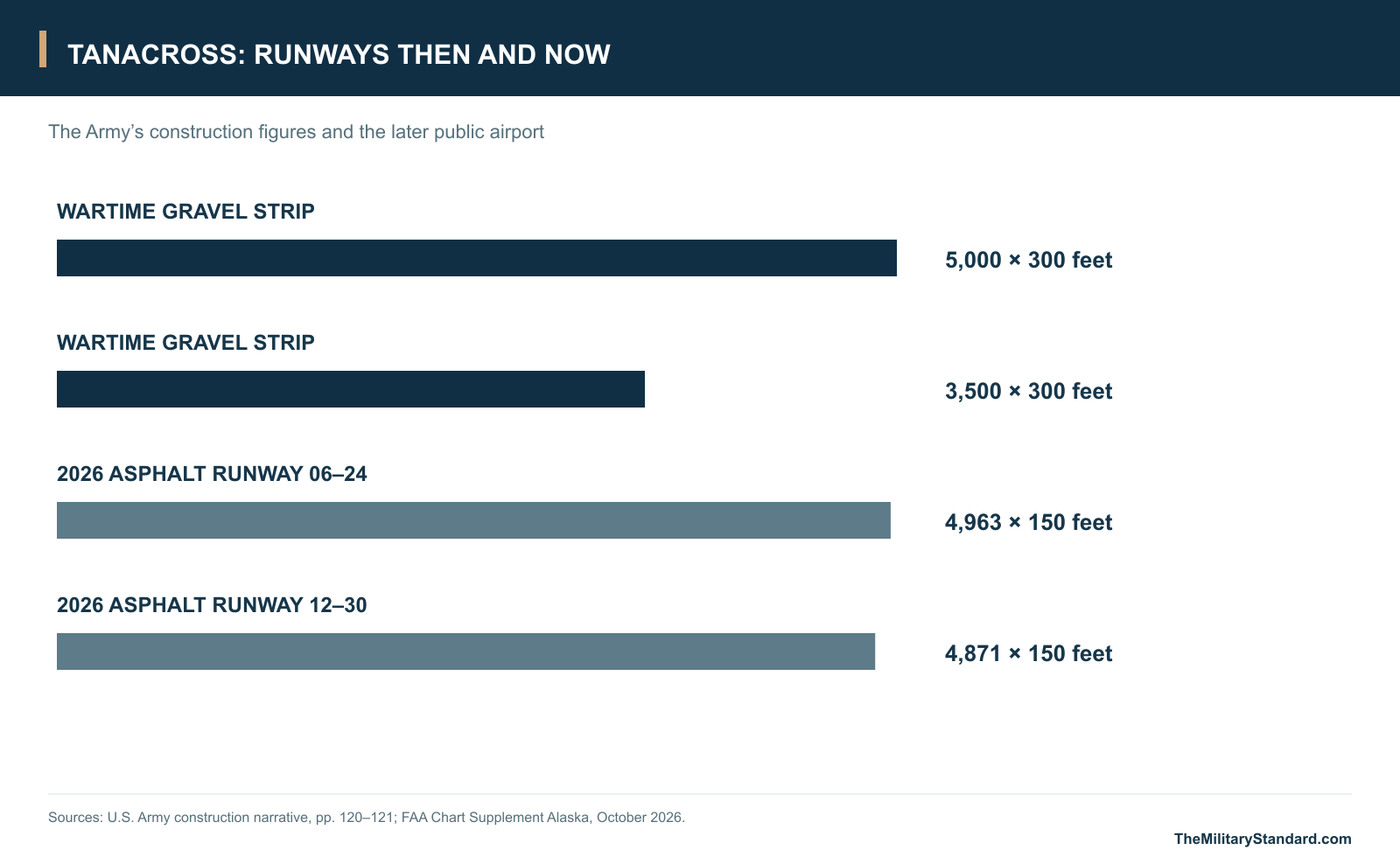
The Civil Aeronautics Administration built two gravel runways. The Army's construction narrative records one at 5,000 feet and the other at 3,500 feet, each 300 feet wide. The garrison also gained a road connection to the Alaska Highway, which the Army report placed about two miles west of the camp. A strip could receive an aircraft, but road access and a staffed camp were necessary to keep the field supplied and useful over the winter. [1]
On November 2, 1942 a platoon of the 176th Engineer Regiment, General Service, began construction with a headquarters and service detachment. Captain William T. Bostick was the resident engineer. The Army report describes difficult winter conditions and disrupted supply routes that delayed the work. The initial project was recorded complete on June 1, 1943 at an estimated cost of $130,000, when responsibility passed to the Northwest Service Command. [1]
The Army's initial program called for facilities for two officers and 48 enlisted men. That figure describes a construction requirement, not the number of all personnel or travelers who passed through Tanacross. Quonset huts and theater-of-operations buildings designed for frigid conditions supplied much of the camp. The Air Corps also used 16-by-16-foot Stout houses as operations buildings. Wells supplied water, and the Army attributed the ability to operate waterborne sewerage through winter to the area's warm springs. [1]
A Stop on the Lend-Lease Route
The Tanacross project was part of a Northwest Service Command expansion for Air Transport Command. The official Air Forces history places a small ATC contingent at Tanacross early in 1943. It also records how the Northwest Division Engineers took on construction at Northway, Tanacross and Big Delta while the ATC organization managed traffic on the route. At an intermediate field, a usable runway, communications and ground service mattered more than the size of the resident detachment. [1] [4]
Aircraft came through Canada and continued west from Tanacross toward the American-Soviet transfer at Ladd Field. Soviet crews carried the aircraft onward through western Alaska, with Galena Army Air Base and Marks Field at Nome among the supporting stops. Tanacross's work was on the eastern approach to that handover. The same system also helped move supplies and personnel into Alaska, where weather, mechanical delays and distance made alternative landing fields valuable. [4] [5]
The later property inventory and tribal work plan describe the scale of support behind the runway: roughly 60 buildings, an aircraft hangar, navigation facilities and fuel systems. The inventory names quarters, mess halls, garages, warehouses, a post office and a terminal. Those functions show the difference between maintaining an emergency strip and operating a staging station: fuel and stores had to be received, crews housed or fed and equipment kept in service. [3] [6]
Reading the Wartime Aerials
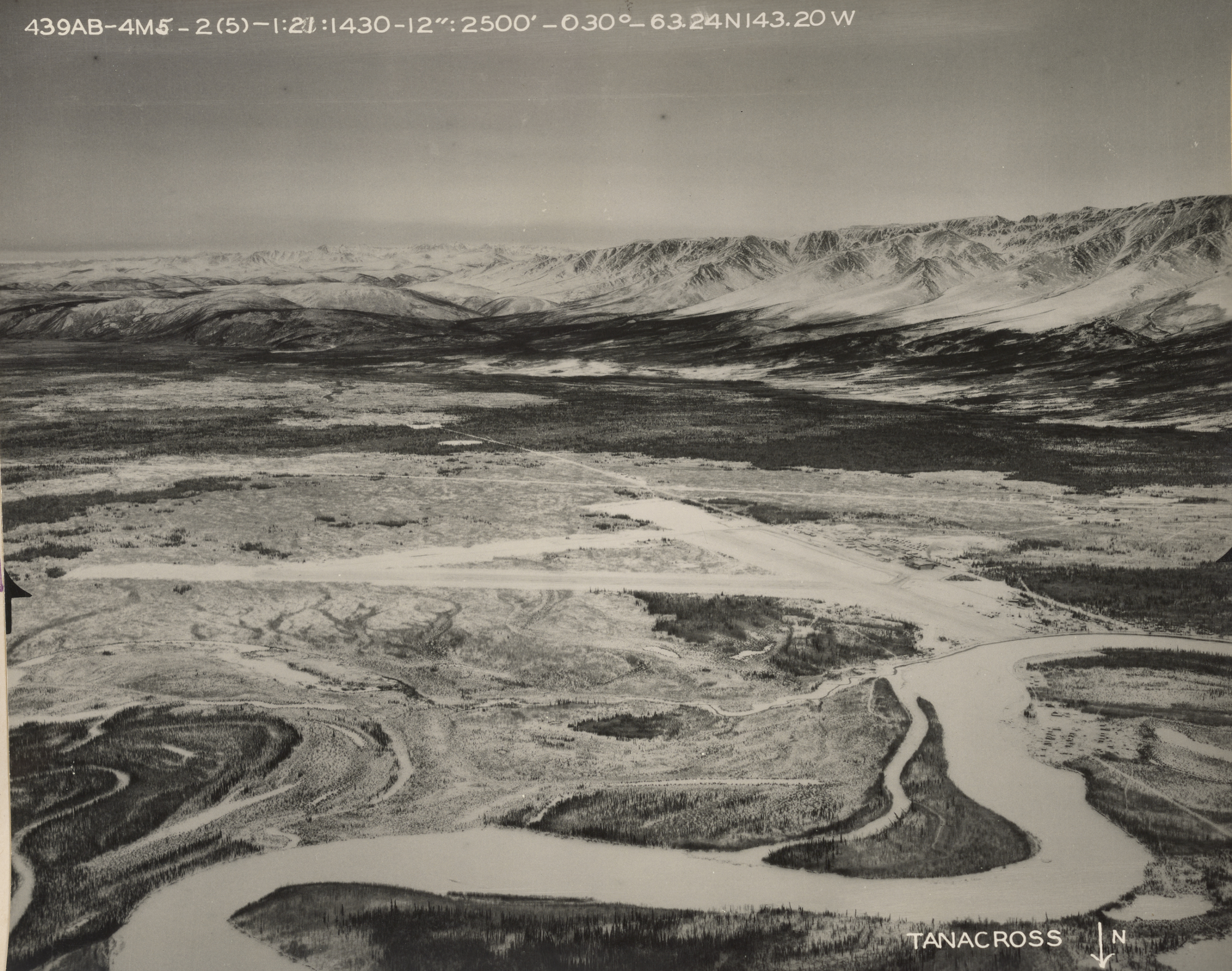
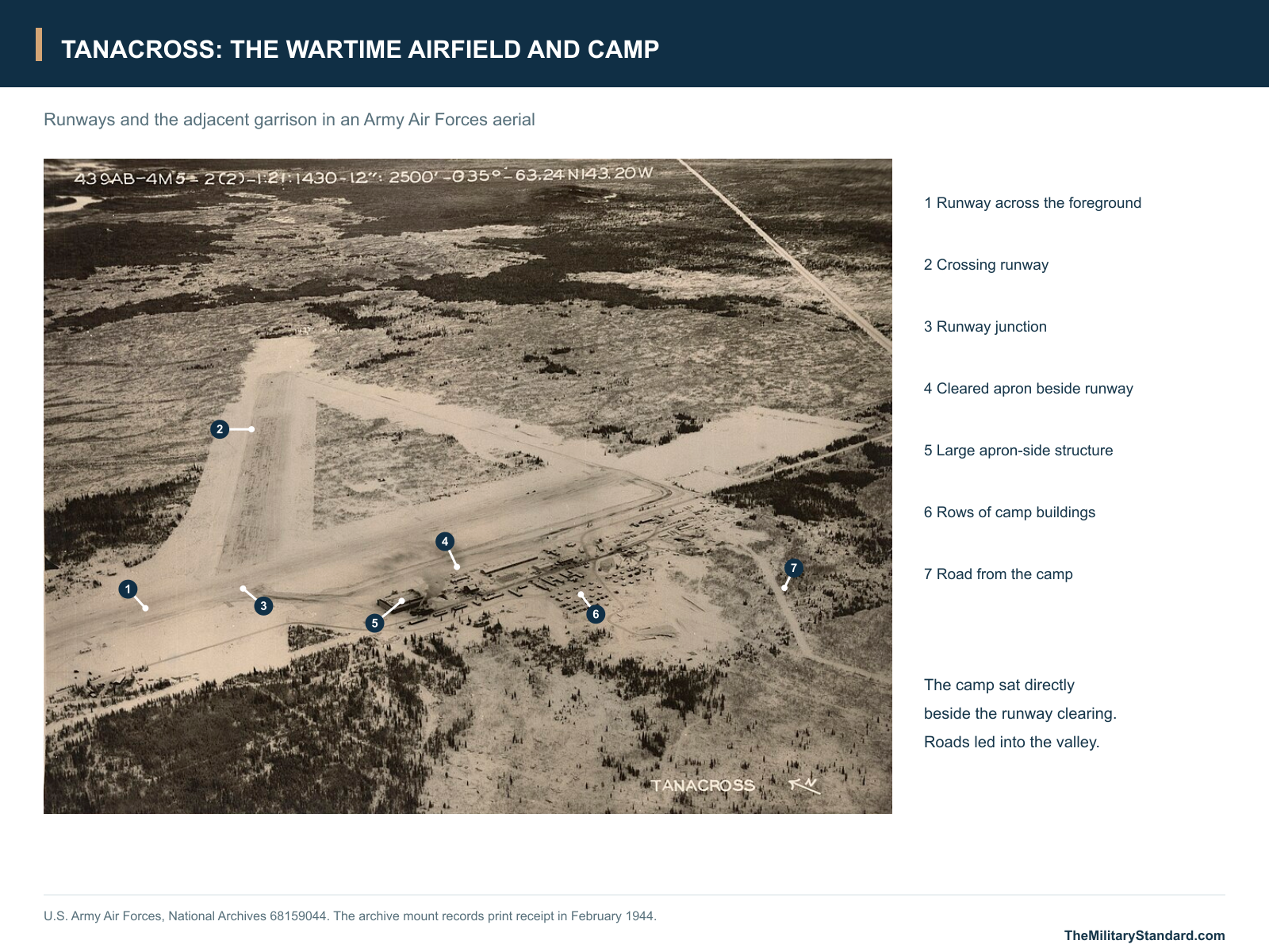
One wartime view looks across both runway alignments toward a dense group of buildings beside the cleared operating area. A large structure stands close to the runway edge, while smaller buildings form rows behind it. Tracks link the camp with the wider road system. The photographs show how closely the flying field and the ground organization were connected and how abruptly the clearing gave way to the wooded river plain. [14] [15] [16]
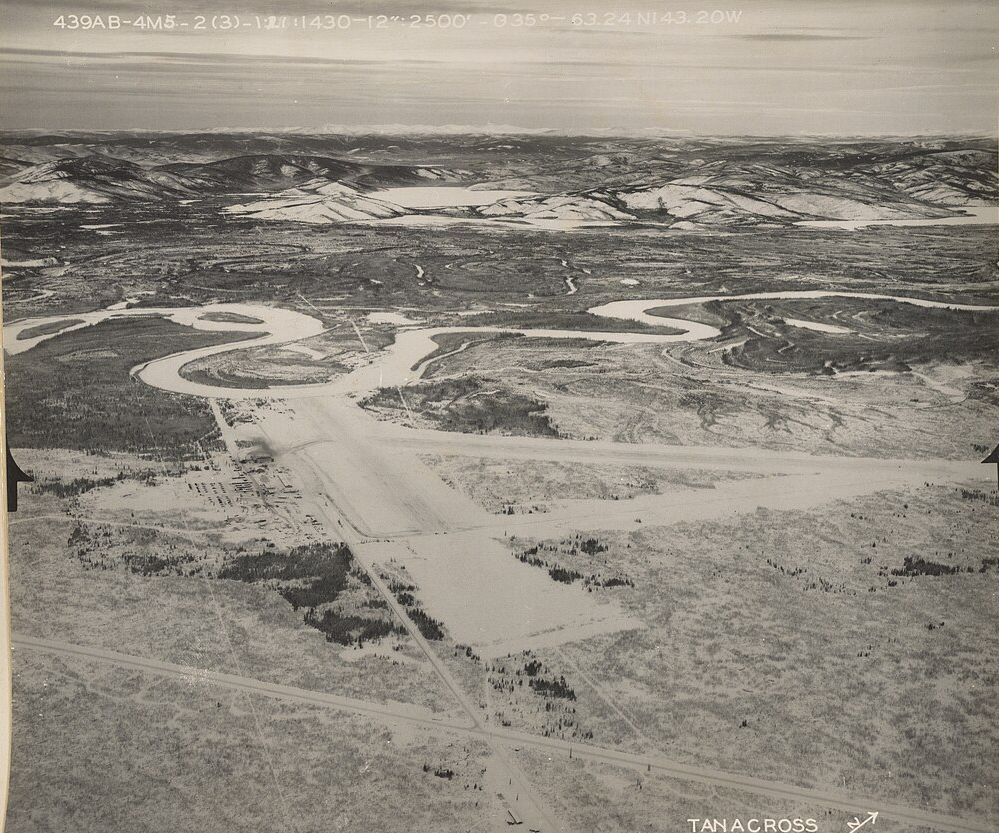
Seen from a second angle, the runway intersection sits between the camp, the road corridor and the Tanana River's looping channels. The change in viewpoint makes clear why a photograph taken from one side can hide buildings visible in another. The August 1942 view already shows the flying ground; the later series shows the larger camp and its supporting clearings after the engineer project had developed the site. [13] [14] [15] [16]
The airfield's communications and fuel functions left traces beyond the main cluster. The Corps' wartime communications inventory lists Tanacross under the Alaska Communication System call sign WSFB. Later investigation records distinguish the airfield beacon-generator area, former radio-site generator and tower supports, and former fuel facilities. These records establish several support areas within the broader property; they describe functions at a different level of detail from the oblique aerial views. [6] [7] [8] [17]
Excess Property and Cold War Reuse
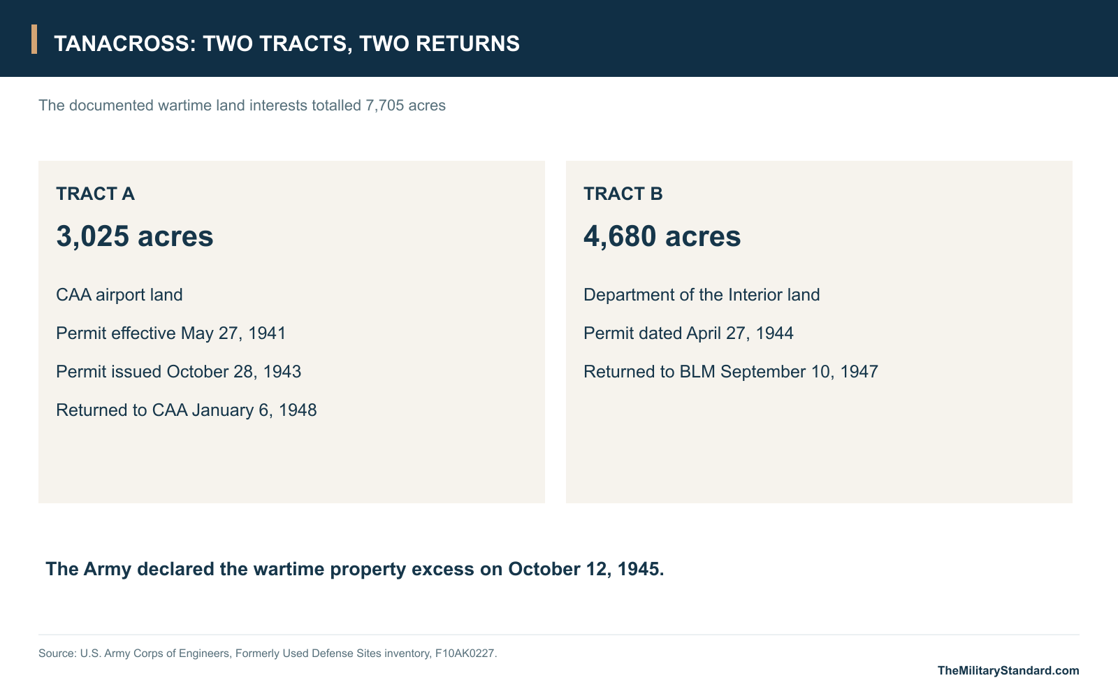
Wartime occupation ended in October 1945. The Corps inventory gives October 12 as the date the property was declared excess. The two tracts then followed separate paths: the 4,680-acre Interior tract returned to the Bureau of Land Management on September 10, 1947; the 3,025-acre tract containing the known airfield improvements returned to the CAA on January 6, 1948. The combined 7,705 acres describe the documented military land interests, rather than the area of today's airport. [3] [6] [8]
Civil aviation continued after the garrison era. The former military field also remained useful for temporary exercises. For the joint Army and Air Force exercise Polar Strike, the Federal Aviation Agency set up temporary controlled airspace at Tanacross for the January 26-March 1, 1965 exercise period. Its rule provided for a mobile control tower and weather observations because exercise traffic and civilian aircraft would be sharing a major interior flying corridor. [6] [9]
The exercise illustrates a different kind of military use from the wartime base. The established airfield could support a concentrated period of flying without maintaining the permanent wartime camp. Later property records describe a mosaic of uses and jurisdictions, including federal lands, airport operations and land held by Tanacross, Inc. The old runway corridor survived those changes even as the original operating organization disappeared. [3] [6] [9]
The Airfield Today
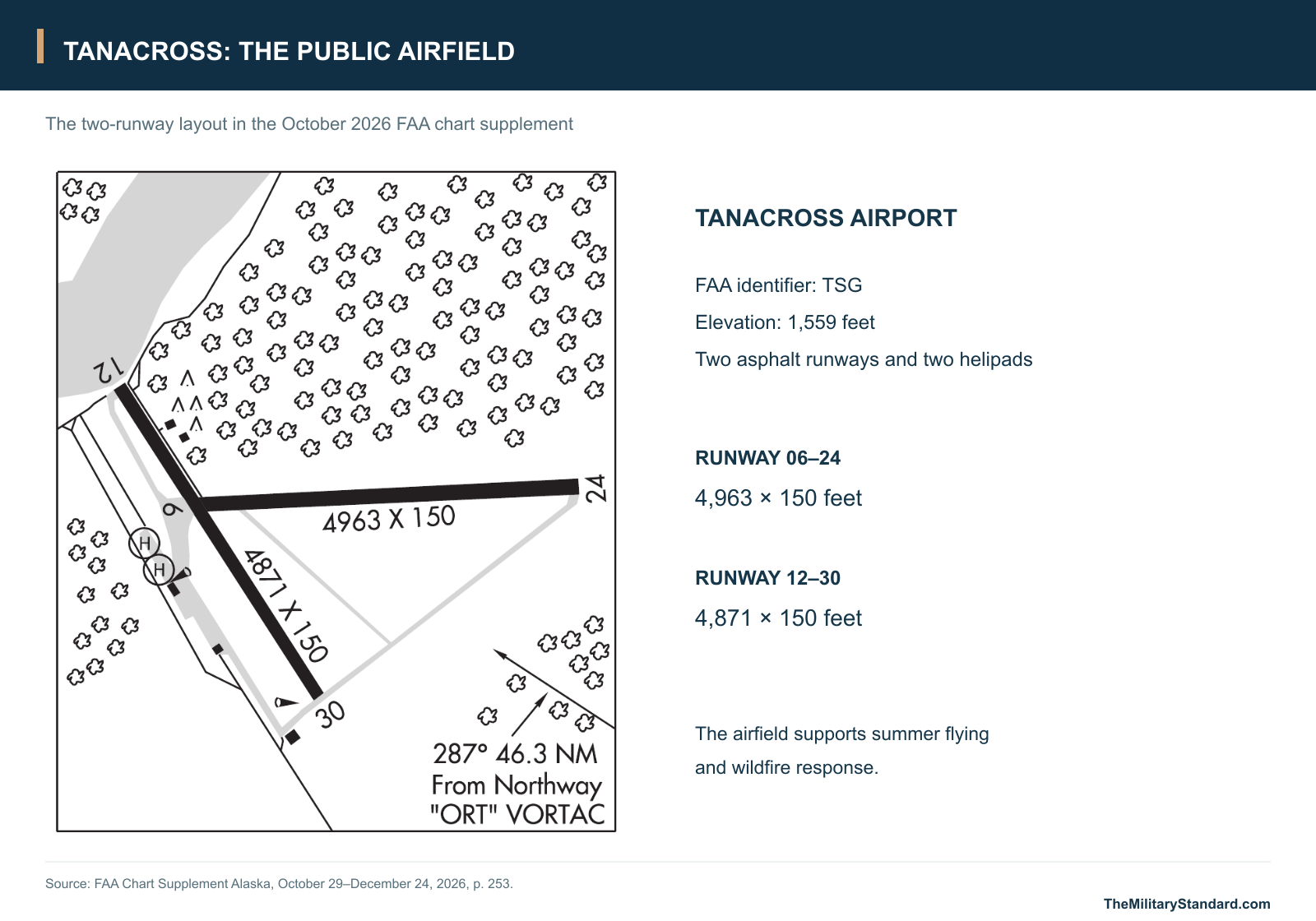
Tanacross Airport remains a public airfield, identified by the FAA as TSG. The October 2026 airport entry lists two asphalt runways: 06-24 at 4,963 by 150 feet and 12-30 at 4,871 by 150 feet. It also shows two helipads and notes summer air operations and fire support. The Alaska Division of Forestry & Fire Protection identifies Tanacross as a retardant reload base, a use that carries forward the airfield's regional support role in a different form. [10] [12]
The Native Village of Tanacross has led work under the Native American Lands Environmental Mitigation Program to investigate and address former military impacts. At the former fuel facilities, the state records removal of roughly 1,000 cubic yards of soil in 2012 and installation of monitoring wells in 2015. Later reports describe work at the former beacon area and other distinct locations. These actions address particular parts of a large former property; the fuel area and other subsites have their own records and outcomes. [6] [7] [8]
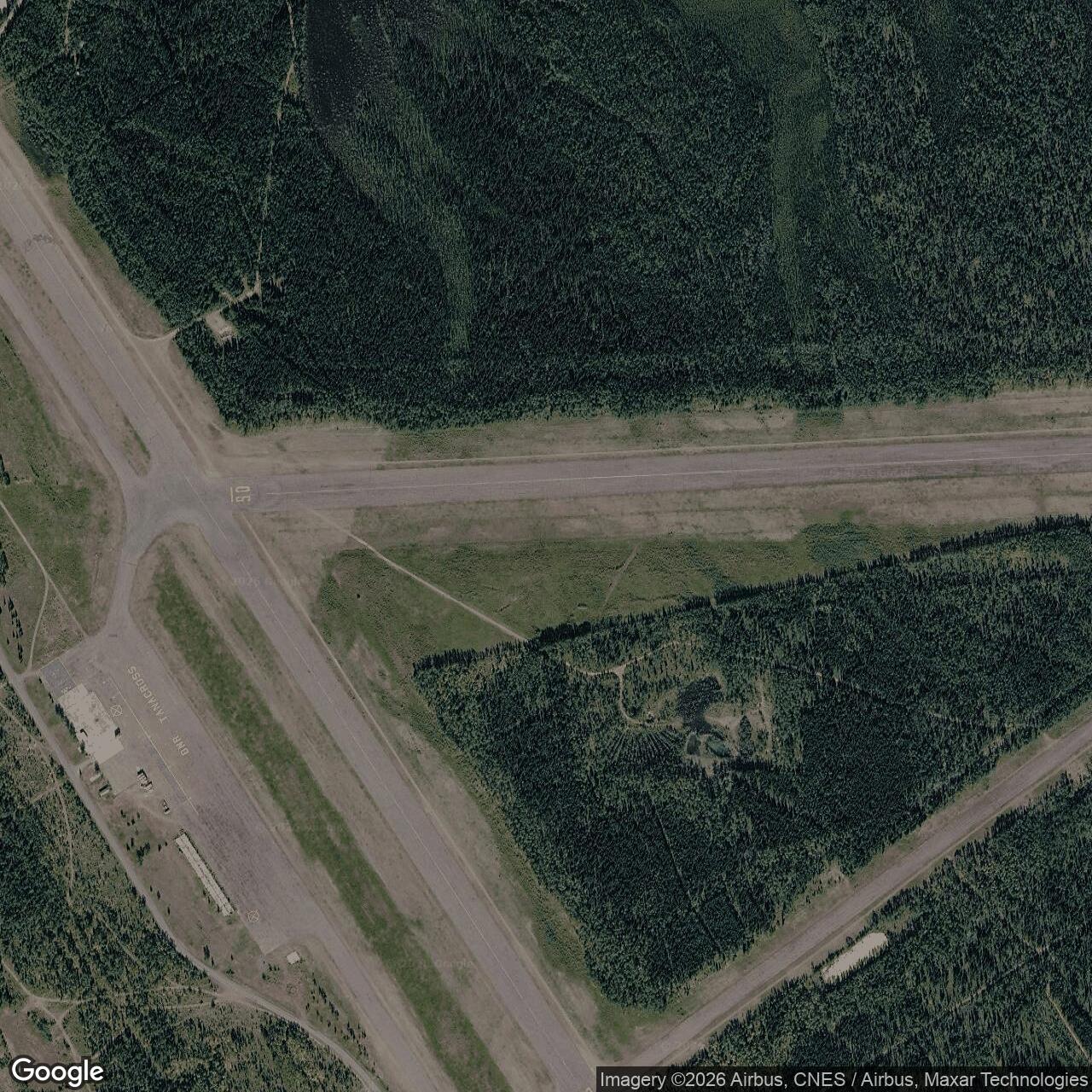
The surviving airport preserves the two-runway form visible in the wartime photographs, even though surfaces, dimensions and uses have changed. Tanacross's history connects an established Athabascan community and its early air service, a wartime Army construction project, the international aircraft ferry route, and a modern airfield that supports Interior Alaska. [1] [2] [5] [10] [13] [14]
Chronology
- Early 1930s An airstrip is cleared on the south bank of the Tanana River. [2]
- May 27, 1941 Effective date of the CAA tract permit later issued to the War Department. [3]
- August 15, 1942 An Army aerial shows the intersecting strips before construction of the garrison. [13]
- November 2, 1942 The 176th Engineer Regiment starts the garrison project. [1]
- June 1, 1943 The original project is recorded complete; responsibility passes to the Northwest Service Command. [1]
- October 28, 1943 The use permit for the 3,025-acre CAA tract is dated. [3]
- February 1944 The mounts of a wartime aerial series record receipt of prints showing the airfield and camp. [14] [15] [16]
- April 27, 1944 The Interior Department permit adds the 4,680-acre tract. [3]
- October 12, 1945 The wartime property is declared excess. [3]
- September 10, 1947 The Interior tract is returned to the Bureau of Land Management. [3]
- January 6, 1948 The airfield tract is returned to the Civil Aeronautics Administration. [3]
- January-March 1965 Tanacross Airport supports joint exercise Polar Strike; temporary air traffic services are arranged. [9]
- 1972 The village moves to the south side of the river. [2] [18]
- 2012 Approximately 1,000 cubic yards of affected soil are removed at the former fuel facilities. [8]
- 2015 Three monitoring wells are installed at the former fuel facilities. [8]
- 2025 DEC approves a site investigation report for the former beacon-generator area and records plans for further sampling. [7]
- 2026 The FAA lists two asphalt runways and two helipads at the public airport. [10]
Related Sites
Information sources (19)
- PDFU.S. Army, Narrative Report of Alaska Construction, 1941-1944, Tanacross, pp. 120-121
Garrison construction, engineers, runway surfaces and dimensions, buildings, water, completion and estimated project cost.
- PDFWilliam E. Simeone, Upper Tanana Ethnographic Overview and Assessment, Alaska Department of Fish and Game Technical Paper 325
Upper Tanana communities, early air service, the village council's wartime agreement and the 1972 village relocation.
- WEBU.S. Army Corps of Engineers, Tanacross AF, FUDS property inventory F10AK0227
Wartime use permits, acreage, approximately 60 buildings, excess declaration and separate tract returns.
- WEBU.S. Air Force, The Army Air Forces in World War II, volume VII, chapter 6
Air Transport Command staffing and construction responsibilities along the Northwest Staging Route.
- WEBNational Park Service, Ladd Field and the Lend-Lease Mission: Defending Alaska in WWII
Tanacross in the Alaska staging chain; aircraft handover at Fairbanks and the onward route to Siberia.
- PDFNative Village of Tanacross and Bristol Environmental Remediation Services, Groundwater Monitoring, Debris/Soil Removal, and Site Investigation Work Plan, April 2019
Wartime hangar, navigation and fuel facilities; military reuse, tract history and investigation of distinct airfield areas.
- WEBAlaska Department of Environmental Conservation, Tanacross Airfield Site, Hazard ID 868
Tribal mitigation program, distinct airfield subsites and dated remediation and groundwater actions.
- WEBAlaska Department of Environmental Conservation, Tanacross Airfield Site - Former Fuel Facilities, Hazard ID 25180
Wartime occupation period and documented fuel-area investigation, soil removal and monitoring.
- PDFFederal Aviation Agency, Federal Register, January 13, 1965, Airspace Docket 64-AL-23
Exercise Polar Strike use of Tanacross Airport and provision for a temporary control tower and weather reporting.
- PDFFederal Aviation Administration, Chart Supplement Alaska, October 29-December 24, 2026, p. 253
Airport reference coordinates, identifier, two asphalt runways, two helipads and seasonal fire support.
- PDFU.S. Geological Survey, Tanacross quadrangle, 1956 series with limited revisions in 1981
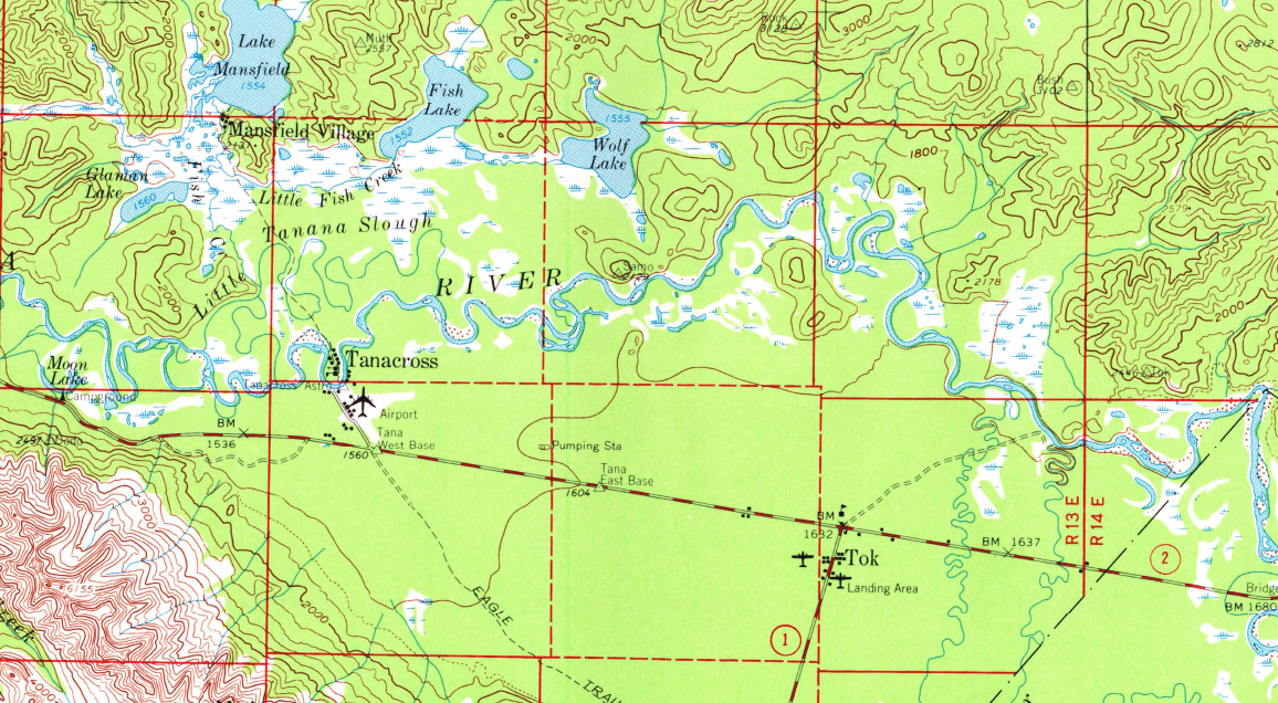
Topographic context for the Tanana River, airport, Tanacross and Tok.
- WEBAlaska Division of Forestry & Fire Protection, Aviation: Retardant Bases
Tanacross airfield's role as a wildfire retardant reload base.
- WEBU.S. Army Air Forces, Landing Fields - Alaska, National Archives 68159046
August 15, 1942 aerial of the crossing strips before the documented November garrison start.
- WEBU.S. Army Air Forces, Landing Fields - Alaska, National Archives 68159044
Oblique wartime view of the runway junction, apron-side structures, camp and access roads; mount records receipt in February 1944.
- WEBU.S. Army Air Forces, Landing Fields - Alaska, National Archives 68159042
Complementary wartime aerial looking across the airfield toward the Tanana River and surrounding hills.
- WEBU.S. Army Air Forces, Landing Fields - Alaska, National Archives 68159040
Wartime oblique aerial showing the airfield in its river-valley setting.
- PDFU.S. Army Corps of Engineers, History of World War II in Alaska and Management Plan, 1987, table 4-2
Tanacross listed in the wartime Alaska Communication System inventory under call sign WSFB.
- WEBTanana Chiefs Conference, Tanacross community profile
Community history, south-bank village and local account of wartime traffic.
- PDFU.S. Army, Alaska Army Lands Withdrawal appendix, Fort Greely history
Identifies the wartime Big Delta staging field as the predecessor of Allen Army Airfield.