
Marks Air Force Base, Nome Alaska
A wartime Army airfield, a gateway for aircraft bound for Siberia, and an early Air Force base on the Snake River flats.
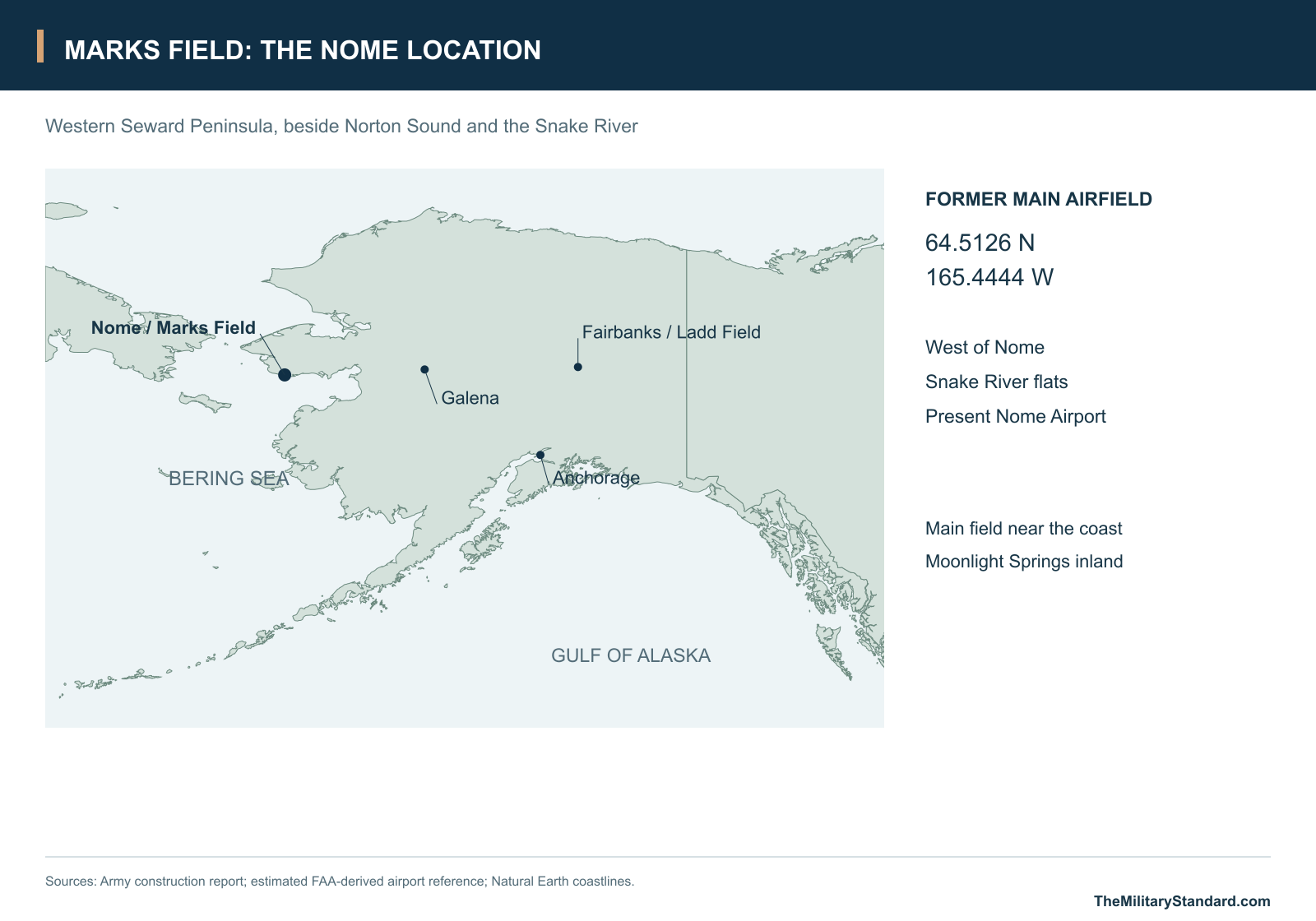
Longitude: -165.4444
Airport ICAO ID: PAOM
Current Role: Public airport; historic military base redeveloped
- Names
- Nome Air Base; Marks Army Airfield; Marks Air Force Base
- Location
- Snake River flats west of Nome, Seward Peninsula
- Army construction begins
- July 23, 1941
- First garrison troops
- September 1941
- Wartime roles
- Western Alaska air defense, aircraft staging and Lend-Lease support
- Fighter detachment
- 56th Fighter Squadron, June 20-October 20, 1942
- Aircraft instruction
- P-39 Airacobra school
- Main north-south runway
- 4,146 feet long in the October 1943 camp plan
- Main east-west runway
- 5,700 feet long in the October 1943 camp plan
- Satellite field
- Moonlight Springs, a separate inland airfield
- Hangars
- Two Birch-type T hangars; modified Birchwood hangar in the expansion program
- Hospital
- 100 beds in the construction report
- Gasoline storage
- Approximately 3 million gallons in the construction report
- Fuel-oil storage
- 850,000 gallons in the construction report
- 1943 expansion
- Additional parking, river diversion, hangar, satellite runway extension and housing
- Air Force base closure
- 1950
- Later main-field use
- Nome Airport (PAOM / OME)
A Western Alaska Air Gateway
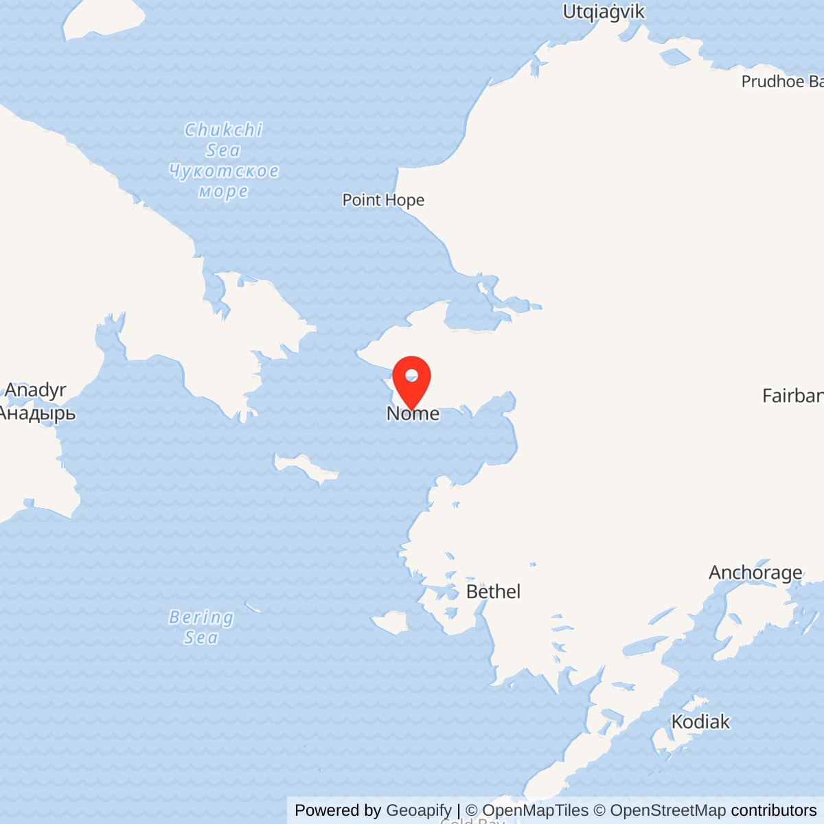
Marks Field brought a major wartime air base to the flats west of Nome, on the southern shore of the Seward Peninsula. Its runways served aircraft moving toward Siberia, while its garrison supported flying, maintenance and the defense of western Alaska. The installation developed as an Army air base during World War II and continued into the early postwar period as Marks Air Force Base. Its main flying ground became the present Nome Airport. [1] [2] [5]
The location placed the base beside Norton Sound and within reach of the Bering Strait. Aircraft approaching the far western end of the Alaska-Siberia route needed fuel, repairs, weather information and somewhere to land when conditions interrupted a journey. Nome supplied those services close to the international crossing. The military landscape extended inland from the main airport through separate camps, supply areas and the satellite airfield at Moonlight Springs. [1] [2]
The field took its name from Captain Jack Marks, killed in action in Alaska on July 17, 1942. The name became associated with the airfield, its wartime Army community and the later Air Force base. The airport that succeeded it continues to occupy the same broad main-field location beside the Snake River. [2] [7]
Building the Nome Garrison
Construction began on July 23, 1941, with civilian employees working under Engineer officer supervision. The first troops of the initial garrison arrived in September. During the June 1942 expansion, troop units erected their own accommodation, while the 32nd Engineer Company supplied technical construction work and helped establish construction camps. Captain John W. Baum conducted the first surveys and planning and served as the first resident engineer. [1]
The main field was placed in an old gold-dredging area where tailings and already thawed ground offered a suitable construction site. Building on the Seward Peninsula involved decisions about ground conditions as well as runway alignment. Airfield earthwork, drainage, roads, fuel storage and dispersed accommodation all had to be fitted into a landscape crossed by streams and altered by mining. [1] [7]
The Civil Aeronautics Administration arranged construction of the runways by contract. The October 1943 Air Corps camp plan labels the north-south main-field runway at 4,146 feet and the east-west runway at 5,700 feet. The construction narrative describes both main runways as 300 feet wide. A third runway belonged to the separate Moonlight Springs satellite field. The two airfields each required a garrison and operating support. [1] [2]
Airfield services grew around the flying surfaces. The construction report records a 100-bed hospital and two Birch-type T hangars. Fuel storage amounted to approximately three million gallons of gasoline and 850,000 gallons of fuel oil. Tank groups, truck-filling points, stores and roads linked fuel delivery with the aircraft and the many separate camp areas. [1]
Aircraft, Patrols and the Lend-Lease Route
Nome had a defensive role during the urgent expansion of Alaska's air protection in 1942. A detachment of the 56th Fighter Squadron reached Nome on June 20 and flew patrols until October 20, 1942, when it left for Anchorage. The squadron had converted to the Bell P-39 Airacobra before the Alaska deployment. A P-39 school at Nome added aircraft instruction to the base's technical-support work. [5] [6]
The Lend-Lease delivery route connected factories and staging fields in North America with the Soviet war effort. Ladd Field at Fairbanks was the principal American-Soviet aircraft handover point. Soviet crews then took the aircraft onward through western Alaska toward Siberia. Galena and Nome formed important parts of that onward journey, providing places to stage, refuel and deal with the practical demands of moving aircraft across a vast region. [3] [4]
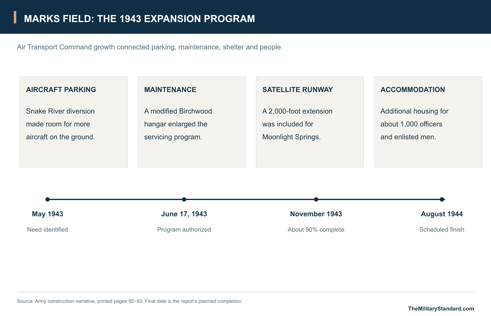
By May 1943, increasing ferry traffic between Fairbanks and Siberia had made additional facilities at Nome necessary. The resulting expansion, called Plans B and C in the Army report, was authorized by a June 17, 1943 letter concerning the Alaskan Wing of Air Transport Command. The program included diverting part of the Snake River to make room for additional aircraft parking, erecting a modified Birchwood hangar, extending the satellite runway by 2,000 feet and adding housing for about 1,000 officers and men. [1]
The expansion joined aviation engineering with the movement of aircraft and people. Parking space reduced congestion on the ground, a larger maintenance shelter supported servicing, and additional quarters accommodated the personnel needed to keep the traffic moving. By November 1943, the report judged the original and subsequent programs about 90 percent complete. It scheduled completion of Plans B and C for August 1944 and estimated the Nome project's cost at about $7 million. [1]
A Dispersed Military Landscape
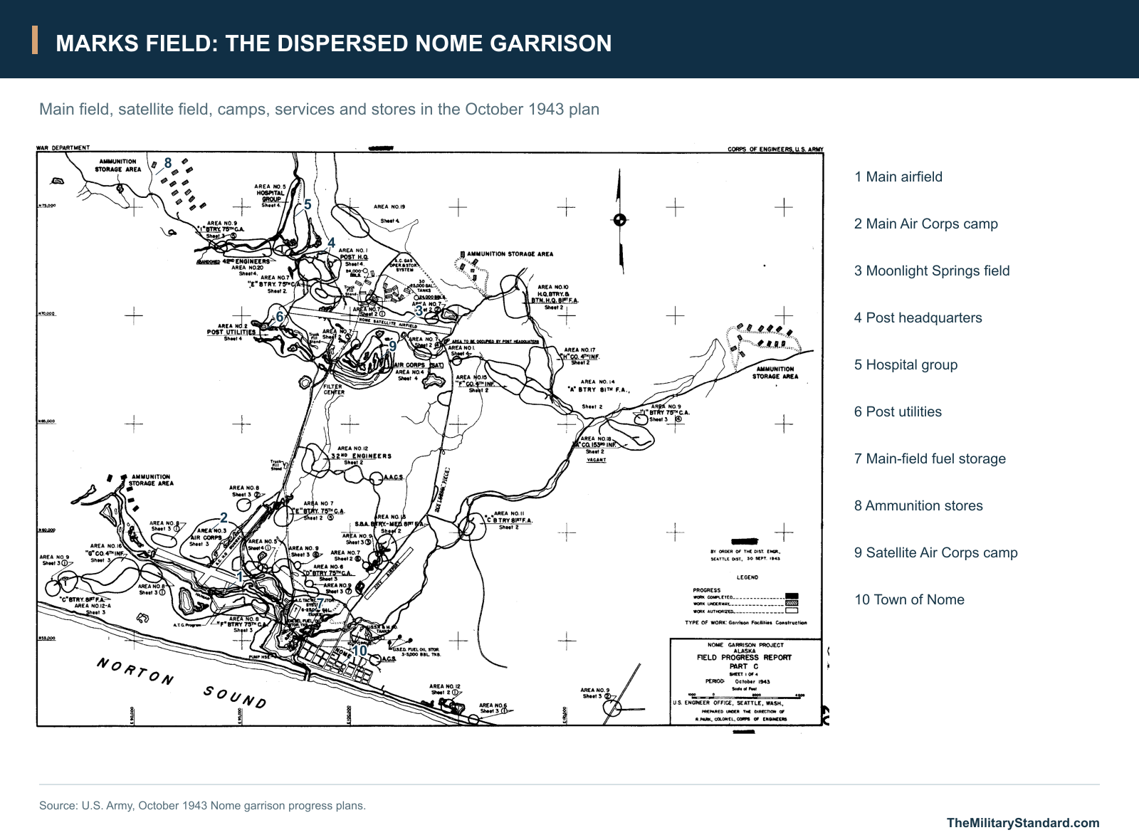
The October 1943 progress plan shows the main airfield near the coast, the town of Nome to the southeast and Moonlight Springs farther inland. The garrison spread across a network of roads rather than concentrating around a single parade ground. Post headquarters, the hospital, utilities, engineer camps, Air Corps areas and artillery or infantry accommodation occupied separately labeled areas. [1]
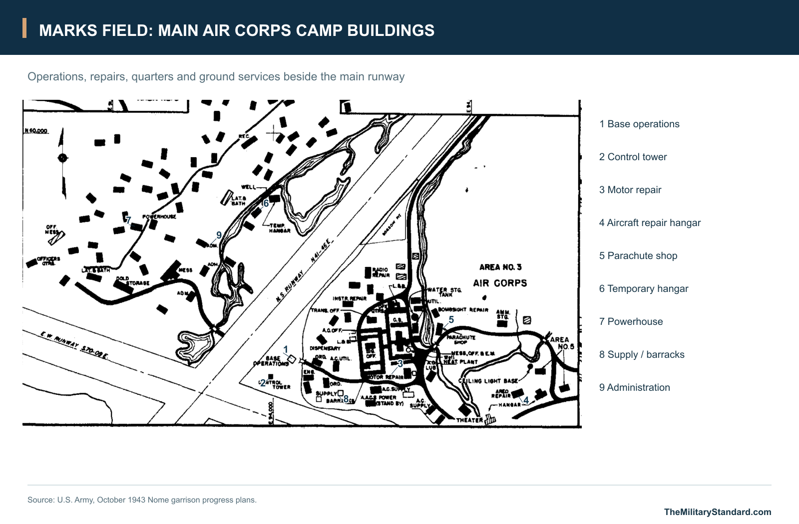
The Air Corps area beside the main field brought together base operations, a control tower, motor repair, aircraft repair, parachute work, supply, administration and quarters. Alongside these operating facilities stood mess buildings, latrines and baths, recreation space and storage. The drawing also identifies a temporary hangar, illustrating the mixture of permanent work, temporary construction and continuing expansion around the runways. [1]
Moonlight Springs formed a second aviation cluster inland. The plan labels its Air Corps camp separately from the main-field Air Corps area and places the post headquarters and utility area nearby. Ammunition storage lay in dispersed groups beyond the principal camps. Roads connected these areas with the waterfront, tank farms and the main airport, making ground transport an essential part of the flying operation. [1]
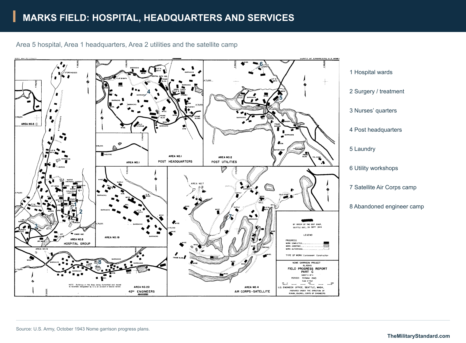
The hospital group had its own wards, operating and treatment spaces, medical supply, staff quarters and supporting services. The post utilities area included workshops, laundry, bakery and other facilities that sustained the garrison. Those buildings connected the air mission to ordinary needs: food, clean clothing, heat, vehicle repair and medical care. [1]
Work and Life at Marks Field
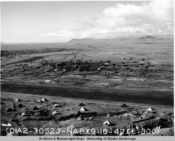
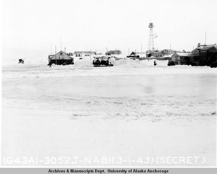
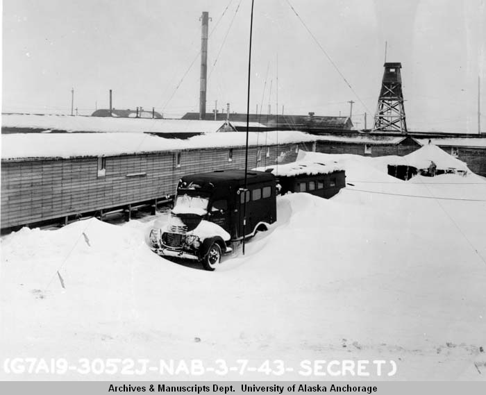
The wartime photographs in the Lawrence E. Marx collection show the base as a working community. A September 1942 view records tents and huts beside a runway while construction was still changing the landscape. In March 1943 photographs, snow surrounds the ground-operations buildings and a Signal Corps vehicle. Communications and transport continued through weather that could bury equipment and interrupt movement across the camp. [5] [18] [19] [20]
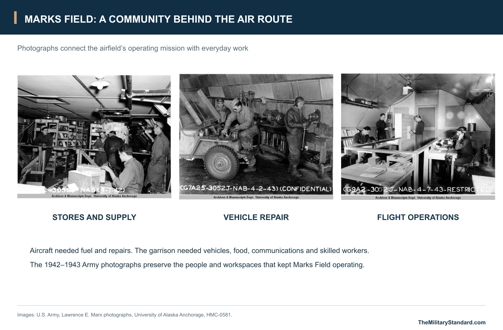
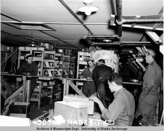
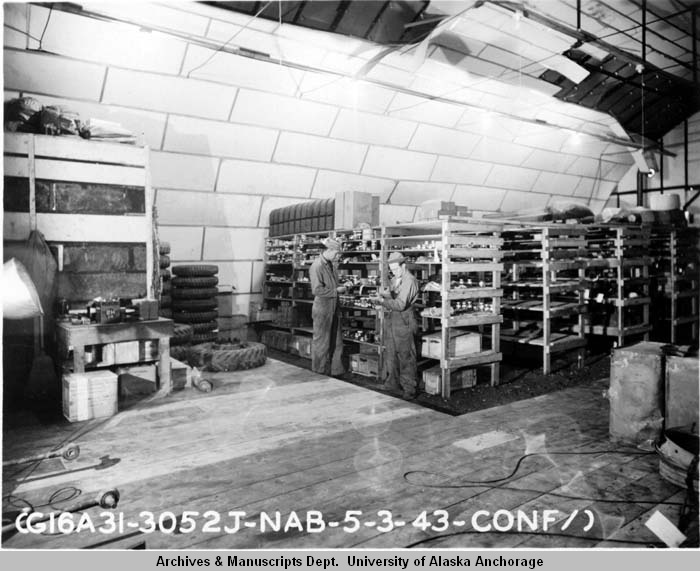
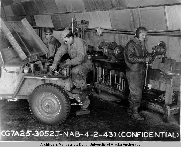
Inside, soldiers handled the stores and repairs needed by a remote air base. The September 1942 supply-room photograph shows shelves, cartons and counters in an occupied work space. A later motor-pool stockroom held tires and parts, while garage mechanics worked on a jeep and equipment at a bench. Such tasks kept the base's vehicles and support services available for its aircraft and camps. [13] [17] [21]
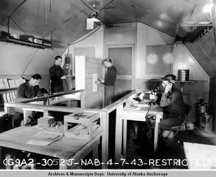
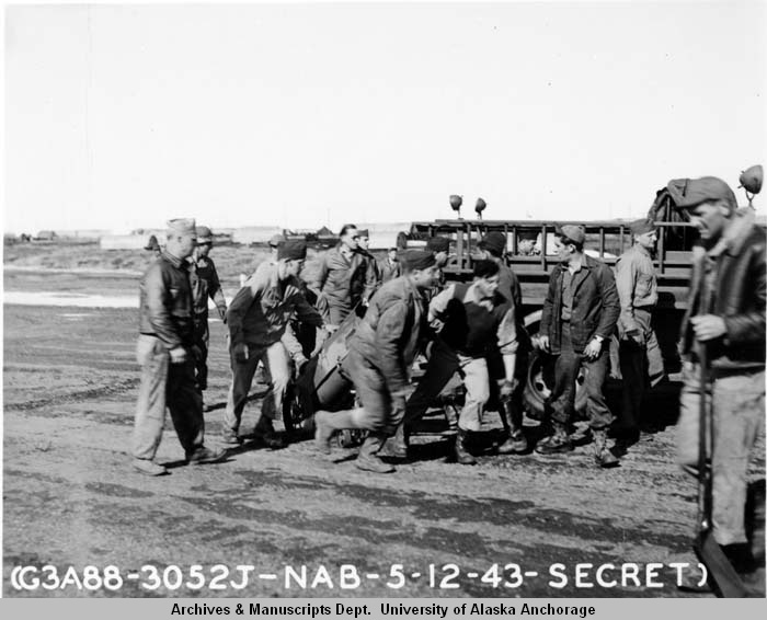
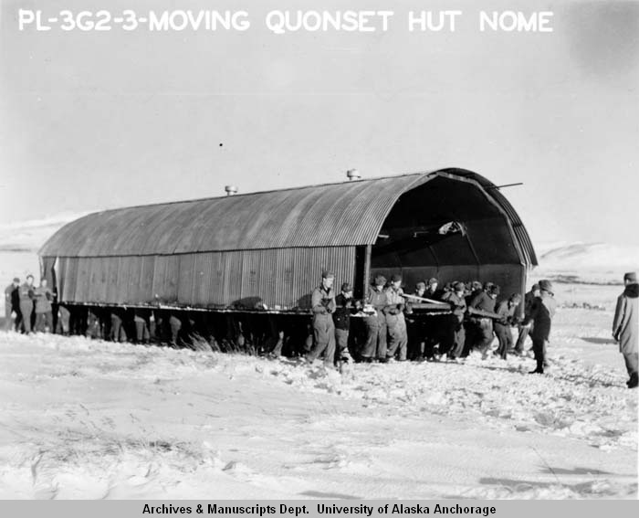
Operations personnel worked with telephones, records and a large wall display, linking activity on the ground with the organization of flights. Fire crews practiced with heavy equipment, and the garrison moved buildings as requirements changed. One photograph shows a large group of soldiers carrying a Quonset hut across the snow, a direct view of how temporary camp construction could be rearranged. [14] [15] [22]
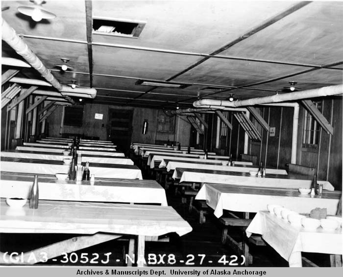
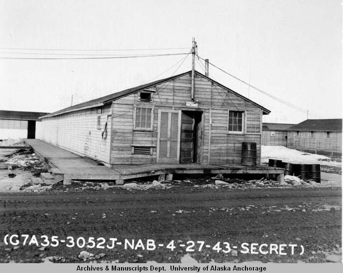
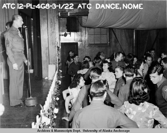
Mess halls, cold storage and recreation sustained the people behind those services. The photographs preserve an empty dining room set with rows of tables, a cold-storage building approached by a wooden walkway, and an Air Transport Command dance. These scenes give the installation a scale beyond its runways: people ate, worked, repaired equipment and gathered indoors during a demanding posting. [11] [12] [16]
Weather Support Beyond the Airfield
Reliable reports from remote locations mattered to pilots crossing the Seward Peninsula. At Lava Lake, a small military weather station opened in April 1945 and operated until November. Four soldiers staffed the station, which also had a small airfield. Its weather observations supported flying in the region, especially the Lend-Lease traffic that passed through Nome. [2]
The outlying station belonged to the wider system that made an air route usable. Information on conditions ahead could influence departures, waiting periods and the choice of landing places. At Nome itself, the operations buildings, communications facilities and ground crews brought those requirements together with fuel, maintenance and accommodation at the end of the western Alaska leg. [1] [2] [3]
The Air Force Period and the Civil Airport
Marks continued into the early years of the independent Air Force, but its postwar air-defense role was limited. By July 1950 a contemporary Alaska-defense report described inactivation under way and long stretches of nearly deserted barracks. The Marx collection guide dates the Air Force base's closure to 1950. The military airfield had reached the end of its brief postwar base period. [2] [5] [10]
Air-defense planning moved toward other forward locations. In 1951 the Air Force negotiated joint military use of Galena Airport with the Civil Aeronautics Administration, replacing Marks in its fighter-interceptor forward-base plans. That change linked the end of Marks' early Cold War role with the development of a different system for supporting interceptors in interior and western Alaska. [4]
The main airfield continued as Nome Airport. The Corps' 1994 cultural-resources inventory reported that the wartime structures used during the Cold War had been removed. The 2012 airport assessment identifies the former Birchwood hangar as demolished and records an earlier determination that Marks Field lacked the integrity needed for National Register eligibility. The surviving airport landscape therefore reflects extensive rebuilding as well as its wartime origin. [2] [7]
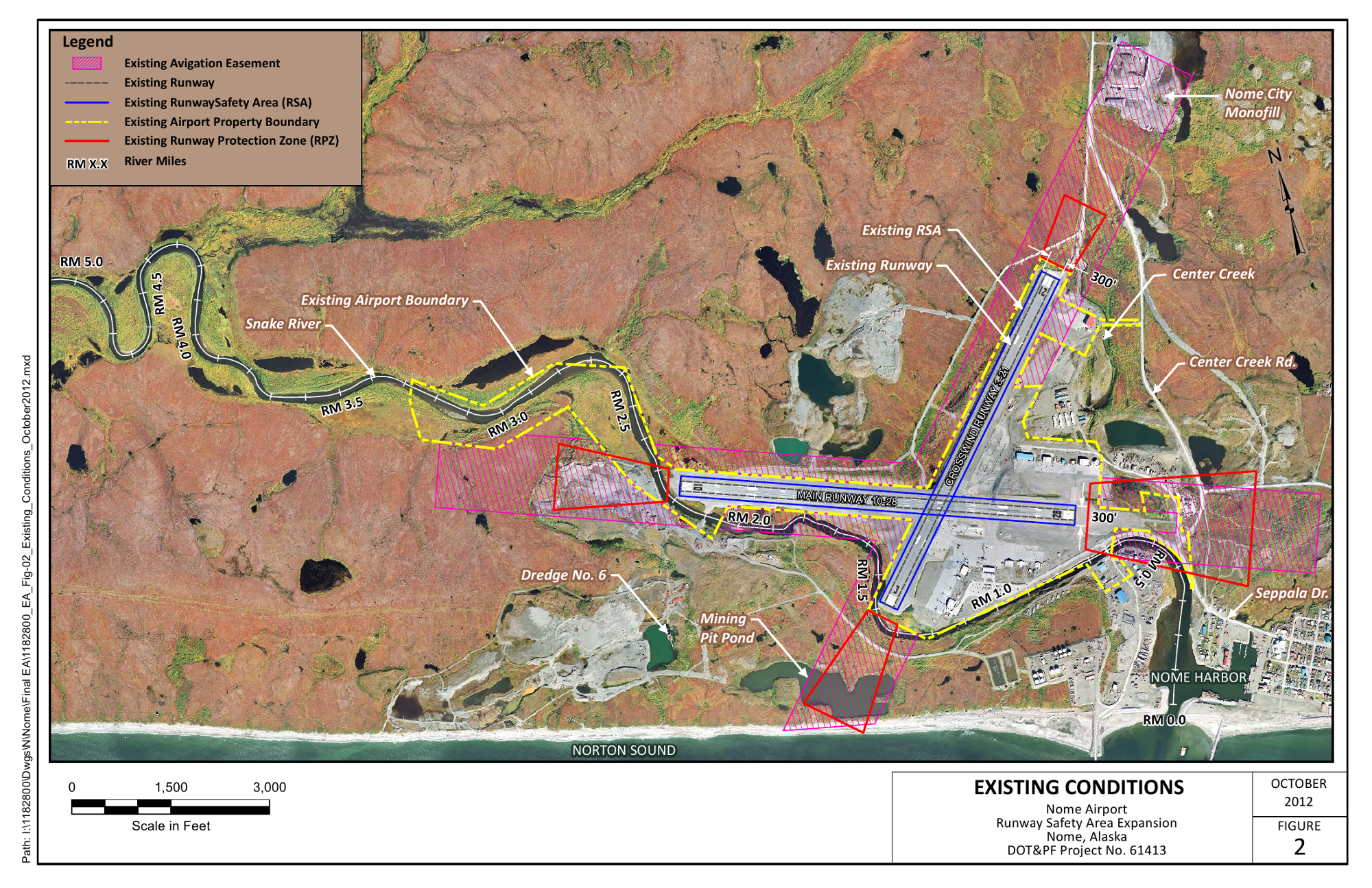
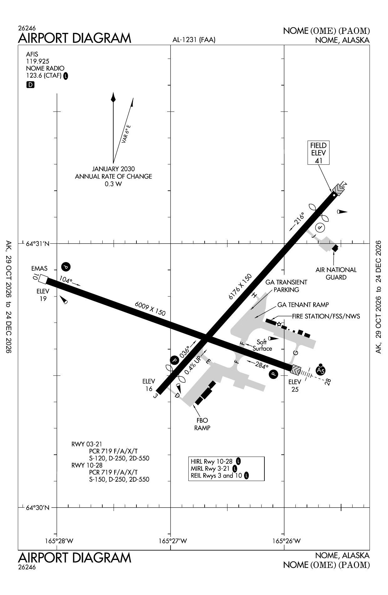
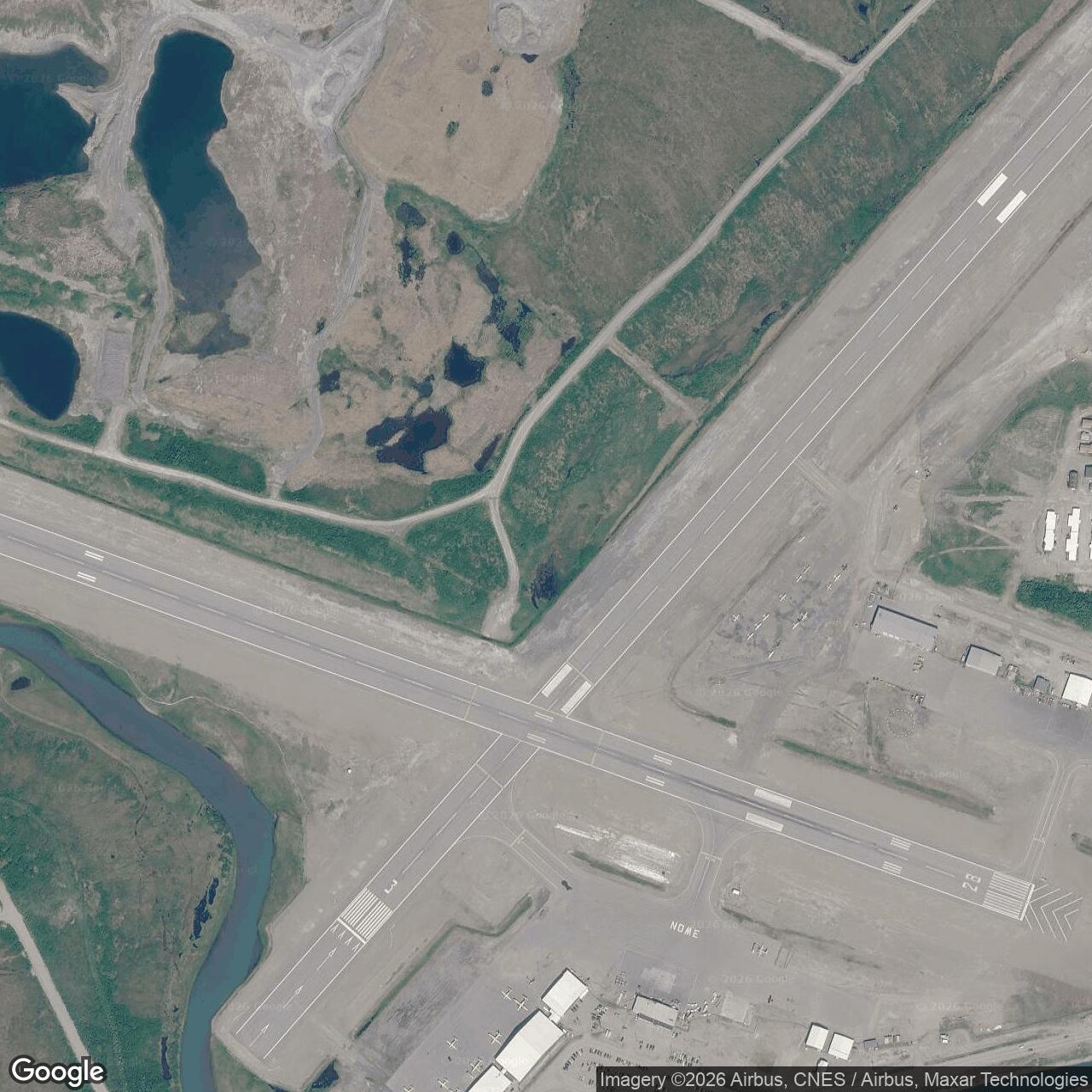
The 2012 existing-conditions drawing places the airport beside the Snake River and Nome Harbor, while the later FAA diagram shows the functioning civil airport and its intersecting runways. These later records help locate the former main field in the present landscape. Marks' historical importance remains in its wartime construction, western Alaska patrols, aircraft ferrying and the support community that connected the air route with Nome. [1] [7] [8]
Chronology
- July 23, 1941 Construction begins under Engineer officer supervision. [1]
- September 1941 The first troops of the initial Nome garrison arrive. [1]
- June 1942 The garrison expands, with troop units erecting accommodation and engineer forces supplying technical construction work. [1]
- June 20, 1942 A 56th Fighter Squadron detachment arrives at Nome for patrol operations. [6]
- July 17, 1942 Captain Jack Marks, whose name is given to the field, is killed in action in Alaska. [2]
- August 27, 1942 An official Army photograph records a completed mess-hall interior. [11]
- September 16, 1942 The Marx collection records the runway, tents and hut development at the air base. [18]
- October 20, 1942 The 56th Fighter Squadron detachment departs Nome for Anchorage. [6]
- March 1943 Official photographs record ground operations and a snowbound Signal Corps vehicle. [19] [20]
- May 1943 The Army identifies additional Nome facilities as necessary for expanding aircraft ferry traffic. [1]
- June 17, 1943 Plans B and C are authorized for the Air Transport Command expansion program. [1]
- October 1943 A four-sheet progress plan records the dispersed Nome garrison and both airfields. [1]
- November 1943 The construction narrative reports the original and subsequent programs about 90 percent complete. [1]
- August 1944 The Army report's scheduled completion date for Plans B and C. [1]
- April-November 1945 The small Lava Lake weather station operates in support of Seward Peninsula flying. [2]
- 1950 Marks Air Force Base closes; a July report describes inactivation in progress. [5] [10]
- 1951 Galena replaces Marks in Air Force fighter-interceptor forward-base plans. [4]
- 1991 The historic Marks Field property receives a determination of not eligible for the National Register, as recorded in the later airport assessment. [7]
- 2012 The airport assessment documents the later runways, river and harbor landscape and records the demolished Birchwood hangar. [7]
- 2026 The FAA airport diagram records the continuing Nome Airport operation. [8]
Related Sites
Information sources (22)
- PDFU.S. Army, Narrative Report of Alaska Construction, 1941-1944, Nome project, printed pages 92-97
Construction beginning July 23, 1941; September garrison arrival; CAA runways; hospital, hangars and fuel; 1943 expansion program; October 1943 four-sheet garrison plan.
- PDFU.S. Army Corps of Engineers, The Cold War in Alaska: A Management Plan for Cultural Resources, August 1994
Marks at Nome and its namesake, main and Moonlight Springs fields, limited early interceptor role, later removal of wartime structures; Lava Lake weather station. Printed pages 99-100 and 113.
- WEBNational Park Service, Ladd Field and the Lend-Lease Mission: Defending Alaska in WWII
Fairbanks aircraft handover and the Alaska-Siberia ferry route, placing Nome in the wider wartime delivery system.
- PDFU.S. Air Force and Argonne National Laboratory, Defending Attack from the North, 2001
Early postwar air-defense setting and the 1951 agreement for Galena to replace Marks in fighter-interceptor forward-base plans; printed page 10.
- WEBUniversity of Alaska Anchorage, Lawrence E. Marx photographs, HMC-0581, collection guide
Nome Air Base/Marks Field identity, wartime collection scope, official Army photographs, P-39 school image description, and Air Force base closure in 1950.
- PDF56th Fighter Wing, 56th Training Squadron lineage and history, February 25, 2022
The 56th Fighter Squadron detachment arrived at Nome June 20, 1942 and departed October 20; the unit had converted to P-39s before its Alaska deployment.
- PDFAlaska DOT&PF and FAA, Nome Airport Runway Safety Area Improvements, Final Environmental Assessment, October 2012
Existing airport and river layout, figure 2; later airport redevelopment and table 3 identifying demolished Birchwood hangar and the 1991 determination for Marks Field.
- PDFFederal Aviation Administration, Nome Airport Diagram, AL-1231, October 29-December 24, 2026
Present airport layout, intersecting runways and aviation-support facilities; later civil-airport context.
- WEBAirNav, Nome Airport, FAA-derived information effective October 29, 2026
Estimated present airport reference point 64.512555 N, 165.4443939 W; public airport identity and ownership. Rounded geographic locator used for the former main airfield.
- PDFThe Daily Alaska Empire, July 1, 1950, page 4, Associated Press Alaska-defense report
Contemporary report that inactivation at Marks Field was under way, with deserted barracks at Nome.
- WEBU.S. Army, UAA-hmc-0581-1, Empty mess hall
Nome wartime photograph, August 27, 1942; Lawrence E. Marx photographs, Archives and Special Collections, Consortium Library, University of Alaska Anchorage.
- WEBU.S. Army, UAA-hmc-0581-10, Hut showing walkway
Nome wartime photograph, 1943; Lawrence E. Marx photographs, Archives and Special Collections, Consortium Library, University of Alaska Anchorage.
- WEBU.S. Army, UAA-hmc-0581-11, Motor pool stockroom
Nome wartime photograph, May 3, 1943; Lawrence E. Marx photographs, Archives and Special Collections, Consortium Library, University of Alaska Anchorage.
- WEBU.S. Army, UAA-hmc-0581-12, Fire crew in action
Nome wartime photograph, May 12, 1943; Lawrence E. Marx photographs, Archives and Special Collections, Consortium Library, University of Alaska Anchorage.
- WEBU.S. Army, UAA-hmc-0581-13, Quonset hut on the move
Nome wartime photograph, 1942 - 1943; Lawrence E. Marx photographs, Archives and Special Collections, Consortium Library, University of Alaska Anchorage.
- WEBU.S. Army, UAA-hmc-0581-16, A[ir] T[ransport] C[ommand] dance, Nome
Nome wartime photograph, 1942 - 1943; Lawrence E. Marx photographs, Archives and Special Collections, Consortium Library, University of Alaska Anchorage.
- WEBU.S. Army, UAA-hmc-0581-2, New Air Corps supply
Nome wartime photograph, September 1, 1942; Lawrence E. Marx photographs, Archives and Special Collections, Consortium Library, University of Alaska Anchorage.
- WEBU.S. Army, UAA-hmc-0581-4, Air base looking west, hills 25 miles away
Nome wartime photograph, September 16, 1942; Lawrence E. Marx photographs, Archives and Special Collections, Consortium Library, University of Alaska Anchorage.
- WEBU.S. Army, UAA-hmc-0581-6, Ground operations
Nome wartime photograph, March 1, 1943; Lawrence E. Marx photographs, Archives and Special Collections, Consortium Library, University of Alaska Anchorage.
- WEBU.S. Army, UAA-hmc-0581-7, Signal Corps van buried in snow
Nome wartime photograph, March 7, 1943; Lawrence E. Marx photographs, Archives and Special Collections, Consortium Library, University of Alaska Anchorage.
- WEBU.S. Army, UAA-hmc-0581-8, Garage
Nome wartime photograph, April 2, 1943; Lawrence E. Marx photographs, Archives and Special Collections, Consortium Library, University of Alaska Anchorage.
- WEBU.S. Army, UAA-hmc-0581-9, Operations personnel at work
Nome wartime photograph, April 7, 1943; Lawrence E. Marx photographs, Archives and Special Collections, Consortium Library, University of Alaska Anchorage.