
Delano Army Air Field / Delano Municipal Airport, California
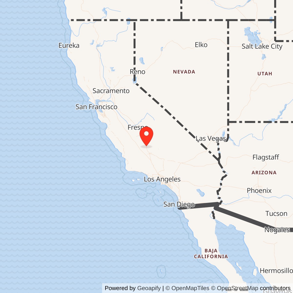
Longitude: -119.2365000
Airport ICAO ID: KDLO
Official Base Website: Delano Municipal Airport
Current Role: Delano Municipal Airport, KDLO, a City-owned public general-aviation and industrial airport supporting agricultural, charter, air-ambulance, firefighting, training, emergency, and transient military activity
Delano's wartime airfield occupied a quiet municipal airport in the northern San Joaquin Valley, but for several months in 1944 it became part of one of the Army Air Forces' most technically demanding training systems. Crews came to Delano to learn how to find, intercept, and destroy aircraft in darkness using radar, instruments, disciplined teamwork, and the new Northrop P-61 Black Widow. The field was not a large independent base. It was an auxiliary station whose value came from its place inside the Hammer Field night-fighter network.
The airport itself predated Army use. The Civil Aeronautics Administration built it through the Development of Landing Areas for National Defense program, and it opened in April 1940. The program improved civil airports that could also support national defense, so the paved field already offered the Army a useful facility when the night-fighter school moved to California. In late 1943 the Army Air Forces acquired usage rights and placed the field under IV Fighter Command. Military records and later historical summaries call it Delano Army Air Field, Delano-Kern Auxiliary Field, and Delano-Kern Auxiliary Field No. 8.
Delano belongs in the Army installation inventory because the wartime field had an assigned base unit, military-controlled facilities, a defined acreage, barracks and hospital capacity, and a sustained training mission. It did not become a United States Air Force base after 1947. The military role ended after World War II, and the same site returned to civil aviation. It is therefore an Army Air Forces installation with an active civilian-airport successor.
Mission Evolution
The airport's first mission was civil aviation and national-defense preparedness. Federal construction produced a usable public airport before the United States entered World War II. That origin helps explain why the City of Delano can accurately describe the field as having seen limited military activity while Army records can also show a meaningful wartime station. Delano was not built into a major cantonment or depot. Its military importance was concentrated in a short, specialized period.
The decisive change came after Headquarters, Army Air Forces moved the night-fighter training program from Florida to California in January 1944. Hammer Field near Fresno became the headquarters. Fourth Air Force and the 481st Night Fighter Operational Training Group supervised a distributed system that used multiple airports for different stages and for relief, dispersal, and organizational training. The official Air Force history describes formal phases at the Bakersfield airport, Hammer Field, and Salinas Field. Smaller fields such as Delano and Visalia expanded the network by giving squadrons additional operating space and places to conduct intensive flying without crowding the principal bases.
Delano was used for operational training with modified Douglas A-20 aircraft designated P-70 and with early production or prototype versions of the Northrop P-61 Black Widow. The P-70 gave crews a night-fighter training platform while the purpose-built P-61 entered service. The P-61 combined a pilot, radar operator, airborne radar, heavy cannon and machine-gun armament, and the range needed for interception and intruder missions. Training required far more than ordinary fighter flying. Pilots and radar operators had to work as a team, fly safely in darkness, respond to ground-control instructions, use airborne radar, identify targets, and approach closely enough to make a visual identification before firing.
After the main night-fighter training organization changed in May 1944, the 319th Wing and Army Air Forces base units continued the program. Delano remained useful through the summer and early fall. On 10 December 1944 the field passed to Air Technical Service Command, went to standby status, and was retained primarily for emergency use. It remained under Hammer Field control as Delano-Kern Auxiliary Field No. 8 and also supported Minter Field as an auxiliary. The transition shows that Delano's intensive training mission had ended before the war itself, but the Army kept the runway available within the regional airfield system.
World War II Operations
The 426th Night Fighter Squadron was the first major night-fighter organization documented at Delano. It trained there from 31 March through 15 June 1944. The squadron was among the first California-trained units prepared for overseas P-61 operations. Its crews had to master a new aircraft while the Army was still refining night-fighter doctrine, equipment, maintenance, and training procedures.
The 548th Night Fighter Squadron followed from approximately June through September 1944. Flights from the 427th, 547th, 549th, and 550th Night Fighter Squadrons also moved through Delano during their California training. The field therefore supported more than one complete squadron cycle. It functioned as a shared operating base in a system that had to produce deployable night-fighter units for both the Pacific and the China-Burma-India theaters.
The training was hazardous because crews deliberately flew in the conditions ordinary pilots tried to avoid. Darkness removed visual references. Instrument errors, mechanical faults, poor weather, unfamiliar aircraft, and fatigue could quickly become fatal. The official Air Force history notes that the wider night-fighter program's accident rate demanded constant attention and that crews often flew six to eight hours at night. Delano's open valley location and comparatively light traffic made it useful, but no auxiliary field could remove the underlying dangers of training for combat at night.
The station also required a ground organization. The base complement was assigned to the 4194th Army Air Force Base Unit (Air Base). A 1945 War Department inventory credited the installation with capacity for 400 enlisted personnel and 65 officers, a ten-bed station hospital, 1,800 square feet of covered storage, and 125,664 square feet of open storage. Those figures show that Delano was more than a runway occasionally visited by military aircraft. It had the personnel and support structure required to sustain a temporary operating station.
Aircraft, Training, and Facilities
The wartime airfield centered on its runway, aprons, dispersed parking and open storage, temporary living and administrative facilities, communications, maintenance support, and medical capability. The 30 September 1945 inventory listed 379 acres owned by the government and 177 acres leased, for a total controlled footprint of 556 acres. The modern city airport encompasses about 520 acres. The small difference reflects changing property boundaries and counting methods rather than a contradiction in site identity.
The P-70 and P-61 represented two stages in American night-fighter development. The P-70 was a converted light bomber and proved useful as a trainer, but its climb and high-altitude performance limited it in combat. The P-61 was designed around the night-interception mission. Its radar operator searched for the target, the pilot maneuvered using ground-control and onboard information, and the crew attempted visual identification before attacking. That workflow demanded repeated practice across a network of fields, not merely classroom instruction.
Delano's auxiliary role also relieved congestion at Hammer Field. A single base could not safely handle every phase, every squadron, maintenance activity, and all-night flying cycle at once. Distributed fields allowed aircraft to operate over different routes and practice areas, reduced the number of aircraft competing for one traffic pattern, and gave squadrons space for organizational training. Delano's contribution was therefore measured less by the size of its buildings than by the flying capacity it added to the network.
Units and Organizations
481st Night Fighter Operational Training Group
The 481st supervised the California night-fighter training program under Fourth Air Force during the first half of 1944. It organized crews into overseas training units and coordinated the distributed field system centered on Hammer Field. Delano operated as one of the group's auxiliary training locations.
3319th Wing
The 319th Wing replaced the 481st training organization in May 1944. Under the revised system, the 450th and 451st Army Air Forces Base Units assumed training responsibilities. The wing completed training for the 427th, 547th, 548th, 549th, and 550th Night Fighter Squadrons.
4194th Army Air Force Base Unit (Air Base)
The 4194th provided Delano's local base complement. Its assignment confirms that the field possessed a defined operating and support organization rather than functioning only as an unstaffed emergency strip.
426th Night Fighter Squadron
The 426th trained at Delano from 31 March through 15 June 1944. It deployed to the China-Burma-India Theater. Its P-61s reached China in November 1944 to protect B-29 bases from Japanese night attacks, then increasingly flew night intruder missions. The official Air Force history credits the squadron with five aerial victories during World War II.
548th Night Fighter Squadron
The 548th trained at Delano during the summer of 1944 and later fought in the Central Pacific. Its Black Widows participated in the defense of Saipan and operations from Iwo Jima, where radar-directed crews intercepted Japanese night aircraft and later attacked enemy-held islands. The official Air Force history credits the squadron with five aerial victories.
427th, 547th, 549th, and 550th Night Fighter Squadrons
Flights from these squadrons used Delano during training. Their later combat service spread across the China-Burma-India and Pacific theaters. The 427th flew night intruder missions over Burma. The 547th, 549th, and 550th contributed to Pacific night defense and intruder operations. Their movement through Delano tied the small California field to a combat network extending across Asia and the Pacific.Role in the Wider Military Network
Delano did not operate independently. It belonged to a chain that began with recruitment and technical instruction, moved through California flight and organizational training, and ended with overseas deployment. Hammer Field supplied the headquarters and central interception training. The Bakersfield airport handled familiarization in the formal three-phase syllabus. Salinas provided advanced night flying. Santa Ana supported final organization before overseas movement. Delano, Visalia, and other fields supplied additional flying capacity, squadron basing, dispersal, and local operating space.
That network existed because night fighting joined several emerging technologies into one combat system. Ground radar found approaching aircraft. Controllers directed fighters toward them. Airborne radar enabled the fighter crew to continue the search. Instruments allowed flight without reliable visual references. Radio discipline, maintenance, intelligence, and trained teamwork connected the parts. Delano's runway was one physical node in that system.
The field's combat significance was indirect but real. No enemy aircraft attacked Delano, and the station did not launch combat missions. Its contribution came through the crews and squadrons prepared there. The 426th defended B-29 bases and attacked Japanese movement in China. The 548th fought over Saipan and Iwo Jima. Other Delano-associated squadrons operated over Burma and across the Pacific. The airfield helped transform personnel and new aircraft into deployable units.
Postwar Closure and Civil Reuse
After the intensive training period ended, Air Technical Service Command placed Delano on standby on 10 December 1944. It remained available for emergencies and as an auxiliary to Hammer and Minter Fields. With victory and demobilization, the Army declared the military facilities excess and returned the airport to civil control.
The field continued as a public airport. Kern County controlled it for much of the postwar era, and the City of Delano acquired ownership in 1973. The city developed aviation services and an adjacent industrial area while retaining the airport's basic physical identity. Unlike many temporary wartime fields that disappeared under farms or subdivisions, Delano remained an active runway on the same site.
Post-World War II Military and Conflict Connections
Delano Municipal Airport has not served as a permanent post-World War II military installation and has no assigned combat unit. The City of Delano reports that military aircraft and military flying services continue to use the airport, and recent planning documents identify military exercises and training among current activities. These are transient or episodic uses of a civil airport, not a continuation of the Army Air Forces base.
The night-fighter program's institutional legacy extended far beyond Delano. The official Air Force history links the wartime development of night and all-weather tactics to the later concept of a 24-hour all-weather Air Force and notes its mature expression during Operation Desert Storm. That is a doctrinal lineage, not evidence that Delano itself participated in later conflicts.
Current Status
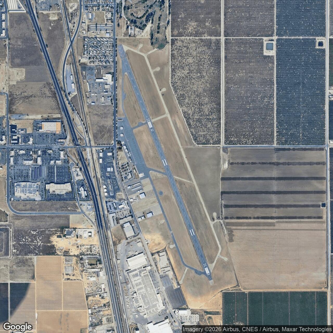
The former Delano Army Air Field is now Delano Municipal Airport, a City of Delano-owned public airport with FAA identifier DLO and ICAO identifier KDLO. It lies about two miles southeast of central Delano and operates without a control tower. The current airport has a single paved runway, 15/33, listed by current FAA-derived data as 5,659 feet long and 75 feet wide.
The city describes the airport as approximately 520 acres and as a transportation and industrial-development asset serving northern Kern and southern Tulare Counties. General aviation, agricultural flying, air charter, air ambulance, firefighting support, and transient military activity use the field. The military cantonment and temporary support facilities no longer survive as an active Army installation.
Chronology
- April 1940 Delano Airport opened after construction through the federal Development of Landing Areas for National Defense program.
- Late 1943 The Army Air Forces acquired usage rights and placed the airport under IV Fighter Command.
- January 1944 The Army Air Forces moved the night-fighter training program from Florida to California, with headquarters at Hammer Field.
- 31 March 1944 The 426th Night Fighter Squadron began its documented training period at Delano.
- May 1944 The 319th Wing replaced the 481st Night Fighter Operational Training Group in the reorganized California program.
- 15 June 1944 The 426th Night Fighter Squadron completed its Delano training period.
- June 1944 The 548th Night Fighter Squadron began training at Delano.
- Summer 1944 Flights of the 427th, 547th, 549th, and 550th Night Fighter Squadrons used the field.
- September 1944 The 548th Night Fighter Squadron's documented Delano period ended.
- November 1944 The 426th Night Fighter Squadron's P-61s reached China to defend B-29 bases.
- 10 December 1944 Delano transferred to Air Technical Service Command and entered standby and emergency-use status under Hammer Field as Delano-Kern Auxiliary Field No. 8.
- 30 September 1945 A War Department inventory reported 556 controlled acres, capacity for 400 enlisted personnel and 65 officers, and a ten-bed station hospital.
- 1945-1946 The Army declared the military facilities excess and returned the airport to civil use.
- 1973 The City of Delano acquired the airport from Kern County.
- Present Delano Municipal Airport remains an active public general-aviation and industrial airport on the wartime site.
Sources & References
- PDF Air Force History and Museums Program, Stephen L. McFarland Conquering the Night: Army Air Forces Night Fighters at War
- WEB City of Delano Delano Municipal Airport
- WEB City of Delano Airport Division
- WEB City of Delano, Delano Municipal Airport Layout Plan and Master Plan materials
- WEB City of Delano Draft Airport Demand Forecast
- WEB California Military Department, California State Military Museums Program Delano Army Air Field Delano Army Air Field history
- WEB AirNav, KDLO Delano Municipal Airport Current Airport information
- WEB National Museum of the United States Air Force Northrop P-61C Black Widow