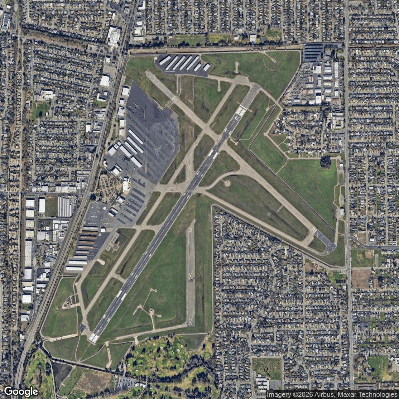
Sacramento Army Air Field, Sacramento California
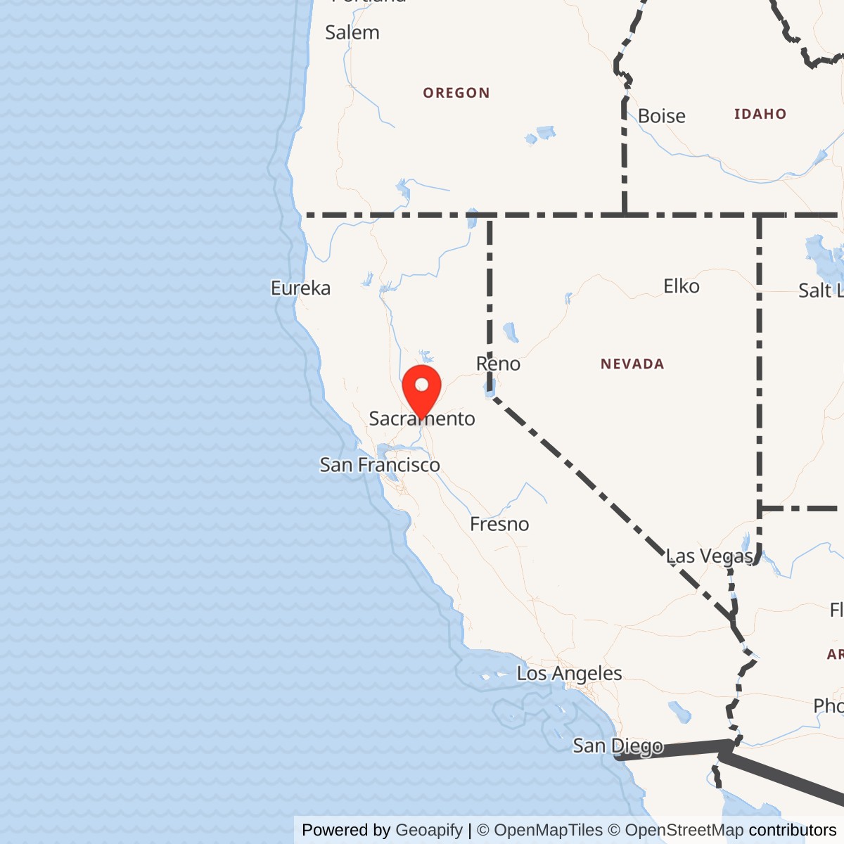
Longitude: -121.4933011
Airport ICAO ID: KSAC
Official Base Website: Sacramento Executive Airport
Current Role: Sacramento Executive Airport, an active City of Sacramento-owned general aviation reliever airport operated by the Sacramento County Department of Airports
Sacramento Army Air Field was the World War II Army Air Forces military use of Sacramento's city airport, the field now known as Sacramento Executive Airport. The site began civilian life as Sutterville Aerodrome in 1930, a city-owned airport south of downtown Sacramento. By 1941, Sacramento was already improving the field by paving and extending its three runways. Then World War II changed the airport's purpose. The U.S. Army took over the city-owned airport during the war, used it as part of the Army Air Forces station network in northern California, and returned it to civil control after the emergency passed.
The field is easy to overlook because it never became a famous Air Force base like Mather or McClellan. That is exactly why it matters. Sacramento Army Air Field represents the wartime conversion of municipal aviation infrastructure into military capacity. Its value was not in becoming a permanent post. Its value was that an existing urban airport could be absorbed quickly into the Fourth Air Force system, improved with Army-funded facilities, used for training and air-terminal support, then returned to the city as a stronger civilian airport.
The wartime field appears under several names. Sacramento County airport history treats the modern Executive Airport as the successor to Sutterville Aerodrome and Sacramento Municipal Airport. California Military Museum material identifies the same site as Sacramento Municipal Airport, Sacramento Army Air Field, and Sutterville Auxiliary Field. The wartime Army footprint included leased city land, smaller fee acquisitions, private leases, aviation easements, government buildings, hangars, a bomb storage area, runways, taxiways, apron hardstands, lighting, fencing, utilities, and refueling infrastructure.
Mission Evolution
The site's first mission was civilian air service. Sutterville Aerodrome opened in 1930, south of Sacramento's downtown core, and grew with the city's early aviation needs. Before the United States entered World War II, the city-owned facility was expanding, and construction was underway to pave and extend three runways. That prewar work made the field useful to the Army. The Army did not have to create an airfield from raw land. It could take over a functioning municipal airport, invest in military improvements, and place it inside a much larger air-defense and training network.
The wartime military mission began in 1942, based on Corps of Engineers and Formerly Used Defense Sites data reproduced by the California Military Museum. Between July 1942 and November 1944, the War Department acquired or leased 663.52 acres connected with the airport. The acquisition pattern shows the nature of the installation: 566.67 acres were leased from the City of Sacramento, smaller fee parcels and private leases supplemented the field, and a license covered a drainage ditch. This was not a classic permanent Army cantonment. It was a militarized municipal airport, with the city-owned airfield forming the core of the wartime installation.
The field's mission was tied primarily to Army Air Forces use in the Fourth Air Force area. Official Army Air Forces wartime history states that Fourth Air Force moved tactical units to municipal airports at San Bernardino, Long Beach, Bakersfield, Oakland, Sacramento, and Mines Field at Los Angeles. The same official history later lists Sacramento Municipal Airport among Army airfields serving as subbases in the broader Army Air Forces installation system. That combination places Sacramento Municipal Airport within the emergency expansion of western air defense, fighter training, and airfield support after Pearl Harbor.
California Military Museum material adds the local operating context. It states that Sacramento Municipal Airport was used as a subbase to Chico Army Air Field, used jointly by Fourth Air Force and Western Flying Training Command, and also served as an auxiliary field for Hamilton Field. It identifies the wartime property as supporting a military air terminal and lists World War II organizations associated with the field, including elements of the 363rd Fighter Group in late 1943 and the 404th Army Air Force Base Unit (Bombardment, Heavy) and 405th Army Air Forces Base Unit (Special) in April 1945. Those unit details are compiled from secondary and station-list references, so they should be treated as useful but not as a complete permanent station roster.
After the war, the mission contracted rapidly. The field was reported excess on December 20, 1945. Fee and leased property were transferred to the War Assets Administration on March 4, 1947, while some private leases terminated in 1946 and a drainage-related license was released in 1947. The government eventually conveyed the leased city airport land for public airport purposes under a November 19, 1948 transfer document. In practical terms, Sacramento Army Air Field ceased to be a military installation and resumed its civic aviation role. The field was renamed Sacramento Municipal Airport, then Sacramento Executive Airport after airline operations moved to the new Sacramento Metropolitan Airport in 1967.
Operational Role
Sacramento Army Air Field's wartime role was not the same as a large Army air base built from scratch. It functioned as a subbase, auxiliary, training-support, and air-terminal field inside a dense northern California air system. The Army needed such fields because the Fourth Air Force had to train fighter and other tactical units, defend the Pacific Coast, disperse aircraft, support ferrying and military air movement, and connect larger bases to auxiliary fields and municipal airports. Existing airports were especially valuable because they already had location, runways, local access, and a relationship to civil air traffic.
The operational work at Sacramento likely combined flying operations, ground support, aircraft servicing, training support, and military terminal activity. The Corps of Engineers description identifies hangars, 28 government-constructed buildings, including housing, a bomb storage area, gas and oil storage and distribution, refueling systems, water supply storage, and sewage and disposal systems. It also identifies runway, taxiway, apron, drainage, marking, lighting, fencing, and beacon improvements. Those features show a working Army Air Forces field, not merely a paper subbase. Aircraft could be based, serviced, fueled, parked, lighted, guarded, and supported there.
The field's relationship to fighter training is particularly important. Secondary station summaries associate late-1943 Sacramento use with the 363rd Fighter Group and its 380th, 381st, and 382nd Fighter Squadrons, equipped with P-39 Airacobras. The P-39 was a common stateside training and tactical aircraft in this period, especially in western training networks. Even if the detailed unit roster requires additional archival verification, the pattern is consistent with the official Fourth Air Force context: Sacramento Municipal Airport was one of several civil airports used as the wartime air arm expanded and distributed tactical aviation across the West Coast.
By 1945, the field's mission appears to have broadened beyond fighter activity. California Military Museum material cites an April 7, 1945 Army Station List showing the 404th Army Air Force Base Unit (Bombardment, Heavy), associated with the 320th Wing, and the 405th Army Air Forces Base Unit (Special), associated with the 321st Wing. The same page's War Department inventory extract labels the field as a Combat Crew Training Station and lists troop capacity for 478 enlisted personnel and 96 officers. The field was therefore part of the flexible late-war AAF system in which a civil airport could support changing training, staging, and terminal functions as units moved through the West Coast air network.
Sacramento Army Air Field did not operate in isolation from the rest of Sacramento's military geography. Mather Field, east of the city, was a major AAF training base. McClellan, northeast of Sacramento, was a major air depot and later Air Force logistics installation. Sacramento Army Depot, farther east and south on the Fruitridge Road side of the city, supported Signal Corps and later Army electronics supply and maintenance. Sacramento Municipal Airport occupied a different niche. It was the city airport turned wartime military field, useful because it added runways, ramp space, terminal capability, and training support inside the same regional military landscape.
Units, Organizations, and Systems
The central confirmed system-level organization was Fourth Air Force. Official AAF wartime history places Sacramento among municipal airports used by Fourth Air Force tactical aviation in California. This means the field belonged to the Pacific Coast defense and training system rather than to an isolated local mission. Fourth Air Force needed many such fields because no single base could absorb all the aircraft, training, staging, and support requirements created by wartime expansion.
California Military Museum material identifies the field as used jointly by Fourth Air Force and Western Flying Training Command, as a subbase to Chico Army Air Field, and as an auxiliary field for Hamilton Field. This is a strong indicator that command and support relationships shifted over time. Sacramento could serve more than one operational need depending on the training cycle, aircraft type, and parent station. That is typical for Army Air Forces municipal airport use during World War II.
Reported unit associations include the 363rd Fighter Group and its 380th, 381st, and 382nd Fighter Squadrons in October to December 1943, and the 404th Army Air Force Base Unit (Bombardment, Heavy) and 405th Army Air Forces Base Unit (Special) in April 1945. These details come from compiled station-list references on the California Military Museum page, not from a complete official unit history in hand.
The postwar organizations were civilian. The City of Sacramento resumed ownership, and Sacramento County eventually became operator of the airport. Sacramento County Department of Airports currently operates a county airport system that includes Sacramento International Airport, Mather Airport, Sacramento Executive Airport, and Franklin Field. Executive Airport is city-owned and leased to the County, which makes the present site a civil public-use airport rather than a military installation.
Facilities and Physical Layout
The wartime field was built around the existing municipal airport. The main airport lay several miles south of downtown Sacramento, with the modern AirNav location placing it three miles south of Sacramento's city center. The site sat within the urbanizing Freeport Boulevard corridor, close enough to the capital city to serve civil and military transportation, but open enough in the early 1940s to support runway expansion and airfield operations.
Corps of Engineers data reproduced by the California Military Museum describes the wartime property in practical terms. The airport site included the airport itself, original hangars, 28 government-constructed buildings, housing, a bomb storage area, gas and oil storage and distribution, refueling systems, water supply storage, and a sewage and disposal system. Airfield improvements included runways, taxiways, apron hardstands, field drainage, marking and lighting systems, fencing, and a beacon attached to a tower building. These are the core ingredients of a wartime AAF municipal-airport station: enough infrastructure to operate aircraft safely, enough hardstand and fuel to sustain flying, enough buildings to house and administer a detachment, and enough security and storage for military materials.
The acreage record shows how the Army assembled the field. California Military Museum and Corps of Engineers data give 663.52 acres acquired or leased between July 1942 and November 1944. That figure included 8.12 fee acres from private owners, 1.13 acres by declaration of taking, 566.67 leased acres from the City of Sacramento, and 87.29 leased acres from private owners. A 0.31-acre license from a private owner supported a drainage ditch. Later War Department inventory data listed 594 acres, with 27 owned acres and 567 leased acres, which likely reflects a different reporting date or accounting basis.
The current airport is smaller than the total wartime acquisition figure. Sacramento County's FY2013 Comprehensive Annual Financial Report describes Executive Airport as approximately 520 acres, with three intersecting runways and one heliport at that time. AirNav currently lists KSAC as an open-to-public airport with FAA identifier SAC, ICAO identifier KSAC, elevation 23.4 feet, two active paved runways, and a helipad. The modern airport layout preserves the central airfield identity, even though many wartime military buildings and temporary uses have disappeared or been absorbed into later airport development.
Role in the Wider Military Network
Sacramento Army Air Field belonged to the emergency wartime network that turned California into one of the Army Air Forces' most important training, defense, ferrying, depot, and staging regions. The official AAF history explains that the air arm grew from a small prewar establishment into hundreds of bases, subbases, auxiliary fields, depots, and ranges by 1945. Civil airports were indispensable to that growth. They allowed the AAF to increase capacity quickly, especially where new permanent construction could not keep pace with training and defense needs.
Within that system, Sacramento Municipal Airport was not a principal depot like McClellan or a major training base like Mather. It was a supporting field that added runway and support capacity in a region already crowded with AAF activity. Its nearby counterparts included Hamilton, Chico, Mather, McClellan, Marysville, Oroville, Hayward, Oakland, San Francisco, and other northern California airfields. Together these fields made it possible to disperse aircraft, train pilots and crews, support fighter and bomber operations, move aircraft and personnel, and connect the West Coast home-defense mission with the wider Pacific war.
It was a city airport, but for several wartime years it was part of the War Department's installation system. Its land was leased or acquired, federal improvements were constructed, AAF organizations used the field, and postwar disposal had to be handled through the War Assets Administration.
Postwar Reuse and Current Status
After the field was reported excess in December 1945, the Army unwound the wartime property arrangement. Fee and leased property moved to the War Assets Administration in March 1947. Private leases terminated in 1946, and a drainage license was released in 1947. The government later conveyed the leased city airport property for public airport purposes, preserving the aviation function rather than selling the site for unrelated redevelopment. That transfer shaped the airport's future. World War II military investment had improved the field, and Sacramento could continue using it as a public airport.
Sacramento Municipal Airport remained the city's commercial airport in the postwar decades. In October 1967, airline service moved to the new Sacramento Metropolitan Airport, later Sacramento International Airport, north of the city. Sacramento Municipal Airport was then renamed Sacramento Executive Airport. Its role narrowed from airline gateway to general aviation, business aviation, flight training, maintenance, and reliever-airport functions. That change is part of the airport's continuity rather than a break. It remained an airport because wartime and postwar aviation infrastructure made the site too useful to abandon.
The present Sacramento Executive Airport is an active general aviation airport operated by the Sacramento County Department of Airports. Sacramento County describes it as a general aviation airport with an FAA tower, instrument approaches, paved runways, tie-downs, hangar space, and aviation businesses offering services such as fixed-base operations, charters, aircraft sales, rentals, repairs, flight training, pilot supplies, testing, and car rentals. AirNav lists the field as open to the public, with Runway 2/20 measuring 5,503 by 150 feet and Runway 12/30 measuring 3,837 by 100 feet. The historic third runway pattern survives in the broader paved and airfield geometry, though current listed runway operations focus on the two active runways and helipad.
The airport also carries a major postwar civil-aviation tragedy in its public memory. On September 24, 1972, a jet aircraft attempting to depart Sacramento Executive Airport crashed into a crowded Farrell's Ice Cream Parlour across from the airport, killing 22 people and burning many others. UC Davis Health's burn center history identifies that disaster as the event that led local firefighters and physicians to create a specialized regional burn care effort, with the Firefighters Burn Institute formed in December 1973 and the UC Davis Regional Burn Center opening in January 1974. This was not an Army event, but it is part of the successor site's history and illustrates how a former wartime military field continued to shape Sacramento's civil aviation and emergency-response landscape.
Chronology
- 1930 Sutterville Aerodrome opened as Sacramento's city-owned airport south of downtown.
- 1940-04 FAA/AirNav lists the airport activation date as April 1940.
- 1941 Sacramento County airport history states that construction was underway to pave and extend the airport's three runways.
- 1942 The War Department began wartime use of the airport as an Army Air Forces field.
- 1942-07 to 1944-11 Corps of Engineers data records that 663.52 acres were acquired or leased for the wartime installation, including city-owned airport land, private leases, fee acquisitions, and a drainage license.
- 1943 Official Army Air Forces history describes Fourth Air Force use of municipal airports in California, including Sacramento, as part of the wartime tactical airfield expansion.
- 1943-10 to 1943-12 California Military Museum unit tables associate the 363rd Fighter Group and its 380th, 381st, and 382nd Fighter Squadrons with Sacramento Municipal Airport.
- 1945-04-07 California Military Museum station-list data associate the 404th Army Air Force Base Unit (Bombardment, Heavy) and 405th Army Air Forces Base Unit (Special) with Sacramento Municipal Airport.
- 1945-12-20 The wartime field property was reported excess.
- 1946-06-30 to 1946-09-30 The remaining 87.29 acres leased from private owners were terminated during this period.
- 1947-03-04 Fee and leased property were transferred to the War Assets Administration.
- 1947-07-01 The drainage ditch license from a private owner was released back to the original owners.
- 1948-11-19 Transfer terms required the former leased city airport property to be used for public airport purposes.
- Postwar The airport returned to civil control and was officially renamed Sacramento Municipal Airport.
- 1955 Sacramento County airport history states that a terminal building was constructed, along with navigational aids and T-hangars.
- 1967-10 Commercial airline operations moved to the newly opened Sacramento Metropolitan Airport, and Sacramento Municipal Airport was renamed Sacramento Executive Airport.
- 1972-09-24 A jet aircraft attempting to depart Sacramento Executive Airport crashed into Farrell's Ice Cream Parlour, killing 22 people and burning many others. The disaster helped lead to creation of the Firefighters Burn Institute and the UC Davis Regional Burn Center.
- 1973-12 The Firefighters Burn Institute was formed.
- 1974-01 The UC Davis Regional Burn Center opened.
- Present Sacramento Executive Airport remains an active public general aviation airport with ICAO ID KSAC, operated by the Sacramento County Department of Airports.