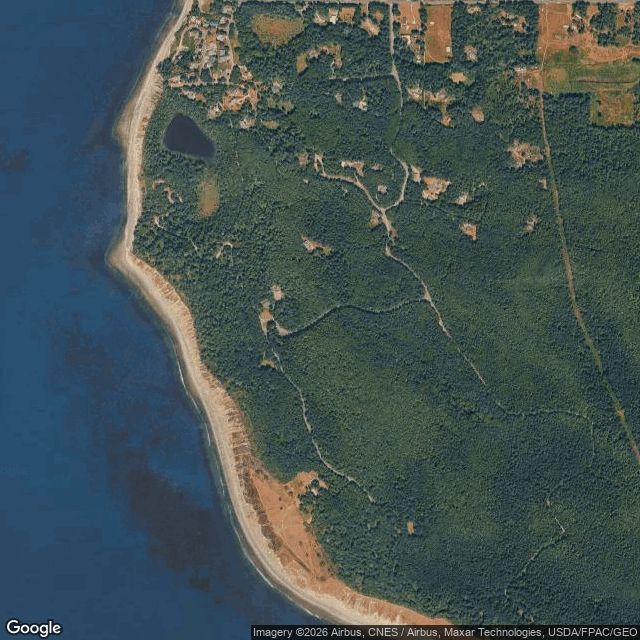
Fort Ebey Army Base, Coupeville Washington
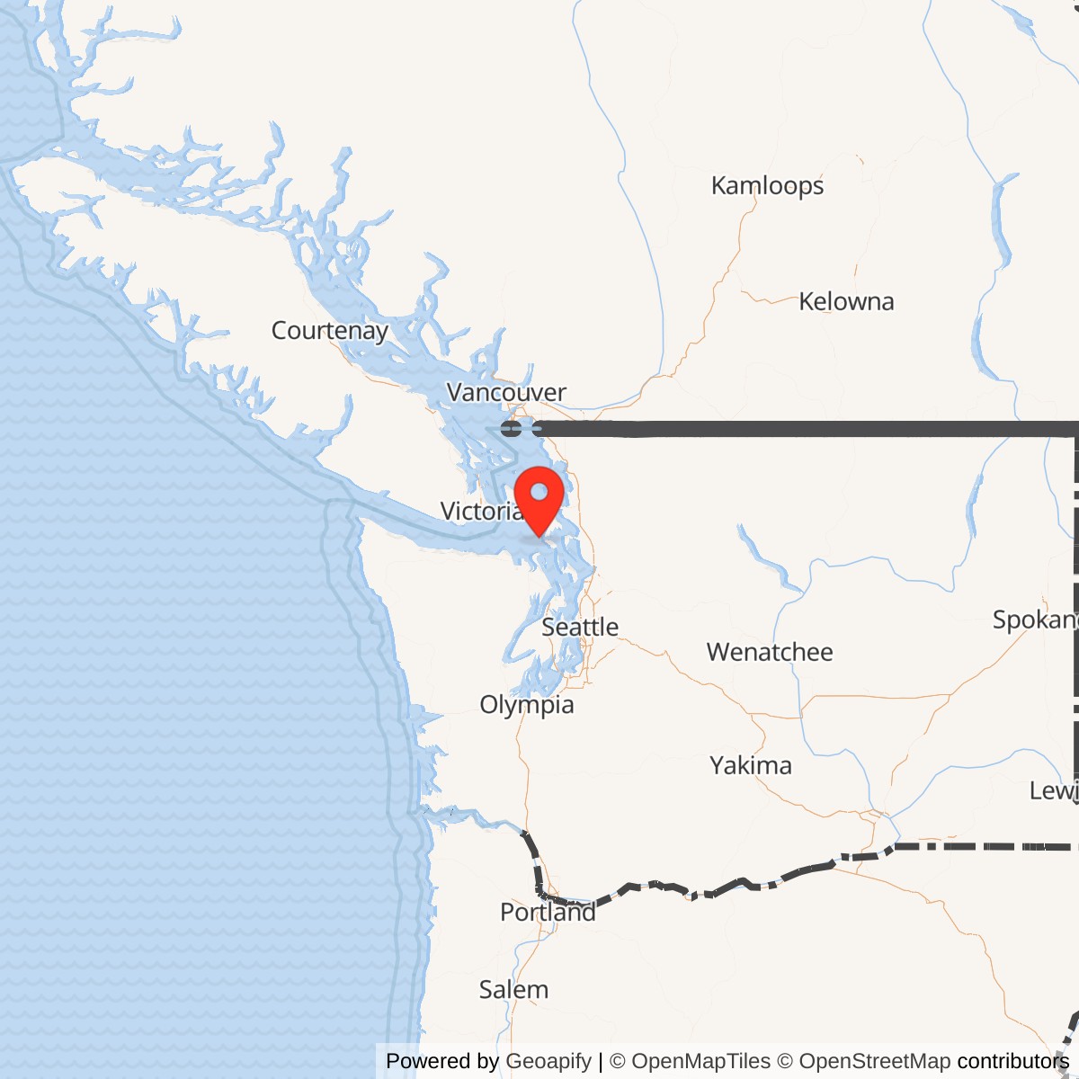
Longitude: -122.7615
Official Base Website: https://parks.wa.gov/find-parks/state-parks/fort-ebey-state-park
Current Role: Fort Ebey State Park; preserved Battery 248, underground rooms, concrete gun emplacements, base-end stations, campground, trails, shoreline access, Lake Pondilla, and public recreation
Closed World War II U.S. Army coastal-defense installation on Partridge Point, Whidbey Island. Established in 1942 as one of the last Puget Sound harbor-defense forts; named for Isaac Neff Ebey under General Order 6 on 1943-02-08. Its only major fortification was Battery 248, later identified as Battery Henry M. Merriam, a camouflaged two-gun 6-inch shielded battery with radar-assisted fire control, base-end observation stations, gas-proofed plotting/spotting spaces, diesel generators, ammunition rooms, and tree-well camouflage. Battery C, 14th Coast Artillery, was transferred to Fort Ebey in 1943 to man the battery and won a 1944 gunnery competition with 22 hits in 18 rounds on a 14,000-yard towed target. Battery 248 was never fired against an enemy target. Fort Ebey was declared surplus in 1947, manned until 1948, then saw brief Corps of Engineers and Navy use before state-park conversion. Washington State Parks acquired the former fort property beginning in 1965/1968 source conventions and dedicated Fort Ebey State Park on 1981-06-13; current park is 651 acres.
Location: 400 Hill Valley Drive, Coupeville, Island County, Washington 98239, on Partridge Point on the west side of Whidbey Island, overlooking Admiralty Inlet, the Strait of Juan de Fuca, Port Townsend, the Olympic Peninsula, and the western approaches toward Puget Sound.
Fort Ebey was a World War II coastal-defense installation built on Partridge Point on the west side of Whidbey Island. It was not one of the original Endicott-period "Triangle of Fire" forts that guarded Admiralty Inlet from Fort Worden, Fort Casey, and Fort Flagler. Instead, it was a late modernization fort, built after the United States entered World War II, when the Army wanted a more advanced gun position with radar, camouflage, and a direct view west through the Strait of Juan de Fuca toward the open Pacific. The present site is no longer an active military installation. The Army fort was declared surplus in 1947 and was no longer manned after 1948; the property is now Fort Ebey State Park, administered by Washington State Parks.
The military identity of Fort Ebey is unusually concentrated. Many seacoast forts developed over decades and accumulated multiple batteries, barracks areas, mine facilities, searchlight positions, fire-control systems, and later training functions. Fort Ebey was different. Its essential wartime purpose was Battery 248, a single two-gun six-inch battery placed in a camouflaged concrete work on a bluff high enough to observe the sea lanes but close enough to the Strait and Admiralty Inlet approaches to matter tactically. The post had supporting buildings, barracks, a water system, observation stations, fire-control spaces, and radar-related functions, but it never became a large, multi-battery garrison like Fort Worden or Fort Flagler. Its significance lies in the fact that it represents the last phase of fixed-gun harbor-defense thinking in Puget Sound: compact, technologically modern, radar-assisted, and obsolete almost as soon as the war that created it ended.
The fort took its name from Isaac Neff Ebey, the early Whidbey Island settler and public figure associated with the central Whidbey landscape. The name connected the new wartime post to the older Euro-American settlement history of Ebey's Landing, but the military reason for the fort was not commemoration. It was geography. Partridge Point provided a broad westward view over the Strait of Juan de Fuca, the water route by which enemy surface ships would approach the naval and industrial targets of Puget Sound. A gun position here could look out toward the open ocean rather than only across the inner Admiralty Inlet choke point. That made Fort Ebey a forward-facing element of the Puget Sound harbor-defense system at the moment when the Army was trying to modernize old coastal defenses under wartime pressure.
The site also sits within a much older cultural and environmental landscape. The present state park lies within the traditional territory of southern Coast Salish peoples, and Washington State Parks identifies present-day descendants in the Swinomish Indian Tribal Community, Tulalip Tribes, Suquamish Tribe, and Lummi Nation. The prairies, shorelines, marine waters, and nearby Penn Cove area had long provided camas, roots, berries, nuts, fish, shellfish, game, lookout points, and travel corridors before the U.S. military arrived. The fort therefore occupies a layered landscape: Indigenous use and management, nineteenth-century settlement and state trust lands, World War II military construction, postwar surplus disposal, and modern public recreation inside the larger Ebey's Landing National Historical Reserve.
Mission Evolution
Fort Ebey's mission grew out of the changing threat picture after 1941. The older Puget Sound defenses had been designed around large fixed batteries at Fort Worden, Fort Casey, and Fort Flagler, with the assumption that hostile warships would have to enter Admiralty Inlet and could be engaged by overlapping heavy guns. By World War II that system was dated. Airpower, long-range naval gunnery, submarines, motor torpedo boats, radar, and amphibious raiding had changed the problem. The Army therefore modernized and dispersed the Harbor Defenses of Puget Sound. Some older batteries were placed in lower readiness or stripped; new batteries were planned farther west and at more tactically useful observation points; radar and camouflage became central to fire control and concealment.Fort Ebey was one of the results of that modernization. Washington State Parks describes it as the last fort developed as part of Puget Sound coastal defense and as a fort whose single Battery 248 incorporated newer technology not available at the older Puget Sound forts. The location's unobstructed westward view through the Strait of Juan de Fuca made it valuable for the enhanced defense of the region during World War II. Rather than adding another large prewar concrete-and-brick post, the Army built a modernized battery whose purpose was to bring two six-inch shielded guns, radar assistance, base-end observation, gas-proofed command spaces, and heavy camouflage to a strategically exposed bluff.
The installation was established in 1942, and its two six-inch shielded guns were mounted in 1943. The battery was construction number 248, and Washington State Parks identifies it as Battery Henry M. Merriam, named for Colonel Henry M. Merriam, who had commanded the Puget Sound Harbor Defense in the 1920s. The proposed or official naming did not fully shape the public identity of the site because the fort was decommissioned before the name was placed on the battery entrances. In practice, the position has remained known as Battery 248 and as Fort Ebey.
Fort Ebey's wartime mission was to help prevent enemy naval penetration toward Puget Sound. Its guns could engage moving surface targets at long range, while its observation stations and radar fed target data into the battery's plotting and spotting rooms. The battery was never fired at an enemy target, but it was not idle. The garrison maintained the installation, drilled on target acquisition and fire control, practiced loading and firing, and took part in the larger defensive readiness system of the Harbor Defenses of Puget Sound. In 1944, Battery C, 14th Coast Artillery Corps, achieved one of the fort's most notable training successes by scoring 22 hits in 18 rounds on a towed target at 14,000 yards, with the target simulating a destroyer. That record is a useful reminder that Fort Ebey's daily mission was measured in readiness, not combat.
The mission ended quickly after World War II. The fort was declared surplus in 1947, although Washington State Parks notes that it was manned until 1948. The gun battery then passed through a short postwar sequence: the Army Corps of Engineers used the site from 1946 to 1948, the Navy used it briefly afterward, and the coastal-fortification system itself became obsolete in the face of long-range bombing, missiles, and the lack of a foreseeable surface naval threat to U.S. harbors. The Coast Artillery Corps was disbanded in 1950, confirming the larger institutional collapse of the branch that had created Fort Ebey. The post's mission therefore evolved from wartime harbor defense to surplus property, then to state park preservation and recreation.
World War II Mission and Activity
Fort Ebey's World War II activity was narrower than the massive training camps that processed divisions and replacements, but it was still operationally important. It was a coastal-defense combat position, and its work centered on readiness for a specific tactical problem: detecting, tracking, plotting, and firing on hostile surface vessels attempting to use the Strait of Juan de Fuca and Admiralty Inlet approaches. The men stationed there were not passing through a basic-training pipeline. They were operating a modernized seacoast battery in a live harbor-defense system.The first layer of wartime activity was construction and concealment. Battery 248 had to be built into the landscape in a way that protected the gun crews, hid the battery from aerial view, and allowed the gun platforms to cover the water approach. The concrete work was covered with earth, and Washington State Parks identifies "tree wells" as a distinctive feature of the battery. When the battery was covered with dirt, brick enclosures were built around some trees to keep them alive, so that the living trees would continue to break up the profile of the installation. Ivy and gorse were also planted for camouflage. This was not decorative landscaping. It was a camouflage system intended to make a concrete military target look like part of the bluff and forest.
The second layer of activity was observation. Fort Ebey's battery depended on seeing, measuring, and transmitting information about moving targets. Observers in small concrete base-end stations along the bluff used telescopes to identify and track enemy vessels. They then relayed the information to plotters inside the battery. Two base-end stations still survive along the Bluff Trail, which makes the fire-control system legible today. These observation stations were critical because a seacoast battery could not simply point at the ocean and fire by eye from the gun platform. It needed triangulated target data, correction, and a chain of communication connecting observers, plotters, spotters, and gun crews.
The third layer of wartime activity was radar-assisted fire control. Washington State Parks emphasizes that radar was a new technology at the time and that Battery 248 was designed with radar to help aim the guns. The interpretive brochure explains that, during visual operations, target locations were called in from base-end stations and transferred to the plotting board; when the guns were fired using radar, the plotting room served as the Battery Commander Station. That arrangement shows why Fort Ebey was more modern than the older Puget Sound batteries. The fort was not simply an Endicott-style concrete battery with newer guns. It was a World War II fire-control installation designed to combine traditional optical observation with radar operations.
The fourth layer of activity was ammunition handling and gun operation. Battery 248's two Naval Model 1905A2 six-inch guns had a range of up to 15.3 miles over a 142-degree field of fire. Each gun required a 26-man gun section to load and fire. The battery's shell rooms could store high-explosive projectiles and armor-piercing projectiles; the brochure identifies high-explosive rounds weighing 90 pounds and armor-piercing projectiles weighing 108 pounds. Powder charges were stored in sealed metal canisters, with different charges for high-explosive and armor-piercing service. Temperature and humidity mattered because powder ignition depended on stable conditions. The battery therefore operated as a small industrial system, not simply as two guns on a bluff.
The fifth layer of activity was support and survivability. Battery 248 included a storeroom for operation and maintenance equipment, an air-compressor room, shell rooms, powder rooms, a plotting room, a spotting room, a latrine, a chemical-warfare service room, a power room, a water-cooling room, a muffler gallery, fuel-tank vents, gun telephones, and ammunition shelves. The chemical-warfare service room, plotting room, spotting room, and latrine were gas-proofed, and pressurized air was filtered through carbon scrubbers. The power room contained three 125 KVA, 440-volt diesel generator sets, and one generator could power the entire battery. These details matter because they show that Fort Ebey was built for wartime endurance: it had to function under attack, under blackout, under possible gas threat, and without depending entirely on outside utilities.
The sixth layer of activity was garrison life. The barracks were located near the present park office. Washington State Parks identifies other facilities including a barber shop, library, bowling alley, fire station, and an elevated 100,000-gallon wooden water tank whose remains are visible along the Water Tower Trail. Fort Ebey was smaller than the older forts, but it still required ordinary military life: sleeping quarters, meals, hygiene, barbering, recreation, firefighting, water supply, maintenance, guard duty, and command oversight. A coastal-defense battery could only stay ready if the daily support structure behind the guns worked.
The seventh layer of activity was practice fire and competition. Battery 248 never fired on an enemy ship, but its gunners trained. The 1944 competition result attributed to Battery C, 14th Coast Artillery Corps, 22 hits in 18 rounds on a towed target at 14,000 yards, shows that the battery was not merely symbolic. Certain hits counted twice, but even with that scoring rule the performance reflected coordination between observation, plotting, gun crews, and command. The target simulated a destroyer, exactly the kind of fast surface vessel that a six-inch modernized battery was expected to fight. In that sense, the competition was a controlled version of the battery's wartime mission.
Fort Ebey's WWII history is also defined by what did not happen. It did not become a large troop-training camp. It did not hold prisoners of war. It did not fire in combat. It did not survive long enough to become a Cold War missile or radar installation in the way some other coastal sites were repurposed. Its significance lies instead in a brief but revealing wartime life: the Army built a technologically updated coastal battery at the edge of Whidbey Island, manned it, trained with it, and then quickly abandoned the fixed-gun concept after the war.
Units, Organizations, and Systems
Fort Ebey belonged to the Harbor Defenses of Puget Sound. That system had evolved from the older Coast Artillery defenses at Fort Worden, Fort Casey, and Fort Flagler, but by World War II it extended across a wider geography of old forts, new batteries, temporary batteries, AMTB positions, searchlights, radar, observation stations, and administrative groups. Fort Ebey was one of the modernized additions to that system. Its purpose was not to replace Fort Worden or Fort Casey entirely, but to strengthen the western approach and add a radar-assisted six-inch battery at Partridge Point.The key operating unit associated with the battery was Battery C, 14th Coast Artillery. The 14th Coast Artillery Regiment was the Regular Army component of the Harbor Defenses of Puget Sound. Coast Defense Study Group's history of the regiment records the wartime movement of Battery C from Fort Whitman to Fort Ebey to man the new modernization battery at Partridge Point. That transfer was part of a wider reallocation of scarce Coast Artillery personnel as new and older batteries were selected for continued service. Fort Whitman's armament was placed under caretaker status, while Fort Ebey received Battery C for the new battery.
The 14th Coast Artillery itself was reorganized in 1944. The regiment was disbanded on October 17, 1944, and its personnel were divided among newly designated Coast Artillery battalions, including the 14th, 169th, and 170th Coast Artillery Battalions. Battery C was redesignated Battery B, 14th Coast Artillery Battalion. These administrative changes matter because Fort Ebey's apparent simplicity can hide the complexity of the Army's wartime coastal-defense organization. The guns on the bluff were visible; the changing command structure behind them was less visible but still central to how the site functioned.
The 248th Coast Artillery, the Washington National Guard component of the Puget Sound defenses, is part of the broader system context even when Battery 248 itself should not be confused with that regiment. Battery 248 was a construction-number battery, not the 248th Coast Artillery Regiment. In the Puget Sound system, however, Regular Army and National Guard coast-artillery units both contributed to the defense network. During the war, shifting units among Fort Worden, Fort Casey, Fort Flagler, Fort Whitman, Fort Ebey, Camp Angeles, Camp Hayden, and smaller outposts reflected a system under modernization, not a static peacetime arrangement.
The Army Corps of Engineers also played a role in Fort Ebey's creation and postwar use. Washington State Parks states that the Corps acquired land from the Foss Tug and Barge Company through condemnation and acquired additional lands by purchase from private owners and the State of Washington. After the war, the Corps used Fort Ebey from 1946 to 1948. That role fits the Corps' broader responsibility for constructing and managing military works, including coastal fortifications, land acquisition, and later property disposition.
The Navy's short postwar use is less central to the fort's story, but it underscores the transitional nature of the site after the Coast Artillery mission collapsed. Fort Ebey did not become a long-term naval station; the Navy used the property only briefly before state-park conversion took over the long-term identity of the place.
Facilities and Physical Layout
Fort Ebey's physical layout followed the needs of a compact World War II coast-artillery battery. The centerpiece was Battery 248, set into the bluff above Admiralty Inlet and the Strait approach. Its two gun emplacements faced outward over the water, with the concrete battery buried and camouflaged behind earth and vegetation. The earthen berms protected the guns and helped mask the structure. Today the gun circles and underground rooms remain the most obvious military features, and visitors can still enter some of the underground rooms with a flashlight.The internal structure of Battery 248 shows how modernized seacoast artillery worked. The battery contained shell rooms for high-explosive and armor-piercing projectiles, powder rooms for propelling charges, plotting and spotting spaces, generator rooms, a chemical-warfare service room, equipment rooms, and utility areas. It was both a weapons platform and a control center. The battery had to receive target data, calculate firing solutions, communicate to gun crews, store ammunition safely, generate power, survive possible chemical attack, ventilate engine spaces, and support maintenance. The fort's military value lay as much in these internal rooms as in the two gun pits.
The fire-control system extended beyond the main battery. Base-end stations along the bluff allowed observers to use telescopes and relay target data to the battery. Two of these stations remain accessible from the Bluff Trail. Radar was also part of the system, and the battery's plotting room could function as the Battery Commander Station during radar operations. The result was a networked installation: observation posts, radar, plotting room, spotting room, gun telephones, and gun sections were all part of the same weapon.
The garrison area was separate from the gun rooms. Washington State Parks places the barracks near the present park office and identifies a barber shop, library, bowling alley, fire station, and water-tank remains. These facilities reveal a small but complete wartime post. Soldiers required more than emplacements; they needed housing, recreation, administrative support, fire protection, water supply, and daily services. Fort Ebey therefore had a battery face on the bluff and a support face inland.
The broader landscape also shaped the fort. The high bluff gave the Army observation and range advantages. The surrounding trees and terrain supported camouflage. Lake Pondilla, glacial kettles, and the forested interior now define the park's recreational identity, but they also help explain why Fort Ebey could be hidden and dispersed. The fort was not built on a bare parade ground. It was inserted into a natural and rural landscape that already had topographic cover, forest, fields, and approaches suitable for concealment.
Postwar development changed the physical meaning of the site. Washington State Parks first sought to buy 204 acres of former Fort Ebey land from the General Services Administration in 1965, and the state-park history states that the land transferred to the state that November. A later parks brochure summarizes the acquisition as 1968, and additional state trust lands and recreational leases expanded the park identity over time. In 1971 the Department of Natural Resources established a recreation lease on adjoining trust lands and developed primitive campground and access facilities. In 1980 an easement resolved legal access, and Fort Ebey State Park was dedicated on June 13, 1981. In 1990, 416 acres of surrounding trust lands were added through Washington's Trust Land Transfer program. The modern 651-acre park is therefore a combination of military surplus land and later public-land additions.
System-Level Context
Fort Ebey should be understood as part of the final generation of fixed harbor defenses rather than as an isolated bunker. Puget Sound mattered strategically because it contained naval facilities, shipyards, ports, industrial infrastructure, and population centers. A hostile surface force entering through the Strait of Juan de Fuca and Admiralty Inlet could threaten Seattle, Tacoma, Bremerton, and the Navy's Puget Sound facilities. That concern had driven coastal-defense planning since the late nineteenth century. By World War II, the threat had changed, but the strategic geography remained.The older "Triangle of Fire" forts were built before aircraft, radar, and missiles transformed military planning. Fort Ebey represents the Army's attempt to adapt that inherited defensive system to the world of 1942 and 1943. Its two six-inch shielded guns were not as massive as the older disappearing guns or mortar batteries of the Endicott era, but they were part of a more flexible modernized pattern. They were shielded, radar-assisted, camouflaged, and tied to observation stations. The battery's design reflects a transition from visible masonry-and-concrete fortresses to concealed, instrumented gun positions.
Fort Ebey also fits into the Army's wartime resource allocation problem. By 1943 and 1944 the United States was fighting global campaigns, and coast-artillery manpower, guns, and construction capacity had to be directed where they were most useful. The 14th Coast Artillery's shifting station assignments show that the Puget Sound defenses were being rebalanced. Older positions were placed in caretaker status; some troops moved to Camp Hayden or other western batteries; Battery C moved to Fort Ebey; and the regiment itself was reorganized in 1944. Fort Ebey was therefore one piece of a system under active wartime reconfiguration.
The site's obsolescence also belongs to a larger system story. Fort Ebey was not abandoned because it failed. It became obsolete because the system that justified it had collapsed. Long-range aircraft, missiles, submarine warfare, carrier warfare, and changing naval threat assumptions made fixed harbor guns less relevant after World War II. The Coast Artillery Corps disappeared in 1950. Fort Ebey's guns were cut up for scrap, and the property moved toward surplus and park use. The fort's short life makes sense only if one sees it as a late-built element of a system that was reaching the end of its useful life.
Closure, Transfer, and Reuse
Fort Ebey's military life ended in stages. The fort was declared surplus in 1947 but remained manned until 1948. After the war, its guns were cut up and melted down for scrap. The Army Corps of Engineers used the property from 1946 to 1948, and the Navy used it briefly after that. These postwar uses did not amount to a new mission equal to the wartime harbor-defense role. They were transitional uses during the broader disposal of obsolete coast-artillery property.The state-park conversion was also gradual. Washington State Parks' history records that on April 9, 1965, WSPRC Director Charles H. Odegaard applied to the General Services Administration to purchase 204 acres of former Fort Ebey land, and that on November 5, 1965, the land was transferred to WSPRC for $57,500. The property remained undeveloped for years because the state still needed plans, funding, and legal access. In 1971 the Department of Natural Resources established a 23-acre recreation lease on adjoining trust land, which provided primitive camping and beach access. In 1980 DNR granted an easement over the road, creating access to the state park property. After roads, campground, and other facilities were completed, Fort Ebey State Park was dedicated on June 13, 1981.
Later additions turned the former fort into a larger recreation and conservation landscape. In 1990, 416 acres of surrounding state trust land were added through the Trust Land Transfer program. Combined with Ebey's Landing National Historical Reserve, Island County park lands, conservation holdings, and nearby state parks, Fort Ebey became part of a protected central Whidbey landscape rather than simply a small surplus battery. The military structures now function as interpreted ruins inside a park used for hiking, camping, biking, beach access, fishing, paragliding, and public history.
Current Status
Fort Ebey is not an active military installation. It is Fort Ebey State Park, a 651-acre Washington State Parks property on the west side of Whidbey Island. The park includes the remains of Battery 248, underground rooms, concrete gun platforms, bluff-top observation features, a campground, fields, Lake Pondilla, beach access, and an extensive trail system. Washington State Parks describes the park as a coastal camping park with a historic military fort, 25 miles of wooded trails on the web page and 28 miles of trails in the brochure, and views of the Olympic Mountains, Vancouver Island, the Strait of Juan de Fuca, Port Townsend, and Puget Sound shipping lanes.The military structures remain unusually accessible. Visitors can explore the concrete gun emplacements and underground rooms with appropriate caution and lighting. The base-end stations along the Bluff Trail allow the fire-control system to be understood from the landscape, not only from interpretive text. The park therefore preserves both the battery itself and the visual reason the battery existed: the open westward view toward the Strait and the shipping lanes.
The site also remains connected to current military activity through geography, not ownership. Washington State Parks warns visitors that U.S. Navy jets from nearby Naval Air Station Whidbey Island may fly over the campground during training missions. This modern flight activity is not part of Fort Ebey's former Army mission, but it shows that central and northern Whidbey Island remain part of a military operating environment. The old Army battery is closed, but the island's relationship to national defense has not entirely disappeared.
Chronology
- 1855 Coast Salish tribes ceded ownership of the central Whidbey Island area to the United States under duress through the Treaty of Point Elliott while retaining reserved rights to harvest natural resources in usual and accustomed places.
- 1858 Government surveys were completed in the area that later included Fort Ebey State Park.
- 1870s Some land in the present park area was sold as cash-entry public-domain land.
- 1889 Much of the future park area was granted to the State of Washington at statehood as school trust land.
- 1940 Coast Defense Study Group identifies Fort Ebey's active military period as beginning in 1940, reflecting the broader wartime expansion of the Puget Sound harbor-defense system.
- 1942 Fort Ebey was established on Partridge Point as one of the last forts built in the Puget Sound harbor-defense system.
- 1942 The U.S. Army Corps of Engineers acquired Fort Ebey land through condemnation from the Foss Tug and Barge Company and by purchase from private owners and the State of Washington.
- 1943-02-08 Fort Ebey was named for Isaac Neff Ebey under General Order 6.
- 1943 Two six-inch shielded guns were mounted in Battery 248 at Fort Ebey.
- 1943 Battery C, 14th Coast Artillery, was transferred from Fort Whitman to Fort Ebey to man the new modernization battery at Partridge Point.
- 1944 Battery C, 14th Coast Artillery Corps, won an international gunnery competition by scoring 22 hits in 18 rounds on a towed target at 14,000 yards.
- 1944-10-17 The 14th Coast Artillery Regiment was disbanded and reorganized into Coast Artillery battalions; Battery C became Battery B, 14th Coast Artillery Battalion.
- 1946 Fort Ebey entered postwar transitional use by the Army Corps of Engineers.
- 1947 Fort Ebey was declared surplus.
- 1948 Fort Ebey was no longer manned; Army Corps of Engineers use ended, and the property later saw brief Navy use.
- 1950 The Coast Artillery Corps was disbanded, reflecting the broader end of the fixed harbor-defense branch that had created Fort Ebey.
- 1965-04-09 Washington State Parks and Recreation Commission Director Charles H. Odegaard applied to the General Services Administration to purchase 204 acres of former Fort Ebey land.
- 1965-11-05 The 204-acre former Fort Ebey property was transferred to Washington State Parks and Recreation Commission for $57,500.
- 1968 Washington State Parks' interpretive brochure summarizes the acquisition of Fort Ebey by the state in this year, reflecting the broader transfer and park-creation period.
- 1971 The Washington Department of Natural Resources established a recreation lease on 23 acres of adjoining state trust land and developed access and primitive camping facilities.
- 1978 Ebey's Landing National Historical Reserve was established by Congress, eventually placing Fort Ebey State Park within a wider protected central Whidbey cultural landscape.
- 1980 DNR granted Washington State Parks an easement over the road, resolving access to the park property.
- 1981-06-13 Fort Ebey State Park was dedicated after access, campground, and other park developments were completed.
- 1989 Washington's Trust Land Transfer Program was authorized.
- 1990-09-27 Four hundred sixteen acres of surrounding trust lands were added to Fort Ebey State Park through the Trust Land Transfer program.
- Present Fort Ebey remains closed as a military installation and is open to the public as Fort Ebey State Park, preserving Battery 248, base-end stations, trails, camping areas, shoreline, and bluff-top views over the Strait of Juan de Fuca and Admiralty Inlet.