
Aniak White Alice Communications Site, Alaska
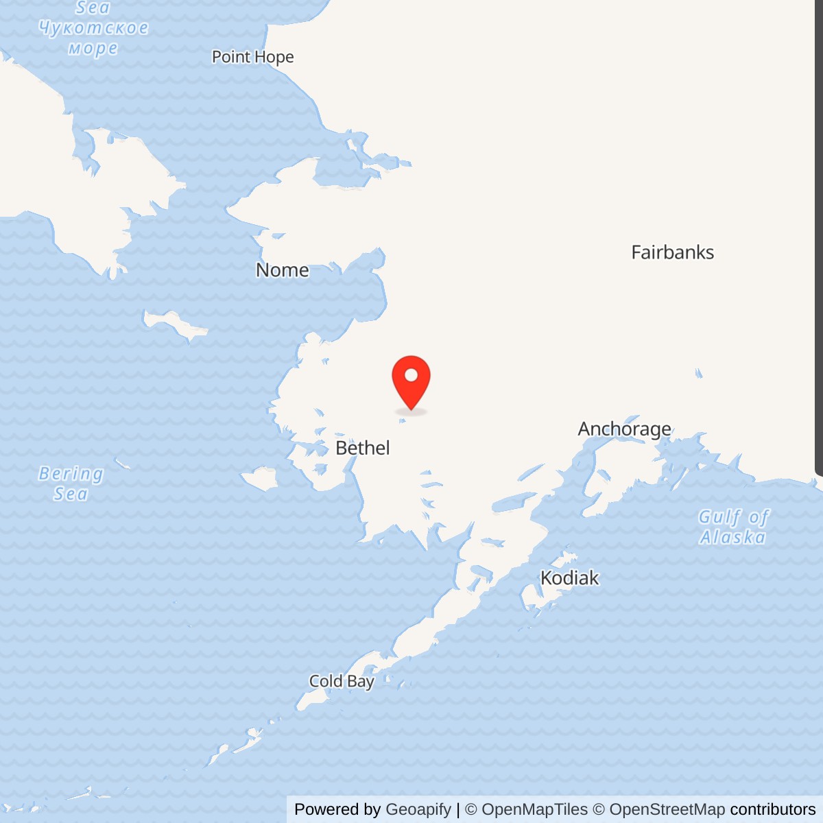
Longitude: -159.550536
Current Role: Former relay property in airport/school district setting; the reused White Alice main building was demolished in 2023. Alaska DEC environmental case remains active and under review for closure with institutional controls. Do not describe the demolished building as an operating school.
Coordinate note: 61.580471 N, 159.550536 W is Alaska DEC's NAD83 environmental-site marker. It is not a surveyed antenna center, installation centroid, property boundary, or access point.
Overview
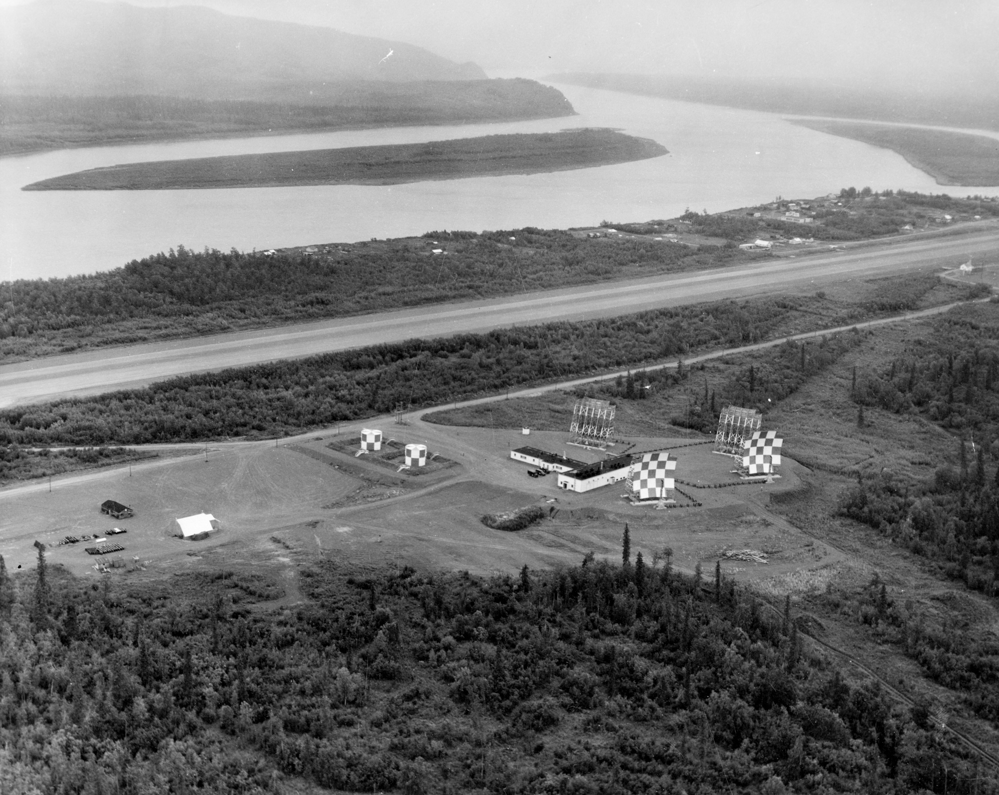
Aniak was a White Alice Communications System (WACS) tropospheric-scatter relay beside Aniak Airport in western Alaska. Its task was to pass voice and other traffic between the Bethel relay to the southwest and the Sparrevohn relay to the east, providing a dependable over-the-horizon segment for the Air Force's Alaska air-defense communications network. The station was a communications installation, not an aircraft-detection radar station. Its four paired billboard antennas and power-intensive relay equipment made the site physically prominent, while its importance lay in the continuity of messages between remote stations and command centers. The U.S. Army Corps of Engineers' 1988 inventory dates construction to 1955-1958, activation to January 14, 1958, and closure to 1979. Alaska Department of Environmental Conservation (DEC) describes the broader Air Force use as 1955-1979, evidently including the construction period.
The Aniak story continued after communications ended. The former technical building was adapted for school use, placing students and staff in a structure and on land affected by petroleum, polychlorinated biphenyls (PCBs), and trichloroethylene (TCE). Decades of investigation, excavation, vapor mitigation, and groundwater monitoring followed. The Joe Parent Vocational Education Center, the converted White Alice building, was demolished in 2023. In September 2026 DEC still listed the environmental case as active and said it was reviewing closure with institutional controls. Therefore the site's historic school reuse must not be described as the current use of the surviving White Alice building: that building no longer stands.
Identity, setting, and coordinates
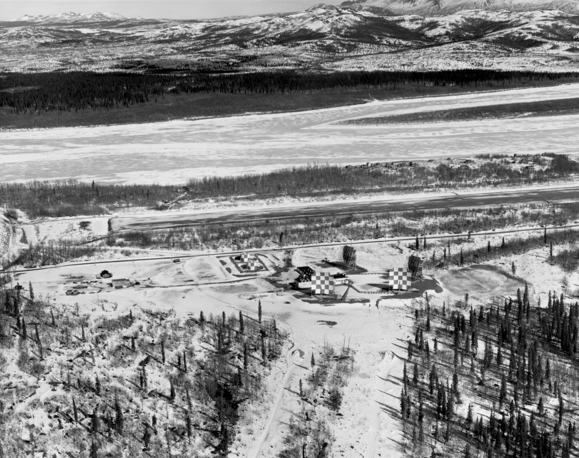
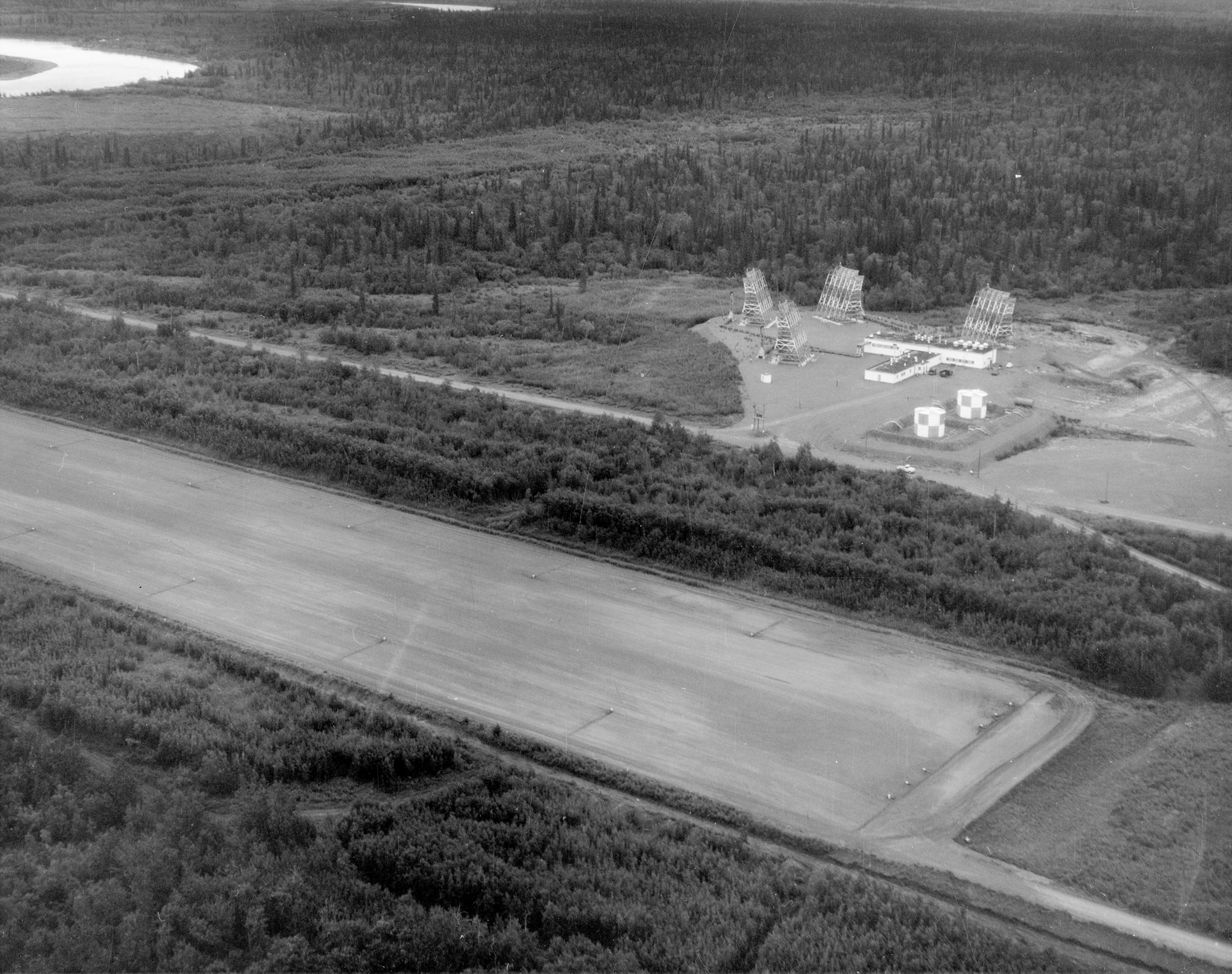
Aniak lies on the south bank of the Kuskokwim River, near Aniak Slough, in the Bethel Census Area. The installation occupied the airport-side landscape rather than a remote mountaintop. The former relay building stood at the southwestern edge of Aniak Airport, with its antennas in the airport flight path. The Corps inventory explains that the billboard antennas were deiced and painted in a red-and-white checkerboard pattern for visibility to aircraft. Their location made the communication system part of a working airfield landscape, but it did not make the airport runway itself a White Alice antenna parcel.
DEC's published NAD83 environmental-site marker is 61.580471 degrees north, 159.550536 degrees west. This is a record point for the former WACS/school site, not a surveyed center of any individual antenna, a runway threshold, or the boundary of the Air Force's former operating interest. The Alaska Department of Transportation and Public Facilities (DOT&PF) airport layout plan preserves a historically used petroleum, oil, and lubricant line corridor serving White Alice. That mapped corridor shows why the site's footprint included supporting fuel infrastructure outside the walls of the relay building.
Origins and construction
The Air Force built White Alice because high-frequency radio links had proved unreliable across Alaska's enormous distances and difficult atmospheric conditions. Air-defense radar stations needed a dependable way to pass warnings, commands, and routine operations traffic. Tropospheric scatter used powerful radio transmissions and large antennas to reach a receiving station beyond the normal line of sight. White Alice combined these long hops with microwave segments where terrain and distance allowed. It also carried civilian communications, which made the system both a defense project and a major change in Alaska's communications infrastructure. The original network contained 31 stations, according to the Alaska Office of History and Archaeology; Aniak was one of its tropospheric-scatter relays.
Western Electric and the Corps developed the original network during the mid-1950s. The 1988 Corps inventory specifically says Aniak was constructed between 1955 and 1958 and officially activated on January 14, 1958. A dated Anchorage Museum photograph identifies the equipment and dormitory building under construction on September 24, 1956, and another cataloged image shows Aniak on August 13, 1957. These archival records independently establish a multiyear build rather than a single 1955 opening. The details of contract award, beneficial occupancy, equipment acceptance, and first live circuit at Aniak have not been located, so activation is the strongest precise operating milestone presently available.
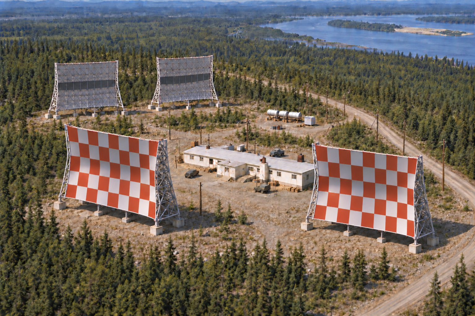
The original station had a 6,080-square-foot equipment and power building and a 4,750-square-foot dormitory planned for 12 people. Three petroleum, oil, and lubricant tanks had a combined capacity of 7,000 barrels according to the Corps inventory. This was a substantial fuel reserve because tropospheric-scatter transmitters and local power equipment needed continuous electricity in a place where a long interruption could sever the relay chain. The dormitory put operating and maintenance personnel close to the equipment; the airport supported supply and access. The station's building, antennas, tanks, fuel line, and supporting utilities formed a working system, not just a set of four large antennas.
Relay equipment and operations
Two 60-foot billboard antennas faced Bethel, about 96 miles away by the Corps' station-to-station figure. A second 60-foot pair faced Sparrevohn, about 135 miles away. The paired antennas supplied the diversity needed to make a long tropospheric path reliable when propagation conditions changed. The Corps inventory identifies Aniak as the intermediate link between Bethel and Sparrevohn and notes that all four antennas had deicing provisions. A 1976 Federal Communications Commission notice also identifies proposed circuits at Aniak toward Sparrevohn and Bethel, confirming those directions in a later telecommunications record. The notice is a proposal, not proof that every frequency and modification listed there was put into service.
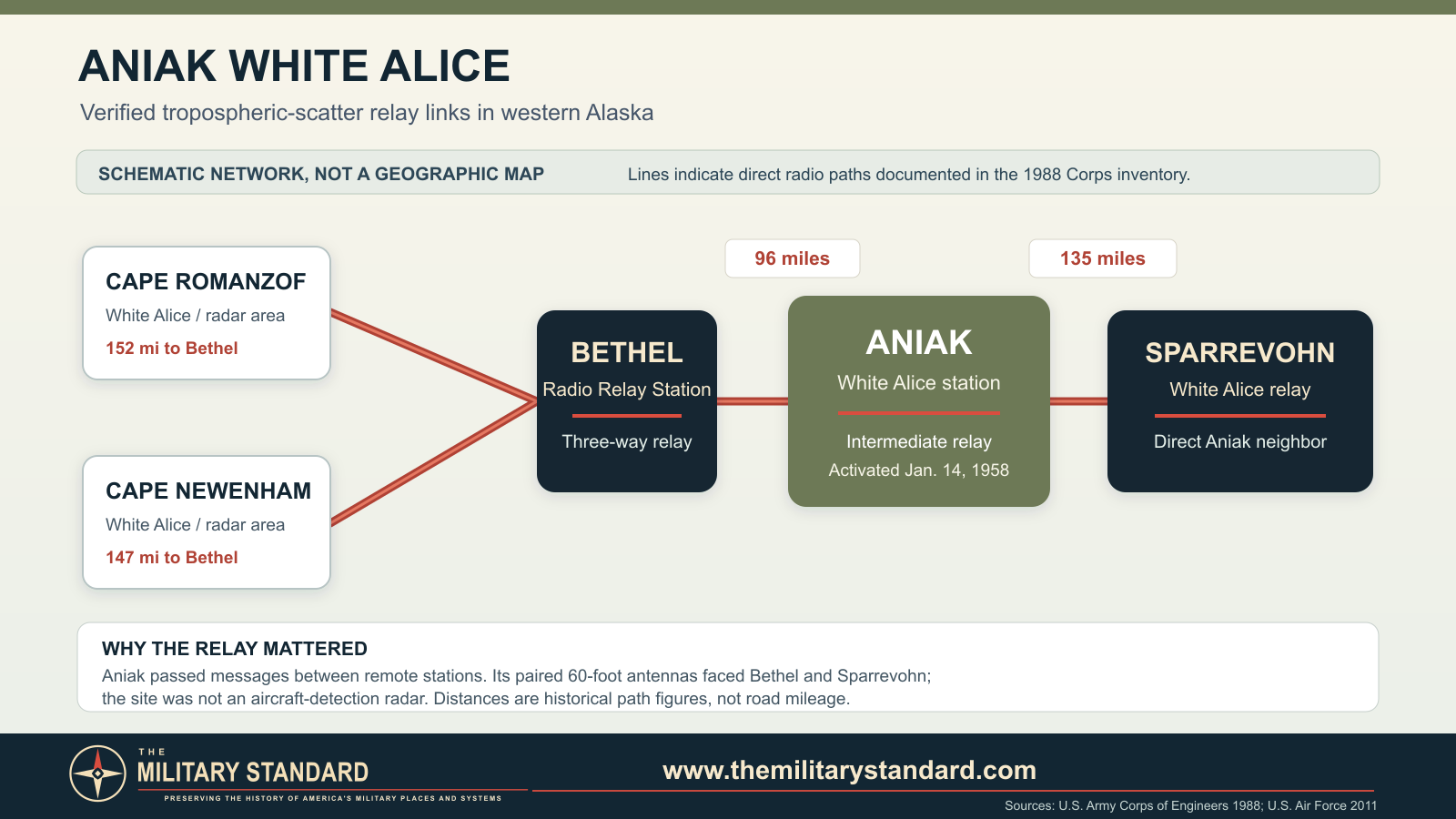
White Alice did not detect aircraft; the radar stations did. The relay kept those remote places connected to the wider command structure, including the Alaskan Air Command network and communication routes toward Elmendorf and Eielson. A 2011 Air Force account says Bethel Radio Relay Station served Aniak, Cape Romanzof, and Cape Newenham for 21 years. That account confirms the Aniak-Bethel relationship but does not mean Cape Romanzof or Cape Newenham linked directly to Aniak. The 1988 Corps inventory identifies Sparrevohn as Aniak's other direct neighbor. These distinctions matter when reconstructing the network: a station can be related through a relay chain without sharing a direct antenna shot.
The Air Force owned and directed the network while contractors performed much operating and maintenance work. The state and federal complaint filed in 2016 describes Federal Electric Company, RCA Service, ITT Arctic Services, and RCA Alascom in successive Aniak operating or lease roles, with approximate periods from 1958 through 1979. That pleading is evidence of the parties' asserted contract history, not a judicial finding for every date or assignment. The site's functioning depended on technicians, generator and fuel maintenance, winter access, and resilient radio equipment as much as on the antennas.
Role in the Wider Military Network
Aniak was a middle relay in a chain, not a terminal command center. The White Alice system converted widely dispersed air-defense positions into a network able to send warnings and directions across terrain where cable was impractical and ordinary radio was unreliable. Bethel was a three-way relay, carrying Aniak traffic as well as circuits toward Cape Romanzof and Cape Newenham. Sparrevohn linked onward into another part of the interior network. The operational value of Aniak therefore cannot be measured by aircraft or missiles based there; its value was the ability to keep other installations in communication. The same circuits could support nonmilitary users under the system's mixed military-civilian purpose, although the available sources do not quantify Aniak-specific civilian traffic.
Transfer, school conversion, and property interests
White Alice's original tropospheric network lost its military role as satellite communications and commercial arrangements superseded it in the 1970s. The Corps inventory records Aniak as closed in 1979, while DEC says the Air Force decommissioned it in 1978 and licensed full occupancy to the Kuspuk School District on May 1, 1979. These are different kinds of milestone, not necessarily contradictory: equipment could be shut down before the final closure, occupancy license, or reuse. DEC says the school district renovated the main building and began using it as a school in 1983. Its current public narrative also says DOT&PF has owned the property since 1965. The title, federal operating rights, and later school lease should not be collapsed into a single unqualified 'transfer from the Air Force to the school' date.
The former relay building became the Joe Parent school/vocational education building. Renovation removed electrical and generating equipment, and DEC's case chronology reports spills of transformer oil, ethylene glycol, and other materials during both the military operating period and the conversion work. These statements do not assign every contaminant to one party or year. The 2016 complaint identifies disputes among the United States, the state, and contractors over operation, cleanup, and liability. It is therefore more accurate to describe a multi-party remediation history than to attribute all contamination to a single actor. The state airport plan still references the former White Alice fuel-line corridor, underscoring that reuse and cleanup extended beyond the converted building.
Environmental investigation and cleanup
The former station became an active DEC contaminated-sites case, file 2404.38.007 and hazard ID 692. PCB-containing fluids affected soil around the generator and wood-shop areas. Disposal into the former wastewater and septic system contributed PCB and TCE contamination west of the building, with TCE also found in groundwater and soil gas. Petroleum contamination was investigated around former tanks, drums, and service areas. DEC records multiple removals beginning around 1979, later characterization, and additional work as school use continued. A 2001 removal sent about 872 tons of PCB-impacted soil and cleanup materials out of state, while DEC still estimated substantial residual PCB soil under temporary cover. In 2008 workers removed the old septic system and shipped roughly 3,000 cubic yards of contaminated soil and related material off-site.
The environmental program intensified when the converted building's occupancy raised concern about vapor intrusion. A 2009 assessment found TCE in indoor air above long-term screening levels, though DEC did not describe an immediate acute hazard. Air filtration was followed by a sub-slab depressurization system that began operating in September 2010. Monitoring, maintenance, and further investigation continued. A major 2017 excavation removed more than 2,800 cubic yards of PCB-impacted soil from the septic-system and wood-shop areas. DEC reports that remaining inaccessible soil near the building was to be addressed when the structure came down. The mitigation system stopped in 2021 after the building was vacated, and the Joe Parent Vocational Education Center was demolished in 2023. These cleanup quantities represent separate actions and should not be added as if they were a single volume estimate for the whole site.
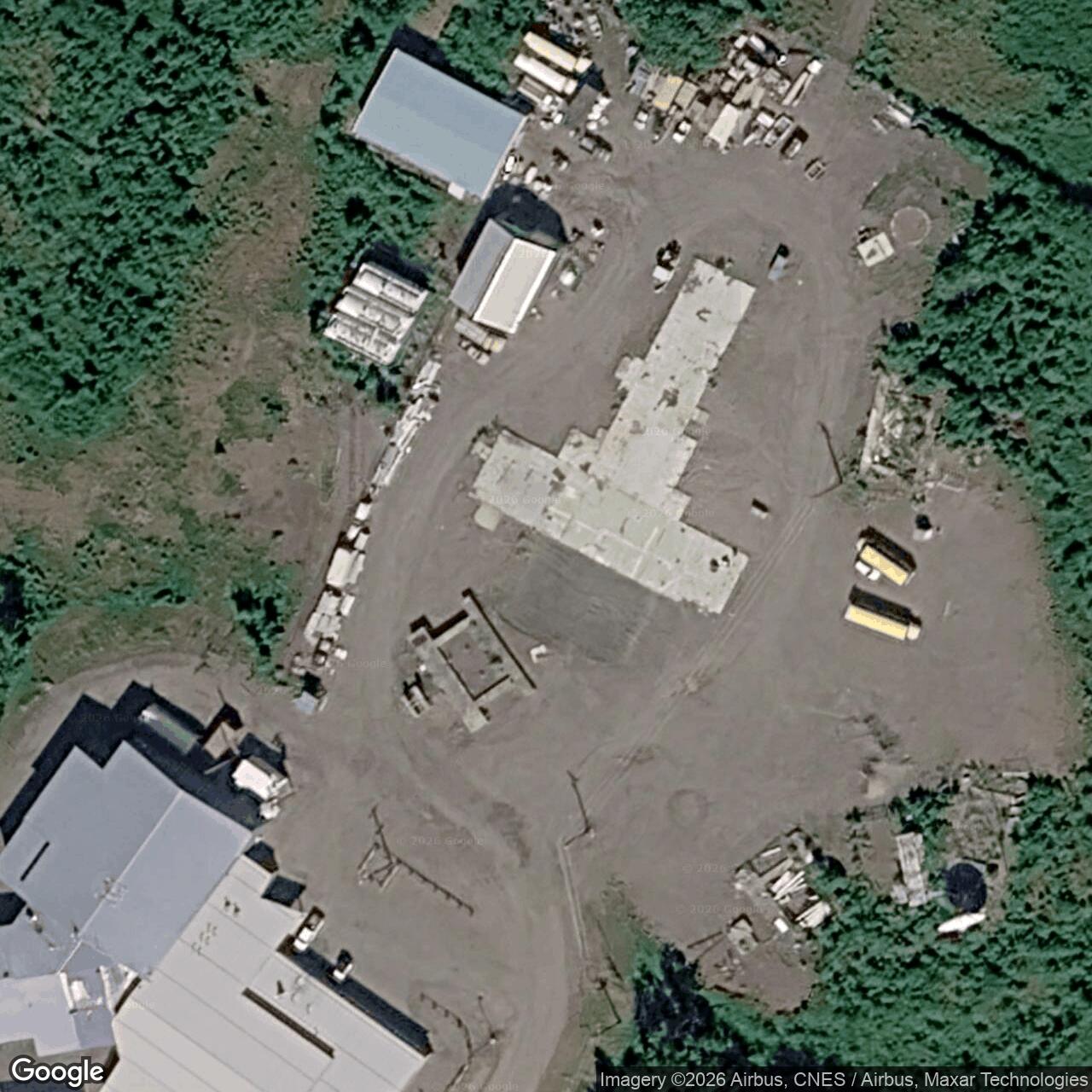
As of DEC's September 2026 update, a delineated TCE groundwater plume remains west of the former vocational building. Monitoring through 2023 indicated stable or decreasing concentrations after source-area removal, and on-site school and nearby residential drinking-water sampling had met drinking-water standards in the reported tests. The state said it was reviewing the case for closure with institutional controls and coordinating final actions with responsible parties. A January 2025 entry in the detailed DEC record reports additional soil sampling through the former building slab: no samples exceeded the applicable PCB cleanup level, while some contained TCE above a migration-to-groundwater threshold. 'Cleanup complete' would therefore overstate the 2026 record. The historic communications mission is over, but the environmental file remains active.
Surviving landscape and current status
The original 60-foot billboard antennas are no longer an operating White Alice array. The converted main building survived for decades in school use but was demolished in 2023. DEC refers to a remaining slab in its later sampling record. The airport-side property remains associated with Kuspuk School District and DOT&PF functions. The former fuel corridor, contaminated-site monitoring points, and documented building location are now the clearest public traces of the relay's footprint. The 2026 DEC record, not older photographs of the school building, governs the present-status statement.
Chronology
- 1955 Construction period begins for the Aniak White Alice relay according to the Corps inventory.
- 1956-09-24 A dated archival photograph records the equipment and dormitory building under construction.
- 1957-08-13 Another dated archival image records work at Aniak during the buildout.
- 1958-01-14 Corps inventory gives official station activation.
- 1965 DEC says DOT&PF ownership of the property began; the Air Force communications use continued under its operating interests.
- 1976 A federal telecommunications notice records proposed Aniak circuits toward Sparrevohn and Bethel.
- 1978 DEC says the Air Force decommissioned the station; exact equipment shutdown date is not established here.
- 1978-12-12 Kuspuk School Board expresses interest in educational reuse, according to a later state legal pleading.
- 1979-05-01 DEC records a license giving Kuspuk School District full occupancy rights.
- 1979 Corps inventory records closure of the Aniak White Alice station.
- 1979-1983 Initial PCB cleanup and conversion work occur while the former relay building is adapted for school use.
- 1983 Kuspuk School District begins school use of the renovated main building, according to DEC.
- 1998 DEC records investigations and removals involving PCB soil and drums around the school property.
- 2001 A PCB soil removal ships about 872 tons of impacted material and cleanup supplies off-site.
- 2008 The former septic system is removed and approximately 3,000 cubic yards of contaminated material are shipped off-site.
- 2009 Vapor-intrusion investigation finds TCE in indoor air above long-term screening levels.
- 2010-09-02 DEC records operation of the sub-slab depressurization system beneath the school building.
- 2017 More than 2,800 cubic yards of PCB-impacted soil are removed from two major source areas.
- 2021 The mitigation system is shut down after the Joe Parent building is vacated.
- 2023 The former White Alice main building, later the Joe Parent Vocational Education Center, is demolished.
- 2025-01-27 DEC reviews post-demolition sampling through and around the remaining slab.
- 2026-09-11 DEC updates its site narrative and continues to list the environmental case as active while reviewing closure with institutional controls.
Information sources (10)
- PDFGeorgeanne Lewis Reynolds, Historical Overview and Inventory: White Alice Communications System, U.S. Army Corps of Engineers Alaska District, April 1988
Source for Aniak construction and activation, direct Bethel and Sparrevohn relay links, four antenna dimensions, facilities, fuel capacity, closure, and station-specific physical description.
- WEBAlaska Department of Environmental Conservation, Aniak White Alice Site
Source for current contaminated-site status, school reuse, building demolition, cleanup milestones, groundwater plume, and September 2026 update.
- WEBAlaska Department of Environmental Conservation, Site Report 692: Aniak White Alice Communications Site
Source for NAD83 site marker, 1978 decommissioning and 1979 occupancy license, detailed cleanup chronology, and 2025 post-demolition investigation.
- PDFAlaska Office of History and Archaeology, The Coldest Front: Cold War Military Properties in Alaska
Source for the original White Alice network count, regional strategic context, and distinction between original and expanded routes.
- WEBJoint Base Elmendorf-Richardson, Cold War era White Alice Communication System antenna felled for a clean and safe dismantling, 2011
Source for Bethel Radio Relay Station's Aniak relationship and the wider three-way western Alaska relay role.
- PDFAlaska Department of Transportation and Public Facilities, Aniak Airport Layout Plan property drawing
Source for the historically used White Alice petroleum, oil, and lubricant corridor and airport-side property context; drawing itself warns that the line center is approximate.
- PDFUnited States District Court for the District of Alaska, Alaska DEC v. United States and contractors, complaint filed February 8, 2016
Source for the parties' pleaded contractor and operating history; legal allegations are not treated as findings of fact.
- PDFUnited States Federal Register, December 13, 1976, Aniak telecommunications applications
Source for proposed directional circuits toward Sparrevohn and Bethel; the application is not treated as proof of implementation.
- WEBAnchorage Museum, Bill Ray White Alice collection image search and Aniak photographs B1994.009.397 and B1994.009.399
Source for dated 1956 and 1957 site-construction photographs; image reproduction permissions should be checked before website publication.
- PDFAlaska Department of Environmental Conservation, Aniak White Alice site printable history
Source for photographs, environmental site layout, and the historical school-reuse record. Some descriptions predate the 2023 building demolition.