
Cape Sarichef Air Force Station / Cape Sarichef White Alice Site, Alaska
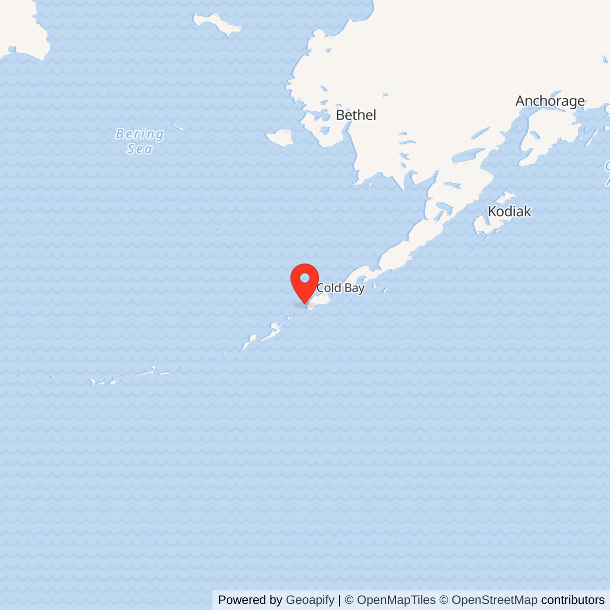
Longitude: -164.882932
Site Number: COB-3
Current Role: Former radar and relay plant. Alaska DEC continues environmental review. Coast Guard LORAN station is a distinct neighboring installation; shared runway and fuel infrastructure do not merge their identities.
Approximate location: 54.593748 N, 164.882932 W. Alaska DEC's environmental reference point is not a surveyed station boundary.
- Station code
- COB-3, Aleutian DEW Line extension.
- Radar
- AN/FPS-19, April 1959-June 1, 1969.
- Communications
- White Alice relay toward Driftwood Bay and Cold Bay, into the late 1970s.
- Location
- Western Unimak Island, near Raven Point.
Overview
Cape Sarichef Air Force Station, code COB-3, was an auxiliary station in the Aleutian extension of the Distant Early Warning (DEW) Line. On western Unimak Island, one Air Force complex combined an AN/FPS-19 aircraft-warning radar with a White Alice troposcatter relay. The radar operated from April 1959 until June 1, 1969. Its communications mission continued after the radar shut down. [1] [3] [6]
The fixed White Alice reflectors formed the link between Driftwood Bay to the west and Cold Bay to the east. This relay was essential: a radar warning had to pass through the network quickly enough to support identification and a defensive response. The nearby Coast Guard LORAN station performed a separate navigational mission and is not part of the Air Force station described here. [1] [2] [4]
The Aleutian Warning Line
The Joint Chiefs of Staff approved the Aleutian extension in 1957 to cover an exposed southwestern approach to Alaska. Cold Bay served as the main station; Cape Sarichef and four other auxiliary stations stretched the line along the Alaska Peninsula and Aleutian Islands. Alaskan Air Command took responsibility for the completed sites in 1959. Unlike the civilian-operated northern DEW stations, military personnel operated the Aleutian extension. [1] [7]
Cape Sarichef occupied a leveled volcanic cinder dome near Raven Point, approximately three miles southwest of a 3,500-foot gravel airstrip. The Corps placed the station at about 560 feet elevation. Its high, exposed position served radar visibility and the long-distance communications paths, but construction and operation had to contend with windblown volcanic ash. [1] [2]
Building a Combined Radar and Relay Station
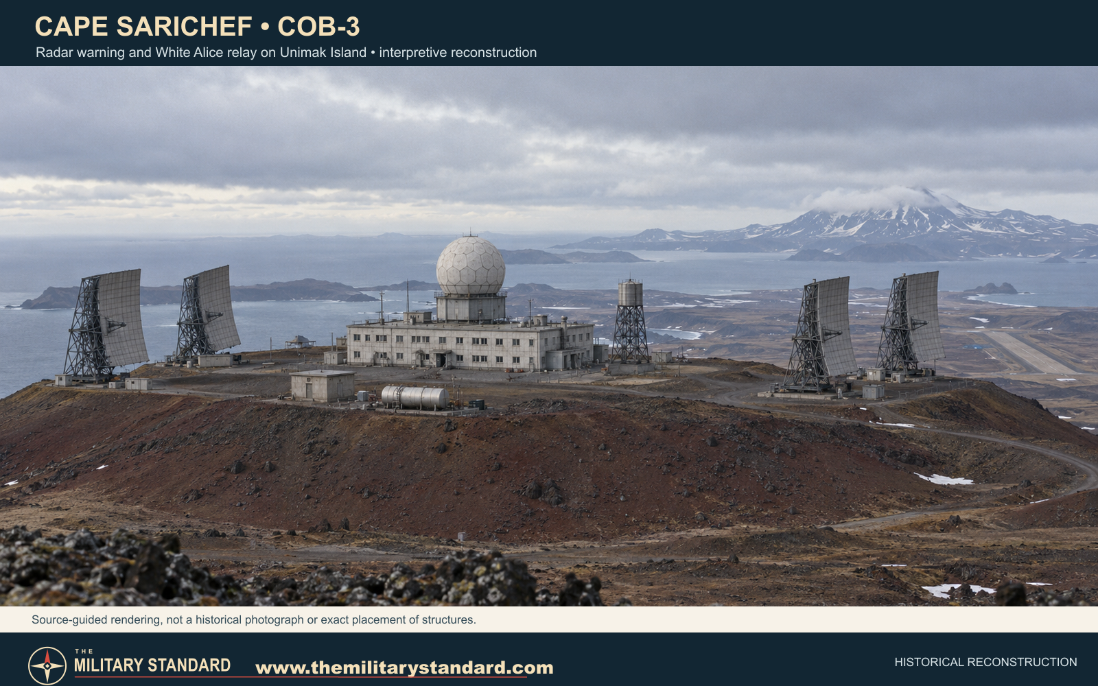
Construction began in 1957 and was largely complete by early 1959. Crews cut the top from a cinder hill and encountered solidified lava that required blasting. The standard Aleutian design placed radar, communications equipment, living quarters, administration, power and support functions in a two-story concrete composite building of about 28,000 square feet. Its central radar installation was sheltered by a radome. A pumphouse, storage bunker, fuel system and the nearby airstrip supported the isolated compound. [1] [2]
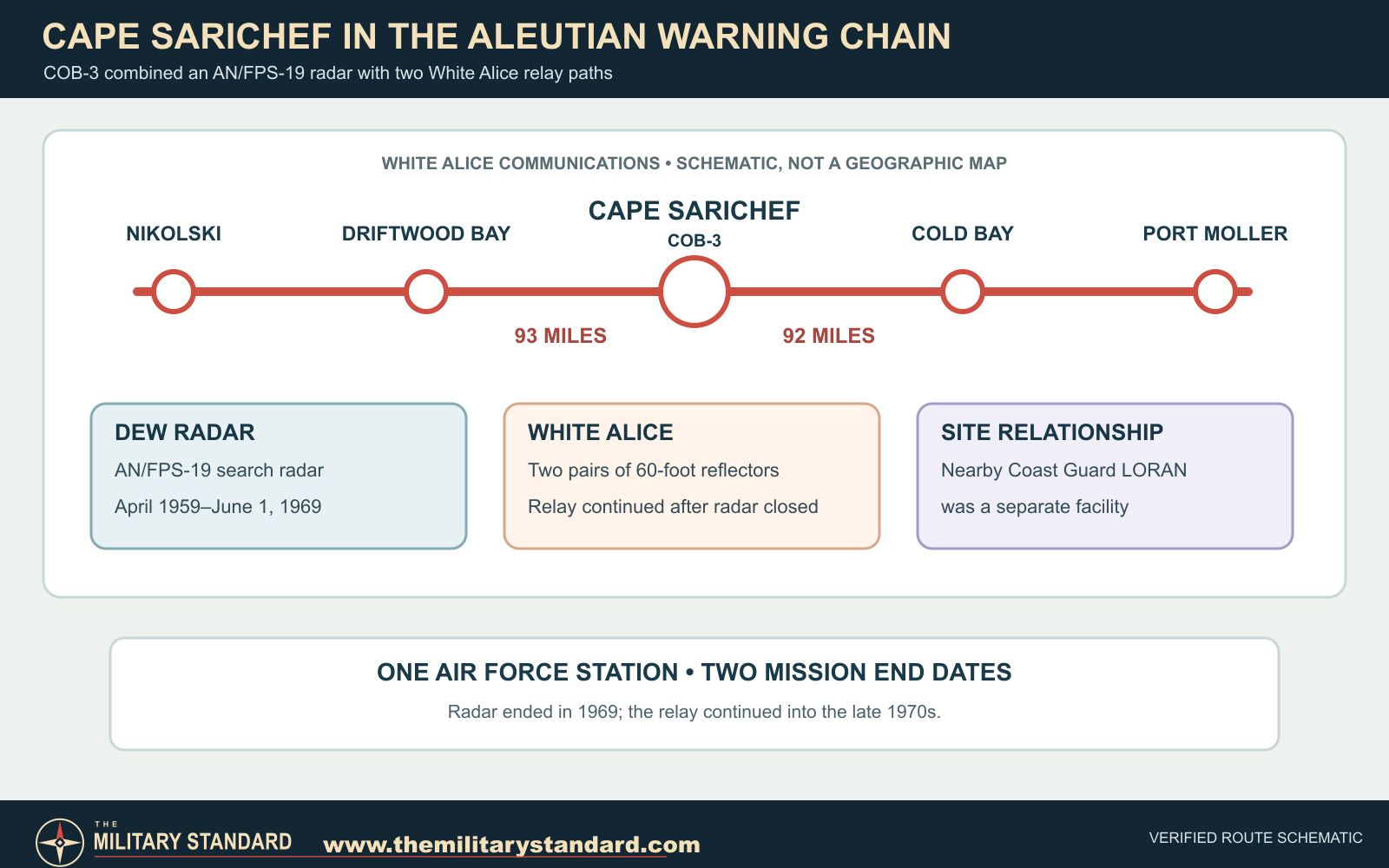
Outside stood four 60-foot White Alice billboard reflectors: a pair aimed about 93 miles toward Driftwood Bay and another pair aimed about 92 miles toward Cold Bay. Their fixed, gently parabolic surfaces directed radio energy for over-the-horizon troposcatter communications. The radar antenna inside the radome had a different task, searching the airspace for aircraft. [1] [2]
Radar Operations
The station entered the Aleutian warning network in April 1959. Its AN/FPS-19 was the long-range search radar recorded for COB-3 in Aerospace Defense Command equipment tables. Military operators maintained the radar and reported tracks through the line toward Cold Bay, the sector's main station. The western approach was a place where communications and warning functions had to work together, not independently. [1] [3]
The 714th Aircraft Control and Warning Squadron had its headquarters at Cold Bay and detachments at Cape Sarichef and the other Aleutian auxiliary stations. Air Force personnel assigned to those remote stations received specialized DEW Line training at Cold Bay before taking up their posts. [8]
The Aleutian radar extension was inactivated on June 1, 1969. Cape Sarichef's search-radar mission ended with it, but the large reflector antennas and communications plant remained useful to the Air Force's western route. [1] [3] [7]
White Alice After 1969
The White Alice circuit continued to bridge Cold Bay and Driftwood Bay after radar operations ceased. A 1988 Corps inventory identifies the station's two 60-foot pairs and their respective 92- and 93-mile paths. Farther west, Driftwood Bay linked to Nikolski; eastward, Cold Bay connected toward Port Moller and the rest of Alaska's communications network. [1] [2]
The station remained a communications site into the late 1970s. One account dates local inactivation to 1977, while another gives November 1978 for the Aleutian White Alice network. [1]
The Coast Guard Neighbor and Later Condition
The Air Force built the radar and White Alice complex on Coast Guard-held land under a permit or license. The Coast Guard's Cape Sarichef LORAN and light station was a separate installation a few miles away; the two facilities shared some support infrastructure, including the airstrip and fuel facilities. [1] [4] [5]
When the Corps surveyed Cape Sarichef in the 1990s, it found the former radar and White Alice structures unusually intact and recommended preservation. Subsequent records document fuel-system removals and continuing environmental investigations. Alaska DEC still lists the former Air Force site as an active cleanup case; the 1990s preservation assessment should not be read as a present-day building inventory. [1] [4]
Historical Images and Graphics
The reconstruction above uses the Corps' descriptions of the cinder-dome setting, concrete composite building, radar radome and four White Alice reflectors. It is an interpretive image, not a historical photograph or surveyed plan. The route diagram below shows the station's two direct communications neighbors and separates the radar mission from the longer-lived relay. [1] [2]
Actual Cape Sarichef station photographs are preserved by the Radomes museum, including a view credited to the U.S. Fish and Wildlife Service and a photograph reproduced from a Corps White Alice report. [9]
See the Radomes Cape Sarichef photograph collection for actual views of the former station.
Chronology
- 1957 Aleutian DEW Line extension approved and Cape Sarichef construction begins.
- 1957-1958 Crews level the volcanic cinder dome and build the combined radar and relay station.
- April 1959 Cape Sarichef enters the radar and White Alice network as COB-3.
- May 1, 1959 Completed Aleutian stations transfer to Alaskan Air Command control.
- June 1, 1969 Aleutian DEW radar extension closes; Cape Sarichef's AN/FPS-19 mission ends.
- 1977-November 1978 Corps histories give different local and network-level dates for the White Alice relay's final period.
- 1994 Corps preservation survey describes the former station as substantially intact.
- 2006 Corps removal action clears major fuel tanks, pipeline and miscellaneous wastes.
- 2019 Alaska DEC receives the final revision of a remedial investigation; case remains active.
Information sources (9)
- PDF1. The Cold War in Alaska: A Management Plan for Cultural Resources, U.S. Army Corps of Engineers, 1994
Source for: Project Stretchout construction, COB-3 service periods, station design and setting, heritage assessment, Coast Guard proximity.
- PDF2. Historical Overview and Inventory: White Alice Communications System, U.S. Army Corps of Engineers, 1988
Source for: The two 60-foot antenna pairs and 93-mile Driftwood Bay / 92-mile Cold Bay links; cinder-cone construction challenge.
- PDF3. Historical Data of the Aerospace Defense Command, 1946-1973
Source for: COB-3 AN/FPS-19 radar, April 1959 operational date and June 1, 1969 inactivation.
- WEB4. Alaska DEC Cape Sarichef Site Report, Hazard ID 72
Source for: Air Force use of Coast Guard-held land, separate LORAN and White Alice locations, shared support, current environmental case status and qualified coordinate.
- WEB5. Alaska DEC USCG Cape Sarichef LORAN Site Report
Source for: The Coast Guard LORAN site as a separate neighboring facility.
- PDF6. Air Force Bases: Within the United States, Air Force Historical Research Agency
Source for: Cape Sarichef Air Force Station official designation and later radar / radio-relay aliases.
- PDF7. The Coldest Front: Cold War Military Properties in Alaska, Alaska Office of History and Archaeology
Source for: Aleutian extension context and 1969 radar / 1978 communications network transitions.
- WEB8. Information on Alaska for Air Force Personnel and Their Families, Air Force Pamphlet 34-8-6, 1964
Source for: 714th Aircraft Control and Warning Squadron headquarters at Cold Bay and detachments at Cape Sarichef and other Aleutian auxiliary stations.
- WEB9. Recent Photos of Cape Sarichef (COB-3), Radomes Museum
Source for: External historical photograph references and credit information; images not reproduced pending rights confirmation.