
Cambria Air Force Station Radar Site, Cambria California
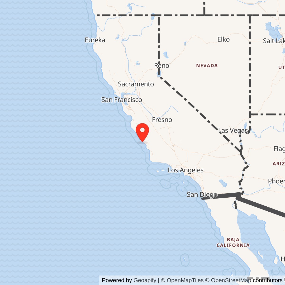
Longitude: -121.0625
Site Number: LP-2; P-2; Z-2
Current Role: Privately owned former radar-station property at 202 Monte Cristo Place; approximately 32 surviving buildings/structures and radar towers remain, with redevelopment/sale activity and no current military mission.
Installation Identity
Cambria Air Force Station was a U.S. Air Force Air Defense Command general-surveillance radar station on a high coastal bluff south of Cambria, California. Its mission was to watch the Pacific approaches to central California, detect and track aircraft, determine altitude with dedicated height-finding radar, and provide the information needed to identify and intercept potentially hostile aircraft. The station began within the hurried early Cold War radar buildup, passed through the manual Ground-Control Intercept era, became part of the Semi-Automatic Ground Environment system in 1961, and remained in the national air-defense network until 1980. Its principal operating unit was the 775th Aircraft Control and Warning Squadron, later the 775th Radar Squadron (SAGE) and then the 775th Radar Squadron.
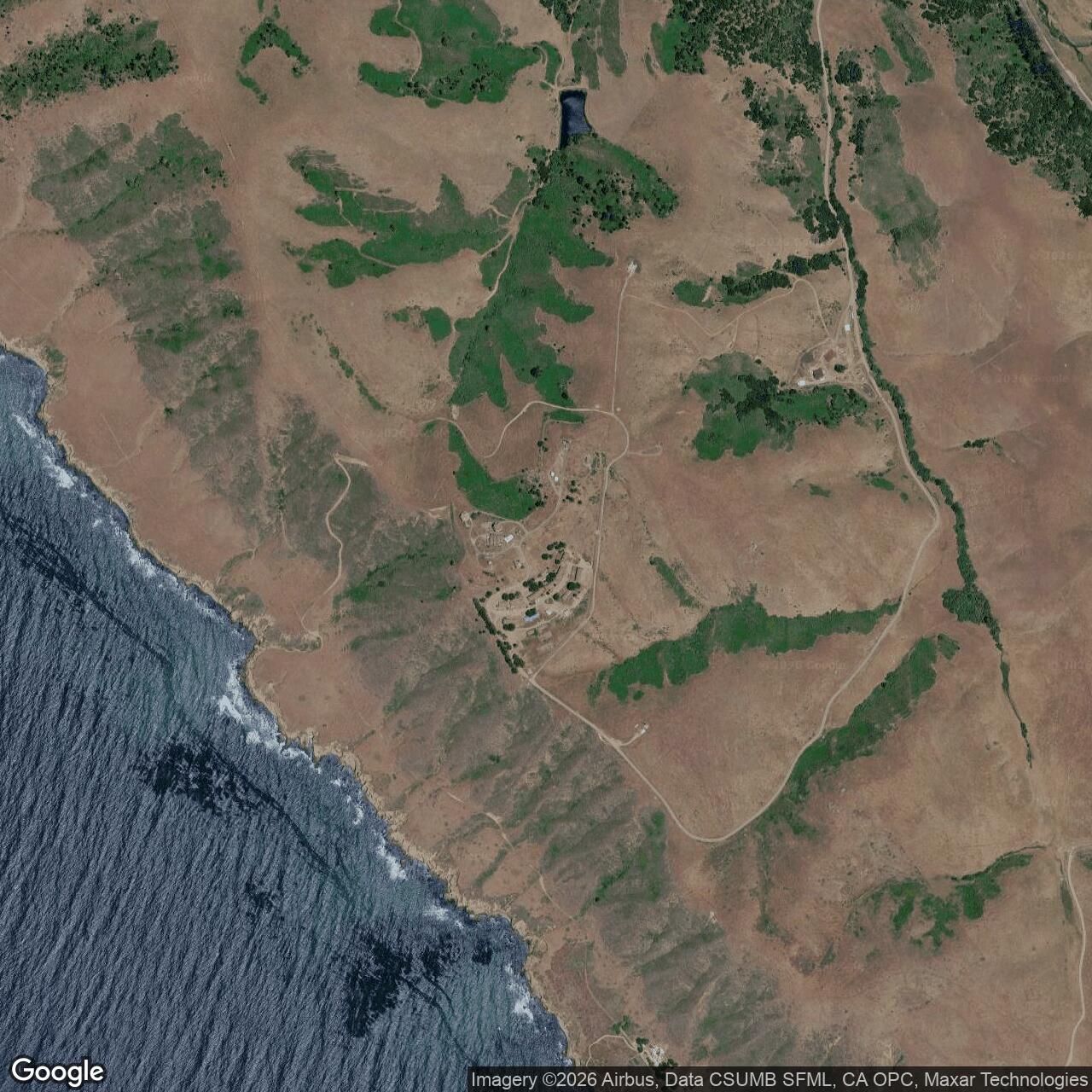
The physical setting gave the station unusual strategic value. Skyhawk Hill rises sharply above the Pacific coast, providing a clear radar horizon over ocean approaches that otherwise lacked dense civilian radar coverage. Contemporary state water-planning material described the Air Force radar station as about three miles south of Cambria on a bluff overlooking the Pacific Ocean. Later local reporting described the radar compound as roughly 700 feet above the ocean. The elevation, exposed coastal position, and long views made the site excellent for surveillance, although the same setting brought persistent wind, fog, salt air, and weather exposure that complicated maintenance and daily life.
Cambria should not be confused with a major flying base. It had no runway and did not permanently base fighter aircraft. The station's combat value came from information. Radar operators, controllers, communications specialists, technicians, power-production personnel, security forces, administrators, cooks, vehicle maintainers, and other support personnel kept a continuous watch and passed tracks to higher air-defense command centers. In the manual era, local controllers could vector fighters by radio. In the SAGE era, radar data fed computerized direction centers that combined information from many stations and coordinated fighter-interceptor responses across a much larger region.
The Cambria installation also had detached properties that should remain distinct from the main Skyhawk Hill site. A family housing area of twenty-one units was located in the town of Cambria. The station initially used separate radio transmitter and receiver sites, and its later Ground-Air Transmit-Receive function was associated with a remote GATR site at Lompoc identified as R-22. Cambria also supported the Lockwood Gap Filler Annex, P-2A and later Z-2A, on Williams Hill. A second planned gap-filler site, New Cuyama P-2B, appeared in early plans but was never built. These annexes belonged to Cambria's operational network but were not part of the same physical parcel as the main station.
Origins in the Permanent Radar Network
Cambria grew out of the emergency expansion of continental air defense that followed the Soviet atomic-bomb test, the Berlin crisis, and the opening of the Korean War. The United States had created a temporary Lashup radar network while construction of a permanent continental system accelerated. Cambria became one of the West Coast stations intended to transform that temporary network into a more capable permanent warning and interception system.
The 775th Aircraft Control and Warning Squadron was activated at Cambria on 7 March 1951 and initially assigned to the 542d Aircraft Control and Warning Group. Station histories describe a temporary Lashup-Permanent site, LP-2, operating with an AN/TPS-1C transportable search radar before the permanent equipment came online. Sources differ slightly in how they describe the opening sequence. Secondary station histories place the temporary LP-2 establishment in November 1951, while Aerospace Defense Command's statistical table records manual operations beginning in January 1952. The most defensible interpretation is that the unit and site organization were in place during 1951, with sustained operational radar coverage established by the beginning of 1952.
The permanent radar arrangement initially centered on an AN/FPS-3 search radar and AN/CPS-4 height finder. The AN/FPS-3 supplied long-range range-and-azimuth information, while the AN/CPS-4 was used to determine target elevation and altitude. Cambria therefore followed the standard early Air Defense Command architecture in which a search radar found the target horizontally and a separate height finder supplied the third coordinate required for interception. The station's operators combined these measurements with identification and communications information to build a track that could be used for warning and fighter control.
On 6 February 1952 the 775th transferred to the 28th Air Division. The site was formally redesignated Cambria Air Force Station on 1 December 1953. That date is important because it marks the official Air Force Station identity, but it does not mark the beginning of radar service. The Cambria radar mission was already operating before the formal AFS naming milestone.
Manual Ground-Control Intercept and Direction-Center Role
During the 1950s Cambria was more than a passive warning site. NORAD and CONAD records list Cambria among permanent radar stations with a direction-center function. In the manual system, radar tracks could be plotted and evaluated locally, and controllers could direct fighter aircraft toward unidentified targets using ground-air radio. The 775th therefore participated directly in the interception chain. Radar detection was only the first step. Operators had to maintain the track, determine altitude, compare the target with known flight information, and pass or use the information quickly enough for an interceptor to reach the contact.
The geographic position of Cambria made this role especially useful. The station guarded a long central California coastal sector between other major radar sites. To the south, the air-defense network included Santa Rosa Island and later Lompoc. To the north and northeast were stations such as Point Arena, Mill Valley, and Almaden. Cambria's coverage over the Pacific helped reduce gaps between these sensors and provided early warning of aircraft approaching the coast from the west.
The squadron's higher headquarters changed as the continental network matured. In the fall of 1954 the 775th transferred to the 27th Air Division. On 1 October 1959 it transferred to the Los Angeles Air Defense Sector. Those command changes reflected the shift from a relatively simple collection of local radar stations toward a regionally integrated system organized around large direction centers.
Radar Equipment Evolution
Cambria's equipment history records the technological evolution of continental air defense unusually well. The earliest LP-2 phase used the AN/TPS-1C, a transportable long-range search radar suited to the Lashup period. By January 1952 the permanent station had the AN/FPS-3 search radar and AN/CPS-4 height finder. These were representative of the first postwar permanent-system generation.
In 1955 the AN/CPS-4 height finder was replaced by the more capable AN/FPS-6. The station also briefly operated an AN/FPS-8 medium-range search radar from approximately 1955 to 1956. ADC equipment tables show the station continuing with AN/FPS-3 and AN/FPS-6 equipment during the later 1950s. By 1958 the record shows two AN/FPS-3 search radars with an AN/FPS-6 height finder, and in 1959 Cambria had two AN/FPS-3 sets, an AN/FPS-6, and an AN/FPS-6A.
The next major change came in 1961 with installation of the AN/FPS-7C high-power search radar. The FPS-7 family was designed for the increasingly automated SAGE environment and incorporated improved electronic-counter-countermeasures capability. The station also replaced the AN/FPS-6A height finder with an AN/FPS-6B during the 1961 transition. In 1963 an AN/FPS-26A frequency-diversity height finder replaced the AN/FPS-6B. ADC's June 1963 listing gives the mature SAGE-era combination as AN/FPS-7C, AN/FPS-6, and AN/FPS-26A.
Later station histories identify the FPS-7C search system as having been modified into the AN/FPS-107 family. The exact modification date is not clear in the reviewed primary tables, so the conversion should be treated as a later equipment modernization rather than assigned an unsupported exact year. By the 1970s, surviving towers and site photographs show the distinctive long-range search tower and the AN/FPS-26A height-finder tower that became the most recognizable physical features of the station.
SAGE Integration
April 1961 transformed Cambria from a local manual-control station into a SAGE radar node. Aerospace Defense Command records give April 1961 as the SAGE operational date, and the 775th was redesignated the 775th Radar Squadron (SAGE) on 1 May 1961. Cambria then fed radar information into the computerized SAGE command network.
Initially the station's SAGE data went to Direction Center DC-17 at Norton Air Force Base, the Los Angeles Air Defense Sector's massive AN/FSQ-7 computer complex. The direction center combined tracks from multiple radar stations, flight-plan data, identification information, and weapons-control inputs. Instead of each radar station independently building the entire regional air picture, SAGE allowed data from Cambria and other sites to be fused into a common operating picture and used to coordinate fighter-interceptor responses over southern and central California.
Cambria remained a staffed radar station after automation. Personnel still operated and maintained the search and height-finding equipment, communications, power systems, and local site infrastructure. SAGE reduced some manual plotting functions but did not make the hilltop station unattended. The radar hardware still required continuous maintenance, calibration, weather protection, and troubleshooting, while controllers and communications equipment remained essential to the system.
When the 775th transferred back to the 27th Air Division on 1 April 1966, Cambria's data relationship shifted within the evolving SAGE command structure. FortWiki's command summary identifies Luke's SAGE Direction Center DC-21 as the later regional control center after the Los Angeles sector period. On 19 November 1969 the squadron was reassigned to the 26th Air Division. On 1 February 1974 it dropped the SAGE parenthetical and became simply the 775th Radar Squadron, reflecting broader organizational changes even though computerized radar reporting remained part of the national air-defense system.
Ground-Air Communications
Radar detection alone could not produce an interception. Cambria needed reliable ground-air communications to reach fighter aircraft. Like many first-generation radar stations, it originally used separate radio transmitter and receiver sites so that high-power transmitters would not interfere with sensitive receivers. Controllers could use those radio links to issue headings, altitudes, and other instructions to interceptors.
As SAGE matured, the communications arrangement evolved into the Ground-Air Transmit-Receive concept. Station records identify OLAA/775th Radar Squadron as a remote GATR site at Lompoc, California, with code R-22. This detached communications site linked aircraft and direction centers through voice and data communications.
The GATR relationship shows how geographically distributed a radar station could become. The main search and height-finding radars sat on Skyhawk Hill. Married personnel could live at a separate housing annex in Cambria. Ground-air communications could be handled at another detached site. A gap filler operated dozens of miles away on Williams Hill. The operational "station" therefore functioned as a network of facilities rather than a single fenced hilltop compound.
Lockwood Gap Filler Annex
Cambria's most important detached radar annex was the Lockwood Gap Filler site, P-2A and later Z-2A, on Williams Hill. Gap fillers were small, normally unattended radar sites intended to cover low-altitude blind spots created by terrain and the curvature of the earth. They did not replace the long-range main station. They supplemented it by detecting aircraft that might pass below the line of sight of the primary radar.
Specialist station histories record Lockwood as operational from February 1960 to December 1963. An AN/FPS-14 was planned, but the operational equipment was an AN/FPS-18 gap-filler radar. The site was located at approximately 2,780 feet elevation in what is now associated with the Fort Hunter Liggett military reservation. The radar building and tower reportedly survive. Although it belonged to Cambria's radar coverage network, Lockwood was a distinct physical property and should not be merged into Cambria's main-site acreage or site identity.
A second gap-filler location, New Cuyama P-2B, appeared in original planning documents but was never built. Its presence in planning records illustrates how ADC continually modeled low-altitude coverage and proposed small annexes where terrain created gaps, even though not every planned site reached construction or operational status.
Physical Plant and Daily Life
Cambria was a small radar station by major-base standards, but it had the infrastructure necessary to support a self-contained Cold War community. The main radar area contained the operations building, radar towers, power plant, backup generators, technical shops, and associated equipment. The operations building was the core of the mission. Radar scopes, communications equipment, identification functions, data-processing equipment, and technical workspaces were concentrated there, while the towers around it supported the search and height-finding antennas.
The cantonment supported the people who kept that mission running. FortWiki identifies enlisted barracks, bachelor officers' quarters, an orderly room, dining hall, motor pool, and other support buildings. Local newspaper reporting and site plans add a movie theater, library, commissary and drug store, officers' club, workshop, putting green, outdoor basketball court, and a two-lane bowling alley. The bowling alley was remembered locally as the smallest in San Luis Obispo County. These facilities mattered because the station was isolated on a windswept bluff. A radar crew worked shifts around the clock, and the Air Force had to provide food, recreation, transportation, maintenance, and administrative support at a location some distance from a large military base.
Married personnel had a separate twenty-one-unit housing area in the town of Cambria. This separation between operational compound and family housing was common at small radar stations where the hilltop location was ideal for electronics but poorly suited for a complete residential community. Families gained easier access to schools and local services in town, while the radar compound retained the elevation and security needed for its military mission.
The station also had substantial utilities. A 1975 California water-quality plan described wastewater treatment at the radar station in unusual detail. Sewage flowed by gravity to two 10,000-gallon septic tanks operated in parallel, then to two slow sand filters with 225 square feet of bed surface each. Filter effluent discharged through an ocean outfall terminating roughly sixty feet offshore at about six feet below mean sea level. The state concluded at the time that the system had sufficient capacity for existing flows and noted that the Air Force did not expect a major personnel increase. This utility system illustrates the practical complexity of maintaining even a relatively small remote radar station.
Personnel, Commanders, and Unit Life
The 775th was the defining organization at Cambria. It existed first as the 775th Aircraft Control and Warning Squadron, became the 775th Radar Squadron (SAGE) in 1961, and then the 775th Radar Squadron in 1974. Higher headquarters changed repeatedly as ADC reorganized the continental defense system, but the local squadron remained responsible for the station's daily radar mission.
A partial commander list survives in specialist station documentation. Major Robert C. Evans is associated with the station around 1962, Major Frank Rudek around 1966, Lieutenant Colonel Adrian E. Powell around 1968, Major Boyd Pethtel around 1973, and Major Franklin Andrews from approximately August 1978 to August 1980. The list is incomplete, so it should not be presented as a full succession, but it provides useful evidence that Cambria's command responsibility generally rested with field-grade officers during the mature SAGE era.
Daily operations were continuous. Radar technicians maintained transmitters, receivers, antenna drives, waveguides, cooling systems, display equipment, and power supplies. Operations personnel monitored scopes and passed tracks. Communications specialists kept landline and radio circuits working. Power-production personnel maintained generators because a commercial power failure could not be allowed to blind the station. Security personnel protected the compound. Vehicle maintenance supported travel between Cambria, the hilltop station, and detached facilities. Weather and salt exposure demanded constant corrosion control and maintenance.
Cold War Operations and National Defense
Cambria did not fire weapons in combat, but it operated continuously during some of the most dangerous decades of the Cold War. The station was built while the Korean War was underway and while planners feared Soviet long-range bomber attack against the continental United States. Its early manual-control role existed specifically to detect such threats and direct fighter interceptors.
The 1950s and early 1960s were periods of rapid change in the bomber threat. Jet aircraft flew higher and faster, electronic countermeasures became more sophisticated, and the time available to identify and intercept an unknown track shrank. Cambria's successive upgrades from TPS-1C to FPS-3, FPS-8, FPS-7C, and later FPS-107-family equipment reflected that changing threat. Height finding similarly progressed from CPS-4 to FPS-6-series equipment and finally the frequency-diversity FPS-26A.
During the SAGE era, Cambria's importance became collective. No single station could defend California, but each radar filled a geographic sector of the continental screen. Cambria contributed coastal tracks to a system that included direction centers, fighter-interceptor squadrons, ground-air communications, gap fillers, and other radar stations. In this network, a target first seen west of Cambria could be tracked across overlapping coverage, identified against flight plans, and assigned to interceptors if it remained unknown.
The station's Cold War role also included routine monitoring rather than constant crisis. Most tracks were friendly commercial or military aircraft. The value of the station lay in reliably distinguishing the ordinary from the anomalous while remaining ready for the rare track that might represent a real threat. That work was repetitive, technical, and largely invisible to the public, but it was the operational foundation of continental air defense.
The 1979 ADTAC Transition
The end of Aerospace Defense Command in 1979 did not immediately end Cambria's mission. As part of the larger reorganization of U.S. air defense, responsibility moved to Tactical Air Command's Air Defense, Tactical Air Command organization, commonly abbreviated ADTAC. Cambria and the 775th continued operating under the new jurisdiction while the Air Force rationalized an aging network increasingly supplemented by Federal Aviation Administration radars and newer joint-surveillance concepts.
This transition reflected changes in both threat and technology. By the late 1970s the United States relied more heavily on long-range missiles, satellites, airborne warning systems, and increasingly integrated civil-military radar data. Many staffed ADC stations built in the early 1950s were expensive to maintain. Cambria's aging radar plant, isolated location, and overlapping regional coverage made it a candidate for closure.
Closure in 1980
The Air Force publicly announced Cambria's planned inactivation in 1978 as part of broader defense reductions. The station and the 775th Radar Squadron were inactivated on 30 September 1980. The closure ended nearly three decades of continuous Air Force radar operations on Skyhawk Hill.
The transition was not instantaneous. Specialist station histories report that an AN/FPS-6 height-finding radar remained operating for a short period after the station itself closed, until a replacement height-finder capability at the Paso Robles area on Black Mountain became operational. This detail shows that radar coverage was handed off in stages. The Air Force could close the administrative station while retaining an individual sensor temporarily to prevent a gap in regional coverage.
Equipment was subsequently removed, but much of the physical infrastructure remained. Radar towers, the long-range radar operations building, power plant, barracks, administrative structures, and other support buildings survived. The family housing area was separately disposed of, with station histories recording its sale in the early 1980s. The main site remained a conspicuous former military complex above the Pacific.
Post-Military Ownership and Reuse
The former station passed into private ownership and became the subject of repeated redevelopment ideas. Radomes records a 13 January 2005 sale for $2 million to private ownership. County planning records identify the principal former station parcel as approximately thirty-four acres at 202 Monte Cristo Place, APN 013-181-005. The property has been considered for communications, institutional, residential, hospitality, and other reuse concepts over the years.
The site's survival is unusually extensive for a former ADC station. Recent sources describe roughly thirty-two existing buildings and structures on about 34.16 acres, including radar towers, barracks, operations facilities, and support buildings. Many Air Defense Command stations lost their towers and most structures after closure. Cambria instead retains enough of its physical plant that the relationship between radar towers, operations building, cantonment, power plant, roads, and support areas can still be read on the ground.
In 2025 and 2026 the property was again marketed for sale, with an asking price around $3.2 million before a court-supervised sale process. Because that process was ongoing in the reviewed 2026 listing material, the exact ownership status should not be over-specified without a recorded post-auction deed. The defensible current description is that the former station is privately held or in private-sale transition, has no current military mission, and remains subject to county land-use, utility, and environmental constraints.
Environmental History
Environmental records require careful interpretation because different acreage figures refer to different things. Defense Environmental Restoration Program records identify Cambria Air Force Station as FUDS property CA99799F539100 with one Installation Restoration Program site and no Munitions Response Program site. DoD tables list approximately $282,000 in response costs and classify the response as complete.
A Corps-derived FUDS summary describes a 5.16-acre response area involving five underground storage tanks and fifteen transformers, with final cleanup action in September 1992. That 5.16-acre figure is not the full historical station acreage and should not replace the approximately 34.16-acre current principal station parcel in the installation inventory. It is an environmental project footprint.
Later local reporting identifies additional redevelopment concerns involving asbestos and PCB contamination in surviving structures and site materials. These concerns do not contradict the earlier FUDS response-complete status because the federal project and later private-property building hazards address different contamination categories and regulatory responsibilities. The historical record therefore supports two simultaneous facts: the DoD environmental response project reached final response complete, while private redevelopment of the surviving complex can still require substantial hazardous-material abatement.
Current Status
Cambria Air Force Station is closed and has no active Department of Defense mission. The main Skyhawk Hill compound remains largely extant on a privately controlled approximately 34.16-acre parcel centered at 202 Monte Cristo Place. Surviving features include radar towers, the long-range radar operations building, power facilities, barracks, administrative buildings, and other support structures. The hilltop location and remaining towers make the former station visually recognizable from miles away.
The property's preservation is accidental rather than the result of a formal military museum program. Structures have survived because redevelopment has proceeded slowly and the large complex has been difficult and expensive to convert. Environmental abatement, limited water, building condition, access, zoning, and the cost of rehabilitating specialized military structures all affect reuse. Even so, the survival of the radar towers and cantonment gives Cambria exceptional interpretive value among former Air Defense Command sites.
Chronology
- 1950-07-11 The Secretary of the Air Force requested accelerated approval for the second segment of the permanent continental radar network during the Korean War emergency.
- 1950-10-24 Local reporting announced that a new military installation would be built south of Cambria on the Alex Ferrasci ranch, although details remained restricted.
- 1951-03-07 The 775th Aircraft Control and Warning Squadron activated at Cambria and was assigned to the 542d Aircraft Control and Warning Group.
- 1951-11 Station histories place establishment of the temporary LP-2 Lashup-Permanent radar operation in this period, using AN/TPS-1C equipment.
- 1952-01 Aerospace Defense Command records manual radar operations at Cambria beginning by January 1952; AN/FPS-3 search and AN/CPS-4 height-finder radars formed the early permanent-site combination.
- 1952-02-06 The 775th transferred to the 28th Air Division.
- 1953-12-01 The site was formally redesignated Cambria Air Force Station.
- 1954 The 775th transferred to the 27th Air Division during the fall.
- 1955 AN/FPS-6 replaced the AN/CPS-4 height finder; AN/FPS-8 search radar also entered short-term service.
- 1955-1956 AN/FPS-8 provided supplementary search coverage before being removed.
- 1958 ADC records two AN/FPS-3 search radars and an AN/FPS-6 height finder at Cambria.
- 1959 The station operated two AN/FPS-3 search radars, AN/FPS-6, and AN/FPS-6A height-finding equipment.
- 1959-10-01 The 775th transferred to the Los Angeles Air Defense Sector.
- 1960-02 Lockwood Gap Filler Annex P-2A began operating on Williams Hill with AN/FPS-18 equipment.
- 1961-04 Cambria entered the Semi-Automatic Ground Environment system and began feeding computerized regional air-defense control.
- 1961-05-01 The 775th Aircraft Control and Warning Squadron was redesignated the 775th Radar Squadron (SAGE).
- 1961 AN/FPS-7C high-power search radar entered service; AN/FPS-6B replaced the AN/FPS-6A height finder.
- 1963 AN/FPS-26A replaced the AN/FPS-6B as the station's advanced height finder.
- 1963-07-31 Cambria's NORAD site identity was standardized as Z-2 during the SAGE-era site-designation transition.
- 1963-12 Lockwood Gap Filler Annex ceased operation.
- 1966-04-01 The 775th transferred from the Los Angeles Air Defense Sector structure to the 27th Air Division.
- 1969-11-19 The squadron was reassigned to the 26th Air Division.
- 1974-02-01 The unit was redesignated the 775th Radar Squadron, dropping the SAGE parenthetical.
- 1975 California water-planning records documented the station's wastewater system and reported no planned major personnel increase.
- 1978 The Air Force publicly announced Cambria AFS for closure as part of broader air-defense reductions.
- 1979 Cambria passed into Tactical Air Command's Air Defense, Tactical Air Command organization after Aerospace Defense Command was inactivated.
- 1980-09-30 Cambria Air Force Station and the 775th Radar Squadron were inactivated.
- 1980 An AN/FPS-6 height finder reportedly continued operating briefly after station closure until replacement coverage at the Paso Robles / Black Mountain area became available.
- 1983 The separate Cambria family housing property was sold during post-closure disposal.
- 1992-09 DoD records indicate final cleanup action for the FUDS underground-storage-tank response area.
- 2005-01-13 The main former station was sold into private ownership for $2 million according to station-history records.
- 2009-2013 San Luis Obispo County planning records documented private communications and redevelopment proposals on the approximately 34-acre former station parcel.
- 2018-2020 Modern photographs documented the surviving AN/FPS-26A and AN/FPS-107-family towers, power plant, operations building, barracks, and other station structures.
- 2025 The former station was publicly marketed again as a roughly 34-acre Cold War property with extensive surviving buildings and radar structures.
- 2026 Property records and sale material continued to describe approximately 34.16 acres and about 32 existing buildings and structures, with redevelopment subject to environmental, utility, zoning, and court-sale considerations.
- Present The former Cambria Air Force Station remains closed, privately controlled, and largely extant, with no current military mission.
Information sources (13)
- PDFHistorical Data of the Aerospace Defense Command, 1946-1973
Primary ADC statistical source for Cambria's squadron activation, manual and SAGE operational dates, radar equipment sequence, P-2/Z-2 identity, and wider network context.
- PDFA Handbook of Aerospace Defense Organization, 1946-1980
Official organizational reference for the 775th Aircraft Control and Warning / Radar Squadron activation, redesignations, and higher-headquarters assignments.
- PDFCONAD/NORAD Historical Summary, July-December 1957
Official NORAD/CONAD source listing Cambria as permanent radar site number 2, 775th Squadron, with direction-center function.
- PDF775th Radar Squadron unit history compilation
Useful unit-lineage and station-equipment summary preserving the Cambria radar sequence, command assignments, GATR relationship, and closure.
- WEBRadomes.org, Cambria AFS
Specialist radar-station reference for coordinates, P-2/Z-2 identity, call sign, equipment, Lockwood gap filler, Lompoc GATR, closure, and historical photographs.
- WEBRadomes.org, Cambria AFS Recent Photos
Detailed post-closure photo documentation of the operations building, radar towers, power plant, barracks, administrative buildings, and other surviving station features.
- PDFPage & Turnbull, Historic Resource Study, Former Almaden Air Force Station
Comparative California Cold War radar study that reproduces documented Cambria photographs, including the 1968 AN/FPS-26A radome and later FPS-107 tower and barracks.
- PDFCalifornia Regional Water Quality Control Board, 1975 Basin Plan
Government source documenting Cambria radar station location and wastewater collection, septic tanks, sand filters, and ocean outfall.
- PDFDefense Environmental Restoration Program, Table 9
DoD environmental source listing Cambria Air Force Station FUDS CA99799F539100 as a response-complete property with one IRP site and no MMRP site.
- WEBSan Luis Obispo County Planning Commission
County land-use source identifying the former Cambria AFS parcel at 202 Monte Cristo Place / APN 013-181-005 as approximately 34 acres.
- WEBMLSListings, 202 Monte Cristo Place
Current-property source describing approximately 34.16 acres and 32 surviving buildings and structures during the 2026 sale process.
- WEBSan Luis Obispo Tribune, former Cambria Air Force Station property
Current-use and preservation source discussing the approximately 34-acre former station, surviving buildings, former amenities, asbestos/PCB redevelopment issues, and 2025 sale listing.
- WEBSan Luis Obispo Tribune, historic Cambria radar-station photographs
Historic-photo article drawing on the Telegram-Tribune archive, including 1968 and 1979 views of the operating station and its radar equipment.