
Naval Auxiliary Air Station Vernalis, Vernalis California
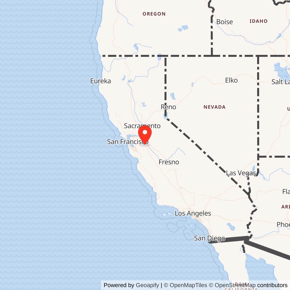
Longitude: -121.316000
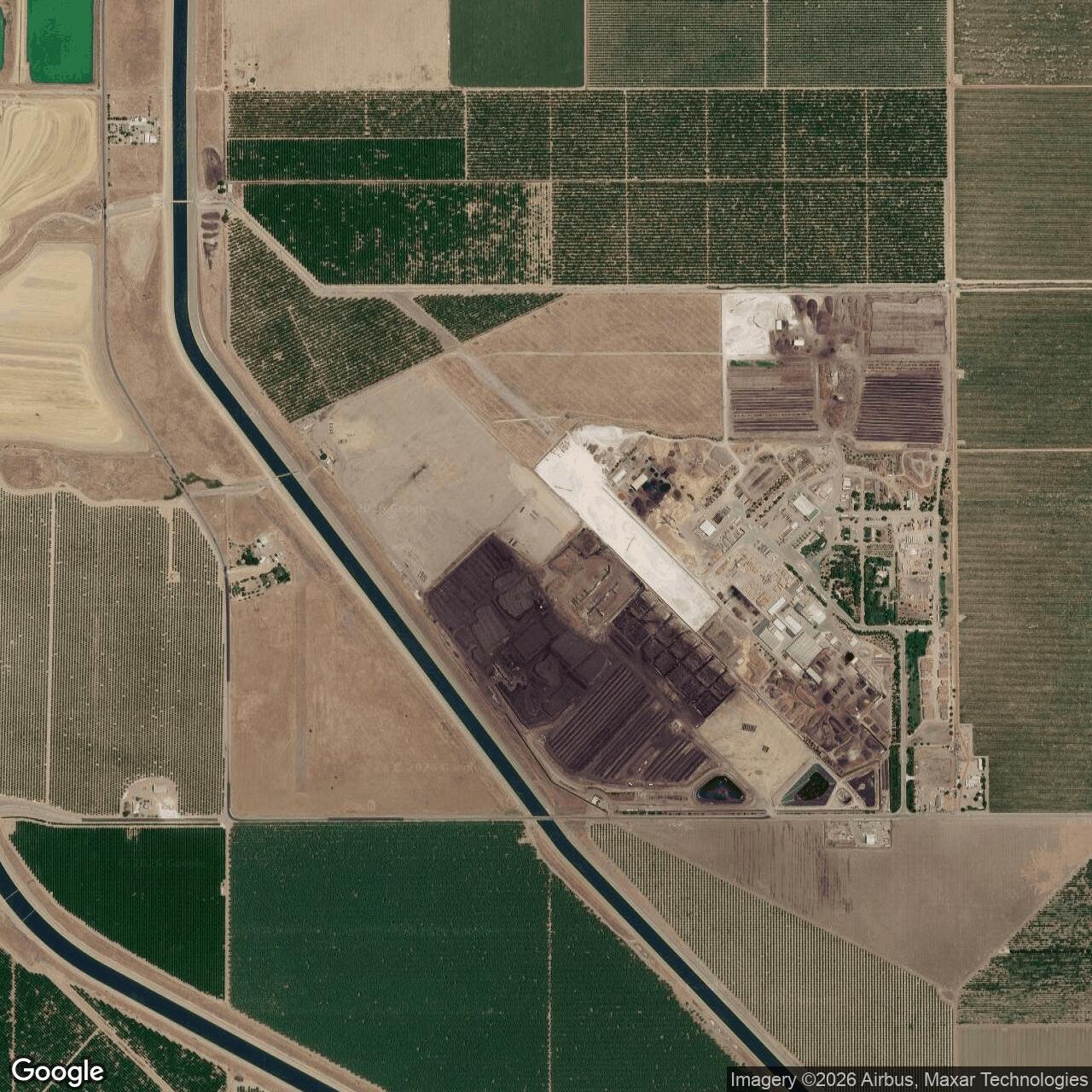
Current Role: Former NAS Alameda auxiliary air station in the Vernalis area northeast of Gaffery Road and Koster Road; wartime airfield remnants have been reused for agricultural, composting, recycling, materials-storage, and other industrial/agricultural activities, including documented composting operations on a portion of the long-closed World War II aircraft training runway. The former air station and associated Vernalis bombing/dive-bombing range properties remain documented in FUDS records.
Naval Auxiliary Air Station Vernalis was a short-lived but revealing World War II Navy airfield in the San Joaquin Valley. It was not a fleet homeport, shipyard, or long-serving Cold War air station. Its importance came from speed, geography, and specialization. In 1942 the Navy needed more flying fields within reach of Naval Air Station Alameda, but the Bay Area itself was too crowded, too industrial, and too constrained for every training need generated by wartime naval aviation. Vernalis gave the Navy a different kind of space: flat valley land, clear flying weather, room for runway expansion, room for associated training ranges, and enough distance from the densely populated San Francisco Bay industrial belt to absorb the noise, risk, and tempo of operational training.
The station was one of the auxiliary airfields that turned NAS Alameda from a single major naval air station into the hub of a regional aviation training system. Vernalis opened on June 8, 1943, first to support heavy patrol and bombing aircraft and then, as the mission changed, to host carrier-based torpedo, fighter, bomber, and composite squadrons completing advanced training. The field's life as an active Navy station was brief. By October 15, 1945, only weeks after Japan's surrender, it had been reduced to caretaker status; in 1946 it moved through surplus and disposal channels. Yet that short service life does not make it insignificant. Vernalis shows how the Navy built temporary inland infrastructure to feed the Pacific war: build the field, train the crews, shift missions as aircraft and fleet requirements changed, then close the station as quickly as it had appeared.
The former station's later life adds another layer. After the Navy left, the airfield remained visible enough to be shown on postwar charts and maps, then entered a second federal life in the 1950s as the Vernalis Geophysics Annex for Air Force high-altitude balloon work. Later the runways, ramp areas, and building traces were reused for drag racing, agricultural processing, composting, materials storage, recycling, and other industrial-agricultural activity. Today the site is a closed military airfield landscape with limited surviving military fabric, but with enough runway and parcel memory to remain identifiable in historical aerials, FUDS records, county planning documents, and airfield-history research.
Mission Evolution
Vernalis grew directly out of the rapid wartime expansion of the Navy's Twelfth Naval District air organization. Its official station history states that the field was built to meet the demand for additional training and station facilities in the district's rapidly expanding aeronautical system. The goal was to create small auxiliary units close enough to NAS Alameda to function smoothly with that headquarters, but far enough from the heavily populated industrial districts around San Francisco Bay to provide useful flying space and reduce urban conflict. On the recommendation of NAS Alameda authorities, the Navy selected a site in San Joaquin and Stanislaus Counties about five miles northwest of Vernalis and roughly sixty air miles from Alameda.The earliest plan was built around heavy patrol and bombing aircraft. The Navy purchased about 700 acres from civilian owners for $33,300 and began construction in June 1942 on a 500-by-4,000-foot runway. In November 1942, contracts followed for essential buildings, added runway area, and gasoline-storage requirements. The original requirement, according to the station history, was to support two bombing squadrons. In that role Vernalis was used by PB4Y and PBY aircraft, tying the field to the long-range patrol and antisubmarine aviation missions that consumed so much Navy attention in 1942 and 1943.
That initial mission did not remain fixed. As better facilities for heavier aircraft became available elsewhere-especially at Crows Landing with its concrete runways-the Navy adjusted fleet requirements and shifted Vernalis toward carrier-based squadrons. The station history is explicit: the field's function changed to support carrier-based squadrons completing advanced training and to base those squadrons while they awaited assignment and transportation. In that later capacity, Vernalis hosted air groups and torpedo, fighter, bomber, and composite squadrons. This change was not a demotion. It was the normal wartime logic of an auxiliary field. The Navy used each field according to the current bottleneck in the training pipeline.
The field's organization also changed. Vernalis originally functioned as a subsidiary of NAS Alameda. Later, with the creation of Commander, Naval Air Bases, the station was placed under that command. That shift reflected the administrative maturity of the regional airfield network. The auxiliary fields were no longer improvised appendages alone; they were part of a controlled system of Navy air bases, training fields, ranges, and support units across the West Coast.
World War II Operations
The daily work at Vernalis was the conversion of aircraft, crews, and squadrons into deployable naval aviation power. In the first phase, patrol and bombing aircraft used the field. Airfield-history sources identify PV-1 and PV-2 Ventura/Harpoon use, and the official station history identifies PB4Y and PBY operations. These aircraft were not small trainers. They required runway length, fuel, ordnance handling, maintenance space, and a surrounding training environment that could support bombing and gunnery practice. Vernalis therefore began as a valley airfield built to relieve Alameda while supporting the heavy-aircraft side of naval aviation.The second phase centered on carrier aviation. Once the Navy shifted heavier patrol aircraft elsewhere, Vernalis became useful for carrier squadrons needing advanced land-based preparation. The field supported torpedo, fighter, bomber, and composite squadrons. This helps explain the physical improvements made during the war. The primary runway was lengthened to roughly 7,000 feet, a 4,000-foot crosswind runway was added, permanent runway lighting was installed, and the Navy used carrier-training equipment. Airfield-history accounts describe catapult and arresting-gear installations and photographs of carrier-deck practice, including aircraft using arresting hooks over a simulated deck environment. The point was to let pilots and squadrons rehearse carrier procedures without using scarce carrier deck time for every step of training.
The station's capacity was large for such a short-lived field. The official history gave a normal messing and berthing allowance of 333 commissioned officers and 2,386 enlisted men. That figure illustrates the human scale behind the runways. Vernalis was not merely an emergency strip. It had barracks, administration, mess, training support, gasoline storage, ordnance-support arrangements, roads, stores, recreation space, radio and lighting projects, and enough personnel infrastructure to host rotating squadrons and air groups. By late 1945 the station had been in full operating status, even as the Navy already knew that the war's end would make many temporary airfields surplus.
Vernalis also had associated range activity. The official station history states that an additional 160 acres were acquired for use as a dive-bombing range. Airfield-history accounts also describe low-altitude bombing, aerial gunnery, a strafing range in the Diablo Range with a painted submarine silhouette, and German prisoners of war housed late in the war who assisted with construction projects. The POW and strafing details are best treated as secondary-source local history rather than the core administrative record, but they fit the field's training function. Vernalis was part of a system in which aircraft did not simply take off and land. They practiced bombing, gunnery, carrier approaches, night or instrument procedures, maintenance routines, and operational staging.
Site Design and Facilities
The former air station's design reflected wartime utility rather than permanence. The official history describes the original 700-acre purchase and later 160-acre range acquisition. The earliest construction focused on a 500-by-4,000-foot runway, essential buildings, additional runway area, and gasoline storage. The station's later configuration included a longer primary runway, a crosswind runway, taxiways, ramps, hangars or nose-hangar facilities, radio and lighting improvements, roads, magazines, warehouses, welfare or recreation facilities, and aviation support buildings. A construction-cost summary in the station history listed projects such as paving and drainage, arch-type magazines, additional runway work, an officers' recreation building, outdoor recreation facilities, gasoline loading stands, wells and pumps, radio transmitter building, temporary slide for laundry facilities, barracks and storehouses, training buildings, gasoline storage, permanent airport lighting, extension of welfare building, changes to the electrical distribution system, and semi-permanent taxiway light marking.The field's 1945 description in airfield-directory research is especially useful because it captures the installation near its wartime peak. Vernalis was described as a 710-acre square-shaped government-owned property operated by the Navy, with two asphalt runways: a 7,000-foot northwest-southeast runway and a 4,000-foot north-south runway. The same source described a single 125-by-60-foot wood hangar. That combination-long paved runway, smaller crosswind runway, modest hangarage, and extensive support features-matches the needs of a training station rather than a permanent naval air station meant to anchor a peacetime fleet aviation community.
The airfield's physical form was later altered by civilian and federal infrastructure. Between the late 1940s and early 1950s, the Delta-Mendota Canal was built through the western part of the former airfield, bisecting the crosswind runway and its connecting taxiway. Historic aerial accounts from 1952 and 1953 still showed the primary runway mostly intact, the street grid and ramp visible, and some buildings and taxiway sections surviving. Over time, however, the military city disappeared. Later industrial and agricultural reuse left runway fragments, foundations, ramp areas, and a few residual structures or concrete buildings, but not a preserved Navy station.
Role in the Wider Military Network
Vernalis was a node in NAS Alameda's wartime auxiliary airfield network. Alameda itself had the deep-water Bay Area position, major support infrastructure, and command role, but it did not have unlimited runway and training capacity. Auxiliary fields like Vernalis allowed Alameda to distribute aircraft and squadrons into inland locations where they could fly, train, stage, and use nearby ranges without overwhelming the main station. In that sense, Vernalis was part of the same system logic as Crows Landing, Hollister, King City, Monterey, Santa Rosa, Watsonville, and other outlying fields connected to Alameda's wartime aviation mission.The station's changing mission also shows how flexible that system had to be. Vernalis was originally conceived for two bombing squadrons and used by patrol and bomber aircraft. When heavier planes and fleet needs shifted, Crows Landing became the better heavy-aircraft field and Vernalis became more useful for carrier squadrons. That move demonstrates that the auxiliary network was not static. The Navy constantly reallocated fields, aircraft types, training functions, and support priorities to match the changing shape of the Pacific war.
Vernalis also sat inside the broader West Coast air-base construction story. The official unit history's attention to magazines, gasoline storage, runway expansion, lighting, taxiways, and welfare facilities shows that auxiliary airfields required much more than pavement. They needed ammunition and pyrotechnic storage, fueling, barracks, recreation, utilities, communications, roads, and range access. The Navy could not build carrier air groups with only carriers and major bases. It needed many smaller fields where pilots and maintenance personnel could repeatedly practice under controlled but realistic conditions.
Finally, the postwar survival of Crows Landing rather than Vernalis illustrates how the Navy sorted temporary wartime assets after victory. Vernalis initially had indications it might remain open, but Crows Landing's concrete runways gave that field a stronger postwar case. Vernalis, with its wartime-built and less durable infrastructure, was reduced to caretaker status and then disposed of. That decision was not simply local; it was a network decision. The Navy chose which inland auxiliary capacity still mattered once the emergency ended.
Closure and Disposition
The end came quickly. The official history states that Vernalis was in full operating status on September 1, 1945, but on September 6 the station received advice that, effective October 15, 1945, it would be reduced to caretaker status. In Navy terms, caretaker status meant a non-operating condition with only a minimum personnel unit to maintain physical U.S. possession of the property and guard it against deterioration, damage, looting, and theft.Further steps followed in 1946. On November 5, 1945, the Chief of Naval Operations advised that the net-war status of the activity would be surplus as of March 15, 1946. The transition to caretaker status was accomplished on March 15, 1946, with a naval officer posted as caretaker. The station was declared to the War Assets Administration that same day, disestablished on May 15, 1946, and the War Assets Administration assumed custody on October 17, 1946, when the Navy command relinquished jurisdiction and removed its caretaker.
That sequence matters because there are several possible "closing" dates. For operational history, October 15, 1945 is the most useful close date because that is when active Navy operations ended and the station was reduced to caretaker status. For administrative history, May 15, 1946 marks formal disestablishment, and October 17, 1946 marks War Assets Administration custody and the final removal of Navy caretaker jurisdiction.
Postwar Reuse and Later Federal Activity
Vernalis did not disappear immediately after the Navy left. The field appeared on postwar aeronautical and topographic mapping, though with inactive or emergency-only status. The primary runway remained identifiable into the early 1950s, and portions of the street grid, ramp, taxiways, and buildings survived. The Delta-Mendota Canal's construction across the western part of the airfield permanently disrupted the crosswind runway, marking the shift from military airfield to repurposed infrastructure landscape.The most important post-Navy federal reuse came from the Air Force. In the 1950s, Vernalis was used as the Vernalis Geophysics Annex by the Air Force Cambridge Research Laboratory. The site supported Project Moby Dick and related stratospheric balloon work intended to study high-altitude wind patterns. StratoCat identifies Vernalis as a launch base and notes that balloons launched from the site traveled across the United States and as far as Mexico, Canada, and Europe. Balloon work at Vernalis continued through the 1950s and into the early 1960s, with listed launches extending to 1961. This Cold War use gave the former Navy station a second federal scientific life, but it did not restore the field as a naval air station.
Civilian reuse was more fragmented. Airfield-history accounts describe drag-strip use beginning informally in the early 1970s and ending around 1980. Later uses included scrap metal, scrap wood processing, fertilizer manufacturing, materials storage, agricultural drying, and related industrial-agricultural activity. Stanislaus County planning material for the Recology / Grover Environmental Products operation documents an existing composting facility on Gaffery Road, east of Koster Road and west of Welty Road, and states that a portion of the facility is located on a long-closed World War II-era aircraft training runway. That county record is one of the clearest modern confirmations that the former airfield's runway landscape continued to shape site reuse decades after the Navy left.
Current Status
Naval Auxiliary Air Station Vernalis is closed. It is not an active Navy installation, not a public airport, and not a preserved historic airfield. The former airfield landscape is now divided among agricultural, composting, recycling, storage, and other industrial-agricultural uses. County planning records identify composting operations on part of the old World War II training runway area, while airfield-history sources describe runway/ramp remnants, foundations, altered buildings, and a heavily reused site with little surviving wartime architecture.The former air station also remains visible in federal environmental and munitions records. The U.S. Army Corps of Engineers FUDS inventory lists Naval Auxiliary Air Station Vernalis in Stanislaus County under property number J09CA7293, with containerized/hazardous waste, munitions-response, building demolition/debris removal, and hazardous/toxic/radioactive waste project categories. The same inventory separately lists Vernalis Bomb Target No. 6 in San Joaquin County and Vernalis Dive Bomb No. 7 in Stanislaus County. A USACE safety guide for the former Vernalis Bomb Target states that the target was used between 1951 and 1968 by Naval Auxiliary Air Station Crows Landing for bombing practice, air-to-ground strafing, and rocket practice, with the Baker 4 Range Complex identified through historical research as having potential explosive hazards. This postwar Crows Landing target history should not be confused with Vernalis's own 1943-1945 air-station operations, but it belongs in the broader Vernalis-area military landscape.
Chronology
- 1942 The Navy purchased roughly 700 acres in the Vernalis area to build an auxiliary airfield supporting NAS Alameda and two multi-engine patrol/bombing squadrons.
- 1942-06 Construction began on a 500-by-4,000-foot runway.
- 1942-11 Contracts were let for essential buildings, additional runway area, and gasoline-storage requirements.
- 1943-05-15 A Navy progress chart showed Vernalis construction and landing-field paving under way.
- 1943-06-08 U.S. Naval Auxiliary Air Station Vernalis was commissioned. Captain Frank McCrary of NAS Alameda attended, and Lieutenant E. A. Quarterman became officer-in-charge.
- 1943 The field initially supported patrol and bombing aircraft, including PB4Y and PBY operations, under the original two-bombing-squadron concept.
- 1943 The main runway was extended to approximately 7,000 feet, and Vernalis was redesignated as a Naval Auxiliary Air Station.
- 1943-1944 Vernalis functioned first as a subsidiary of NAS Alameda and later under Commander, Naval Air Bases.
- 1944 Patrol-aircraft work shifted toward Crows Landing, and Vernalis's mission changed to support carrier-based torpedo, fighter, bomber, and composite squadrons completing advanced training.
- 1944 A 4,000-foot crosswind runway, permanent runway lighting, carrier-training features, and associated range/support improvements were added or in use.
- 1944-10-09 Lieutenant Commander William Janeshek was named commanding officer, relieving Lieutenant E. A. Quarterman.
- 1945-03-26 Commander Harvey R. Bowes relieved Lieutenant Commander Janeshek as commanding officer.
- 1945-09-01 The station was still in full operating status.
- 1945-09-06 Vernalis received notice that it would be reduced to caretaker status effective October 15, 1945.
- 1945-10-15 Active Navy operations ended and NAAS Vernalis entered caretaker status.
- 1945-11-05 The Chief of Naval Operations advised that the activity's net-war status would be surplus as of March 15, 1946.
- 1946-03-15 The transition to caretaker status was formally accomplished; the station was declared to the War Assets Administration.
- 1946-05-15 NAAS Vernalis was disestablished.
- 1946-10-17 The War Assets Administration assumed custody; the Navy relinquished jurisdiction and removed the caretaker.
- 1949-1952 Postwar mapping still showed the former airfield, while construction of the Delta-Mendota Canal cut through the former crosswind-runway area.
- 1953-01-08 Vernalis began documented use as an Air Force high-altitude balloon launch site associated with Project Moby Dick and the Vernalis Geophysics Annex.
- 1953-1961 The former air station supported multiple stratospheric balloon launches and related Air Force Cambridge Research Laboratory work.
- 1960s The airfield was no longer depicted as an active airport, though parts of the former runway and facility layout remained visible.
- Early 1970s The former runway area was used informally and then more formally for drag racing.
- 1980s Agricultural and industrial-materials uses increasingly dominated the former air station property.
- 1993 Aerial imagery described in airfield-history research still showed the street grid, some buildings, ramp areas, taxiway sections, and runway outlines.
- 2003 Airfield-history visitors documented remaining runway/ramp areas, concrete foundations, small buildings, and a wooden flagpole, but few surviving World War II structures.
- 2013 Stanislaus County planning material documented a composting facility at 3401 Gaffery Road and noted that part of the facility occupied a long-closed World War II-era aircraft training runway.
- 2015 USACE's California FUDS inventory listed Naval Auxiliary Air Station Vernalis and related Vernalis range/target properties in federal environmental and munitions-response records.
- Present The former NAAS Vernalis landscape is closed military property in private/industrial-agricultural reuse, with FUDS documentation and surviving airfield traces rather than active aviation use.
Sources & References
- PDF California State Military Museum / U.S. Navy Official Station History - Naval Auxiliary Air Station Vernalis
- WEB Abandoned & Little-Known Airfields California, Central Valley area - Vernalis Naval Auxiliary Air Station
- WEB StratoCat Vernalis Naval Auxiliary Air Station, California - Stratospheric balloon launches
- PDF U.S. Army Corps of Engineers Formerly Used Defense Sites (FUDS) Per State California
- PDF Stanislaus County Planning Commission, Staff Report Use Permit Application No. 2012-04, Recology - Grover Environmental Products
- PDF U.S. Army Corps of Engineers 3Rs Safety Guide for Former Vernalis Bomb Target
- WEB Naval History and Heritage Command Building the Navy's Bases in World War II, Volume II, Chapter 10