
Clam Gulch White Alice Microwave Station, Alaska
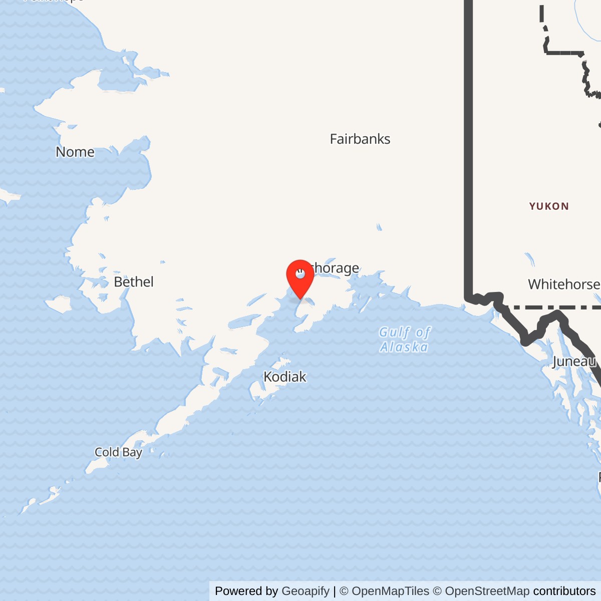
Longitude: -151.41456
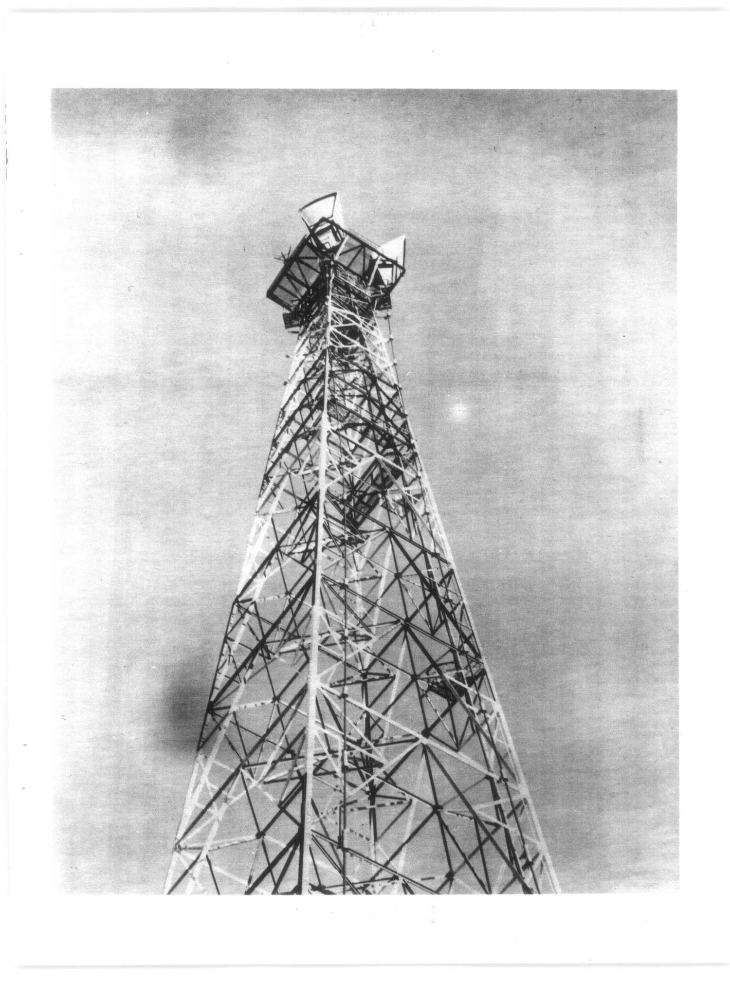
Clam Gulch was a small but consequential station in the original White Alice Communications System. It did not carry the huge billboard reflectors associated with many remote White Alice sites. Instead, its TD-2 microwave equipment passed signals along the Kenai Peninsula, where a chain of comparatively short, line-of-sight paths could connect the Anchorage area with the larger relays at Diamond Ridge. The U.S. Army Corps of Engineers described the station as an unattended repeater, with a 275-foot tower and a 1,250-square-foot equipment and power building. Its original Air Force mission became part of a commercial communications operation, and the Corps still described the facility as active under Alascom ownership in 1994.
- Role
- Unattended TD-2 microwave repeater in the original White Alice system.
- Opened
- March 30, 1957, following 1955-1956 construction.
- Facility
- Historic 275-foot tower, 1,250-square-foot equipment and power building, and fence.
- Verified route
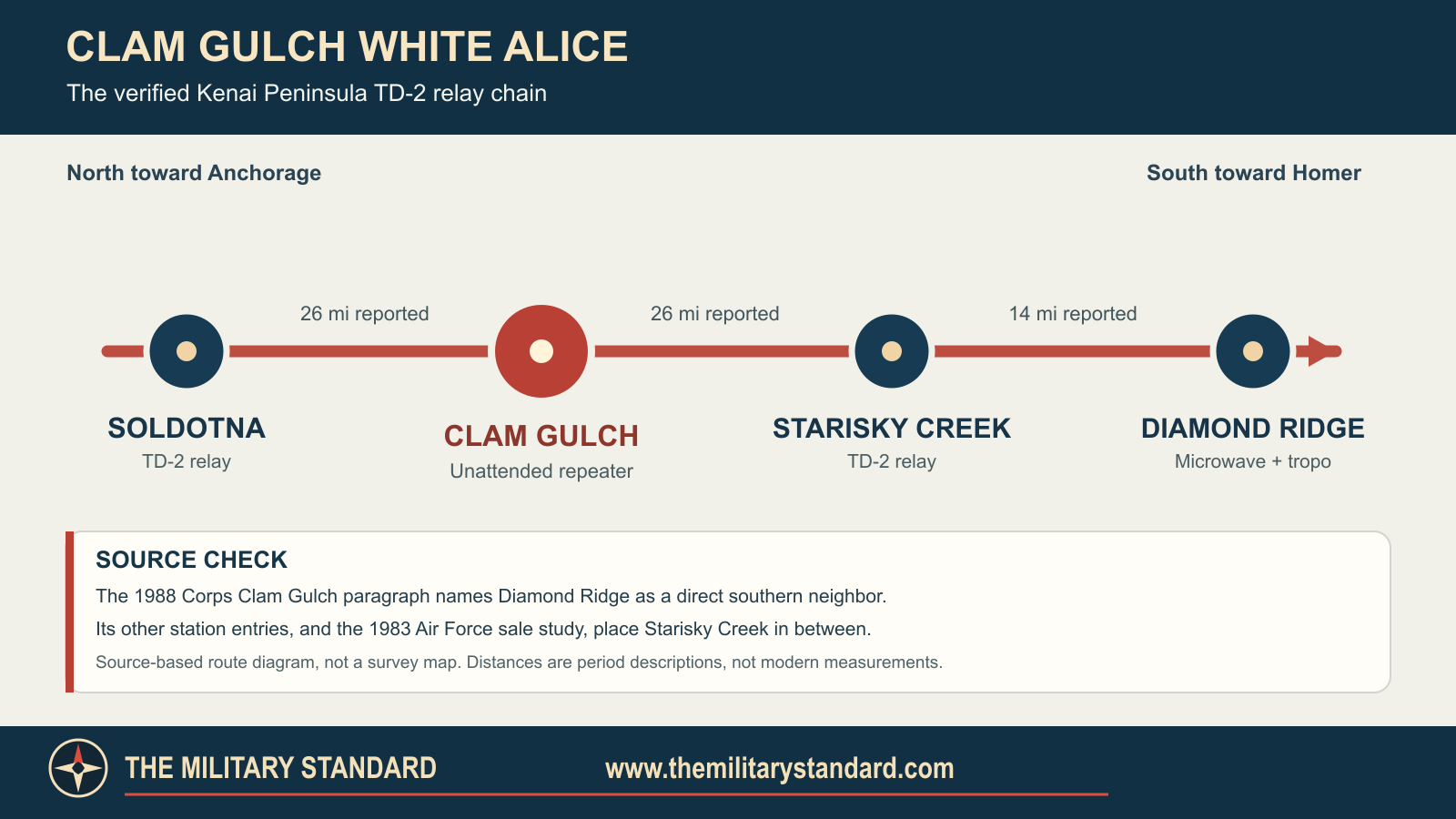
- Soldotna - Clam Gulch - Starisky Creek - Diamond Ridge.
- Location precision
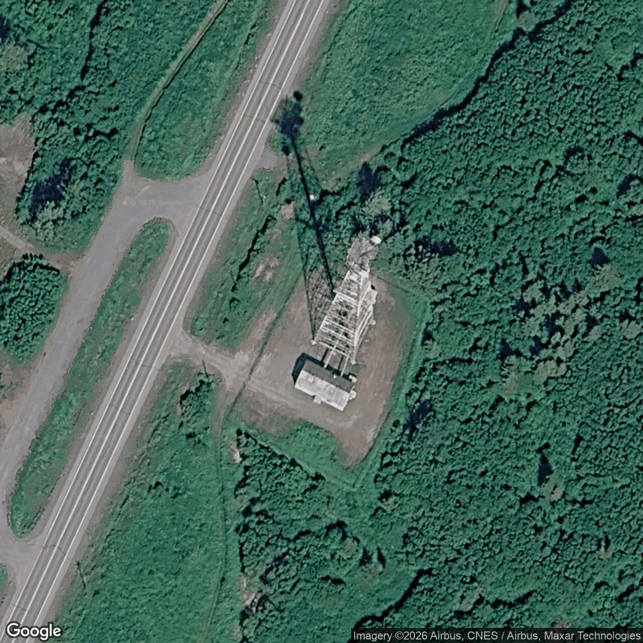
- Kenai Peninsula near Clam Gulch; exact compound coordinate and property acreage have not been verified.
- Later use
- Alascom owned and operated the microwave facility in 1988 and 1994. Present operation and surviving structures are unverified.
Identity, Setting, And Land
The station was also called Kenai R1-S. It was a separate original White Alice microwave site, not a radar installation and not an annex inside Soldotna or Diamond Ridge. A 1988 Corps inventory places it on the Kenai Peninsula and describes its microwave neighbors. A separate 1983 Air Force Communications history places the repeater along the Sterling Highway, about 170 road miles south of Anchorage. That mileage is a period route description, not a surveyed distance from the modern city center. The Alaska Heritage Resources Survey records the historic site as KEN-223 in the Corps' 1994 cultural-resources plan. The Kenai Peninsula setting gave the relay a road-corridor role unlike air-access-only stations in western Alaska.
The available federal histories do not provide a surveyed parcel polygon or an authoritative tower coordinate. Secondary online lists publish an estimated point near 60.21417 N, 151.41456 W, but they label it an estimate and do not document its survey method. The name Clam Gulch is also a community name; a community coordinate cannot stand in for the fenced military tract. No verified historic acreage has been found. The 1,250-square-foot building measurement describes one building's floor area, not the property area.
The 1988 inventory identifies an equipment and power building, the 275-foot TD-2 tower, and a chain-link fence. It does not list a dormitory, mess, major fuel farm, radar antenna, or aircraft landing strip at this site. The 1983 Air Force study calls Clam Gulch an unattended microwave repeater. Its compact plant and highway access explain why it could function without the permanent living complex needed at an isolated tropospheric-scatter station. The records reviewed do not establish whether a small ancillary shelter, generator replacement, or later commercial antenna was added, so the original three documented improvements remain the safe description of the Air Force-era footprint.
Why White Alice Used A Microwave Chain Here
Alaska's Cold War aircraft-warning network depended on moving information from remote radar sites to control centers. Early high-frequency radio was vulnerable to weather and changing propagation. White Alice addressed that problem with long tropospheric-scatter hops where mountains, sea, and distance made ordinary line-of-sight radio impractical, and with microwave relays where a sequence of visible towers could carry the same communications more economically. The original system contained 31 named stations in the Corps inventory: 22 tropospheric-scatter, six microwave, and three mixed installations. Clam Gulch was one of the six original microwave sites.
The Kenai Peninsula chain linked the Anchorage direction through Rabbit Creek, Naptowne, and Soldotna, then south through Clam Gulch and Starisky Creek to Diamond Ridge near Homer. Diamond Ridge joined this TD-2 route to long-distance tropospheric-scatter paths toward Big Mountain and Pillar Mountain. Clam Gulch therefore was not merely a local telephone tower. It was a relay point in a corridor joining the settled, road-served part of Alaska with much more remote defense communications routes. White Alice also carried civilian service under later lease arrangements, so military and commercial use of this line cannot be separated cleanly after the system's early Air Force-only years.
One source error deserves explicit treatment. The Clam Gulch paragraph in the 1988 Corps inventory describes a 26-mile northern path to Soldotna and a 26-mile southern path directly to Diamond Ridge. The same inventory's separate Starisky Creek paragraph says Starisky lay 26 miles south of Clam Gulch and linked onward another 14 miles to Diamond Ridge; its Diamond Ridge paragraph names Starisky as the microwave neighbor. The 1983 Air Force sale study independently identifies Clam Gulch as the unattended relay between Soldotna and Starisky Creek. The consistent station-by-station evidence supports the chain Soldotna - Clam Gulch - Starisky Creek - Diamond Ridge. The direct Diamond Ridge wording in the 1988 Clam Gulch paragraph is treated here as a conflation of the onward route, not as proof of a bypass link. The 26-mile figures are historical path descriptions, not new geodetic measurements.
Construction, Equipment, And Operation
The Corps inventory dates construction to 1955 and 1956 and gives March 30, 1957, as the station's opening. The same day is reported for Starisky Creek and Diamond Ridge, consistent with a coordinated southern route coming into service. The Corps' 1994 management plan repeats the March 30 opening and calls Clam Gulch a TD-2 microwave station.
TD-2 was a line-of-sight microwave radio system. At a repeater, directional antennas on the tower received one segment and sent the traffic onward over the next. Waveguides joined the tower-mounted antennas to radio equipment inside the building. The 1988 Corps documentation of another original TD-2 site, Rabbit Creek, shows how such waveguides, transmitter and receiver equipment, rectifiers, batteries, and emergency power were arranged at a comparable unattended relay. It is useful technical context, not an as-built inventory of Clam Gulch. The reviewed sources do not identify the antenna model, transmitter serial numbers, frequency assignments, channel count, generator rating, or detailed equipment-room plan for Clam Gulch itself.
The documented 275-foot tower matters because a microwave path needs a clear horizon, not the broad elevated reflecting region used by tropospheric scatter. Two neighbor directions were needed to keep the corridor continuous. The tower's height is the Corps' historic figure; it is not a measurement of a surviving 2026 structure. The inventory gives no evidence for additional billboard antennas at Clam Gulch.
The station was unattended in the 1983 Air Force description, but unattended does not mean maintenance-free. A working repeater needed periodic access for power, radio alignment, weather damage, and fault repair. The Sterling Highway location made visits more practicable than at fly-in relay sites. The exact local maintenance crew, dispatch base, inspection schedule, and number of daily circuits are not identified in the examined sources.
Role In The Wider Military Network
Clam Gulch's role is clearest when the original microwave chain is distinguished from the stations at its ends. North of it, Soldotna passed traffic toward Naptowne and Rabbit Creek, which connected with Anchorage-area switching and communications facilities. South of it, Starisky Creek passed traffic to Diamond Ridge, a mixed microwave and tropospheric-scatter site. The Clam Gulch repeater preserved an intermediate line-of-sight step between those stations. A failure at Clam Gulch could interrupt that terrestrial chain even though the station itself had no radar operators, interceptor aircraft, or control room for air defense.
The later Air Force sale study describes the TD-2 road network as carrying government and commercial communications and ultimately connecting Alaska with a Canadian and continental microwave route. That system-level statement explains why the Air Force and RCA Alascom worked to retain the microwave segment when satellite terminals rendered many large tropospheric-scatter sites unnecessary. It does not prove that every long-distance circuit or every defense message traversed Clam Gulch. No station traffic log was found in the reviewed material.
Lease, Sale, And Commercial Continuity
Air Force control of the White Alice system changed in stages. The 1931st Communications Group history describes a July 1, 1976 lease of White Alice facilities and circuits to RCA Alascom, followed by appraisal and difficult negotiations over what parts of the TD-2 system Alascom would purchase. The 1978 appraisal list includes Clam Gulch among the microwave properties under consideration. The document distinguishes some sites for personal property only; Clam Gulch is not marked with that exception in the table. This is evidence of the planned sale scope, not a substitute for a Clam Gulch deed.
The Air Force account says an agreement contemplated a 1979 sale, but negotiations and federal processing took years longer. The Acting Secretary of the Air Force signed the sales contract on August 25, 1983. On October 14, 1983, the Corps delivered Alascom's documents and received the final payment at its Anchorage headquarters. These are system-level contract and closing milestones. The 1988 Corps site inventory subsequently says Clam Gulch was Alascom-owned and in use, while the 1994 Corps plan again calls it an active microwave station owned by Alascom. Taken together, those sources support a transition to commercial operation by the 1980s. They do not supply an independently examined parcel deed, exact date that Clam Gulch's title recorded, or date on which the Air Force ceased all use of circuits on this route.
This continuation distinguishes Clam Gulch from many White Alice tropospheric-scatter stations that were shut down, dismantled, and left for environmental restoration. It does not establish uninterrupted use of the original TD-2 electronics. A station could remain a microwave site while its radios, antennas, power equipment, and customers changed. The 1994 statement that the facility was intact and in use is a dated observation, not a current condition report.
Property, Environment, And Surviving Fabric
The available Corps descriptions contain no site-specific contamination finding for Clam Gulch. Other White Alice stations used fuel tanks, generators, transformers, and PCB-containing equipment and required cleanup, but those facts cannot be transferred to this small repeater without a Clam Gulch investigation. The 1988 inventory names an equipment and power building but no on-site fuel-storage capacity. No Alaska Department of Environmental Conservation case or federal cleanup decision has been matched with confidence to the KEN-223 parcel. The absence of a matched case in this research does not prove that the property has no contamination or no land-use restriction.
Chronology
- 1955-1956 The original Clam Gulch TD-2 microwave station was constructed along the Kenai Peninsula road corridor.
- 1957-03-30 The Corps inventory and later management plan date Clam Gulch's opening to this day.
- 1957-03-30 The Corps also dates the openings of Starisky Creek and Diamond Ridge, completing the documented southern chain.
- 1960s Clam Gulch continued as an original White Alice microwave repeater; no dated local equipment change has been established.
- 1969 The Alaska Communications System sale to RCA Globcom preceded later White Alice leasing; it was not the sale of Clam Gulch itself.
- 1976-07-01 The Air Force's White Alice lease to RCA Alascom became effective at system level.
- 1977-05-20 RCA Alascom submitted a list of White Alice real and personal property it wanted to purchase with the TD-2 system.
- 1978-01-26 The Corps awarded an appraisal contract for White Alice property, principally the TD-2 microwave system.
- 1978 A Corps appraisal table included Clam Gulch in the group of TD-2 properties contemplated for sale.
- 1980-10-07 Alascom's president signed a White Alice sales agreement that then underwent federal review.
- 1983-08-25 The Acting Secretary of the Air Force signed the final system sales contract.
- 1983-10-14 The Corps delivered the first deeds and bills of sale to Alascom and received final payment for the transaction.
- 1988 The Corps inventory identified Clam Gulch as an Alascom-owned, still-used microwave station.
- 1994 The Corps cultural-resources plan identified KEN-223 as an intact, active Alascom microwave facility.
Information sources (5)
- PDFHistorical Overview and Inventory: White Alice Communications System, U.S. Army Corps of Engineers, Alaska District, April 1988
Source for: Original 31-station classification, Clam Gulch construction and opening, 275-foot tower, 1,250-square-foot building, Soldotna and Starisky Creek route comparison, and the period Air Force photograph of Soldotna's TD-2 tower.
- PDFA Special Study of the Sale of the White Alice Communications System, Office of Air Force History, 1931st Communications Wing, October 1983
Source for: Clam Gulch's unattended Soldotna-to-Starisky relay function, the 1976 lease, 1977-1978 appraisal, 1983 contract and closing sequence, and the distinction between system sale and station-specific deed evidence.
- PDFThe Cold War in Alaska: A Management Plan for Cultural Resources, U.S. Army Corps of Engineers, Alaska District, 1994
Source for: March 30, 1957 opening, TD-2 identification, Alascom-owned active status in 1994, and Alaska Heritage Resources Survey identification KEN-223.
- WEBRabbit Creek White Alice Site, Historic American Engineering Record AK-23 and AK-23-A, Library of Congress
Source for: Original White Alice system context and comparable original TD-2 repeater equipment and arrangement; Rabbit Creek details are not represented as Clam Gulch as-builts.
- PDFBill Ray White Alice Collection finding aid, Anchorage Museum
Source for: Evidence that site-specific Clam Gulch photographs exist in an archival collection; image use on a commercial website requires separate rights clearance.