
Naptowne Radio Relay Station, Alaska
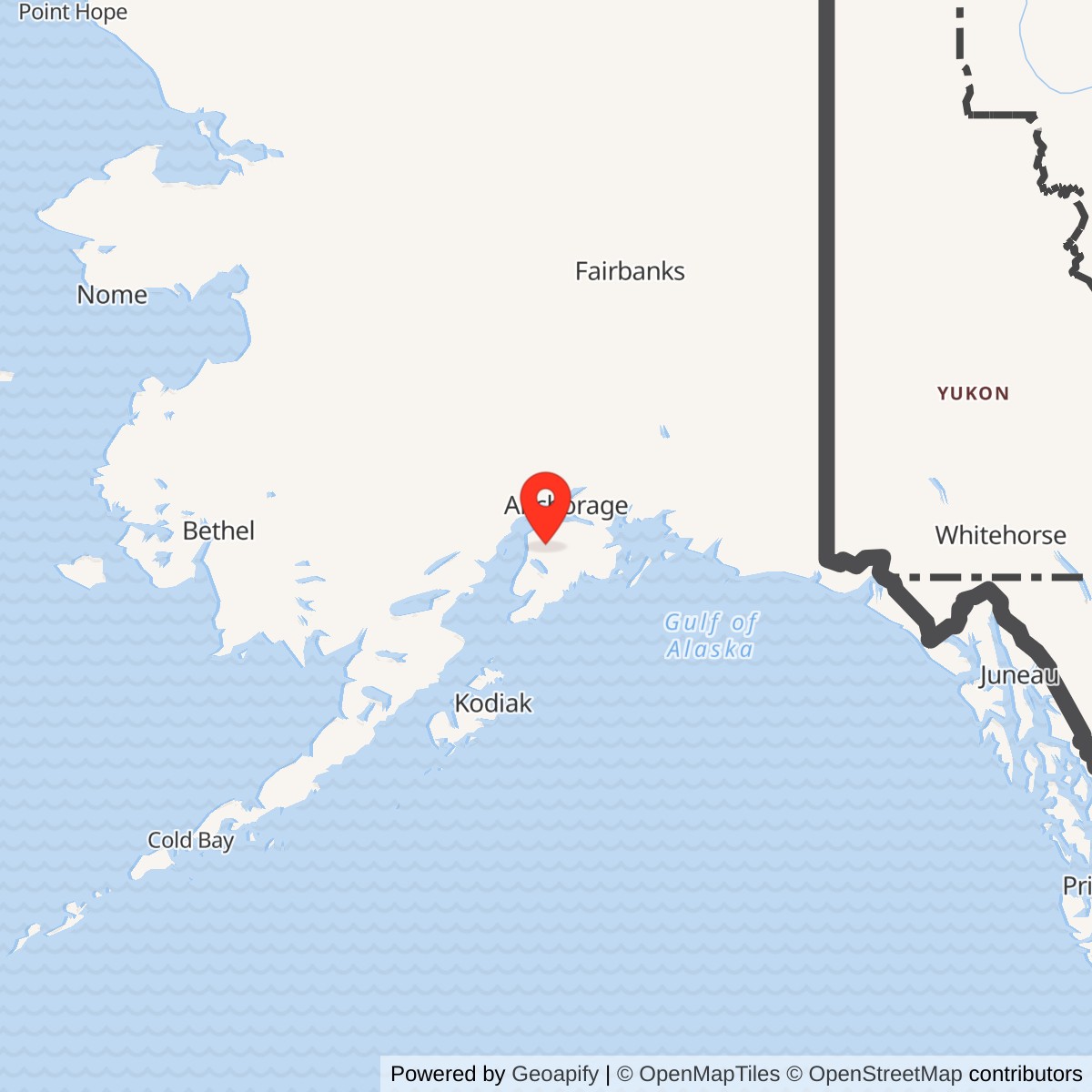
Longitude: -150.583333
Naptowne was an original White Alice Communications System station on the Kenai Peninsula, not a radar station or an annex of Soldotna. Its TD-2 microwave equipment repeated signals between Rabbit Creek to the north and Soldotna to the south. The U.S. Army Corps of Engineers dates construction to 1955-1956 and opening to January 18, 1957. The compact relay outlasted the first military phase: the Corps reported Alascom ownership and continued function in 1988, and its 1994 cultural-resources plan called the site an active Alascom microwave facility. More recent Federal Communications Commission records identify an Alascom-licensed Naptowne radio point, but do not establish that the original White Alice electronics or tower remain in service.
- Role
- Original White Alice TD-2 microwave repeater on the Kenai Peninsula.
- Opened
- January 18, 1957, following 1955-1956 construction.
- Facility
- Historic 250-foot tower, 1,200-square-foot equipment and power building, latrine, fuel tanks, and 595 feet of fence.
- Immediate links
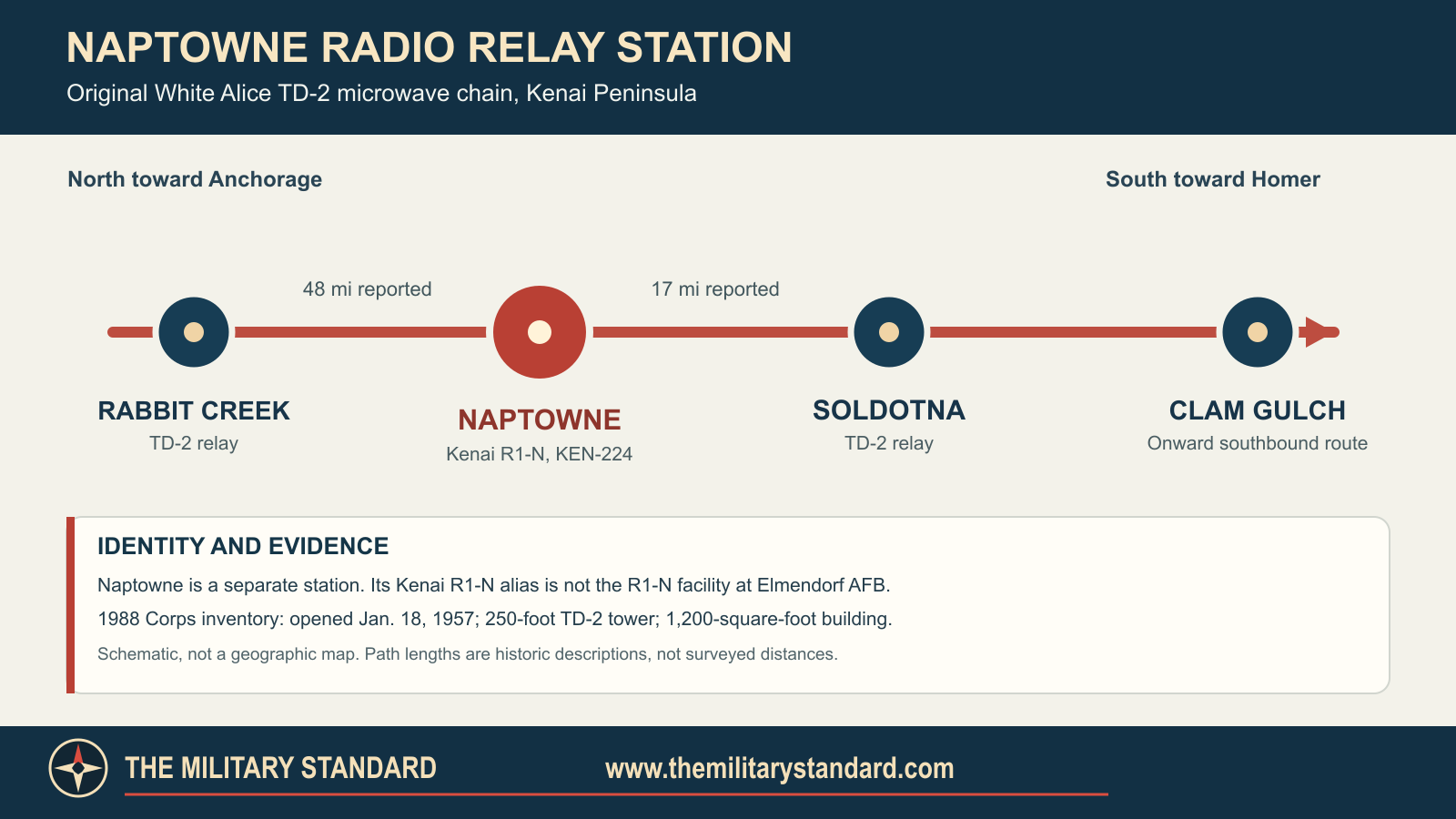
- Rabbit Creek north, approximately 48 miles; Soldotna south, approximately 17 miles, as described in the 1988 Corps inventory.
- Later radio point
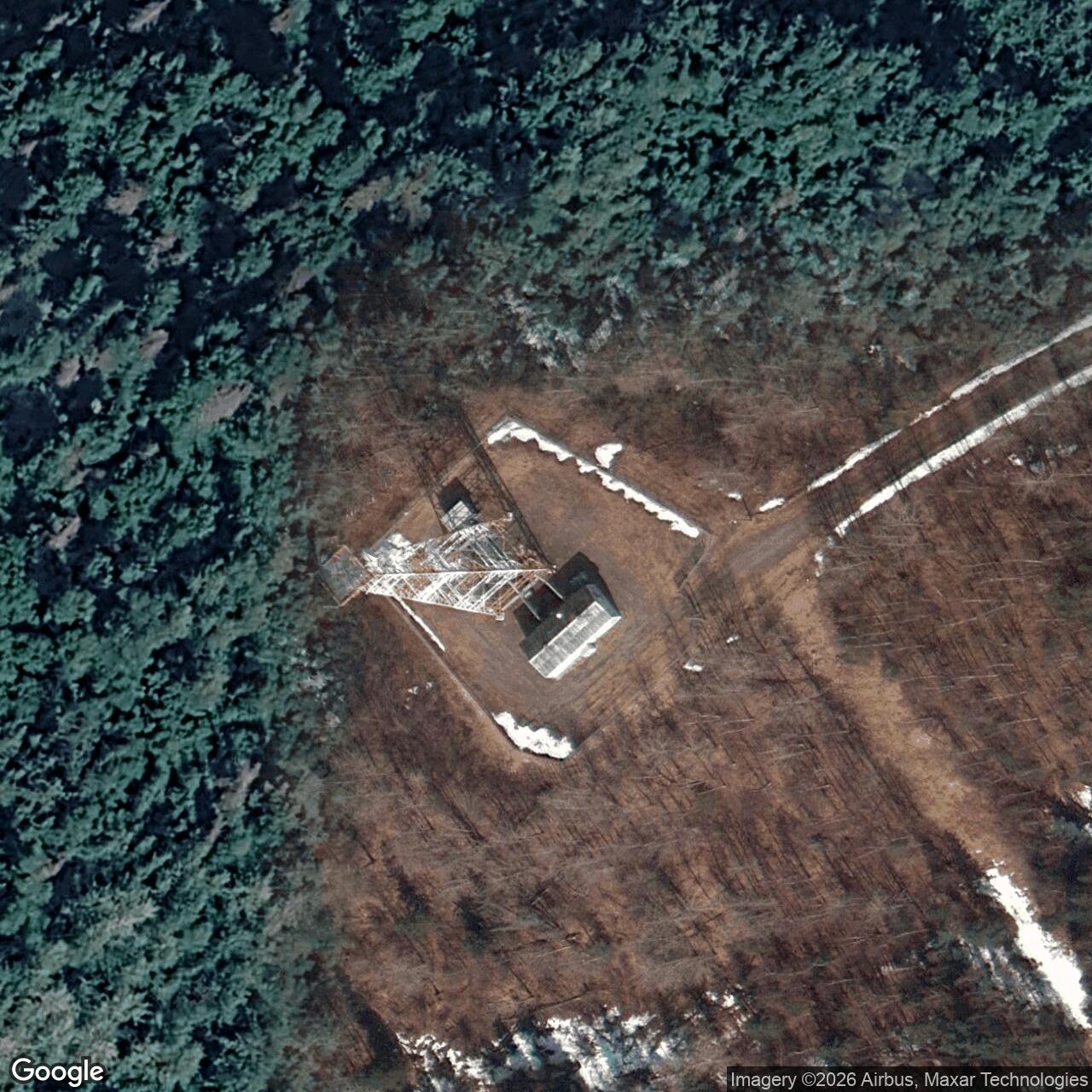
- Approximately 60.529417 N, 150.583417 W in a 2025 FCC application notice. This is a licensed radio point, not a surveyed original compound or property boundary.
- Later use
- Alascom microwave operation documented in 1988 and 1994; FCC WBA911 renewal granted in 2021 and modification application accepted for filing in 2025. Original-structure survival unverified.
Identity and Location
The original station was also called Kenai R1-N. That designation needs care: a separate White Alice microwave component at Elmendorf Air Force Base was also designated R1-N in system records. Naptowne was one of six microwave stations in the original 31-station White Alice network. It was a line-of-sight repeater rather than a tropospheric-scatter station with the large paired billboard reflectors commonly used to illustrate White Alice.
The 1983 Air Force Communications history places Naptowne at approximately Mile 80 on the Sterling Highway. This is a period route description, not a legal parcel description or a precise access-road address. The Corps' 1994 plan identifies the historical resource as Alaska Heritage Resources Survey site KEN-224.
The FCC's 2010 public notice placed a licensed Alascom Naptowne microwave point at 60-31-46.0 N, 150-35-00.0 W. An August 2025 FCC application notice listed the same Naptowne call sign, WBA911, at 60-31-45.9 N, 150-35-00.3 W, or approximately 60.529417 N, 150.583417 W. These coordinates locate a later licensed radio facility; their datum is not specified in the notices examined. They should not be labeled as a surveyed 1957 tower footing, fenced compound centroid, or property boundary. The small difference between the two FCC points may reflect license-record precision or a later facility change; the notices alone cannot decide which.
Why the Kenai Microwave Chain Mattered
White Alice carried communications for Alaska's Cold War air-defense system across distances and terrain that ordinary cable and high-frequency radio could not serve reliably. Tropospheric scatter was valuable for long, difficult hops. Where a road corridor allowed a chain of visible towers, TD-2 microwave offered shorter line-of-sight links. The Kenai route ran south from the Anchorage area through Rabbit Creek, Naptowne, Soldotna, Clam Gulch, and Starisky Creek to Diamond Ridge near Homer. Diamond Ridge connected that terrestrial corridor to long tropospheric-scatter paths. Naptowne was an intermediate relay, not the switching center at an end of the route.
The 1988 Corps inventory gives Naptowne's immediate microwave paths as approximately 48 miles north to Rabbit Creek and 17 miles south to Soldotna. The 1983 Air Force sale study independently calls it a two-way repeater between those same stations. Those figures are historical link descriptions, not a new measurement from the later FCC coordinate. Naptowne's chief operational contribution was continuity: it received and retransmitted traffic between the two legs so a communications signal could traverse the Kenai Peninsula network. A failure there could sever the route even though Naptowne had no radar screen, fighter-alert pad, or local air-defense command post.
Construction and Physical Plant
The Corps reports construction in 1955 and 1956 and an opening on January 18, 1957. Its 1988 inventory specifies a 250-foot TD-2 microwave tower, a 1,200-square-foot equipment and power building, a 16-square-foot sanitary latrine, two petroleum, oil, and lubricant tanks with a combined 200-barrel capacity, and 595 feet of chain-link fence. These are measurements of documented improvements. The 1,200-square-foot number is building area, not station acreage; the 200-barrel figure is aggregate tank capacity, not evidence that both tanks were always full.
The Corps' 1994 architecture discussion groups Naptowne with Clam Gulch, Rabbit Creek, and Starisky Creek as the four sites built with the standardized 1,200-square-foot concrete-block microwave equipment building. It distinguishes these small relays from Soldotna and Anchorage microwave equipment installed at earlier communications stations, and from the much larger staffed tropospheric-scatter complexes. The 1994 plan therefore corroborates Naptowne's building type, but it is not an as-built drawing of Naptowne's particular room arrangement.
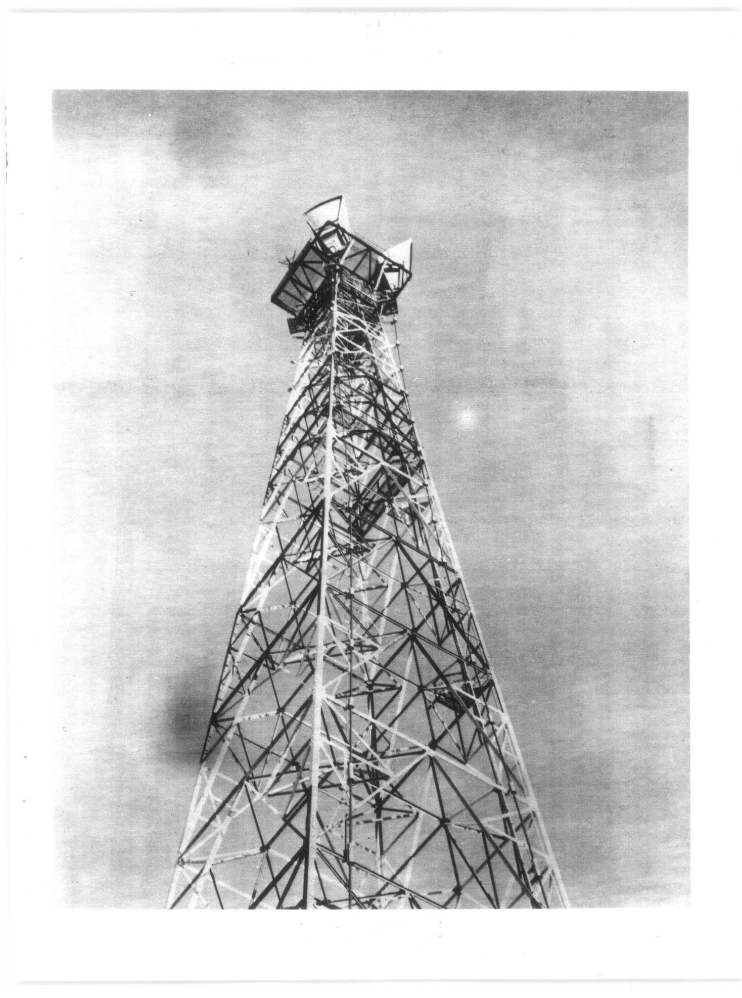
A TD-2 repeater needed directional microwave antennas, radio equipment, waveguides, power conversion, and maintenance access. The documented tower height helped clear the terrain along both paths. Historic American Engineering Record documentation of nearby Rabbit Creek illustrates the equipment and operating method of a comparable White Alice TD-2 station. No Naptowne-specific antenna model, circuit capacity, frequency assignment, transmitter serial number, generator rating, or room-by-room plan was established in this audit.
Operation and Maintenance
The Air Force's 1983 description calls Naptowne a two-way microwave repeater. It does not document a resident garrison or a local radar squadron. The compact building, fenced plant, and Sterling Highway setting are consistent with the less labor-intensive relay design used on the road corridor, but a precise staffing pattern and inspection schedule have not been found for Naptowne. The latrine and fuel tanks show that personnel had to visit and service the facility; they do not prove full-time occupancy. Maintenance would have addressed radio alignment, power failures, tower and antenna damage, and fuel or generator needs, but the reviewed records do not identify the assigned crew or its dispatch base.
White Alice supported military communications and, under evolving federal and commercial arrangements, public telecommunications. It is tempting to treat every path on the diagram as a dedicated military voice circuit, but the sources do not supply a Naptowne circuit roster or traffic log. The station's documented function is as a relay in the Kenai chain. How many circuits it carried at a given date, which messages traversed it, and exactly when each service shifted to other media remain unverified.
Lease, Appraisal, and Alascom Transfer
The transition from Air Force to commercial control occurred in stages. Air Force Communications history describes a July 1, 1976 system lease of White Alice facilities and circuits to RCA Alascom. A 1978 Corps appraisal table lists Naptowne among the TD-2 properties under consideration for purchase. Unlike a few table entries marked personal property only, Naptowne is not marked with that exception. The table establishes appraisal scope, not a deed or a parcel acreage.
Negotiations and federal approval took longer than first anticipated. The Acting Secretary of the Air Force signed the system sales contract on August 25, 1983. On October 14, 1983, the Corps delivered deeds and bills of sale and accepted final payment. These are system-level milestones, not independently verified recording dates for the Naptowne parcel. The 1988 Corps inventory says Naptowne had been acquired by Alascom in 1983 and was still functioning. The 1994 Corps plan describes an active Alascom microwave facility in good condition. Together these sources support post-Air Force commercial continuity at Naptowne, while leaving the exact title chain and the retirement date of original TD-2 hardware unresolved.
Later Radio Licensing and Current Condition
An FCC public notice in 2010 identified an Alascom Naptowne microwave point under call sign WBA911. An FCC renewal notice records a grant in January 2021. An August 2025 FCC public notice lists a modification application accepted for filing for Alascom at Naptowne, with three microwave frequencies near 6.2 to 6.3 GHz and a point only a few meters from the earlier listing. An accepted application is not proof that its requested modifications were granted or built. The notices establish a continuing licensed radio identity for Naptowne into the 2020s, not a verified statement that the 1957 White Alice tower, 1957 radios, fuel tanks, building, or fence survive unchanged.
Environmental and Cultural-Resource Record
The 1988 inventory documents two historic POL tanks, a feature relevant to later environmental review. Federal inventories identify Naptowne Radio Relay as a Formerly Used Defense Site, but the reviewed material does not include a Naptowne-specific sampling report, cleanup decision, or unrestricted-use finding. Fuel storage alone does not prove a spill; the absence of a matched cleanup report does not prove the land is uncontaminated.
The 1994 Corps plan assessed Naptowne as an active, good-condition historical resource and recommended notifying the landowner of its potential significance. That is an observation and recommendation made in 1994, not a current National Register determination for every surviving component. The plan's system-wide wording about White Alice's historical recognition should not be read as an individual Naptowne building designation without a specific nomination. The station's surviving fabric, archaeology, ownership, and any restrictions on the parcel require a current property and field review.
Naptowne's historical record is stronger than its present-condition record. The federal documents establish a separate original station, its exact opening day, basic plant, immediate paths, Alascom-era continuation, and a later licensed Naptowne radio point. They do not settle its surveyed boundary, acreage, deed recording, circuit-by-circuit history, original-equipment survival, or current structural condition. Those limits are carried forward so the original Air Force station is not confused with either a modern FCC record or an adjacent White Alice site.
Chronology
- 1955-1956 The original Naptowne TD-2 microwave station was constructed on the Kenai Peninsula.
- 1957-01-18 The Corps inventory dates Naptowne's opening to this day.
- 1976-07-01 The Air Force's system-level White Alice lease to RCA Alascom took effect; this is not a site-specific deed date.
- 1978 A Corps appraisal table listed Naptowne among TD-2 microwave properties considered for sale.
- 1983-08-25 The Acting Secretary of the Air Force signed the White Alice system sales contract.
- 1983-10-14 The Corps completed system-level document delivery and received final payment from Alascom.
- 1988 The Corps described Naptowne as Alascom-acquired in 1983 and still functioning.
- 1994 The Corps cultural-resources plan recorded KEN-224 as an active Alascom microwave facility in good condition.
- 2010 An FCC public notice listed Alascom's Naptowne WBA911 licensed microwave point.
- 2021-01-05 An FCC notice recorded grant of a WBA911 renewal application.
- 2025-08-06 An FCC public notice accepted for filing an Alascom Naptowne modification application at 60-31-45.9 N, 150-35-00.3 W.
- 2026 The original tower, building, electronics, parcel boundary, and current physical condition have not been independently verified in this audit.
Information sources (9)
- PDFU.S. Army Corps of Engineers, White Alice Communications System Historical Overview and Inventory, 1988
Source for: original Naptowne alias, 1955-1956 construction, 1957-01-18 opening, immediate paths, tower and building measurements, tanks, fence, and 1983 Alascom acquisition.
- PDFU.S. Air Force Communications, Special Study of the White Alice Communications System Sale, 1983
Source for: Naptowne's Sterling Highway location, two-way repeater role, 1978 appraisal listing, and system-level lease and sale chronology.
- PDFU.S. Army Corps of Engineers, The Cold War in Alaska: A Management Plan for Cultural Resources, 1994
Source for: standardized concrete-block microwave building, original-network classification, KEN-224 identity, active Alascom status, condition and preservation recommendation as of 1994.
- PDFFederal Communications Commission, Wireless Telecommunications Bureau Public Notice, 2010
Source for: WBA911 Alascom Naptowne later licensed radio point, not a survey of the original military parcel.
- PDFFederal Communications Commission, Wireless Telecommunications Bureau Renewal Grant Public Notice, 2021
Source for: WBA911 renewal granted January 5, 2021.
- PDFFederal Communications Commission, Wireless Telecommunications Bureau Public Notice, Report 19750, August 6, 2025
Source for: Alascom Naptowne WBA911 modification application accepted for filing, listed radio point, and proposed frequencies; acceptance is not a grant or proof of installation.
- WEBU.S. Government Accountability Office, Alaska Formerly Used Defense Sites inventory
Source for: federal inventory identity of Naptowne Radio Relay; not a cleanup finding.
- WEBHistoric American Engineering Record, Rabbit Creek White Alice Site, Library of Congress
Source for: technical context at a neighboring original TD-2 microwave relay, not Naptowne-specific equipment or a Naptowne photograph.
- PDFAnchorage Museum, Bill Ray White Alice Collection finding aid
Source for: identified Naptowne photographic holdings and future image-permission inquiry; no image from this collection reproduced here.