
Wainwright DEW Line Station / Wainwright Short Range Radar Site, Alaska
LIZ-3 watched Alaska's northwest coast from the first DEW Line years through the unmanned North Warning System.
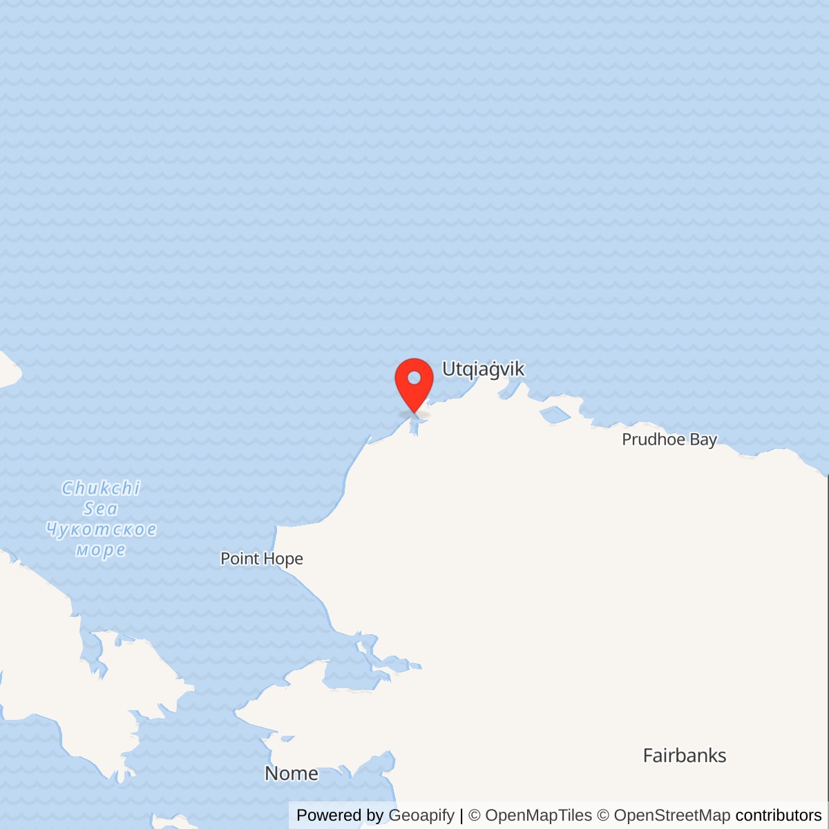
Longitude: -159.8676
Site Number: LIZ-3; A-16 (later Alaska radar designation)
Current Role: Former radar reservation. Olgoonik Corporation acquired the property in 2016; later plans describe possible local reuse of surviving facilities and the airstrip.
Wainwright LIZ-3 was an auxiliary radar station in the Distant Early Warning Line. Built southeast of the village near Wainwright Inlet, it carried an AN/FPS-19 search radar and AN/FPS-23 gap-filling equipment during the Cold War. An unmanned AN/FPS-124 short-range radar later continued the warning mission until the Air Force closed the site in 2008. [1] [2] [3]
- Station code
- LIZ-3, Cape Lisburne sector auxiliary station.
- DEW radar
- AN/FPS-19 search radar and AN/FPS-23 gap-filling equipment.
- North Warning System radar
- AN/FPS-124 short-range radar, installed in the 1994 transition.
- Air Force closure
- 2008.
- Location
- Near Wainwright Inlet, southeast of Wainwright, Alaska.
Building LIZ-3
The federal government reserved land for a military radar station at Wainwright in 1952. Alaska DEC dates construction to 1953; the Corps' station table records LIZ-3 entering the operational DEW Line in August 1957. The station occupied low tundra several miles southeast of the village, close to Wainwright Inlet and the mouth of the Kuk River. [1] [2] [4]
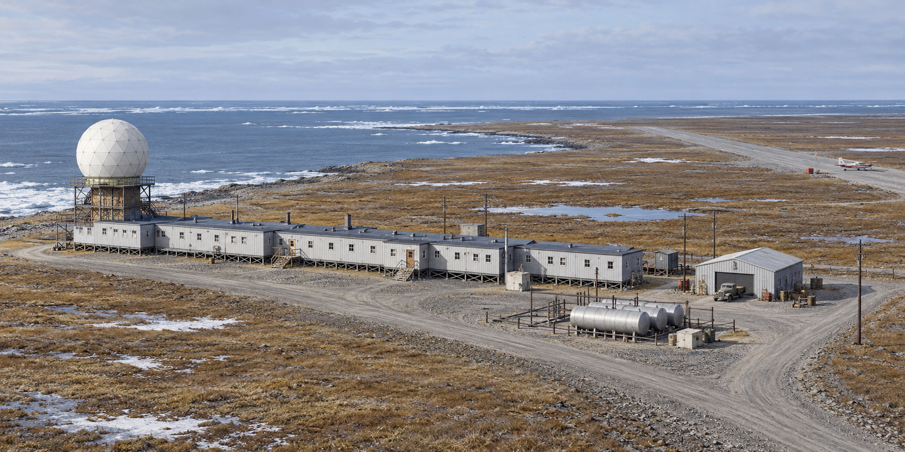
As an auxiliary station, Wainwright filled the coastal watch between main stations rather than serving as a sector headquarters. LIZ-3 belonged to the Cape Lisburne sector. Along the coast, the smaller Icy Cape LIZ-B and Peard Bay LIZ-C intermediate posts stood on either side of Wainwright; Point Lay LIZ-2 was the next auxiliary station to the southwest. [1] [3]
Radar and Arctic Operations
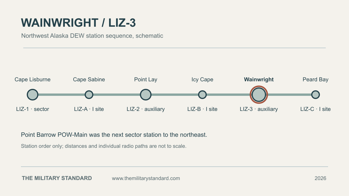
An AN/FPS-19 search radar turned beneath the station's weatherproof radome. AN/FPS-23 equipment complemented the search set with a low-altitude detection fence. Together these systems helped warn of aircraft approaching North America over the Arctic. The warning depended on staffed operations, reliable communications, power and maintenance at an exposed coastal site. [1]
In 1963, improved coverage from rotating radars allowed the DEW program to retire its smaller intermediate stations. Icy Cape and Peard Bay closed with that class of site, while Wainwright continued as an auxiliary radar station. The change made LIZ-3 one of the remaining staffed radar posts on this stretch of the coast. [1] [3]
The working and living rooms were housed in a long prefabricated module train. A garage, fuel storage and gravel airstrip supported daily operation and seasonal resupply. The former reservation covered about 1,518 acres, including the airfield and associated facilities. Those support areas were part of LIZ-3's operation, although the present village airport was a separate facility. [1] [4] [5]
The North Warning System
Wainwright remained a manned DEW station into the late 1980s. Alaska DEC places the end of active manning in 1989. The original radar system and its replacement overlapped during the wider northern modernization: the Corps recorded an AN/FPS-124 installation planned for 1994, and the later station rosters identify Wainwright as a North Warning System short-range radar site. [1] [2] [3]
The AN/FPS-124 changed the station from a continuously staffed auxiliary DEW post to a remotely operated short-range radar. Its role was to help cover gaps between the new long-range radar sites. Wainwright belonged to the same Alaska modernization that placed long-range AN/FPS-117 radars at Point Lay, Point Barrow, Oliktok Point and Barter Island. [1] [3]
Closure and the Former Station
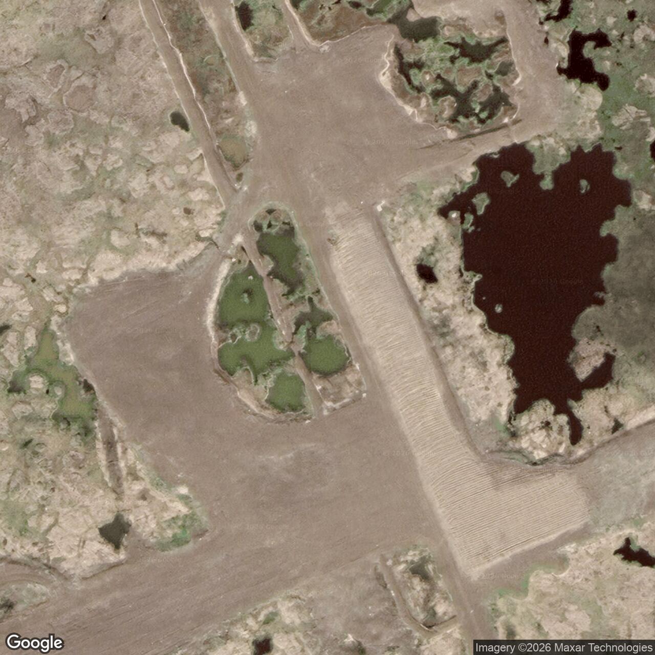
The Air Force closed Wainwright's short-range radar site in 2008. In 2013, an Air Force contractor demolished the old module train and most support buildings and removed tanks and fuel lines. Alaska DEC reported that the technical services building and radar building with its antenna remained after that work. [2] [6]
The former station's airstrip and some structures survived into later local planning. The North Slope Borough identified the old military parcel as a potential site for community and industrial use. Wainwright's Cold War role is still legible in its records: an early coastal auxiliary station adapted to automated radar before its final closure. [2] [5]
Chronology
- 1952: Federal land is withdrawn for the military radar reservation. [4]
- 1953: Alaska DEC dates the start of station construction to this year. [2]
- August 1957: LIZ-3 enters the operational DEW Line with AN/FPS-19 and AN/FPS-23 equipment. [1]
- 1989: Active manning of the original station ends, according to Alaska DEC. [2]
- 1994: The AN/FPS-124 short-range radar is installed during North Warning System conversion. [1] [2] [3]
- 2008: The Air Force closes the short-range radar site. [2] [6]
- 2013: The module train and most support facilities are demolished; the radar and technical services buildings remain. [2] [6]
- 2016: Olgoonik Corporation acquires the former station property, as recorded in the North Slope Borough plan. [5]
Related Sites
- Point Lay LIZ-2, the next auxiliary station southwest
- Cape Lisburne Air Force Station, the LIZ sector station
- DEW Line station directory and DEW Line history
- AN/FPS-19 search radar
Information sources (6)
- PDFU.S. Army Corps of Engineers, The Cold War in Alaska: A Management Plan for Cultural Resources, 1994, DEW Line table and North Warning System section
Source for Wainwright LIZ-3, August 1957 operation, AN/FPS-19 and AN/FPS-23 equipment, station type, and the planned AN/FPS-124 installation.
- WEBAlaska Department of Environmental Conservation, Wainwright DEW Line/LIZ-3, contaminated sites record, hazard ID 764
Source for the 1953 construction account, manned service through 1989, 1994 unmanned conversion, 2008 closure, and surviving structures after 2013 demolition.
- PDFDefence Research and Development Canada, The DEW Line: A Bibliography and Documentary Resource List, 2012, Alaska station roster
Source for Wainwright LIZ-3 as an auxiliary DEW and later short-range North Warning System station, neighboring LIZ stations, and the 1994-1995 transition.
- PDFU.S. Congressional Record, Senate, Wainwright DEW Line Land Acquisition Act statement, July 31, 2014, S5304
Source for the 1952 military land withdrawal, 1,518-acre reservation, airfield and fuel facilities, and later property disposition.
- PDFNorth Slope Borough, Wainwright Comprehensive Plan 2045, 2024, DEW Line station discussion
Source for the station southeast of the village, runway, surviving radome building, and later local reuse.
- PDFAlaska Department of Environmental Conservation, Wainwright Short Range Radar Station cleanup complete determination, February 22, 2017
Source for the site position, 2013 demolition, and retained technical services and radar buildings.