
Joshua Tree Gap Filler Annex / P-76F / P-59C, California
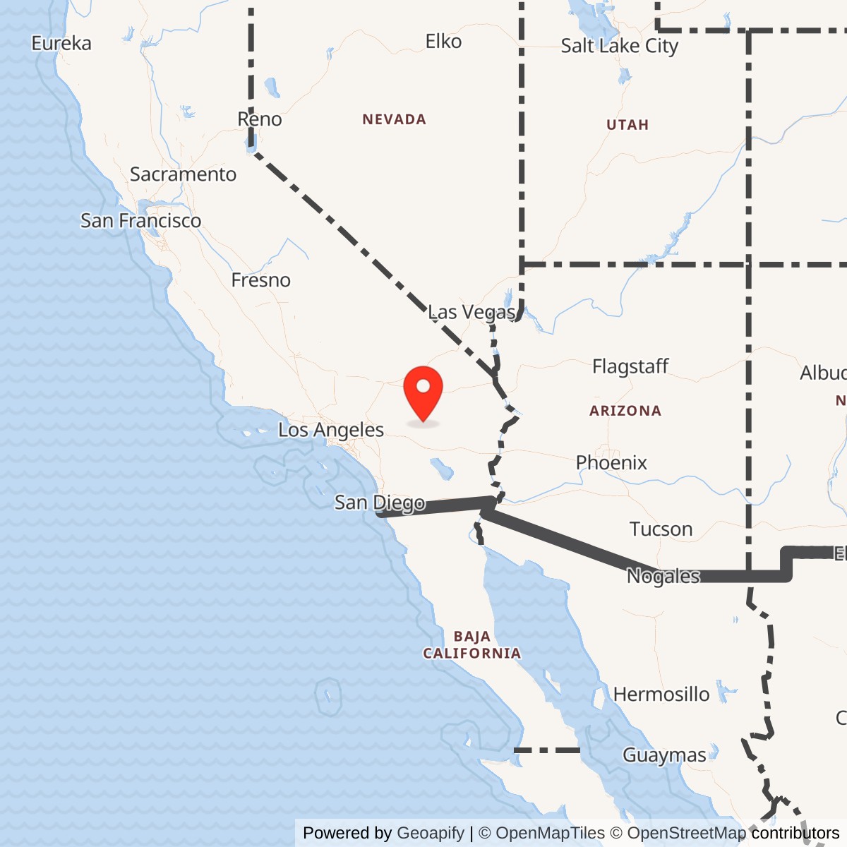
Longitude: -116.20225
Site Number: P-76F; Z-76F; P-59C; Z-59C
Current Role: Former Copper Mountain radar property. The AN/FPS-18, radar tower, and former masonry radar building are gone. Tower foundations and disturbed summit features remain; later communications use is documented. Current deed-level ownership and control were not independently verified.
Installation Identity
Joshua Tree Gap Filler Annex was a small, remote Air Defense Command radar installation on Copper Mountain that operated during a brief but important transition from the manual continental air-defense system to the Semi-Automatic Ground Environment. The surviving record supports one physical site, not two installations. Later radar-history compilations preserve the designations P-76F and P-59C, with corresponding Z-76F and Z-59C cross-references, but the strongest official operational evidence is the Aerospace Defense Command historical-data volume. That source lists Joshua Tree as P-59C, records manual operations beginning in September 1960, gives a SAGE operational date of December 1960, and identifies the installed search radar as AN/FPS-18.
The P-76F designation still matters because it preserves the site's earlier association with the Mount Laguna radar network. Specialist histories of Mount Laguna list Joshua Tree as P-76F, while specialist histories of Boron list the same Copper Mountain property as P-59C. No evidence located establishes two parcels, two radar buildings, or two successive physical Joshua Tree sites. The correct interpretation is therefore a single annex whose administrative or network parentage changed during development or early operation. The exact order and date that changed P-76F to P-59C were not recovered.
The site was unusual among the Mount Laguna-related gap fillers because official ADC data gives it an actual SAGE operational date. Tecate and Coyote Wells appear in the same ADC historical table without SAGE dates, while Joshua Tree is listed as entering manual operation in September 1960 and SAGE operation in December 1960. This makes the Copper Mountain annex more than a planned peripheral radar. It became an automated low-altitude input to the regional air-defense network during its short operational life, even though the main-site organizational histories place the broader Boron and Mount Laguna transitions into SAGE in 1961.
Strategic Setting on Copper Mountain
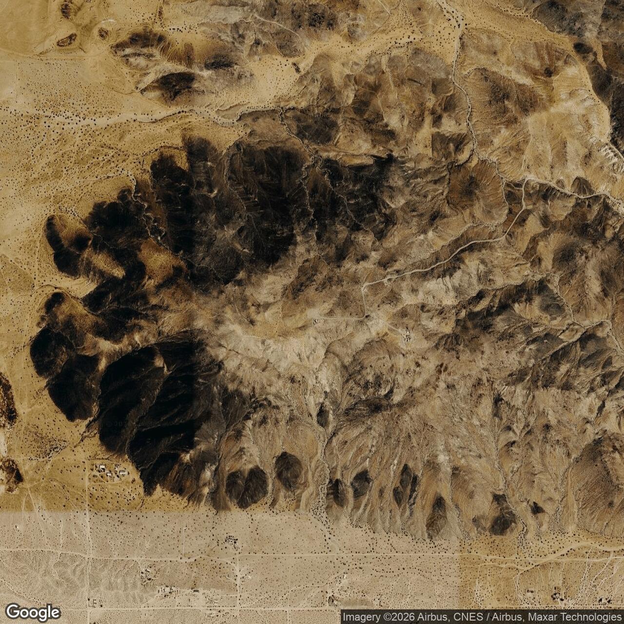
Copper Mountain rises sharply from the high-desert basin east of the community of Joshua Tree. The summit is only about 3,060 to 3,070 feet above sea level, but its abrupt relief above the surrounding desert gave a short-range radar a clear horizon in directions that could be masked from more distant long-range stations by terrain and the curvature of the earth. The annex did not need the acreage, housing, or operations infrastructure of a full aircraft-control-and-warning station. Its purpose was to occupy precisely the piece of terrain from which low-flying aircraft could be detected and their radar returns inserted into the wider warning system.
The location also illustrates why the Air Force gap-filler program used detached properties rather than simply adding more equipment at existing stations. A long-range radar on Boron or Mount Laguna could see high-altitude aircraft at great distance, but its practical low-altitude coverage was limited by the radar horizon and intervening mountains. A smaller radar placed on Copper Mountain could cover a local blind sector and send target information back to the control network. The geographic value of the annex therefore came from where it stood, not from the size of its garrison or the power of its radar compared with the main stations.
A 1997 site visit documented the physical consequences of this mountaintop siting. The former radar compound was reached by a steep rough road climbing more than a thousand feet from the surrounding desert. The report described a masonry blockhouse, a metal firewall, concrete four-bolt pads that had supported the short radar tower, remains of generator supports, and numerous later communications antennas on the summit. Those observations provide unusually specific evidence for the site's physical layout and confirm that the radar installation occupied the same Copper Mountain location represented by the modern coordinates.
Planning, P-76F, and the Parentage Problem
Joshua Tree's code history cannot be treated as a simple list of interchangeable names. P-series site numbers normally linked a gap filler to a parent radar station, so changing the prefix from P-76F to P-59C signaled more than clerical shorthand. P-76 was Mount Laguna. P-59 was Boron. The specialist record therefore points to a real administrative or network shift in which Joshua Tree moved from the Mount Laguna family of planned gap fillers into the Boron family before or during operational service.
The chronology of regional maps strengthens that interpretation but does not resolve the exact transfer date. Radomes notes that a 1958 SAGE map used P-59C for Lathrop Wells, Nevada, while 1961 and 1962 SAGE maps used P-59C for Joshua Tree. Lathrop Wells was separately recorded as SM-163B and ceased operation in December 1960. The reuse of P-59C for Joshua Tree shows that site codes could be reassigned as the gap-filler program evolved. It also warns against treating a code as a permanent physical identity independent of date and network context.
Official ADC records settle the operational identity more firmly. In the retrospective gap-filler directory, Joshua Tree appears as P-59C. In the operational table, P-59C Joshua Tree entered manual service in September 1960, entered SAGE service in December 1960, and carried an AN/FPS-18. That is the best evidence for how the Air Force itself ultimately cataloged the operating annex. P-76F is therefore retained as a historically meaningful Mount Laguna planning or lineage designation, but P-59C receives priority when describing the site's actual operational phase.
The Z-series aliases require equal caution. Specialist radar records preserve Z-76F and Z-59C, and later DoD environmental records actually use the property name JOS TREE GFA Z59C. However, Joshua Tree ceased Air Force radar operation in June 1961, while the main Mount Laguna and Boron stations did not receive their familiar Z-76 and Z-59 NORAD identifiers until 1963. The Z designations are therefore valuable later cross-references and environmental identifiers, but they should not be presented as proven day-to-day operational labels used at the annex before closure.
Operational Service, September 1960 to June 1961
The official ADC chronology begins Joshua Tree's manual operations in September 1960. The annex was an unattended or minimally attended low-altitude radar site rather than a command post. Its AN/FPS-18 searched the local airspace and generated radar information that could be processed and transmitted to the parent and regional control system. The site did not maintain a fighter-control room, height-finder section, interceptors, barracks population, or independent command organization comparable to Boron Air Force Station or Mount Laguna Air Force Station.
By December 1960 ADC recorded Joshua Tree as SAGE operational. That date is particularly significant because SAGE converted radar warning from a collection of local manual plots into a large automated network centered on direction centers equipped with AN/FSQ-7 computers. In southern California, the Los Angeles Air Defense Sector used Direction Center DC-17 at Norton Air Force Base. Joshua Tree's role was not to make command decisions. Its value was to provide additional low-altitude radar information that could be combined with data from long-range stations and other sensors to produce a more continuous regional air picture.
The December 1960 SAGE date precedes the 1 May 1961 formal redesignation of both the 750th at Boron and the 751st at Mount Laguna from Aircraft Control and Warning Squadrons to Radar Squadrons (SAGE). That difference is not necessarily contradictory. Equipment and data circuits could become operational before the parent organization's title changed. It does, however, make it unsafe to infer a precise parent transfer solely from the redesignation dates. The source-controlled conclusion is narrower: Joshua Tree was officially P-59C and SAGE operational by December 1960, while the exact administrative action that moved the annex from the P-76F lineage to the P-59C lineage remains unresolved.
AN/FPS-18 Radar and Data Transmission
Joshua Tree's confirmed radar was the Bendix AN/FPS-18, a fixed S-band gap-filler search radar designed specifically for unattended low-altitude surveillance. Technical documentation for the equipment family gives a 2700 to 2900 MHz tuning range, approximately 1 megawatt peak power, a nominal 5.33 rpm antenna rotation rate, and a 50 nautical mile handbook display maximum. Those are equipment-family characteristics, not evidence that every target at Joshua Tree could be detected at fifty nautical miles. Actual coverage depended on aircraft altitude, terrain, propagation, antenna siting, and the geometry of the local coverage gap.
The AN/FPS-18 was engineered for reliability at isolated sites. It used dual automatic transmitter and receiver channels, moving-target-indication paths, and automatic failover so that a failure in one channel did not immediately remove the site from the warning network. The antenna produced a broad vertical search pattern suited to low-altitude surveillance rather than precision height measurement. Joshua Tree had no documented height-finder radar because that was not the gap filler's job. Height and track refinement came from the wider air-defense network and other radar stations.
Specialist histories of both Boron and Mount Laguna associate Joshua Tree with AN/FST-1 coordinate-data transmission equipment. In the standard gap-filler architecture, the AN/FST-1 converted radar video into coded target-position information that could move over telephone circuits, while AN/FSW-1 equipment at the parent station provided remote monitoring and control. That architecture is consistent with Joshua Tree's official December 1960 SAGE date. The primary ADC operational table, however, names only the AN/FPS-18, so the history treats FST-1 as well-supported specialist evidence rather than silently promoting it to the same evidentiary level as the officially listed radar.
Units, Organizations, and Staffing
No separate Joshua Tree radar squadron has been identified, and no evidence supports treating the annex as a conventional staffed Air Force station. The operating concept was remote. Maintenance personnel traveled to the site for scheduled servicing and in response to fault indications, while monitoring and some equipment control were handled from the parent system. This staffing model explains the compact physical plant. The annex needed a radar tower, equipment building, generators, communications circuits, access road, security measures, and maintenance space, but not the housing, medical, dining, recreation, and administrative facilities found at a full radar station.
The best-supported operational parent is Boron Air Force Station and the 750th Aircraft Control and Warning Squadron because ADC's official operational designation was P-59C. The 750th had transferred to the Los Angeles Air Defense Sector on 1 October 1959 and was redesignated the 750th Radar Squadron (SAGE) on 1 May 1961. Specialist Boron histories explicitly state that the 750th maintained remote gap fillers at Shafter and Joshua Tree and list Joshua Tree as P-59C with AN/FPS-18 and FST-1 equipment. This relationship fits the operational code and the short 1960-1961 service period.
The Mount Laguna connection should nevertheless remain visible. The 751st Aircraft Control and Warning Squadron at Mount Laguna was also assigned to the Los Angeles Air Defense Sector from 1 October 1959 and became the 751st Radar Squadron (SAGE) on 1 May 1961. Specialist Mount Laguna records include Joshua Tree in the P-76F family. That evidence is best read as an earlier planning, engineering, or administrative relationship that was superseded or overlapped by the Boron P-59C relationship.
Facilities and Physical Layout
The standard AN/FPS-18 gap-filler installation was deliberately compact, and the physical evidence at Copper Mountain matches that model. The 1997 trip report described an ivory-toned masonry radar building near the western edge of the summit, a metal firewall, concrete anchor pads for the short radar tower, and remains associated with generator support. The tower itself was already gone. The isolated mountaintop location required independent electrical generation, equipment environmental control, communications, and an access road robust enough for maintenance teams and replacement parts.
The site also accumulated post-radar communications use. By 1997 the summit carried two-way, telephone, pager, FM, and local television antennas, showing that the same terrain that had made Copper Mountain valuable for military radar also remained attractive for civilian or government communications. The former Air Force building was then still standing and in good condition. Later Radomes documentation reports that the building was eventually demolished. The exact demolition date was not recovered, so the chronology records the 1997 survival and later demolition as separate evidence points rather than manufacturing a precise date.
The radar tower foundations are especially important for site identification. A short gap-filler tower did not resemble the massive structures used by some long-range radars, but its concrete anchor pattern, relationship to the equipment building, and position on the summit are strong physical signatures. Specialist histories continue to identify the building and tower pads as surviving site features even after the radar mission ended. Modern physical interpretation should therefore distinguish the surviving foundations and disturbed summit area from any unverified original property boundary.
Closure and Post-Air Force Use
Radomes records June 1961 as Joshua Tree's inactivation month. The official ADC historical table confirms the September 1960 and December 1960 operational milestones but does not supply the June 1961 closure date in the same entry, so the close month remains source-qualified rather than promoted to an exact day. No closure order or disposition deed was located. The timing nevertheless fits the rapid reconfiguration of the gap-filler network and the retirement of several short-lived southern California annexes during the same period.
After Air Force radar operations ended, the property did not simply disappear from federal use. Radomes reports that the site was later used by the "USMC Naval Investigative Service." That wording is preserved as the source gives it, but the exact agency title, dates, mission, and property instrument were not independently established. Older FUDS inventory material is consistent with later DoD control because it classified JOSHUA TREE GAP FILLER AX Z59C as ineligible for the FUDS program at that time on the ground that it was an active DoD installation. The environmental record therefore supports continued federal defense use without fully reconstructing that later mission.
This post-Air Force period also helps explain why the old Z-59C identity persisted. Environmental records use the shortened property name JOS TREE GFA Z59C and the federal facility identifier CA99799F546800. That does not prove that Z-59C was the annex's operational call sign in 1960-1961. It does show that the later Defense Department real-property and environmental record associated the physical Copper Mountain site with the Z-59C lineage. The designation is therefore historically useful when tracing the property after the radar mission ended.
Current Status
The former Joshua Tree Gap Filler Annex is no longer an operating Air Force radar site. The AN/FPS-18 and its tower are gone, and Radomes reports that the former radar building has also been demolished. Concrete tower pads, disturbed summit features, access traces, and communications infrastructure provide the surviving physical context. The exact current owner, controlling agency, and legal parcel boundary were not established, so the site should not be described as currently federal, private, county, or Marine Corps property without a deed-level source.
Chronology
- 1958 A SAGE-era map cited by later radar historians used P-59C for Lathrop Wells, Nevada, showing that the code later associated with Joshua Tree was not yet fixed to Copper Mountain.
- 1959-10-01 Both the 750th Aircraft Control and Warning Squadron at Boron and the 751st at Mount Laguna transferred to the Los Angeles Air Defense Sector.
- 1960-09 Headquarters Aerospace Defense Command later recorded P-59C Joshua Tree as beginning manual operations with an AN/FPS-18.
- 1960-12 Headquarters Aerospace Defense Command recorded Joshua Tree as SAGE operational.
- 1960-12 Lathrop Wells SM-163B ceased operation according to specialist radar histories, reinforcing the contemporary reassignment context for the P-59C code.
- 1961-05-01 The 750th at Boron was redesignated 750th Radar Squadron (SAGE), while the 751st at Mount Laguna was likewise redesignated 751st Radar Squadron (SAGE).
- 1961-06 Specialist radar histories record inactivation of the Joshua Tree gap-filler radar.
- 1961 SAGE map evidence cited by Radomes shows Joshua Tree as P-59C.
- 1962 A second SAGE map cited by Radomes continues to show Joshua Tree as P-59C even though the radar had already been inactivated.
- 1963-07-31 Main Boron and Mount Laguna received the Z-59 and Z-76 NORAD identifiers; Joshua Tree had already ceased Air Force radar operation.
- 1997-10-06 A site visit documented the masonry radar building, metal firewall, radar-tower anchor pads, generator-related remains, access road, and extensive later communications antennas.
- 1997 A DoD/FUDS inventory period continued to identify JOS TREE GFA Z59C / CA99799F546800 as a one-site defense property with no projected cleanup cost.
- 1998-1999 Defense Environmental Restoration Program tables listed JOS TREE GFA Z59C as one site with zero recorded cost and zero estimated cost to completion.
- Post-1997 Radomes reports that the former radar building was demolished; an exact demolition date was not located.
- Present The Air Force radar mission remains closed. The former Copper Mountain site is represented by surviving foundations, disturbed summit features, access traces, and later communications use, while current deed-level ownership remains unresolved.
Information sources (17)
- PDFHeadquarters Aerospace Defense Command, Historical Data of the Aerospace Defense Command, 1946-1973
Primary ADC statistical source for Joshua Tree's official P-59C identity, September 1960 manual date, December 1960 SAGE date, AN/FPS-18 equipment, and gap-filler directory.
- PDFHeadquarters Aerospace Defense Command, A Handbook of Aerospace Defense Organization, 1946-1986
Organizational chronology for the 750th and 751st radar squadrons, including Los Angeles Air Defense Sector assignment and 1961 SAGE redesignations.
- WEBU.S. Air Force Cold War radar history, Searching the Skies: The Legacy of the United States Cold War Defense Radar Program
Official historical context for Boron, Mount Laguna, SAGE modernization, gap fillers, and the continental radar network.
- PDF750th Radar Squadron history compilation
Unit chronology and Boron operational history, including the 750th's SAGE role and 1975 inactivation.
- PDF751st Radar Squadron history compilation
Unit chronology and Mount Laguna mission history, including Los Angeles Air Defense Sector assignment and the 1 May 1961 SAGE redesignation.
- WEBRadomes, Joshua Tree, California
Specialist site record for exact coordinates, P-76F/P-59C and Z-76F/Z-59C cross-references, AN/FPS-18, September 1960 to June 1961 service, map-code history, later investigative-service use, and building demolition.
- WEBRadomes, Mount Laguna Air Force Station
Specialist parent-station record preserving Joshua Tree's P-76F/P-59C lineage within the Mount Laguna gap-filler network.
- WEBRadomes, Boron Air Force Station
Specialist parent-station record preserving Joshua Tree as a Boron-associated P-59C gap filler.
- WEBRadomes, Las Vegas Air Force Station
Specialist record showing Lathrop Wells SM-163B and explaining that the 1958 SAGE map used P-59C for Lathrop Wells before later maps used P-59C for Joshua Tree.
- WEBRadomes, Joshua Tree GFA Trip Report, 6 October 1997
On-site description of Copper Mountain access, masonry building, firewall, radar-tower pads, generator remains, and later communications antennas.
- WEBFortWiki, Boron Air Force Station
Specialist technical explanation of the Boron gap-filler system, including Joshua Tree P-59C, AN/FPS-18, AN/FST-1 data transmission, AN/FSW-1 monitoring, and maintenance concept.
- WEBFortWiki, Mount Laguna Air Force Station
Specialist technical and lineage source preserving Joshua Tree as P-76F in the Mount Laguna gap-filler family and describing AN/FPS-18/FST-1 architecture.
- PDFDepartment of the Army Technical Manual TM 11-487C-1
Technical source for AN/FPS-series radar characteristics used to distinguish AN/FPS-18 equipment-family capability from site-specific operational claims.
- PDFDepartment of Defense, Defense Environmental Restoration Program, FUDS Properties Index
Official DoD index identifying Joshua Tree Gap Filler as FFID CA99799F546800.
- PDFDepartment of Defense, DERP Table B-2, FY99 to Completion
Official environmental-program table listing JOS TREE GFA Z59C / CA99799F546800 as a one-site property with zero FY99-to-completion estimate.
- PDFDepartment of Defense, DERP Table B-2, FY00 to Completion
Official environmental-program table continuing the one-site, zero-cost listing for JOS TREE GFA Z59C / CA99799F546800.
- WEBU.S. Government Accountability Office, California Formerly Used Defense Sites inventory
Historical inventory source for property number J09CA0403 and the then-current classification of Joshua Tree Gap Filler AX Z59C as an active DoD installation rather than an eligible FUDS cleanup property.