
Boron Air Force Station, Boron California
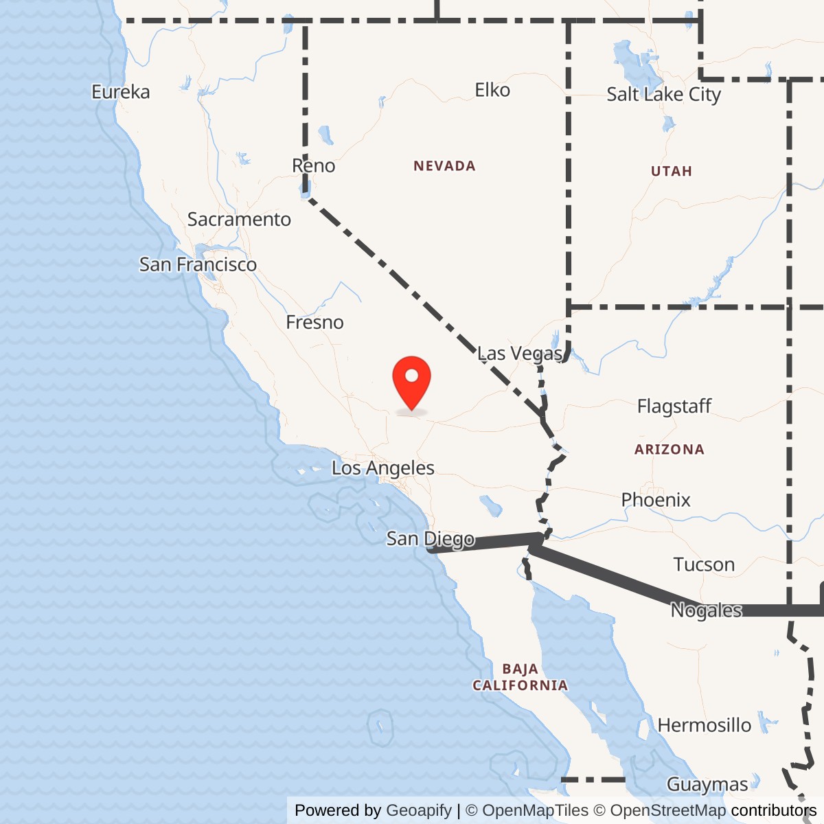
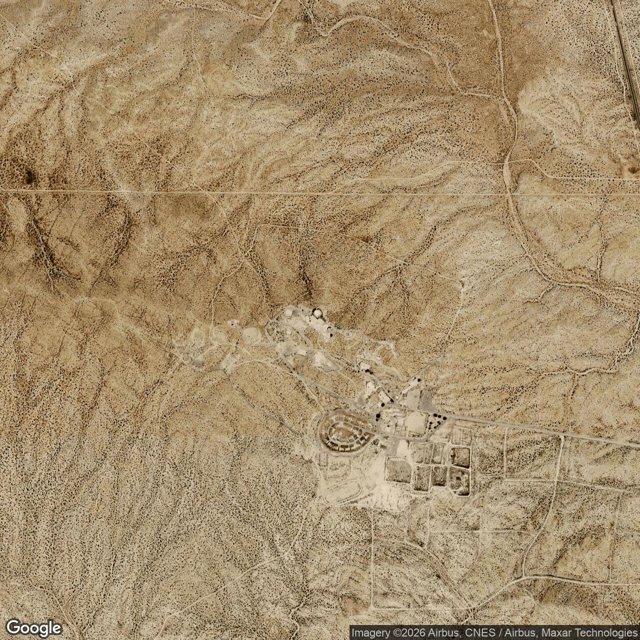
Longitude: -117.582200
Site Number: P-59; Z-59
Call sign: Duly
Current Role: FAA long-range CARSR/JSS radar operation on the retained radar parcel; Bureau of Prisons owns and maintains the former Federal Prison Camp/cantonment property; the 640-acre southeast tract was conveyed to California for wildlife conservation; other former station land and easements were disposed after closure.
Radar Equipment: Boron Air Force Station opened with two AN/FPS-10 radars (details on this system located here). In 1958 the height finders were replaced with an AN/FPS-6 and a second AN/FPS-6A was added in 1959 (details on this system located here). SAGE brought the transition to AN/FPS-20, which in turn was soon replaced by a much more substantial AN/FPS-35.
Boron Air Force Station was a staffed Air Defense Command long-range radar and weapons-control installation in California's Mojave Desert, created during the rapid expansion of continental air defense that accompanied the Korean War and the early nuclear Cold War. The 750th Aircraft Control and Warning Squadron moved from Edwards Air Force Base to the new Atolia site in January 1952, and by February it had assumed the radar coverage previously provided from Edwards by Lashup site L-40. The station was renamed Boron Air Force Station on 1953-12-01. It remained an active Air Force radar installation until the 750th Radar Squadron was inactivated on 1975-06-30.
The installation was more than a radar antenna on a hill. Boron combined long-range search radar, height finding, identification equipment, tactical control positions, communications, hardened emergency power, support facilities, and a cantonment that sustained a permanently staffed squadron in an isolated desert setting. Its mission changed as the national air-defense system changed. Boron began as a manual ground-controlled-interception and warning station, became a SAGE data source and joint Air Force-Federal Aviation Administration radar site, gained Backup Interceptor Control capability, and ultimately surrendered its military radar mission to the FAA while the Air Force withdrew.
Boron must also be separated from several related but distinct properties. Shafter Gap Filler Annex P-59A/Z-59A at Minter Field filled a low-altitude coverage gap for the Boron network. Shafter Communications Facility Annex No. 1, code R-10, was a remote ground-air transmit-receive location supporting Boron. A separate Boron Communication Facility Annex was formally activated under the parent station in 1959 and occupied a detached local communications compound. The 640-acre tract southeast of the station that the Army Reserve temporarily used from 1963 to 1967 was also a distinct service-use property and should not be collapsed into the Air Force station's operational identity.
Strategic Setting
The Mojave Desert setting was well suited to a permanent radar station because the high, open terrain provided long sight lines and relatively little urban obstruction. Boron lay east of the southern Sierra Nevada and north of the Los Angeles Basin, in a position from which radar coverage could contribute to the warning and interceptor-control network protecting Southern California. Its location also tied it naturally to Edwards Air Force Base, where the 750th initially served before moving to the permanent site. In 1952 Boron effectively replaced the temporary Edwards L-40 coverage with a purpose-built station intended for long-term continental defense.
The threat driving that construction was strategic rather than local. Air Defense Command was preparing for the possibility that Soviet long-range bombers carrying nuclear weapons could approach major American population centers, ports, industrial regions, and military installations. Southern California contained an especially dense concentration of targets, including Los Angeles, aircraft plants, naval facilities, air bases, and command installations. Boron's role was to detect aircraft at distance, establish their track and altitude, identify friendly traffic when possible, and support tactical action against unknown or hostile tracks before they could reach the Los Angeles defense area.
Construction and Opening at Atolia
The Air Force acquired the Boron property through several transactions between 1950 and 1952. The 750th Aircraft Control and Warning Squadron had been at Edwards Air Force Base before moving to Atolia on 1952-01-28. The surviving squadron history states that in February 1952 the unit assumed the coverage responsibilities formerly held by Edwards Lashup site L-40 and operated two AN/FPS-10 radars at the new station. February 1952 is therefore the best supported operational opening month for the radar station, while 1952-01-28 marks the documented movement of its principal squadron.
The site's early design reflected the manual air-defense concept. The 750th was initially intended to function as a Master Direction Center, a role in which radar plotting, identification, communications, and weapons-control personnel would build an air picture and direct interceptor aircraft through human-operated consoles and voice circuits. The later squadron history explicitly noted that this concept changed when SAGE came into being. Boron was then converted into a long-range radar site feeding a larger computerized direction system, while retaining the ability to perform local tactical control when the centralized system was unavailable.
The 750th Aircraft Control and Warning Squadron
The 750th was the principal assigned military organization throughout Boron's Air Force life. The surviving lineage records place it at Edwards Air Force Base from late 1950 until 1952 and then at Boron. It transferred to the 27th Air Division on 1952-02-06, later moved under the Los Angeles Air Defense Sector on 1959-10-01, was redesignated the 750th Radar Squadron (SAGE) on 1961-05-01, returned to the 27th Air Division on 1966-04-01, and shifted to the 26th Air Division on 1969-11-19. It became the 750th Radar Squadron on 1974-02-01 before inactivation in 1975.
The surviving compiled AFHRA material does not provide a complete commander list, but it does identify Lieutenant Colonel Martin D. Mulligan as commander in 1954. That is enough to establish that Boron was a conventional squadron-commanded Air Force station rather than an unmanned radar annex. The commander's responsibilities extended beyond administration because, under elevated readiness and Backup Interceptor Control operations, the squadron commander or designated NORAD commander could serve as Battle Commander. In that role the commander and battle staff coordinated the air defense of Boron's assigned area using radar, communications, interceptor information, and links to adjacent defense organizations.
Early Radar Equipment
Boron opened with two AN/FPS-10 radars. The (AN/FPS-10 was a combined search and height-finding set derived from the early permanent radar-network equipment that replaced many temporary Lashup installations. At Boron one set supported the search mission while the other provided height information. The search radar remained in service until 1959. This early configuration gave the 750th the essential information required for manual ground-controlled interception: range and azimuth from the search radar, altitude from height finding, and communications for passing vectors and tactical instructions to interceptor units.
The early equipment did not remain static. In 1958 an AN/FPS-6 height-finder replaced the height-finding AN/FPS-10, and a second AN/FPS-6A was added in 1959. These changes improved altitude determination at a time when jet aircraft were becoming faster and higher-flying and when continental defense increasingly depended on precise three-dimensional track data. The equipment upgrades also anticipated Boron's transition into the SAGE system, where accurate radar data had to be transmitted to a computerized direction center rather than interpreted only on local plotting boards.
Ground-Controlled Interception Mission
Before and alongside SAGE, Boron's basic tactical purpose was ground-controlled interception. Radar operators watched plan-position indicators for targets, reported position, speed, course, and track continuity, and passed that information through the operations crew. Weapons controllers used the air picture to determine how interceptors should be brought toward an unknown or hostile aircraft. The squadron's surviving operations description makes clear that this was an active weapons-control mission rather than passive observation. The station could order scrambles, select intercept vectors and climb schedules, assign controllers, and coordinate handoffs with adjacent radar sites.
The Weapons Assignment Officer occupied one of the most consequential positions in the operations center. Under the Battle Commander or Senior Director, the officer could order scrambles on critical tracks, determine the type of aircraft to launch, specify the vector, climb schedule, altitude, radio channel, and Interceptor Director, and coordinate with subordinate sites. A Weapons Assignment Technician maintained the tactical log, recording aircraft scrambled, airborne times, and results. An attack coordinator tracked the disposition of interceptors and recorded tactical actions and handoffs to neighboring control agencies.
Intercept directors and control technicians translated the radar picture into instructions an airborne fighter crew could use. The station's control personnel had to understand both their own radar and communications equipment and the performance limitations of the fighters assigned to the Los Angeles defense system. That knowledge mattered because successful interception depended on geometry, speed, altitude, fuel, and time. A controller had to place an interceptor at a point where it could acquire the target rather than simply point the aircraft toward the target's current position.
Surveillance and Identification
The majority of the combat crew worked within the surveillance function. Scope operators monitored radar displays and passed reports to plotters, who maintained the track picture. The Air Surveillance Officer and supervisors controlled the collection, display, and dissemination of information, coordinated with adjacent radar stations, monitored the condition of communications and electronic equipment, and ensured continuity when tracks crossed sector boundaries. These tasks created the common air picture on which every tactical decision depended.
Identification was equally important because Southern California airspace contained heavy civilian and military traffic. Boron used Identification Friend or Foe and Selective Identification Feature equipment to help verify friendly aircraft, identify unknowns, locate aircraft in distress, and assist controllers in following aircraft under control. The squadron history states that the SIF equipment could identify more than 400 aircraft simultaneously. That capability became increasingly valuable once the station was serving both Air Force defense requirements and Federal Aviation Administration traffic-control functions.
The 1954 System Training Program
Boron also participated in an important experiment in radar-crew training. Historical scholarship on RAND's System Research Laboratory describes an August 1954 Air Force-RAND effort at the Boron Air Defense Direction Center that used simulation and structured system-level training to exercise an entire air-defense crew. The experiment addressed a fundamental readiness problem: individual radar operators and controllers could be trained separately, but a direction-center crew had to perform as an integrated system under time pressure. The Boron test helped demonstrate a method that could train teams against simulated air situations without requiring a full live flying exercise for every event.
The significance of the 1954 experiment should not be overstated as a claim that Boron itself was the birthplace of SAGE. The program was a training-system experiment conducted at an operational air-defense center during the same broad period in which Air Defense Command was moving toward more automated command and control. Its importance lies in the recognition that continental defense depended on coordinated human performance as much as on radar hardware. The Air Force subsequently asked the team to expand the training approach to a much larger number of radar sites.
Renaming to Boron Air Force Station
The station was originally associated with Atolia, a desert locality north of Boron, and the unit history records the move to Atolia in January 1952. On 1953-12-01 the installation was redesignated Boron Air Force Station. The change aligned the military installation more closely with the better-known nearby community while preserving its distinct hilltop location. The site code P-59 identified Boron within the permanent radar network, while the later NORAD/SAGE designation Z-59 reflected the station's place in the evolving automated defense system.
The call sign Duly appears in compiled radar-site records. Call signs and site codes mattered operationally because radar stations formed a network in which controllers, direction centers, interceptor units, communications sites, and adjacent stations had to identify one another quickly and unambiguously. Boron's different names therefore reflect different administrative and operational layers: Atolia as the early geographic designation, Boron AFS as the formal installation name, P-59 as the permanent-network site code, Z-59 as the later system designation, and Duly as a communications call sign.
SAGE Conversion
By 1961 Boron was supplying radar information to the regional Semi-Automatic Ground Environment system. The station's data fed the SAGE direction center at Norton Air Force Base, where computer-assisted processing combined inputs from multiple radar sites to create a broader regional air picture. The 750th was redesignated the 750th Radar Squadron (SAGE) on 1961-05-01. SAGE changed the relationship between radar stations and tactical command by moving much of the large-scale track correlation and weapons-assignment process into direction centers linked by data circuits.
Boron did not become irrelevant when SAGE centralized control. The squadron continued to generate the primary sensor data on which the direction center depended, including search returns, mapping, automatic track information, and height data requested by the direction center. The station also retained local operations personnel and communications because a centralized system could fail or be disrupted. That combination of routine data feeding and emergency local control explains why Boron later became important within the Backup Interceptor Control program.
AN/FPS-20 and AN/FPS-35 Modernization
During the SAGE transition the AN/FPS-10 search set was replaced by an AN/FPS-20, which in turn was soon replaced by a much more substantial AN/FPS-35 frequency-diversity radar. The squadron history described the AN/FPS-35 installation as costing $13.5 million and providing coverage beyond 190 miles. Its pulse-compression capability improved target resolution in range and azimuth. The size and cost of the system show how far Boron had evolved from the comparatively austere 1952 station.
The AN/FPS-35 installation was physically imposing. The surviving squadron description gives an 85-foot tower supporting an antenna about 48 feet high, 135 feet wide, and weighing approximately 70 tons. The search radar was designed for joint use by multiple agencies. The Air Force supplied parts, test equipment, and electronic-counter-countermeasures operators, while the FAA maintained and operated the radar itself. Radar output passed through a coordinate-data transmitter and land lines to the Los Angeles Air Defense Sector direction center.
Joint Air Force and FAA Operations
Boron became an operational Air Force-FAA joint-use radar site in 1961. This arrangement reflected the fact that the same long-range sensor could serve two national needs: military warning and air defense, and civilian air-traffic surveillance. The joint mission was not simply a post-closure reuse. FAA personnel and functions were integrated while the 750th was still an active Air Force squadron. That relationship helped make the 1975 transition possible because the civilian agency already depended on and operated important parts of the radar system.
Joint use also placed Boron at the intersection of two very different operational cultures. Air Defense Command cared about early warning, unknown-track identification, electronic countermeasures, interceptor control, and survival of the defense network under attack. The FAA cared about safe and orderly management of civilian traffic. Both needed reliable radar, accurate position information, maintenance, communications, and continuity. Boron's location and long-range sensor coverage allowed one physical installation to contribute simultaneously to the National Airspace System and continental defense.
Height Finding and Electronic Countermeasures
By 1963 the AN/FPS-35 search radar operated with AN/FPS-26A and AN/FPS-90 height-finder radars. The AN/FPS-26A was part of a frequency-diversity effort intended to improve radar performance in an electronic-warfare environment. The squadron history described it as a dual-channel, high-powered set with electronic-counter-countermeasures capabilities, water cooling, and a pressurized radome that allowed operation in winds up to 100 knots. These features were not luxuries. A radar station expected to function during a strategic attack had to cope with weather, jamming, equipment stress, and the possibility of degraded communications.
The AN/FPS-90 remained until 1968, while the AN/FPS-26A continued as part of Boron's final military-era configuration. The paired search and height-finder arrangement gave controllers range, azimuth, and altitude information before fully three-dimensional long-range radars became standard. Height finding was labor intensive because controllers or direction centers often had to request altitude checks on specific tracks. The presence of two height-finder systems at Boron's peak reflected the importance and workload of the Southern California air-defense mission.
Backup Interceptor Control
Boron gained Backup Interceptor Control, or BUIC, capability as the Air Force sought ways to keep the interceptor-control system functioning if SAGE direction centers were disabled. The squadron history states that the NORAD control-center function could move from Fort MacArthur to the 750th to provide a stronger defense capability. Under normal conditions Boron operated as a long-range radar site feeding Norton. If SAGE became inoperative and a Mode III configuration was declared, Boron assumed the Los Angeles NORAD Control Center function for its assigned area.
BUIC transformed the station from a sensor node into a potential regional battle-management center. During Mode III operations the 750th joined the 47th Artillery Brigade and assigned fighter-interceptor units in the air defense of the Los Angeles Sector. Its duties included surveillance, identification, and tactical action on compulsory-reporting tracks entering the area. The station's battle staff, weapons assignment personnel, controllers, Army air-defense-artillery liaison, and communications systems were therefore organized to fight the air-defense battle locally if the normal SAGE chain was unavailable.
Army Air Defense Artillery Integration
The Mode III organization included an Army Air Defense Artillery officer who advised, evaluated, and disseminated tactical information between agencies. That officer helped coordinate interceptors and civilian aircraft through the Army air-defense area without allowing friendly aircraft to be engaged by mistake. Outside Mode III operations, the officer maintained readiness for that emergency configuration. This position illustrates the close relationship between Air Force fighter interception and Army surface-to-air missile defense around Los Angeles during the Cold War.
The surviving Boron source does not identify every Nike or later Army missile battery with which the 750th might have coordinated, and the history should not manufacture a site-by-site relationship that is not documented. What is clear is the system-level role. Boron's BUIC crew could integrate with the 47th Artillery Brigade and fighter-interceptor forces, meaning the station contributed to a layered defense in which radar identification, interceptor aircraft, and Army antiaircraft weapons had to share the same tactical picture.
Subordinate Gap-Filler Coverage
Long-range radar stations could have blind areas caused by terrain and the curvature of the earth, particularly against aircraft flying at low altitude. Boron's network therefore included gap-filler radar support. The 750th's own history identifies Shafter, approximately 124 miles from Boron and north of Bakersfield, as its gap-filler site. Shafter used an AN/FPS-18 search radar with a stated range greater than forty miles and an AN/FST-1 data processor. The processed radar information traveled by land line to Boron and then onward to the Los Angeles Air Defense Sector direction center.
Shafter Gap Filler Annex P-59A/Z-59A was an unmanned or minimally attended remote sensor, not part of the Boron cantonment. Its relationship to Boron shows how a staffed parent radar station extended its coverage through detached technical sites. Joshua Tree also appeared in the broader P-59 gap-filler planning and site-code system. These remote sensors were important because a strategic bomber or attack aircraft trying to penetrate at low altitude might disappear beneath the main station's line of sight unless the network placed additional radars in vulnerable terrain corridors.
Boron Communication Facility Annex
Air Defense Command Special Order G-53, dated 1964-05-25, recorded the Boron Communication Facility Annex as having been activated effective 1959-01-01, with Boron AFS Z-59 as its primary installation. Contemporary and later site descriptions place a local ground-air transmit-receive function several miles from the main radar, consistent with the practice of separating sensitive communications receivers and transmitters from the intense radio-frequency environment of large search radars.
The annex supported the voice and data pathways by which controllers at Boron communicated with interceptor aircraft. It should not be confused with Shafter Communications Facility Annex No. 1, R-10, which was a separate remote GATR site near Minter Field. The local Boron annex deserves its own preliminary installation record because it was formally activated as a distinct Air Force property. Its exact parcel boundaries, detailed equipment inventory, staffing, and closure chronology require a dedicated future history rather than assumptions folded into the parent-station record.
Power and Survivability
Boron required independent electrical power because radar, data processing, communications, and control functions could not depend entirely on the civilian grid during a national emergency. The squadron history describes a new diesel plant capable of producing 2,600 kilowatts. The 60-by-82-foot building contained four 950-horsepower generator sets rated at 650 kilowatts each. Its control system could identify equipment malfunctions, and the plant was sized to supply the station during a grid outage.
Survivability measures reflected nuclear-age assumptions. The generator building had double concrete-block exterior walls, an 18-inch solid-concrete roof, and a fallout-shielded operations area. The source characterized the installation as costing about $1.5 million. Such construction does not mean Boron was hardened to survive a direct nuclear strike. It shows that the Air Force expected radar stations to continue operating through fallout, utility disruption, nearby attack effects, and the kind of infrastructure failures that might accompany a broader strategic emergency.
Cantonment and Daily Life
The radar mission depended on a resident military community because operations continued around the clock. The station included a cantonment separate from the radar and technical summit, and later federal reuse confirms that a substantial group of buildings and residential/support areas existed. Airmen had to live, eat, maintain vehicles and equipment, perform administrative duties, and sustain shifts in an isolated high-desert environment. The station's remoteness made its support plant essential to readiness rather than merely a convenience.
The exact building roster changed over more than two decades, and much of the former cantonment was later altered for prison use and ultimately demolished. Surviving photographs and later site records nevertheless preserve the basic physical distinction between the radar hill, technical buildings, access roads, generator facilities, communications areas, and lower support compound. The fact that the Federal Bureau of Prisons could convert the cantonment into a self-contained minimum-security institution demonstrates the scale of the non-radar infrastructure the Air Force left behind.
Operational Tempo and Cold War Context
Boron did not deploy overseas as a unit and did not fight a conventional foreign campaign from California. Its conflict role was continuous continental defense. The station opened during the Korean War, remained on watch through the most dangerous years of the U.S.-Soviet bomber threat, operated during the Cuban Missile Crisis era, and continued through much of the Vietnam War period. Its contribution was measured in uninterrupted surveillance, alert status, exercises, controller proficiency, and the ability to direct defensive action if an unknown track became a real attack.
Air-defense work was often uneventful by design. A normal shift might consist of hundreds of routine tracks, identification checks, equipment-status reports, coordination with FAA traffic controllers, and readiness drills rather than an actual hostile interception. That apparent routine was the point. The system existed so that a rare emergency would encounter a trained crew, functioning radar, working communications, and established procedures rather than an improvised response. Boron's historical importance therefore lies in sustained readiness across thousands of ordinary shifts as much as in any single dramatic incident.
Exercises and Battle Staff Readiness
The 750th's Battle Commander position was manned during conditions above normal preparedness and during air-defense exercises. The battle staff had access to the local and adjacent air picture and communications to participating organizations through BUIC circuits. These exercises tested the station's ability to transition from routine surveillance to active tactical control. They also tested coordination among Air Force radar crews, fighter-interceptor elements, Army air-defense personnel, and civilian air-traffic functions that might continue operating during a military alert.
Training had to cover equipment failures as well as enemy action. The crew organization included specialists responsible for surveillance, identification, weapons assignment, control, communications status, and data maintenance. The AN/FPS-26A and other systems were designed with electronic-counter-countermeasures in mind because jamming could be part of a real attack. The result was a station whose readiness depended on both technical redundancy and practiced human procedures, particularly the ability to keep tracking and controlling aircraft when the preferred SAGE configuration was unavailable.
Transition to AN/FPS-67
In 1968 the AN/FPS-90 height finder was deactivated. The following year the massive AN/FPS-35 search radar was removed. An AN/FPS-67 replaced it on the same tower, protected by a radome, and became operational in 1970. This change simplified the long-range search mission while retaining the radar site as a valuable regional sensor. By the early 1970s Boron's military configuration centered on the AN/FPS-67 search radar and AN/FPS-26A height finding, with FAA participation already well established.
The AN/FPS-67 proved especially important to Boron's afterlife because the FAA retained it when the Air Force left. The continuity of radar use distinguishes Boron from Cold War stations where both the military mission and the sensor plant disappeared. At Boron, the military organization closed but the core location remained valuable for national surveillance. Later modernization converted the site to the Common Air Route Surveillance Radar system, preserving the hilltop's role in monitoring aircraft decades after the 750th Radar Squadron ceased to exist.
Closure Decision
By the mid-1970s improvements in radar networking, changing interceptor forces, consolidation of Aerospace Defense Command, and the ability of the FAA to operate shared sensors allowed the Air Force to reduce staffed radar stations. A federal base-realignment record specifically identified Boron for closure. It stated that the 750th Radar Squadron would be inactivated, the FAA would assume responsibility for air-traffic-control radar functions, and 76 military and 10 civilian positions would be reduced. The personnel figure demonstrates that closure was a genuine loss of a staffed military organization, not merely a change of sign on an unmanned site.
The formal unit chronology gives the decisive date. The 750th Radar Squadron was inactivated on 1975-06-30. The official Aerospace Defense organization chronology records Boron among five radar squadrons transferred to FAA responsibility that day. The Air Force station therefore closed as a military installation on 1975-06-30 even though radar operations did not stop. The former radar site remains active under civilian federal operation and still contributes to the wider national surveillance architecture.
Property Disposal and Qualified Acreage
Federal disposal records make it possible to assign a qualified acreage figure that is stronger than an unsupported modern parcel estimate. In 1977 and 1978 the General Services Administration described a plan to transfer approximately 1.72 acres in fee, plus 9.40 acres of easements and improvements, to the FAA for continued operation of the long-range radar. Approximately 640 acres were to go to the State of California Department of Fish and Game for wildlife conservation. Approximately 174 acres in fee, plus 23.64 acres of easements and improvements, were planned for competitive public sale.
The three fee-land components total approximately 815.72 acres. That total is the best supported disposal-era extent located. It should not be interpreted as a reconstructed original legal boundary for every Air Force acquisition from 1950 through 1952, nor should easement acreage simply be added to fee acreage as though the two forms of property interest were identical. The figure instead describes the principal fee lands addressed by the final disposal planning after military closure.
Army Reserve Use of the Southeast Tract
One part of the Boron property had an additional military history before final disposal. The Corps of Engineers FUDS record states that a 640-acre tract southeast of the station was temporarily transferred to the U.S. Army Reserve in 1963, called Boron Army Reserve Training Site, for use as an outdoor training site. It carried DERP project number J09CA066400. The land reverted to the Air Force in 1967, meaning the Army's use was a distinct four-year service phase within a larger Air Force-owned landscape rather than a permanent change of parent installation.
The tract had a separate service user, separate training mission, and separate DERP identifier. No evidence located establishes a permanent cantonment, firing range, or resident Army unit on the tract, so the preliminary record should remain conservative. Its dedicated history will need to determine what outdoor training occurred, whether munitions were used, exact boundaries, and how the tract related to the later wildlife-conservation transfer.
Federal Aviation Administration Continuity
The FAA retained the radar tower, generator building, entry road, and associated support equipment needed to continue long-range surveillance. This was not merely preservation of a Cold War artifact. Radar continued to serve active aviation functions after the Air Force withdrawal. The former Boron AFS therefore became a rare case in which the central technical mission survived the closing of the military station, even though the organizational purpose shifted from a combined Air Force-FAA operation to an FAA-operated sensor integrated into national civil and defense surveillance systems.
The older AN/FPS-67 was later modernized into a Common Air Route Surveillance Radar installation. Radomes documentation identifies the conversion by 2012 and photographs from 2025 show the current FAA CARSR tower at the location associated with the earlier search-radar tower. Department of Defense mission-compatibility reporting has continued to identify Boron CARSR as a radar of defense concern when evaluating wind-energy interference. That continuing concern demonstrates that an FAA-operated radar can still matter to NORAD and national-defense surveillance even though the Air Force no longer owns the surrounding station.
Federal Prison Camp Boron
The former cantonment received a very different federal mission after Air Force closure. The Library of Congress describes Federal Prison Camp Boron as a self-contained minimum-security prison that operated from 1979 to 2000. Bureau of Prisons material from the 1990s identifies Boron among former military bases converted to correctional use. The conversion reused the physical separation, housing, utilities, roads, and federal control left by the Air Force while the radar hill continued its FAA mission nearby.
The prison era produced its own nationally significant event. On 1993-02-08 the prison's Black Affairs Committee hosted Rosa Parks during its annual Black History Month program. The Library of Congress preserves a wooden plaque made for Parks by Boron prisoners and documents her lunch and meeting with inmates in the Food Service Annex. This event belongs to the post-military history of the former station rather than the operational history of the 750th, but it illustrates how completely a Cold War air-defense cantonment could be repurposed for a new federal institution.
The Federal Bureau of Prisons now states that it owns and maintains the site of FPC Boron and warns that entry requires express BOP consent. Most or all of the prison-era and former cantonment buildings have been removed according to modern site documentation and photographic surveys. The BOP ownership notice is important because it cautions against describing the whole former station as abandoned public land. The present landscape is divided among continuing federal interests, state conservation land, and former disposal parcels rather than being a single freely accessible historic site.
Environmental Restoration
The former Air Force station is tracked by the Department of Defense as FUDS property J09CA0248, FFID CA99799F537400. The Corps of Engineers describes the property as eligible and lists all projects at site closeout, with the property not on the National Priorities List. DoD inventory reporting identifies two Installation Restoration Program sites and no Military Munitions Response Program sites, and lists Boron among properties that achieved Final Response Complete before the relevant reporting cutoff.
The public FUDS summary does not support a claim that Boron was a bombing or gunnery range. Its environmental projects are associated with conventional installation contamination and building or debris concerns rather than a documented munitions-response mission. That distinction matters because the temporary Army Reserve use of the 640-acre tract could tempt an unsupported inference about live-fire training. No such conclusion is entered here. Environmental completion means the identified Defense Environmental Restoration Program response requirements reached their documented endpoint, not that every parcel of the broader former station is necessarily free of all non-DoD environmental or property-management issues.
Current Physical Remains
The most conspicuous surviving military feature is the radar hill itself. Modern photographs show the FAA CARSR tower rising above the desert, with the current radome occupying the location associated with the former Air Force search-radar installation. The foundation of the former AN/FPS-26A height-finder tower also survives and has been photographed in detail. Older photographs document GATR-related structures, access roads, and remnants of the cantonment and prison periods, though much of the lower built environment has disappeared.
These remains make the station unusually readable even after major demolition. The radar tower preserves the essential reason the site was chosen, while the abandoned foundations show the larger technical complex that once surrounded it. At the same time, the loss of most cantonment buildings can distort interpretation if the surviving radar structure is treated as the entire station. Boron AFS was a community of operators, controllers, maintainers, administrators, support personnel, and families or dependents associated with a staffed squadron, not simply a concrete tower.
Current Status
Boron Air Force Station is closed as a United States Air Force installation. The 750th Radar Squadron has been inactive since 1975-06-30, and the Air Force no longer operates the station as an Aerospace Defense Command unit. The former radar site, however, remains active under the FAA as a long-range surveillance location equipped with CARSR. Current Department of Defense documentation continues to treat Boron radar performance as relevant to national defense because the sensor contributes to surveillance used beyond purely local civilian traffic control.
The remainder of the former property has a fragmented post-military ownership and use pattern. The 640-acre southeast tract went to California for wildlife conservation after its earlier Army Reserve use. The former prison compound remains under Bureau of Prisons ownership and control even after prison closure and demolition. Other fee land and easements were disposed of through federal property actions. The result is a former military station whose functional core survives, but whose cantonment and land base no longer form one Air Force reservation.
Chronology
- 1950 The Air Force begins acquiring property for the future Boron radar station through transactions that continue into 1952.
- 1950-11-27 The 750th Aircraft Control and Warning Squadron begins its documented stationing period at Edwards Air Force Base before the move to the permanent desert radar site.
- 1952-01-28 The 750th Aircraft Control and Warning Squadron moves from Edwards Air Force Base to Atolia, California.
- 1952-02 The 750th assumes radar coverage previously provided by Edwards Lashup site L-40 and operates two AN/FPS-10 radars at the new station.
- 1952-02-06 The 750th transfers to the 27th Air Division.
- 1953-12-01 Atolia Air Force Station is redesignated Boron Air Force Station.
- 1954 Lieutenant Colonel Martin D. Mulligan is documented as commander of the 750th.
- 1954-08 An Air Force-RAND system training experiment is conducted at the Boron Air Defense Direction Center to improve integrated crew training.
- 1958 An AN/FPS-6 height-finder replaces the height-finding AN/FPS-10.
- 1959-01-01 Boron Communication Facility Annex is activated under Boron AFS according to Air Defense Command Special Order G-53.
- 1959 A second height-finder, AN/FPS-6A, is installed.
- 1959 The original AN/FPS-10 search radar is removed from the Boron search mission.
- 1959-10-01 The 750th transfers to the Los Angeles Air Defense Sector.
- 1961-05-01 The unit is redesignated 750th Radar Squadron (SAGE).
- 1961 Boron becomes an operational Air Force-FAA joint-use radar site and provides data to the regional SAGE system.
- 1961 The AN/FPS-20 search radar is replaced by the more capable AN/FPS-35 frequency-diversity radar during the SAGE-era modernization.
- 1963 The Boron radar complex operates AN/FPS-35 search radar with AN/FPS-26A and AN/FPS-90 height finders.
- 1963 A 640-acre southeast portion of the Air Force property is temporarily transferred to the U.S. Army Reserve for use as an outdoor training site, DERP project J09CA066400.
- 1963-07-31 Boron is identified under the later NORAD/SAGE site designation Z-59 in compiled station records.
- 1966-04-01 The 750th transfers from the Los Angeles Air Defense Sector to the 27th Air Division.
- 1967 The 640-acre Army Reserve training tract reverts to Air Force control.
- 1968 The AN/FPS-90 height-finder radar is deactivated.
- 1969 The AN/FPS-35 search radar is removed.
- 1969-11-19 The 750th is reassigned to the 26th Air Division.
- 1970 The replacement AN/FPS-67 search radar becomes operational on the former AN/FPS-35 tower.
- 1974-02-01 The unit is redesignated 750th Radar Squadron.
- 1975 Federal realignment planning directs inactivation of the 750th and transfer of radar responsibility to the FAA, with 76 military and 10 civilian positions identified for reduction.
- 1975-06-30 The 750th Radar Squadron is inactivated and Boron closes as an active Air Force station; the FAA retains the long-range radar function.
- 1976-11-19 Federal property planning records a proposed transfer of part of Boron AFS to the FAA and other reuse actions for former station property.
- 1977-11-02 GSA planning identifies approximately 1.72 fee acres plus easements for FAA radar use, 640 acres for state wildlife conservation, and approximately 174 acres for public sale.
- 1978-08-08 Federal Register disposal planning specifies approximately 1.72 fee acres and 9.40 easement acres for FAA use, 640 acres for California wildlife conservation, and approximately 174 fee acres plus 23.64 easement acres for competitive sale.
- 1978 The 640-acre former Army Reserve and Air Force tract is acquired by the California Department of Fish and Game for wildlife-conservation use according to the Corps of Engineers FUDS record.
- 1979 The Library of Congress dates the beginning of Federal Prison Camp Boron's operation as a self-contained minimum-security prison in the former station cantonment.
- 1993-02-08 Rosa Parks visits Federal Prison Camp Boron for its Black History Month program and meets with inmates.
- 1999-08 Compiled radar-site records identify the federal prison as deactivated during this period; other federal historical material describes the prison's operating span through 2000.
- 2000 The Library of Congress gives 2000 as the end of Federal Prison Camp Boron's operation.
- 2012 Compiled radar-site records document conversion of the former AN/FPS-67 location to Common Air Route Surveillance Radar.
- 2013 Department of Defense mission-compatibility reporting identifies Boron CARSR among radars of primary NORAD concern in evaluating wind-turbine interference.
- 2024 The Corps of Engineers FUDS database lists Boron Air Force Station Z-59, J09CA0248 / CA99799F537400, with all projects at site closeout and the property not on the National Priorities List.
- 2025-04-12 A modern photographic survey documents the surviving AN/FPS-26A foundation and the active FAA CARSR tower at the former radar site.
- Present Boron remains closed as an Air Force station, while the FAA radar function continues and the former land base remains divided among federal, state, and disposed properties.
Information sources (19)
- PDF750 Radar Squadron (SAGE), USAF Unit Histories / AFHRA-derived compilation
Source for squadron lineage, commanders, mission, radar equipment, BUIC organization, operating positions, joint FAA use, power plant, Shafter gap filler, and closure chronology.
- PDFA Handbook of Aerospace Defense Organization, 1946-1980, Office of History, Aerospace Defense Center
Source for official Aerospace Defense Command organizational chronology and the 1975 transfer of Boron and four other radar squadrons to FAA responsibility.
- WEBSearching the Skies: The Legacy of the United States Cold War Defense Radar Program, David F. Winkler
Source for national context on permanent radar stations, SAGE, Cold War radar infrastructure, and the evolution of continental air defense.
- PDFDefense Military Base Realignments and Closures
Source for the federal decision to inactivate the 750th Radar Squadron, transfer air-traffic radar responsibility to FAA, and reduce 76 military and 10 civilian positions.
- WEBU.S. Army Corps of Engineers FUDS Data, Boron Air Force Station Z-59
Source for FUDS identity J09CA0248, FFID CA99799F537400, representative coordinates, 1950-1952 acquisitions, current property disposition summary, Army Reserve use of the 640-acre tract, and site-closeout status.
- PDFDepartment of Defense DERP Final Response Complete table
Source for Boron's two IRP sites, zero MMRP sites, and Final Response Complete reporting status.
- PDFFederal Register, 1977-11-02
Source for federal disposal planning involving FAA radar retention, the 640-acre wildlife-conservation conveyance, and approximately 174 acres planned for public sale.
- PDFFederal Register, 1978-08-08
Source for the detailed disposal-acreage breakdown of 1.72 fee acres and 9.40 easement acres for FAA, 640 acres for wildlife conservation, and 174 fee acres plus 23.64 easement acres for sale.
- PDFFederal Register, 1976-11-19
Source for an earlier stage of federal property-transfer planning at the closed Boron Air Force Station.
- WEBRadomes.org, Boron AFS, California
Source for site codes P-59/Z-59, call sign Duly, radar equipment succession, operational dates, Shafter relationship, and FAA/CARSR continuity.
- WEBRadomes.org, Recent Photos of Boron AFS
Source for surviving AN/FPS-26A foundations, the current CARSR tower, former GATR structures, and modern physical-condition photographs.
- WEBFederal Bureau of Prisons, FPC Boron No Trespassing Warning
Source for current Bureau of Prisons ownership and maintenance of the former Federal Prison Camp Boron property and current access restrictions.
- PDFFederal Bureau of Prisons, Federal Prisons Journal, Fall 1992
Source for the Bureau's documented reuse of former military bases, including Boron Air Force Station, for federal correctional facilities.
- WEBLibrary of Congress, Federal Prison Camp, Rosa Parks: In Her Own Words
Source for the 1979-2000 operating span of Federal Prison Camp Boron and Rosa Parks's 1993-02-08 visit.
- PDFDepartment of Defense, Mission Compatibility Evaluation Process Annual Report
Source for the continuing defense significance of the FAA Boron CARSR and concern about wind-turbine interference with NORAD-relevant radar coverage.
- PDFFederal Aviation Administration, Air Traffic Radar and Communications Service Documentation
Source for FAA radar and communications infrastructure associated with Boron and the continuing federal aviation-surveillance mission.
- PDFRAND System Training Program historical study
Source for the August 1954 system-level air-defense crew training experiment conducted at Boron and its wider influence on radar-site training.
- PDFAir Defense Command Orders Collection
Source for the formal activation of Boron Communication Facility Annex effective 1959-01-01 under parent installation Boron AFS Z-59.
- WEBCenter for Land Use Interpretation, Boron Radar Station
Source for recent site interpretation, modern radar photographs, and the continuing FAA Joint Surveillance System function.