
Pond Auxiliary Field No. 2 / Minter Auxiliary A-2, Pond California
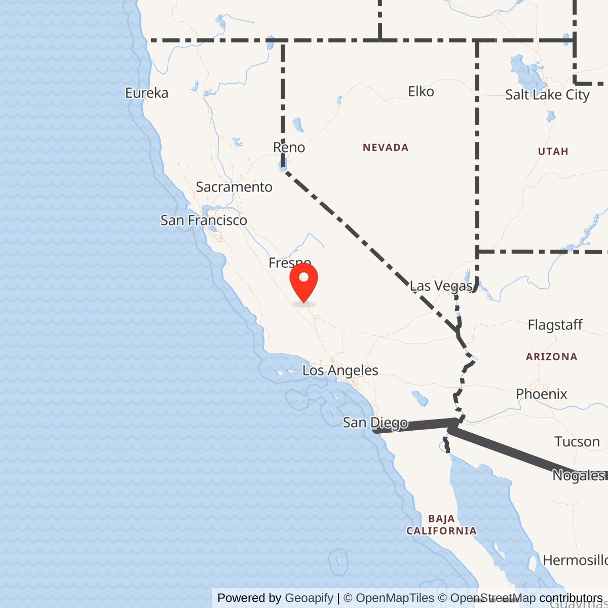
Longitude: -119.3500000
Official Base Website: Former Pond Auxiliary Field No. 2 site
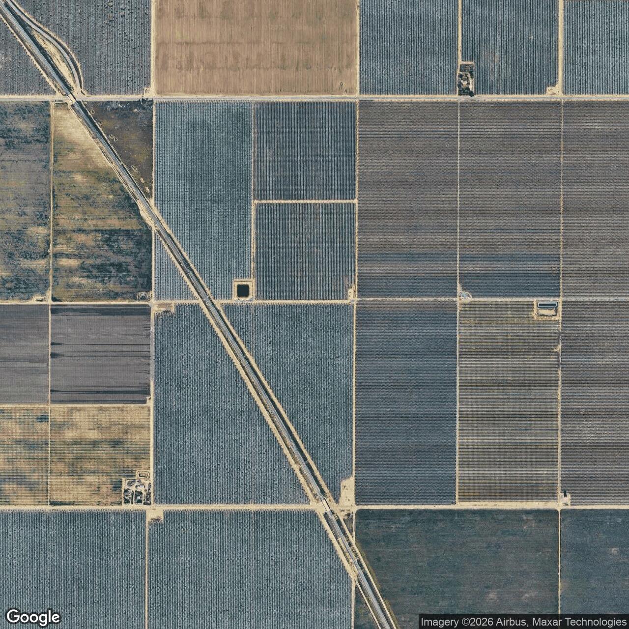
Current Role: Former military landing-field property returned to agriculture. USACE described it as privately owned and cultivated after disposal, and later aerial research shows the five-runway pattern erased by farming; exact 2026 parcel ownership was not independently verified.
Pond Auxiliary Field No. 2 was a small, deliberately austere Army Air Forces satellite field in the basic-flying-training system centered on Minter Field near Shafter, California. The War Department leased 158 acres from Kern County Land Company on June 16, 1941, specifically to create a temporary landing field where student pilots from Minter could practice takeoffs and landings away from the traffic concentrated at the parent base. It was not a separate flying school, depot, cantonment, combat base, or bombing range. Pond existed because a busy basic pilot school needed more runway time than one main airfield could safely provide.
The installation is variously identified as Pond Auxiliary Field, Pond Field, Minter Auxiliary Field No. 2, Minter Auxiliary Army Airfield A-2, and similar shortened forms. Those names refer to the same wartime landing property. The "No. 2" or "A-2" designation placed it within Minter's auxiliary-field network, alongside Wasco No. 1, Famoso No. 3, Dunlap No. 4, Semi-Tropic No. 5, Poso No. 6, and Lost Hills No. 7. Pond should therefore be understood as an independent leased military property with its own physical site, but an operational dependency of Minter Field rather than a self-contained station.
The site lay in the agricultural plain of northern Kern County, about sixteen miles northwest of Minter Field by the Army Corps of Engineers' historical estimate. It was roughly seven miles southwest of Delano and seven miles north of Wasco. That position put Pond close enough for repeated training sorties from Minter while separating student traffic from the parent field's busier pattern. Flat agricultural terrain, sparse development, and the ability to lease a compact square tract made the location well suited to a low-cost auxiliary landing field.
Acquisition and Opening
The strongest surviving real-property evidence fixes the beginning of Pond's military identity more precisely than later airfield compilations. The War Department acquired the 158-acre property from Kern County Land Company under Lease No. W.1105-3213 on June 16, 1941. The U.S. Army Corps of Engineers later described the purpose directly: a temporary landing field for aircraft and a place to train pilots. Because no separate activation ceremony or first-landing date has been found, June 16 is the most defensible opening date for the installation as a military-controlled property, while the exact date of the first training sortie remains unknown.
Pond's lease preceded the formal dedication of Minter Field in February 1942 and belongs to the earlier mobilization phase when flight training was expanding before the United States entered World War II. Minter itself began operations in June 1941, initially with a small guard force while construction and organization continued. Pond was therefore not an afterthought added after the school matured. Its land was secured at the beginning of the parent field's operating life, showing that auxiliary landing capacity was part of the training system from the outset.
The timing reflects how rapidly the Army Air Corps and then Army Air Forces were scaling pilot production in 1941. Basic flying training required repeated cycles of takeoff, climb, pattern work, approach, landing, taxi, and immediate return to the air. Concentrating all of that activity on a single parent field would create congestion and reduce the number of repetitions each student could obtain. Leasing nearby agricultural properties for simple satellite landing areas was a comparatively inexpensive way to multiply usable training capacity without reproducing Minter's barracks, classrooms, maintenance shops, hospital, administration buildings, or supply infrastructure.
Physical Layout and Facilities
Pond was built to be simple. The Corps of Engineers found no evidence of substantial military improvements other than possible hard surfacing of the landing area. It identified no ammunition storage, ordnance facilities, or developed cantonment. Later aerial interpretation strengthens that picture. A July 7, 1946 aerial photograph, taken after military disposal but while the flying surfaces were still visible, showed five oiled runways arranged within a square property. No buildings were visible anywhere on the field.
The five-runway layout gave student pilots multiple landing directions, an important practical advantage at an elementary auxiliary field where wind direction could otherwise interrupt training. The surfaces appear to have been oiled or otherwise stabilized rather than constructed as the heavy paved runways of a permanent air base. This arrangement allowed the Army to use a compact agricultural lease for repeated basic-flight operations while avoiding the expense of a full runway, taxiway, apron, hangar, and utility complex.
No evidence supports a permanent control tower, hangar, barracks, mess hall, fuel farm, station hospital, armory, bomb storage area, machine-gun range, or maintenance shop at Pond. That absence is operationally significant. Aircraft, instructors, students, mechanics, fuel, administration, medical support, and most communications remained at Minter Field. Pond's military plant was essentially the landing area itself, supported by the roads and agricultural landscape around it.
The Corps of Engineers' later interviews with people familiar with wartime military activity in Kern County also found no evidence that ammunition or ordnance had been stored or used at Pond. That is consistent with the installation's mission. Pond was a landing-and-takeoff practice field, not an aerial gunnery, bombing, weapons-storage, or combat-training range. The distinction matters when interpreting the former property today because nearby wartime airfields could have very different environmental and munitions legacies.
Mission and Training Operations
Pond's official mission was direct and repetitive: help Minter Field teach pilots to take off and land. The Corps of Engineers described the landing strip as being used for landing and takeoff maneuvers as part of Minter's basic training program. Although simple on paper, this was one of the most demanding stages in pilot production. Students had to learn aircraft control near the ground, judge approach speed and glide path, compensate for crosswinds, manage engine power, maintain runway alignment, and recover safely from imperfect approaches.
An auxiliary field let instructors move these repetitions away from the crowded main base. A student could depart Minter, enter Pond's local pattern, make repeated approaches and landings, then return to the parent field when the training period ended. The five available landing directions increased the chance that an acceptable runway orientation would be available as valley winds changed. The field therefore converted 158 leased acres into additional training time, one of the least glamorous but most useful resources in a wartime flying school.
Pond's austere layout also meant that training there depended on disciplined self-contained flight operations. A student and instructor arriving from Minter could not expect the full support structure available at the parent station. The aircraft had to be serviceable before departure, fuel planning had to cover the sortie and return, and serious maintenance or medical needs would normally require assistance from the parent field. The satellite's value came from simplicity, not independence.
The principal basic trainer associated with Minter during World War II was the Vultee BT-13 Valiant, powered by a Pratt & Whitney R-985 radial engine. Minter also operated Cessna UC-78 Bobcats and saw AT-6 Texans, B-25 Mitchells, P-38 Lightnings, and other types. The strongest site-specific evidence does not establish that every aircraft type used Pond. The BT-13, however, belonged directly to the basic-training mission for which Pond was leased, and an accident involving a 525th School Squadron pilot near Pond in 1942 further connects the local training area to Minter's single-engine school operations.
Minter Field and the Training Organization
Pond had no documented permanently assigned squadron or independent garrison. Its flying activity came from Minter Field, whose organization supplied students, instructors, aircraft, maintenance, administration, medical support, fuel, and command. Units assigned to Minter could use Pond as part of the school's operating area without being permanently stationed on the auxiliary property.
By June 1943, Minter's station list included the Army Air Forces Basic Flying School, Aviation Cadet Detachment, 64th Base Headquarters and Air Base Squadron, 324th, 326th, 327th, 525th, 526th, 739th, and 740th Basic Flying Training Squadrons, weather and signal detachments, medical and veterinary personnel, the 7th Sub-Depot, guard, quartermaster, trucking, ordnance, and other support organizations. These organizations illustrate the manpower behind the auxiliary-field system. Pond itself did not duplicate them; it depended on that larger base organization.
The 525th School Squadron has the clearest direct association with Pond's local flying area. Stewart Smith of that squadron was killed in a stall-and-spin accident six nautical miles west of Pond Field in August 1942. The accident did not occur on Pond's 158-acre property, so it should not be described as a Pond Field crash. It nevertheless demonstrates that Minter training aircraft and crews were operating in the immediate area and that Pond served as a meaningful navigation and reporting reference within the school's local flying environment.
Minter's organization changed as the training establishment matured. By April 1945, the parent base's station list centered on the Army Air Forces Pilot School (Basic), Headquarters and Headquarters Squadron of the 35th Flying Training Wing, the 3001st Army Air Forces Base Unit, and the 3008th Army Air Forces Base Unit (Pilot School, Basic), along with communications, weather, repair, band, and Women's Army Corps organizations. Pond had already been released from its lease by then, but this later structure shows the organizational evolution of the school whose earlier training demand had created the auxiliary field.
Aircraft, Procedures, and Training Risk
The BT-13 made Pond's mission operationally useful because basic training required a large number of takeoffs and landings before a cadet could progress. The aircraft was more powerful and demanding than a primary trainer, exposing students to heavier controls, more complex cockpit procedures, radio work, formation concepts, and the habits required for advanced training. The satellite field did not teach an entirely separate syllabus. It provided physical airfield capacity for portions of the basic syllabus that consumed runway and traffic-pattern time.
Repeated pattern work carried risks. Stall-and-spin accidents were a persistent danger in training because low-altitude maneuvering gave little time for recovery from an aerodynamic stall or loss of control. The August 1942 fatal accident west of Pond illustrates that risk without proving a defect in the field itself. The available record does not show that Pond's runways, facilities, or personnel caused the accident, and the crash site was several miles away.
Another local accident occurred after the military lease had already ended. On June 24, 1944, an AT-17B trainer, serial 42-38889, piloted by Neal Wiedenmann of Minter's 3008th Army Air Forces Base Unit, made a forced landing following engine trouble about seven nautical miles west of Pond Field. This event is useful mainly as geographic evidence. It shows that aviators continued to use "Pond Field" as a recognizable local reference after the War Department terminated its lease in May 1944, but it does not establish that the former auxiliary was still an active military installation.
The accident chronology also cautions against using every nearby crash as proof of operations at the field. Minter's local flying area covered a broad part of northern Kern County, and auxiliary fields were natural reference points for reporting locations. A crash six or seven miles from Pond could involve aircraft connected with Minter while having no operational relationship to the auxiliary at the moment of the accident. The history therefore separates the military property's own activity from incidents merely described in relation to it.
Role in the Wider Minter Field Network
Pond was one piece of a deliberately distributed airfield network. The Corps of Engineers identified Wasco No. 1, Pond No. 2, Famoso No. 3, Dunlap No. 4, Semi-Tropic No. 5, Poso No. 6, and Lost Hills No. 7 as Minter auxiliaries. Other historical summaries describe a larger total depending on period and counting method, but the operational principle is clear. Minter's training system spread students across multiple satellite fields rather than forcing every lesson through the parent base.
The network also allowed different properties to serve different levels of development and flexibility. Pond was among the simplest, with no known buildings and only stabilized landing surfaces. Dunlap and Semi-Tropic had documented square road-mix landing mats, while Lost Hills developed from a prewar public field and possessed a paved runway, taxiway, apron, dispersal pads, and revetments. Poso ultimately survived in part as a public airport. The variations demonstrate that "auxiliary field" described a function, not a single standardized physical design.
Within that network Pond's value came from location and availability. Its square multi-direction layout offered repeated landing practice north of Minter, while nearby auxiliaries distributed additional traffic east, west, and north of the parent school. The 1944 local-flying-area map shows these fields as a system spread across the agricultural valley. Cadets trained not just at one airfield but inside an operational geography of routes, landmarks, practice areas, emergency options, and satellite landing sites.
Minter's wider wartime output gives scale to this support role. More than 11,000 cadets graduated from the parent field during the war and went on to flying assignments in theaters around the world. Pond cannot be credited with training every one of them, and no source provides a Pond-specific student or sortie count. Its significance lies instead in contributing runway capacity to the overall system that produced those pilots.
Closure and Disposal
Pond's military life ended earlier than the parent base. The War Department terminated Lease No. W.1105-3213 in May 1944 and released the 158-acre property. The Corps of Engineers found no more detailed disposal instrument in its later review, but the Air Force Real Estate Agency list it consulted identified May 1944 as the disposal month. That evidence is stronger than the preliminary assumption that the field survived into 1945 merely because other Minter auxiliaries did.
The early disposal explains several otherwise confusing pieces of evidence. Pond was omitted from the 1945 Army Air Forces Airfield Directory, unlike several other Minter auxiliaries. A February 1944 sectional chart did not formally depict Pond, although a historical copy later had its location hand-marked with the other Minter auxiliaries. The field's name could still be used as a geographic reference after disposal, as the June 1944 AT-17B forced-landing report demonstrates. None of those facts requires continued Army control after the lease ended.
Because Pond had almost no permanent construction, disposal was straightforward compared with closing a full air base. The government did not have to remove barracks, hangars, fuel systems, magazines, a hospital, or extensive utilities. The landing surfaces could simply be abandoned to weathering and agricultural reclamation once military flying stopped. The lease structure also meant the War Department was returning control rather than disposing of a fee-owned installation.
Postwar Landscape and Current Status
Aerial photography provides a clear picture of Pond's physical afterlife. On July 7, 1946, two years after lease termination, the five oiled runways were still visible as a square geometric pattern, but there were no buildings. The photograph is especially valuable because it captures the installation's design after military activity had ceased but before farming erased its surfaces.
By 1953 the field no longer appeared on the USGS topographic map reviewed by later airfield researchers. A 1994 USGS aerial photograph showed the property returned to farming with no recognizable airfield trace. An August 27, 2012 aerial image likewise showed no visible remains. The former military geometry had been absorbed back into the agricultural grid of roads, canals, and cultivated fields that originally made the temporary lease possible.
The Army Corps of Engineers' 1998 and 1999 histories described the former property as privately owned and cultivated, including alfalfa and cotton. Later aerial interpretation continued to show agricultural use.
Chronology
- 1941-06 Minter Field begins flight-training operations near Shafter while construction and organization continue.
- 1941-06-16 The War Department leases 158 acres from Kern County Land Company under Lease No. W.1105-3213 for Pond Auxiliary Field.
- 1941 Pond enters the Minter Field auxiliary system as a temporary landing field for basic pilot training; the exact first aircraft movement is not documented.
- 1942-02-07 Minter Field is formally dedicated, although operations had already been underway since June 1941.
- 1942-07 Minter is described as the largest training base of its type on the West Coast, supported by a network of auxiliary landing fields including Pond.
- 1942-08-12 Stewart Smith of the 525th School Squadron is killed in a stall-and-spin accident approximately six nautical miles west of Pond Field; the crash is near the field but not documented on the Pond property.
- 1943-06-01 Minter's station list documents multiple basic flying training squadrons and supporting organizations that sustain the parent school's distributed flying program.
- 1944 A Minter local-flying-area map depicts Pond Field with the other auxiliary fields.
- 1944-02 Pond is absent from the formal Los Angeles Sectional Chart, although a historical copy has its location hand-marked with the Minter auxiliary fields.
- 1944-05 The War Department terminates the Pond lease and disposes of the 158-acre military interest.
- 1944-06-24 Minter AT-17B 42-38889, piloted by Neal Wiedenmann, makes a forced landing after engine trouble approximately seven nautical miles west of Pond Field; the former auxiliary remains a geographic reference after disposal.
- 1945 Pond is absent from the Army Air Forces Airfield Directory, consistent with its documented May 1944 disposal.
- 1946-07-07 A postwar aerial photograph shows five oiled runways occupying the square former field and no buildings.
- 1953 The former Pond Field is no longer depicted on the reviewed USGS topographic map.
- 1994 USGS aerial photography shows the former field returned to agriculture with no recognizable airfield trace.
- 1998 A U.S. Army Corps of Engineers Los Angeles District history documents the 158-acre lease, training mission, lack of ordnance use, May 1944 disposal, and agricultural reuse.
- 1999 A second Corps of Engineers history again documents Pond as a former temporary Minter auxiliary field with no substantial improvements beyond possible hard surfacing.
- 2012-08-27 Aerial imagery reviewed by later airfield researchers shows no visible trace of the former field.
- Present The former Pond Auxiliary Field landscape remains agricultural in the latest reviewed evidence; exact 2026 parcel ownership has not been independently verified and no active military use is documented.
Information sources (12)
- WEBU.S. Army Corps of Engineers Los Angeles District histories, reproduced by California Military History, "Pond Auxiliary Field"
Primary property-history source for the 1941 lease, 158-acre footprint, training mission, lack of ordnance use, May 1944 disposal, and agricultural reuse.
- WEBCalifornia Military History, "Minter Field"
Source for Minter's 1941 opening, auxiliary-field system, aircraft, command context, wartime output, and Army station-list organizations.
- WEBMinter Field Airport District, "Our History"
Current parent-airfield source for Minter Field's Army training history, 1941 opening, wartime scale, and postwar civil reuse.
- WEBMinter Field Airport District
Current official website for the surviving Shafter-Minter Field civil airport and airport district.
- WEBAbandoned & Little-Known Airfields, "Minter Auxiliary Army Airfield A-2 / Pond Field"
Source for the Pond local-flying-area map, 1946 aerial evidence, five-runway configuration, nearby training accidents, and later disappearance under agriculture.
- WEBAbandoned & Little-Known Airfields, Bakersfield Area
Regional source for comparison of Pond with Minter's other auxiliary properties and their different wartime layouts and postwar outcomes.
- WEBCalifornia Military History, Pond Auxiliary Field site map
Source image for the Corps of Engineers reconstructed location and 158-acre property area.
- WEBMinter Field Airport District, Airport Facilities
Current parent-airport reference for Shafter-Minter Field and its continuing civil aviation use.
- WEBCalifornia Military History, "Minter Field" Army Station Lists
Source for the 1943 and 1945 Minter unit organizations whose training and support structure sustained the auxiliary-field system.
- WEBCalifornia Military History, "Pond Auxiliary Field," 1998 Corps of Engineers history
Source for the approximate location seven miles southwest of Delano and seven miles north of Wasco and the Kern County Land Company lease.
- WEBCalifornia Military History, "Pond Auxiliary Field," 1999 Corps of Engineers history
Source for the temporary landing-field purpose, pilot landing and takeoff training, and finding of no ammunition or ordnance use.
- WEBMinter Field Airport District, "Our History," wartime facilities and personnel
Source for the parent field's roughly 7,000-person wartime community and the infrastructure that Pond itself did not duplicate.