
Poso Auxiliary Field No. 6 / Poso-Kern County Airport, California
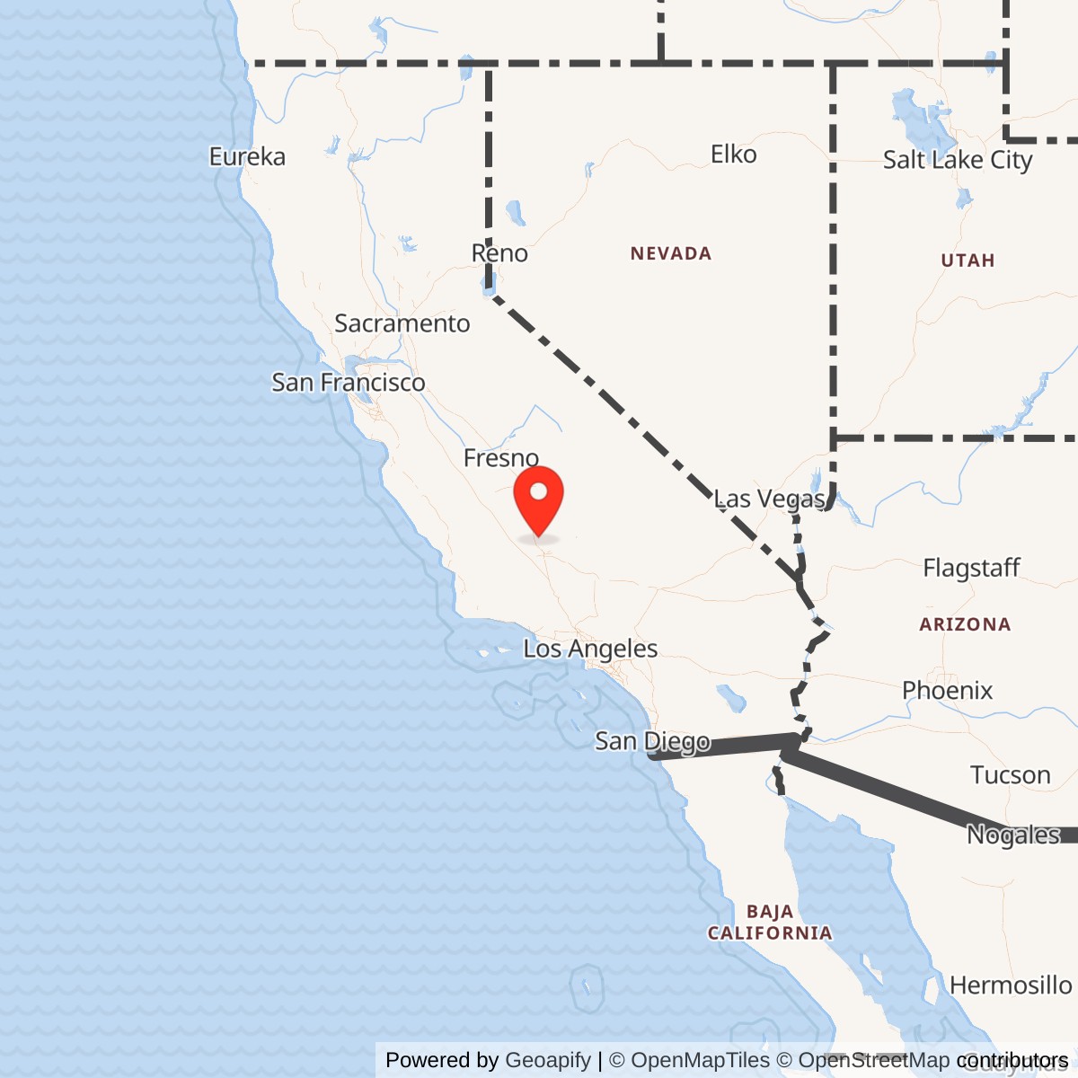
Longitude: -119.1283330
Official Base Website: Poso-Kern County Airport / Famoso Dragstrip
Current Role: Active unattended Poso-Kern County Airport, FAA L73, with occasional general aviation, no county-reported based aircraft, agricultural-product activity, and the Famoso Dragstrip operating on the western portion of the former military field.
Poso Auxiliary Field No. 6 had no barracks city, headquarters complex, or permanently assigned flying organization. Its importance came from pavement and space. The Army constructed a 3,000-by-3,000-foot landing mat on 400 acres northeast of Minter Field so aviation cadets could practice takeoffs, approaches, landings, traffic patterns, emergency procedures, and local navigation without overwhelming the parent school's runways. What appeared from the ground to be an expanse of pavement functioned as a high-volume training machine.
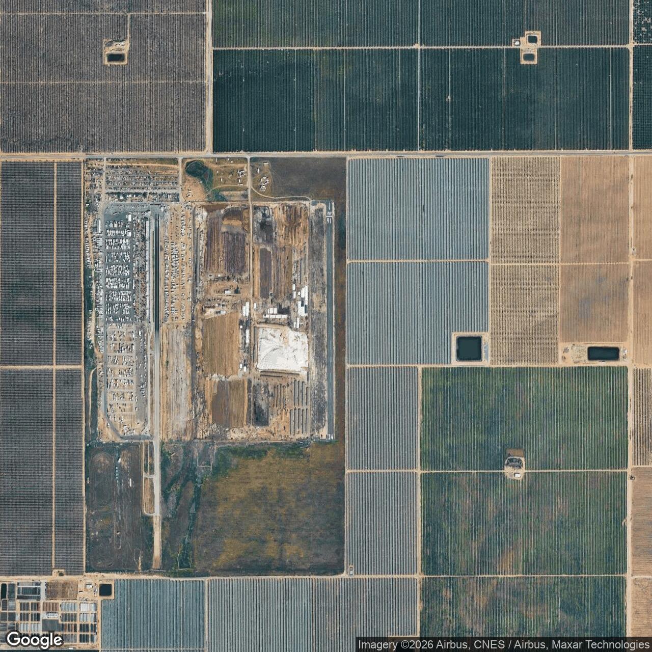
The military field is now represented by two nationally recognized but very different activities. The eastern portion continues as Poso-Kern County Airport, FAA identifier L73. The western portion became Famoso Dragstrip, whose converted military pavement helped establish one of American drag racing's most important venues. The airport and dragstrip are therefore not unrelated neighbors. They are parallel civilian reuses of one World War II auxiliary landing property.
The installation was also known as Poso Auxiliary Field, Poso Field No. 6, Minter Auxiliary Field No. 6, and Minter Auxiliary Army Airfield A-6. The name referred to the former community of Poso, which became known as Famoso. Modern aviation records use Famoso as the associated community while retaining Poso in the airport's official name. That combination explains why historical and current sources sometimes appear to describe different places.
Wartime Establishment
The Army built Poso during the 1942 expansion of the Minter Field training system. Minter had opened in 1941 under the Defense Landing Area Program and quickly developed into a major Army Air Corps and Army Air Forces flight-training installation. Approximately 7,000 military and civilian personnel eventually worked or lived at the parent base, whose runways, housing, classrooms, shops, hospital, depot functions, and recreation facilities supported a large and continuous flow of aviation students.
A basic flying school generated unusually heavy runway demand. Each cadet had to repeat takeoffs and landings until the procedures became reliable under varying wind, visibility, and traffic conditions. Using the main base for every exercise would have created congestion and increased collision risk. Auxiliary fields distributed aircraft around the region and allowed instructors to concentrate on one phase of training without interfering with other Minter operations.
Poso's 400 acres gave the Army enough room for a broad square landing mat and the clear areas needed around it. The square design allowed aircraft to use several headings according to wind direction rather than accept a strong crosswind on a single runway. This flexibility was particularly useful for inexperienced pilots still learning speed control, alignment, flare, touchdown, and directional control.
The exact date on which the first aircraft landed at Poso has not been located. County and compiled military histories consistently place construction in 1942. The later closure date of October 8, 1946, comes from compiled property histories.
The Army did not need a full cantonment at Poso because the field was only about six miles from Minter. Students, instructors, and aircraft could arrive from the parent base, conduct training, and return. The field's purpose was to multiply safe landing capacity, not to duplicate Minter's housing, administration, maintenance, medical, or supply infrastructure.
Training Mission
The central task at Poso was repetitive flying practice. Cadets entered the traffic pattern, established spacing behind other aircraft, aligned with the selected landing direction, controlled descent, touched down, and either stopped or immediately took off again. Instructors used repeated circuits to identify weak judgment or technique before those problems followed a student into more advanced aircraft.
Takeoff practice was equally important. Students learned to hold directional control, manage engine torque and wind correction, recognize aircraft performance, and decide whether a developing problem required an abort. The broad landing mat gave instructors options for matching the takeoff heading to prevailing wind and for separating one training flow from another.
Emergency instruction was a natural part of auxiliary-field use. An instructor could reduce power to simulate engine failure and require a cadet to judge a glide, select a landing area, and reach the prepared surface. The proximity of Poso to Minter provided a controlled destination for exercises that would have been riskier over an unfamiliar field or active main-base traffic.
Poso also served local navigation training. Although the distance from Minter was short, cadets still had to identify roads, rail lines, canals, settlements, agricultural patterns, and the airfield itself. The flat San Joaquin Valley could be deceptively difficult because one grid of fields resembled another, particularly through haze, smoke, dust, or summer glare.
The field's emergency value extended beyond planned instruction. Aircraft experiencing engine trouble, weather deterioration, traffic conflict, or student disorientation could use Poso instead of continuing to Minter. Every satellite field shortened the distance to a known landing surface somewhere in the local training area. The mission did not include operational combat deployment, aircraft production, depot overhaul, bombing-range activity, or permanent stationing of a numbered combat squadron. Poso contributed earlier in the military system by helping aviation students survive and complete the basic stage of the pilot-training pipeline.
Aircraft and Flying Organizations
The Vultee BT-13 Valiant was the aircraft most closely associated with Minter's basic training. It was heavier, faster, and more demanding than the primary trainers cadets had flown earlier. The BT-13 introduced students to a more powerful engine, variable-pitch propeller procedures, flaps, radio work, instrument instruction, formation, and the disciplined landing technique expected of military pilots.
Stearman primary trainers are also associated with the wider Minter system in compiled accounts, although Poso's strongest documented function was as a basic-training satellite. Minter operated or hosted other aircraft, including UC-78s, AT-6s, B-25s, P-38s, and transient or transition types. The existence of those aircraft at the parent base does not prove that each type used Poso routinely.
No permanent Poso squadron has been identified. The field was used by Minter's training organizations, instructors, student flights, airfield operations personnel, and support units. Wartime school squadrons and later Army Air Forces base-unit organizations controlled the parent installation, but the available sources do not assign a separate resident detachment to Poso.
Instructors carried immediate responsibility for flight discipline. They determined which landing direction to use, supervised students in the pattern, corrected errors, and took control when necessary. Their judgment connected the simple physical field to the formal training syllabus administered at Minter. Minter's engineering, crash-response, communications, and operations organizations supported the auxiliary as required. Because Poso lacked the parent base's extensive facilities, serious mechanical work, medical care, administration, and student housing remained at Minter. Mobile personnel or vehicles could be dispatched when an aircraft could not return.
Facilities and Physical Layout
The defining wartime improvement was a square landing mat measuring approximately 3,000 by 3,000 feet. A square mat differed from a modern runway because aircraft could use multiple strips or headings across the prepared area. Wind direction, surface condition, traffic, and the instructor's lesson determined the operating line.
The mat occupied a substantial portion of the 400-acre property but not all of it. Clear zones, drainage, access, safety margins, aircraft movement areas, and undeveloped buffers surrounded the prepared surface. This distinction explains why the field's acreage cannot be calculated simply by converting the nine-million-square-foot mat into acres.
No reliable source located identifies a large hangar, permanent tower, barracks block, station hospital, or maintenance depot at Poso. Temporary shelters, markers, wind indicators, access improvements, or crash equipment may have existed, but their number and location remain unverified.
The current airport occupies the eastern aviation portion. Its single asphalt Runway 16/34 measures 3,000 by 60 feet. The current runway is a narrow conventional strip within the footprint of the former broad mat, demonstrating how the same site adapted from mass military training to low-volume civil aviation.
The FAA reports a displaced threshold of approximately 210 feet on Runway 16 because of trees. The airport is unattended, has no control tower, and relies on pilots to self-announce on the common traffic advisory frequency. These conditions are consistent with a lightly used rural airport rather than a staffed transportation hub.
The western portion uses former aviation pavement and associated land for drag racing. The division between airport and raceway preserves more of the military site's open geometry than agricultural conversion would have, even though the current surfaces, safety barriers, access roads, buildings, and operating patterns were built for postwar purposes.
Training Risk and Accidents
Basic flying training was dangerous even at purpose-built auxiliary fields. Students operated relatively powerful aircraft while learning stall recognition, traffic spacing, crosswind correction, emergency procedures, and judgment. A square mat reduced crosswind exposure but could not remove the hazards of engine failure, disorientation, collision, poor approach control, or loss of control.
Accident databases record several BT-13 losses at or near Poso. A BT-13A was destroyed approximately one mile northeast of the field on February 28, 1943. Another BT-13A accident was recorded at Poso Auxiliary Field on September 18, 1943. These records confirm that the training environment produced real losses, although complete narratives and personnel outcomes were not available for every event reviewed.
The distinction between an accident at Poso and one merely near Poso is important. Training aircraft crossed the entire Minter operating area, and a location reference could identify the nearest known field rather than the planned destination.
The field itself reduced some risk by giving students a large surface and alternatives to the congested parent base. The same broad landing area could create traffic-management challenges because several headings might be available. Visual lookout, predictable patterns, wind indicators, radio procedures, and instructor supervision remained essential. Every accident affected more than an aircraft. It interrupted training, required crash and medical response, prompted maintenance and command review, and reminded cadets that washout or death could follow a lapse in judgment.
Role in the Minter Field Auxiliary Network
Poso was No. 6 in Minter's regional satellite system. Wasco, Pond, Famoso, Dunlap, Semi-Tropic, Poso, and Lost Hills formed the numbered chain, while old Coalinga Municipal Airport also supported Minter and Lemoore training. Each property supplied landing capacity or specialized options beyond the parent base. The fields were not identical. Wasco used an enlarged prewar county airport. Pond had five oiled runways. Famoso, Dunlap, and Semi-Tropic used square or extended landing mats that later disappeared beneath agriculture. Lost Hills had a longer runway, taxiway, dispersal pads, and revetments. Poso combined a square mat with unusually durable postwar reuse.
Distance helped determine how the satellites were used. Poso's location only about six miles from Minter made it practical for rapid cycles of landing practice. More distant fields could support navigation and emergency work over a larger area. Together they gave instructors choices based on lesson objectives, wind, traffic, and field availability.
The network also protected Minter's main-field capacity. Aircraft arriving for maintenance, administrative travel, transition activity, or other missions did not have to compete constantly with cadets making repetitive circuits. The satellites dispersed the most runway-intensive portion of training across the countryside. Poso's survival is particularly valuable because much of the network has vanished. A visitor can still stand within the former property and see aviation and high-speed vehicle activity using portions of the military landscape. That physical continuity makes the network easier to understand than at fields whose landing mats were completely erased.
Closure and Property Transition
Minter's basic training requirement contracted during 1944 and 1945 as the Army Air Forces reduced pilot production. Auxiliary fields became less necessary when classes shrank and the war approached its end. Poso likely experienced declining use before the final property action recorded in 1946. Compiled histories give October 8, 1946, as the military closure date. The same date appears in descriptions of other surplus actions and may represent formal release rather than the last training flight.
The transition did not erase the entire landing complex. Kern County retained the eastern portion for public aviation, while the broad western pavement attracted automotive enthusiasts. This division occurred because both uses benefited from large, level, paved ground with rural separation from dense development. The county's continuing airport operation preserved the Poso name. FAA and county records list the facility as Poso-Kern County Airport while associating it geographically with Famoso. The historical community name therefore survived in aviation even after local usage changed. The military installation did not transfer into the United States Air Force as an active base. Although the Air Force inherited many Army Air Forces properties in 1947, Poso had already left operational military service. Its correct service routing remains Army.
Civil Airport Reuse
Poso-Kern County Airport is a county-owned public-use general aviation facility. Kern County reports that it serves occasional aviation activity and has no based aircraft. Its single 3,000-foot runway provides a usable landing site in the northern Kern County agricultural region. The airport's limited activity does not mean it is abandoned. FAA publications continue to list L73, provide runway and communications information, and require pilots to self-announce before landing or takeoff. The county continues to identify Poso as one of its general aviation airports.
Agricultural activity is a major part of the current property. County records identify SunGrow operations, and earlier county agreements allowed agricultural products to be dried on airport land. This use reflects the surrounding economy and the large amount of open acreage not required by the narrow modern runway. The airport has no scheduled airline service, control tower, permanent passenger terminal, or full-service fixed-base operator. Its value is local and situational. It provides aviation access, emergency potential, agricultural support, and preservation of a public-use landing site in a region dominated by farming and petroleum activity. County planning records have long described the airport as a basic-utility facility with minimal services. A regional aviation system plan listed the 400-acre property, 635-foot elevation, 3,000-by-60-foot runway, no lighting, no based aircraft, and approximately 1,000 annual operations in the planning period.
Famoso Dragstrip
The western part of the former auxiliary field became Famoso Dragstrip. NHRA's official history dates the dragstrip's opening to 1954 and identifies it as a converted Poso airstrip. The rural location, existing pavement, and long clear operating area made the site attractive for organized acceleration contests that were moving away from public roads. The dragstrip became known as "The Patch" and developed into one of the sport's most important historic venues. The first Smokers March Meet was held in 1959. Racers seeking to run nitromethane during periods when national sanctioning rules restricted the fuel helped make Bakersfield and Famoso central locations in drag-racing culture.
Current Status
Poso Auxiliary Field No. 6 is closed as a military installation. Poso-Kern County Airport remains an active, unattended, county-operated public-use airport under FAA identifier L73. The western portion of the former field remains active as Famoso Dragstrip, while agricultural uses occupy additional acreage. The current airport reference point is 35.596333, -119.128333 at an elevation of 635 feet. Runway 16/34 is 3,000 feet long and 60 feet wide. The Runway 16 threshold is displaced approximately 210 feet because of trees.
Kern County reports no based aircraft and only occasional general aviation activity. Those conditions may change with future FAA records, but they accurately describe the current county presentation. The airport remains charted and available rather than closed.
Chronology
- 1941-06 Minter Field opened near Shafter as an Army Air Corps flight-training center.
- 1942 The Army constructed Poso Auxiliary Field No. 6 on approximately 400 acres.
- 1942 A 3,000-by-3,000-foot square landing mat entered use for takeoff, landing, traffic-pattern, navigation, emergency, and basic pilot-training exercises.
- 1942-1943 Minter's expanding basic training program used Poso as one of its numbered satellite fields.
- 1943-02-28 A BT-13A was destroyed approximately one mile northeast of Poso Field.
- 1943-09-18 A BT-13A accident was recorded at Poso Auxiliary Field.
- 1944 Minter and its satellite network continued high-tempo flight training while national pilot-production requirements began to decline.
- 1945 The end of World War II sharply reduced the need for the Minter auxiliary-field system.
- 1946-10-08 Compiled property histories identify this as Poso's military closure or final surplus date.
- 1947 The United States Air Force was created, but Poso did not continue as an active Air Force installation.
- 1954 Famoso Dragstrip opened on converted Poso airfield pavement.
- 1959 The first Smokers March Meet established the raceway as a major drag-racing venue.
- 1999 Kern County approved improvements for turnarounds at Poso Airport's Runway 16/34.
- 2001 Kern County approved agricultural-product drying on part of Poso Airport.
- 2002 Kern County began negotiations for a long-term lease of the Famoso racing facility at Poso Airport.
- 2010 FAA-derived records reported approximately 1,000 annual general aviation operations and no based-aircraft concentration.
- Before FY 2021 Department of Defense reporting recorded final response complete for the Poso Auxiliary Field FUDS property.
- 2026-03-19 The FAA Chart Supplement continued to list Poso-Kern County Airport, L73, with Runway 16/34 measuring 3,000 by 60 feet.
- 2026 Kern County continues to list the 400-acre property as an active airport with occasional general aviation, no based aircraft, agricultural use, and the Famoso Raceway.
Information sources (13)
- WEBKern County General Aviation Airports
Source for current airport acreage, runway, aviation activity, agricultural use, raceway, and military origin.
- PDFFederal Aviation Administration Chart Supplement Southwest
Source for current airport coordinates, elevation, runway dimensions, displaced threshold, and operating remarks.
- WEBFederal Aviation Administration Location Identifier Directory
Source for the current L73 airport identifier and Famoso location.
- WEBMinter Field Airport District History
Source for the parent installation's opening, wartime scale, and training mission.
- PDFKern County Regional Aviation System Plan
Source for airport acreage, physical facilities, services, operations, and regional aviation role.
- PDFFormerly Used Defense Sites Inventory, California
Source for the Poso FUDS property number and military-munitions response record.
- PDFDefense Environmental Restoration Program Table 9
Source for final environmental response status before fiscal year 2021.
- WEBNHRA, March Meet and Famoso Dragstrip History
Source for the 1954 dragstrip opening, 1959 March Meet, and motorsport legacy.
- PDFKern County Board of Supervisors Proceedings, 2002-10-08
Source for county management and lease negotiations at the Famoso racing facility.
- PDFKern County Board of Supervisors Proceedings, 2001-01-09
Source for agricultural-product drying use on the airport property.
- WEBKern County Board of Supervisors Proceedings, 1999-12-07
Source for Runway 16/34 turnaround improvements.
- WEBAviation Safety Network, BT-13 Accident Database
Source for documented BT-13 losses at or near Poso Field.
- WEBAir Training Command and the Korean War
Source for the national flying-training system and Minter Field's postwar context.