
Wasco Auxiliary Field No. 1 / Wasco-Kern County Airport, California
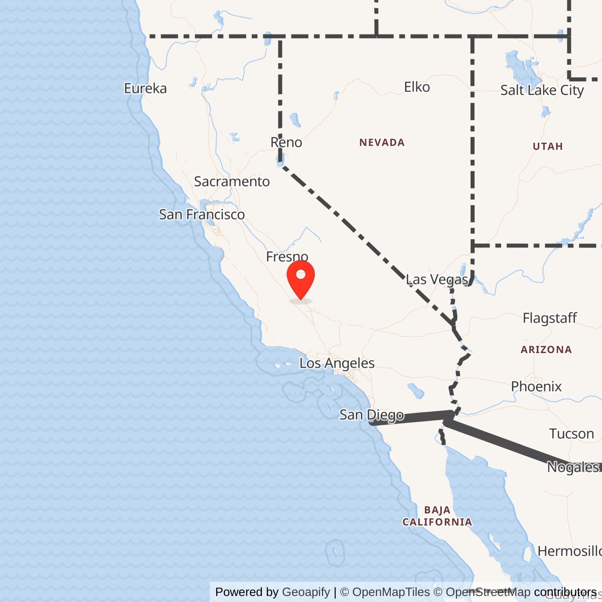
Longitude: -119.3536100
Official Base Website: Wasco-Kern County Airport
Current Role: Active Wasco-Kern County Airport, FAA L19, serving general aviation and primarily agricultural application aircraft on a 3,380-foot Runway 12/30.
Wasco Auxiliary Field No. 1 was built to do one repetitive task safely and often. Aviation cadets from Minter Field needed somewhere away from the main base where they could practice approaches, landings, takeoffs, traffic patterns, go-arounds, and emergency procedures without crowding the runways used by other classes and aircraft. The answer was a compact auxiliary field north of Wasco, created by enlarging an existing county airport and covering much of the property with a multidirectional landing mat.
The installation was not a conventional Army airfield with barracks, administrative offices, shops, warehouses, or a permanently assigned flying organization. It was an operating surface within Minter Field's training network. Instructors and students arrived by aircraft, conducted repeated flight exercises, and returned to the parent base. Ground activity was limited to inspection, maintenance, emergency response, access control, and whatever temporary support was necessary to keep the landing area usable.
The official and commonly used names reflect this subordinate but distinct role. Wartime references identify Wasco Auxiliary Field, Wasco Field No. 1, Wasco Auxiliary Field No. 1, and Minter Auxiliary Army Airfield A-1. The present property is Wasco-Kern County Airport, FAA location identifier L19. The military and civil identities occupy substantially the same site, although the current runway system is not identical to the five-direction wartime landing configuration.
Prewar Airport and Army Lease
Wasco already possessed a small public airport before the Army arrived. Secondary histories describe a 40-acre county airport established in the early 1930s. The field served a rural agricultural community whose economy depended on cotton, potatoes, fruit, vegetables, nurseries, petroleum, and the transportation systems linking the southern San Joaquin Valley. Its open, level surroundings made the location suitable for expansion when national defense planning accelerated before the United States entered World War II.
Minter Field was under construction near Shafter in 1941 as part of the Army Air Corps flying-training expansion. A single main airfield could not safely handle the number of repetitive landings required by a basic flying school. Auxiliary fields dispersed aircraft across the local area, gave instructors alternatives when one field was congested, and provided emergency landing surfaces along common training routes. Wasco's existing airport offered an economical foundation for one of those satellites.
The Army leased the 40-acre airport and approximately 120 adjoining acres from Kern County on June 16, 1941. The resulting property covered about 160 acres. This date marks the beginning of documented federal military control, although grading, surfacing, and the first training flight may have occurred later.
The arrangement preserved county ownership while transferring operational control to the Army. Leasing avoided the time and cost of purchasing land outright and made eventual reversion to civil aviation easier. The county supplied a known airport site, while the Army paid for the expansion and military improvements necessary to integrate Wasco into Minter Field's training system.
Construction and Physical Layout
The Army developed a five-direction landing mat rather than a single conventional paved runway. Such fields were designed to let training aircraft take off and land more nearly into the wind. A cadet and instructor could select a suitable strip across the prepared surface as wind direction changed, reducing crosswind exposure during the early stages of military pilot training.
The five-direction layout also allowed several training patterns and approaches to be practiced from different headings. This was useful in the San Joaquin Valley, where heat, haze, dust, wind, and agricultural burning could alter local conditions. The field gave cadets experience in selecting a landing direction, judging drift, maintaining spacing, and adapting to a surface that did not resemble a fully developed operating base.
No substantial wartime buildings are documented at Wasco. The available histories describe the landing mat as the principal Army improvement and do not identify hangars, barracks, a control tower, permanent shops, or a station hospital. The absence of a cantonment was intentional. Wasco was close enough to Minter Field for aircraft and instructors to use it without duplicating the parent base's extensive support facilities.
The wider 160-acre leasehold provided more than the actual landing surface. It created room for clear approaches, drainage, access, safety margins, possible aircraft parking, and the unobstructed areas needed around a training field. This distinction matters because the landing mat itself did not occupy every acre under Army control.
The current airport's single Runway 12/30 does not preserve the complete wartime geometry. Postwar civil operators concentrated aviation activity on a conventional paved runway suitable for local general aviation and agricultural aircraft. Other portions of the former landing mat were abandoned, altered, cultivated, or absorbed into the modern airport property.
Training Mission
Wasco supported Minter Field's basic pilot-training mission. The Vultee BT-13 Valiant was the aircraft most closely associated with Minter's wartime school. Cadets arriving from primary training learned to handle a heavier, faster, all-metal aircraft with more complex systems and flight characteristics. Basic training introduced formation work, instrument procedures, night flying, navigation, and more demanding takeoff and landing performance.
Repeated landing practice was essential because the BT-13 could punish poor technique. Cadets had to control airspeed, alignment, flare, touchdown, and directional stability while coping with wind, propeller effects, limited visibility over the nose, and the pressure of military evaluation. An auxiliary field allowed these exercises to continue without monopolizing Minter's main runways.
Wasco also provided a useful destination for local navigation and instructor-supervised cross-country exercises. Its distance of roughly twelve miles from Minter was short enough for frequent sorties but sufficient to require students to identify landmarks, maintain a heading, monitor altitude, and enter a traffic pattern at another field. The flight linked classroom navigation theory to the visual decisions required in the air.
The installation could serve as an emergency landing option when weather, mechanical trouble, traffic, or student error made a return to Minter undesirable. A network of satellites reduced the amount of time a troubled training aircraft had to remain airborne. That safety function was important in a program operating large numbers of relatively inexperienced pilots.
The surviving sources do not establish that every aircraft type assigned to Minter used Wasco. Minter also handled UC-78, AT-6, B-25, P-38, and other training or transition aircraft at different times. Wasco's compact property and lack of extensive support facilities make basic single-engine training the best-supported core mission. Claims of routine heavy bomber or fighter operations at Wasco would require more direct evidence.
The field's mission was not combat operations, aircraft production, depot maintenance, or operational-unit staging. Its contribution was one step earlier in the military system. It helped turn cadets into pilots who later advanced to specialized, replacement, transition, or operational training before joining combat organizations.
Units and Organizations
Wasco had no documented independent garrison. Its parent was Minter Field, initially known as Lerdo Field and later named for First Lieutenant Hugh C. Minter. The parent installation belonged to the West Coast Training Center and later Western Flying Training Command within the Army Air Forces Flying Training Command system.
Minter's school squadrons, instructors, maintenance personnel, airfield operations staff, and base organizations supplied the people who used or supported Wasco. The 525th School Squadron is documented in the Minter-area training record, while later wartime organization centered on the 64th Army Air Forces Base Unit. Publicly available material does not establish that either organization maintained a permanent detachment at Wasco.
Flight instructors carried the immediate responsibility for operations at the auxiliary. They evaluated students, selected exercises, enforced traffic patterns, and intervened when a cadet made an unsafe approach. Their work at Wasco formed part of a larger syllabus rather than a separate school course.
Minter's engineering and airfield personnel would have inspected and repaired the landing surface, drainage, markings, access points, and other improvements. Crash and fire response depended on the parent installation and local emergency arrangements. The lack of permanent buildings increased reliance on mobile or rapidly dispatched support.
Army leasing and real-property officials handled the legal relationship with Kern County. This administrative function was essential because the government controlled the airport for military purposes without owning it permanently. The long period between the end of intensive training and final lease termination illustrates how operational closure, property accountability, and legal release could occur on different schedules.
Role in the Minter Field Auxiliary Network
Wasco was No. 1 in a network of at least eight fields associated with Minter. The numbered chain included Pond No. 2, Famoso No. 3, Dunlap No. 4, Semi-Tropic No. 5, Poso No. 6, and Lost Hills No. 7. The old Coalinga Municipal Airport also supported Minter, although its numbering and simultaneous relationship with Lemoore Army Air Field require careful treatment.
The satellites differed significantly. Some were prewar civil airports expanded for Army use. Others were square or multidirectional landing mats created on leased farmland. Poso and Wasco survived as public airports. Lost Hills remained a county airport until 2019. Pond, Famoso, Dunlap, and Semi-Tropic largely disappeared beneath agricultural use. Coalinga returned to municipal service before being replaced by a new airport around 2000.
Wasco was one of the most durable sites because civil aviation preceded and followed the military period. The county had an institutional reason to preserve an airport, while the Army's improvements strengthened the property's usefulness. Auxiliary fields without a strong postwar civil sponsor were more likely to lose their surfaces to farming.
The network distributed risk as well as traffic. A forced landing near one satellite could bring an aircraft closer to a known military surface and to personnel familiar with training operations. The fields also reduced congestion-related accidents at the parent base by separating repetitive landing practice from other movements.
Minter's auxiliary system belonged to a much larger Western Flying Training Command network across California and the Southwest. Gardner, Lemoore, Merced, Stockton, Victorville, and other training bases maintained their own satellite fields. The system converted farmland, municipal airports, and desert tracts into a regional training machine capable of producing pilots at wartime scale.
Decline and Closure
Minter's training mission changed as wartime requirements shifted. Basic single-engine flying training declined during 1944, and some auxiliary fields were already described as inactive by the 1945 Army Air Forces directory. The end of the war sharply reduced the need for the large pilot-production system.
Wasco's exact last day of intensive Army flying has not been located. Secondary material sometimes associates 1944 with closure or reduced use, but the property lease continued long afterward.
The Army retained its leasehold interest until June 30, 1951. This extended period may reflect property administration, emergency-use provisions, residual aviation requirements, or the slow process of terminating wartime agreements. It does not demonstrate continuous full-scale pilot training through 1951.
Minter itself remained under federal control into the postwar period and was considered during Korean War training expansion, although it was not reopened as a major contract school. Wasco's continued lease may have preserved a nearby auxiliary option during this uncertain period. Direct evidence tying Wasco to Korean War flight activity was not located.
When the lease ended, operational control returned fully to Kern County. Because the site had been a public airport before military use, transition did not require creation of a new civil identity. The county continued aviation activity while gradually reshaping the field around a conventional runway.
Postwar Civil Reuse
Wasco-Kern County Airport became a modest general aviation facility serving the northern Kern County agricultural region. Agricultural application aircraft are particularly important at the airport because surrounding farms require aerial seeding, spraying, surveying, and crop support. The airport also accommodates private, business, training, emergency, and transient aviation.
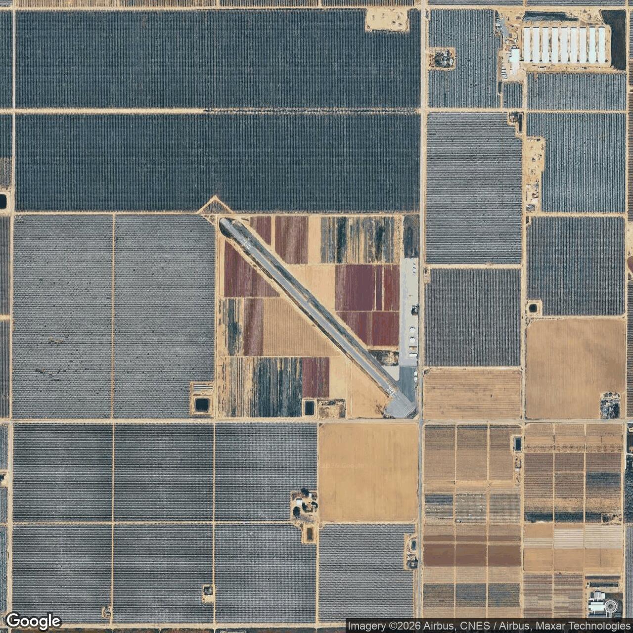
Current Kern County information reports a 158-acre airport with one 3,380-foot asphalt-concrete runway designated 12/30. The small difference between the reported 160 wartime acres and 158 current acres may reflect later survey precision, boundary adjustments, road rights, or disposal of marginal parcels. It does not indicate that the wartime acreage record was necessarily wrong.
The modern runway uses one alignment across the former multidirectional field. Concentrating operations simplified maintenance and matched postwar civil demand, which was far lower than wartime training traffic. Pavement, taxiways, aircraft parking, and agricultural-service areas replaced the broad military landing concept.
An extensive vineyard occupies part of the airport property. This coexistence of aviation and agriculture reflects the site's regional setting and the reduced amount of land needed for modern airport operations.
No active military unit is assigned. Military aircraft may use the airport transiently when operationally appropriate, but such visits do not constitute a continuing base mission. The Army Air Forces identity ended with the lease and postwar release.
Current Status
Wasco Auxiliary Field No. 1 is closed as a military installation. The property continues as active Wasco-Kern County Airport, operated by Kern County under FAA identifier L19. Its current mission is civil general aviation with an important agricultural-aviation component.
Chronology
- Early 1930s Kern County established a small public airport north of Wasco on approximately forty acres.
- 1941-06-16 The United States Army leased the county airport and approximately 120 adjoining acres, creating a roughly 160-acre auxiliary property.
- 1941 Construction and improvement proceeded as Minter Field, initially Lerdo Field, entered service near Shafter.
- 1941-1942 The Army developed a five-direction landing mat for satellite pilot-training use.
- 1942 Minter Field's expanding basic flying program relied on Wasco and other regional auxiliary fields to distribute landing practice and emergency capacity.
- 1943 The auxiliary network supported high-tempo BT-13 and related flying training throughout the southern San Joaquin Valley.
- 1944 Minter's basic training mission contracted, and some auxiliary properties began entering reduced or inactive status.
- 1945 The end of World War II eliminated the need for the wartime pilot-production system, although federal property interests continued.
- 1948 Minter Field entered county civil use while federal disposition and lease administration continued at some associated properties.
- 1950 Air Training Command considered Minter Field during Korean War flying-training expansion but selected other locations.
- 1951-06-30 The Army lease at Wasco terminated, ending documented federal military control.
- Post-1951 Kern County continued operating the property as Wasco Airport and later Wasco-Kern County Airport.
- 2011 Kern County aviation planning continued to identify Wasco as an active general aviation airport.
- 2026 Wasco-Kern County Airport remains active on 158 acres with a 3,380-foot Runway 12/30 and significant agricultural-aviation use.
Information sources (9)
- WEBSource for current airport identity, acreage, runway, civil use, and Minter Field relationship
https://meadowsfield.com/general-aviation/
- WEBSource for the parent installation's opening, scale, military service, and postwar reuse
https://www.minterfield.com/our-history
- WEBSource for auxiliary-field layout, regional network, historical maps, and postwar physical changes
https://www.airfields-freeman.com/CA/Airfields_CA_Bakersfield.htm
- WEBSource for Wasco's Minter Field satellite designation and auxiliary numbering
https://aerofiles.com/usaf-basesX.html
- WEBSource for the wider training system and postwar consideration of Minter Field
https://www.aetc.af.mil/Portals/88/Documents/history/AFD-061109-021.pdf?ver=2016-01-12-160020-003
- WEBSource for the national wartime base-development and flying-training context
https://www.dafhistory.af.mil/Portals/16/documents/Airmen-at-War/Shaw-AFD-100928-010.pdf?ver=2016-08-22-131428-850
- WEBSource for a documented pilot's description of BT-13 training at Minter Field
https://www.mildenhall.af.mil/News/Article-Display/Article/3066748/from-bi-planes-to-b-17-bomber-100th-bg-veteran-wolff-pack-pilot-shares-memories/
- WEBSource for the regional airport system and current civil-airport planning context
https://www.kerncog.org/wp-content/uploads/2009/10/images_docs_aviation_Kern_Regional_Aviation_System_Plan.pdf
- WEBSource for surviving artifacts, photographs, and public interpretation of the parent training base
https://www.minterfieldairmuseum.com/