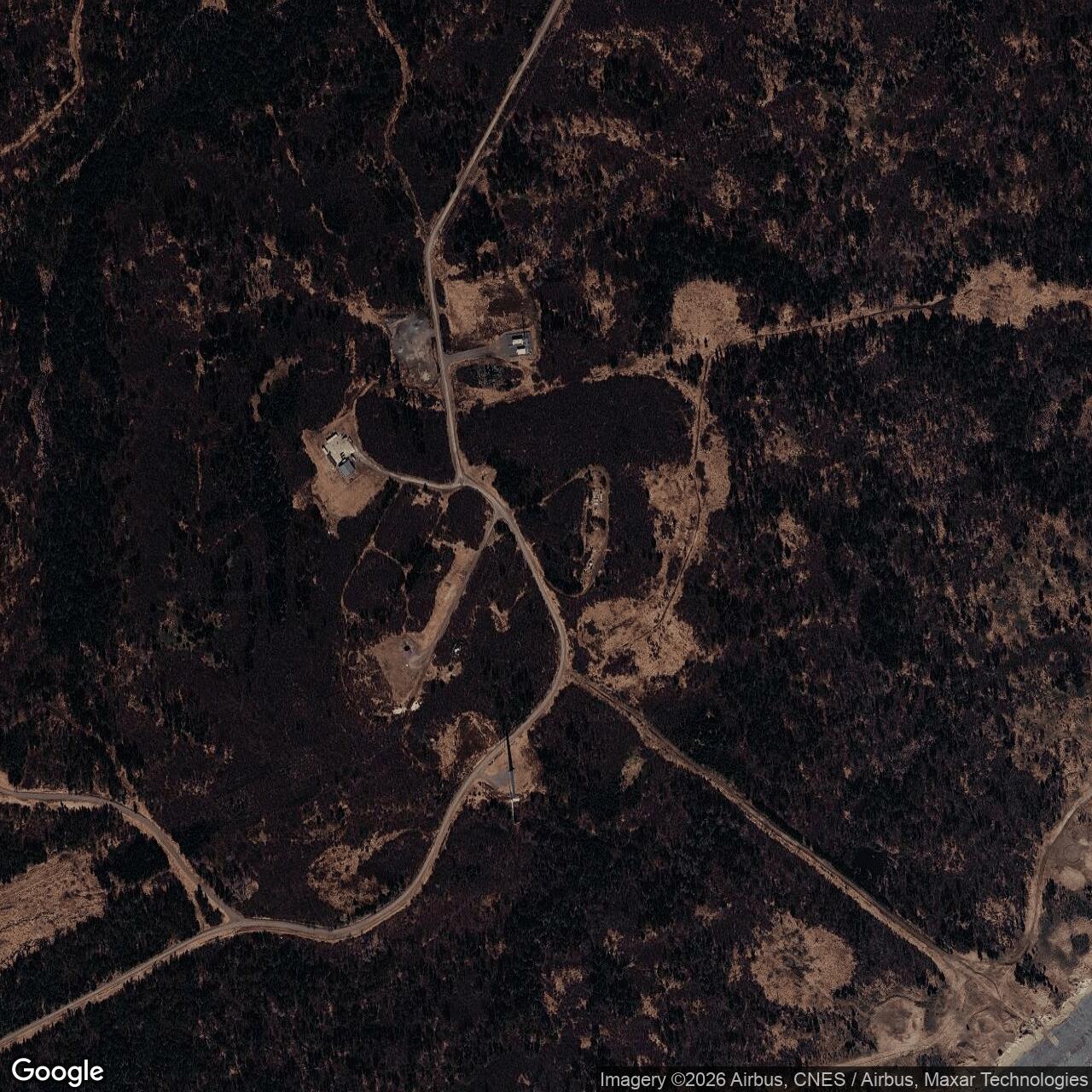
Fire Island Air Force Station, Alaska
Across Cook Inlet from Anchorage, the 626th Squadron helped direct southern Alaska's air defense from a wooded island radar station.
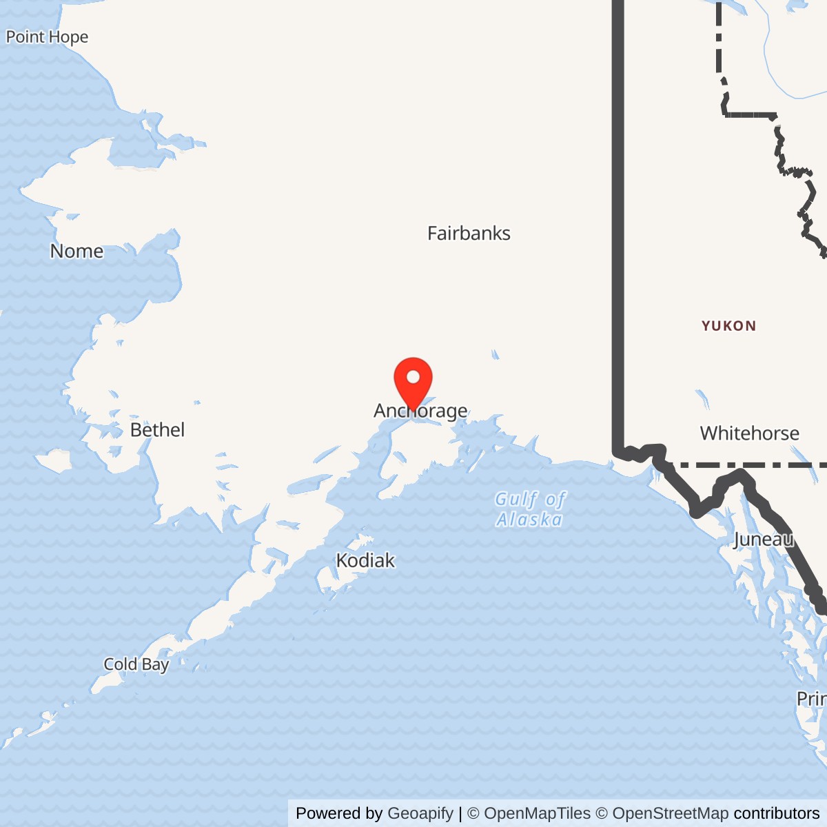
Longitude: -150.215207
Site Number: F-01
Current Role: Former radar-station property on Fire Island. The Alaska state study reports demolition of nearly all original structures and Air Force remediation in 1985.
- Station code
- F-01 / F-1
- Military role
- Southern master ground-controlled-interception station and NORAD direction center
- Operating unit
- 626th Aircraft Control and Warning Squadron
- Original radar
- AN/CPS-6B
- Backup equipment
- AN/FPS-8 search radar and AN/CPS-4 height finder
- Later equipment
- AN/FPS-20 search radar; AN/FYQ-9 track-processing system
- Military operating period
- September 1951-1969
- Joint functions
- Army air-defense command post; FAA surveillance and navigation support
- Regional successor
- King Salmon Air Force Station inherited southern control duties
- Support plant
- Power generation, water treatment, connected accommodation and workshops, barge and helicopter resupply
- Location
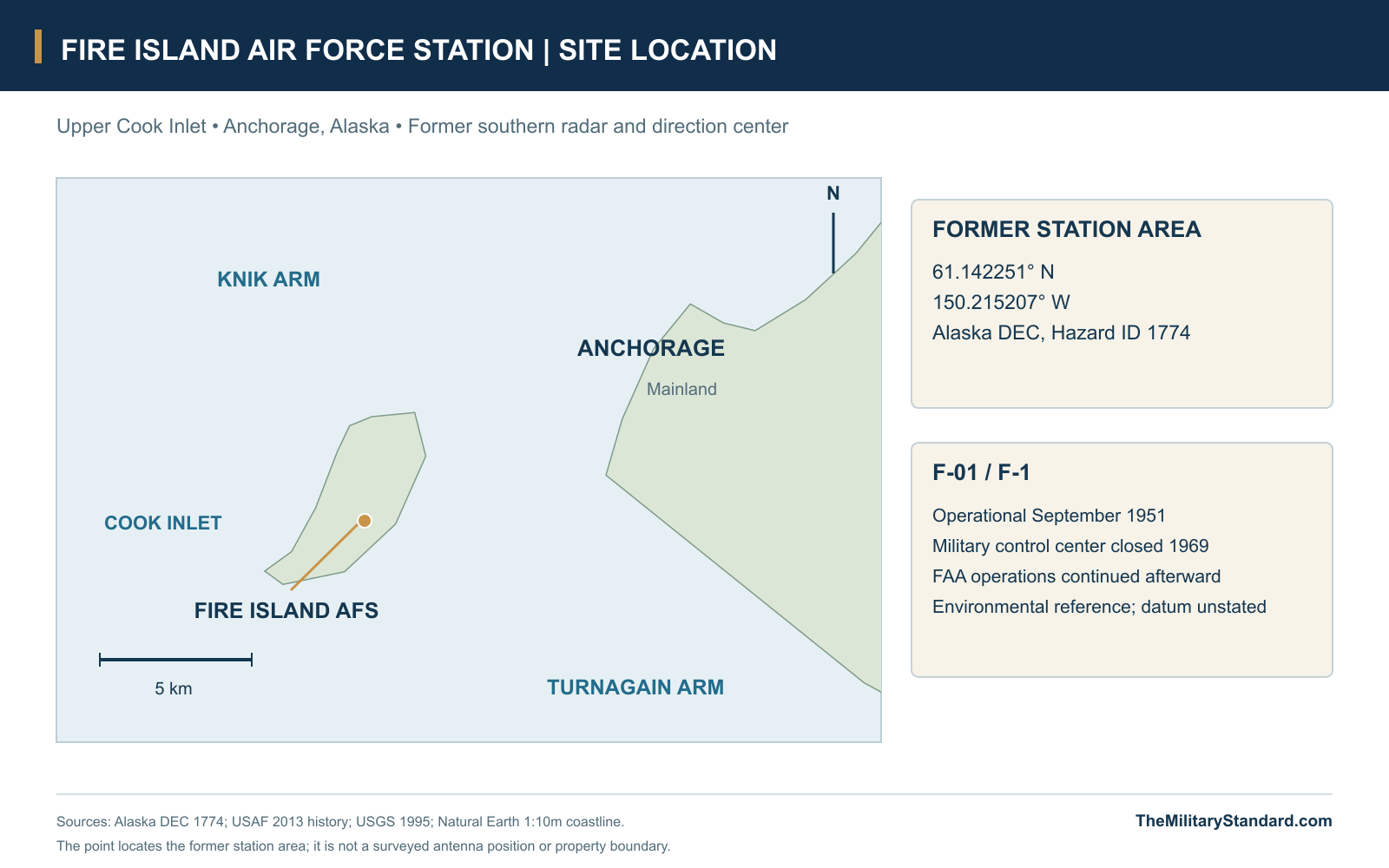
- Fire Island, upper Cook Inlet, west of Anchorage
- Latitude / longitude
- 61.142251, -150.215207; DEC station-area reference, datum unspecified
A Control Center Across Cook Inlet
Fire Island Air Force Station watched the approaches to Anchorage from a wooded hill across Cook Inlet, close enough for its men to see the city but separated from it by difficult water and an isolated tour of duty. Beginning in September 1951, the 626th Aircraft Control and Warning Squadron operated one of Alaska's principal radar and direction centers. The station gathered observations from its own equipment and other warning sites, interpreted the air picture and helped direct the aircraft assigned to defend the region. Its significance lay as much in the people and decisions behind the radar displays as in the domes above the buildings. [1] [2] [3]
Fire Island served the southern part of the early Alaska warning system, while Murphy Dome performed a corresponding northern role near Fairbanks. This arrangement connected coastal surveillance, interior radar stations, command headquarters and interceptor bases in a defense organized around the threat of Soviet bomber attack. The island station later brought Air Force, Army and FAA personnel into the same operating community. Those overlapping responsibilities made Fire Island a place where military warning, local missile defense and civil air-traffic requirements met. [1] [2] [3] [5]
Building the Southern Master Station
The permanent radar network grew out of the weaknesses of Alaska's interim postwar warning system and the urgency created by the Cold War and Korean conflict. Fire Island offered a relatively accessible site near Anchorage and Elmendorf Air Force Base, with a high hill, available groundwater and a position beside the entrance to the two arms of upper Cook Inlet. Construction began in 1950 as part of a larger program of coastal warning stations and inland control sites. Geography made it easier to supply than many remote western posts, although it still required an island transport system of its own. [1] [2]
Pomeroy & Company received the Fire Island construction contract, but labor and technical problems prevented the intended September 1950 occupancy. The installation became operational in September 1951 at a reported cost of $3,485,795. Its wood-frame buildings and covered connections followed the same standardized design used at Murphy Dome, with the arrangement changed to suit the island's terrain. Standardization simplified the building program while allowing each of the two master stations to fit a different landscape. [1] [2]
The station occupied part of a much larger federal land reservation. Public Land Order 639 of April 26, 1950 reserved the island lands for Air Force use, and a 1966 amendment described an approximately 4,240-acre area while permitting compatible mineral leasing. The amendment retained military safeguards, including restrictions on structures and drilling activity. The radar compound itself remained a concentrated hilltop development within that wider reservation, with roads, an airstrip, fuel facilities and utility lines extending its practical footprint. [6] [7] [10]
Buildings, Domes and the Island Support Plant
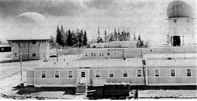
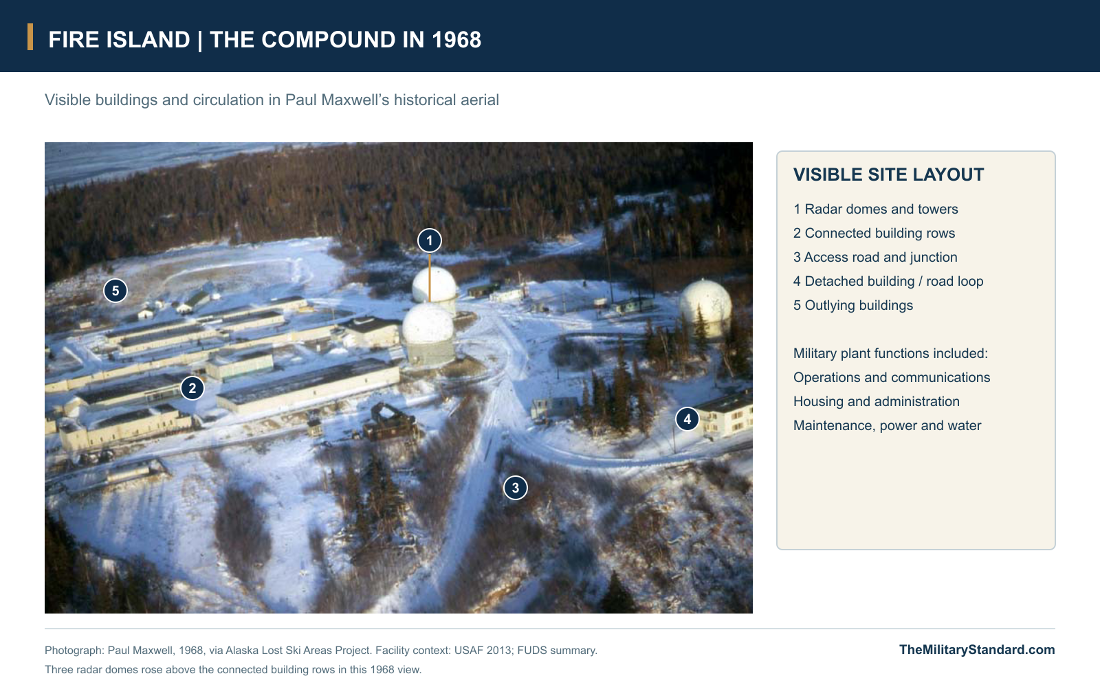
The hilltop complex combined operations, administration, communications, maintenance and accommodation in rows of low buildings joined by covered passageways. Radome towers rose above the compound, while roads connected the developed area with other parts of the island. The federal property summary counted 33 buildings and structures, including the operational plant, dormitory, towers, utilities and airstrip. Historical aerials show how the connected building rows and surrounding road system made a compact working settlement in the forest. [1] [6]
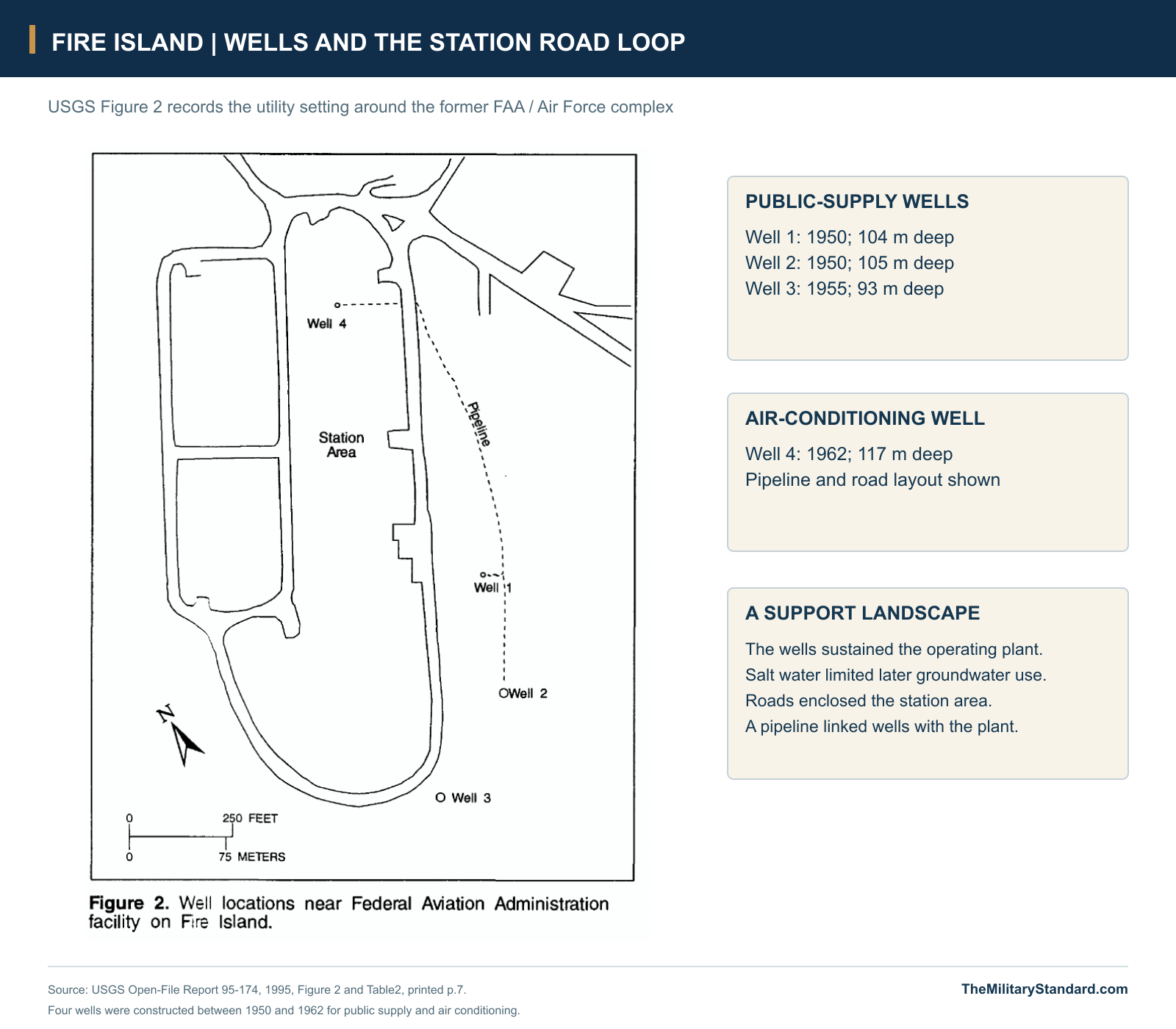
Electricity and water were essential parts of that settlement. The Air Force's 1967 account describes ten electric-power generators and a water-softening plant supplied with salt through the summer resupply program. USGS records identify public-supply wells drilled in 1950 and 1955, plus a fourth well constructed in 1962 for air conditioning. These facilities supported both the electronic equipment and daily life, tying radar availability to the work of mechanics, utility crews, fuel handlers and the rest of the support force. [3] [7]
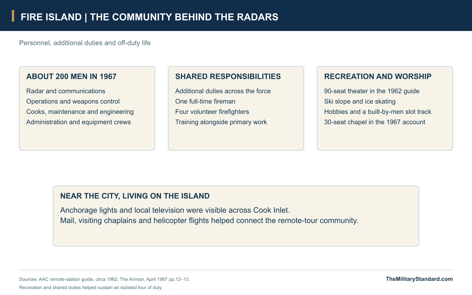
The buildings also had to be protected by the men who used them. In 1967, the station's volunteer fire department consisted of one full-time fireman and four volunteers training in their spare time. The commander expected personnel to carry an additional duty alongside their main specialty, spreading necessary tasks across a limited workforce. For a post of roughly 200 men, that approach joined operations, maintenance and housekeeping into one system: keeping the community functioning was part of keeping the air-defense center on watch. [3]
Search Radar, Height Finding and Electronic Tracks
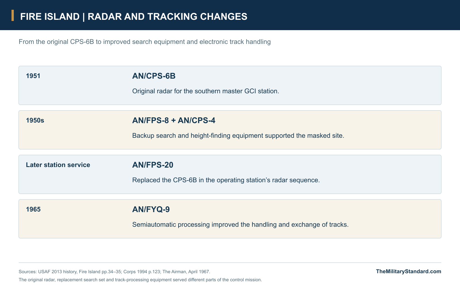
Fire Island opened with the AN/CPS-6B, a large radar installation serving its early control mission. Although the station stood on the island's high ground, the surrounding terrain created masking angles that limited the useful view of a comparatively low-sited sensor. An AN/FPS-8 backup search set and AN/CPS-4 backup height finder helped the operating force work around these limitations. Separate search and height information gave controllers the observations needed to follow aircraft in three dimensions and judge their movements. [1]
Radar modernization unfolded while the station remained in service. NORAD's 1958 history discusses proposed AN/FPS-7 replacements for the CPS-6B sets at Fire Island and Murphy Dome, along with funding delays. The later Fire Island record documents replacement by the AN/FPS-20 instead. Equipment changes thus formed part of a continuing effort to improve detection and control without rebuilding the whole Alaska defense organization at once; the station's mission outlasted its original radar set. [1] [5]
The AN/FYQ-9 data-processing and display system brought a further change in 1965 by giving Alaska a semiautomatic means of handling radar tracks. Fire Island's 1967 Airman feature describes an electronic transmission-and-display system carrying a current air picture among control centers and the regional headquarters at Elmendorf. This reduced reliance on the older laborious reporting and plotting process while retaining the need for operators to interpret the information. The technology connected geographically scattered stations more effectively, rather than making the local battle staff unnecessary. [2] [3]
The Battle Staff and Anchorage Air Defense
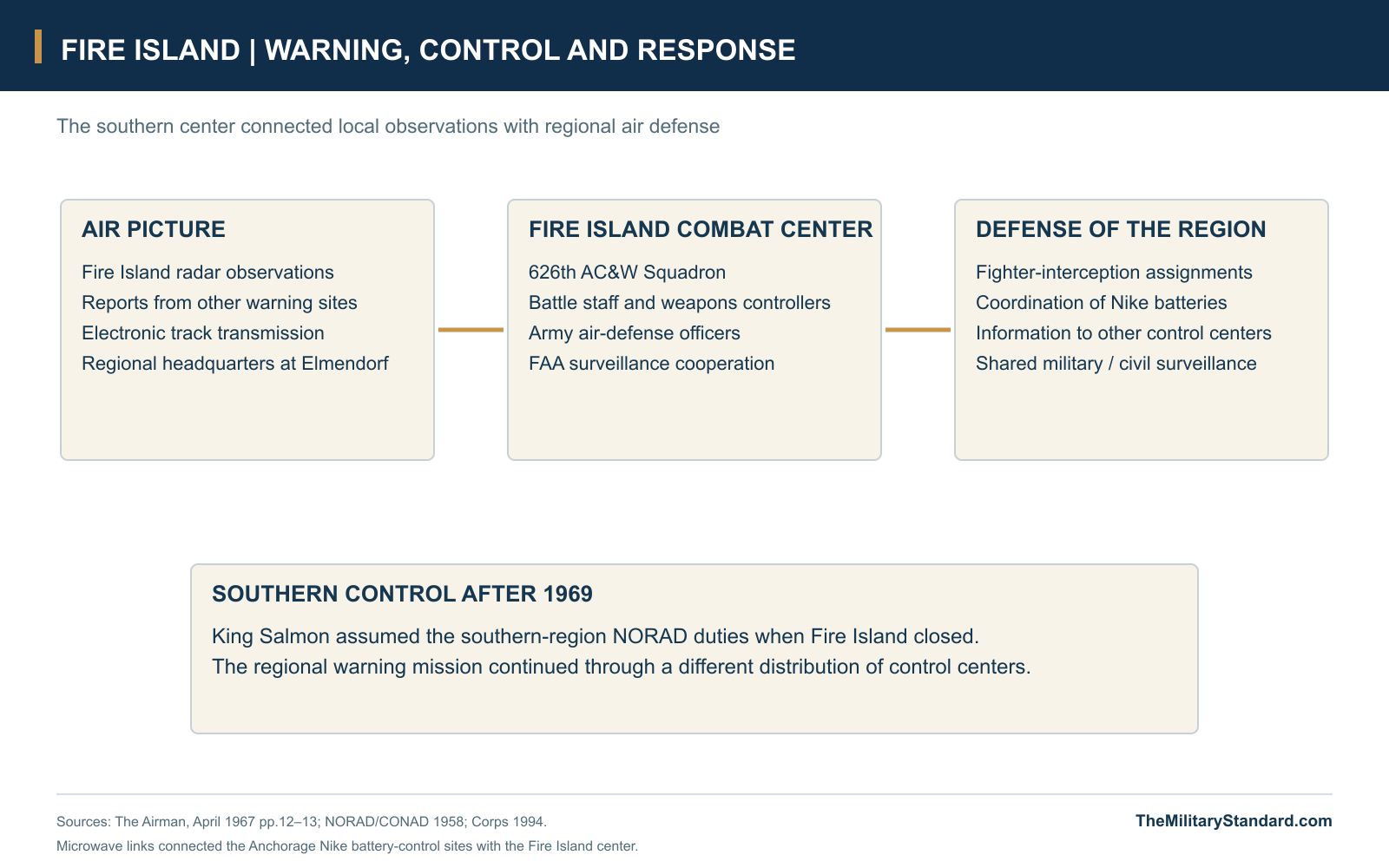
The 626th Squadron operated Fire Island within Alaskan Air Command's changing air-defense organization; the official station history identifies its service under the 10th Air Division. Inside the combat center, personnel kept watch on the air picture and passed information to the organizations responsible for identification and response. The 1967 account describes Air Force weapons controllers assigning interception missions to fighter aircraft. Radar operators, communications specialists and the battle staff therefore formed the link between detecting an aircraft and arranging an airborne response. [1] [3]
Army air-defense officers worked beside their Air Force counterparts because the Anchorage defense combined interceptors with Nike surface-to-air missiles. NORAD approved Fire Island for collocation in October 1957, and the early plans had to resolve compatibility problems between Army and Air Force control equipment. The Army command post coordinated the missile batteries around Anchorage, which were connected to Fire Island by microwave. This was a command-and-control role at the island center, supporting weapons positioned elsewhere around the defense area. [2] [3] [5]
A published Army account gives a late-June 1968 snapshot of 147 Air Force personnel and 16 civilians at Fire Island, plus 21 Army personnel staffing the air-defense command post. The Army contingent included four officers and seventeen enlisted men. These figures describe the post near the end of its military service, when a single island community supported several distinct operating responsibilities. The mix of services and civilians helps explain why the center mattered beyond the 626th Squadron's own radar equipment. [12]
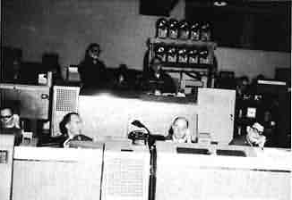
FAA Operations Within the Military Station
The FAA shared the site with the Air Force by 1961, and the 1967 feature describes one of the island's three surveillance radars as FAA-maintained for air-traffic control. The Air Force squadron provided support for the civil operation as well as carrying out its military mission. Civil controllers and military personnel could draw on related surveillance infrastructure while serving different purposes. This joint occupancy made the later civilian phase possible without requiring the island's useful aviation functions to end with the military squadron. [1] [3]
Navigation and communications facilities developed alongside the main radar station. DEC's station history records a VOR built on Air Force land in 1956, a remote communications air/ground facility added in 1964 and TACAN equipment in 1966. The combined VORTAC continued at its original location after the large staffed radar installation declined. The history of Fire Island consequently includes both a former combat-control center and a smaller continuing aviation-support presence, with different buildings and operating requirements. [9]
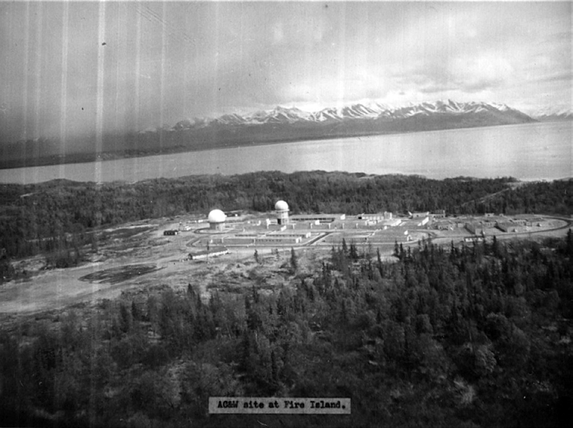
Barges, Helicopters and the 1964 Earthquake
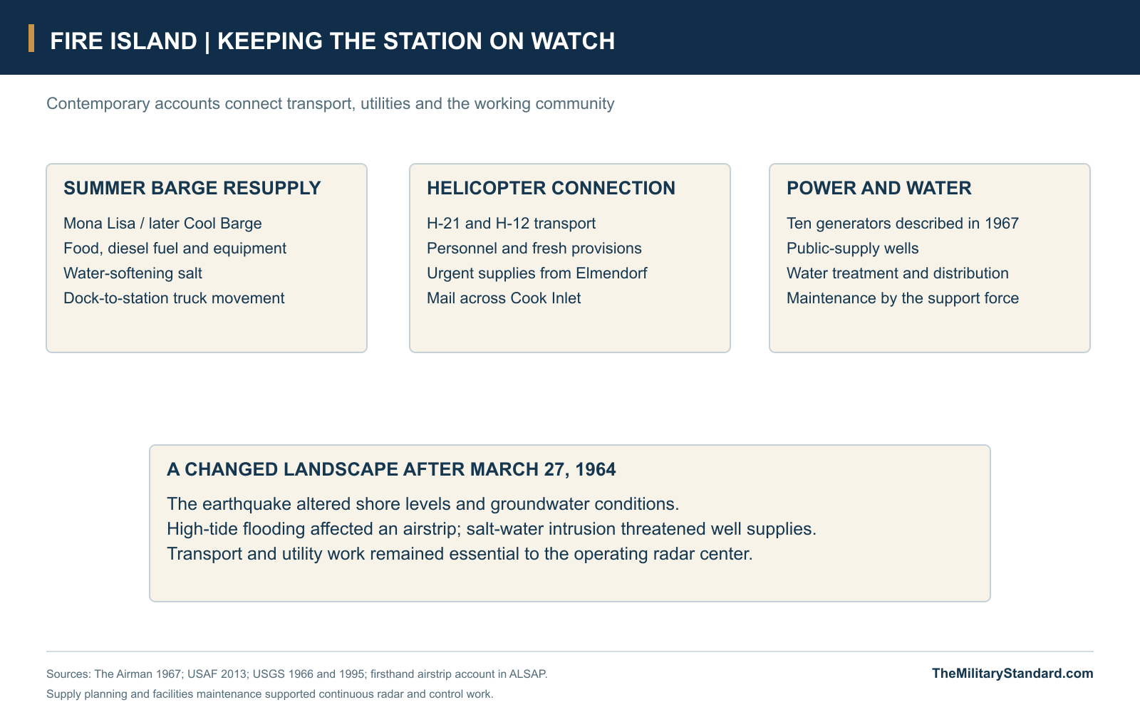
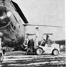
Fire Island's proximity to Anchorage did not make ordinary movement simple. Annual Mona Lisa resupply, later known as Cool Barge, brought nonperishable food, diesel fuel, heavy equipment and treatment salt to the island by barge. The cargo was unloaded at a dock about three miles from the radar plant and moved onward by truck. Such deliveries sustained the fixed plant for long periods, while fresh food, urgent requirements and personnel depended heavily on air transport from Elmendorf. [1] [3]
The 1967 Air Force account identifies H-21 and H-12 helicopters as the principal means of military travel and perishable resupply. The flights also carried mail, a particularly valued connection during a remote tour. An earlier station guide advertised daily mail and the ability to receive Anchorage television, reminders of how close the city remained in practical and emotional terms. Helicopter access nevertheless depended on weather and available aircraft, so the station could feel remote even with city lights visible across the inlet. [3] [4]
The March 27, 1964 earthquake changed the island's shore and groundwater conditions. Accounts describe an airstrip rendered unusable by high-tide flooding after subsidence, while USGS found that land-level lowering and changed groundwater pressure could worsen salt-water intrusion into island wells. The problem connected a major regional disaster to the mundane necessities of transport and drinking water. The radar station continued operating, but its support landscape had been altered by the same event that devastated parts of Anchorage. [8] [11]
A Working Community Beyond the Watch Floor
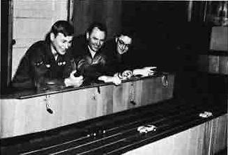
The remote tour required ways to occupy time outside the operations center. Fire Island offered a theater, hobby activities, indoor and outdoor sport, skiing, skating and a slot-car track built by the men themselves. The 1962 station guide listed a 90-seat theater, an archery range and boats for summer use on island lakes. The Airman feature later described the importance of recreation to morale, along with a 30-seat chapel visited by military chaplains, priests and civilian missionaries. [3] [4]
The ski hill was one of the clearest examples of personnel creating their own recreation. Dave Gross, stationed at Fire Island in 1965-1966, recalled volunteers completing the rope tow, tow shed and warming cabin before the autumn snow in 1965. Civil-engineering heavy-equipment personnel guided the work, using station equipment and materials to build a facility for their neighbors. The slope and cabin gave off-duty life a recognizable local center, complementing the organized work of the radar station. [11]
The 1969 Drawdown and the Civilian Afterlife
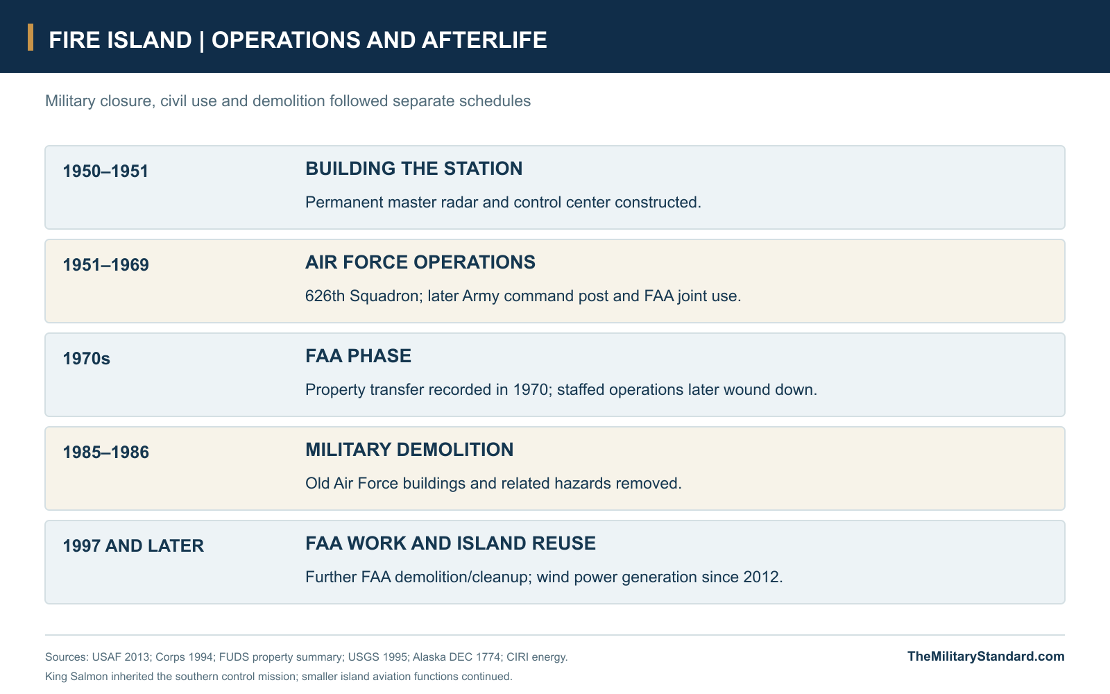
Military economies brought Fire Island's control-center era to an end in 1969, alongside reductions at other Alaska warning stations and the Aleutian DEW extension. King Salmon took over the southern-region NORAD duties, and the 626th Squadron was inactivated. The Fire Island regional operations center was declared excess on July 28. This was a redistribution of surveillance and control responsibilities across Alaska, with the island center closing while the wider defense system continued. [1] [2] [6]
The official station history records a property transfer to the FAA in 1970, followed by the winding down of the staffed civil operation toward the end of the decade. Smaller navigation functions survived the decline of the main compound. Air Force demolition and restoration followed in 1985-1986, removing the old military plant while leaving useful FAA facilities outside that demolition program. By the time of the USGS study in 1995, the former station's much smaller aviation-support role was clearly different from its earlier combat-control mission. [1] [6] [7]
Later work addressed individual FAA buildings, tanks and pipelines. DEC records major demolition in 1997 and cleanup decisions in 2014 and 2016, while identifying retained FAA interests around navigation facilities and other specified areas. Its historical account also records substantial land conveyance to CIRI. The island's later development included the Fire Island Wind project, which has supplied power since 2012; the developer identifies eleven turbines and 17.6 megawatts of generating capacity under a long-term relationship with Chugach Electric. [9] [13]
What Fire Island Changed
Fire Island's military importance came from combining a regional picture with local decisions. Its domes and electronics provided observations, but the station's greater contribution was the organization that connected warning sites, the regional headquarters, fighter controllers, Army missile defense and FAA users. The support force made that continuous work possible through power generation, water treatment, communications, maintenance and transport. The visible compound was one part of a larger system of people and installations defending the Anchorage region. [1] [2] [3]
The 1969 closure removed a major staffed control center without ending Alaska's air-defense mission, and the later demolition erased most of its physical form. Historical photographs preserve the connected barracks, radar towers, watch floor and recreation facilities of a community that once stood in clear view of Anchorage. Together they show how an apparently nearby post could still demand an isolated way of life, and how a compact island station helped manage a defense extending far beyond Cook Inlet. [1] [2] [3] [7]
Chronology
- 1950 Construction begins for the southern master radar station on Fire Island. [1] [2]
- April 26, 1950 Public Land Order 639 reserves island lands for Air Force use. [10]
- September 1951 Fire Island becomes operational as a master ground-controlled-interception station. [1] [2]
- 1956 The FAA establishes a VOR on Air Force land. [9]
- October 16, 1957 NORAD approves Fire Island for Army/Air Force control-center collocation. [5]
- July 1958 The NORAD equipment appendix lists F-1 and the 626th Squadron as a direction center. [5]
- By 1961 Air Force and FAA jointly occupy the station; later records describe AN/FPS-20 radar replacing the CPS-6B. [1]
- March 27, 1964 The Alaska earthquake changes island shore and groundwater conditions. [8] [11]
- 1964 A remote communications air/ground facility is added. [9]
- 1965 The AN/FYQ-9 introduces semiautomatic radar-track processing in the Alaska system. [2]
- Autumn 1965 Volunteers complete the ski tow, tow shed and warming cabin. [11]
- 1966 TACAN is added to the FAA navigation facilities. [9]
- April 1967 The Airman publishes a detailed account of the combat center and station community. [3]
- June 1968 The published staffing snapshot records Air Force, civilian and Army command-post personnel. [12]
- 1969 The military control center closes and southern-region NORAD duties pass to King Salmon. [1] [2]
- July 28, 1969 The Fire Island regional operations center is declared excess. [6]
- 1970 The official station history records transfer of the property to the FAA. [1]
- 1985-1986 The Air Force demolishes and restores the former military installation. [2] [6] [7]
- 1997 Further demolition removes specified FAA buildings and associated facilities. [9]
- 2012 Fire Island Wind begins supplying electricity from the island. [13]
- 2014 and 2016 DEC issues cleanup determinations for the specified FAA station areas. [9]
Related Sites
Information sources (14)
- PDFU.S. Air Force, History of the Aircraft Control and Warning System in Alaska: Air Defense of Arctic Skies, Argonne National Laboratory 2002, updated CEMML 2013
Construction contractor and cost, September 1951 opening, standardized buildings, 626th ACWS, radar masking and equipment sequence, resupply, FAA occupancy and later disposition. Printed pages 15-18, 28 and 34-35.
- PDFU.S. Army Corps of Engineers, D. Colt Denfeld, The Cold War in Alaska: A Management Plan for Cultural Resources, 1994
Southern control-center purpose, construction/design, 1965 semiautomatic system, 1969 reductions and King Salmon succession, Nike microwave links and 1985 demolition. Printed pages 21, 121-123, 153-154 and 270.
- WEBU.S. Air Force, SSgt. Stan McDonnough, Those Lights Are a Year Away!, The Airman, April 1967, pages 12-13
Contemporary description of Fire Island control operations, Army/FAA cooperation, roughly 200 personnel, additional duties, ten generators, water-softening salt, H-21/H-12 transport, Mona Lisa resupply, fire department and recreation. Two original page scans preserved in references; page 13 linked from the source gallery.
- WEBAlaskan Air Command, Fire Island Next Door to Anchorage, remote-station guide, circa 1962
Original island location plan and complex photograph; daily mail, television reception, 90-seat theater, skiing, skating, archery and summer boats. Source scan preserved under its original filename.
- PDFHeadquarters NORAD/CONAD, Historical Summary, January-June 1958
1957 approval of Army/Air Force collocation at Fire Island, equipment compatibility issues, proposed FPS-7 replacements and July 1958 appendix identifying F-1/626th as a direction center. PDF pages 41, 64 and 149.
- WEBU.S. Army Corps of Engineers, Fire Island Air Force Station FUDS property summary, F10AK0495, reproduced by Online Air Defense Radar Museum
Thirty-three buildings/structures, separate historic land interests, July 28, 1969 excess declaration and 1986 restoration report. Separate land-order text is listed below.
- PDFU.S. Geological Survey, Allan S. Nakanishi, Overview of Environmental and Hydrogeologic Conditions on Fire Island, Anchorage, Alaska, Open-File Report 95-174, 1995
Original island and well/pipeline maps, four Air Force wells, salt-water limitations, 1985-1986 demolition/restoration and continuing FAA navigation use. Figures 1-2 and printed pages 1-9.
- PDFU.S. Geological Survey, Roger M. Waller, Effects of the March 1964 Alaska Earthquake on the Hydrology of the Anchorage Area, Professional Paper 544-B, 1966
Approximately 3.7-foot land-level lowering, changed groundwater conditions and possible acceleration of salt-water encroachment at Fire Island wells. Printed pages B1 and B12-B13.
- WEBAlaska Department of Environmental Conservation, FAA Fire Island Station, Hazard ID 1774
Published former-station environmental reference 61.142251/-150.215207 with datum unspecified; FAA facilities, retained land interests, 1997 demolition, 2014 and 2016 cleanup decisions. Current record checked November 6, 2026.
- PDFU.S. Department of the Interior, Public Land Order 3920, January 20, 1966, Federal Register January 26, 1966
Original amendment to PLO 639 of April 26, 1950; approximately 4,240-acre described island area, mineral-leasing compatibility and military height restrictions. PDF page 13.
- WEBAlaska Lost Ski Areas Project, Fire Island AFS Ski Area, firsthand accounts and photograph collection
Dave Gross's account of the volunteer-built 1965 rope tow/cabin; named contributors and dated 1959-1968 station, ski and helicopter photographs. Paul Maxwell's 1968 aerial used for the annotated visible-layout view.
- WEBNike Alaska, The Last Alaskan Nike-Hercules AADCP, Fire Island section
Army command-post function, 1968 staffing breakdown, 1969 transition toward Site Point and historical Fire Island photographs. Contributor-based account checked against contemporary Air Force and NORAD records.
- WEBCIRI, Energy: Fire Island Wind
Current developer description of the island's later energy use: wind generation since 2012, eleven turbines, 17.6 MW and Chugach Electric power-purchase relationship. Checked November 6, 2026.
- WEBNatural Earth, 1:10m Admin 0 Countries
Public-domain shoreline geometry for the separate Cook Inlet location diagram; site reference comes from Alaska DEC source 9.