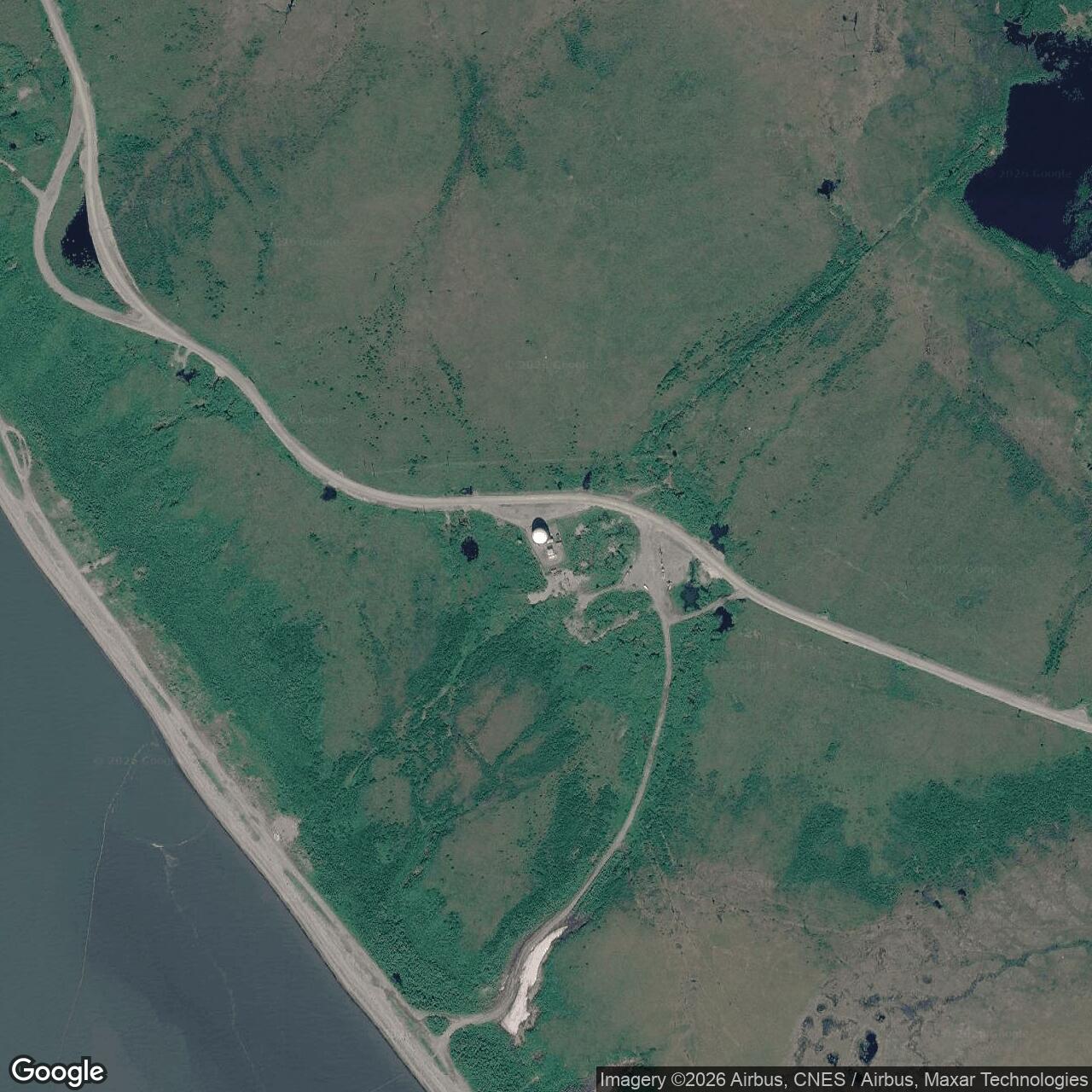
Kotzebue Air Force Station / Kotzebue Long Range Radar Site, Alaska
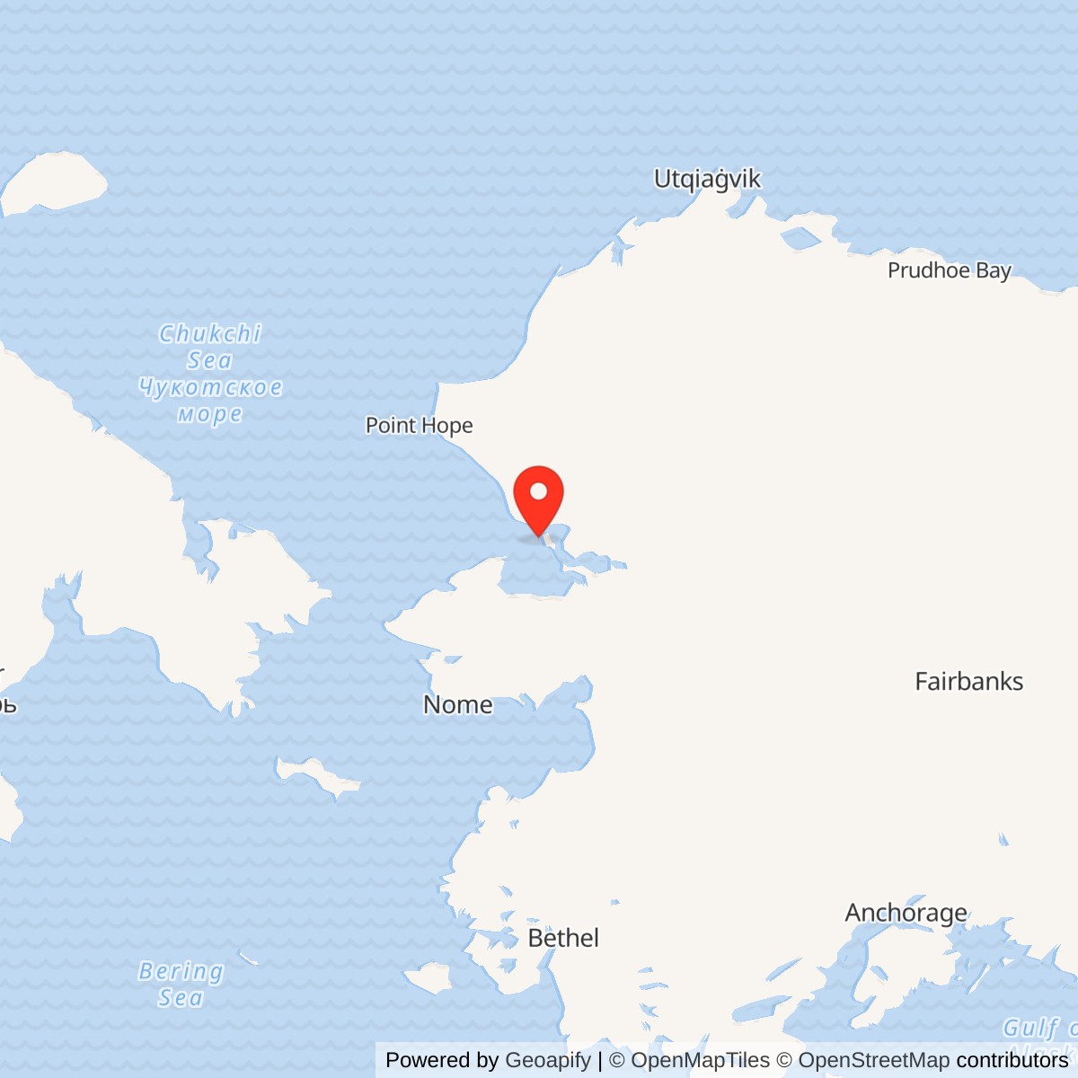
Longitude: -162.5955
Site Number: F-24; A-12
Official Base Website: Kotzebue Long Range Radar Site
Current Role: Active Alaska Radar System Long Range Radar Site / minimally attended AN/FPS-117 radar in available official record; most staffed-era buildings demolished. ST005/SS002 long-term monitoring and controls continue. Current staffing and exact equipment revision not independently verified.
- Historic unit
- 748th Aircraft Control and Warning Squadron
- Temporary radar began
- 1950
- Permanent GCI station
- February 1958
- Staffed phase ended
- 1983; radar operation continued
- Later radar
- AN/FPS-117 operational 9 June 1984
- Approximate radar-site point
- 66.84317 N, 162.59550 W; not a surveyed antenna or property centroid
- Historic survey area
- 676-acre U.S. Survey 10393 Lot 1 in a 2013 state report; not a verified current operating footprint
Identity, Location and Land
Kotzebue Air Force Station began as a temporary aircraft-control-and-warning radar outpost in 1950, became a permanent ground-control-intercept station in 1958, and continued after the staffed squadron era as Kotzebue Long Range Radar Site. The historic radar-network identifier F-24 and later Alaska Radar System identifier A-12 name phases of the same continuing radar installation, not two unrelated stations. It is on the Baldwin Peninsula south of the community of Kotzebue, facing Kotzebue Sound. The installation's setting mattered to its mission: relatively low coastal ground limited the radar horizon, while wet tundra, a narrow summer shipping season and Arctic weather made reliable roads, power, fuel and communications part of the air-defense system itself. [1] [2] [3]
Location and acreage need careful labels here. A specialist radar-site location near 66.84317 N, 162.59550 W is useful as an approximate installation/radar-vicinity point, not a surveyed antenna pedestal or legal parcel centroid. Alaska DEC publishes different points for individual contaminated areas, including ST005 at 66.842611 N, 162.602500 W; those environmental markers must not be treated as radar coordinates. A 2013 state cultural survey identifies a 676-acre U.S. Survey 10393 Lot 1 Air Force installation; a 2001 BLM conveyance scenario reported approximately 508 acres then withdrawn and an original 1,115-acre reserve encompassing radar and White Alice interests. These figures describe different boundaries and dates. The 676 acres is a documented historic surveyed lot, not a verified 2026 operating footprint. [2] [4] [5]
The Temporary Radar, 1948-1954
Alaskan Air Command selected Kotzebue in 1948 to close a radar gap while permanent coverage at Cape Lisburne and Tin City was being built. A lightweight search radar became operational in 1950, placing warning capability on the northwest coast before the larger Kotzebue plant existed. The temporary installation already required personnel shelter and communications, so the word temporary describes the Air Force's original network plan, not a radar operated without supporting infrastructure. The record does not establish a secure model designation or a day-level 1950 opening date for that first radar. The decision to retain and rebuild Kotzebue was made in November 1954 in the Alaska historic study; a state highway survey more generally places that decision in 1955, the year construction began. These statements concern decision and construction milestones, not conflicting operational openings. [1] [2] [6]
The strategic rationale changed as the Alaska warning chain matured. Kotzebue was no longer merely an interim substitute for radar farther north; it could also direct fighter interception across the northern sector. Its location was close enough to the Kotzebue community and airfield to support regular travel, but separated from both by several miles of tundra and installation road. The permanent design concentrated radar, operations, communications and support in one camp instead of a mountaintop/lower-camp arrangement like some other Alaska stations. This meant an observer could mistake the radomes, White Alice equipment and former barracks as a single undifferentiated station. They served related but distinct purposes: detection and height finding, control and reporting, communications relay, and the logistics needed to keep those functions running. [1] [2]
Building the Permanent Station
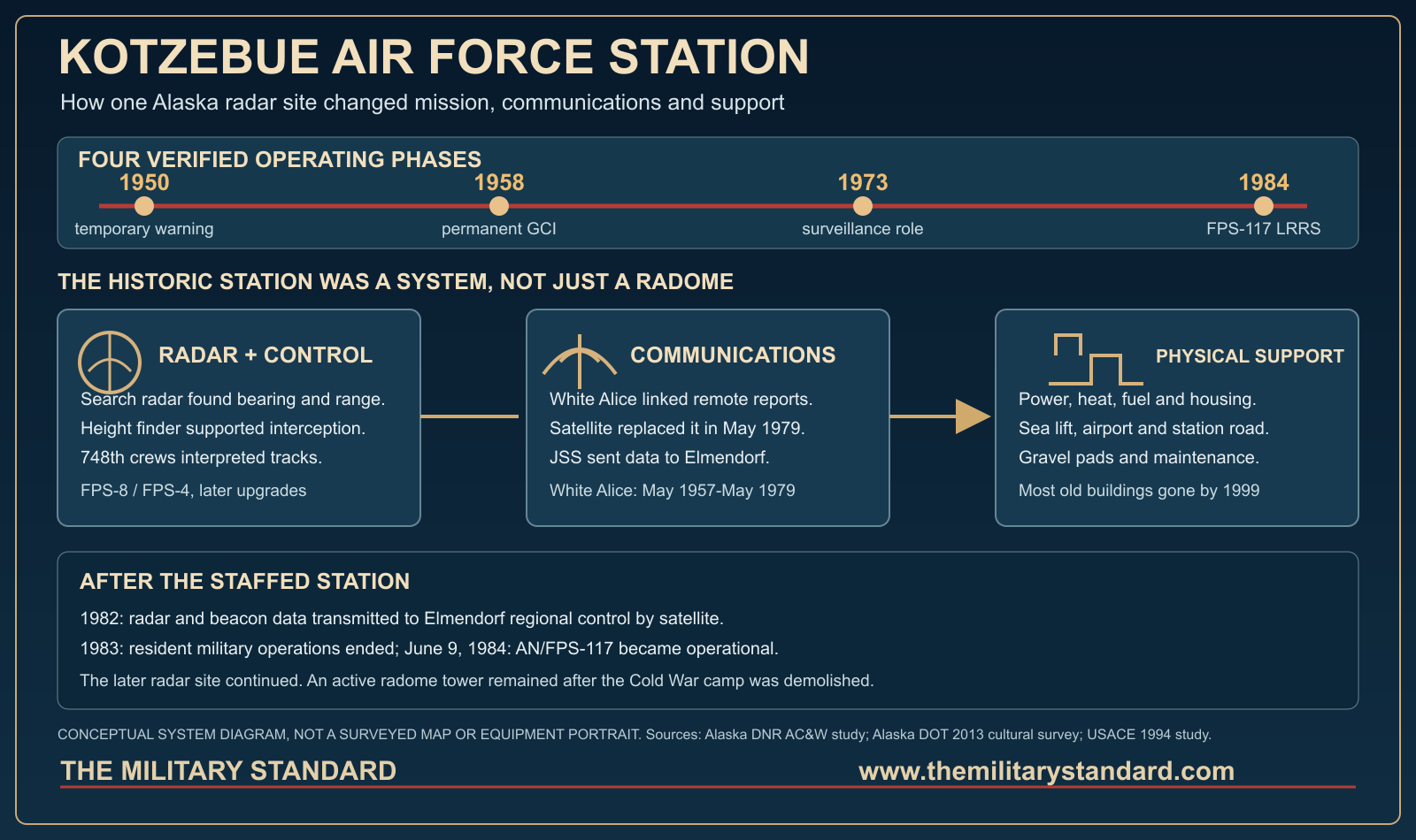
The Manson-Osberg Company of Seattle began construction in June 1955 under a contract reported by the Alaska historic study at $4,949,111. Labor disputes and delayed material deliveries pushed completion into 1958. The permanent station began operational ground-control-intercept work in February 1958, after the temporary radar had already supplied warning for about eight years. This chronology avoids the common error of calling 1958 the first use of the site. An Air Force unit chronology reproduced in another squadron's historical record dates activation of the 748th Aircraft Control and Warning Squadron to 8 January 1957, before the permanent plant's operational opening. Other retrospective summaries give April 1958 for its local station role. Activation of a unit, occupation of a new plant, and beginning GCI operations should not be silently collapsed into one date. [1] [2] [7]
The 748th became the principal unit operating the station. Its radar crews watched the search display, determined height with a separate finder, worked tracks and passed information to the regional command chain. At a GCI station, controllers could use those tracks to guide interceptors launched from forward operating bases such as Galena or King Salmon. The site itself was not an interceptor airfield. The Air Force also chose Kotzebue for Tactical Air Control and Navigation equipment in 1954, and a TACAN tower survived without major improvements until 1999 demolition. This navigation function supported aviation in the wider network but was not the station's principal radar mission. The reviewed sources do not provide a complete month-by-month succession of commanders, unit strengths or every small tenant detachment. [1] [2]
Radar Equipment and Operating Method
The permanent installation replaced the initial lightweight search set with AN/FPS-8 search and AN/FPS-4 height-finder radars. The Alaska state study records an AN/FPS-6 height-finder upgrade in 1962 and AN/FPS-20 search radar in 1963. A specialist station table instead gives 1965 for the FPS-20, so the exact acceptance date remains unresolved and the 1963 state-history date is used with that qualification. The historical equipment list also associates AN/FPS-87A and a later AN/FPS-93-family search configuration with Kotzebue, but the official historic narrative does not independently establish the dates or exact configuration for each of those intermediate designations. [1] [8]
The difference between search and height-finding equipment is essential to understanding Kotzebue's early mission. A long-range search radar supplied bearing and distance; a height finder helped controllers estimate the altitude needed to vector a fighter. Operators initially had to interpret returns and transmit plots by voice or other manual means. In 1965, the AN/FYQ-9 semiautomatic data-processing and display system entered the Alaska AC&W system and reduced the amount of manual reporting needed to move track information toward control centers. AN/FYQ-9 was not another radar dish. Technical improvements changed the speed and reliability of the warning chain, but they did not immediately remove Kotzebue's staffed operating mission. [1] [2]
Role in the Wider Military Network
Kotzebue fitted between the Arctic/coastal warning sites and the interceptor bases in the Alaskan and NORAD defensive system. During the temporary phase it bridged the gap before Cape Lisburne and Tin City reached full coverage. During the permanent GCI phase it could help direct fighters based elsewhere. Later it functioned primarily as a surveillance sensor feeding a separate northern-sector direction center. A 1985 Air Force history summarized in DEC's site record says the GCI role ended in 1973 and Kotzebue became a NORAD surveillance station. This was a shift in where the control decision was made, not a cessation of radar operations. Campion and Murphy Dome also changed roles in the northern sector during this period, illustrating that a site's job depended on the design of the regional network. [1] [2] [6]
In the early system, communication links were as important as the radar sets because a track that did not reach controllers could not support an interception. The White Alice Communications System installed a Kotzebue station that began service in May 1957. Its tropospheric-scatter equipment provided a long-distance path through a network linking remote defense facilities. When White Alice ended at Kotzebue in May 1979, a commercially owned and operated satellite communications system took over its role. [1] [2] [4]
Life and Logistics at Kotzebue
The original camp included radar and communications facilities along with housing and work spaces. The documented historic-building inventory later recorded supply warehouses, a composite dormitory, waste-treatment works, a fuel pump station, power generation, radar towers, a gymnasium, roads and gravel pads. Those buildings were not decorative additions to a radar platform. Heating and electrical generation had to continue through cold weather; fuel had to be delivered, stored and pumped; specialists needed sheltered workplaces and places to sleep; and the station road tied the installation to the surrounding community and transport system. The 2013 cultural survey describes a generally rectangular gravel-pad system about 560 by 460 feet and an Air Force Road of roughly 21,630 feet in the historic-resource inventory, while warning that later construction had altered the road. These are recorded resource dimensions, not a surveyed present-day property plan. [2]
In the earliest years supplies could be airdropped. Sealift later brought bulk material through the short open-water season, while air transport moved people, perishables and critical cargo through Kotzebue Airport. The airport supported the station but was not identical to the radar property. This division of transport explains the large beach fuel-tank and distribution system that later became a major environmental concern. A delayed barge was not merely a supply inconvenience; it could constrain generator fuel, heat or maintenance during the following winter. The later minimally attended model reduced on-site lodging needs, and a 2013 state survey reports that maintenance staff then lived in the city of Kotzebue. That 2013 observation should not be read as proof of an unchanged 2026 staffing arrangement. [1] [2]
Contract Support and Automation, 1973-1984
The Air Force's 1977 support contract with RCA Services removed 69 military positions at Kotzebue according to the Alaska historic study. Military personnel remained chiefly in operations while contractors took over more support and maintenance duties. The change responded to the expense of sustaining isolated staffed stations, but Kotzebue still contributed radar data to the air-defense network. A Joint Surveillance System digitizer was complete by 1982 and enabled radar and beacon data to be transmitted by satellite to the Regional Operations Control Center at Elmendorf. The regional center was operational in 1983, allowing the Air Force to withdraw military crews from remote AC&W locations and end the 748th's resident squadron phase. These were successive changes in staffing and data handling, not evidence that the physical station ceased all military function. [1] [2] [9]
The older search and height-finder plant gave way to the AN/FPS-117 minimally attended radar. The Army Corps of Engineers' 1994 Cold War management study gives Kotzebue installation in April-June 1984 and operational status on 9 June 1984. The 2013 Alaska highway cultural survey also states that the minimally attended radar upgrade occurred in June 1984. These dated official records are more specific than some derivative accounts that assign the new radar to 1983. The phrase 1983 transition refers to remote operations and withdrawal of the military garrison; June 1984 refers to the new AN/FPS-117 becoming operational. The later A-12 LRRS designation thus belongs to a continuing sensor site with a fundamentally smaller local work force and a remote control relationship. [2] [3]
Property Change and Historic Preservation
Withdrawal of the squadron left many Cold War-era buildings unused. The Air Force and state preservation authorities documented their significance before demolition. A 1997 memorandum of agreement called for Historic American Buildings Survey Level 3 documentation; the White Alice buildings were removed in 1996 and most of the AC&W/LRRS buildings in 1999 during environmental restoration. The 2013 survey identifies the surviving Radome Tower Building, AHRS KTZ-00190, as individually eligible for National Register listing and still operating at the time of the 2012 survey. It also identifies the surviving road and gravel-pad systems, although it discusses whether their historic integrity remained sufficient after alteration and loss of the associated buildings. Eligibility, nomination and actual listing are different statuses: the White Alice historic district was determined eligible but the study said it had not been listed. [2]
The 2013 survey described U.S. Survey 10393 Lot 1 as 676 acres and said most of it had been selected by Kikiktagruk Inupiat Corporation, with a 400-by-400-foot area around buildings then in Air Force use excluded from that selection. At that time, the selected acreage had not yet been conveyed. DEC also reproduces a 2001 BLM account of approximately 508 acres then withdrawn and an original 1,115-acre reserve. A separate BLM 2024 notice discussed a Kotzebue village surface-estate conveyance, but the public notice excerpt does not establish that the specific radar parcel transferred. Consequently, current parcel-by-parcel title, access rights and any final relinquishment cannot be stated as settled here. [2] [4] [10]
Environmental Record
An Air Force installation-restoration visit in 1985 observed diesel-stained soil behind the power plant and petroleum evidence in drainage near Kotzebue Sound. Later investigation identified multiple source areas including former fuel storage, landfills, spills and building pads. ST005, the beach tank area, held three large aboveground diesel tanks and a water tank; DEC records the removal of fuel tanks in 1992 and the water tank in 1998. Its concern is not the mere existence of former tanks but petroleum remaining in soil and groundwater close to the coast. SS002 is the former waste-accumulation/landfill area. Other documented areas involved a former power plant/garage, a water-supply lake, PCB spills and a truck-fill stand. Each is a subsite of the same installation and should not be turned into a new base identity. [5] [6]
Cleanup involved investigation, excavation and decisions for different source areas, not one installation-wide closure certificate. DEC's current ST005 record describes long-term monitoring and institutional/land-use controls, including restrictions on disturbance and off-site soil transport. It records approval of a 2025 long-term-management report in March 2026, followed in April 2026 by unresolved comments on a proposed notice of activity and use limitations. A 2021 work-plan entry also flagged increasing recreation on parts of the property as a potential challenge for controls. These records establish continuing environmental stewardship and potential exposure-management needs; they do not prove that every historic structure or every acre remains contaminated. They also do not make public recreation equivalent to general access to the operational radar. [5] [6]
Current Condition and Evidence Limits
Kotzebue remains identified by the Air Force as one of Alaska's long-range radar sites. Its staffed GCI barracks, most older radomes, White Alice plant and TACAN tower are gone; the 2012 state survey documented the operating radome tower and remnants of the old road and gravel pad. A 1989 Defense Department photograph records the then-current sign and radar installation, while a 1974 aerial and 1993 building photograph appear in the 2013 state cultural survey. Those images are useful controls for any future reconstruction, but a 1974 arrangement should not be represented as the 1984 AN/FPS-117 layout. The current radar's exact equipment revision, staffing contract and land title require fresh operator and land-record confirmation before being stated more narrowly than the published sources allow. [2] [9] [11]
The enduring story of Kotzebue is more than a change in radar model. A temporary stopgap acquired a permanent GCI role, then became a regional surveillance input as control migrated elsewhere, and finally continued as a remotely supported sensor after the local squadron withdrew. White Alice and later satellite communications connected each phase to the regional system. Roads, pads, tanks and a protected radome made that abstract network work in a specific Arctic landscape. The same physical systems also created a long preservation and cleanup legacy, with an active radar embedded in a much larger former military property whose ownership and land-use controls cannot be summarized by a single uncomplicated acreage number. [1] [2] [3] [5]
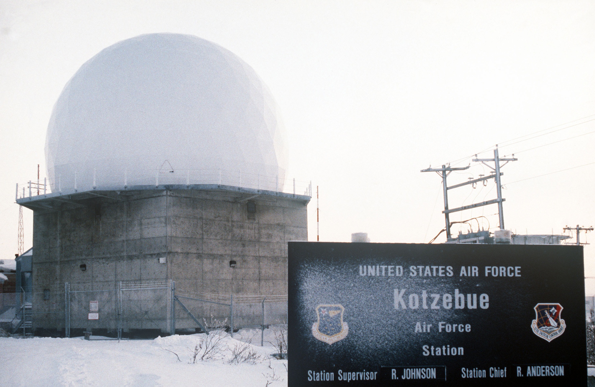
Additional historic views: 1974 aerial, 1993 building view and 2012 site photographs in the Alaska DOT cultural survey. Original photograph and reuse record.

Chronology
- 1948 Alaskan Air Command selects a temporary Kotzebue radar position to bridge coverage before Cape Lisburne and Tin City are completed. [1]
- 1950 Lightweight search radar begins temporary AC&W operation; the exact opening day and radar model remain unverified. [1] [5]
- 1953-02-03 Public Land Order 883 withdraws land for Air Force use according to the BLM conveyance account reproduced by DEC. [4]
- 1954 Air Force selects Kotzebue for TACAN service. [1]
- 1954-11 Alaska historic study dates the decision to make Kotzebue a permanent AC&W installation. [1]
- 1955-06 Manson-Osberg begins construction of the permanent plant. [1]
- 1957-01-08 AFHRA-derived squadron compilation lists activation of the 748th AC&W Squadron. [7]
- 1957-05 Kotzebue White Alice communications service begins. [1] [2]
- 1958-02 Permanent Kotzebue station becomes operational for GCI. [2]
- 1958 Permanent construction reaches completion after labor and delivery delays. [1] [5]
- 1962 AN/FPS-6 height finder is installed according to the Alaska historic study. [1]
- 1963 Alaska historic study dates the AN/FPS-20 search upgrade; a specialist table gives 1965 instead. [1] [8]
- 1965 AN/FYQ-9 semiautomatic data processing enters the Alaska AC&W system. [1]
- 1973 Kotzebue shifts from GCI to northern-sector surveillance reporting. [5]
- 1974-06 Later state cultural survey preserves an aerial photograph of the operating Cold War complex. [2]
- 1977 RCA installation-support contract removes 69 military positions at Kotzebue. [1]
- 1979-05 White Alice service ends and commercial satellite communications replace it. [1] [2]
- 1982 JSS equipment permits satellite transmission of radar and beacon data toward Elmendorf ROCC. [1] [2]
- 1983 Remote-control transition permits withdrawal of resident military operations and ends the 748th staffed phase. [1] [2]
- 1984-04 to 1984-06 Army Corps study dates AN/FPS-117 installation interval. [3]
- 1984-06-09 Army Corps study dates the new AN/FPS-117's operational status. [3]
- 1985-12-30 Air Force installation-restoration visit records petroleum evidence near the power plant. [5]
- 1992 Three former beach diesel tanks are removed. [5]
- 1996 Former Kotzebue White Alice buildings are demolished after cultural-resource documentation. [2]
- 1997-10 Memorandum of agreement requires HABS Level 3 documentation of affected Cold War resources. [2]
- 1998 Former beach water tank is removed. [5]
- 1999 Most remaining staffed-era AC&W/LRRS buildings and the TACAN tower are demolished; radar tower remains. [1] [2]
- 2012 State cultural survey documents active radome tower, altered road, gravel pad and demolished foundations. [2]
- 2026-03-16 Alaska DEC approves a Kotzebue SS002/ST005 long-term-management report. [5]
- 2026-04-08 Alaska DEC records unresolved comments on an activity/use-limitations notice. [5]