
Oliktok Point DEW Line Station / Oliktok Long Range Radar Site, Alaska
From POW-2 on the original DEW Line to an operating AN/FPS-117 radar, Oliktok has watched Alaska's Arctic approach for seven decades.
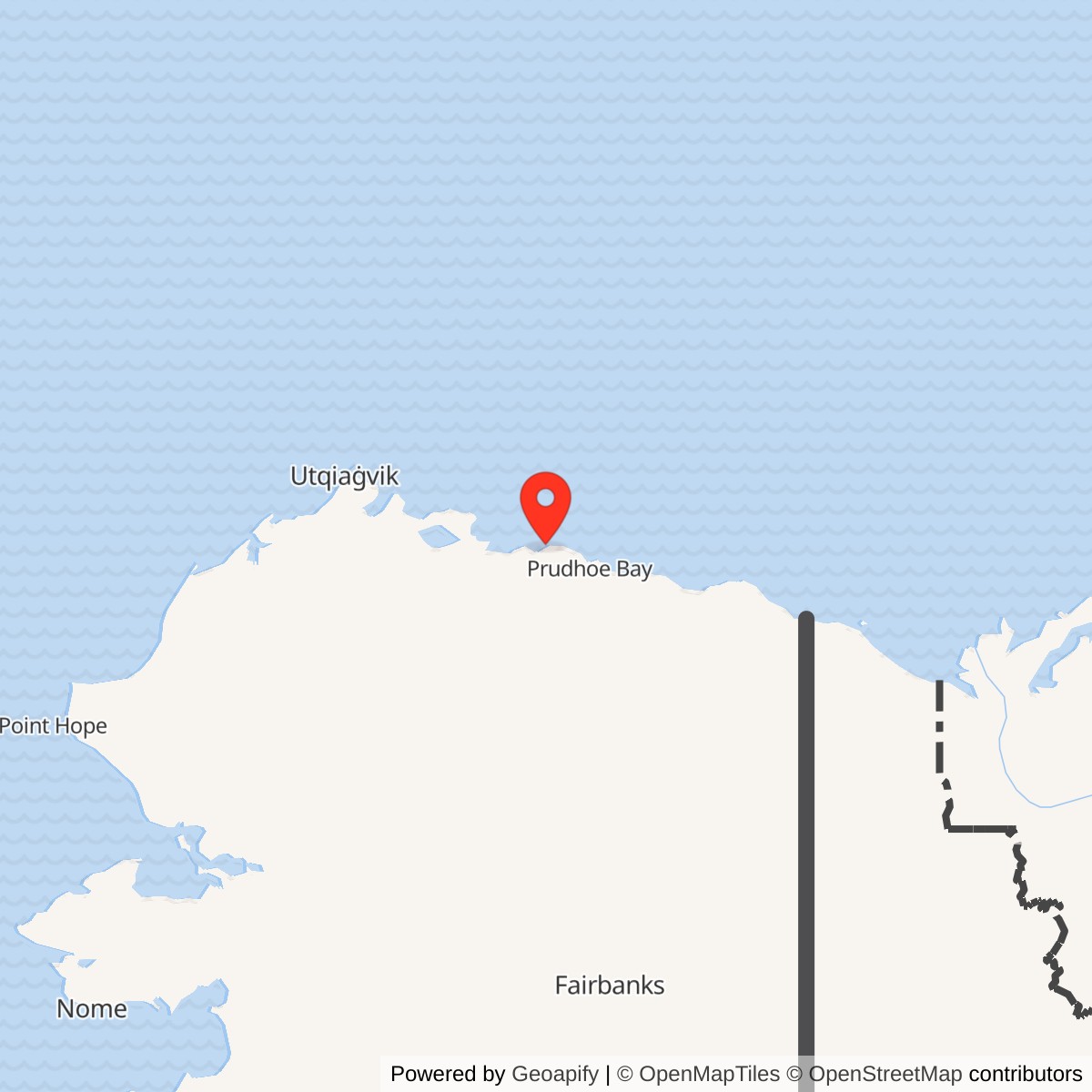
Longitude: -149.8894
Current Role: Operating AN/FPS-117 long-range radar site in the Alaska Radar System / North Warning System.
Oliktok Point was a DEW Line auxiliary station on Alaska's Beaufort Sea coast. Built in the mid-1950s as POW-2, it operated an AN/FPS-19 radar and passed aircraft-warning reports through the Point Barrow sector. The site later received an AN/FPS-117 radar under the North Warning System and remains an operational Air Force long-range radar site. [1] [2] [4]
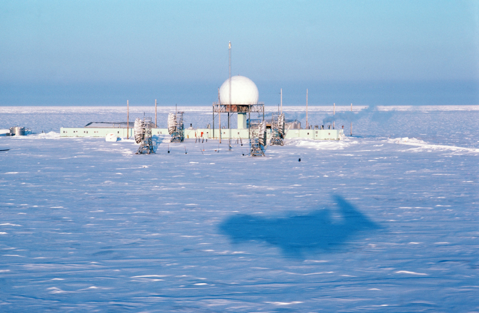
- DEW Line designation
- POW-2, auxiliary station in the Point Barrow sector.
- Original radar
- AN/FPS-19 aircraft search radar.
- Later radar
- AN/FPS-117 long-range radar, installed during 1989-1990 modernization.
- Operation
- DEW service from August 1957; operating long-range radar site in 2025.
- Location
- Oliktok Point, Beaufort Sea coast, northwest of Prudhoe Bay.
Building POW-2
The Air Force built Oliktok Point as an auxiliary station of the Distant Early Warning Line on the Beaufort Sea coast. The 1994 Corps survey places construction in 1955. Its station table records operational service beginning in August 1957, when the completed DEW Line formed a chain of radar and communications stations across the Arctic. [1] [2]
The site lay south of Spy Island on Simpson Lagoon and north of the Ugnurayik River. It included an airstrip in the northern part of the installation, gravel roads linking station buildings, and access to beachside fuel storage. The isolated location required aircraft, sealift, and overland movement to bring fuel, equipment, and people to the station. [1]
Radar and Sector Role
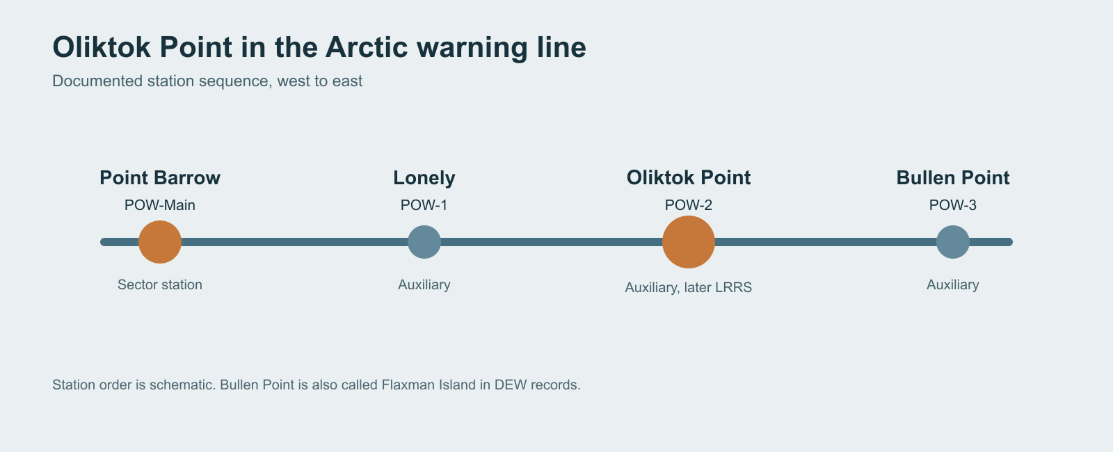
Oliktok was designated POW-2 in the Point Barrow sector. It was an auxiliary radar station, while Point Barrow POW-Main served as the sector's main station. Oliktok's rotating AN/FPS-19 radar searched for aircraft approaching the Arctic coast. The Air Force Historical Research Agency identifies an actual Oliktok photograph showing that radar beneath its protective radome. [1] [2]
Aircraft warning depended on links between stations as well as the local radar. Reports moved laterally along the DEW Line to the sector main station and then to continental air-defense centers. Oliktok stood between Lonely POW-1 to the west and Flaxman Island or Bullen Point POW-3 to the east. The smaller Point Barrow-sector intermediate stations closed in July 1963 as coverage improved, while the Oliktok auxiliary station continued. [1]
A New Long-Range Radar
The 1985 United States-Canada air-defense modernization agreement led to replacement of the older DEW equipment. The Corps history places installation of AN/FPS-117 long-range radars at Oliktok, Point Lay, Point Barrow, and Barter Island in 1989-1990. Oliktok became part of the North Warning System while retaining its Arctic aircraft-warning mission. [1]
Automation reduced the number of people needed at the remote station. In 1994 the Corps described an average of seven contractor personnel at Oliktok. The radar remained part of Alaska's wider surveillance network, with information sent to regional control facilities rather than managed solely by the original DEW sector arrangement. [1]
Oliktok Today
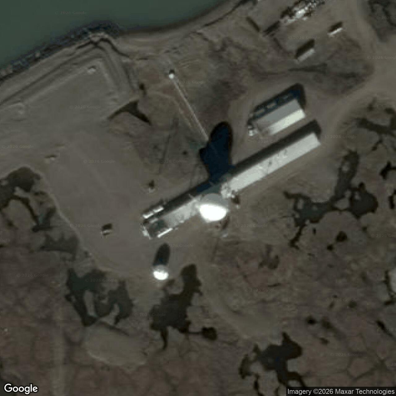
An Air Force photograph published in 2013 shows the modern long-range radar site with a large white radome above a low station building. The Air Force described it then as an operating Alaska radar site. In 2025, the Alaska Department of Natural Resources again identified Oliktok as one of the state's operational long-range radar sites and described its mission as tracking aircraft in Alaska's airspace and along its borders. [3] [4]
The Beaufort Sea setting continues to shape station operations. A 2025 Corps public notice describes a proposed inland access road and powerline intended to provide more reliable year-round access and electricity. Coastal erosion has also affected roads and former support areas. These are current challenges at a site that has maintained an air-defense role since the 1950s. [4] [5] [6]
Chronology
- 1954-1955: The Air Force constructs the Oliktok auxiliary station. [1] [3]
- August 1957: POW-2 begins operational service with the completed DEW Line. [1] [2]
- July 1963: Several smaller intermediate stations in the Point Barrow sector close; Oliktok continues as an auxiliary station. [1]
- 1985: The United States and Canada agree to modernize northern air defense. [1]
- 1989-1990: An AN/FPS-117 replaces Oliktok's DEW-era long-range search equipment. [1]
- 2013: An Air Force photograph records the operating long-range radar site. [3]
- 2025: Alaska DNR describes Oliktok as an operational radar site; the Corps reviews a proposed access road and powerline. [4] [5]
Related Sites
- Lonely POW-1, the western auxiliary station
- Barter Island LRRS, the eastern Alaska main station
- DEW Line station directory and network history
- AN/FPS-19 and AN/FPS-117 radar histories
Information sources (7)
- PDF[1] U.S. Army Corps of Engineers, The Cold War in Alaska: A Management Plan for Cultural Resources, 1994, pp. 186-188, 205
Source for POW-2 construction, station type, August 1957 operation, 1989-1990 AN/FPS-117 installation, station features and 1994 staffing.
- WEB[2] Air Force Historical Research Agency, Space Heritage: North America's Polar Shield: The DEW Line, 2026
Source for the AN/FPS-19 at Oliktok POW-2 and the DEW Line development and operational opening.
- WEB[3] Joint Base Elmendorf-Richardson, Cold War Radar Sites an Integral Part of Alaska History, Oliktok photograph, 2013
Source for the actual Oliktok modern-site photograph, construction period, 2013 operational status and public-domain rights.
- WEB[4] Alaska Department of Natural Resources, Oliktok Long Range Radar Site Public Utility Easement Decision, 2025
Source for the 2025 operational description and continuing aircraft-tracking mission.
- WEB[5] U.S. Army Corps of Engineers, POA-2025-00116 Oliktok LRRS Access Road and Powerline Public Notice, September 30, 2025
Source for the proposed access road and powerline serving the operating radar installation.
- WEB[6] Alaska Department of Environmental Conservation, Oliktok DEW Dock Storage ST03, hazard ID 751
Source for historic coastal fuel storage and shoreline erosion context.
- WEB[7] U.S. Air Force, Former DEW Line Radar Station at Oliktok, photograph DF-ST-88-03448, February 20, 1987, via Wikimedia Commons
Source for the actual-site 1987 aerial, photographer credit and public-domain reuse record.