
Point Barrow DEW Line Main Station / Long Range Radar Site, Alaska
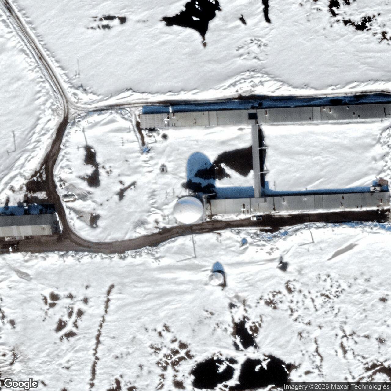
At the northern edge of Alaska, POW-Main served as a DEW Line sector station, an Arctic construction hub and later a North Warning System radar site.
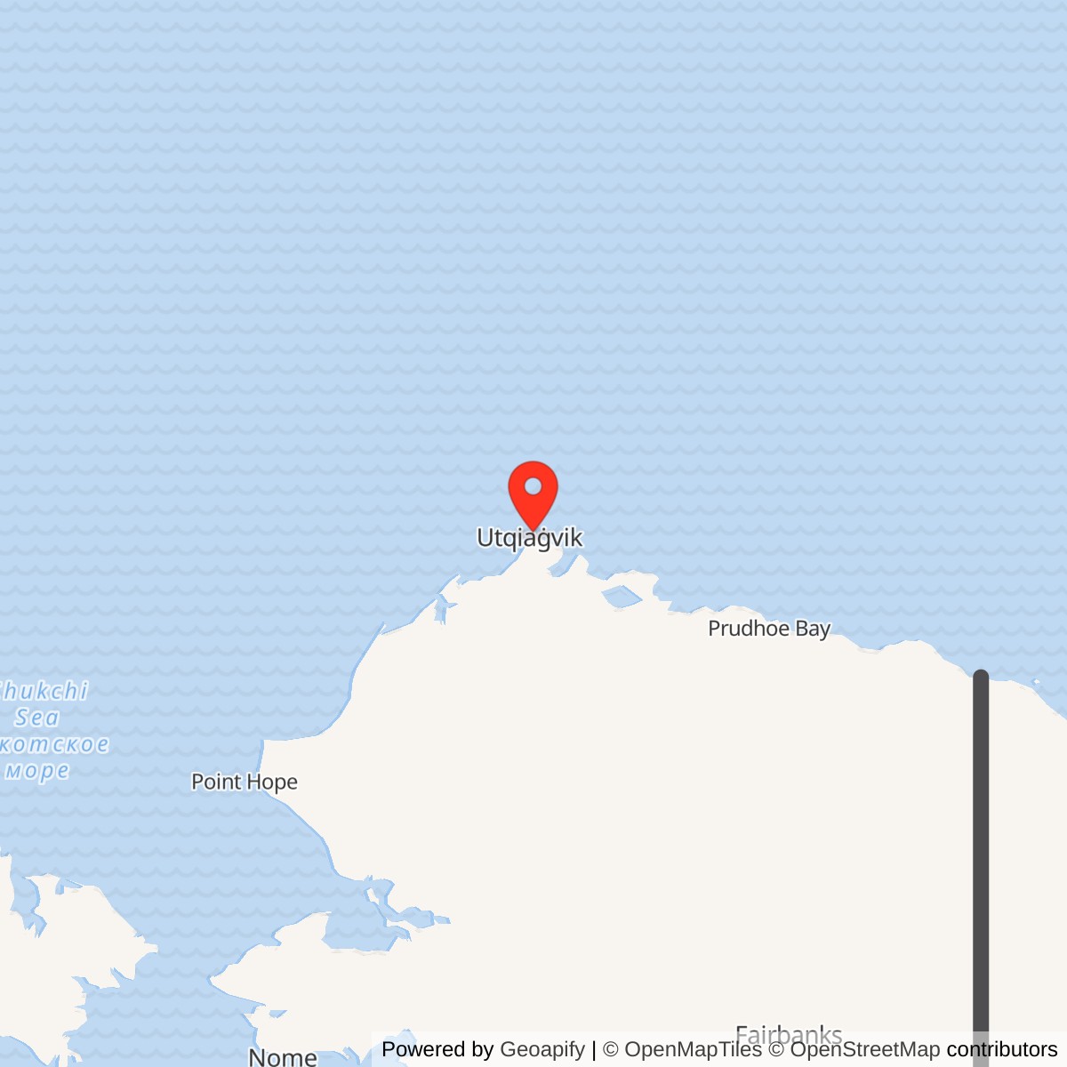
Longitude: -156.6362
Current Role: AN/FPS-117 long-range radar site supporting Arctic air surveillance; 2023 Air Force report describes 24-hour operation.
Point Barrow POW-Main was one of the main stations of the Distant Early Warning Line. Built near present-day Utqiaġvik, it combined aircraft detection, sector coordination and long-distance communications. The site later received an AN/FPS-117 radar. Air Force reporting in 2023 described an active, continuously operating long-range radar mission. [1] [2] [3] [4]
- DEW Line code
- POW-Main, Point Barrow sector main station.
- Original radar
- AN/FPS-19 search radar and AN/FPS-23 gap-filling equipment.
- Later radar
- AN/FPS-117 long-range radar.
- DEW operation
- August 1957 operational network opening.
- Location
- Near Utqiaġvik, Alaska, between North Salt Lagoon and Imikpuk.
Building POW-Main
Point Barrow became an assembly and supply center as the United States built the Alaskan DEW Line in the 1950s. Existing facilities at the former Navy Point Barrow camp, including a heated hangar, supported the work. Construction materials arrived by sea and air, while tractor trains carried supplies along the Arctic coast. The Corps dates completion of the radar station to 1955; its station roster records operational DEW service beginning in August 1957. [1] [6] [7]
The Point Barrow main station was built on a coastal site outside the town. Prefabricated modules formed long connected building trains for operations, living quarters and support functions. The elevated radar, communications equipment, power generation and fuel storage allowed crews to maintain a watch in severe Arctic weather. [1] [2] [5]
The Sector Station
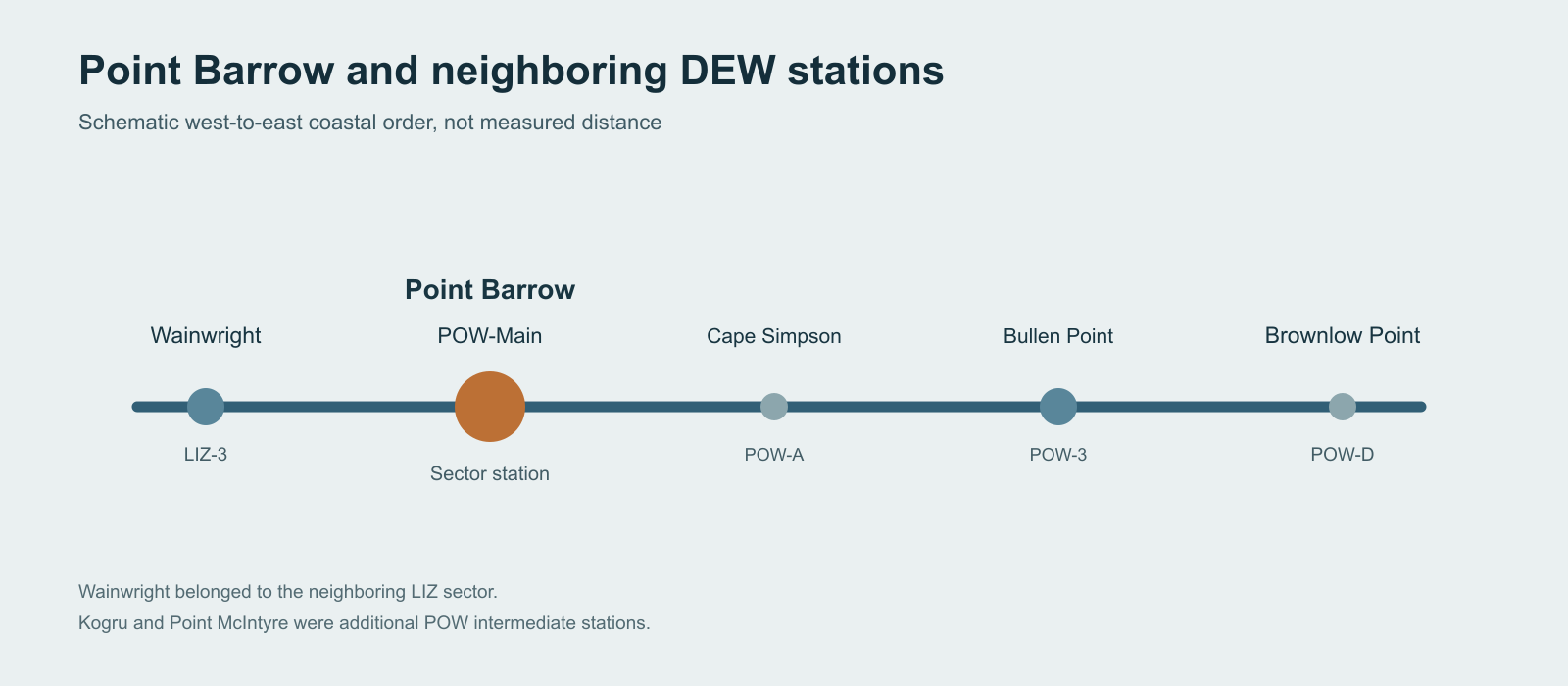
POW-Main was a sector headquarters as well as a radar station. Its AN/FPS-19 search radar watched for aircraft approaching from the Arctic, while AN/FPS-23 equipment supported low-altitude detection. The main station collected and relayed warning information from smaller stations in its POW sector, including Oliktok Point and Bullen Point. To the southwest, Wainwright belonged to the adjoining Cape Lisburne sector. [1] [2]
The original Point Barrow sector also included intermediate stations at Cape Simpson, Kogru, Point McIntyre and Brownlow Point. Improvements to radar coverage led to their closure in July 1963. The larger main and auxiliary stations continued their warning mission. [1]
Arctic Supply and Communications
The importance of Point Barrow went beyond the radar sweep. Its crews and contractors supported the construction and resupply of the eastern Alaskan DEW stations. Prefabricated building modules were assembled at Barrow, and overland tractor trains moved equipment to remote sites after the shipping season. [1] [6]
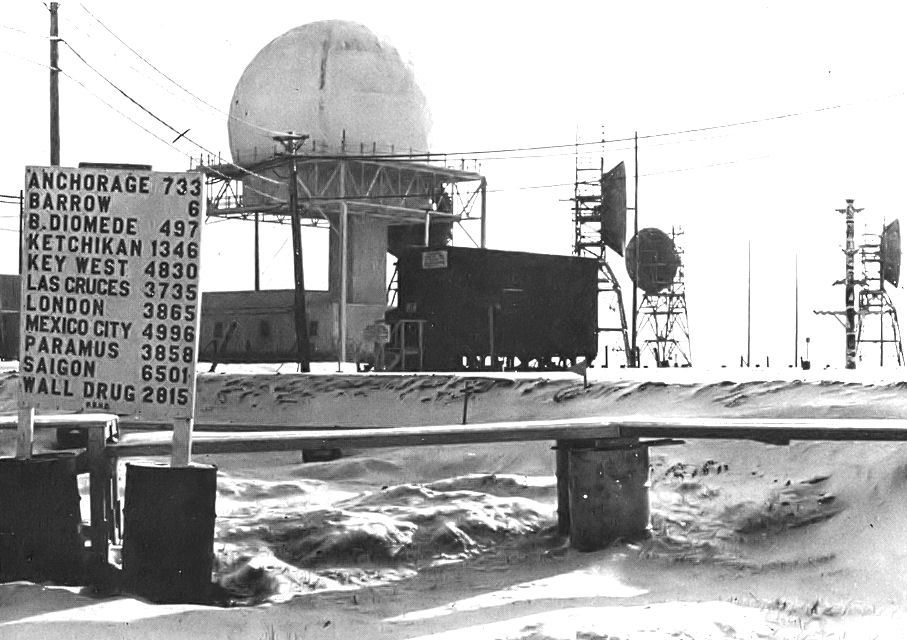
Long-range tropospheric-scatter communications carried warning reports along the line. The historic Air Force photograph shows the radar radome and separate tall communications antenna structures at the same station. Radio and radar functions had to operate together to pass a warning to the wider North American air-defense network. [2] [5]
A New Radar for the North Warning System
During the late 1980s and early 1990s, the United States and Canada replaced much of the older DEW Line equipment with the North Warning System. Point Barrow received an AN/FPS-117 long-range radar. Its automated surveillance role continued the same basic Arctic warning mission with far fewer people on site. [1] [4] [6]
The modernization connected Point Barrow with other Alaska long-range radar locations, including Barter Island to the east and Point Lay and Oliktok Point to the west. Radar data traveled to regional control facilities rather than depending on a large resident sector crew at Barrow. [1] [2] [4]
The Station Today
In 2023, the Air Force described Point Barrow as an around-the-clock long-range radar site supported by a small group of contractors and rotating airmen from Joint Base Elmendorf-Richardson. The mission remained the detection and reporting of aircraft on the northern approach to North America. [4]
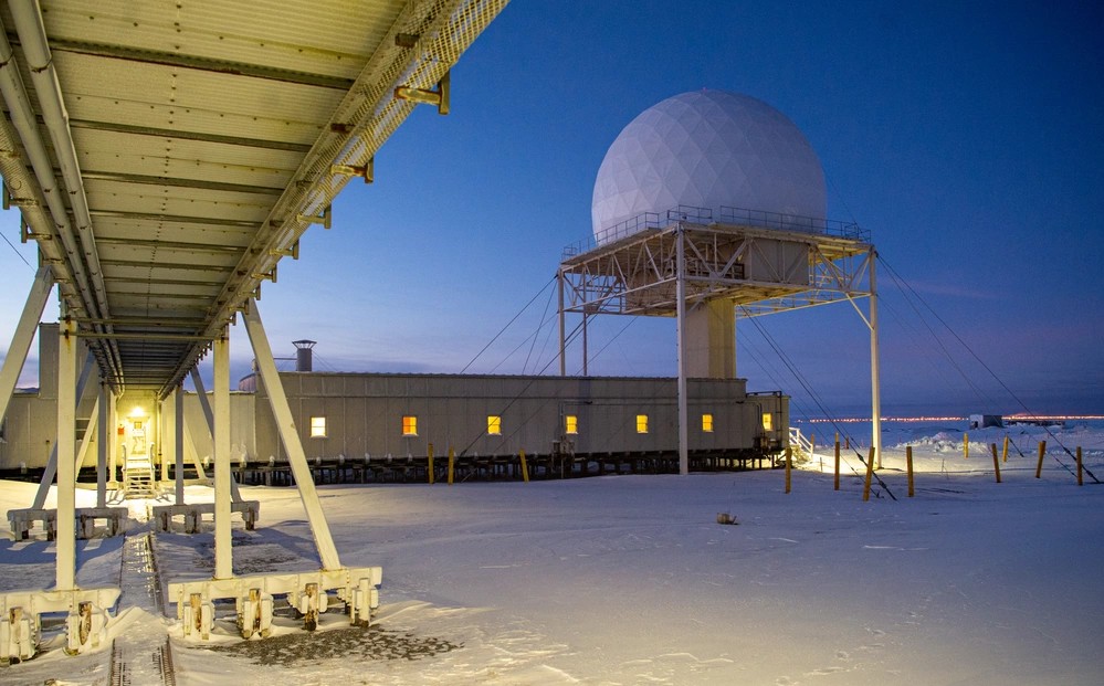
During DEW construction, the Navy Point Barrow Camp and Naval Arctic Research Laboratory supplied space and facilities nearby. At POW-Main, the radar facilities mark the transition from the original Cold War line to the automated warning network. [3] [4] [7]
Chronology
- Early 1950s: Point Barrow serves as a construction and supply center for the Alaskan DEW Line. [1] [6]
- 1955: The Corps dates completion of the Point Barrow radar station to this year. [6]
- August 1957: POW-Main enters the operational DEW Line with AN/FPS-19 and AN/FPS-23 equipment. [1]
- July 1963: Four Point Barrow-sector intermediate stations close as radar coverage improves. [1]
- Late 1980s to early 1990s: An AN/FPS-117 radar replaces the original DEW-era radar during North Warning System modernization. [1] [6]
- 2023: Air Force reporting describes continuing around-the-clock radar operations with a small rotational workforce. [4]
Related Sites
- Naval Arctic Research Laboratory and Point Barrow Camp, a separate Navy installation that supported DEW construction
- DEW Line station directory and DEW Line history
- AN/FPS-19 radar and AN/FPS-117 radar
Information sources (8)
- PDFU.S. Army Corps of Engineers, The Cold War in Alaska: A Management Plan for Cultural Resources, 1994, pp. 184-188
Construction headquarters, Arctic logistics, station roster, radar types, operational date and modernization.
- PDFNorth American Aerospace Defense Command, A History of the DEW Line, 1946-1964
Main-station sector role, radar and communications systems, and the original network.
- WEBAlaska Department of Environmental Conservation, Point Barrow LRRS, hazard ID 768
Station location, continued federal radar use and site history.
- WEBU.S. Air Force, Atop the World, Point Barrow LRRS Keeps Watch Over North America, 2023
Contemporary AN/FPS-117 surveillance mission and small rotational workforce.
- WEBU.S. Air Force, Point Barrow Long Range Radar Site, historical photograph and public-domain record
Rights and identification for the actual-station historical photograph.
- PDFU.S. Army Corps of Engineers, Barrow Coastal Erosion Feasibility Study, 2018
1955 completion and later AN/FPS-117 radar installation.
- PDFNaval Facilities Engineering Command, Former Naval Arctic Research Laboratory Barrow PFAS Preliminary Assessment, 2019
Navy Point Barrow Camp and Arctic Research Laboratory history distinct from POW-Main.
- WEBU.S. Air Force, Day Breaks at Point Barrow Long Range Radar Site, February 4, 2023, DVIDS photo 7658772
Identification, date, photographer and public-domain status of the 2023 site photograph.