
Laredo Air Force Station, Texas
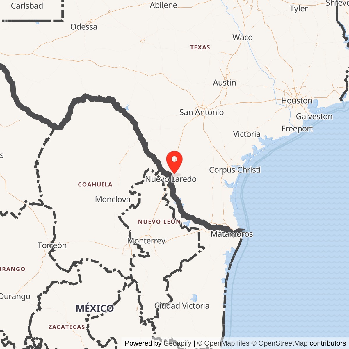
Location: Webb County, northeast of Laredo, Texas
Historical roles: Radar development, space surveillance, emergency Cuban missile warning and later southern SLBM warning
Status: Former military tracking property; Webb County ownership documented in the Corps FY2024 inventory
Longitude: -99.385000
Current Role: Webb County-owned former tracking property according to USACE FY2024 inventory queried 2026-09-27. Prison and seized-vehicle storage documented in 1992; locked sheriff impound use reported in 2003. Exact 2026 operations, access and surviving radar features unverified.
Overview
Laredo Air Force Station was a radar and tracking installation northeast of Laredo in Webb County, Texas. Its importance came from three successive missions: testing long-range missile-detection technology, contributing observations to the developing American space-surveillance network, and providing warning of ballistic missiles launched from the south. During the Cuban Missile Crisis, its AN/FPS-78 tracker joined an emergency network watching for launches from Cuba. The station was separate from the pilot-training airfield known as Laredo Air Force Base, although that base provided early support and later housed a missile-warning squadron headquarters.
The installation's history cannot be reduced to one opening and one closing date. Government land interests began in 1955, AN/FPS-17 experiments followed in 1956, and an operational space-surveillance detachment arrived in 1961. The early sensor operation ended on 15 July 1964. A Corps of Engineers property history records reactivation on 1 April 1966, followed by a different radar mission using AN/FSS-7. Army control began in May 1974, while Defense Department planning still described a Laredo warning-radar phaseout in 1975. These were distinct changes in property, organization, and sensor employment.
Identity and Location
Early names included Laredo Tracking Site, Laredo Test Site, Laredo Radar Test Annex, and Laredo Radar Annex. Laredo Air Force Station became the name associated with Air Defense Command control, and Z-230 identified the later missile-warning site. A 1957 Air Force installation directory listed the radar test annex under property installation number 5346 and identified Laredo AFB as its parent. The directory's support relationship explains why some radar records say Laredo AFB without placing the tracking equipment on the airfield itself.
Distances in the sources vary. The 1957 directory describes the annex as approximately 13 miles northeast of the city, while the 1992 Corps survey uses 16 miles northeast. These descriptions are useful regional locators, not surveyed distances from a consistent reference point. The former station occupied a separate rural property with its own utilities, access road, security fence, and support buildings. Its location and mission should not be confused with either Laredo's airfield or the separate low-altitude Laredo Gap Filler Annex near Webb.
No verified antenna phase-center or surveyed station-center coordinate is supplied here. A specialist location reference places the former radar installation near 27.619722 north, 99.385000 west, but the Corps' fiscal-year 2024 FUDS inventory point is 27.64861111 north, 99.35666667 west, in WGS 84 decimal degrees. The separation is material, and the federal point is an inventory locator rather than proof of an antenna position. The 1957 directory prints a plainly inconsistent latitude of 29 degrees 38 minutes north beside the Laredo annex, which is not adopted or silently corrected. A definitive station coordinate remains unestablished pending a georeferenced property map or an authenticated radar location.
Land Acquisition and Construction
The Corps' May 1992 site survey provides the strongest recovered account of the land interests. It describes an initial lease covering 318.62 acres, divided into 294.24 acres later acquired in fee and 24.38 acres associated with easements. An additional 6.88 acres were licensed on 22 July 1955. The government purchased the 294.24-acre fee tract and obtained a perpetual right-of-way easement over 24.38 acres on 23 October 1958. Those legal categories should remain separate: the fee tract was not 318.62 acres, and the licensed area was not another fee purchase.
The Corps attributes construction of the radar test facility to the Air Force under Air Training Command. Technical development involved Lincoln Laboratory, General Electric, and Rome Air Development Center, whose interests were different from the administrative command that supported the property. The installation required much more than a radar antenna: reliable power, operating and equipment space, water, sewage disposal, road access, and controlled entry were necessary for sustained work in a remote setting. The surviving disposal record documents these support functions without establishing their individual construction dates.
Rome Air Development Center's own history supplies a more specific construction milestone: the Laredo operations building was completed in 1955. RADC was responsible for installing and operating the radar, while construction funding came from a special Air Force appropriation rather than its own budget. The same history records the test facility becoming operational in 1956 and satellite tracking for Harvest Moon in 1960. These entries distinguish completed support construction, working test equipment, and the later space-surveillance mission instead of treating them as a single founding event.
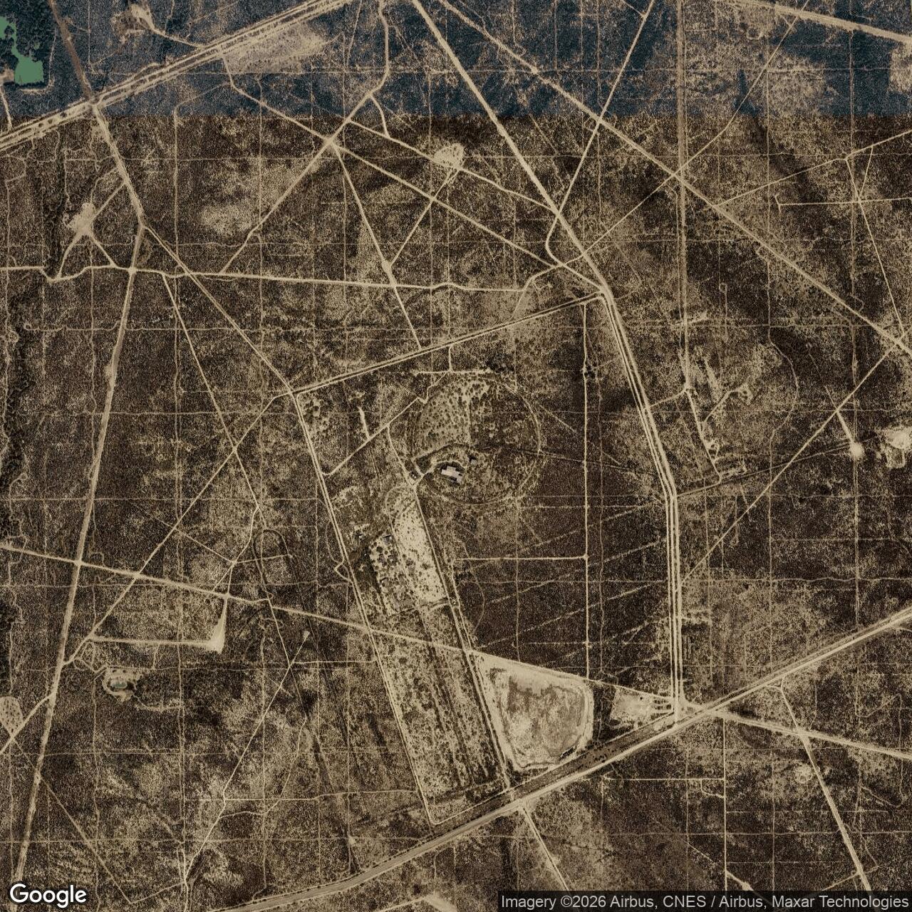
In 1980 the disposal inventory included 13 buildings, a sewage treatment plant, utilities, a water well and storage tanks, an access road, and a security fence. This is evidence of the developed property handed to the county, not a complete original station plan. The record does not identify each building's wartime-style function, give floor areas, or locate every radar foundation.
AN/FPS-17 and the Early Test Mission
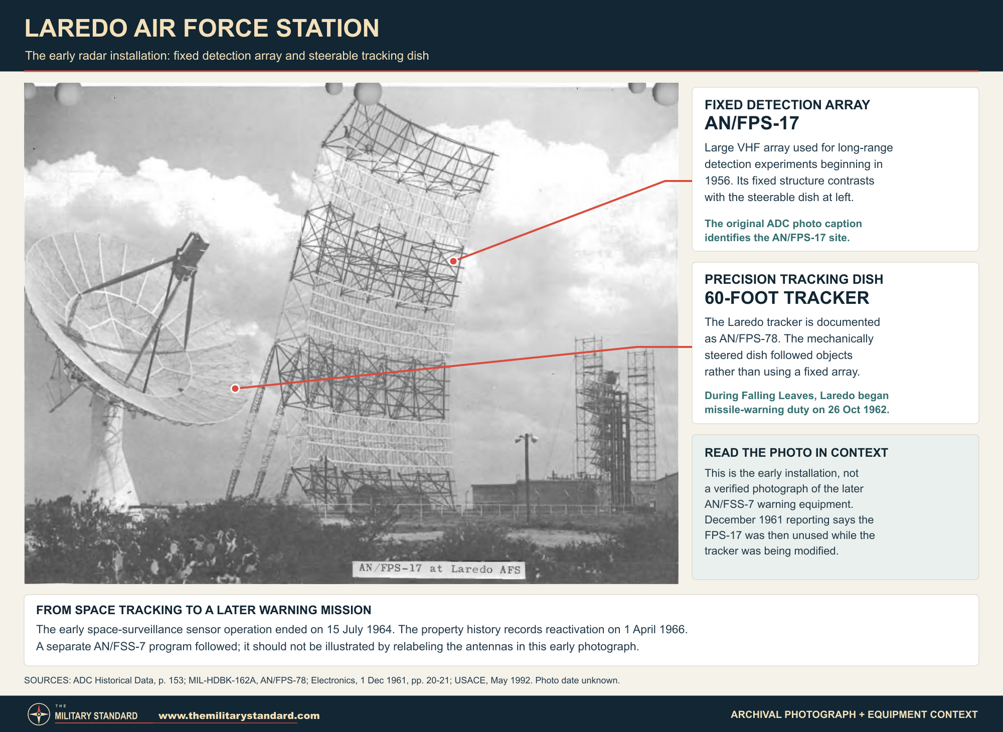
Lincoln Laboratory's institutional history places an AN/FPS-17 installation at Laredo in 1956. Its beam looked generally northwest toward the New Mexico missile-test region. In July, the radar observed sounding rockets launched near White Sands. The experiments demonstrated that coded-pulse processing could obtain target range and velocity together. Laredo consequently served as a practical test environment for technology intended to detect fast, distant targets, rather than simply extending the ordinary aircraft-warning network.
The tests also revealed a significant problem: ionized meteor trails triggered automatic target detection. Engineers modified the system to reduce those false detections. This episode connects the installation's experimental work to an enduring warning requirement, distinguishing a threatening object from natural echoes. It also explains why signal processing and target interpretation mattered as much as the conspicuous antenna. A radar could be sensitive enough to detect a distant return yet still require substantial engineering before that return became dependable warning information.
ADC's historical data identifies the Laredo detection set as AN/FPS-17, XW2. Its large fixed antenna was physically and functionally different from the adjacent mechanically steered tracking dish. An official photograph captioned AN/FPS-17 at Laredo AFS records the distinctive early radar landscape. Dimensions and power figures from other FPS-17 installations should not be transferred automatically to this variant. Likewise, the later C-band FSS-7 was not a modification of the large VHF FPS-17 array.
Space Surveillance and AN/FPS-78
The launch of Sputnik in 1957 accelerated American efforts to detect, identify, and follow objects in orbit. Laredo's test work acquired a wider value as military planners organized observations from experimental and operational radars into a space-surveillance system. Project Harvest Moon and subsequent SPACETRACK and SPADATS arrangements drew on this developing sensor capability. The essential task was not merely seeing an object once: repeated observations helped establish an orbit, associate new detections with known objects, and recognize objects that did not fit the existing catalog.
The principal tracking radar at Laredo became AN/FPS-78, a General Electric VHF system with a 60-foot mechanically steered parabolic antenna. The Defense Department handbook lists two transmitters, two receivers, a monitor-control tracker console, and an automatic digital data processor. Its published transmit band was 186 to 207 MHz, with a broader receive range of 175 to 215 MHz. Those documented features describe the equipment configuration; they do not establish a universal target-detection range or prove that its processor computed ballistic impact points in every mission.
Jurisdiction over the Laredo test site transferred from Rome Air Development Center on 1 July 1961. ADC's roster lists Detachment 1 of the 1st Aerospace Surveillance and Control Squadron at Laredo in July. The Corps independently dates transfer of the property from Air Training Command to Air Defense Command to that month. These accounts describe related administrative transitions rather than competing explanations of who invented or manufactured the radar. General Electric contractor participation remained important as experimental equipment entered a more regular surveillance role.
The detection and tracking sets were complementary, but they were not interchangeable. A fixed detection array could register an object within its covered volume, while the steerable dish followed selected targets to obtain more useful measurements. Such observations fed a geographically distributed system rather than a self-contained Laredo catalog. The existence of a digital processor does not make the site a SAGE direction center, and the station's radar designations do not establish that it performed the same aircraft-control mission as the nearby tactical radar stations.
The December 1961 Electronics report adds an important qualification: the large FPS-17 was then unused, while the tracker was being modified for automatic tracking and data output. An equipment roster or photograph therefore cannot prove both sets worked simultaneously throughout the space-surveillance phase. The article credited earlier work with thousands of space-object intercepts, but this retrospective total is not a separately audited FPS-78 production record. It supports a long experimental-to-operational transition without establishing a continuous, unchanged two-radar configuration.
Recovered organizational and technical records explain what the station did more clearly than how its personnel lived. They identify military detachments and contractor participation but do not provide a reliable local strength, shift schedule, housing allocation, dining arrangement, or complete maintenance roster. Tracking depended on trained operators, equipment service, data handling, and communications, yet those required functions should not become invented staffing figures. The early parent-base relationship is documented; the precise division of daily support between the airfield, contractor, and remote station still requires unit and contract records.
Some local accounts associate the Laredo tracker with John Glenn's Mercury-Atlas 6 flight on 20 February 1962. The claim fits the installation's general tracking role, but a reviewed primary mission record has not established the specific Laredo equipment, observation times, or operational contribution. It is retained as an unresolved research lead rather than a confirmed accomplishment. Laredo's documented military space-surveillance work is substantial without relying on a precise manned-spaceflight claim that remains unverified.
Falling Leaves and the Cuban Missile Crisis
In October 1962 the discovery of Soviet ballistic missiles in Cuba created a warning problem outside the normal northern approach assumptions of the continental defense system. Existing radars were repurposed because no purpose-built southern missile-warning network could be erected during the crisis. Project Falling Leaves used the AN/FPS-49 at Moorestown, New Jersey, Laredo's AN/FPS-78, and the AN/FPS-35 at Thomasville, Alabama. Each site's equipment and viewing geometry shaped its contribution to the emergency arrangement.
Official NORAD records place Moorestown's start on 24 October, Laredo's on 26 October, and Thomasville's on 30 October. A broader statement that the emergency network was operational on 27 October therefore describes an initial capability, not simultaneous activation of all three sensors. Laredo's existing tracker could be redirected much more quickly than a new installation could be built. That speed had a cost: its normal SPADATS work was interrupted, and other sensors were asked to help cover the resulting space-surveillance shortfall.
The emergency watch relied on communications and correlation as well as antennas. Voice circuits connected participating sites and command posts, allowing reports to be compared rapidly. Moorestown had the trajectory-computing capability emphasized in the official crisis account. Laredo's automatic digital data processor should not be equated with that specific capability. The distinction is operationally important because a radar observation alone could not answer every question about whether an object was a missile, where it originated, or what area it might threaten.
The official narrative includes a Laredo report that Moorestown identified as a satellite. This was not evidence of a Cuban missile launch; it illustrates how ordinary space objects could complicate an urgently assembled warning system. The network needed confirmation procedures to avoid transforming an ambiguous observation into a strategic alarm. Laredo's contribution was thus part of a chain of detection, comparison, and command interpretation, rather than an independent guarantee that every launch from Cuba would be detected and classified correctly.
Laredo and Moorestown returned to their primary SPADATS tasks on 28 November 1962. Laredo was released without a specific Falling Leaves recall capability, while Thomasville continued the Cuban watch longer. This end date helps define the emergency episode: the Cuban mission was an interruption of Laredo's early space-surveillance work, not its permanent operating purpose. The temporary reassignment also exposed the vulnerability of depending on research-derived sensors whose normal workload remained important to another national defense mission.
The 1964 Shutdown and a Different Reactivation
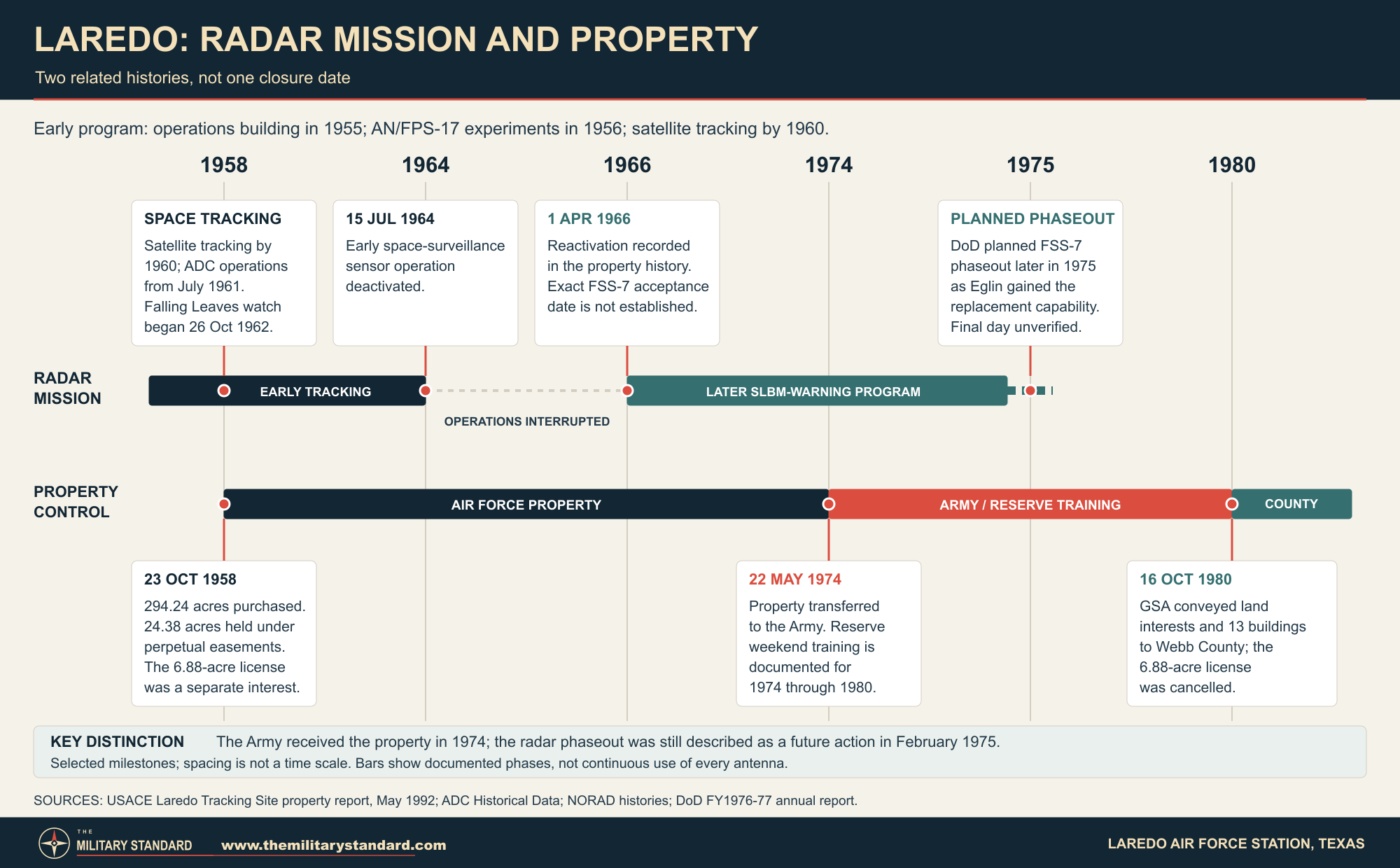
ADC and NORAD records establish 15 July 1964 as the end of the early Laredo sensor operation. The date should be applied to the documented AN/FPS-78 and associated space-surveillance phase, not to every later military use of the property. The one-of-a-kind installation had helped bridge the transition from radar experimentation to organized space monitoring. Its withdrawal occurred as sensor arrangements, command requirements, and the availability of other tracking resources changed, rather than as proof that space surveillance itself had become unnecessary.
The Corps property history records reactivation on 1 April 1966. Some specialist accounts instead describe a later return around 1968. Facility reactivation, equipment installation, contractor testing, and full operational acceptance need not have occurred together. The 1966 date is retained as the primary property-history milestone; it is not presented as a recovered acceptance certificate for a fully operational AN/FSS-7. The precise transition between reoccupied property and routine southern warning coverage remains less securely documented than the earlier shutdown.
An additional contemporary record resolves part of the naming history. ADC Special Order G-89 of 10 August 1966 announced that Laredo AFS, PIN 5346, was redesignated Laredo Tracking Site, retaining the same property number. Laredo Tracking Site was therefore not solely an early informal label: it was also an official later designation. The order does not specify an independent effective date for that announcement or certify radar acceptance, so its issue date should not replace the Corps' April reactivation milestone.
The later installation used AN/FSS-7, part of the interim submarine-launched ballistic-missile warning network. Six sites used modifications of existing AN/FPS-26-family height finders, while Laredo received an FSS-7 installation whose hardware provenance has not been established in the recovered primary records. Assertions that the Laredo set came from a particular other station therefore remain unconfirmed. Its appearance under a radome and its warning task distinguish this phase from the exposed 60-foot VHF tracker and large fixed detection array of the early station.
The approved program helps explain the apparent date conflict. In July 1965 the Defense Department accepted AVCO's proposal for six conversions and an additional Laredo installation, with the system expected to become operational by the end of 1967. The development contract followed on 9 December 1965. An April 1966 property reactivation thus preceded the program's projected readiness. These planning milestones support a staged return to use, but neither the projected 1967 date nor a secondary 1968 account substitutes for a recovered Laredo acceptance record.
The warning mission reflected the possibility of missiles launched from submarines approaching outside the older northern ballistic-missile warning geometry. The FSS-7 searched, acquired a candidate target, and tracked it briefly so that warning information could be evaluated and passed to the command system. Laredo provided the southern element of a network otherwise concentrated at coastal stations. Program-wide range and warning-time figures describe planning assumptions and target geometry; they are not a verified circular coverage boundary around the Texas station.
ADC's 1965 description envisaged six to ten seconds of tracking before impact prediction and a message reaching the Cheyenne Mountain central processor within 50 seconds of first detection. Its quoted maximum-range warning interval was about seven to ten minutes, not a promise for every trajectory. The designed sequence shows why continuous search, rapid computer-directed mode changes, and reliable communications were essential. It also shows the limited precision of an interim warning system: its predicted impact area was intended to support urgent strategic decisions, not pinpoint an individual target on the ground.
Units, Headquarters, and Laredo Air Force Base
The 4783rd Surveillance Squadron was organized at Laredo Missile Tracking on 1 July 1967. ADC's organizational handbook places it initially under the 31st Air Division, then records reassignment to the 27th Air Division on 15 November 1969 and the 26th Air Division on 19 November. The same handbook records assignment to Fourteenth Aerospace Force, movement to Laredo AFB around 8 July 1972, and inactivation on that date. These details place the local mission within changing missile-warning administration rather than ordinary pilot-training operations.
The successor 14th Missile Warning Squadron was constituted on 17 April 1972 and activated on 8 July. It cannot correctly be described as the station's resident squadron throughout the late 1960s. Its responsibilities extended beyond one Texas antenna because it administered distributed warning sensors. A squadron headquarters located at an air base also does not establish that every radar it supervised stood at that headquarters. This distinction is especially important at Laredo, where airfield, rural station, and headquarters names recur in the same records.
AFHRA lists the 14th at Laredo AFB from 8 July 1972, then at Laredo, Texas, from 1 January 1974, and at MacDill AFB from 30 June 1975. These are organizational station dates. They should not be silently converted into radar commissioning or final-transmission dates. The sequence nevertheless corroborates continued Laredo missile-warning administration beyond the early tracker shutdown and clarifies why a property transfer in 1974 cannot, by itself, settle the final operational history of the warning mission.
Phaseout, Army Use, and County Transfer
The Corps records an Air Force declaration of excess and transfer to the Army on 22 May 1974. Local Army Reserve components then used the property for weekend training between 1974 and 1980. This was a documented successor military use, but the recovered record gives no formal Army installation name, tenant-unit roster, troop capacity, or detailed training schedule. The descriptive name Laredo Army Reserve Training Site identifies this successor use of the same property; it is not a recovered formal Army post designation and should not be confused with Laredo AFB.
Defense Department reporting prepared for fiscal years 1976 and 1977 described a further planned action at Laredo: phasing out the FSS-7 during 1975 when modifications gave the Space Track radar at Eglin AFB a submarine-launched missile-warning capability. This is direct evidence that the departmental operational sequence was not simply a May 1974 final radar closure. It also identifies Eglin's expanded mission as the immediate programmatic substitute, rather than attributing Laredo's retirement directly to a Texas PAVE PAWS installation built many years later.
The exact reconciliation requires additional records. Army control could coexist with retained Air Force equipment or rights, and a headquarters move could accompany rather than precisely date a radar shutdown. The recovered documents do not establish those arrangements or a final transmitted warning message. The 1975 phaseout remains a planned milestone in the recovered primary record, rather than a verified final operating date. The separately documented 1974 property transfer is preserved explicitly instead of being discarded.
On 16 October 1980, the General Services Administration conveyed the 294.24-acre fee tract, 24.38 acres of easement interests, and 13 buildings to Webb County. The additional 6.88-acre license was cancelled on the same date. By the 1992 Corps visit, the county had converted the site to a prison and was storing vehicles seized by the United States Marshals Service. These are documented reuse conditions at that time, not evidence that all of the former station remained unchanged or retained those functions through 2026.
Environmental Review and Present Status
The Corps visited the property on 8 April 1992 and reported no visible evidence of defense-related hazardous waste, explosive ordnance, or unsafe debris. Its summary recommended no further action. The visit documents observed conditions and an administrative recommendation, not a comprehensive modern environmental clearance. The site's development and successor uses should be considered separately from the presence or absence of a funded FUDS cleanup project.
GAO revisited the evidentiary basis in its August 2002 national review. Its Laredo Tracking Site entry, K06TX0216, found that the file did not show a search for hazards beyond building demolition and debris removal. GAO therefore questioned the support for the no-action determination. This was not a finding that contamination existed; it was a finding that the available investigation record did not adequately establish the broader conclusion. Both the Corps' observations and GAO's criticism belong in the history.
The public Corps fiscal-year 2024 inventory, queried in September 2026, identifies Laredo Tracking Site as eligible for FUDS, lists Webb County as owner, and classifies it as a property without projects. It is listed as not on the National Priorities List. None of these administrative fields establishes unrestricted public access, confirms current jail operations, or resolves every environmental question. The inventory's description independently preserves the Air Force radar and Army weekend-training succession, strengthening the identification of the former military property.
A specialist visitor account from May 2003 describes locked access and sheriff impound activity. It is useful dated evidence of later reuse but is not a current county operating statement. A present-day building inventory, verified tenant list, precise parcel boundary, and confirmed radar-foundation condition were not recovered. The defensible current description is a county-owned former radar and training property, with prison and vehicle-storage reuse documented historically and its exact present functions unverified. Visitors should not assume it is an accessible museum or abandoned public land.
Other Laredo Radar Identities
The Laredo Gap Filler Annex was a separate low-altitude aircraft-detection facility, originally coded TM-189B and later TM-188C. ADC's tables record AN/FPS-18 there in October 1959 under the earlier code and subsequently under the 733rd Aircraft Control and Warning Squadron arrangement. ADC Special Order G-83 dated 28 June 1963 lists the annex as excess effective 1 May 1963, under Eagle Pass AFS. The effective excess date is not automatically the day the unattended radar stopped reporting.
That gap filler belongs to the Zapata and Eagle Pass aircraft-warning story, not to the FPS-17/FPS-78 space-tracking compound or the FSS-7 southern warning station. The two Laredo radar identities served different target classes, occupied different places, and used different systems. The gap filler and its parent stations must be treated as distinct installations. This prevents a search for Laredo radar history from producing a synthetic station assembled from unrelated dates, antennas, squadron assignments, and property acreage.
Historical Significance and Surviving Evidence
Laredo's importance lies in the reuse of a geographically useful test site for successive national defense problems. Coded-pulse experimentation contributed to the development of long-range sensing; operational tracking supported the space-object catalog; the 1962 emergency diverted that capability toward Cuba; and a later radar supplied southern SLBM warning. Each mission depended on a wider system of sensors, communications, contractors, and command centers. Laredo illustrates both the speed with which existing equipment could be repurposed and the limits of treating an experimental installation as a permanent substitute for dedicated warning coverage.
The best visual evidence is the contemporary ADC site photograph and roster, supplemented by the 1961 Electronics photograph of the General Electric tracker. They permit comparison of the exposed fixed array and tracking dish without fabricating a precise ground plan. Later radome photographs must be dated and associated with the FSS-7 phase, not captioned as the earlier FPS-78. A reliable site-layout graphic still requires a georeferenced map because the disposal inventory identifies facilities but does not give their exact arrangement.
Important remaining research targets are the original construction drawings, Air Force real-estate transfer instruments, AN/FSS-7 acceptance and shutdown logs, Army Reserve unit records, the 1980 county deed and reuse restrictions, and a modern county property plan. These gaps limit precision about particular buildings and the last warning shift. They do not erase the verified sequence of land acquisition, radar experimentation, space surveillance, Cuban missile warning, reactivation, Army use, and county disposal documented across independent military and federal records.
Chronology
- 1955 RADC records completion of the Laredo operations building, funded through a special Air Force appropriation.
- 22 July 1955 The government licenses an additional 6.88 acres associated with the developing tracking property.
- 1956 AN/FPS-17 is installed at Laredo for long-range detection experiments.
- July 1956 The radar observes sounding rockets launched in the New Mexico missile-test region.
- 1957 The USAF installation directory lists Laredo Radar Test Annex, PIN 5346, with Laredo AFB as parent.
- 4 October 1957 Sputnik 1's launch increases the urgency of American space-surveillance development.
- 23 October 1958 The government purchases 294.24 fee acres and obtains perpetual easement rights over 24.38 acres.
- October 1959 ADC records AN/FPS-18 at the separate Laredo Gap Filler Annex under TM-189B.
- 1960 RADC records satellite tracking and reporting to Harvest Moon, later Space Track.
- December 1960 ADC's gap-filler tables place the Laredo annex under the later TM-188C arrangement.
- 1 July 1961 Jurisdiction over the Laredo test site transfers from Rome Air Development Center.
- July 1961 ADC records Detachment 1 of the 1st Aerospace Surveillance and Control Squadron at Laredo; the Corps dates command transfer to ADC to this month.
- 18 October 1961 The nomenclature card subsequently cited for AN/FPS-78 is dated.
- 1 December 1961 Electronics publishes contemporary reporting and a photograph of the 60-foot Laredo tracker.
- 24 October 1962 Moorestown starts the Falling Leaves warning mission.
- 26 October 1962 Laredo's AN/FPS-78 starts Falling Leaves missile-detection duty.
- 30 October 1962 Thomasville joins the three-site emergency arrangement.
- 28 November 1962 Laredo and Moorestown return to their primary SPADATS work.
- 1 May 1963 The separate Laredo Gap Filler Annex is listed as excess effective this date in the later ADC general order.
- 28 June 1963 ADC issues Special Order G-83 identifying Laredo Gap Filler Annex TM-188C under Eagle Pass AFS.
- 15 July 1964 The early Laredo space-surveillance sensor operation is deactivated.
- July 1965 The Defense Department approves AVCO's plan for six radar conversions and an additional Laredo FSS-7 installation.
- 9 December 1965 The Air Force awards AVCO the development contract for the interim SLBM-warning system.
- 1 April 1966 The Corps property history records reactivation; the exact FSS-7 operational-acceptance date remains unverified.
- 10 August 1966 ADC Special Order G-89 announces redesignation of Laredo AFS to Laredo Tracking Site, retaining PIN 5346.
- 1 July 1967 The 4783rd Surveillance Squadron is organized at Laredo Missile Tracking.
- 15 November 1969 The 4783rd is reassigned to the 27th Air Division.
- 19 November 1969 The 4783rd is reassigned to the 26th Air Division.
- 17 April 1972 The 14th Missile Warning Squadron is constituted.
- 8 July 1972 The 14th Missile Warning Squadron activates at Laredo AFB and the 4783rd inactivates.
- 1 January 1974 AFHRA changes the 14th's station designation from Laredo AFB to Laredo, Texas.
- 22 May 1974 The former Air Force property transfers to the Army for subsequent local Reserve training use.
- 5 February 1975 The Secretary of Defense's annual report plans Laredo FSS-7 phaseout later that year after Eglin's Space Track radar gains an SLBM warning capability; final shutdown day remains unverified.
- 30 June 1975 The 14th Missile Warning Squadron headquarters moves to MacDill AFB.
- 16 October 1980 GSA conveys the fee tract, easement interests, and 13 buildings to Webb County and cancels the additional license.
- 8 April 1992 The Corps visits the county property, documenting prison and seized-vehicle-storage reuse.
- May 1992 The Corps prepares the site survey summary recommending no further action.
- August 2002 GAO questions the evidence supporting the Laredo Tracking Site no-action determination.
- May 2003 A specialist visitor account documents locked access and impound use.
- Fiscal year 2024 The Corps inventory lists Webb County ownership and a FUDS property without projects.
- 27 September 2026 Current public inventory review confirms the FY2024 record; precise present use and a surveyed radar coordinate remain unverified.
Information sources (20)
- PDFSite Survey Summary Sheet and Findings and Determination of Eligibility, Webb County Property, former Laredo Tracking Site, May 1992
SOURCE FOR: U.S. Army Corps of Engineers primary property record, K06TX021600; acquisition categories, 1958 purchase, 1961 command transfer, 1964 shutdown, 1966 reactivation, 1974 Army transfer, 1980 county conveyance, facilities, reuse, and 1992 inspection.
- PDFADC Historical Data, 1946-1973
SOURCE FOR: User-supplied Aerospace Defense Command reference; printed pages 153-155 for Laredo photograph, detector/tracker roster, Detachment 1 and 1964 cessation; gap-filler tables for TM-189B and TM-188C and parent-station context.
- PDFUnited States Air Force Installations Directory, 1957
SOURCE FOR: Official contemporary directory, Laredo Radar Test Annex entry, PIN 5346, parent-base relationship and regional distance; supplied directory evidence used to establish the separate radar property identity.
- PDFMIT Lincoln Laboratory: Technology in Support of National Security
SOURCE FOR: Lincoln Laboratory institutional history, printed page 46; 1956 Laredo AN/FPS-17 tests, coded-pulse measurements, New Mexico rocket observations, and meteor-echo problem.
- PDFForty Years of Research, Development, Test, and Evaluation
SOURCE FOR: Rome Air Development Center institutional history; development and transfer context for the Laredo and Trinidad test sites and transition into space surveillance.
- PDFMIL-HDBK-162A, United States Radar Equipment, reproduced with TM 11-487C-1
SOURCE FOR: Defense Department AN/FPS-78 model sheets; 60-foot antenna, VHF bands, equipment components, and nomenclature-card date. Model information is not used to invent local operating performance.
- PDFTrinidad and Texas Radars Hunt Satellites, Electronics, 1 December 1961
SOURCE FOR: Contemporary technical reporting and photograph of the General Electric Laredo tracking radar; corroboration of configuration and contractor participation.
- PDFNORAD/CONAD Participation in the Cuban Missile Crisis, Historical Reference Paper No. 8
SOURCE FOR: Official NORAD historical account; staged Falling Leaves activation, Laredo duty beginning 26 October 1962, voice reporting, computing distinction, satellite correlation, and return to space surveillance.
- PDF1962 NORAD/CONAD History, July through December
SOURCE FOR: Official command history corroborating emergency Cuban missile warning and the consequences for SPADATS tasking.
- PDF1964 NORAD/CONAD History, July through December
SOURCE FOR: Official record of Laredo sensor deactivation on 15 July 1964 and wider surveillance-network changes.
- PDF1965 NORAD/CONAD History, July through December
SOURCE FOR: Official planning history, printed pages 61-62; AVCO selection, July 1965 Laredo installation approval, December contract, projected readiness, search/acquisition/track sequence, and warning-message timing. Archived primary copy reviewed where the official download was unavailable.
- PDFA Handbook of Aerospace Defense Organization, 1946-1980
SOURCE FOR: User-supplied official Air Force handbook; 4783rd Surveillance Squadron organization, assignments, movement and inactivation, and later missile-warning organization chronology.
- WEB14 Test Squadron, AFHRA Lineage and Honors
SOURCE FOR: Official lineage of the former 14th Missile Warning Squadron, including 1972 constitution and activation, 1974 Laredo station designation, and 30 June 1975 MacDill move.
- PDFAnnual Defense Department Report, Fiscal Years 1976 and 1977
SOURCE FOR: Secretary of Defense report dated 5 February 1975, section II-49; Laredo FSS-7 planned 1975 phaseout tied to Eglin SLBM-warning modification, distinct from the 1974 land transfer. Relevant official indexed text and dated cover reviewed; direct PDF download unavailable.
- PDFEnvironmental Contamination: Corps Needs to Reassess Its Determinations That Many Former Defense Sites Do Not Need Cleanup, GAO-02-658
SOURCE FOR: GAO August 2002 review, Appendix II, printed page 45; questioned evidentiary basis for the Laredo Tracking Site K06TX0216 no-action determination, not a finding of proven contamination.
- WEBU.S. Army Corps of Engineers FUDS Property Points, fiscal-year 2024 inventory
SOURCE FOR: Public official GIS record queried 27 September 2026; K06TX0216 ownership, eligibility, no-project status, historic description, and inventory-point coordinate with explicit spatial limitations.
- WEBFUDS GIS Information, U.S. Army Corps of Engineers
SOURCE FOR: Official context and limitations of the public property inventory and why inventory status does not certify present access or safety.
- PDFADC Orders Collection, Special Orders G-83 and G-89
SOURCE FOR: Official orders reproduced in archival collection, PDF pages 37 and 47; G-83 of 28 June 1963 identifies PIN 5677, Laredo Gap Filler Annex and excess status effective 1 May; G-89 of 10 August 1966 announces Laredo AFS redesignation to Laredo Tracking Site, PIN 5346.
- WEBSouth Texas USAF Installation Visit, May 2003
SOURCE FOR: Dated specialist eyewitness account, used only for locked access and sheriff impound observations, not current official use.
- WEBEagle Pass AFS, Radomes Online Air Defense Radar Museum
SOURCE FOR: Specialist location context for the separate Laredo gap filler; parent-station information checked against ADC records. Conflicting final operation dates are not resolved by inference.