
Eagle Pass Air Force Station Radar Site, Eagle Pass Texas
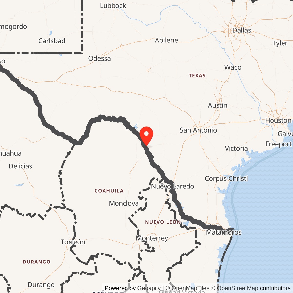
Longitude: -100.527
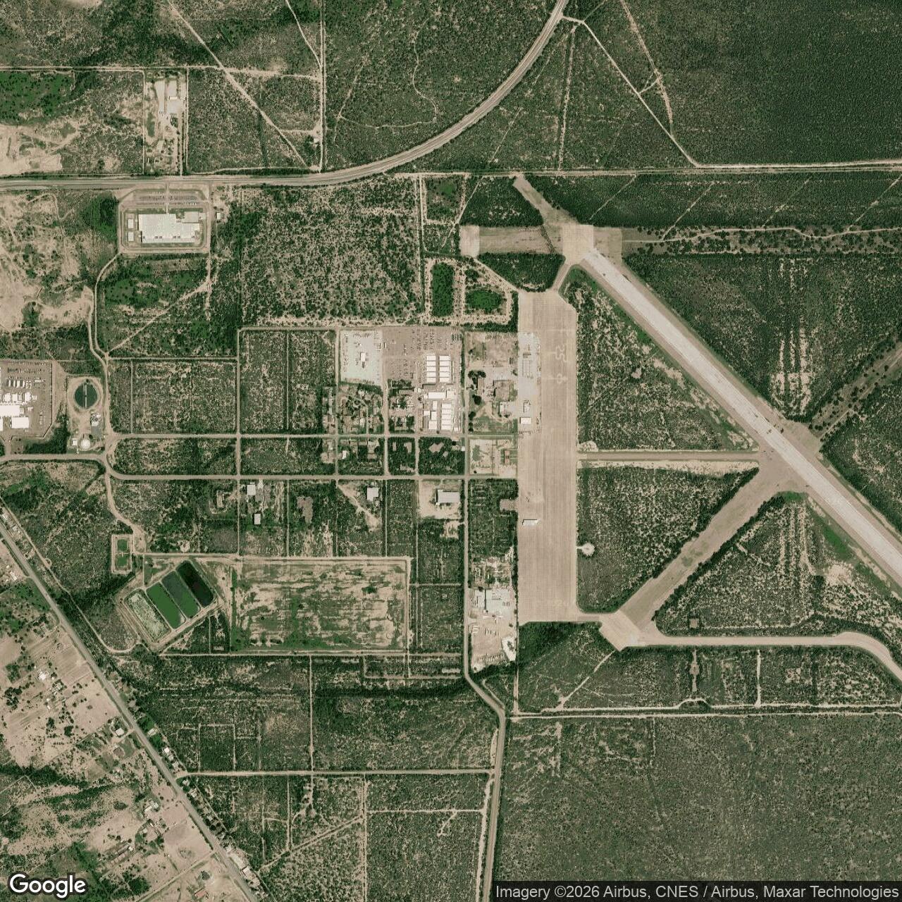
Location: Radar Base area north of Eagle Pass, Maverick County, Texas
Site designation: TM-188; later Z-188 in Guard planning and property accounting
Unit: 733rd Aircraft Control and Warning Squadron
Mission: Manual aircraft surveillance, warning and ground-controlled interception
Documented radar service: May 1959 to April 30, 1963; administrative and property phases extend beyond these dates
Approximate historical radar-compound locator: 28.860 north, 100.527 west. Not a surveyed antenna position, property boundary or public entrance.
Acreage: Radar-station acreage has not been established.
Installation Identity
Eagle Pass Air Force Station was a staffed Air Defense Command aircraft-control and warning installation operated by the 733rd Aircraft Control and Warning Squadron. Its principal equipment combined an AN/FPS-20A search radar with an AN/FPS-6 height finder, allowing the station to detect aircraft and provide the altitude information needed for air-defense decisions. Official ADC records date manual radar operation to May 1959 and its termination to April 30, 1963. The installation's administrative existence began earlier, and military use of property associated with its name continued afterward. Those separate phases explain why apparently contradictory opening and closing dates appear in later summaries.
The station was not simply another name for Eagle Pass Army Air Field, Eagle Pass Air Force Auxiliary Field or the much later Eagle Pass Tethered Aerostat Radar System site. The Army airfield was a World War II flying-training installation. The Air Force auxiliary field supported postwar flying training, including activity associated with Laughlin Air Force Base. The ADC station performed ground-based aircraft surveillance and control. The modern aerostat site belonged to a different surveillance program. Geography and reused property connected some of these activities, but their missions, operating organizations and administrative identities must remain distinguishable.
Eagle Pass's principal ADC identifier was TM-188. A 1956 installation directory also assigned it Property Identification Number 3306. Later documents used Z-188 in connection with proposed Air National Guard retention and subsequent storage-property accounting. That later designation does not establish that Eagle Pass became a SAGE-operational radar station. The original ADC equipment and operating table places its May 1959 opening in the manual-operation column and leaves the SAGE column blank. The defensible account is therefore a manual aircraft-control and warning station, not an automatically digitized SAGE sensor inferred from its later site number.
The Older Airfield Landscape
Eagle Pass's military landscape originated in the wartime expansion of Army aviation training. The Texas State Historical Association identifies Eagle Pass Army Air Field as a 1942 installation used for advanced single-engine pilot training, followed by basic training in November 1944. Flight training ended there in April 1945. The Army had created not only runways but also the buildings, fuel facilities, utilities and support infrastructure necessary for a flying school. The subsequent radar station occupied part of this larger military landscape rather than creating an entirely unrelated defense presence in the Eagle Pass area.
The Corps of Engineers' Formerly Used Defense Sites inventory retains four distinct Army property identities: Eagle Pass Army Air Field, Auxiliary Field No. 1, Auxiliary Field No. 2 and Auxiliary Field No. 3. These are not four names for the ADC radar station. The inventory describes differing landing-field improvements and land interests, including a 639.20-acre lease for Auxiliary Field No. 2. That lease figure belongs to the auxiliary property and cannot supply the radar station's missing acreage. The broad Army airfield inventory incorporates both Army training improvements and later Air Force radar and runway use, making it valuable for context but insufficient for a radar-only boundary.
Postwar flying activity adds another layer. Robert Mueller's official Air Force base history records Eagle Pass auxiliary-airfield inactivity and reactivation intervals, a transfer from Laredo Air Force Base to Laughlin on October 28, 1955, another inactivation on July 31, 1958, and activation on December 10, 1962. It also records an October 1962 opening of a new runway. These entries describe the flying property, not the ADC squadron's operating schedule. Indeed, the auxiliary field was reactivated shortly before the radar mission ended, demonstrating that radar closure did not mean every military activity at the former airfield ceased simultaneously.
Establishment, Construction and Arrival of the 733rd
The Air Force installation directory dated July 1, 1956, already lists Eagle Pass Air Force Station, TM-188, under Air Defense Command. On the same page it separately lists Eagle Pass Air Force Auxiliary Field, PIN 1177, under the flying-training organization. The distinction is particularly important because it predates radar operation and provides contemporary administrative evidence rather than retrospective naming. The 1956 directory gives the radar station logistical support through Goodfellow. By the March 31, 1957, directory, Laughlin appears as its logistical-support base, while the radar station remains an ADC installation.
Construction was still part of the story in early 1957. The March 8 Cotulla Record reported that the Corps of Engineers was seeking bids for several projects, including sewage treatment at the Eagle Pass radar station. The report also covered proposed construction at separate gap-filler locations. It establishes procurement activity, not a completed contract or accepted facility. Nevertheless, a sewage-treatment project is evidence that Eagle Pass required a sustained staffed installation with utilities, not merely a radar antenna placed beside an existing runway. The radar station's construction award, total cost and final acceptance date have not been recovered.
The 733rd Aircraft Control and Warning Squadron was activated on September 8, 1956, at Oklahoma City Air Force Station, initially assigned to the 33rd Air Division. The official organizational handbook dates its move to Eagle Pass to July 3, 1957. This movement provides a precise personnel and unit milestone nearly two years before the May 1959 radar-operation entry. It should not be replaced with a guessed construction-completion date. The sequence shows an administrative installation, a utility-building program and arrival of its operating squadron before the final documented operational opening of the radar system.
Eagle Pass belonged to the expansion commonly called the Mobile Radar program. In this context, a mobile-program designation does not imply that the station was a temporary convoy or that its equipment routinely moved between locations. Searching the Skies explains how the program required substantial fixed support facilities despite its name. At Eagle Pass, buildings, utilities, housing and tower foundations developed into a recognizable permanent-looking compound. Its relatively short operational life resulted from subsequent decisions about the continental air-defense network, not from an absence of a physical installation.
Manual Aircraft Warning and Interceptor Control
The station's work was to convert radar observations into usable information about aircraft approaching or moving through its surveillance area. The search radar supplied range and direction, while the height finder added altitude measurements. Together these observations supported aircraft identification, warning and ground-controlled interception. Eagle Pass's location near the southwestern border placed it within the South Texas portion of the continental defense network, but its Cold War mission should not be confused with the later border-law-enforcement role of aerostat surveillance. The 733rd was an Air Force air-defense unit, not a civilian air-traffic tower or customs detachment.
Manual operation meant that trained personnel remained central to interpreting and communicating the radar picture. Searching the Skies describes the broader system of operators, plotting, reporting and controllers coordinating fighter interception. That architecture explains Eagle Pass's mission, although a complete local operating instruction or shift roster has not been recovered. It is not evidence of a specific unrecorded scramble, aircraft identification incident or combat engagement. Nor does the station's participation in continental defense establish an automatic data connection to an AN/FSQ-7 computer or local installation of AN/FST-2 SAGE conversion equipment.
The 733rd's higher-headquarters assignments changed during the station's life. It was assigned to the Oklahoma City Air Defense Sector on January 1, 1960, then to the 4752nd Air Defense Wing on September 1, 1961. The official handbook returns it to the Oklahoma City sector on June 25, 1963, before discontinuance that August. These changes describe control and administration of the squadron; they do not independently demonstrate replacement of its radars or conversion to SAGE. Laughlin's logistical-support relationship was different again, providing a nearby support base rather than becoming the radar station's air-defense command.
Search Radar, Height Finder and Supporting Plant
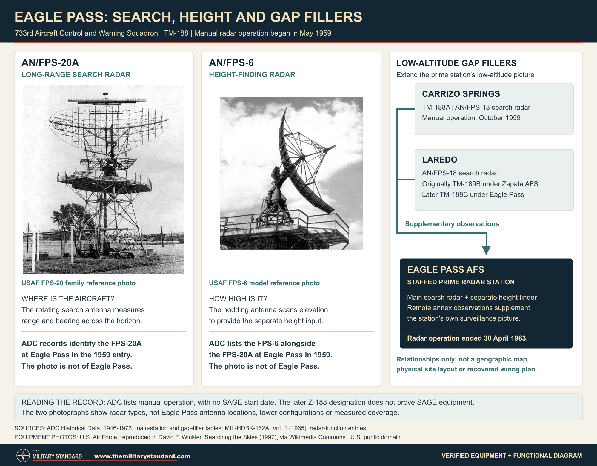
The ADC historical table identifies AN/FPS-20A and AN/FPS-6 equipment at Eagle Pass in 1959. Searching the Skies uses the broader FPS-20 family designation in its site summary. The more specific ADC suffix is retained because it is installation-level equipment evidence. The FPS-20A was a long-range search radar whose rotating antenna produced aircraft range and bearing information. It was not itself a precision height finder. Pairing it with a separate height-finding set explains the two conspicuous radar positions at a staffed station and the different information each contributed to aircraft control.
The AN/FPS-6 used an elevation-scanning antenna to determine target height rather than simply repeating the search radar's horizontal sweep. MIL-HDBK-162A describes it as a high-power height finder normally operated with a search radar of comparable range. The handbook's model reference gives a 200-nautical-mile range figure and S-band operation, but those are equipment characteristics, not proof that every aircraft at that distance could be detected or measured from Eagle Pass. Terrain, altitude, target characteristics and operating conditions affected results. No local performance-test record establishing the station's actual coverage envelope has been recovered.
The radar equipment depended on much more than the antennas. The Corps inventory describes later Air Force construction of support buildings, access roads, utilities and recreation facilities on the older military property. Dated field photographs identify operations and support structures, barracks and recreational buildings. The sewage project belongs to that same support story. Together these sources show a compound that had to house and sustain people as well as radar electronics. They do not justify reconstructing every room, assigning building numbers or depicting a standard ADC floor plan as a verified Eagle Pass layout.
Specialist station histories report that installation of an AN/FPS-27 had been contemplated but was canceled when Eagle Pass closed. This is a planning association, not evidence that the later radar actually operated there. No FPS-27 is substituted for the documented FPS-20A/FPS-6 combination in the active equipment record. Similarly, references to separate radio functions do not establish a precisely located, independently named GATR installation. The available evidence supports communications as necessary to the station's mission, while the exact detached radio-site boundaries, identifiers and local equipment acceptance records remain unresolved.
The Gap-Filler System
Low-flying aircraft could be difficult to observe from a distant principal radar because terrain and the curvature of the earth limited line-of-sight coverage. Remote gap fillers addressed that problem by extending low-altitude search coverage into additional areas. Eagle Pass's documented network included Carrizo Springs Gap Filler Annex, TM-188A, and the later parent relationship with Laredo Gap Filler Annex, TM-188C. These were separately located unattended radar installations. They supported the staffed station's information picture but did not duplicate its full height-finding, controller and residential establishment.
ADC records place Carrizo Springs in manual operation in October 1959 with an AN/FPS-18. Laredo also has an October 1959 operating entry, originally under TM-189B in the Zapata program. A later ADC roster identifies Laredo as TM-188C with the 733rd and a December 1960 manual-operating entry. That later month documents the later organizational record; it is not independently proven to be the exact day or month on which every circuit was retied. The original ADC tables and subsequent property order support TM-188C, rather than relying on the conflicting TM-188B identification found in a secondary summary.
Special Order G-83, issued June 28, 1963, identifies both Carrizo Springs, PIN 5659, and Laredo, PIN 5677, under Eagle Pass TM-188, with excess status effective May 1. This is particularly useful evidence because it names the parent and each separate property. The AN/FPS-18 at an annex furnished aircraft-search information, not a substitute for the parent's height finder. Technical-handbook descriptions of AN/FST-1 data transmission and AN/FSW-1 remote monitoring explain the standard gap-filler architecture. They do not, without a local equipment record, prove an independently documented installation of every standard component at Eagle Pass or each annex.
Personnel and Everyday Station Life
The surviving record contains modest but unusually tangible evidence of daily life. Charles Ray contributed a liberty pass and meal card identifying the 733rd at Eagle Pass. The liberty pass was issued August 25, 1961, when the holder was an airman second class. The meal card is dated April 2, 1963, identifies him as an airman first class, and carries the authorizing officer's name, Melvin R. Graham, second lieutenant. These are ordinary administrative documents, but they establish people using the station's personnel and dining system across two dated moments, including the final month of radar operation.
An interstation bowling match supplies another contemporary glimpse. The March 7, 1963, Rockport Pilot reports competition between Eagle Pass's 733rd and Rockport's 813th, including a six-game match. This connects the two small radar communities through recreation as well as their common command environment. The same newspaper page describes Rockport's own internal leagues, but those details cannot be transferred to Eagle Pass. Housing and recreation photographs complement the cards and sports report; none establishes the 733rd's exact authorized strength, duty-shift pattern, medical staffing or commander succession. Those details remain absent rather than being filled with generic station assumptions.
Why the Radar Mission Ended
Eagle Pass's closure occurred within a wider reorganization of continental air defense. The NORAD/CONAD historical summary for January through June 1963 describes late-1962 Department of Defense decisions to reduce the 416L program, including SAGE direction centers and prime radar stations. ADC and NORAD raised concerns about withdrawing facilities before replacement backup-control capabilities were ready. The official history therefore presents the reduction as an institutional and resource decision, not as proof that Eagle Pass's individual radar had failed or that its personnel had ceased to perform useful work.
The same history describes ADC proposals for reductions in the Oklahoma City sector and Air Force approval on March 8, 1963. Its shutdown account uses May 1 as the boundary for a group of radar and gap-filler withdrawals. Eagle Pass's own ADC site table gives April 30 as its last operational date, which is consistent with a May 1 shutdown boundary. Searching the Skies likewise separates a March closure order from an April end to radar operation. These mutually compatible records are stronger than selecting a later squadron or property date as the radar's last day.
An Air National Guard continuation was considered, but did not become a documented Eagle Pass operating phase. NORAD's summary lists Eagle Pass as Z-188 among seven possible sites for Guard retention. Eagle Pass and Ozona did not meet the proposed criterion of lying within 50 miles of a city with at least 25,000 people, and Eagle Pass was dropped from consideration by mid-1963. The proposal explains one appearance of the Z-188 designation. It does not establish a Guard squadron taking over the site, a resumed radar mission or a completed SAGE conversion.
Several closure milestones therefore need separate treatment. Radar operations ceased April 30, 1963. The 733rd was discontinued August 1. A congressional list published in April 1964 gives August 30, 1963, as the announced closing date for the Eagle Pass radar site. That list is an administrative closing record, not a local log of the final radar shift or a conveyance deed. For the annexes, May 1 excess status and the later issuance of G-83 are separate events again. Keeping these dates distinct preserves the actual sequence of operational shutdown, personnel administration and property accounting.
Storage, Disposal and Equipment Removal
Mueller's official history records Eagle Pass AFS, Z-188, redesignated as Laughlin Storage Annex, with a Laughlin-associated interval from November 15, 1963, to November 15, 1968, when it was disposed of. It also records an activation dated June 3, 1977. This is an important post-radar administrative trail, but the entry alone does not resolve whether the later activation involved precisely the same land interests and boundaries. It certainly does not state that the 733rd returned or that aircraft-warning radars resumed operation. The storage identity belongs in the station's afterlife, with the parcel-continuity limitation retained.
Physical removal also took longer than operational closure. A photograph series contributed by Harvey Hartman is captioned November 1965 and shows disassembly of the AN/FPS-6 tower. One image shows the tall lattice structure with its antenna already absent; another shows dismantled steel members laid out on the ground. These photographs demonstrate a surviving tower after the 1963 shutdown and its subsequent removal. They are not evidence of radar operation through 1965. They also offer a more reliable visual reference for the local tower than an imagined generic height-finder installation.
The radar property's subsequent history must remain distinct from continued flying use of the larger airfield. The 2023 Department of Homeland Security environmental assessment describes the former auxiliary airport as having supported Laughlin flying training and reports a 1995 excess declaration, drawing on earlier property studies. That late airfield date does not extend the ADC mission by three decades. Nor does the storage annex's 1968 disposition settle ownership of every runway, housing parcel and later federal project. The military landscape passed into different uses through different administrative and property sequences, rather than through a single universal closing date.
Environmental Records and Parcel Limits
Eagle Pass Army Air Field remains listed in the Corps' Formerly Used Defense Sites inventory as property K06TX0030. Its descriptive entry explicitly includes both Army training improvements and later Air Force radar-related construction. The fiscal-year 2024 inventory records an eligible property with projects and a Maverick County ownership entry. These are broad property-program fields, not a current radar-compound deed or an environmental clearance. The absence of a National Priorities List designation likewise does not certify that every parcel is free of contamination, munitions concerns or restrictions.
Older records show why the environmental program cannot be reduced to a single status label. The GAO's 2001 database records project 02, containerized hazardous, toxic or radioactive waste, with a completed remedial-action construction status and a 1995-1996 interval. Project 03, hazardous, toxic or radioactive waste, has a completed site-inspection status for 1998. The Corps' September 30, 2015, inventory lists those projects and two Military Munitions Response Program projects, 04 and 05. Completion of one action or inspection is not evidence that every later project, or the entire former Army and radar property, reached unrestricted-use cleanup.
The most detailed recent investigation available concerns a different part of the former military landscape. The August 2023 DHS environmental assessment for an Eagle Pass Joint Processing Center covers a proposed 62.76-acre project near 223 Fire Fly Lane, including an existing 25.70-acre facility area within a larger 153-acre tract. Its cultural-resources discussion places the former radar station about one mile east of the project. The assessment relates the project to the former approximately 1,100-acre auxiliary airport and a roughly 55-acre trap and skeet range. None of these acreage figures defines the ADC radar compound.
Field investigation found physical evidence of that western training landscape. A December 2022-January 2023 cultural survey used 30-meter transects and 53 shovel tests. Three semicircular concrete skeet-range paths predating 1947 were recorded as archaeological site 41MV422. The assessment describes extensive disturbance and reports a recommendation that the range was not eligible for the National Register, with Texas Historical Commission concurrence that the project would not affect historic properties. That conclusion concerns the project's area of potential effects. It is not a National Register determination for the radar operations building or the whole former Army airfield.
The environmental findings were similarly specific. A March 2023 Phase I assessment recommended additional investigation following observations of broken clay targets and other conditions. Phase II work in February and March examined a two-acre skeet-range area, its runoff areas and approximately twelve acres containing dumps, slag, dirt piles and borrow pits. The assessment reports forty soil borings, including background samples, and ten groundwater investigation locations; six wells were installed where groundwater was encountered at approximately 30-50 feet. Analyses included volatile and semivolatile organic compounds, metals, pesticides and PCBs. This was an actual sampling program, not merely a cursory description of possible historical contamination.
The reported results did not show metal exceedances of the applicable Texas residential or industrial protective concentration levels. They did identify three locations with polycyclic aromatic hydrocarbon or related semivolatile exceedances, affecting approximately four acres. Two were five-foot-deep samples in the skeet-range area and one was an aboveground soil pile; ten-foot samples did not show those PAH exceedances. The assessment discusses clay-target binding material as a possible source and recommends delineation and removal of affected soil. A final cleanup-completion report was not recovered. These findings cannot be reassigned to the radar compound a mile away, and the underlying studies are known here through their findings reproduced in the DHS assessment.
Buildings, Housing and the Surviving Landscape
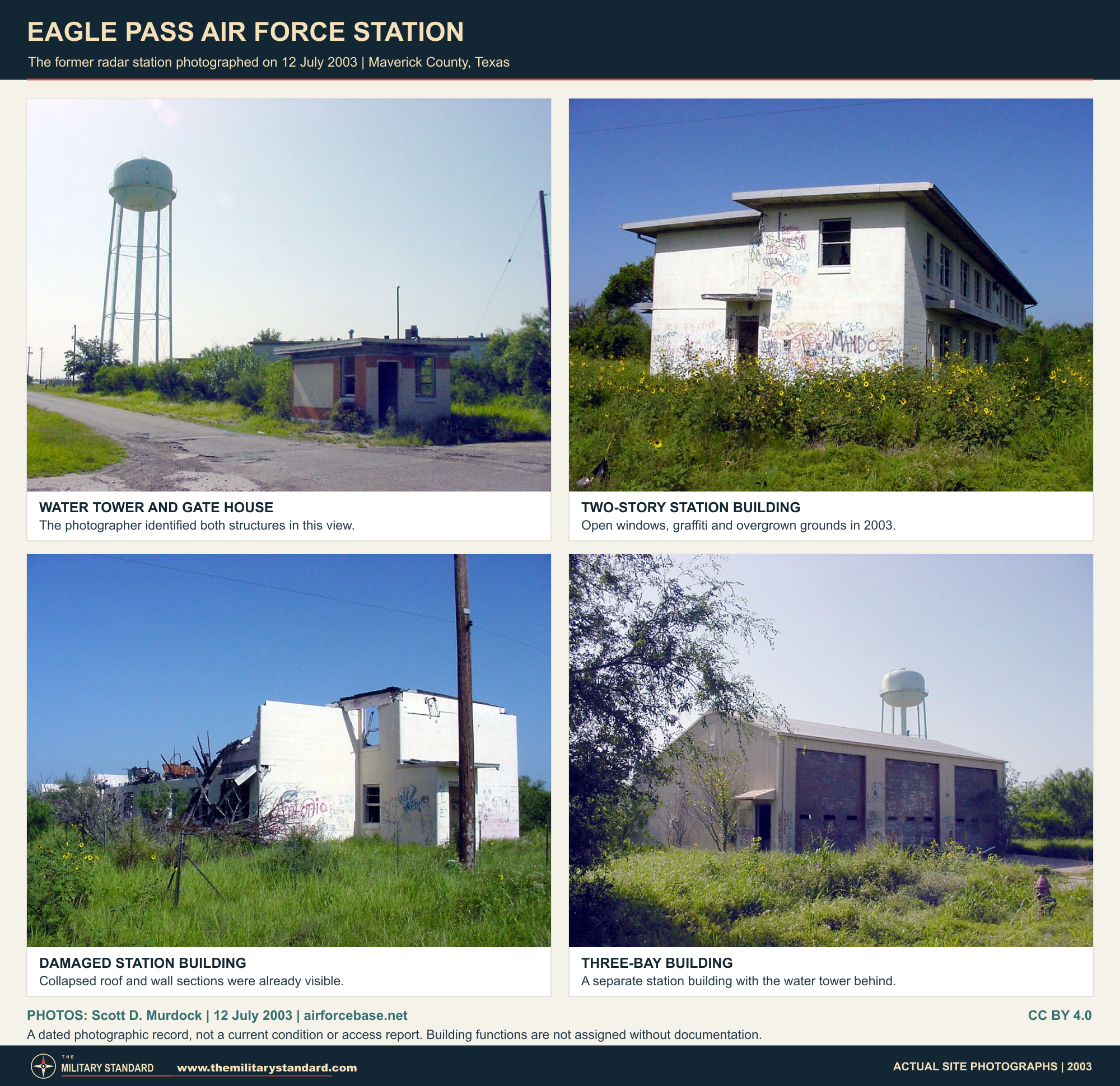
Photo credit: Scott D. Murdock, South Texas Flashback, July 12, 2003. Creative Commons Attribution 4.0. Original frames reproduced without retouching.
Scott D. Murdock's July 12, 2003, visit provides a dated primary observation of the former radar compound. He described deterioration of operational buildings since a 1994 visit, including neglect, vandalism and demolition, while reporting that much of the former housing remained occupied and better maintained. His linked photographs include support structures and a water-storage and gatehouse view. The contrast shows how a former station could lose its operational core while residential use continued. It remains a 2003 observation, not a statement that all those buildings, occupants or conditions are unchanged today.
FortWiki's November 2017 field photographs provide a later checkpoint: an operations building, barracks and recreational structures were still identifiable, and an FPS-20 tower foundation survived without its antenna and tower. These are dated observations, not a 2026 condition survey. The neighboring Radar Base community and Maverick County Memorial International Airport preserve parts of the wider military landscape, but neither is simply the radar compound under a new name. Exact present title to individual radar and housing parcels, the station's deeded acreage and current access arrangements have not been independently established. Nothing in the surviving-photo record implies public permission to enter.
A separate modern Eagle Pass radar identity appears in the Defense Department's 2004 facility inventory as Eagle Pass Radar Site, TARS No. 5. That table counts maintenance and production facilities; its figure is not acreage. CBP's February 2014 publication identifies Eagle Pass among the aerostat sites in the network transferred from Air Force responsibility to CBP. An official 2019 Air Force article again includes Eagle Pass in that network. Aerostat surveillance adds another military and federal surveillance chapter to the region, but it is not a documented continuation of the 733rd's fixed AN/FPS-20A and AN/FPS-6 station.
Eagle Pass AFS's distinctive history lies in the combination of an older flying-training landscape, a later staffed manual air-defense station, remote low-altitude radar annexes and an unusually complicated property afterlife. Its operational span was short, but its administrative and physical traces were longer lived. The contemporary directories, unit lineage, dated service documents and tower photographs allow those phases to be reconstructed without turning the former auxiliary airport into the radar station or treating every subsequent Eagle Pass surveillance activity as the same installation. The unresolved parcel details are important limits to that reconstruction, not reasons to erase the well-documented radar mission.
Chronology
- 1942 Eagle Pass Army Air Field is established as a World War II flying-training installation; this is the older airfield, not the later ADC radar station.
- November 1944 The Army airfield shifts from advanced single-engine to basic flying training.
- April 1945 Wartime flight training at Eagle Pass Army Air Field ends.
- October 28, 1955 Mueller records transfer of the Eagle Pass auxiliary field from Laredo AFB to Laughlin.
- July 1, 1956 The USAF installation directory lists Eagle Pass AFS, TM-188/PIN 3306, separately from Eagle Pass AF Auxiliary Field, PIN 1177.
- September 8, 1956 The 733rd Aircraft Control and Warning Squadron activates at Oklahoma City AFS under the 33rd Air Division.
- March 8, 1957 The Cotulla Record reports Corps bid solicitation for sewage treatment at the Eagle Pass radar station.
- March 31, 1957 The installation directory identifies Laughlin as the radar station's logistical-support base.
- July 3, 1957 The 733rd moves from Oklahoma City AFS to Eagle Pass.
- July 31, 1958 Mueller records auxiliary-airfield inactivation, separate from the radar mission's development.
- May 1959 ADC records manual radar operation at Eagle Pass with AN/FPS-20A and AN/FPS-6.
- October 1959 Carrizo Springs TM-188A begins documented manual AN/FPS-18 operation; Laredo also has an original TM-189B operating entry.
- January 1, 1960 The 733rd is assigned to the Oklahoma City Air Defense Sector.
- December 1960 A later ADC roster uses this manual-operation month for Laredo under TM-188C and the 733rd; the exact retie date is not independently established.
- August 25, 1961 Charles Ray's Eagle Pass liberty pass is issued.
- September 1, 1961 The 733rd is assigned to the 4752nd Air Defense Wing.
- October 1962 Mueller records opening of a new auxiliary-airfield runway, not a radar-system opening.
- December 10, 1962 Mueller records auxiliary-field activation under Laughlin.
- March 7, 1963 The Rockport Pilot reports bowling competition between the 733rd at Eagle Pass and the 813th at Rockport.
- March 8, 1963 The NORAD/CONAD summary records Air Force approval of proposed radar reductions.
- April 2, 1963 Charles Ray's 733rd meal card is issued during the final month of radar operation.
- April 30, 1963 ADC records cessation of Eagle Pass radar operations.
- May 1, 1963 The NORAD shutdown boundary follows the last operational day; G-83 later applies this excess date to Carrizo Springs and Laredo annex properties.
- By June 1963 Eagle Pass is dropped from consideration for Air National Guard radar-site retention; no completed Guard takeover is established.
- June 25, 1963 The 733rd returns administratively to the Oklahoma City Air Defense Sector.
- June 28, 1963 ADC issues Special Order G-83, identifying both annexes under Eagle Pass TM-188.
- August 1, 1963 The 733rd is discontinued, separate from the April radar shutdown.
- August 30, 1963 The later congressional closing list gives this announced closing date for the Eagle Pass radar site.
- November 15, 1963 Mueller's Laughlin accounting begins an Eagle Pass AFS/Laughlin Storage Annex interval.
- November 1965 Dated photographs show removal of the former AN/FPS-6 tower.
- November 15, 1968 Mueller records disposition at the end of the storage-annex interval.
- June 3, 1977 Mueller records a later activation in the storage-annex entry; exact parcel continuity and any change in function remain unresolved.
- 1995 The DHS assessment reports an excess declaration for the former auxiliary airport; this is not the radar station's closing date.
- 1995-1996 GAO's later database records a completed remedial-action construction interval for FUDS project 02.
- 1998 GAO records completed site inspection for FUDS project 03, not whole-property unrestricted-use clearance.
- July 12, 2003 Scott D. Murdock photographs deteriorating radar buildings and continuing residential use.
- 2004 The Defense Department facility inventory separately lists Eagle Pass Radar Site, TARS No. 5.
- February 2014 CBP identifies Eagle Pass in the aerostat network transferred from Air Force responsibility.
- September 30, 2015 The Corps' Texas inventory lists Eagle Pass AAF projects 02, 03, 04 and 05 in hazardous-waste and munitions-response categories.
- November 2017 FortWiki's field photographs document surviving station buildings and the former FPS-20 foundation.
- December 2022-January 2023 A cultural survey examines the western Joint Processing Center project area and records former skeet-range remains.
- February-March 2023 Phase II investigation samples soil and groundwater in the western project area; limited PAH exceedances are reported.
- August 2023 DHS publishes its environmental assessment, distinguishing the project from the former radar station about a mile east.
- Fiscal year 2024 The Corps inventory retains the broader Eagle Pass AAF property as an eligible FUDS property with projects.
Information sources (28)
- PDFHistorical Data of the Aerospace Defense Command, 1946-1973
SOURCE FOR: Printed page 56/PDF page 89, TM-188, May 1959 manual operation, AN/FPS-20A/FPS-6, April 30 radar cessation and August 1 squadron inactivation; gap-filler tables, printed pages 78 and 87, Carrizo Springs and Laredo identities and operating entries.
- PDFA Handbook of Aerospace Defense Organization, 1946-1980
SOURCE FOR: Printed page 100/PDF page 111, 733rd activation at Oklahoma City, July 3, 1957 move, higher-headquarters assignments and August 1, 1963 discontinuance.
- PDFDirectory of United States Air Force Installations, July 1, 1956
SOURCE FOR: Printed page 11/PDF page 29, distinct ADC radar station PIN 3306 and flying-training auxiliary field PIN 1177, administrative existence and Goodfellow support.
- PDFDirectory of United States Air Force Installations, March 31, 1957
SOURCE FOR: Printed page 12/PDF page 23, separate station and auxiliary-field entries, ADC identity and Laughlin logistical support; ambiguous scan coordinate not used as a precise location.
- PDFSearching the Skies: The Legacy of the United States Cold War Defense Radar Program, David F. Winkler, Air Combat Command, June 1997
SOURCE FOR: Printed page 157/PDF page 167, Eagle Pass GCI mission and radar pair, March closure order and April operational termination; network chapters on Mobile Radar construction and manual air-defense architecture. Public mirror of the USAF-authored report reviewed.
- PDFNORAD/CONAD Historical Summary, January-June 1963
SOURCE FOR: Printed pages 1-4 and 12/PDF pages 14-17 and 25, 416L reduction context, March approval, May shutdown boundary, Eagle Pass Z-188 Guard-retention proposal and withdrawal from consideration.
- PDFADC Orders Compilation, Special Order G-83, June 28, 1963
SOURCE FOR: PDF page 37, Carrizo Springs PIN 5659/TM-188A and Laredo PIN 5677/TM-188C under Eagle Pass, May 1 excess effective date; not a parent-property deed.
- WEBThe Cotulla Record, March 8, 1957, front page
SOURCE FOR: Contemporary bid solicitation for Eagle Pass radar sewage-treatment facilities and separate gap-filler construction, not contract award or completion.
- PDFCongressional Record, April 23, 1964, installation-closing list
SOURCE FOR: Eagle Pass radar-site announced closing date August 30, 1963, distinguished from last radar operation and unit discontinuance.
- PDFAir Force Bases, Volume I: Active Air Force Bases Within the United States of America on 17 September 1982, Robert Mueller, 1989
SOURCE FOR: Printed pages 319-320/PDF pages 337-338, Laughlin relationship, separate auxiliary-field chronology and Eagle Pass AFS/Laughlin Storage Annex accounting, 1963-1968 disposition interval and 1977 activation entry.
- PDFTM 11-487C-1 / MIL-HDBK-162A, Volume 1, United States Radar Equipment, December 15, 1965
SOURCE FOR: AN/FPS-6 model function and reference characteristics; AN/FST-1 and AN/FSW-1 gap-filler architecture, without promoting generic configuration to verified local inventory.
- WEBThe Rockport Pilot, March 7, 1963, page 5
SOURCE FOR: Contemporary intersquadron bowling competition between the 733rd at Eagle Pass and 813th at Rockport; separate Rockport league details not attributed to Eagle Pass.
- WEB733rd Eagle Pass AFS, Texas, Liberty Pass and Meal Card, contributed by Charles Ray
SOURCE FOR: Original cards dated August 25, 1961 and April 2, 1963, unit identification, rank change and meal-card authorizing officer; no personal service numbers reproduced.
- WEBEagle Pass AN/FPS-6 Tower Disassembly, November 1965, contributed by Harvey Hartman
SOURCE FOR: Dated original photographs of tower survival after radar shutdown and subsequent dismantling; not evidence of 1965 radar operation.
- WEBUSACE Formerly Used Defense Sites, Fiscal Year 2024 Property Inventory, Eagle Pass query
SOURCE FOR: K06TX0030 Army/radar/runway property description and inventory status; distinct Army auxiliary properties K06TX0031, K06TX0035 and K06TX0038 and the No. 2 lease acreage. Coordinates are broad property locators, not ADC antenna positions.
- PDFFormerly Used Defense Sites Per State, Texas, September 30, 2015
SOURCE FOR: Printed inventory page 295/PDF page 6, Eagle Pass AAF projects 02 CON/HTRW, 03 HTRW, 04 MMRP and 05 MMRP; category definitions and limits of project listing.
- WEBGAO-01-1012SP, Environmental Contamination: Cleanup Actions at Formerly Used Defense Sites, Texas Project Data, 2001
SOURCE FOR: Eagle Pass AAF project 02 completed remedial-action construction, 1995-1996, and project 03 completed site inspection, 1998; not whole-property cleanup certification.
- PDFEnvironmental Assessment for the Eagle Pass Joint Processing Center, Department of Homeland Security, August 2023
SOURCE FOR: Sections 3.8 and 3.11, printed pages 3-36/37 and 3-44/45, figure 3-5; western project and former skeet-range geography, airfield excess context, cultural survey, Phase I/II findings, PAH exceedances and recommended soil work. Underlying consultant studies reviewed through findings reproduced in this assessment, not as separately obtained reports.
- WEBSouth Texas Field Trip, Scott D. Murdock, July 2003
SOURCE FOR: July 12 Eagle Pass field observations and photographs, operational-building deterioration compared with 1994 and continuing housing occupancy. Author's text and images licensed CC BY 4.0 unless otherwise noted.
- WEBEagle Pass Air Force Station, FortWiki
SOURCE FOR: Dated November 2017 building/foundation photographs and qualified compound locator; secondary conflicting shutdown and annex-code statements not adopted.
- WEBEagle Pass AFS, Texas, Radomes Museum Station Record
SOURCE FOR: Secondary historical locator and canceled FPS-27 planning association, not an active FPS-27 installation or proof of SAGE conversion.
- WEBEagle Pass Army Air Field, Art Leatherwood, Texas State Historical Association
SOURCE FOR: Separate wartime predecessor's 1942 establishment, advanced single-engine/basic training sequence and April 1945 end of flight training.
- PDFInstallation/Facilities Inventory, Department of Defense, 2004
SOURCE FOR: PDF page 180, separately named Eagle Pass Radar Site, TARS No. 5, in the Air Force maintenance and production facilities inventory; facility count not acreage.
- PDFCBP Access, Volume 3, Issue 4, February 28, 2014
SOURCE FOR: Eagle Pass among eight aerostat sites transferred from Air Force responsibility to CBP, separate from the 1960s ADC station.
- WEBTethered Aerostat Radar System Optimization, 505th Command and Control Wing, November 19, 2019
SOURCE FOR: Official later identification of Eagle Pass in the TARS network; site-specific equipment changes elsewhere not assumed for Eagle Pass.
- WEBAN-FPS-20 Radar.jpg, USAF photograph from Searching the Skies, via Wikimedia Commons
SOURCE FOR: Authentic FPS-20 family photograph used in the approved equipment graphic; model reference, not an Eagle Pass photograph. Identified as a U.S. public-domain government work.
- WEBAN-FPS-6 Radar.jpg, USAF photograph from Searching the Skies, via Wikimedia Commons
SOURCE FOR: Authentic FPS-6 photograph used in the approved equipment graphic; model reference, not an Eagle Pass photograph. Identified as a U.S. public-domain government work.
- WEBCreative Commons Attribution 4.0 International
SOURCE FOR: Reuse license for the Scott D. Murdock photographs, with photographer, source and license links retained near the image.