
Unalakleet Air Force Station, Alaska
The 718th Squadron operated search and height-finding radar above Norton Sound, supported by a compact hilltop camp and nearby White Alice communications.
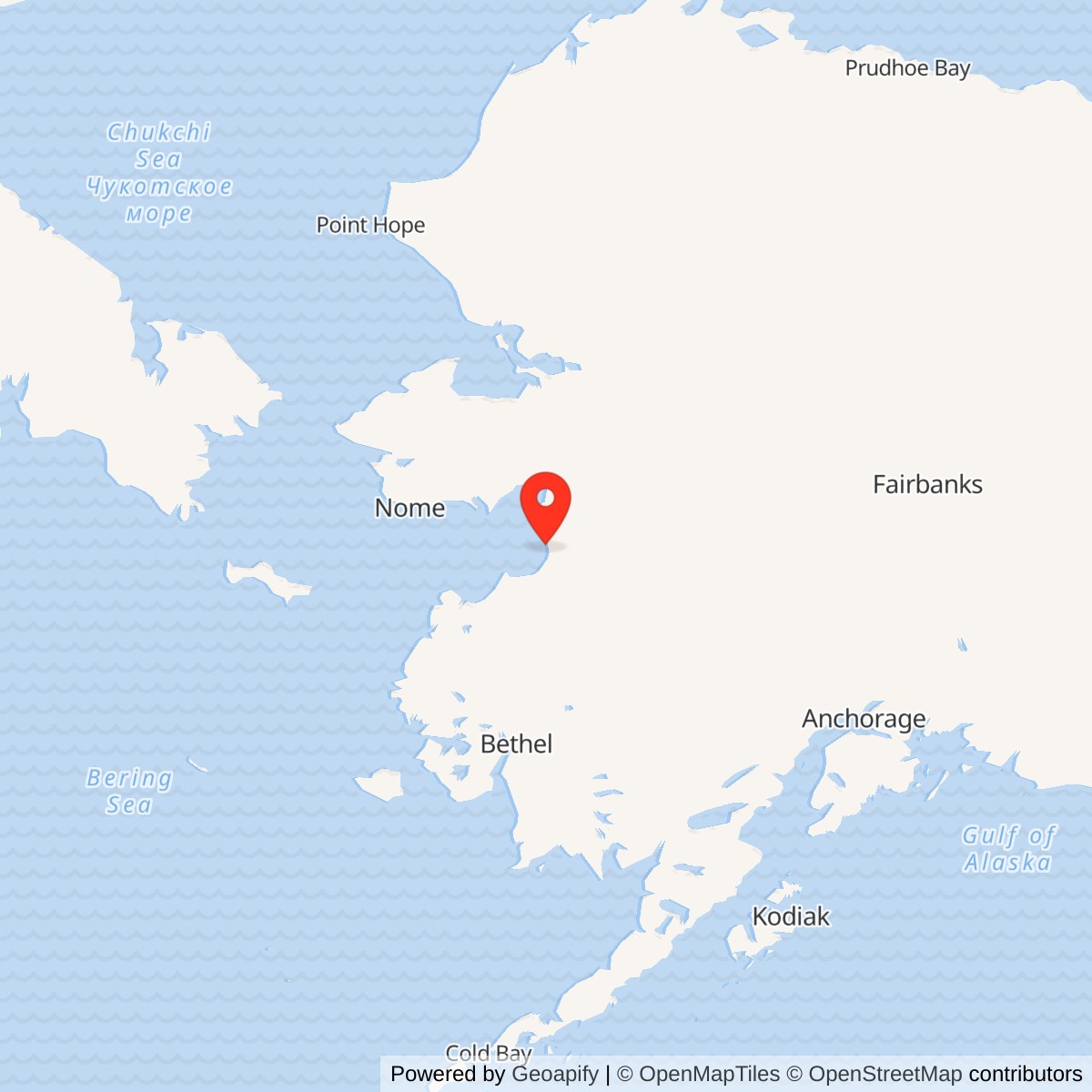
Longitude: -160.752205
Site Number: F-20
Current Role: Former radar facility; main buildings were demolished. Alaska DEC lists the main radar environmental site as active, with Unalakleet Native Corporation custody reported for the former 740-acre land parcel.
- Station code
- F-20
- Military role
- Aircraft surveillance and ground-controlled interception
- Operating unit
- 718th Aircraft Control and Warning Squadron
- Original search radar
- AN/FPS-4
- Late-1962 search upgrade
- AN/FPS-20A
- Radar operating period
- June 1958-June 1969
- Later Air Force use
- Unalakleet Recreational Annex, 1971-November 1974
- Historical property
- Approximately 740 acres; concentrated main complex 22.6 acres
- Associated communications
- Separate North River White Alice relay
- Location
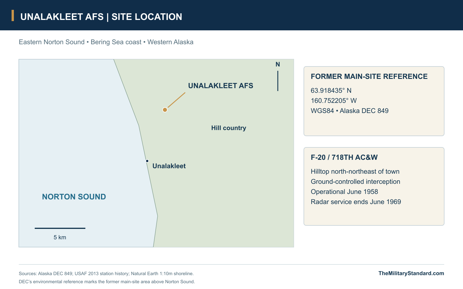
- Hilltop north-northeast of Unalakleet, eastern Norton Sound
- Latitude / longitude
- 63.918435, -160.752205; WGS84 main-site environmental reference (DEC 849)
A Radar Watch Above Norton Sound
Unalakleet Air Force Station stood on a hill above the eastern shore of Norton Sound, where the 718th Aircraft Control and Warning Squadron operated one of Alaska's permanent Cold War radar posts. Designated F-20, it entered ground-controlled-interception service in June 1958 and remained part of the air-defense screen until June 1969. Search and height-finding equipment supplied observations that helped the command follow aircraft approaching across western Alaska. Around the radar towers, a compact camp provided the accommodation, utilities and maintenance needed to sustain that work. [1] [3]
The main radar site lay about three and a half miles north-northeast of Unalakleet. Its hilltop gave the electronic equipment a position above the coastal lowlands, while the town, airport and seasonal marine supply route connected the station to the wider territory. Nearby North River White Alice served a separate communications purpose east of the radar post. Together they illustrate two different requirements of Alaska's defense: detecting aircraft and carrying information between widely separated installations. [1] [5] [6]
Survey, Construction and the 718th Squadron
Alaskan Air Command and Army Corps of Engineers representatives surveyed a permanent radar location at Unalakleet in 1948, well before the station entered service. The project eventually became part of the late-1950s expansion of the aircraft-control-and-warning network. A construction contract went to Sam Bergstrom of Tacoma, Washington, in 1955. The interval between the first survey and commissioning reflects a program that had to secure a suitable position, prepare the ground and assemble an entire operating community alongside its radar equipment. [1]
Preparing the summit changed the land itself. The Corps' later description places the original hilltop at about 705 feet above sea level and the graded station surface at roughly 681-684 feet. Excavation also created space for utilities and underground fuel storage in the bedrock. Roads, foundations, tanks and service lines made the location usable through changing seasons, while the resulting compound concentrated the radar buildings and much of the station's domestic plant on the prepared hill. [7]
The Air Force history records activation of the 718th Aircraft Control and Warning Squadron in April 1957, followed by operational GCI service in June 1958. NORAD's equipment roster dated July 31, 1958 lists F-20, the 718th Squadron, search radar and a height finder together. That contemporary record captures the station early in its working life. Although higher-headquarters assignments changed over time, the 718th remained the organization responsible for running Unalakleet throughout its air-defense career. [1] [3]
The Hilltop Compound
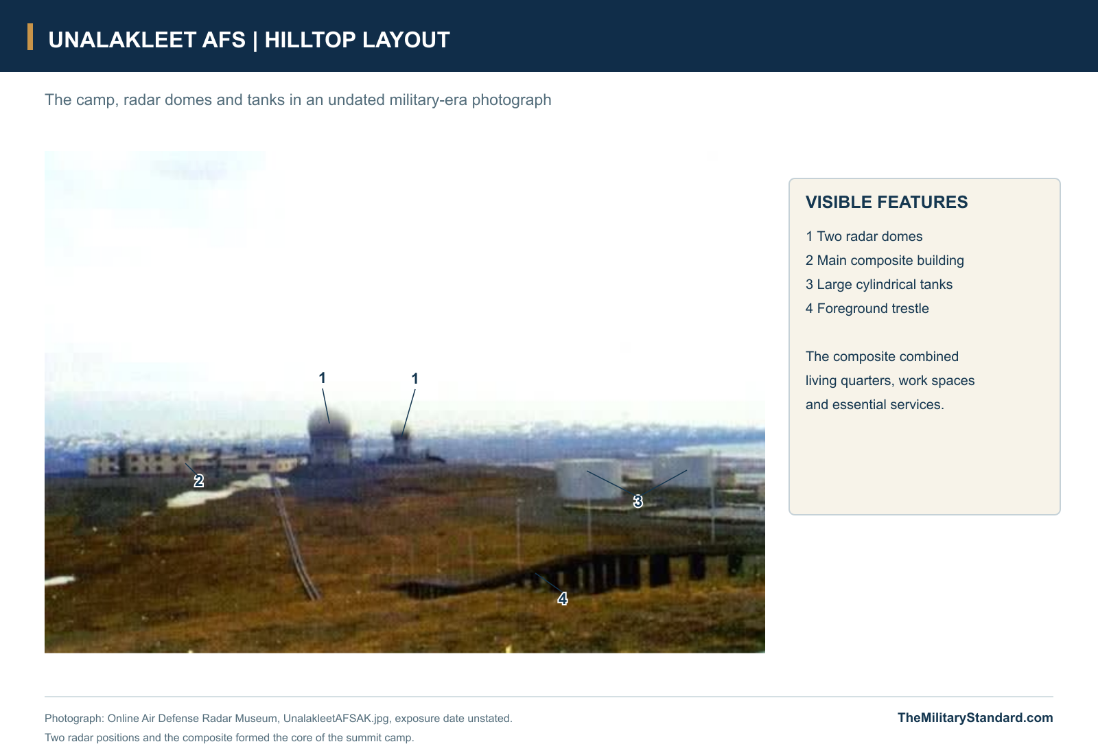
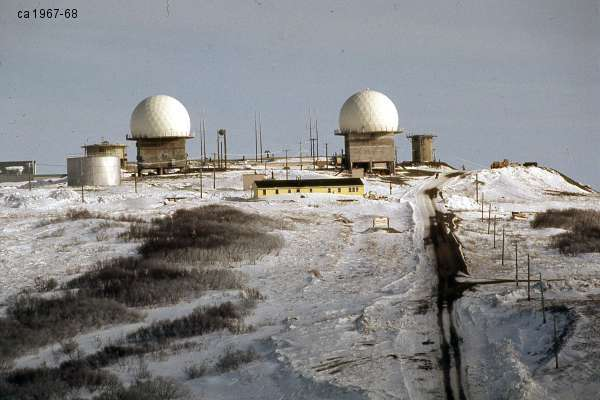
Unalakleet used the standardized compact construction associated with the second group of Alaska radar stations. The Corps describes a two-story wood-frame composite and a supporting group of wood-frame, concrete and mixed-construction buildings, with two dome towers beside the technical plant. Historical photographs show the dominant living-and-service building, the two radar positions, large cylindrical tanks and the approach across the prepared ground. Their proximity reduced the distance between the operating sections and the services on which they depended. [2] [7] [11]
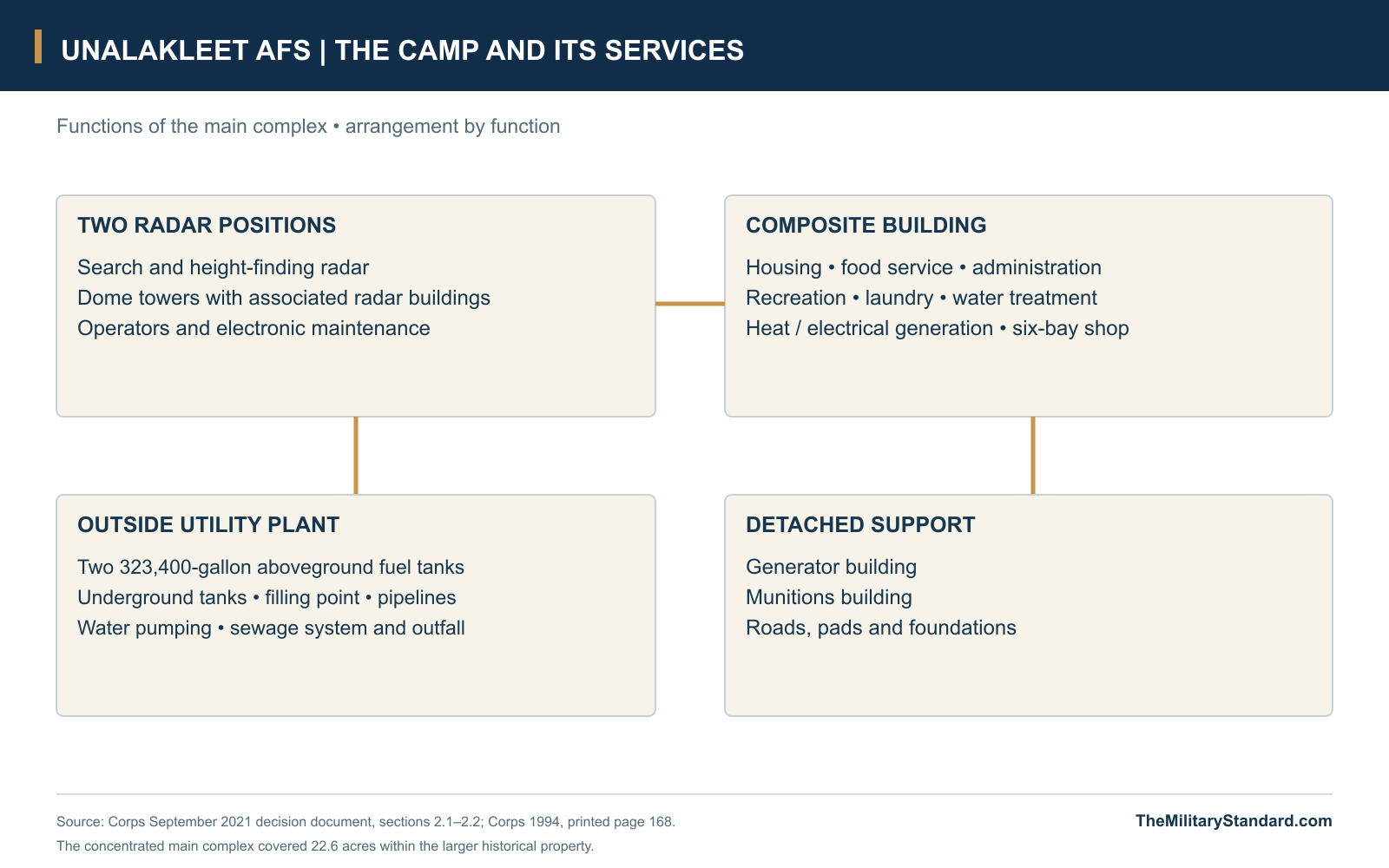
The composite brought housing, food service, recreation, laundry and administration together with water treatment, heating and electrical generation. It also contained a six-bay automotive shop capable of supporting small vehicles and heavy equipment. The building consequently served as both home and workplace for many of the station's personnel. A problem with heat, power or water could affect the domestic community and the radar watch at the same time, making utility maintenance a direct part of mission readiness. [7]
Outside facilities extended that central plant. The main complex included radar buildings and towers, water-pumping facilities, pipelines, fuel storage and filling equipment, sewage facilities, a generator building and a munitions building. The Corps' later description treats the main complex as a 22.6-acre area. This was the concentrated operational plant within a much broader historical property holding, whose roads, interests and other associated ground extended beyond the buildings visible in a hilltop photograph. [7] [9] [10]
Search Radar, Height Finding and Interception
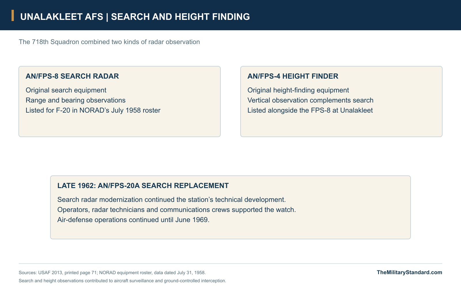
Unalakleet began with an AN/FPS-4 height finder. The search set provided range and bearing observations; the height finder added the vertical information needed to describe an aircraft's position more fully. Operators combined these different observations into the radar picture used for identification and control. NORAD classified Unalakleet as a GCI station in 1958, placing it among the posts that contributed to ground-controlled interception as well as aircraft surveillance. [1] [3]
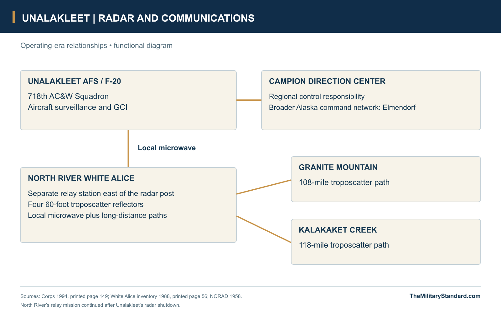
The local watch worked within a regional command system. Campion Air Force Station's control responsibilities expanded in 1958 to include Unalakleet, connecting the Norton Sound post with the interior direction center and the broader command structure associated with Elmendorf Air Force Base. That relationship gave the observations from F-20 a purpose beyond the local scope. Trained operators, communications staff and technicians had to keep information useful and moving so that a distant observation could contribute to identification and an organized air-defense response. [2] [3]
In late 1962, Unalakleet received an AN/FPS-20A search radar in place of its original search equipment. The replacement extended the station's technical career well beyond its initial installation, while the underlying division between search and height finding remained central to the work. Photographs from about 1967-1968 still show two prominent domes above the camp. The radar mission continued until the 1969 reduction in Alaska's air-defense forces brought an end to the station's operational watch. [1]
North River and the White Alice Connection
Reliable communications were essential to making a remote radar useful. North River White Alice entered operation on September 13, 1957, before Unalakleet's GCI commissioning, and provided a local microwave link to the radar station. Its four 60-foot troposcatter reflectors carried longer paths toward Granite Mountain, 108 miles away, and Kalakaket Creek, 118 miles away. The relay connected the Unalakleet area to the larger White Alice system without requiring an uninterrupted line of towers across the intervening country. [5]
The relay made use of many AC&W support facilities, but it also had its own equipment-and-power building and a separate dormitory. Sharing services tied the two stations together in practical ways without giving them identical missions or identical working lives. Radar operators at Unalakleet dealt with aircraft observations and interception work; relay personnel maintained the links that carried traffic between stations. North River's communications role continued after the 718th's radar mission ended, and the White Alice station remained in service until 1978. [1] [2] [5]
Fuel, Water and Seasonal Supply
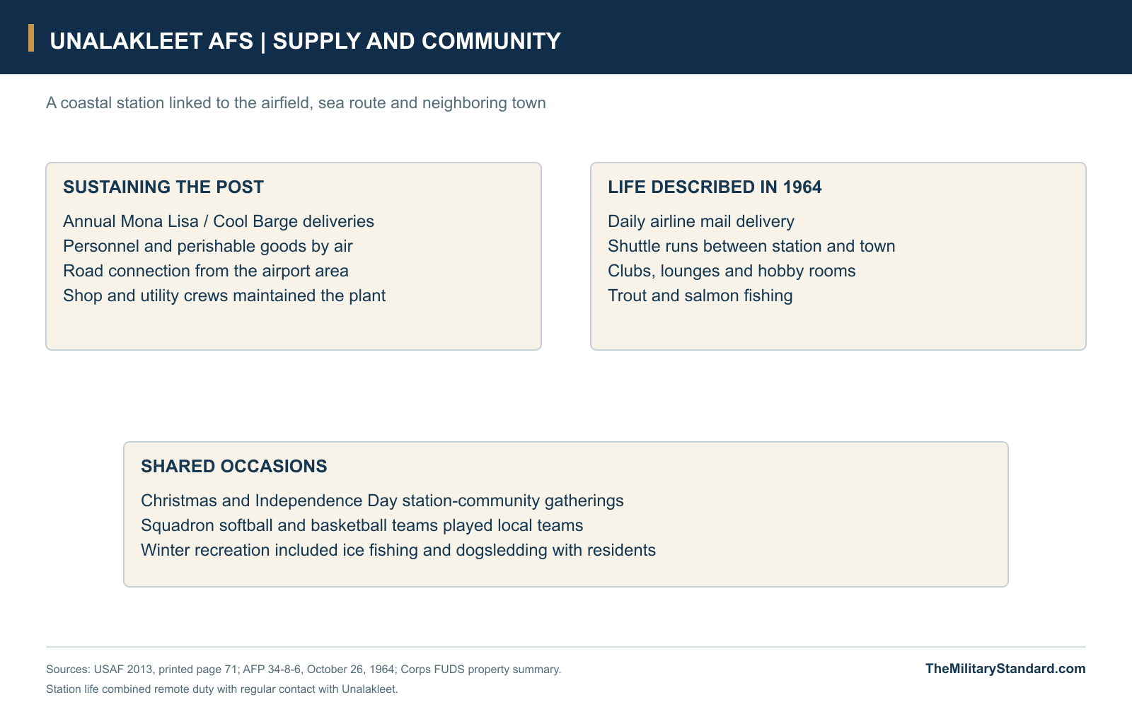
Annual marine resupply brought bulk stores to the Unalakleet area under the Mona Lisa program, later known as Cool Barge. Perishable goods and personnel traveled by air. This combination joined a seasonal heavy-lift route with a more frequent but smaller air connection, allowing the station to accumulate the supplies needed for sustained operations while maintaining contact with the rest of Alaska. The road from the airport area to the hill completed the movement from outside transport to the camp and its technical facilities. [1] [9]
Fuel storage was an especially substantial part of the plant. The Corps identifies two large aboveground tanks rated at 323,400 gallons each, along with underground tanks, filling equipment and pipelines. Water required wells or pumping points, treatment and distribution; sewage had its own collection and outfall facilities. These systems gave mechanics and utility crews work that was as necessary as maintaining the radar electronics. Vehicles, generators and heating equipment all depended on a dependable flow of fuel, water, spare parts and attention. [7]
The difference between the operating plant and the broader property is visible in the land records. Public Land Order 1771, signed December 24, 1958 and published the following January, withdrew two parcels totaling 622.85 acres for the station. A later Corps property summary adds lesser interests to produce 737.18 acres, while DEC describes approximately 740 acres. The order also addressed the public road and customary hunting, fishing and berry gathering, showing how military administration intersected with an established local landscape. [6] [9] [10]
The Radar Crew and the Unalakleet Community
The Air Force's oral-history participants give names to several kinds of technical work at the station. Fred Mahaney served as a radar operator in 1958-1959, Robert C. Prew worked in radar maintenance in 1959-1960, and Staff Sergeant Charles W. Greenleaf was the radar-maintenance NCO in charge during 1962-1963. Their assignments span the station's opening years and the search-radar modernization. Operating the scopes and keeping the equipment functioning were complementary responsibilities within the same small installation. [1]
The station also hosted specialized support beyond the 718th's own radar organization. David C. Tepe recalled serving there in 1960 with the 1930th Airways and Air Communications Service organization, maintaining TACAN equipment while a guest of the squadron. Such work added another technical specialty to the Unalakleet military community. Cooks, vehicle mechanics, utility personnel, supply staff and administrative workers supported the living-and-working plant that allowed these technical sections to carry out their duties. [1] [7]
A 1964 Air Force personnel guide presented Unalakleet as a year-long remote assignment with unusually good opportunities for trout and salmon fishing. It described equipment available for recreation, a dining hall, clubs, lounges, hobby shops and recreation rooms. Daily Alaska Airlines service brought mail, while shuttle runs connected the station and town. These details show the practical means by which a remote post maintained morale and contact with people beyond the hilltop. [4]
Contact with the community extended beyond transport and shopping trips. The guide described joint station-and-town gatherings at Christmas and Independence Day, and squadron softball and basketball teams competing with local teams. Winter activities included ice fishing and dogsledding with residents. For personnel arriving for a limited tour, these occasions offered a connection to the place around the installation; for Unalakleet, they were part of the everyday relationship with a nearby military community whose needs and routines overlapped with those of the town. [4]
Radar Closure and the Recreation Annex
The Air Force ended defense operations at Unalakleet in June 1969 as reductions changed the Alaska air-defense establishment. Fire Island and Northeast Cape also lost their radar missions in the same general contraction. At Unalakleet, the end of the watch preceded the inactivation of the 718th Squadron in October. The two events marked different parts of the shutdown: first the operational function, then the organization that had maintained it. [1]
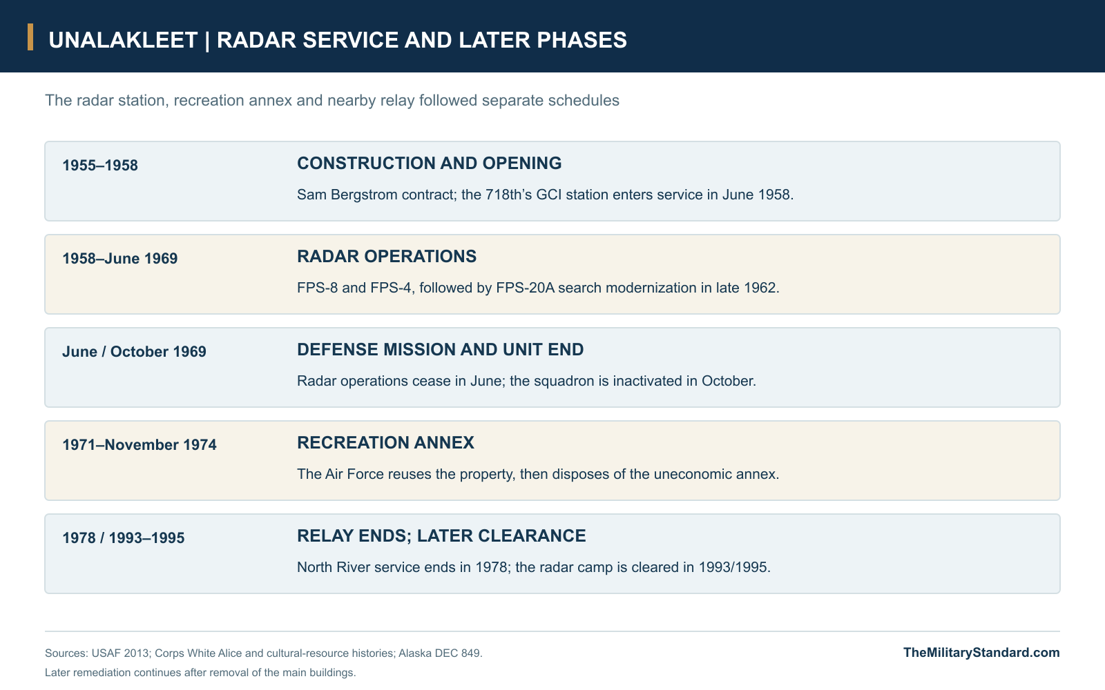
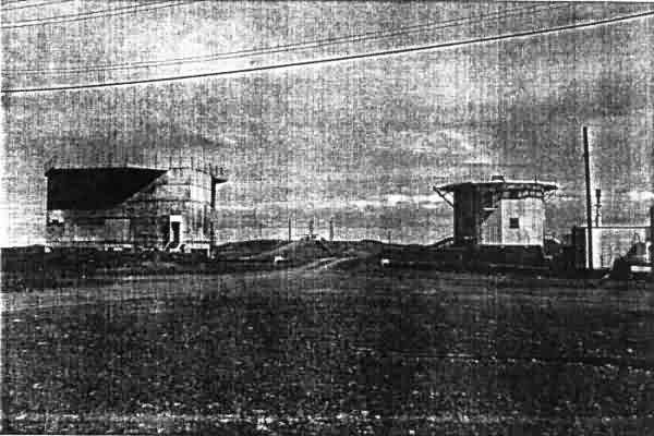
The property subsequently acquired a different Air Force role. Alaskan Air Command activated the Unalakleet Recreational Annex in 1971, reusing the location after its radar service had ended. June 1971 GSA disposal-inspection photographs show the radar platforms without their domes and antennas, a striking change from the late-1960s view. The annex proved costly to retain and was disposed of in November 1974. North River's continuing communications service followed its own schedule nearby. [1] [8]
Removal and the Former Station
The unused plant remained a substantial physical presence after military operations ended. A 1986 inventory recorded nine buildings, six generators, large fuel tanks, underground tanks and miscellaneous debris. Demolition and removal work in 1993 and 1995 cleared the principal aboveground infrastructure and addressed tanks, debris and contaminated soil. The later environmental program had to deal with the legacy of the entire support plant, including fuel handling and disposal practices, after the radar equipment itself had long gone. [6] [7] [9]
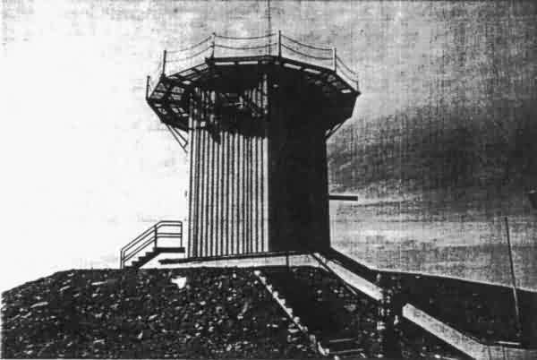
Restoration continued through further investigations, excavation, disposal and treatment. More recent work has included phytoremediation, using planted willows as part of the soil-treatment approach, alongside removal of contaminated material. In May 2026, DEC approved a final report on phytoremediation construction and contaminated-soil disposal. The main radar environmental case remains listed as Active. DEC reports Unalakleet Native Corporation custody of the former property, placing this continuing restoration within the land and community that outlasted the station. [6]
Unalakleet's surviving record brings together aircraft surveillance, long-distance communications and the work of sustaining a coastal Alaska post. Its search and height-finding radars belonged to an air-defense system reaching far beyond Norton Sound, while the composite, fuel plant and supply routes made that mission possible locally. The later recreation annex and long restoration effort added different chapters to the same hilltop. Photographs of the domes, the connected camp and the emptied platforms preserve successive stages in a landscape whose military buildings have disappeared. [1] [5] [7] [8]
Chronology
- 1948 Air Command and Corps representatives survey a permanent radar location. [1]
- 1955 The construction contract is awarded to Sam Bergstrom of Tacoma. [1]
- April 1957 The Air Force history records activation of the 718th AC&W Squadron. [1]
- September 13, 1957 Nearby North River White Alice enters operation, with a local microwave connection to Unalakleet AFS. [5]
- June 1958 Unalakleet becomes an operational GCI station. [1]
- July 31, 1958 NORAD lists F-20, the 718th Squadron, FPS-8(A), FPS-4(A) and GCI service. [3]
- December 24, 1958 Public Land Order 1771 withdraws two station parcels totaling 622.85 acres. [10]
- Late 1962 AN/FPS-20A search radar replaces the original search equipment. [1]
- October 26, 1964 The Air Force personnel guide describes station life, mail, recreation and community events. [4]
- June 1969 Air-defense operations cease at the radar station. [1]
- October 1969 The 718th AC&W Squadron is inactivated. [1]
- 1970 DEC records relinquishment of the historical station parcel to BLM. [6]
- 1971 The Air Force activates Unalakleet Recreational Annex. [1]
- June 1971 GSA inspection photographs show the radar platforms without domes or antennas. [8]
- November 1974 The recreation annex is disposed of after proving uneconomic. [1]
- 1978 North River's separate White Alice communications service ends. [2] [5]
- 1986 Inspection inventories the abandoned buildings, generators and fuel-storage plant. [6] [9]
- 1993-1995 Demolition, tank removal, debris clearance and soil work remove the principal station infrastructure. [6] [7]
- September 2021 The Corps issues a decision document for the former main complex. [7]
- May 5, 2026 DEC approves a report on phytoremediation construction and contaminated-soil disposal. [6]
Related Sites
Information sources (12)
- PDFU.S. Air Force, History of the Aircraft Control and Warning System in Alaska: Air Defense of Arctic Skies, Argonne 2002, updated CEMML 2013
Printed page 71: 1948 survey, 1955 contract, June 1958 operation, radar sequence, 718th Squadron, supply, June 1969 shutdown and 1971-1974 recreation annex. Printed pages 127-128 identify former operators and maintenance personnel.
- PDFU.S. Army Corps of Engineers, D. Colt Denfeld, The Cold War in Alaska: A Management Plan for Cultural Resources, August 1994
Printed page 168 describes the composite, supporting buildings and two dome towers. Printed page 149 places Unalakleet in Campion's control area; the North River entry distinguishes the nearby communications station.
- PDFHeadquarters NORAD/CONAD, Historical Summary, January-June 1958
Appendix Five, data dated July 31, 1958, PDF page 149: Unalakleet F-20, 718th Squadron, FPS-8(A) search, FPS-4(A) height finding and GCI function.
- WEBU.S. Air Force, AFP 34-8-6, Information on Alaska for Air Force Personnel and Their Families, October 26, 1964, transcribed by the Online Air Defense Radar Museum
The 718th at Unalakleet: shuttle trips, daily airline mail service, dining, clubs, hobby rooms, fishing, winter recreation, community holidays and sports teams.
- PDFU.S. Army Corps of Engineers, Historical Overview and Inventory of the White Alice Communications System, 1988
North River entry, printed page 56: September 13, 1957 operation, four 60-foot reflectors, Granite Mountain and Kalakaket Creek paths, local microwave to Unalakleet AFS, shared support and separate relay buildings.
- WEBAlaska Department of Environmental Conservation, Unalakleet Air. Warning - Main Radar Site, Hazard ID 849
WGS84 site reference, approximately 740-acre historical property, 1970 relinquishment, Native-corporation custody, 1986 inventory, 1993/1995 demolition and later remediation. Current Active case and May 5, 2026 report approval checked November 7, 2026.
- WEBU.S. Army Corps of Engineers, Final Decision Document, Unalakleet Aircraft Control and Warning Station, September 2021
Sections 2.1-2.2 describe the 22.6-acre main complex, hilltop grading, composite-building functions, radar towers, generator and munitions buildings, fuel tanks and water facilities.
- WEBGeneral Services Administration, June 1971 photographs in the October 26, 1971 Disposal Inspection Report, via the Online Air Defense Radar Museum
Two views of the former radar structures with dome coverings and antennas absent. Photographs contributed to the museum by Ronald G. Plante.
- WEBU.S. Army Corps of Engineers, Unalakleet Air Force Station FUDS property history, transcribed by the Online Air Defense Radar Museum
F10AK0036 property summary: 622.85 acres under PLO 1771, 114.33 acres of lesser interests, 737.18-acre total, road access and the 1985-1986 inspection sequence.
- PDFU.S. Department of the Interior, Public Land Order 1771, December 24, 1958, Federal Register January 6, 1959
Printed pages 105-106: two Unalakleet Air Force Station parcels totaling 622.85 acres, retained Interior responsibilities and provisions concerning the public road and customary local activities.
- WEBOnline Air Defense Radar Museum, Unalakleet AFS historical photograph
Undated color view of the composite, two radar domes, large cylindrical tanks and hilltop approach.
- WEBNatural Earth, 1:10m Admin 0 Countries
Public-domain shoreline geometry for the Norton Sound and Unalakleet location diagram. The former radar-site reference is supplied by DEC source 6.