
Naval Outlying Landing Field Cope, California
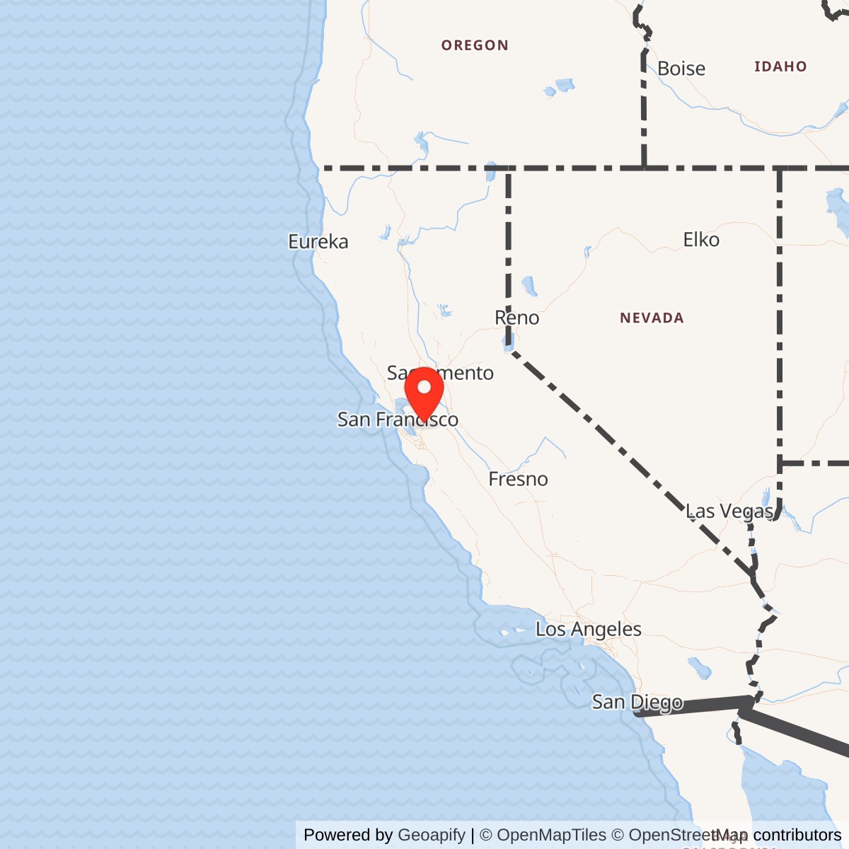
Longitude: -121.84
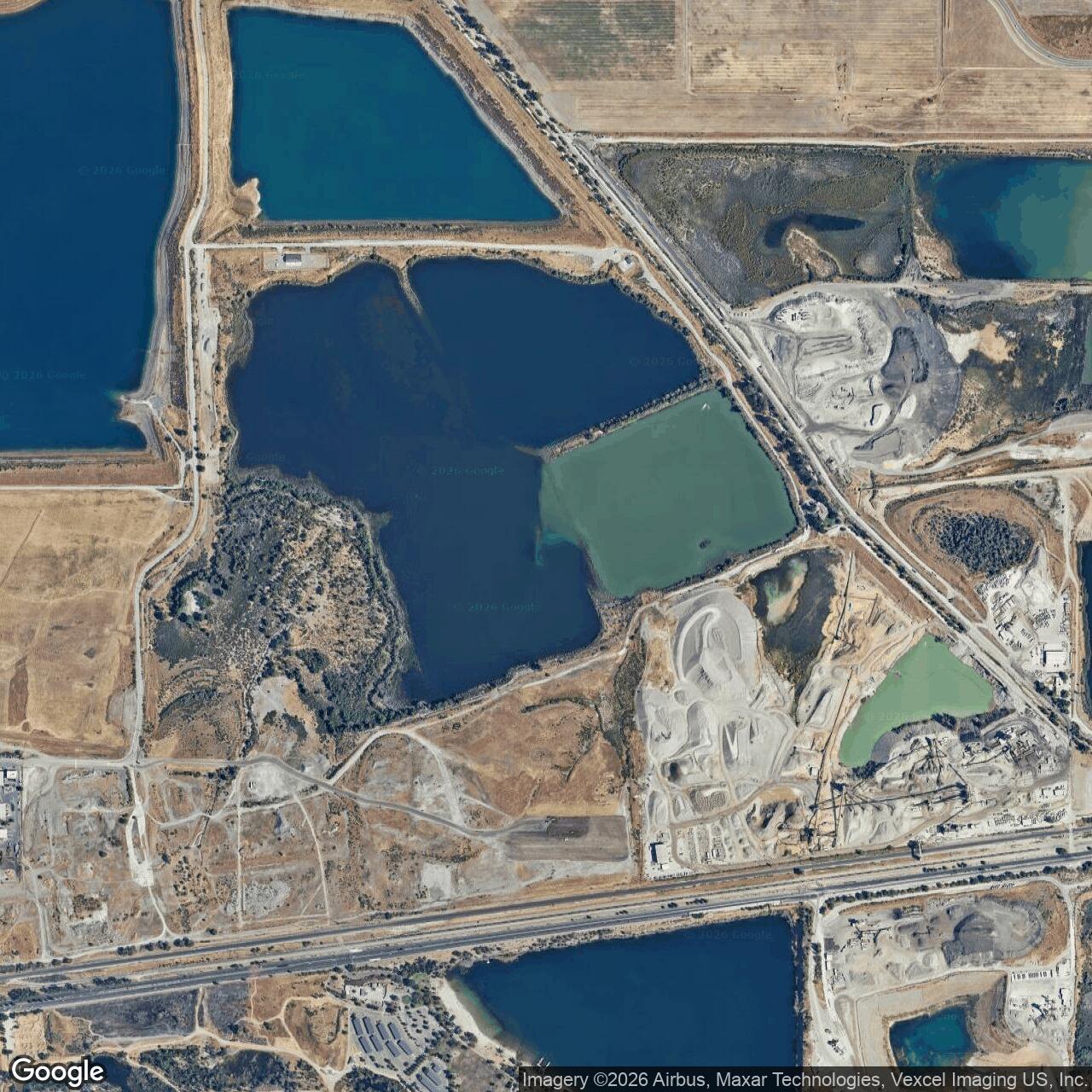
Current Role: Former NAS Livermore outlying landing field northeast of Pleasanton; documented in the 1944 Army/Navy Directory-derived list as NOLF Cope with a 3,200-foot sod runway at 37.68, -121.84. No active Navy or aviation use identified; later landscape appears altered by quarry/industrial or open-space reuse.
Naval Outlying Landing Field Cope was one of the small, easily overlooked flying fields that helped make Naval Air Station Livermore work. It was not a full naval air station, and it was not a separate command community with the permanence of Alameda, Oakland, or Moffett Field. Cope was a wartime landing surface, a sod training field, and a pressure-release valve for a naval aviation system that needed far more room than one main base could provide.
The field was located in the Pleasanton area of Alameda County. Airfield-history research citing the 1944 U.S. Army and Navy Directory of Airfields identifies NOLF Cope as a Navy outlying landing field attached to NAS Livermore, with a 3,200-foot sod runway. That makes Cope part of the documented Livermore outlying-field network rather than a merely rumored local airstrip.
Cope's identity was shaped by wartime urgency. When naval aviation training expanded in the Bay Area, Oakland became too crowded for the volume of primary flight training the Navy needed. Livermore was developed east of the Bay Area as a larger training station, but even Livermore depended on satellites. Student pilots required repetition: approaches, landings, takeoffs, mistakes, corrections, and more landings. The Navy therefore used surrounding rural fields, including Cope, to spread training traffic across the East Bay and western San Joaquin Valley landscape.
Cope should be understood as a functional naval installation. It may have had little visible infrastructure compared with a full station, but its lack of permanent buildings does not make it unimportant. The field's value was the open landing area itself, the surrounding airspace, and its position close enough to NAS Livermore to serve daily training. In a wartime pilot-training system, a sod strip could be as essential as a hangar if it allowed students to keep flying.
Mission and Military Role
Cope's mission was to support NAS Livermore's primary flight-training program. The parent station handled command, maintenance, aircraft concentration, station services, and the main training operation. Cope provided an additional place where student pilots and instructors could practice basic aircraft handling away from the parent field's busiest traffic.The 3,200-foot sod runway gives the best direct evidence of the field's use. A runway of that size was suited to primary trainers and light naval training aircraft rather than heavy operational aircraft. It gave instructors a controlled, open surface for repetitive landings, pattern work, and emergency-field familiarization. The field likely supported the same basic training logic as the other Livermore outlying fields: get students into the air, move them away from congested main-base operations, and give them room to learn through repetition.
This kind of work was routine, but it was not trivial. Naval aviation training in World War II was dangerous precisely because inexperienced pilots were learning complex skills under pressure. Student pilots bounced landings, drifted in crosswinds, misjudged altitude, overcontrolled, and sometimes mishandled stalls, go-arounds, or engine problems. Outlying fields like Cope reduced risk by moving some of that activity into open rural spaces, where mistakes were less likely to collide with dense base traffic or urban development.
Cope also supported training throughput. Every landing completed at an outlying field was one less landing competing for time and space at NAS Livermore. The Navy needed a constant flow of qualified pilots for advanced training, carrier aviation, combat aircrew assignments, and fleet operations. Cope did not send aircraft into combat, but it helped supply the training capacity that made combat aviation possible.
The field's role probably changed after Livermore's primary-training function declined in October 1944. Available sources do not document a separate late-war operational mission for Cope, and the safest interpretation is that its importance was greatest during the primary-training period. As pilot demand fell and NAS Livermore shifted toward operational carrier-aircraft staging and reserve-related functions, small sod OLFs like Cope became less central and were eventually released from Navy use.
Site Design and Facilities
The available evidence identifies Cope as a sod outlying landing field with a 3,200-foot runway. No source used for this focused history documents a large permanent building complex, barracks, fuel farm, hangars, hospital, magazine, independent command headquarters, or major paved runway system at the site. That is consistent with the field's NOLF role.The site was part of a broad pattern of leased or adapted rural landing fields. Wartime naval outlying fields often needed only basic improvements: a graded or selected landing area, boundary markings, windsock or landing signals, possibly temporary shelters, and enough surface maintenance to keep the field usable. Their purpose was not to duplicate the parent air station. Their purpose was to create safe, simple training capacity.
Cope's 3,200-foot sod runway placed it in the middle of the Livermore OLF group by runway length. It was shorter than Brown-Fabian's 6,300-foot listing and Brown's 4,000-foot listing, and longer than Wagoner's 2,000-foot and Gelderman's 2,200-foot listings. It was close in scale to Rita-Butterworth's 3,000-foot runway and Spring Valley's 3,500-foot runway. That comparison reinforces the field's probable use for primary trainer operations rather than large-scale, independent station work.
The Pleasanton-area location was part of the design logic. Open land northeast of Pleasanton and west of Livermore gave the Navy a field close to the parent station but outside the most congested local traffic pattern. The surrounding geography also placed Cope near other Livermore-associated outlying fields, including Rita-Butterworth and Spring Valley. Together, those fields turned the Pleasanton and Dublin side of the Livermore Valley into part of the Navy's dispersed training environment.
The site also illustrates why sod NOLFs are difficult to preserve in later memory. A paved naval auxiliary air station can leave runways, aprons, roads, and buildings. A sod outlying field can vanish once boundary markers are removed, the land is plowed, graded, excavated, developed, or returned to open land. The coordinates used here should therefore be treated as a documented reference point from the directory-derived listing, not as a surveyed property boundary.
Role in the Wider Military Network
Cope only makes sense inside the NAS Livermore system. NAS Livermore itself grew out of pressure on Oakland-area naval aviation training. The Navy needed an inland field with enough space to handle the training load, and by the end of 1942 primary training had shifted from Oakland to Livermore. Livermore was commissioned as a naval air station in 1943 and became a major training location before its mission changed later in the war.The wider system included twelve documented sod outlying fields associated with Livermore: Abel, Cope, Brown, Brown-Fabian, Gelderman, Heath, Lindeman, Livermore, Mays School, Rita-Butterworth, Spring Valley, and Wagoner. The 1944 directory-derived list places Cope among that network and gives its runway length and Pleasanton-area coordinates. The Navy's World War II activity list also identifies Naval Air Station Livermore and Wagoner Field under Livermore, confirming that the parent station operated in a wider local field system.
The network existed because pilot training consumes space. A busy training station could not safely handle every student approach and landing on one field. Distributed OLFs allowed instructors to assign aircraft to multiple practice areas, reduce traffic density, and keep training flights moving even if one field was unavailable because of wind, mud, dust, maintenance, or congestion. Cope was one of those pieces of distributed capacity.
This distributed system also connected the Navy to local civilian landscapes. Ranches, farms, local airfields, school areas, and named private properties were folded temporarily into military use. Some fields were known by property-owner names or local features. Cope appears to belong to that world of wartime adaptation, where ordinary East Bay agricultural and rural land became part of a national naval aviation training machine.
The field's strategic importance was therefore indirect but real. Combat aviation depended on trained pilots. Trained pilots depended on primary instruction. Primary instruction depended on repeated flying. Repeated flying depended on field capacity. Cope supplied a small but necessary part of that capacity.
Postwar Reuse and Current Status
Cope's Navy use appears to have ended as World War II training demands declined. The sources used for this focused history do not identify an active postwar Navy role, a long-lived municipal-airport successor, or surviving Navy-built facilities at the site. Unlike the older Livermore OLF, which became Livermore Sky Ranch and later municipal airport property before replacement, Cope does not appear to have developed into a durable civilian airport.The present status is best described as a closed former naval outlying landing field in the Pleasanton area, with no active Navy function and no active airport use identified. Modern land use at or near the recorded coordinate appears substantially altered from the rural wartime landscape, with quarry, industrial, open-space, or related non-aviation reuse in the broader area. Because the precise wartime footprint has not been confirmed from property plats or Navy lease files, that current-use description should remain cautious.
Chronology
- 1942 Naval aviation training pressure around Oakland helped drive the development of NAS Livermore as a new inland training station.
- 1942 By the end of the year, primary training had shifted from Oakland to Livermore.
- 1943 Livermore was commissioned as a naval air station, and its outlying-field network became part of the station's training system.
- 1943 Cope entered wartime Navy use as one of the Pleasanton-area outlying landing fields supporting NAS Livermore.
- 1944 The U.S. Army and Navy Directory of Airfields, as preserved in airfield-history research, listed NOLF Cope at Pleasanton, California, with a 3,200-foot sod runway at approximately 37.68, -121.84.
- 1944 NAS Livermore reached peak wartime use in the training era, with hundreds of primary trainers and thousands of personnel reported in airfield-history research.
- 1944-10-15 NAS Livermore lost its primary training function as pilot demand declined and the station shifted toward support for operational carrier-based aircraft and transient naval aviation.
- 1945 Navy use of the Livermore outlying-field network wound down as wartime training requirements declined.
- Post-1945 Cope did not continue as a documented active Navy installation and no long-term civilian airport successor has been identified in the sources used for this focused history.
- Present The former NOLF Cope site is a closed former naval outlying landing field in the Pleasanton area, with no active Navy or aviation use identified.
Sources & References
- WEB Abandoned & Little-Known Airfields, Abandoned & Little-Known Airfields: San Jose area NAS Livermore and Livermore outlying-field discussion
- WEB U.S. Naval Activities, World War Two, By State [California] Naval Historical Center transcription hosted by HyperWar
- WEB California State Military Museum / MilitaryMuseum.org Historic California Posts: Naval Air Station, Livermore
- WEB eLivermore.com Livermore Naval Air Station photograph and local-history page