
Naval Outlying Landing Field Rita-Butterworth, Pleasanton California
Longitude: -121.85
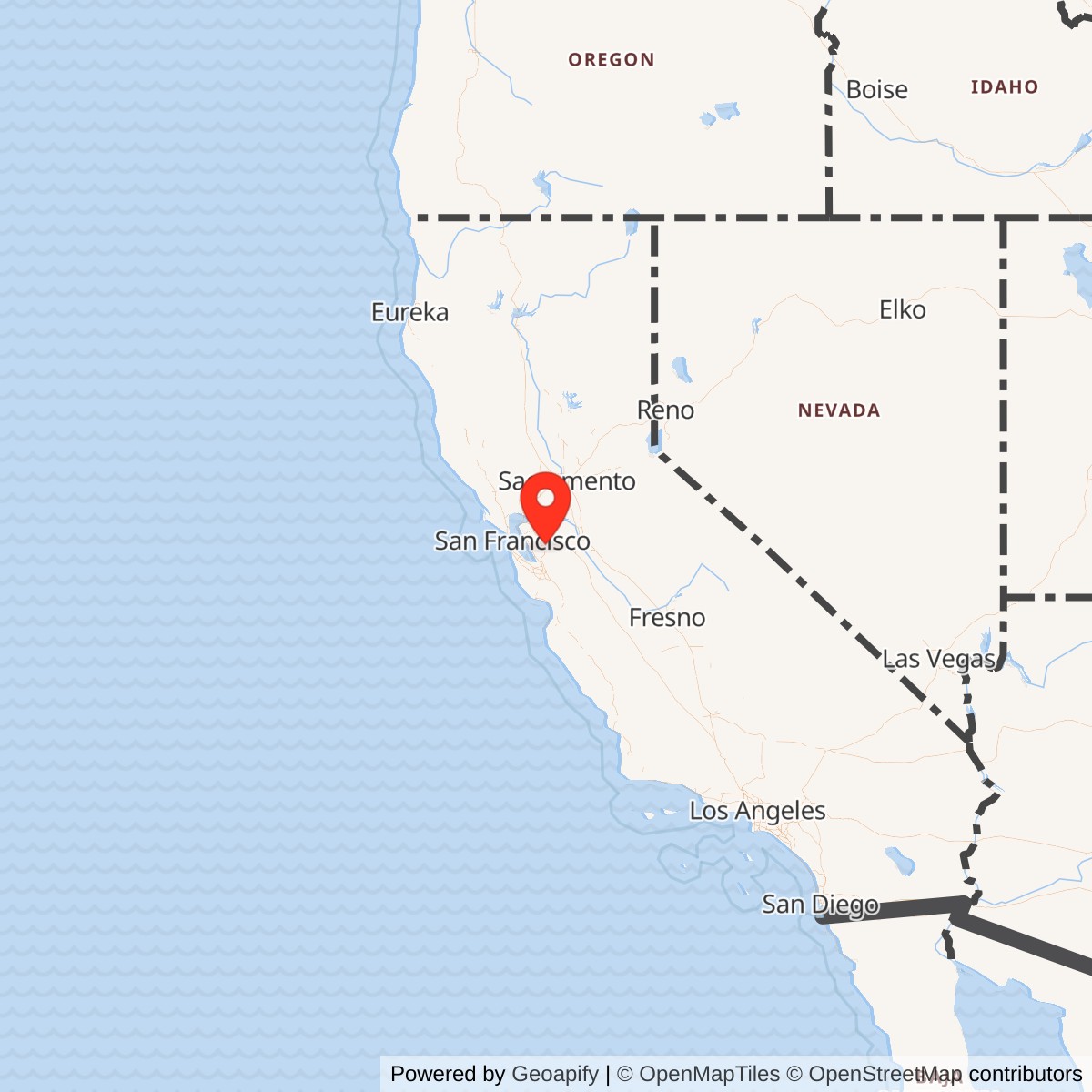
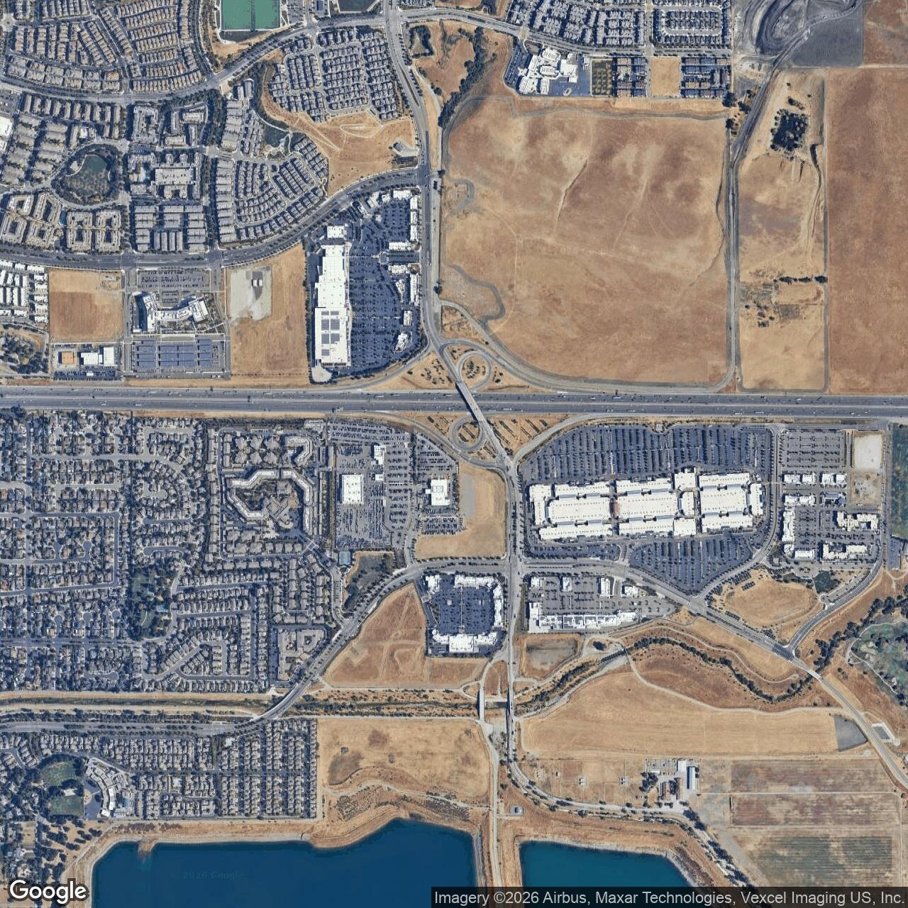
Current Role: Approximate former 3,000-foot turf-field location in eastern Dublin, north of Interstate 580 and west of Fallon Road, within a commercial and urban development corridor. The 37.7/-121.85 position is a rounded World War II directory coordinate, not a surveyed parcel or runway point. No recognizable runway, verified Navy structure, active aviation use, or Rita-Butterworth-specific cleanup project has been confirmed.
Naval Outlying Landing Field Rita-Butterworth was a small World War II training airfield assigned to Naval Air Station Livermore. The surviving site-specific record is unusually thin, but the essential identity is clear. A 1944 Army and Navy airfield directory listed Rita-Butterworth near Pleasanton with a 3,000-foot turf runway, and later California military-history references retained the same parentage, runway length, and rounded coordinate. The field was not a naval air station, an independently commissioned activity, or a permanent aviation base. It was one of the low-infrastructure landing fields that extended NAS Livermore's flying program across the Livermore-Amador Valley.
The distinction between the outlying field and its parent station is central to understanding the site. NAS Livermore contained the major landing surface, hangars, maintenance shops, barracks, classrooms, medical and administrative services, and the personnel needed to operate a wartime training command. Rita-Butterworth supplied additional landing ground away from the main traffic pattern. No evidence has been found for a separate command, resident squadron, permanent aircraft complement, barracks area, maintenance plant, or self-contained support organization at the outlying field. Its value came from being simple, available, and close enough to the parent station for repeated training flights.
The name appears in surviving records as Rita-Butterworth or Rita Butterworth Airport. The available sources do not explain whether it honored a landowner, combined two local property names, or preserved the name of a preexisting private field. They also do not establish an exact Navy acquisition date, lease boundary, acreage, runway orientation, or formal activation order. The commonly used 1943 to 1945 operating window is consistent with the period when NAS Livermore was commissioned and its primary-training network was active, but it should be treated as a year-level estimate rather than a fully documented legal chronology.
Mission Evolution
Rita-Butterworth emerged from the rapid wartime expansion of naval pilot training in the San Francisco Bay region. Naval Air Station Oakland had become crowded as the Navy increased aviation training after the United States entered World War II. The Navy acquired land east of Livermore in 1942 and built a new station where flying activity could expand over open inland terrain. By the end of that year, primary training had moved from Oakland to Livermore, and NAS Livermore was commissioned in 1943. The station's location offered broad agricultural valleys, comparatively light civil air traffic, and room to disperse repetitive training operations among several satellite fields.The mission of an outlying landing field was narrower than the mission of the parent station. Student pilots needed repeated takeoffs, approaches, landings, go-arounds, and traffic-pattern work. Performing every exercise at the main station would have crowded one airfield with students at different stages of training, instructors, transient aircraft, maintenance movements, and emergency traffic. A surrounding network of satellite strips distributed that workload and allowed several training groups to operate at the same time. Rita-Butterworth's 3,000-foot turf runway was part of that system, providing a simple practice surface near Pleasanton rather than duplicating the full facilities at Livermore.
The field's importance was therefore tied closely to the primary-training mission. By late 1944 the Navy's demand for new pilots had begun to decline. NAS Livermore ended primary training on 1944-10-15 and shifted toward supporting operational carrier aircraft and serving as a stopover for fighter, bomber, and torpedo units moving through the West Coast system. The main station remained useful because it had substantial facilities and paved operating surfaces. A small turf outlying field had far less value after repetitive primary flight instruction ended. No evidence has been found that Rita-Butterworth received a distinct carrier-aircraft, reserve, transport, or postwar mission.
Operational Role
The documented physical fact that best explains Rita-Butterworth's wartime role is its 3,000-foot turf runway. That surface was suitable for the light primary trainers used at NAS Livermore, especially the Boeing-Stearman N2S and Timm N2T aircraft associated with the station. The aircraft and their supporting personnel were based at the parent installation, not proven to have been permanently stationed at Rita-Butterworth. Training flights could leave Livermore, enter the pattern at an outlying field, complete multiple landing evolutions, and return to the main station for fuel, maintenance, instruction, and crew support.Surviving records do not provide Rita-Butterworth sortie counts, daily schedules, instructor rosters, accident reports, or logbook entries. Its likely operating activities can be described only at the network level. A turf satellite field would have been used for basic pattern work, full-stop and repeated landings, approach judgment, cross-country familiarization, and diversion practice. It also gave instructors a place to separate student traffic from the more complex operations at NAS Livermore. These functions are consistent with the Navy's use of outlying landing fields, but no claim can be made that every standard exercise occurred at Rita-Butterworth on a known date.
Weather and surface conditions would have shaped operations. All twelve fields in the Livermore primary-training network were described as sod, and nearby planning records for Mays School show that wet ground could interrupt training. Rita-Butterworth's turf runway was therefore an economical but weather-dependent asset. The Navy could use multiple fields to take advantage of local conditions, distribute wear, and reduce congestion, but prolonged rain or soft soil could restrict a sod strip. No evidence has been found that Rita-Butterworth was paved, lighted for night operations, equipped for instrument approaches, or improved into an all-weather field.
The installation contributed to World War II through training rather than combat at the site. More than 4,000 candidate pilots passed through NAS Livermore during its primary-training period, and the outlying-field system helped make that volume possible. Pilots trained in the United States later moved through advanced training and into fleet assignments, but the available record does not connect a named graduate, squadron, battle, or overseas operation specifically to Rita-Butterworth. No hostile action, named exercise, sabotage incident, or significant local wartime emergency has been identified at the field.
Aircraft, Training, and Daily Use
NAS Livermore reached peak wartime use with 234 N2S Stearman aircraft and 24 Timm N2T Tutors, along with a station population of about 2,881 personnel. Those numbers describe the parent station, not a Rita-Butterworth inventory, but they show why the satellite network was necessary. Hundreds of training aircraft could not efficiently conduct all landing practice on the main field. Rita-Butterworth and the other outlying strips converted the surrounding agricultural landscape into an expanded training plant whose operational capacity was much larger than the parent airfield alone.The N2S was a durable open-cockpit biplane widely used for primary instruction, while the N2T was another primary trainer built with an Aeromold bonded-plywood structure. Both types were designed for student use and could operate from relatively modest landing surfaces. A 3,000-foot turf runway offered adequate space for the low-speed training regime, provided the surface was firm and obstacles were controlled. There is no evidence that Rita-Butterworth had carrier arresting gear, catapult equipment, permanent weapons facilities, or the specialized systems associated with advanced combat-aircrew training.
Daily activity at the field would have been governed from NAS Livermore. Aircraft dispatch, instructor assignment, weather decisions, maintenance release, fuel, medical response, and flight records belonged to the larger station system. At a minimally developed outlying field, local staffing may have been limited to field maintenance, communications, safety, or temporary support as required. No source identifies a permanent officer in charge or an assigned detachment at Rita-Butterworth, so a detailed staffing structure should not be reconstructed from assumptions.
The lack of a known resident unit also explains why the field left so little documentary and physical evidence. Large stations generated building plans, command histories, property-transfer records, unit rosters, photographs, and newspaper coverage. A leased or acquired turf strip could perform an important daily function with few buildings and a small administrative footprint. Once flying stopped, cultivation, grading, road construction, and urban development could erase its surface quickly. Rita-Butterworth's obscurity is therefore not proof that it was unused. It reflects the temporary and subordinate nature of the facility.
Units, Organizations, and Systems
The principal organization associated with Rita-Butterworth was Naval Air Station Livermore. The field was assigned to that station and functioned as one component of its primary pilot-training system. NAS Livermore provided the aircraft, instructors, aviation support, maintenance, administration, housing, and command structure needed to use the satellite field. No evidence supports identifying Rita-Butterworth as a separate naval shore activity with its own commanding officer or independent unit designation.The Navy's World War II activity list for Livermore identifies the Naval Air Station, Wagoner Field, and a Combat Aircrew Refresher Training Unit carrying activity number A46440. That listing confirms the broader operational community at Livermore after the station's mission evolved. It does not place the refresher unit at Rita-Butterworth, and the field should not be described as that unit's home. The most defensible conclusion is that Rita-Butterworth served the station's primary-training organization during the period when the twelve-field sod network was required.
The station's training establishment operated within the Navy's continental aviation-training system, which moved candidates from initial instruction through more advanced phases before assignment to operational commands. Rita-Butterworth occupied the lowest physical tier of that system. It was not a school headquarters or fleet-replacement base, but a place where basic flying skill could be practiced repeatedly and safely. Its military value depended on the throughput of the system rather than on a resident combat organization.
No post-World War II military unit has been identified at the former field. The Naval Reserve briefly used the main NAS Livermore property in 1946, with fighter, dive-bomber, and torpedo aircraft present before reserve operations returned to Oakland, but there is no evidence that Rita-Butterworth participated in that reserve phase. The field has no documented connection to later Cold War units, mobilizations, overseas conflicts, homeland-defense operations, or domestic emergency responses.
Facilities and Physical Layout
The only firmly documented Rita-Butterworth aviation feature is a 3,000-foot turf runway. The available sources do not establish its compass orientation, width, exact endpoints, or whether the landing area contained one prepared strip within a larger sod rectangle. They also do not identify a hangar, control tower, operations shack, fuel installation, lighting system, paved apron, taxiway, barracks, magazine, utility plant, or permanent road network. Any reconstruction showing those features would exceed the evidence.The rounded coordinate, 37.7 north and 121.85 west, should be treated as a general locator. It originated in a wartime-directory-derived listing and lacks the precision needed to define a legal parcel or surveyed runway centerline. Later California military-history material placed the field in the same Pleasanton-area location, and an annotated 2007 aerial image marked an approximate point north of Interstate 580 and west of Fallon Road. That image is useful for orientation, but it is not a wartime engineering plan and cannot prove exact runway boundaries.
The landscape was well suited to a temporary turf field. The Livermore-Amador Valley contained broad, comparatively level agricultural tracts connected by local roads and lying beneath relatively open wartime airspace. Such ground could be leased or acquired, graded, marked, and maintained with far less construction than a permanent naval air station. The field's 3,000-foot length placed it near the middle of the Livermore satellite network, longer than the 2,000-foot Wagoner and 2,200-foot Gelderman fields but shorter than the larger Brown-Fabian and Brown strips.
Role in the Wider Military Network
Rita-Butterworth made sense only as part of NAS Livermore's twelve-field primary-training network. The 1944 directory-derived list included Abel at Milpitas; Cope, Rita-Butterworth, and Spring Valley near Pleasanton; Gelderman near Dublin; Brown, Brown-Fabian, and Lindeman near Tracy; Livermore, Mays School, and Wagoner in the Livermore area; and Heath, which was later reused for civilian aviation. Together, these sod fields spread Navy training across a wide arc east and southeast of San Francisco Bay.The network solved several operational problems at once. It reduced congestion at the parent station, gave instructors alternative fields when local weather or traffic made one site unsuitable, increased the number of students who could practice landing at the same time, and offered diversion points during mechanical or weather difficulties. The fields also exposed students to different visual approaches and local terrain while keeping them within a manageable distance of NAS Livermore. Rita-Butterworth's Pleasanton-area location helped fill the western and southwestern portion of that pattern.
The outlying fields were also connected to the larger wartime expansion of naval aviation. NAS Livermore had been created because Oakland could no longer absorb all required primary training. Livermore then depended on its satellites for the same reason. Each organizational level pushed routine flying away from the most congested installation while retaining central control of aircraft, instruction, maintenance, and personnel. Rita-Butterworth was therefore a small but functional node in a layered training system extending from local turf strips to the parent air station and onward to advanced schools and fleet assignments.
When primary training ended at Livermore on 1944-10-15, that network lost its central purpose. The main station could shift to transient carrier aircraft because it possessed the necessary aviation plant. The sod fields had been optimized for a different problem and were easier to abandon than to adapt. Rita-Butterworth's disappearance illustrates how auxiliary properties could become operationally obsolete even while the parent station remained active for another mission.
Closure and Postwar Reuse
No authoritative document has been found giving an exact closure, lease-termination, or disposal date for Rita-Butterworth. The field was documented in the 1944 directory, and the 1945 close year reflects the common conclusion that it had been abandoned by the end of World War II. The end of primary training at NAS Livermore on 1944-10-15 is the best-supported operational turning point. After that date, the field may have seen little or no Navy flying even if administrative disposal took longer.The postwar history of the main station does not automatically apply to Rita-Butterworth. NAS Livermore supported a short Naval Reserve phase in 1946 and was deactivated that year. The main station's airfield and buildings later became part of the site developed for the University of California Radiation Laboratory and today's Lawrence Livermore National Laboratory. Rita-Butterworth lay several miles away and has no documented connection to that scientific reuse. It should not be described as part of the laboratory property.
The approximate Rita-Butterworth location remained largely open land in the 2007 aerial image used by the California State Military Museum, but the surrounding eastern Dublin area has undergone extensive growth. City planning records identify the Fallon Gateway commercial center west of Fallon Road between Dublin Boulevard and Interstate 580 and broader development planning along the freeway corridor.
No confirmed postwar civilian airport operated on the site. No surviving runway trace, Navy building, historical marker, museum, or preserved landing-field feature has been identified in accessible public sources. Because the wartime surface was turf, later agricultural use and grading could erase it without demolition debris. Highway interchanges, streets, commercial construction, utilities, and other urban changes further reduced the likelihood that the runway alignment remains legible.
Chronology
- 1942 The Navy established the Livermore air station project east of Livermore as primary flight training expanded beyond crowded Naval Air Station Oakland.
- 1942, end of year Primary training had relocated from Oakland to Livermore, creating the need for a broad network of nearby practice fields.
- 1943 Naval Air Station Livermore was commissioned. Rita-Butterworth's commonly reported operating window begins in this year, although no site-specific activation order has been found.
- 1943-1944 Rita-Butterworth functioned as a 3,000-foot turf outlying landing field assigned to NAS Livermore during the station's primary-training mission.
- 1944-08 A regional aeronautical chart depicted the dense cluster of Navy auxiliary fields surrounding Livermore, including Butterworth in the Pleasanton-area network.
- 1944 The Army and Navy directory-derived listing identified NOLF Rita-Butterworth near Pleasanton at 37.7, -121.85 with a 3,000-foot runway.
- 1944, late in the year NAS Livermore reached peak use with 234 N2S Stearmans, 24 N2T Tutors, and about 2,881 personnel at the parent station.
- 1944-10-15 NAS Livermore ended its primary-training mission and shifted to support for operational carrier aircraft, removing the principal reason for maintaining the sod outlying-field network.
- 1945 Rita-Butterworth is generally treated as closed or abandoned by the end of World War II. The exact administrative disposal date remains unverified.
- 1946 NAS Livermore supported a short Naval Reserve phase and was deactivated, but no evidence links Rita-Butterworth to the reserve operation.
- 2007 The aerial image later published by the California State Military Museum showed the approximate former field area as open land north of Interstate 580 and west of Fallon Road.
- 2016-02-08 The California State Military Museum updated its Rita-Butterworth page, preserving the NAS Livermore assignment, 3,000-foot turf runway, and rounded coordinate.
- Present No active airfield, confirmed surviving Navy structure, resident military unit, or recognizable runway has been identified at the approximate former site.
Sources & References
- WEB California State Military Museum, Naval Outlying Field, Rita Butterworth Airport Source for the field's NAS Livermore assignment, turf runway length, and rounded location.
- WEB Abandoned and Little-Known Airfields, San Jose Area: Livermore NAS Source for the twelve-field sod network, Rita-Butterworth listing, aircraft totals, and mission transition.
- WEB U.S. Navy, U.S. Naval Activities, World War II, by State: California Source for the official wartime activity listing for NAS Livermore and its refresher-training organization.
- WEB eLivermore, Livermore History: Naval Air Station Source for parent-station opening and closure context and historical photographs.
- WEB Lawrence Livermore National Laboratory, Our History Source for the parent NAS Livermore site's wartime origin and later institutional reuse.
- WEB Aerofiles, U.S. Navy and Marine Corps Air Stations Source for cross-checking NAS Livermore and its outlying-field network.
- WEB Aerofiles, California Airports Source for cross-checking the Livermore-area satellite-airfield listing.
- WEB City of Dublin, Fallon Gateway Source for modern commercial-development context west of Fallon Road and north of Interstate 580.
- WEB City of Dublin, Fallon East Economic Development Zone Source for broader current land-use planning along the eastern Dublin Interstate 580 corridor.