
Cold Bay Long Range Radar Site, Alaska
A compact radar near Cold Bay Airport carries forward Alaska's long-range air-surveillance mission after the move from Grant Point.
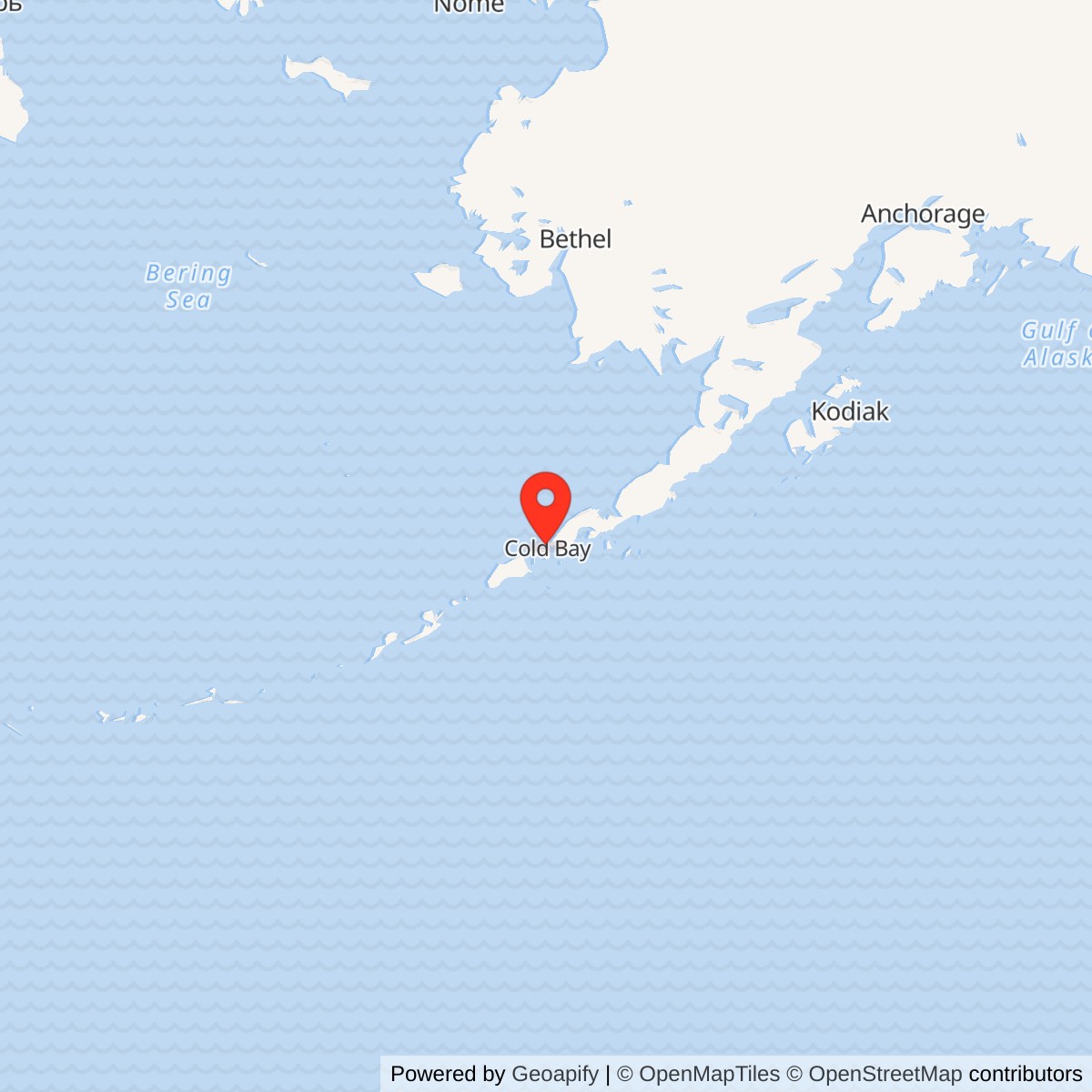
Longitude: -162.769776
Current Role: Later Alaska radar-system site.
- Site designations
- A-08; CDB; FY5018
- Role
- Three-dimensional long-range air surveillance
- Radar
- AN/FPS-117
- Radome
- CW-396A/GPS rigid radome
- Operational start
- July 6, 1985; radar installed May-June 1985
- Operating model
- Local contractor maintenance with regional radar control
- Regional control
- Joint Base Elmendorf-Richardson; 176th ADS and 611th AOC
- Facilities
- Electronics building and radar tower; maintainer apartment; utility and supply support
- Predecessor
- Cold Bay AFS / Grant Point White Alice site
- Location
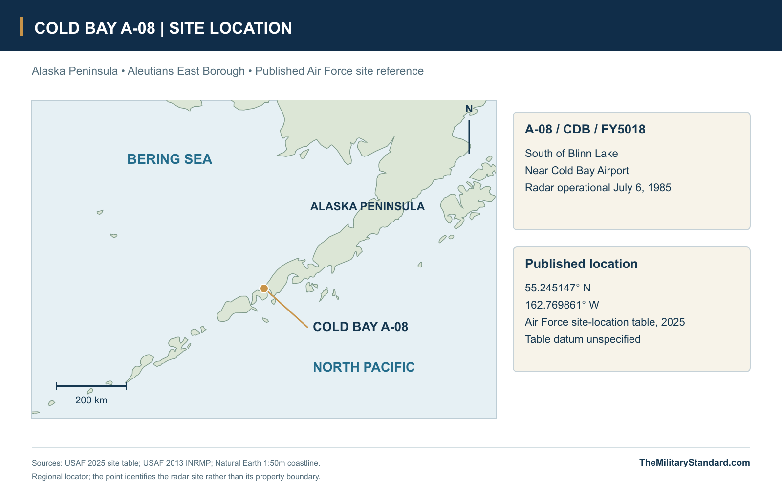
- South of Blinn Lake near Cold Bay Airport, Alaska Peninsula
- Latitude / longitude
- 55.245147, -162.769861; published 2025 Air Force reference, datum unspecified
A New Radar Near Cold Bay Airport
Cold Bay Long Range Radar Site began operating on July 6, 1985, as a smaller replacement for the staffed radar station at Grant Point. Its AN/FPS-117 gathered aircraft range, bearing and height information for Alaska's air-surveillance network while sending data to regional controllers elsewhere. The new installation stood nearer Cold Bay Airport, south of Blinn Lake, and carried the A-08 designation. Its compact plant and small contractor presence represented a different way of maintaining the air picture along the southwestern approaches to Alaska. [1] [2] [3]
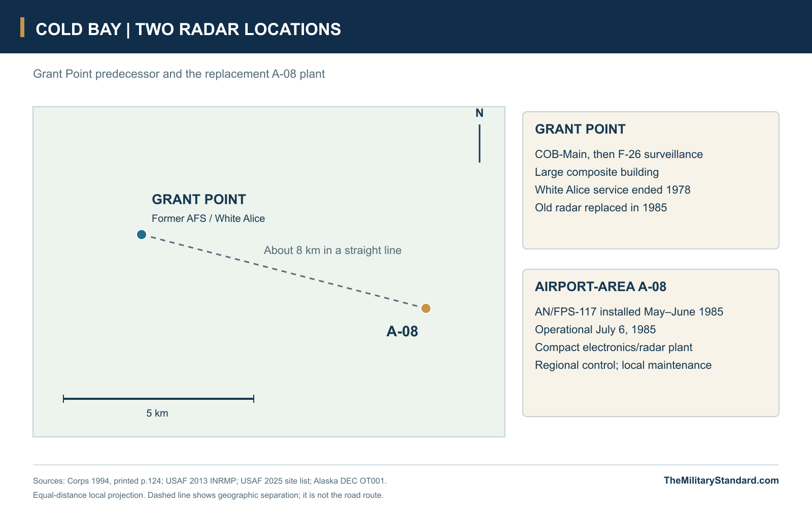
The relocation created a separate physical installation rather than a new name for the Grant Point compound. The earlier Cold Bay Air Force Station had combined the COB-Main DEW radar, later F-26 surveillance duties and White Alice communications. A-08 continued the regional radar mission from its new location after the earlier communications role had already ended. Cold Bay Airport and the community provided access and services, but the radar site retained its own equipment, buildings and operating responsibilities. [1] [2] [10]
From the Grant Point Station to SEEK IGLOO
Grant Point's large concrete compound dated from the 1957-1959 Aleutian DEW Line extension. It housed the 714th Aircraft Control and Warning Squadron, radar operations and the White Alice plant serving the peninsula and Aleutian stations. The Aleutian DEW mission ended in 1969, while Cold Bay continued as a NORAD surveillance station and White Alice remained until 1978. These separate changes left a substantial staffed installation supporting a narrower radar mission, creating an opportunity for modernization to reduce both equipment demands and the cost of sustaining the remote compound. [1] [2]
SEEK IGLOO replaced earlier radar combinations with the AN/FPS-117 and moved the principal air-defense picture to a regional operations center at Elmendorf Air Force Base. Search and height information came from one radar, and satellite communications carried tracks to controllers who no longer needed to sit at each remote antenna. The new concept reduced the requirement for large barracks, recreation facilities and supporting personnel. At Cold Bay, the Air Force also shortened the practical supply connection by constructing the replacement closer to the airport. [1]
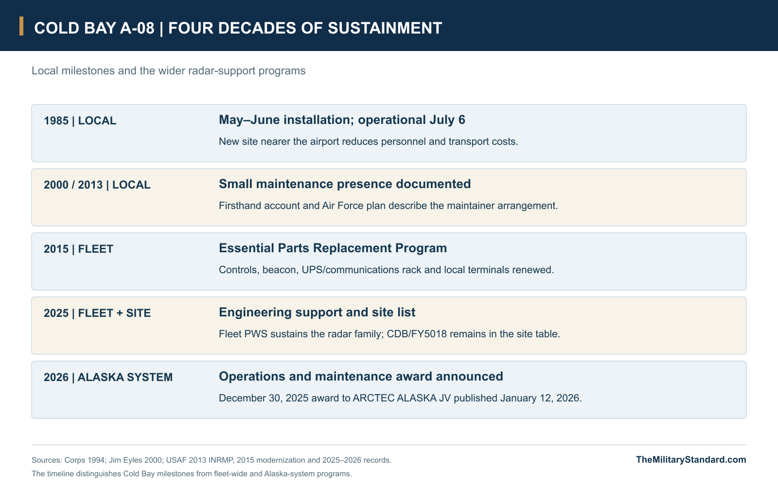
The Corps' installation table records Cold Bay's radar changeout in May and June 1985, followed by operational status on July 6. Its discussion specifically identifies Cold Bay and Galena as relocations made to save personnel and transportation costs. The move left the old Grant Point building redundant, and demolition followed during the later 1980s. The modern radar's opening belongs to 1985, while the predecessor's 1959 start remains part of the earlier installation's history. [1] [2]
The Compact Radar Compound
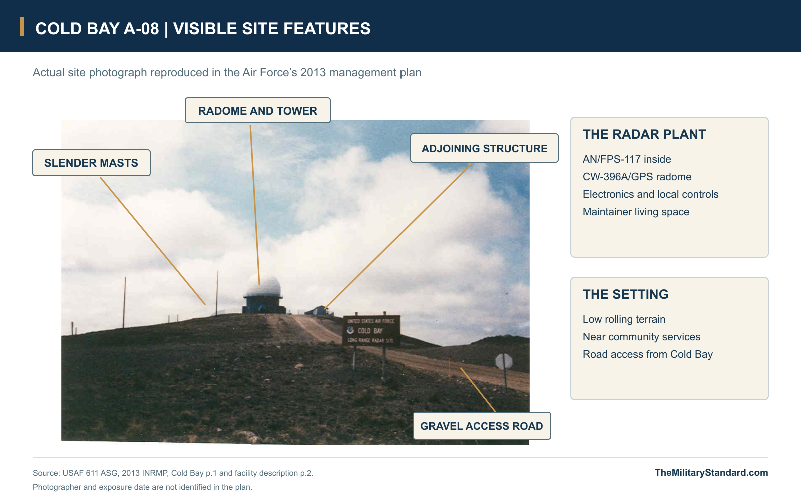
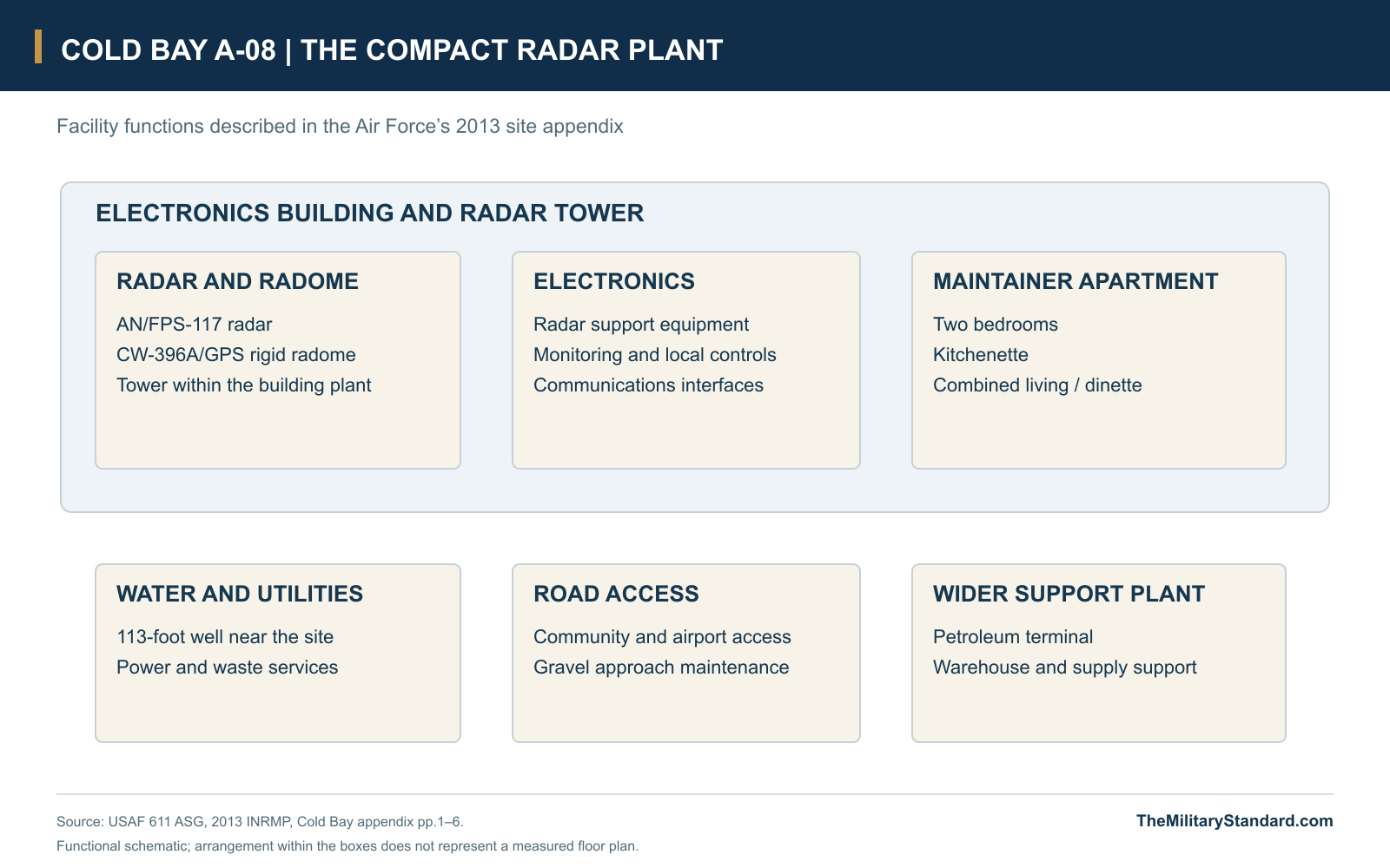
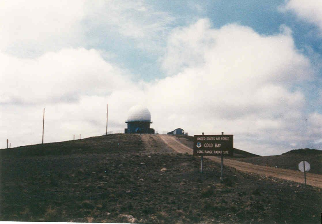
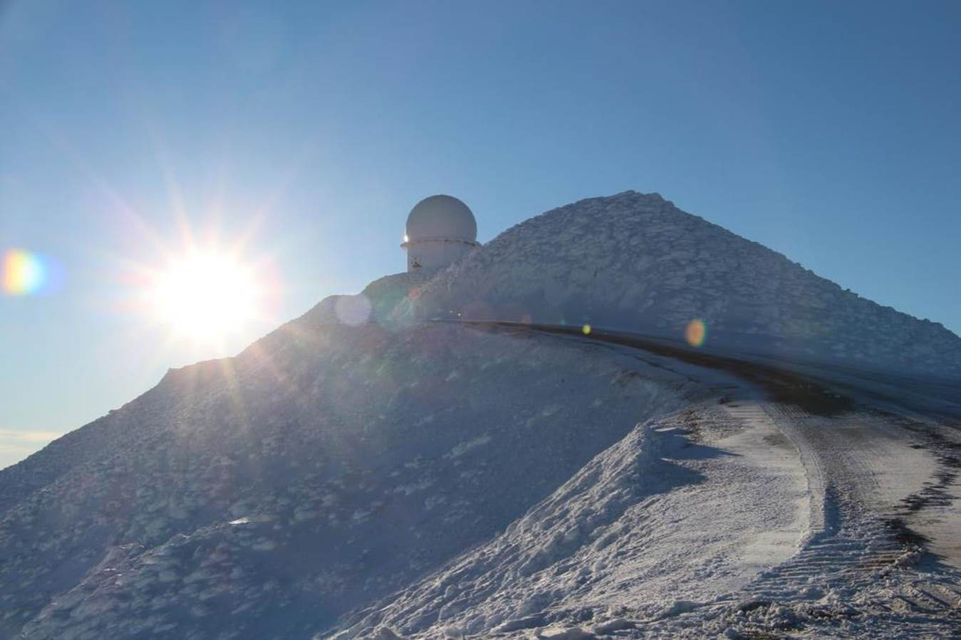
The Air Force's 2013 site appendix describes an electronics building containing the radar tower, a CW-396A/GPS rigid radome, the AN/FPS-117 and other electronics. The external dome sheltered the working antenna from the weather. The published ground-level photograph shows the elevated radar structure, a small adjoining support structure, slender masts and the gravel approach road. These features give the new station a very different appearance from the old five-story concrete composite building and its White Alice reflectors. [2]
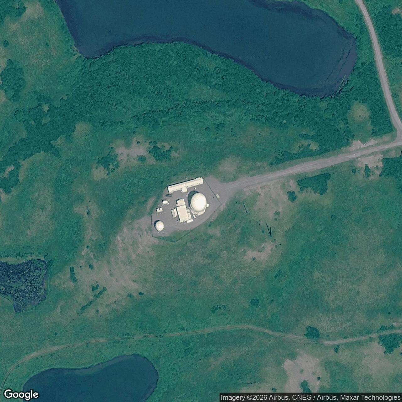
Living space was also compressed into the operating plant. The same appendix describes a two-bedroom apartment with a kitchenette, living room and dinette combination for the single contract maintenance person. Housing the maintainer within the electronics building reduced the need for the larger residential compound associated with the former warning station. A petroleum terminal and warehouse supported the LRRS through the wider Cold Bay network, so the small fenced radar compound depended on infrastructure beyond the dome itself. [2]
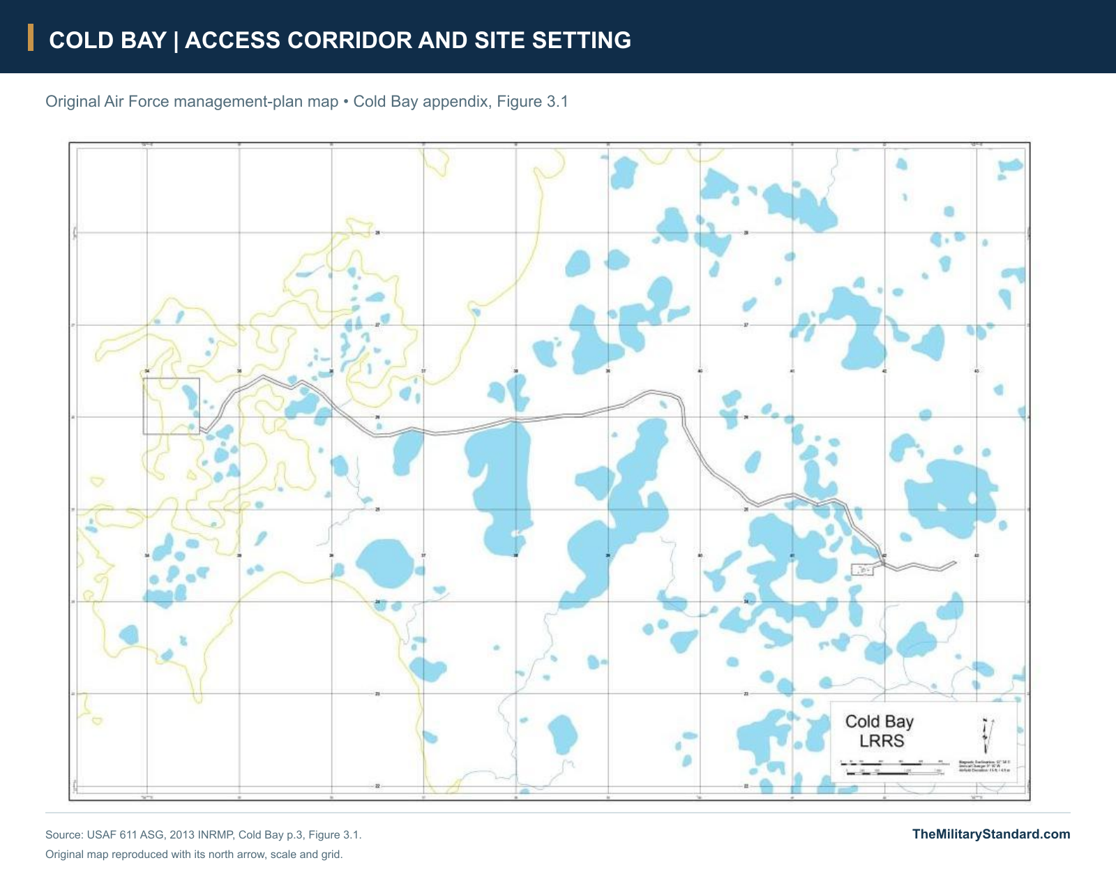
The fenced operating area occupied less than two acres according to the 2013 management plan, but the radar depended on a much wider support landscape. The road corridor connected the operating compound with the community and other Air Force interests, while separate lands retained the remains of Grant Point. This arrangement concentrated the active electronics and living space in a small plant without eliminating the transportation and utility links needed to sustain it. The extensive former reservation and the compact replacement compound therefore represent different stages of the Cold Bay military presence. [2] [10]
How the AN/FPS-117 Supports the Air Picture
The AN/FPS-117 provides three-dimensional surveillance by combining range, azimuth and height observations in one system. Its antenna turns to survey the surrounding airspace, while electronic control supplies the elevation information used to build a three-coordinate track. The radar remains at Cold Bay, but the information is useful far beyond the local site because communications carry it to the regional system. The new architecture replaced the earlier dependence on a large local operating crew using separate search and height-finding equipment. [1] [4] [5]
Remote control also changes the meaning of an attended radar. Cold Bay needs physical maintenance, power, communications and access, even when controllers and many technical functions operate from elsewhere. A May 2000 account by radar maintainer Jim Eyles described one local electronics maintainer, remote maintenance from Elmendorf and periodic specialist visits for inspections. The Air Force's 2008 account of Alaska radar contractors similarly describes the small-site operating concept and the 611th Air Support Group's support responsibilities. The later apartment description shows how this arrangement shaped the Cold Bay building. The term minimally attended therefore describes the distribution of work across the system, with people still responsible for keeping the equipment usable. [2] [6] [13]
Controllers, Commands and the Regional Mission
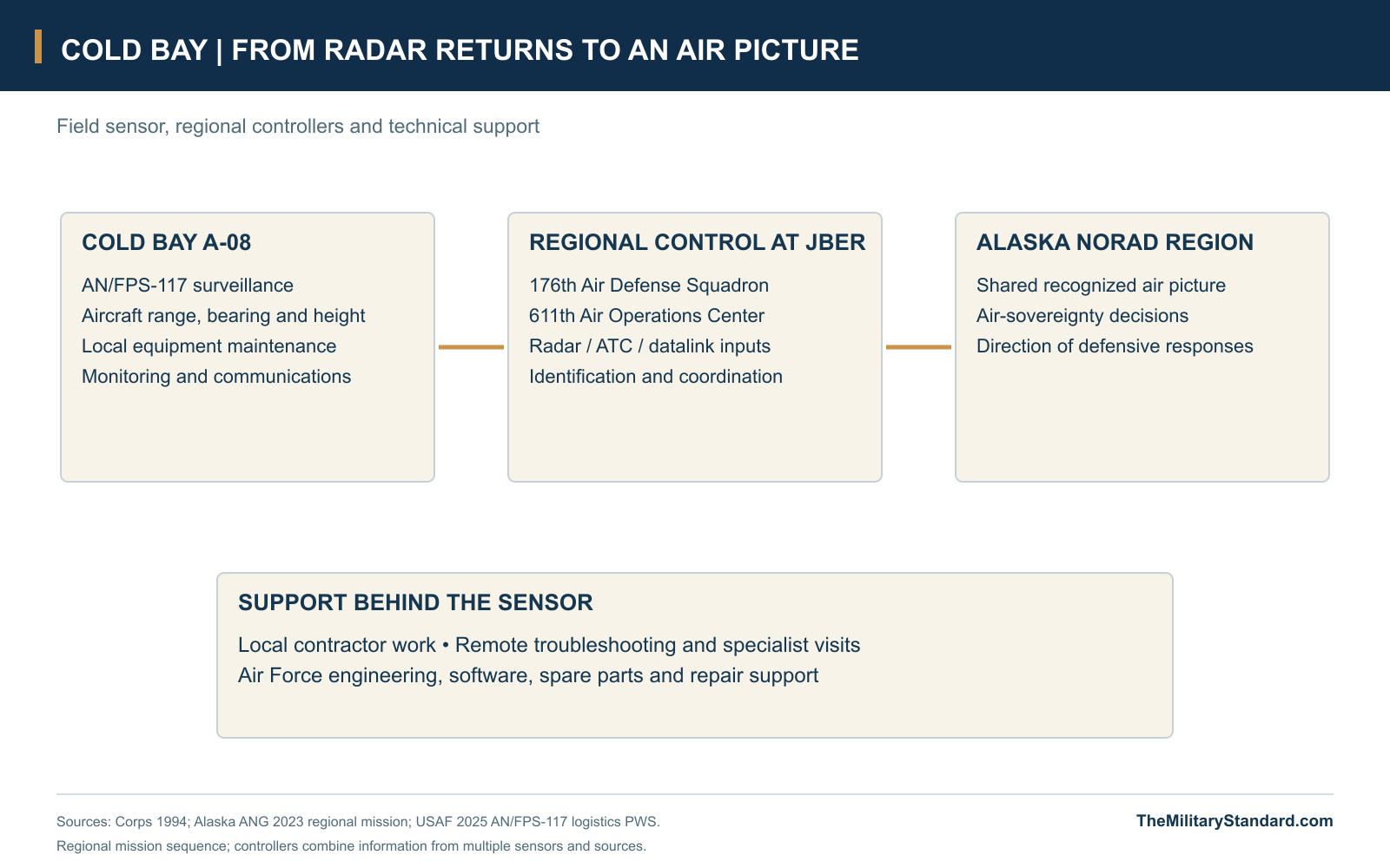
At the regional level, surveillance information becomes part of an integrated air picture. The 176th Air Defense Squadron at Joint Base Elmendorf-Richardson combines radar observations with air-traffic feeds and datalink information, working with the 611th Air Operations Center and NORAD leadership on identification and response. The unit's account of Russian aircraft approaching the Alaska Air Defense Identification Zone in February 2023 describes how surveillance, weapons and battle-management teams validate the picture before an intercept is directed. That is the operational network to which Alaska's fixed radar sites contribute. [9]
Cold Bay's responsibility within that network is the ground-sensor and support function at A-08. Radar data can be combined with observations from other fixed sites and airborne assets, while regional controllers evaluate the integrated picture and assigned aircraft conduct response missions. The field station supports this distributed operation by maintaining the sensor, its communications and local facilities. Cold Bay's continuing contribution is sustained surveillance information from the southwestern Alaska location, backed by the equipment and contractor organization needed to keep that information flowing. [1] [4] [9]
Life and Maintenance at a Community-Supported Site
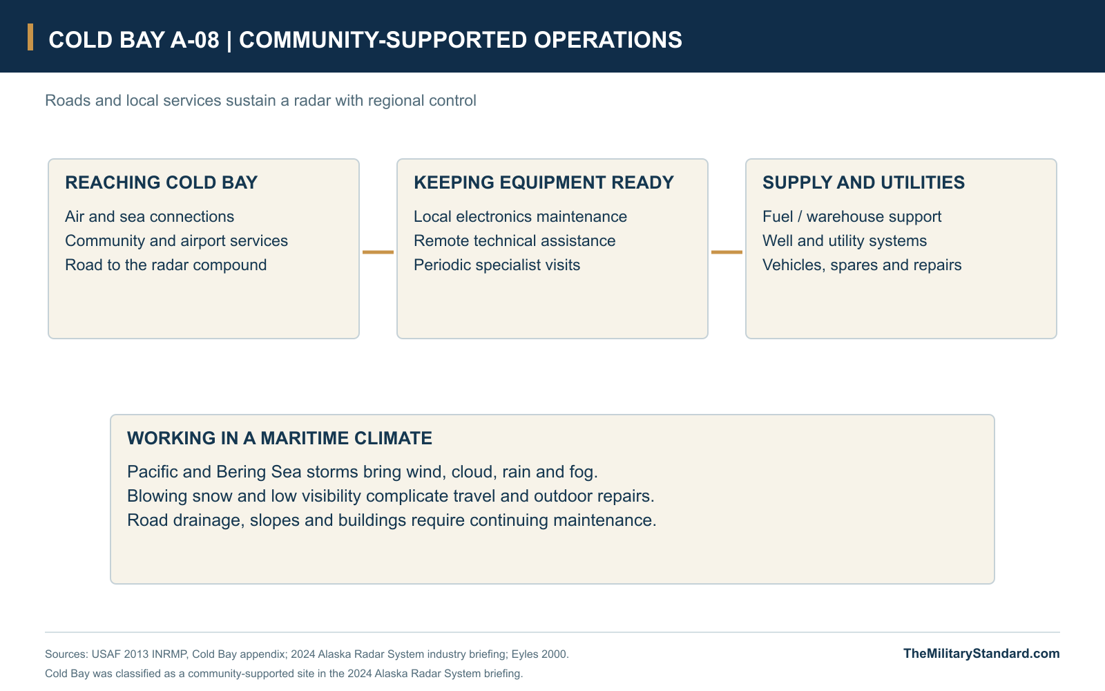
The 2024 Alaska Radar System briefing places Cold Bay among the community-supported sites, alongside King Salmon, Fort Yukon, Kotzebue and Murphy Dome. This category differs from isolated radar stations with their own gravel airfields and separate upper and lower camps. Cold Bay's road reaches an existing community and airport, allowing the site to draw on local transportation and services. Its remote setting still matters, but its support pattern is shaped by proximity to those facilities rather than by a self-contained military airstrip at the radar compound. [2] [7]
The 2013 plan describes road access from Cold Bay, with the community reached from outside by air or sea. It records a 113-foot well adjacent to the radar site and contrasts this with the earlier Grant Point station's use of Zaegel Lake. Power, water, waste handling, vehicle support and spare parts all remain necessary even when the radar staff is small. Moving the radar nearer the airport simplified the chain of support; it did not remove the need to plan deliveries and maintain the local plant. [2] [10]
Weather puts persistent demands on that support system. The site plan describes a maritime climate dominated by Pacific and Bering Sea storms, with frequent cloud, fog, strong wind and low visibility. Winter blowing snow and summer fog affect access as well as outdoor work, while wet tundra and shallow drainage channels surround the developed ground. Maintaining gravel approaches, slopes, buildings and utility systems is therefore part of radar readiness, connecting ordinary facilities work to the availability of a regional defense sensor. [2]
Modernization After the Original Installation
The radar family's long service required more than retaining the 1985 hardware. By 2015 the Air Force's Essential Parts Replacement Program had replaced four major subassemblies: the Maintenance and Control System, beacon system, uninterruptible-power/communications rack and local control terminals. The fleet program reduced replaceable-unit counts by about 80 percent and addressed obsolete parts, while preserving remote monitoring and troubleshooting. Those changes illustrate how the AN/FPS-117 system was sustained beyond its original Cold War electronics; the Air Force's report describes a fleet-wide effort rather than a Cold Bay-specific installation schedule. [5]
The 2025 sustainment statement places the radar within the Atmospheric Early Warning System fleet and continues support for towers, radomes, controls, hardware, software and associated equipment. It identifies the engineering facility at Hill Air Force Base as a test bed for qualification, integration, upgrades and resolving obsolete components. This gives the small field station a much larger technical backing: local maintainers work within a supply and engineering system that can repair assemblies, update documentation and test changes before they reach operational sites. [4]
Contracted support also continued at the Alaska-system level. The Air Force's January 2026 award notice records an Alaska Radar System operations and maintenance contract awarded to ARCTEC ALASKA JV on December 30, 2025. The award sustains operations across the Alaska system, linking individual field stations to a common maintenance organization. Together with the 2025 site-location list, it places A-08 within a continuing support framework four decades after the radar first entered operation. [3] [8]
Land Management and the Older Defense Property
The current radar operates in a landscape that contains several generations of military property and environmental records. The Air Force's 2013 appendix places A-08 south of Blinn Lake in the Alaska Peninsula refuge setting and separately describes the abandoned Grant Point lands in the Izembek refuge. Its maps retain the road corridor and other associated interests. The same document notes erosion and gullying near the access road as matters addressed through routine maintenance, showing how the limited developed compound meets the surrounding wet tundra. [2]
Environmental cases named Cold Bay LRRS can include earlier facilities well beyond the operating radar enclosure. DEC's MARs Facility record discusses the former Grant Point station and the later radar well within one history, while the White Alice OT001 record covers the old communications area. Their cleanup decisions concern specified releases, landfills or demolition areas. Those decisions do not establish closure of the active A-08 radar, and their historical reservation figures and environmental markers should be understood within the properties they describe. [2] [10] [11]
A Continuing Radar Mission
The Air Force continued to list Cold Bay as CDB/FY5018 in its 2025 AN/FPS-117 support records. Four decades after the relocation, the radar remained part of a geographically distributed surveillance system whose field stations relied on regional control and common technical support. The site's principal public milestones remain the 1985 move, the July 6 operational start, the adoption of a small maintenance presence and successive radar-support programs. Its continuing role rests on the combination of a fielded sensor, dependable utilities and communications, and a regional organization able to turn observations into an air picture. [1] [2] [3] [4]
Cold Bay A-08 represents a sustained mission carried out with a changed physical and staffing model. The original station's concrete buildings, local squadron population and White Alice antennas gave way to a compact radar plant nearer the airport, with regional controllers and technical support distributed elsewhere. The operational continuity links the two Cold Bay histories, while their distinct sites and facilities explain why the older station could disappear and the long-range surveillance function continue. [1] [2] [4]
Chronology
- 1959 The Grant Point predecessor enters service as COB-Main on the Aleutian DEW extension. [1]
- 1969 The Aleutian DEW mission ends; Cold Bay continues as a surveillance station. [1]
- 1978 Grant Point White Alice communications end, before the later radar relocation. [1]
- Early 1980s SEEK IGLOO introduces three-dimensional radars and centralized operations across Alaska. [1]
- May-June 1985 Cold Bay's replacement AN/FPS-117 is installed at the separate airport-area site. [1]
- July 6, 1985 The new Cold Bay radar becomes operational. [1]
- Later 1980s The old Grant Point composite installation is demolished. [1] [2]
- May 2000 A published maintainer account describes one local electronics maintainer and remote technical support. [13]
- 2013 Air Force site appendix documents the CW-396A/GPS radome, electronics building and maintenance apartment. [2]
- 2015 The AN/FPS-117 fleet modernization program reaches full operational capability. [5]
- May 2024 Cold Bay appears among community-supported sites in the Alaska Radar System briefing. [7]
- 2025 The Air Force site-location list identifies Cold Bay CDB/FY5018 and publishes its coordinate. [3]
- December 30, 2025 The Air Force awards the wider Alaska Radar System operations/maintenance contract to ARCTEC ALASKA JV. [8]
- January 12, 2026 The Air Force publishes the Alaska Radar System contract award notice. [8]
Related Sites
Information sources (13)
- PDFU.S. Army Corps of Engineers, The Cold War in Alaska: A Management Plan for Cultural Resources, 1994
SEEK IGLOO, Cold Bay relocation to reduce personnel/transport costs, May-June 1985 radar installation and July 6 operational date; LRRS facilities and Grant Point predecessor. Printed pages 64-65, 124, 209-210 and 247.
- PDFU.S. Air Force, 611th Air Support Group, Integrated Natural Resources Management Plan, Site-Specific Appendices, 2013, Cold Bay appendix
Actual LRRS photograph, access map and 2005 habitat/corridor map; south-of-Blinn-Lake location, electronics building, CW-396A/GPS radome, maintenance apartment, well, climate and management context. Printed Cold Bay pages 1-13; PDF pages 220-232.
- WEBU.S. Air Force, AN/FPS-117 Site Locations, PWS Attachment A, solicitation FA821725RB004, 2025
Original Cold Bay row: CDB, FY5018 and published coordinate 55°14'42.530" N, 162°46'11.500" W; datum not specified in the table. Page 1.
- WEBU.S. Air Force AFLCMC, Atmospheric Early Warning System AN/FPS-117 Contractor Logistics Support PWS, July 18, 2025
Current fleet sustainment scope, Hill AFB engineering facility, radar/radome/control subsystems, repair, software, spares and technical support. This is the fleet statement, not a record of Cold Bay-specific repair dates.
- WEBU.S. Air Force, Patty Welsh, Radar upgrades ensure situation awareness, October 21, 2015
Essential Parts Replacement Program: four principal subassemblies, remote monitoring/control, reduced replaceable-unit count and fleet modernization completion. Accompanying photograph depicts an Alaska radar, with site unspecified.
- WEBJoint Base Elmendorf-Richardson, Extraordinary people maintaining extraordinary locations, 2008
Contractor operation and maintenance of Alaska's radar sites, the small-site operating concept and 611th Air Support Group responsibilities in the period described.
- WEBU.S. Air Force PACAF Regional Support Center, Final Alaska Radar System Industry Day Brief, May 3, 2024, FA521524R0006
Cold Bay classified as a community-supported radar site; five-site class, commercial/standby power and community logistics contrasted with airfield and train sites. Published original briefing text and procurement record.
- WEBU.S. Air Force, Alaska Radar System Operation/Maintenance award notice FA521526C0004, published January 12, 2026
System-wide operations and maintenance award to ARCTEC ALASKA JV dated December 30, 2025; continuation of contracted radar-system support.
- WEBAlaska Air National Guard, 176th Wing integral to NORAD air sovereignty and routine intercept of Russian aircraft, March 7, 2023
Regional use of fused radar, air-traffic and datalink information; 176th ADS/611th AOC and NORAD identification/intercept decisions. Describes the regional mission, not attribution of a particular detection to Cold Bay.
- WEBAlaska Department of Environmental Conservation, Cold Bay RRS MARs Facility, Hazard ID 687
Historical distinction between Grant Point surface-water supply and the later MAR well; case-specific cleanup-complete determination. Its coordinate and station-wide acreage are not used for A-08.
- WEBAlaska Department of Environmental Conservation, Cold Bay White Alice Communications Site OT001, Hazard ID 2826
Grant Point environmental reference 55.262551/-162.887605 and legacy demolition/restoration context, separate from the operating A-08 radar point.
- WEBNatural Earth, 1:50m Admin 0 Countries
Public-domain regional coastline geometry used with separately identified site coordinates in the location diagram.
- WEBJim Eyles, May 2000 maintenance account, and Cold Bay LRRS photographs, Online Air Defense Radar Museum
Firsthand description of a single local electronics maintainer and remote maintenance from Elmendorf with periodic specialist visits; photograph records identify later views but downloadable originals were unavailable.